Premium Storm Update (Fri May 18 at 7:30 AM): We discuss the chances that the incoming storm could come in stronger and cause flooding across the region on Saturday. Plus, an update on the potential severe storm risk on Friday. READ NOW
—
We’re only half way through May, but many locations across the Front Range have already exceeded their normal precipitation for the entire month. This wet trend continues with another round of severe thunderstorms and widespread soaking rainfall this weekend.
Rain, rain go away?
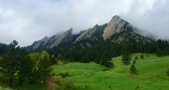
The hills and prairie across the Denver Metro area have turned a vibrant hue of green….about as green as you will ever see. This is thanks to just two slow-moving storm systems which brought significant precipitation to our region in the last two weeks or so (Storm #1 / Storm #2). Both storms were relatively well forecasted by the models many days in advance. Boulder has seen 3.08″ of rain so far this month, already exceeding the normal of 3.05″ for all of May. Denver (DIA) has recorded a respectable 1.64″….on pace to best the monthly normal for May which is around 2.0″.
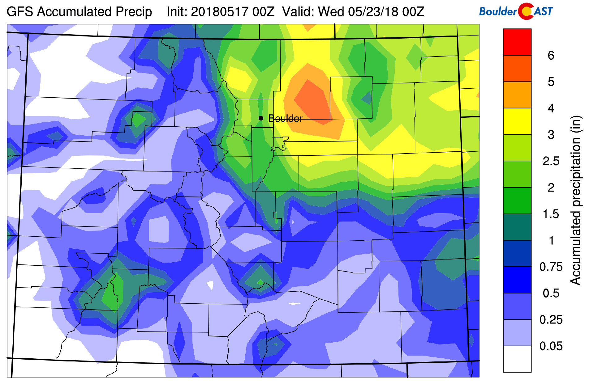
The map below shows precipitation totals across the region for May so far. Some of the heaviest precipitation has fallen in and around the cities of Boulder and Longmont, 3 to 4 inches worth. These higher amounts are due to amplified upslope precipitation during the first storm at the beginning of the month, as well as a little luck this past Sunday when several consecutive thunderstorms moved across eastern Boulder County. These storms caused minor street flooding in Longmont.
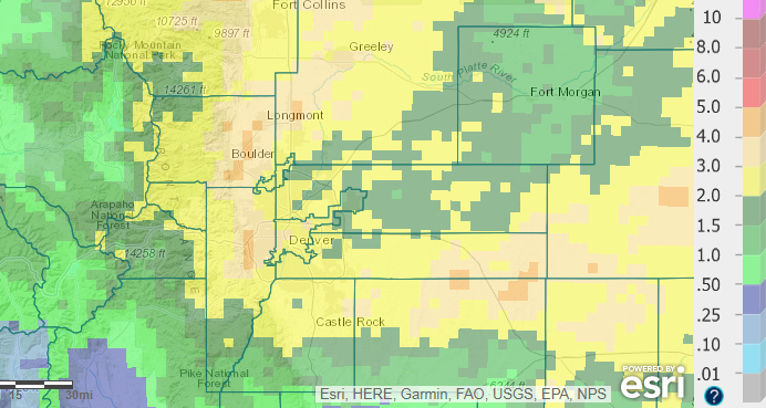
May 1-15, 2018 precipitation totals for northeast Colorado.
So far this month, we’ve only had three days where temperatures wound-up below the average for the date. With thirteen days of warm temperatures, Boulder is running about 3 degrees above normal for the month so far (4 degrees in Denver). Consequentially, all of the precipitation this month has fallen as rain across the Plains. Pending a late season storm packing a strong cold front, May 2018 will likely conclude as only the third in the last 18 years to have no snow occur in Boulder.
More wet weather on the horizon
While we had dry weather yesterday and expect another relatively quiet day today, don’t be fooled into submission. Another lengthy stretch of rain is knocking on the door Friday lingering right through the upcoming weekend (yuck!). We’ve been discussing the arriving storm with our Premium members through the week. The GFS ensemble 500 mb height animation below shows the disorganized, but slow-moving storm system that will impact our region this weekend.
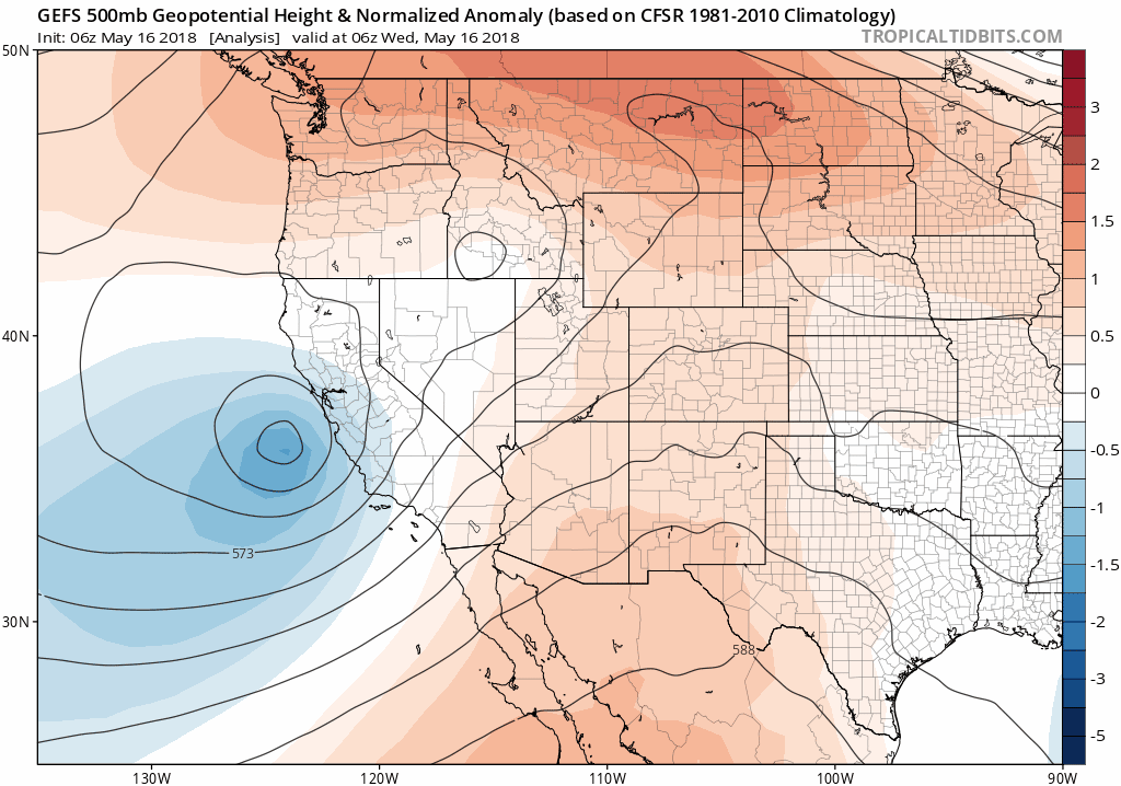
GFS ensemble 500 mb height animation for this weekend.
Can you locate the storm rotating near Reno, Nevada in this morning’s GOES-16 water vapor animation below?
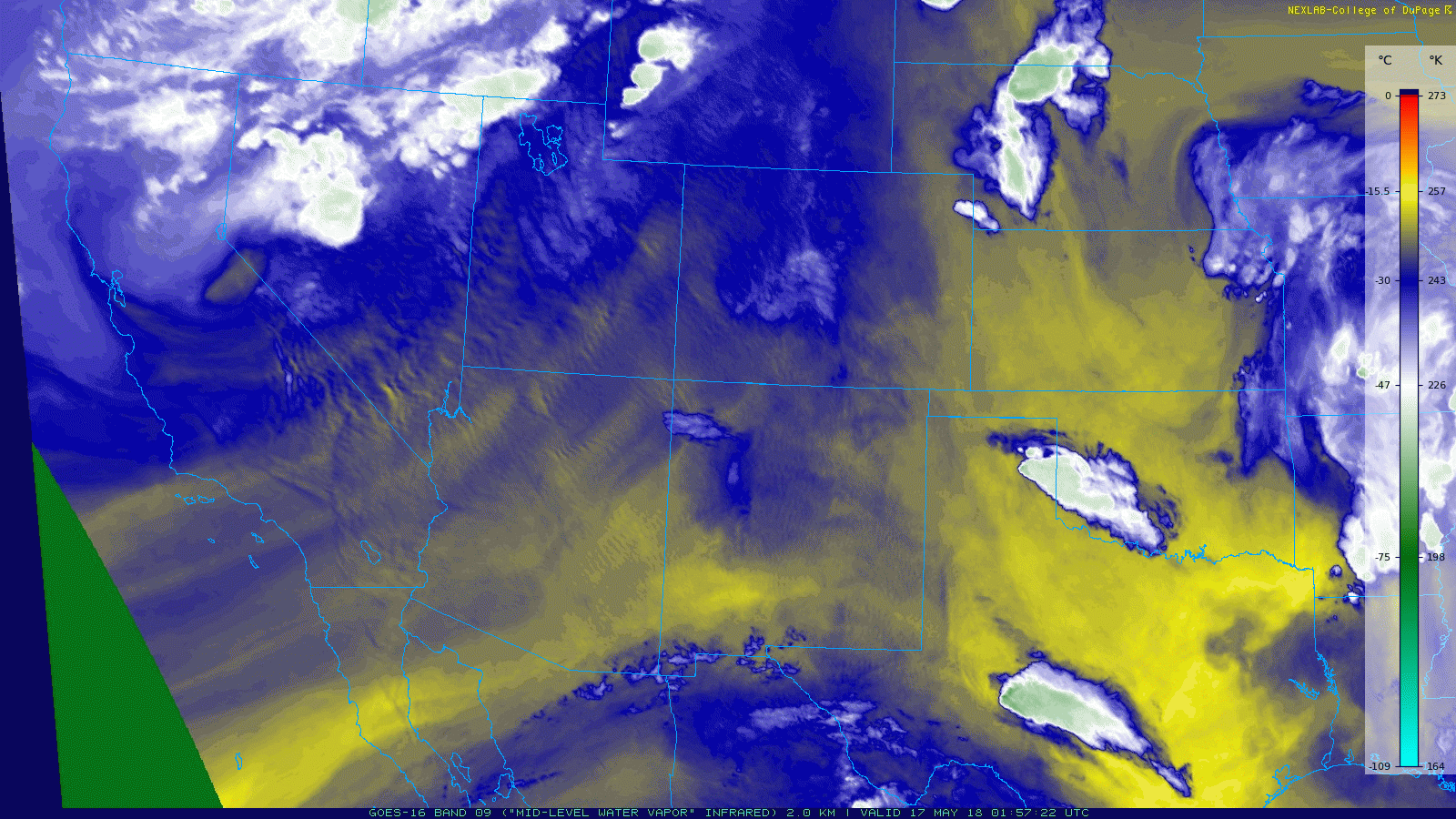
GOES-16 water vapor animation this morning.
The storm will arrive into western Colorado by Friday afternoon, weaken and then redevelop slightly across northeast Colorado. The precise details and location of this regeneration are going to be a key factor for how much precipitation we see this weekend. There is a ton of moisture available with this system. As a result, somewhere between Denver and Cheyenne will end-up in the “sweet spot” of the storm….cashing in on convective thunderstorms on Friday afternoon, and then eventually strong and juicy upslope on Saturday. The GFS 700 mb temperature and wind forecast map below is for Saturday morning.
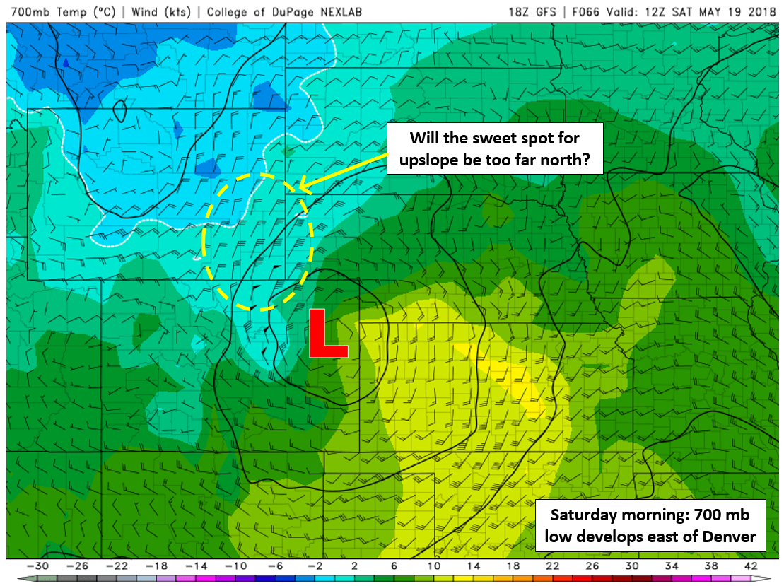
GFS 700 mb temperature and wind forecast for Saturday. The best upslope will stretch from Denver into southern Wyoming.
Most model runs right now, including this one, dump the heaviest precipitation north and east of Denver into southeast Wyoming. Here is a look at what the latest GFS model run thinks for precipitation potential. The precipitation is heaviest to our north and east…2 to 4 inches.
Latest GFS total precipitation forecast through Tuesday.
However, there is enough variation in model runs that we can’t rule out the more southern track which would give our region a significant period of intense upslope rainfall. In fact, we believe this is the most likely scenario.

GFS ensemble plumes precipitation forecast for the weekend in Denver.
Nonetheless, it’s going to be a busy forecast over the next few days. Here’s what we believe will happen…
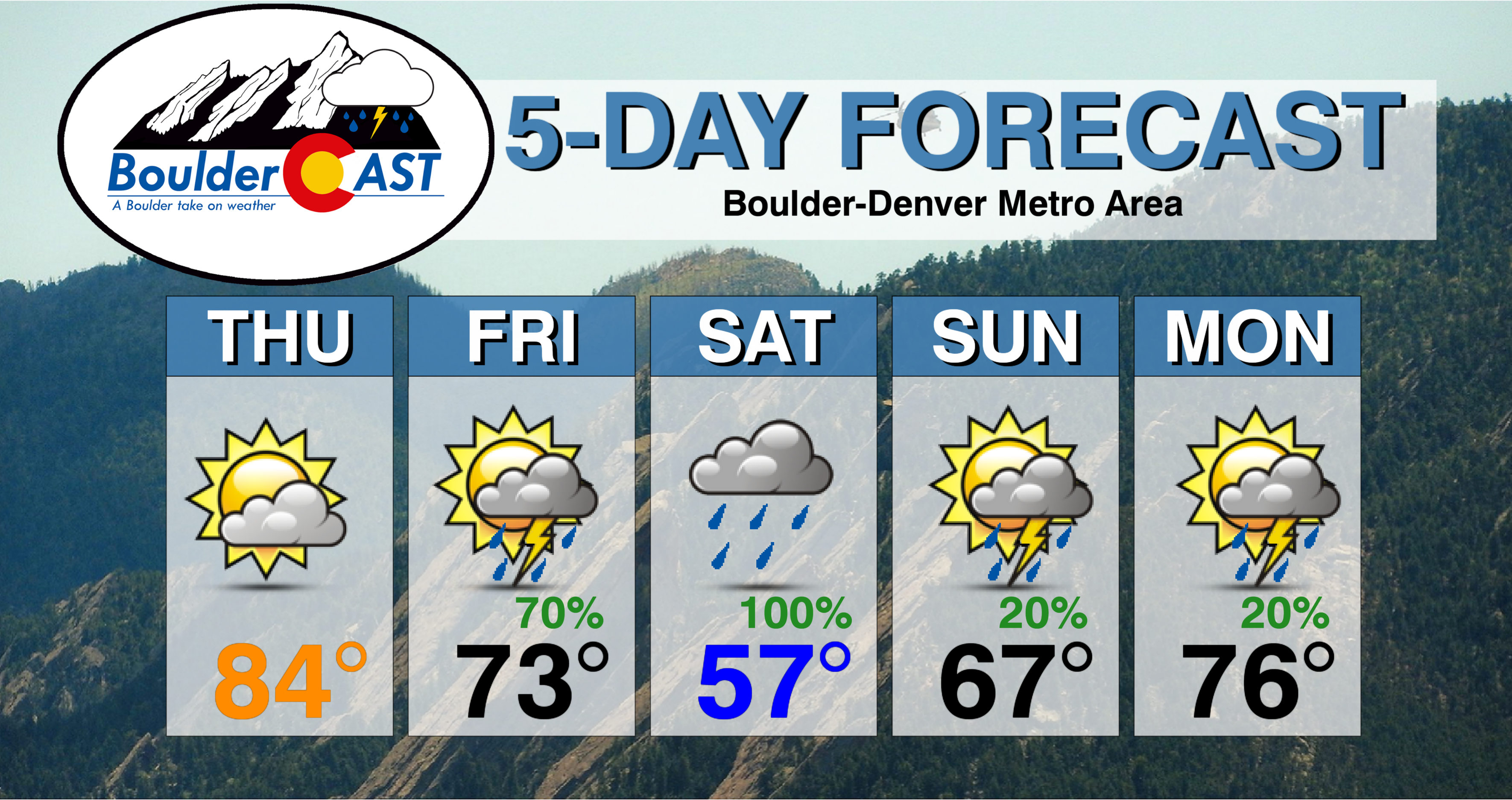
Thursday: Mostly dry, partly sunny
Ahead of the storm, conditions will largely remain quiet across the Metro area. Expect temperatures in the lower 80’s with increasing clouds through the day and about a 10% chance of an afternoon shower or thunderstorm. Severe storms with large hail are possible during the evening in the northeast corner of Colorado into Nebraska.
Friday: Scattered severe thunderstorms capable of large hail
Deeper moisture and more favorable lift will combine to produce a wave of late afternoon and early evening thunderstorms across the Metro area on Friday. Southwest flow aloft and northeasterly surface flow, in tandem with 1500 to 2500 J/kg of CAPE will set the stage for the development of severe storms near and northeast of the Metro area on Friday.
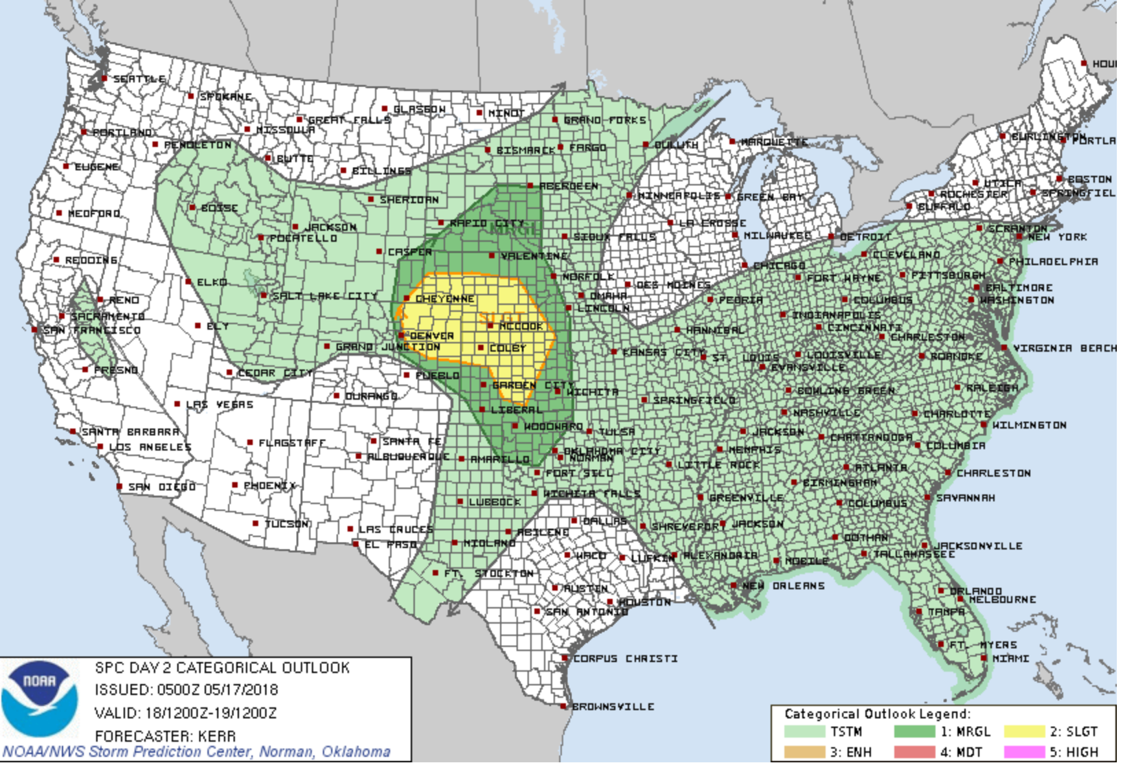
Severe storm outlook for Friday from the Storm Prediction Center.
Storms are expected to initiate in the higher elevations and move eastward onto the Plains by late afternoon. The severe threat is highest heading east from Denver. Though we’ll be catching to storms early in their development cycle, the atmosphere will be rather unstable and the storms could quickly explode and be capable of producing large hail and strong outflow winds across the region. Be sure to keep an eye to the sky on Friday, especially between about 3:00 and 8:00 PM. You do not want to be caught off-guard by 1 to 2″ diameter hail. Temperatures on Friday will be in the 60’s with mostly cloudy skies.
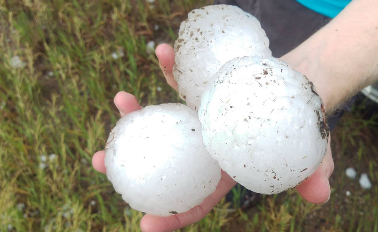
3.75″ hail from a storm chase in June 2017.
There may be a lull in the action later Friday evening and night. This will be the figurative “eye of the storm”…the calm after the convective thunderstorms on Friday and before the main system develops across northeast Colorado on Saturday.
Saturday: Cancel any outdoor plans
It will be a soggy, dreary day. In the morning, a surface low will deepen across east-central Colorado, moving into Kansas by afternoon. This is shown in the surface map below.

GFS sea-level pressure and precipitation forecast map for Saturday afternoon. Widespread precipitation is indicated across northeast Colorado!
This development will increase moisture-rich north-northeasterly winds into much of northern Colorado. As such, we expect Saturday to be dominated by overcast skies and widespread light to moderate precipitation. We say precipitation, and not just rainfall, because some colder air will be wrapping into the northwest quadrant of the storm. The 700 mb temperature map below has slightly sub-freezing temperatures across the region Saturday afternoon (a mile above ground level).
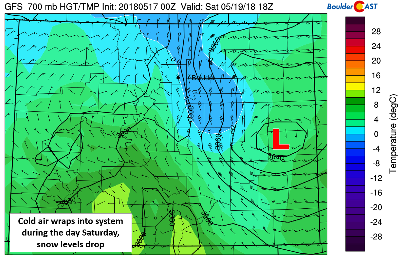
700 mb temperature and wind map for Colorado on Saturday. The 700 mb low develops in east central Colorado with cool northerly winds pushing into the Metro area.
Snow levels are expected to drop down to around 9,000 feet Saturday morning and through the afternoon hours. Though at the moment, there are significant model differences (by several thousand feet) between the NAM and GFS (even colder). 3 to 10″ of snow will be possible in the Mountains above 10,000 feet and north of Interstate 70, with maybe even a few wet snowflakes around Ward near 9,000 feet.
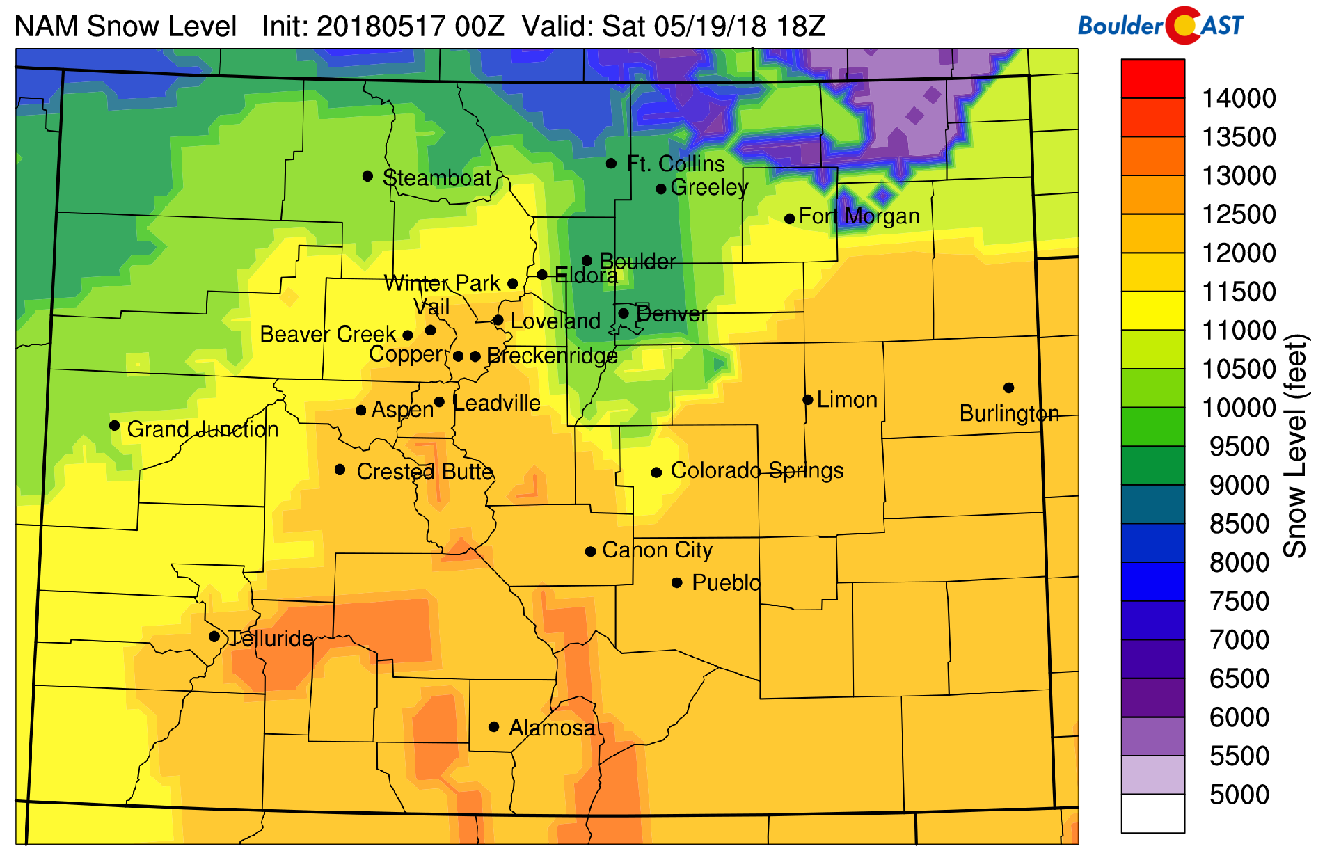
NAM model-derived snow level forecast for Saturday afternoon.
For most residential areas, though, it will be all rain on Saturday….lots of rain….with temperatures remaining on the cool side in the lower 50’s. Rain will taper off through the evening and night Saturday.
We think rain totals across the Denver Metro area through Saturday night land between 0.75″ and 2.0″. Though, we have seen repeated model indication that some portions of the area could see 2 to 5″, which of course would raise flood concerns for the Front Range.
Sunday and beyond:
The main storm system will be gone by Sunday morning. Residual moisture and southwest flow across the region will allow for daily isolated to scattered afternoon and evening thunderstorms Sunday and heading into early next week. In general, there will be a warming trend with temperatures returning to the 70’s by Monday and 80’s come the middle of next week.
The overall warm and wet pattern of late is right in-line with the extended forecast we issued at the beginning of the month.
.
Feature photo credit: @Kat Shanahan on Instagram
.
Spread the word about the hail and flooding potential! Share this forecast:


You must be logged in to post a comment.