We warned you on Monday about the potential for the weather to turn gloomier just in time for the weekend. While that forecast is indeed going to materialize, the track of the cut-off storm system has trended further west through the week. This means it won’t be quite as cold or soggy as initially expected across Colorado. Nonetheless, the unseasonably warm and dry pattern we’ve experienced for the last week is now over. Cooler weather and chances for rain are here to stay.
The 500 mb height anomaly animation below shows the storm system in question. The animation covers Friday through next Tuesday. Watch the storm as it dives southward into northwestern Nevada initially, then gets “stuck” and remains stationary.
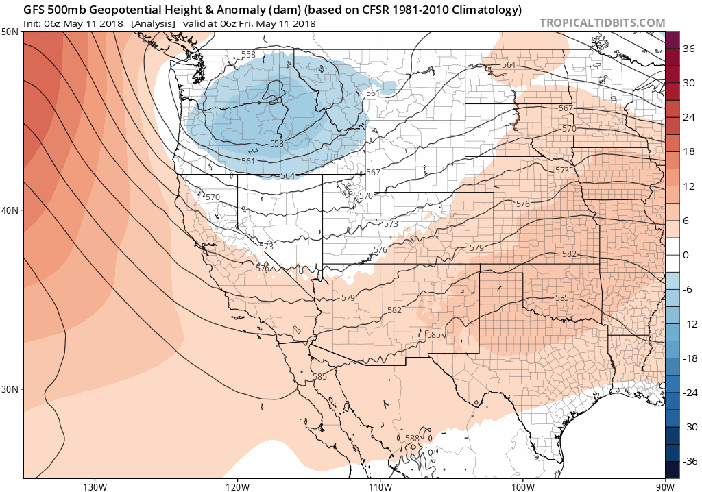
GFS 500 mb height anomaly animation for Friday through Tuesday (from Tropical Tidbits).
Sandwiched between the two ridges, the storm will basically have nowhere to go over the weekend and into early next week. Here’s the storm’s position Friday evening…
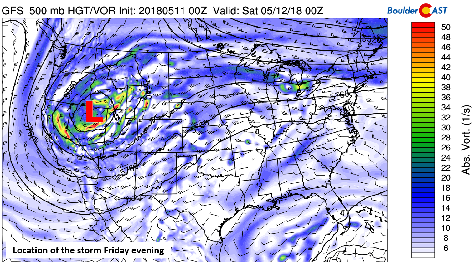
GFS 500 mb vorticity map for Friday evening.
And then Saturday night….
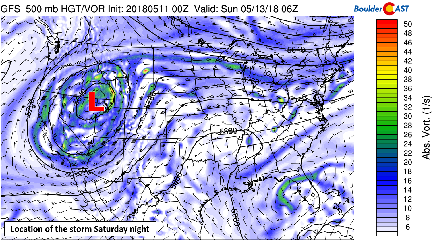
GFS 500 mb vorticity map for Saturday night.
And finally next Tuesday afternoon…
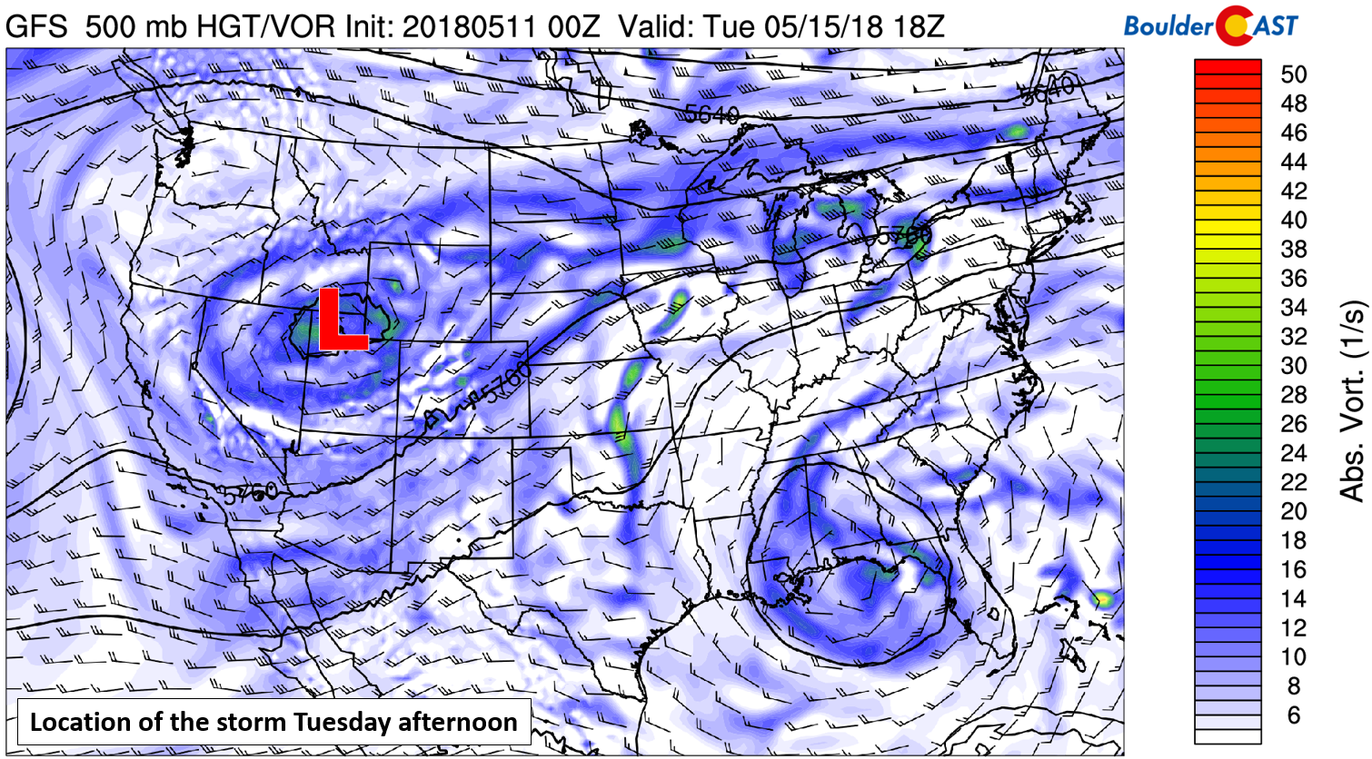
GFS 500 mb vorticity map for Tuesday afternoon.
Northern Colorado will be on the fringe of influence the entire time from this system. The best forcing for widespread precipitation will be closer to the center of the low, that is in Wyoming, Idaho, and Utah. However, in the lower levels of the atmosphere, there will be a pesky frontal boundary meandering back and forth through the weekend across the Front Range. We already saw this boundary move into the Metro Area Thursday evening. It has since pushed back northward on Friday.
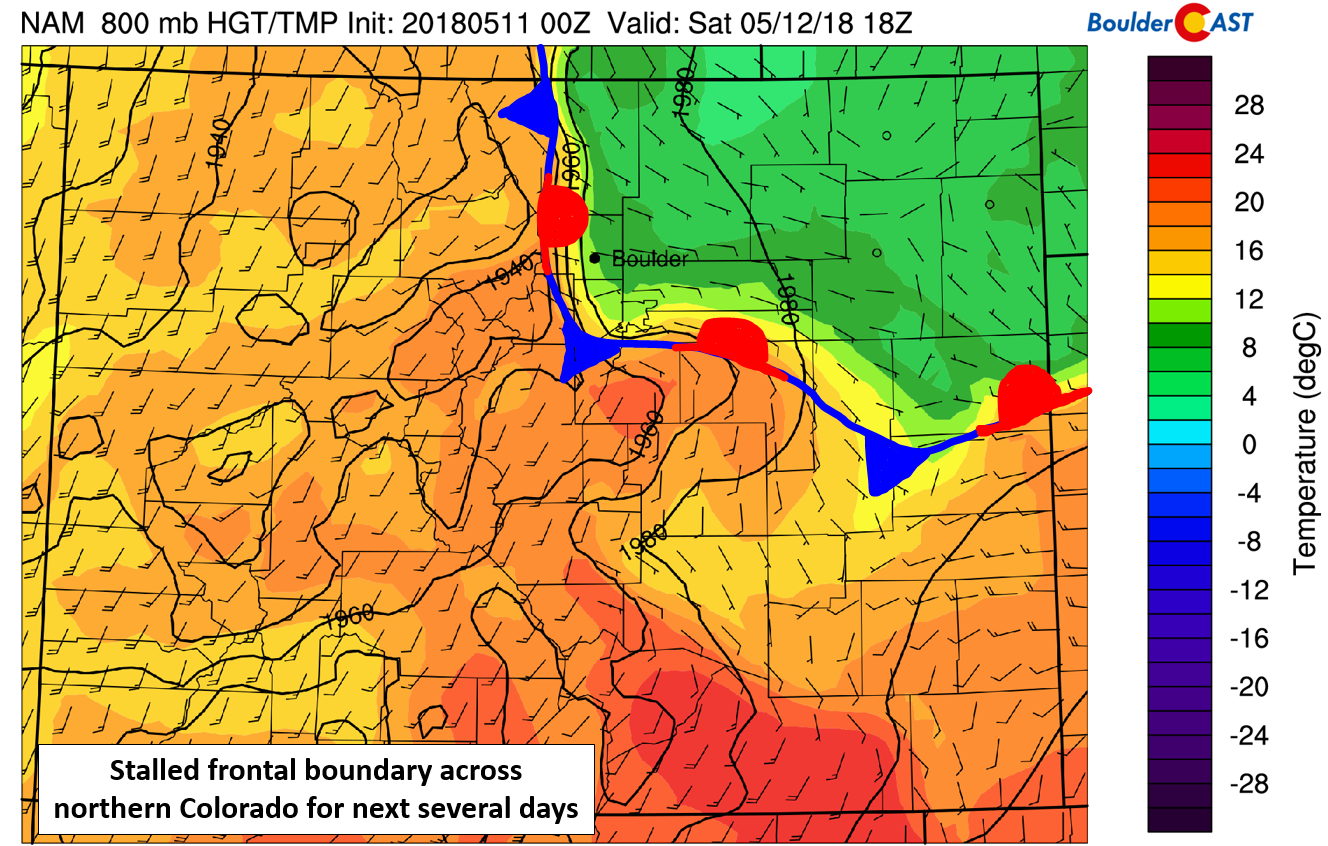
NAM 800 mb temperature and wind forecast for Saturday showing a stalled frontal boundary draped across northeast Colorado.
The moist easterly flow on the cool side of the front in tandem with southwest flow on the warm side will act as a focusing mechanism for afternoon and evening showers and thunderstorms each and every day for the foreseeable future. This boundary will also provide sizable shear to allow for isolated severe thunderstorm development if enough lift is available. The main threat will be large hail and strong winds, especially Friday and Sunday northeast of Denver, though conceivably the severe threat may persist into early next week given the stagnant weather pattern.
Overall, the weather this weekend will not be terrible. Temperatures will be in the mid 50’s to mid 60’s with periods of clouds and sun. Showers and storms will mainly be confined to the afternoons and evenings, and will be hit-or-miss in nature. Not everyone will see rain everyday. The best chances for more widespread thunderstorm coverage will be Sunday and early next week as the storm system slowly moves eastward.
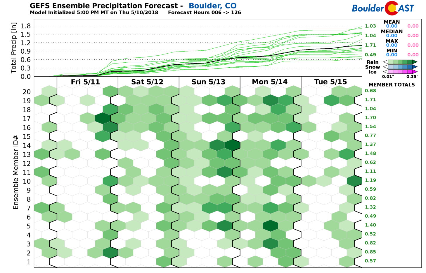
GFS ensemble precipitation forecast through Tuesday.
Rainfall totals by the middle of next week should be decent across the Front Range. A summation of numerous hit-and-miss thundershowers should equate to most areas picking up 0.5 to 1.0″ of rain, with higher amounts in lucky spots. The GFS rainfall accumulation forecast map below seems rather reasonable.
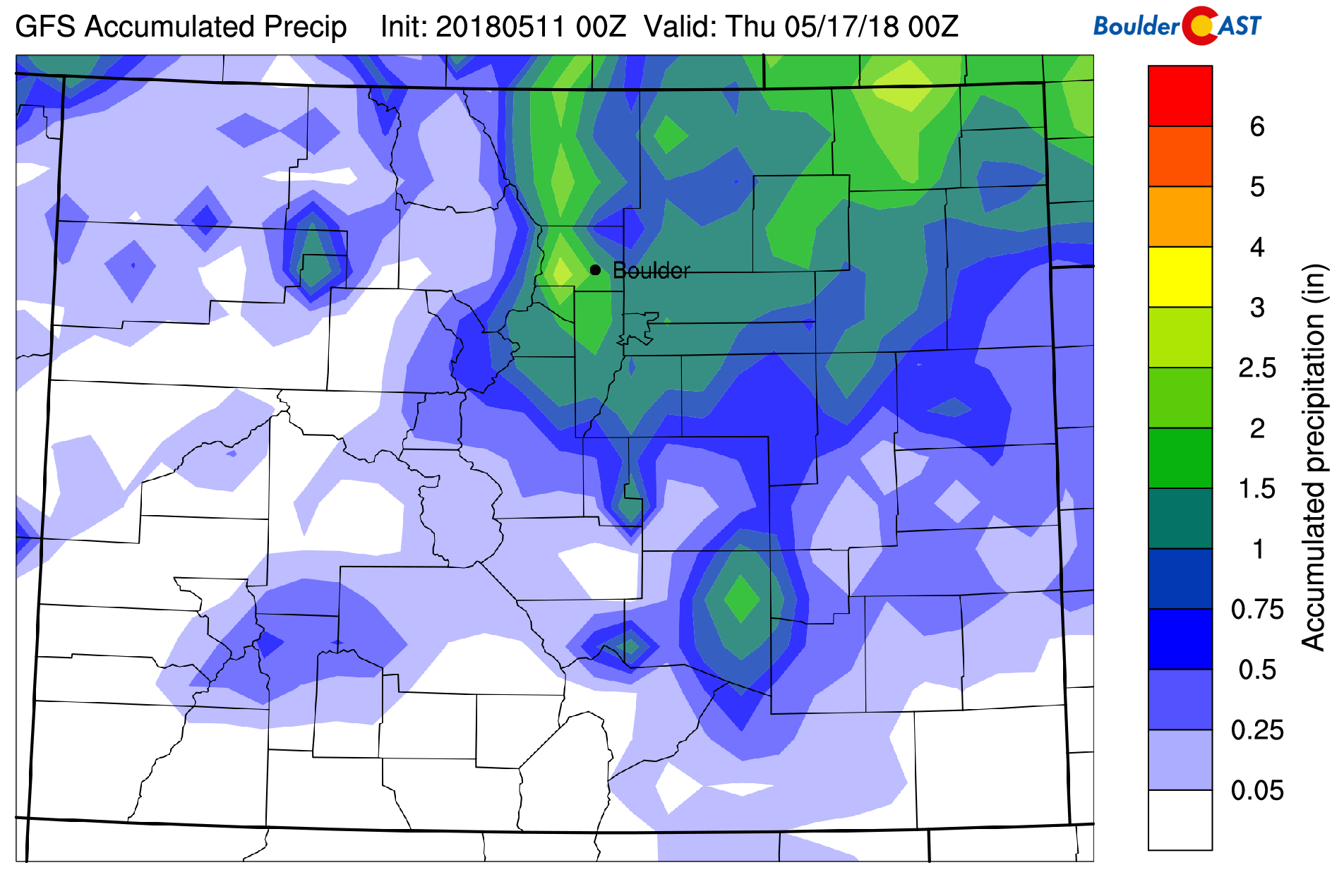
GFS total accumulated precipitation forecast through next Wednesday.
Unfortunately, this will be yet another system that spreads moisture into northern Colorado, but skips the withering southern portion of our state…
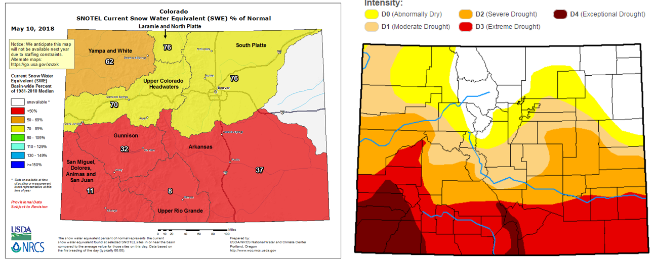
Current Colorado snowpack (left) and drought (right) as of May 11, 2018.
Forecast Specifics:
Friday: Mostly sunny early with widely scattered showers and thunderstorms in the evening and overnight. Isolated severe thunderstorms capable of large hail are expected well northeast of Denver towards the Wyoming border. Highs in the low 70’s. Chance of rain 30%.
Saturday: Mostly cloudy with isolated afternoon and evening thunderstorms. Highs in the mid to upper 50’s. Chance of rain 20%.
Sunday: A mix of clouds and sun with scattered afternoon and evening storms. A few isolated storms could reach severe level with large hail in and around the Metro area. Highs in the 60’s. Chance of rain 40%.
Early Next Week: Unsettled weather continues across the Front Range with hit-or-miss afternoon and evening storms likely each and every day.


You must be logged in to post a comment.