This week’s storm produced a hefty amount of precipitation to the entire Front Range. We provide a recap of the storm’s rain and snow, and also discuss a major pattern shift set to impact the western United States soon.
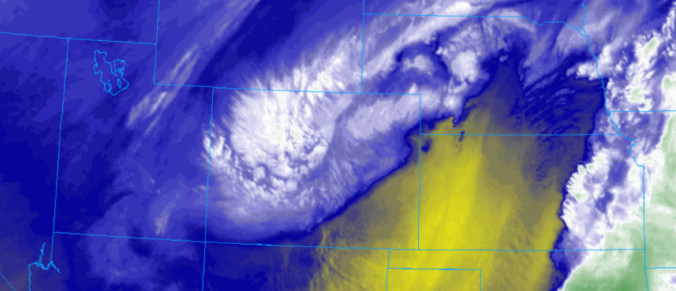
Yet another slow-moving, southern-track storm system moved across the state of Colorado this week. The mid-level water vapor animation below shows the storm’s progression from Tuesday through Thursday night this week. Try to follow the track from southern California all the way into Nebraska!
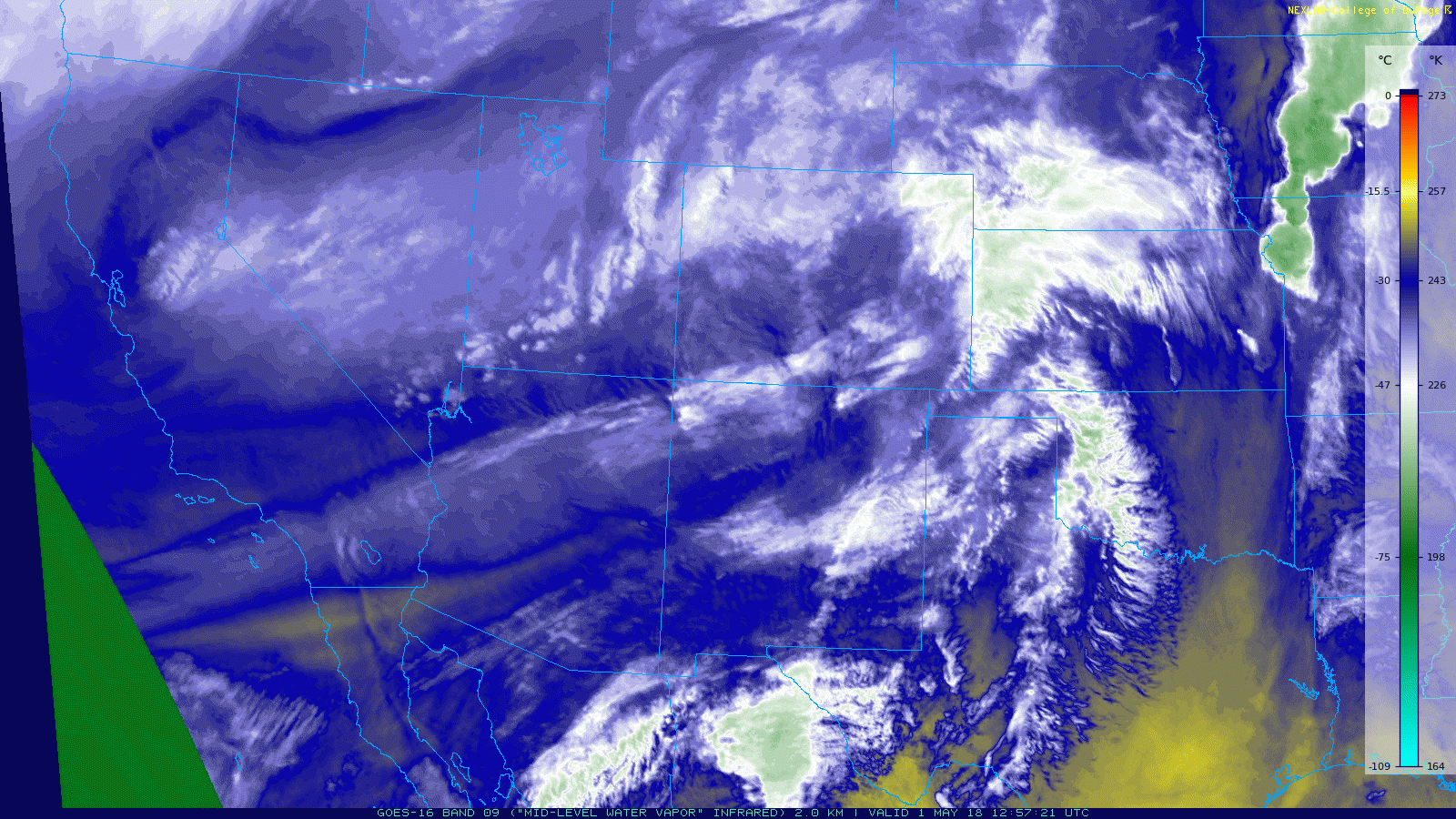
If you notice, the storm moves directly into northeast Colorado and exits into Nebraska. As we discussed in our forecast, this track is slightly too far north in order to maximize our precipitation here in the Denver Metro area. The graphic below shows observed 3-day precipitation totals for the storm across the Front Range. Totals generally landed in the 0.75″ to 1.75″ range. This was right in-line with our forecast. As expected due to the northern track, the biggest totals were to our north near the Wyoming border where up to 3″ of precipitation was reported.
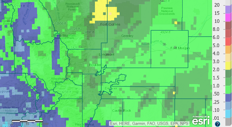
May 1-3, 2018 precipitation totals across Front Range Colorado.
The drought-stricken San Juan Mountains also received beneficial rain and snow from this storm…thought it wasn’t nearly the magnitude of dumping our region received.

May 1-3, 2018 precipitation totals across the Southern Rockies.
Boulder officially recorded 1.70″ of rain from the storm, with Denver trailing behind at 0.96″. The timeline of Thursday’s weather from BoulderCAST station shows an extended period of steady rainfall beginning around 1:00 AM and continuing into the afternoon.

Timeline of temperature (red) and dewpoint (green) for May 3, 2018 in Boulder, CO.
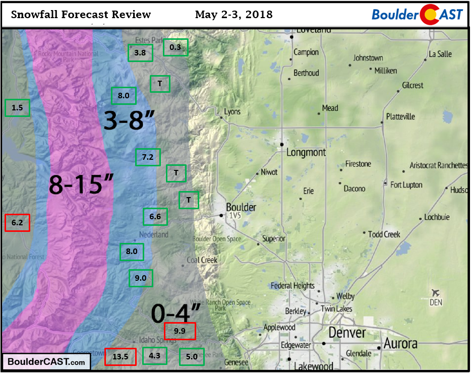
As you can see above, temperatures were indeed too warm for snow across the lower elevations. We only dropped to 39 degrees at BoulderCAST Station during the peak of the rain Thursday morning. However, we did see sloppy snowfall in the Foothills above 7,000 feet. Temperatures were very marginal so there was a fine snow-line during the storm, with many valleys in the Foothills remaining all rain while heavy snow fell on the top of the hills. Reports indicate anywhere from a slushy coating up to a foot of snow accumulated in the Foothills. Shown below are some of the reports (in boxes) overlaid on top of our snowfall forecast map.
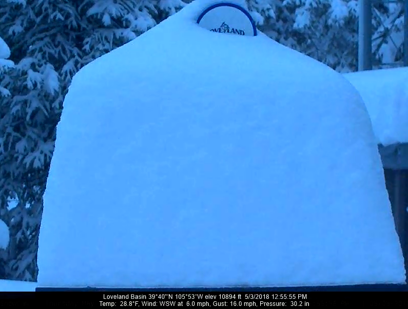
The few remaining ski resorts that are open reported between 16 and 20″ of fresh snow. The image below shows 15″ on the snow table at Loveland Thursday afternoon!
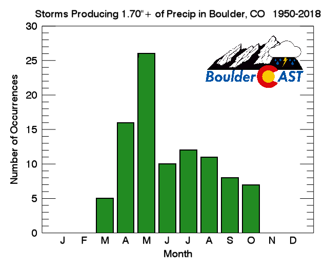
The 1.70″ of rain in Boulder is a lot of precipitation for one storm! In fact, that’s about 10% of our ANNUAL average for Denver Metro area. How rare is a precipitation event of this magnitude in Boulder? In the last 68 years, there has only been 95 storms that have produced 1.70″ of precipitation (or more). That averages out to once or twice per year. As you can see in the plot below, the most likely month for these big storms to occur is May. Go figure…our wettest month!
If you’re tired of the rainy weather, you’re in luck! A major pattern shift is in progress right now. Much of North America will see a ridge form this weekend and hold strong for an extended period. There is good agreement in the long-range models and the ensembles for this (see below). We’ll surely be discussing this big warm-up and boring weather in our weekly outlook on Monday. Spoiler alert: We’ll most likely see many days in a row in the 80’s. Have a good weekend!

Share this update:
.


You must be logged in to post a comment.