

Last week’s storm finally delivered the kind of soaking rain we’ve been waiting months to see, but don’t get used to it. The atmosphere is shifting back into a familiar pattern this week, with summer-like warmth, abundant sunshine, and another surge of tropical moisture headed toward the Southwest. The catch? Most of that moisture will never make it to the Front Range. In this week’s update, we look at the drought-improving impacts of last week’s storm, why the San Juans are poised to cash in yet again, and whether a late-week cold front can squeeze out a little bit of rain for us before temperatures finally start feeling a bit more like October.
This week’s highlights include:
- 🌧️ A Storm That Delivered — Last week’s soaking rain delivered Boulder’s biggest storm since May and may finally be enough to chip away at drought conditions that have worsened across the region all summer.
- ☀️ Autumn Still on Hold — Another week of temperatures running 5 to 15 degrees above normal is ahead, with many afternoons feeling more like September than the second half of October.
- 🌊 Tropical Moisture Takes Aim — Moisture connected to Tropical Storm Trudy will surge into the Southwest later this week, pushing atmospheric moisture levels to remarkable levels for this time of year.
- ⛰️ Southwest Colorado Strikes Gold Again — The San Juans are positioned for yet another round of heavy precipitation, adding to an already impressive wet streak that has transformed drought conditions in that region.
- ☁️ Lots of Moisture, Little Rain? — Despite the impressive moisture plume overhead, the Front Range will be left with little more than thicker clouds and a few passing showers after the Mountains wring out most of the available moisture upstream.
- 🌦️ Watching the Weekend Closely — A late-week cold front could bring our next opportunity for showers while also ending the extended warm spell and returning temperatures to a more seasonable October feel.
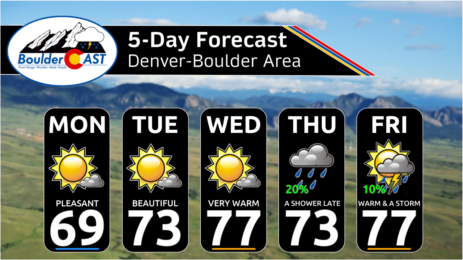
DISCLAIMER: This weekly outlook forecast is created Monday morning and covers the entire upcoming week. Accuracy will decrease as the week progresses as this post is NOT updated. To receive daily updated forecasts from our team, among many other perks, subscribe to BoulderCAST Premium.

Go Premium, get all the perks.
Daily Forecast Updates
Get our daily forecast discussion every morning delivered to your inbox.
All Our Model Data
Access to all our Colorado-centric high-resolution weather model graphics. Seriously — every one!
Ski & Hiking Forecasts
6-day forecasts for all the Colorado ski resorts, plus more than 120 hiking trails, including every 14er.
Smoke Forecasts
Wildfire smoke concentration predictions up to 72 hours into the future.
Exclusive Content
Weekend outlooks every Thursday, bonus storm updates, historical data and much more!
No Advertisements
Enjoy ad-free viewing on the entire site.
Last Week’s Storm Delivered, Just Not Everywhere Equally
Last week’s storm was exactly the kind of event the Front Range desperately needed. After months of watching systems either miss us entirely or underperform where it mattered most, this one finally produced a widespread soaking rain for much of the region. The storm’s upper-level low tracked from southwest to northeast, passing almost directly over the Denver area on Thursday, a path that is typically somewhat favorable for sustained precipitation in our area.
GOES-East water vapor animation of last week’s storm as it passed across Colorado
The storm’s evolution wasn’t perfect. In fact, it was a bit backwards from what many expected. The front half of the event overachieved while the back side underperformed, leading to some concern Thursday that totals might come up short. In the end, though, most areas received roughly the precipitation allocation we were forecasting, just delivered in a slightly different way than originally anticipated.
As is often the case with these type of storm tracks, the biggest winners were Boulder and Larimer Counties, where upslope enhancement and favorable positioning relative to the low combined to maximize rainfall totals. Most locations west of Interstate 25 picked up at least 0.75″ of precipitation, while pockets west of Boulder approached 2″ of rain. Meanwhile, parts of eastern and southeastern portions of the Denver Metro area were left wanting more, missing out on much of the heavier precipitation.
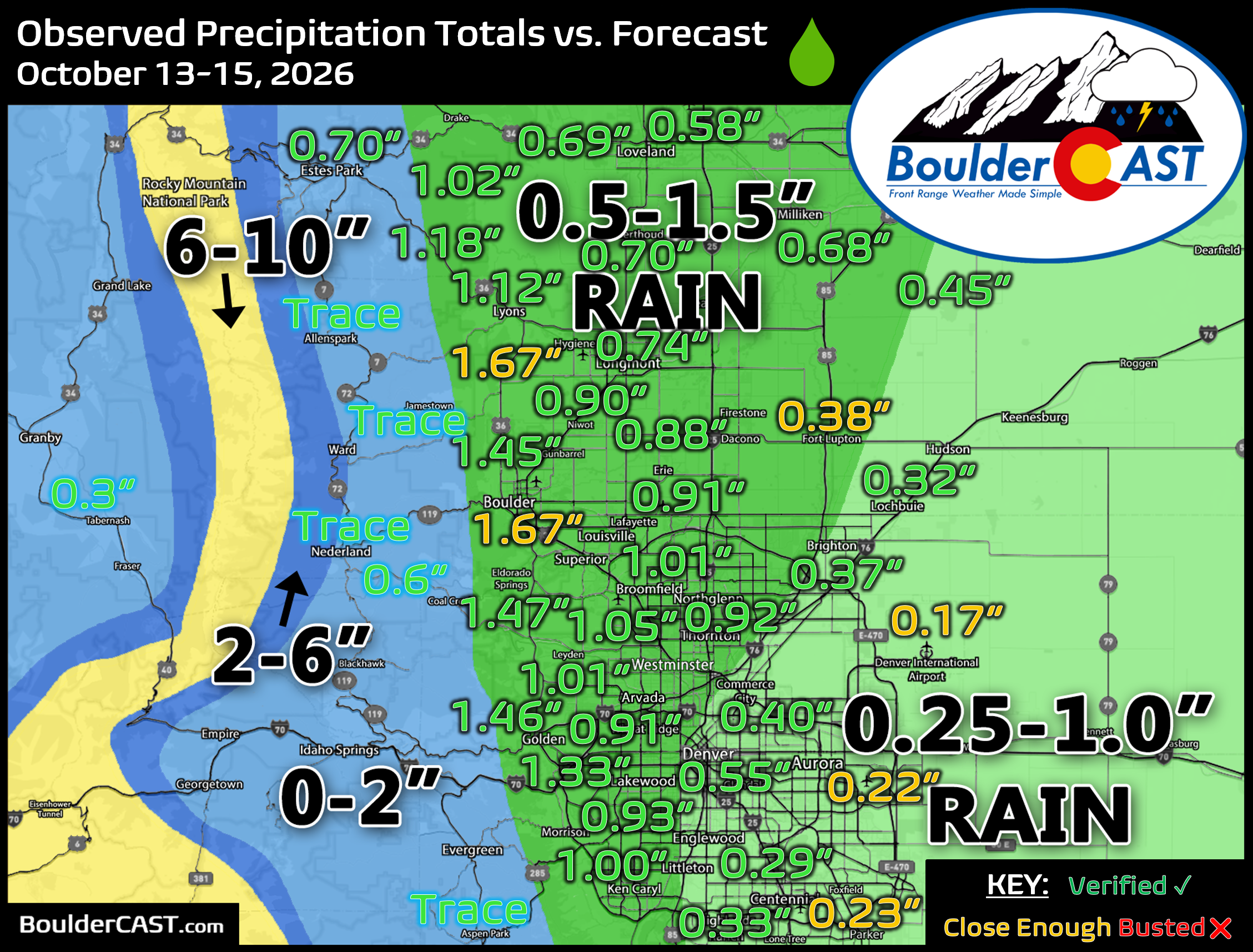
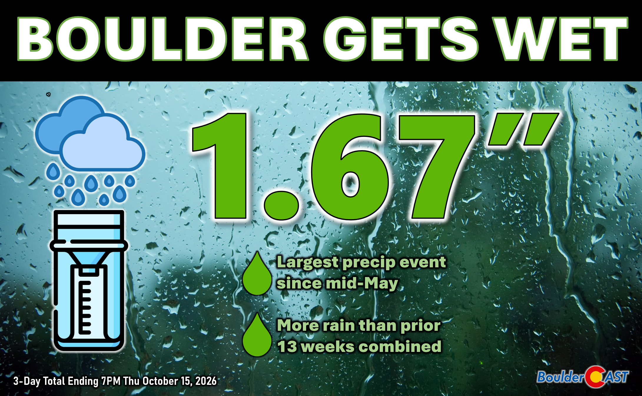
Officially, Boulder measured 1.67″ of rain from the storm. To put that into perspective, that’s more precipitation than fell during the previous 13 weeks combined, dating back to late July. It was also Boulder’s biggest storm since mid-May and one of the most impactful precipitation events of the last two years. Denver’s results were considerably less impressive, especially near the airport where only 0.17″ was measured, an amount that barely stands out among several other modest rain events from recent months.
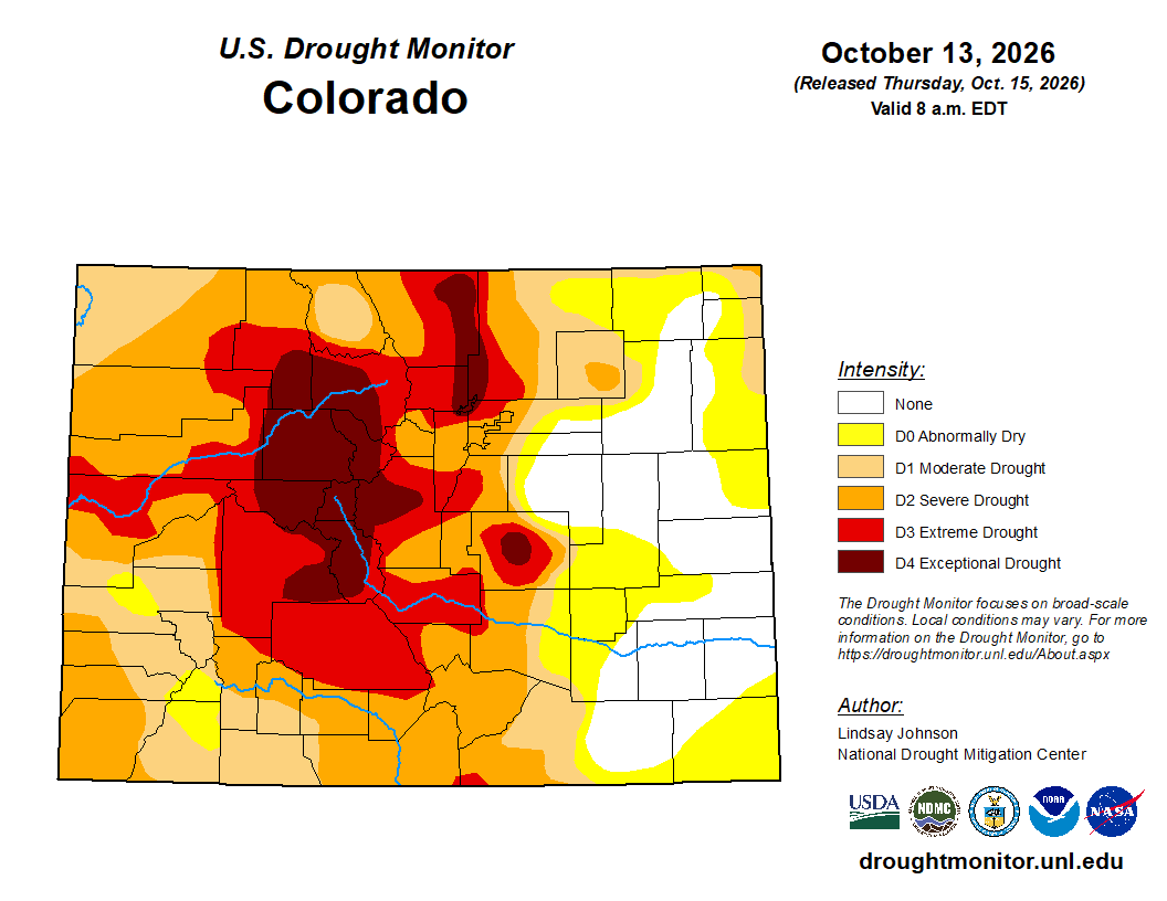
Overall, this was an excellent storm for the northern Front Range and one that arrived at an important time. While a single storm won’t erase months of accumulating drought impacts, it likely provided enough relief to improve conditions by one or perhaps even two drought categories in some locations. We’ll find out later this week when the latest Drought Monitor update incorporates last week’s rainfall. Given how much of the recent expansion of Extreme and Exceptional Drought has occurred across Boulder, Larimer and nearby counties, this storm should finally turn the needle in the right direction.
On the backside of the storm, as expected, most (but not all) of the lower elevations saw frost or a light freeze Friday morning. It’s possible your location may have dodged a truly killing freeze, though temperatures came pretty close to freezing several nights in a row.
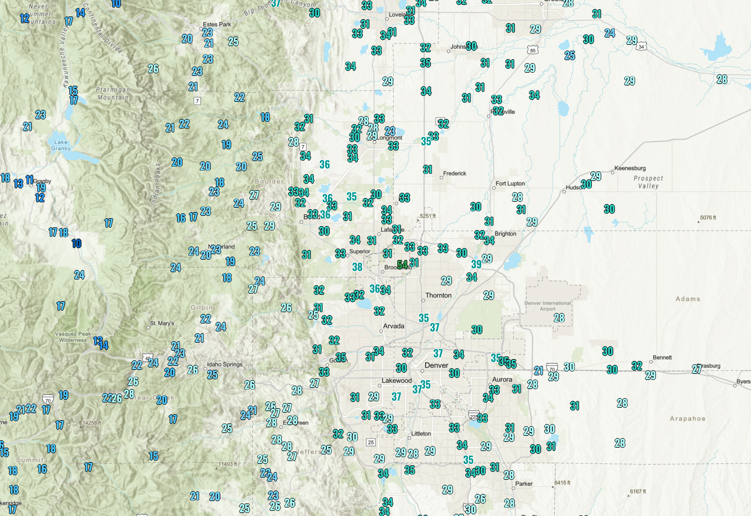
Observed low temperatures on Friday October 16, 2026. Not everyone saw a freeze, but many did.
A Warm, Quiet Week Returns to the Front Range
After last week’s excitement, the atmosphere is taking a much more relaxed approach.
This past weekend was beautiful across the Front Range, with highs reaching well into the 70s both Saturday and Sunday under mostly sunny skies. If it felt more like September than the second half of October, that’s because it essentially was. Warmth has been one of the defining weather stories of this fall, and the pattern ahead suggests no immediate rush toward winter either.
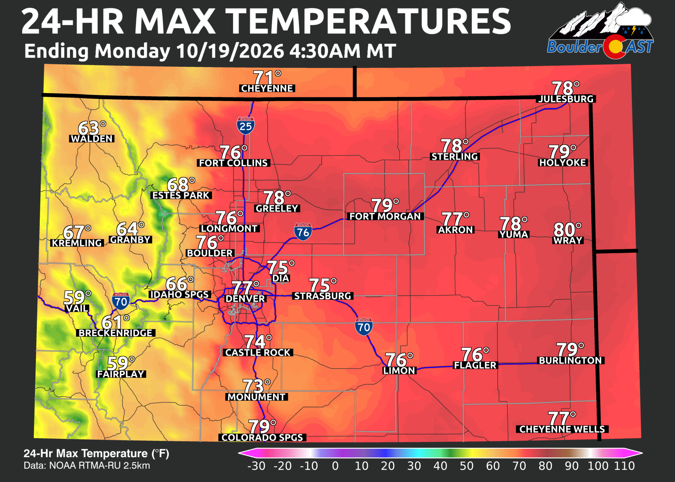
Sunday’s observed high temperatures
Looking at the big-picture setup Monday morning via GOES-East satellite imagery, three features stand out:
- A deep Pacific low pressure system sitting offshore of the Pacific Northwest. This will eventually influence our weather, but it remains in no hurry to do so.
- Tropical Storm Trudy, spinning west of Puerto Vallarta with sustained winds near 60 MPH. While the storm itself poses no direct threat to Colorado, some of its moisture will eventually be drawn northward into the Southwest and Rockies.
- A dominant ridge of high pressure stretching across the eastern half of the United States. This ridge is acting like a traffic jam in the atmosphere, slowing the progression of western weather systems and allowing warm conditions to persist across much of the nation.
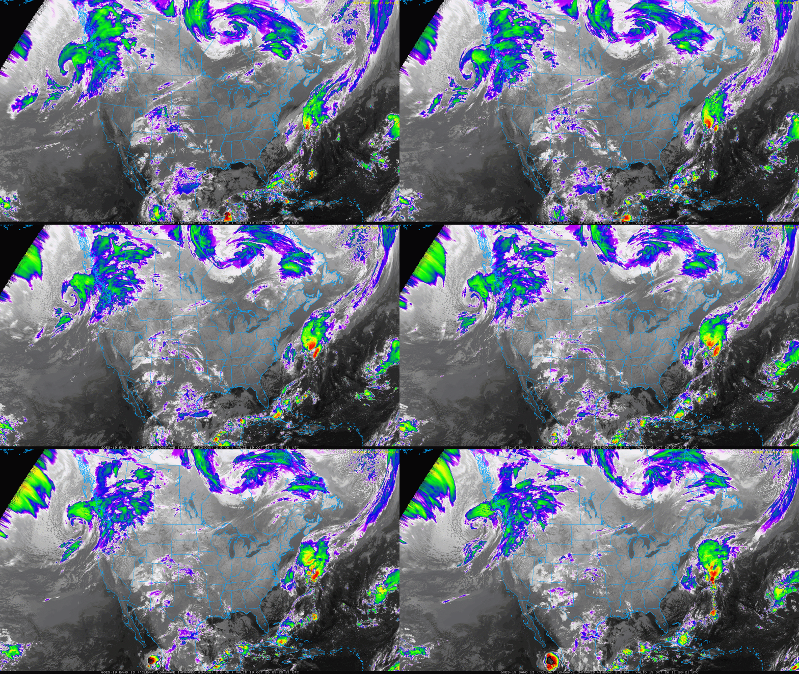
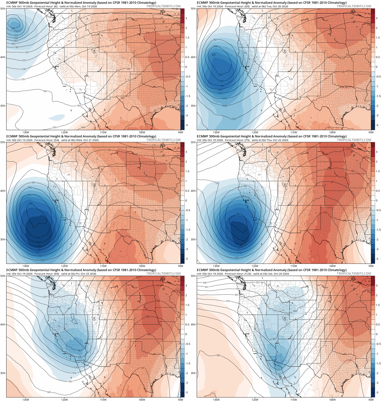
The result will be an impressively deep southwest flow developing across the Four Corners region.
Atmospheric moisture levels are forecast to surge to more than 200% of normal between Wednesday and Friday, with some guidance briefly pushing values above 300% of climatology on Thursday. That’s an extraordinary amount of moisture for late October, and part of it traces back to Tropical Storm Trudy in the mid and upper atmosphere.
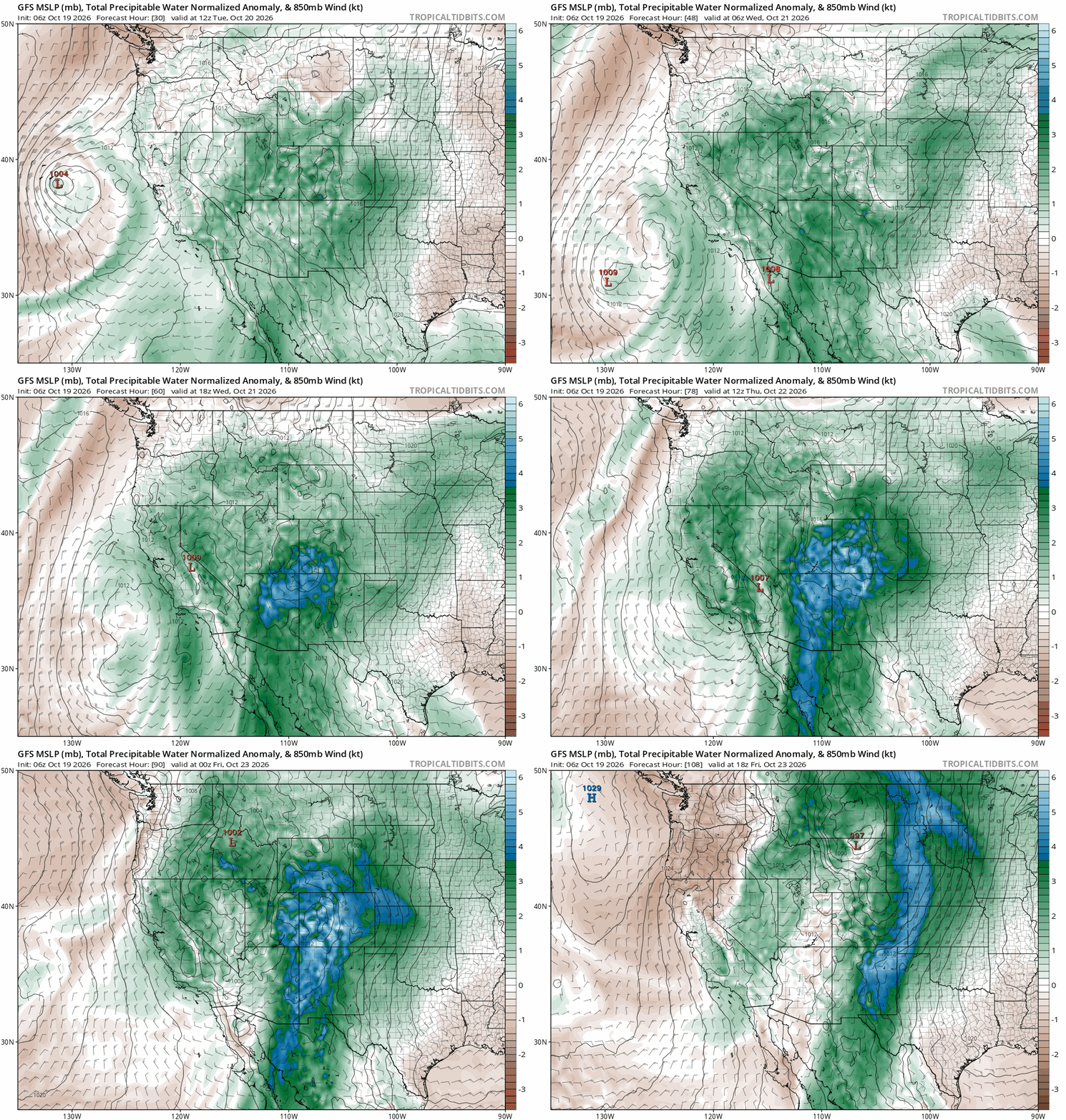
Unfortunately for Front Range rain lovers, we’ve seen this movie several times over the last few months.
Deep southwest flow by itself is often not enough to generate meaningful precipitation east of the Continental Divide. Without strong forcing, cold air, or a favorable upslope component, much of that moisture will get intercepted and wrung out over the mountains long before it reaches the Denver area.
That means the primary beneficiaries once again will be the Mountains, especially southwest Colorado and the San Juans. This region has been repeatedly favored by tropical moisture events during the past two months and the results have been remarkable. Some locations have accumulated between 8 and 18 inches of precipitation since late summer, an almost unbelievable amount by Colorado standards. Much of it has fallen as rain, even at elevations that would typically be seeing much more snow by this point in the season.
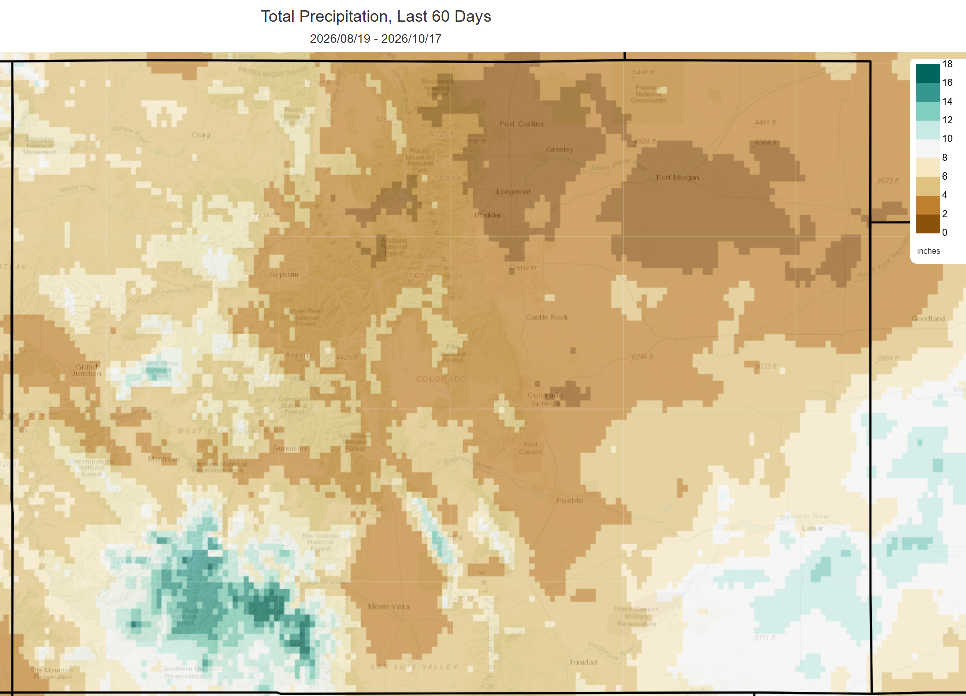
Not surprisingly, drought conditions have improved dramatically across portions of southwest Colorado while much of central and northern Colorado have continued to struggle.
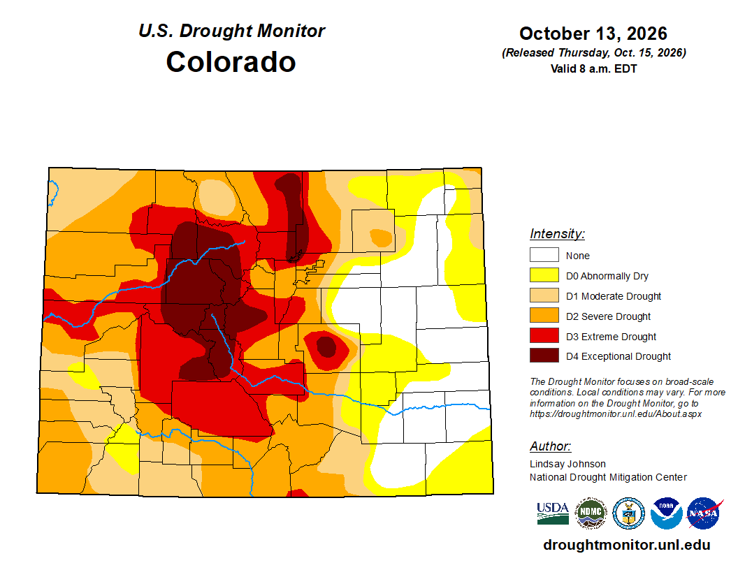
This week’s setup will likely add to those gains. Another 1 to 3 inches of precipitation appears possible across portions of the San Juans. Meanwhile, an influx of unusually warm subtropical air will keep snow levels exceptionally high for late October, generally above 12,000 feet. That means widespread rain, rather than snow, falling onto existing early season snowpack and already saturated soils. As a result, flooding concerns may begin to emerge later this week across parts of southwest Colorado and will bear watching closely.
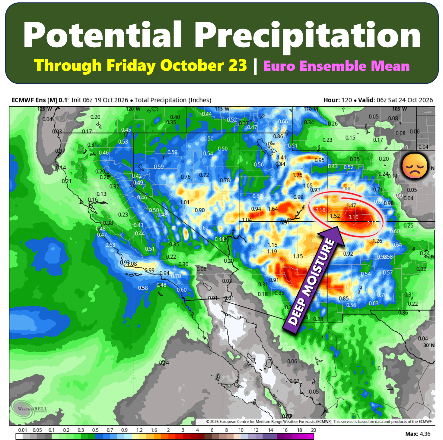
Here along the Front Range, however, expectations remain far more modest.
We’ll once again be positioned downstream of multiple mountain ranges that will strip much of the available moisture from the atmosphere before it can reach us. Some light showers or rounds of sprinkles are possible Thursday into Friday as the deepest moisture plume brushes the area, but forecasts currently support little more than a few hundredths of an inch of rain. The most noticeable impact of this moisture event will end up being extensive mid and upper-level cloud cover rather than measurable rainfall.
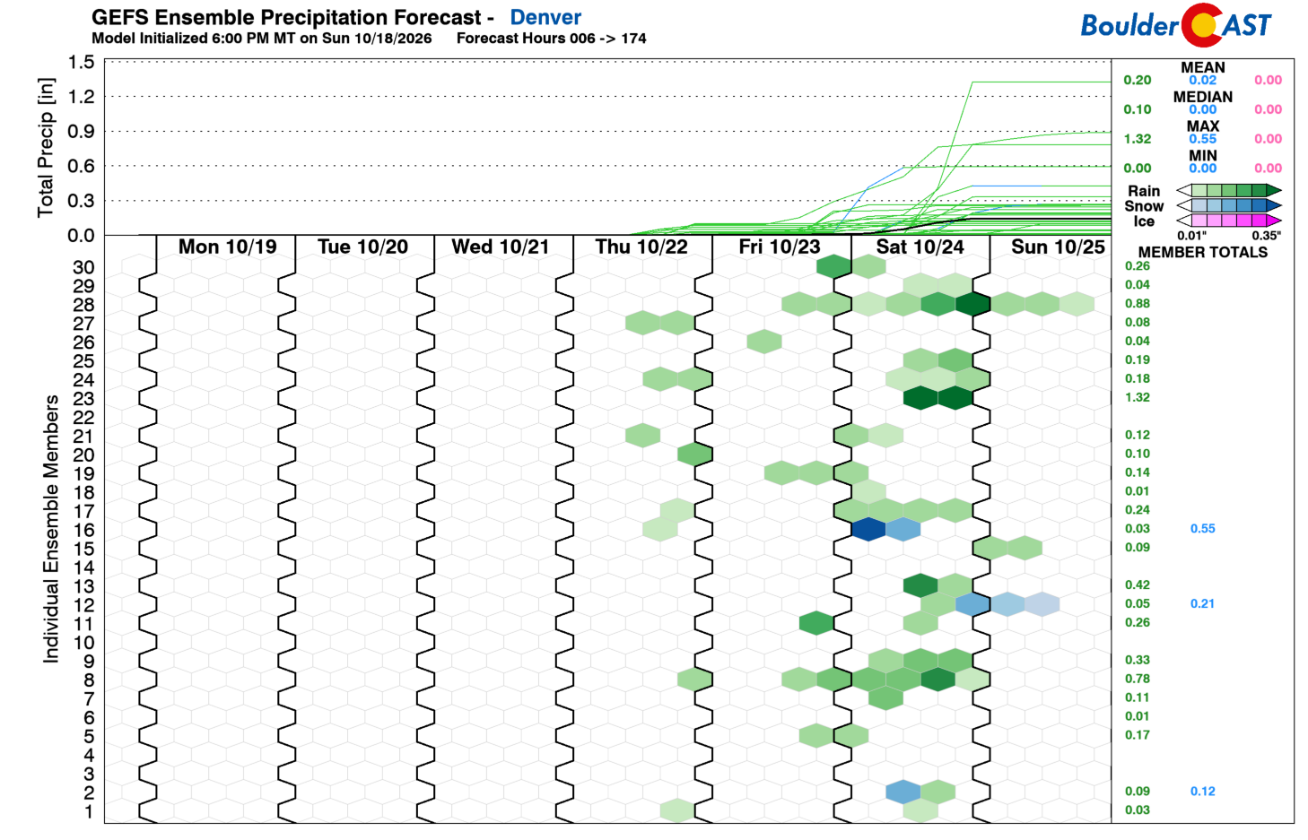
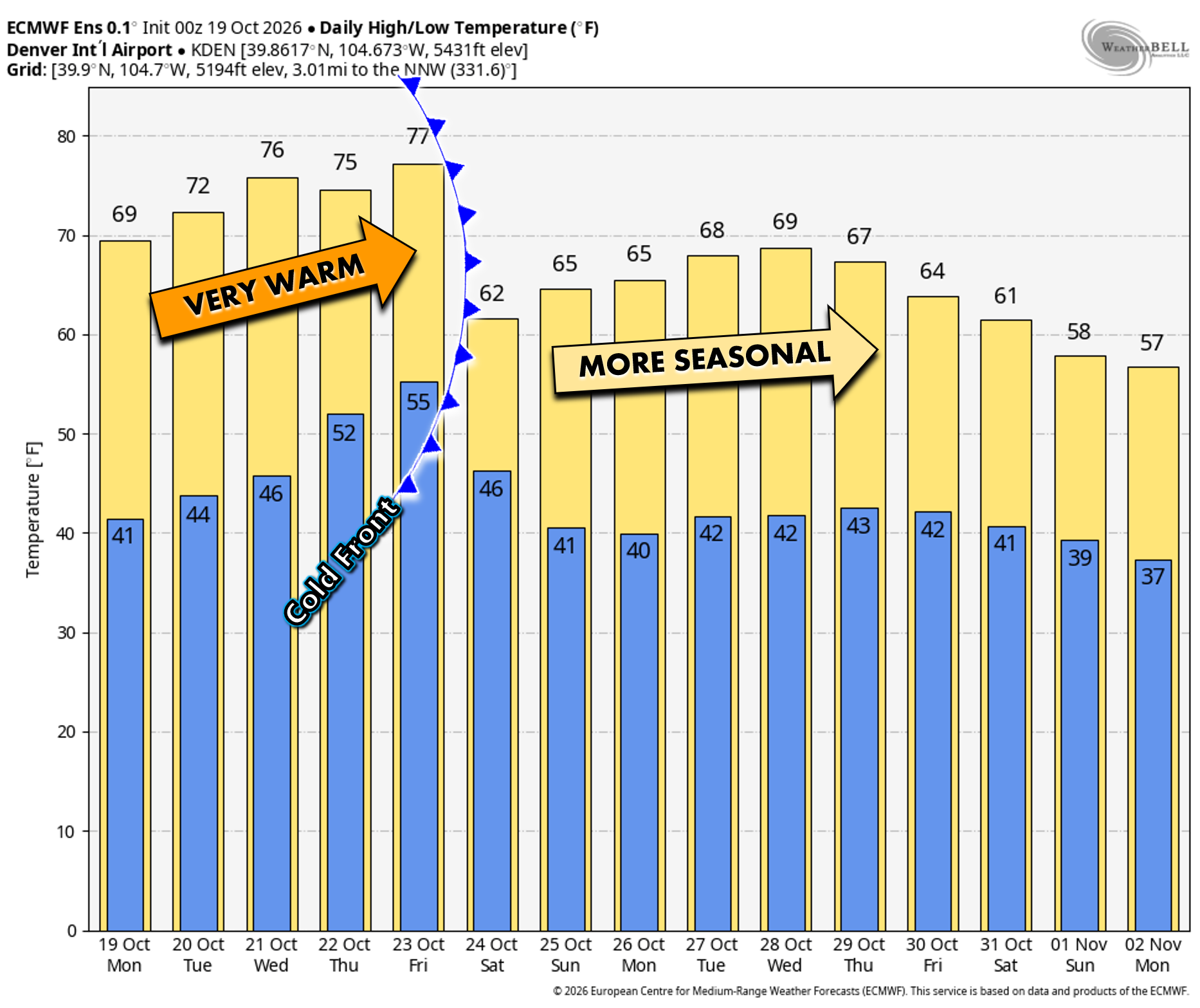
Temperatures throughout the week should remain 5 to 15 degrees above average. Monday will likely be the coolest day following a weak cold front, but even that cooldown is relative. Sunshine should dominate through at least Wednesday morning before increasing subtropical moisture spreads northward and thickens cloud cover later in the week. Despite the increase in clouds, temperatures will remain unusually warm for October.
More Active by the Weekend?
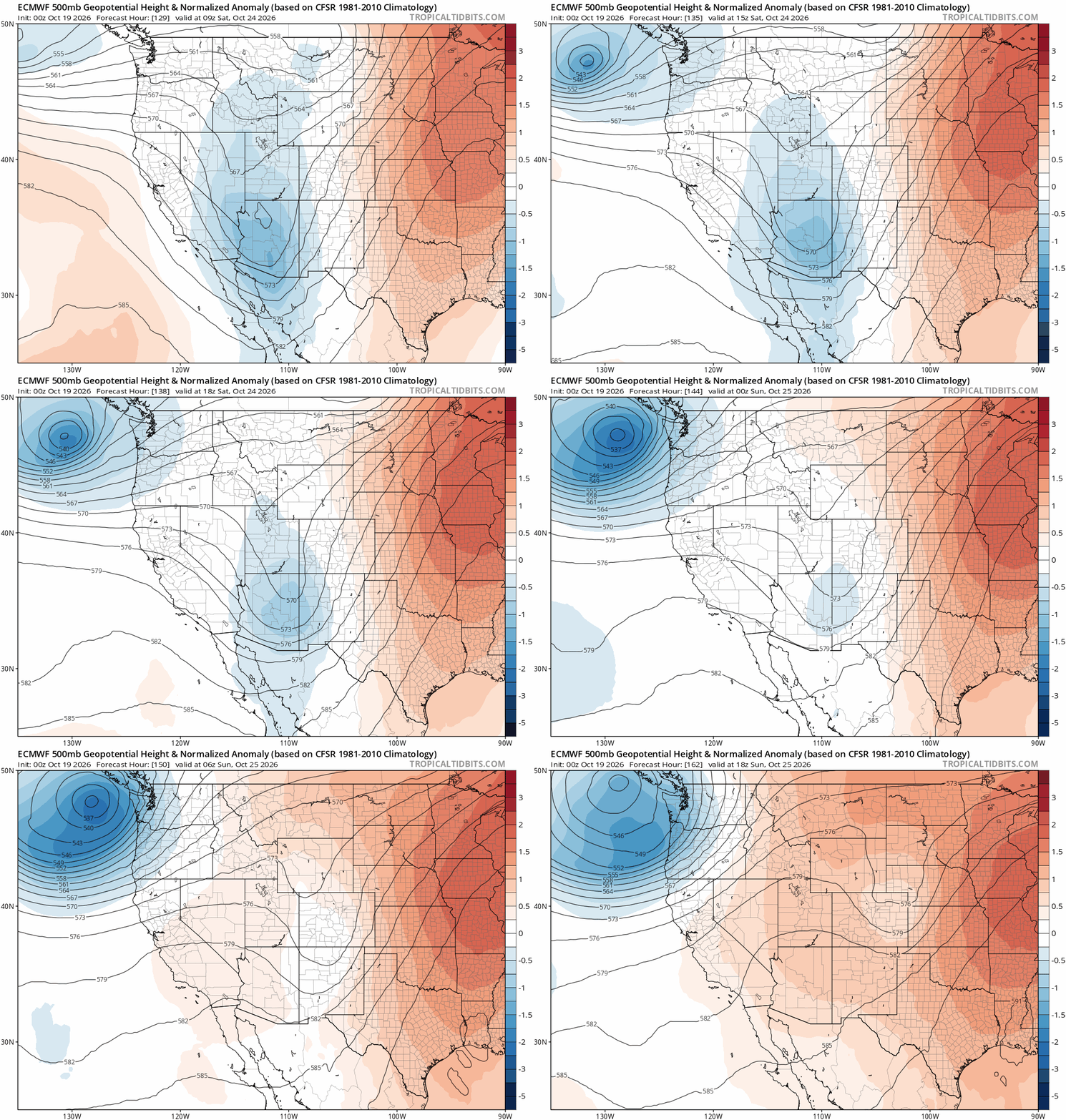
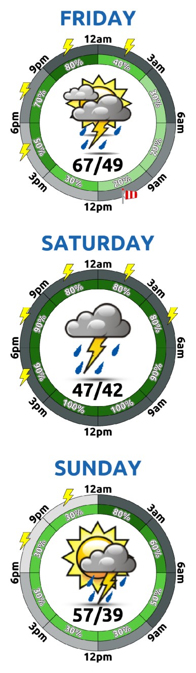
Looking beyond Friday, forecast guidance suggests the stubborn Southwest low will finally begin to weaken and eject eastward during the weekend. As that occurs, a cold front is expected to slide south across eastern Colorado sometime Saturday.
This setup could provide a slightly better opportunity for precipitation across the Front Range compared to what we’ll see during the workweek. At the moment, shower chances remain fairly low, generally in the 20 to 30% range, but they are worth watching. Any precipitation would likely fall as rain across the lower elevations, with snow confined to the higher Foothills and Mountains.
The more certain outcome is a return to temperatures that actually feel like October. Highs should settle back into the 60s this weekend and likely remain there into next week, bringing the Front Range back toward a more seasonable autumn pattern.
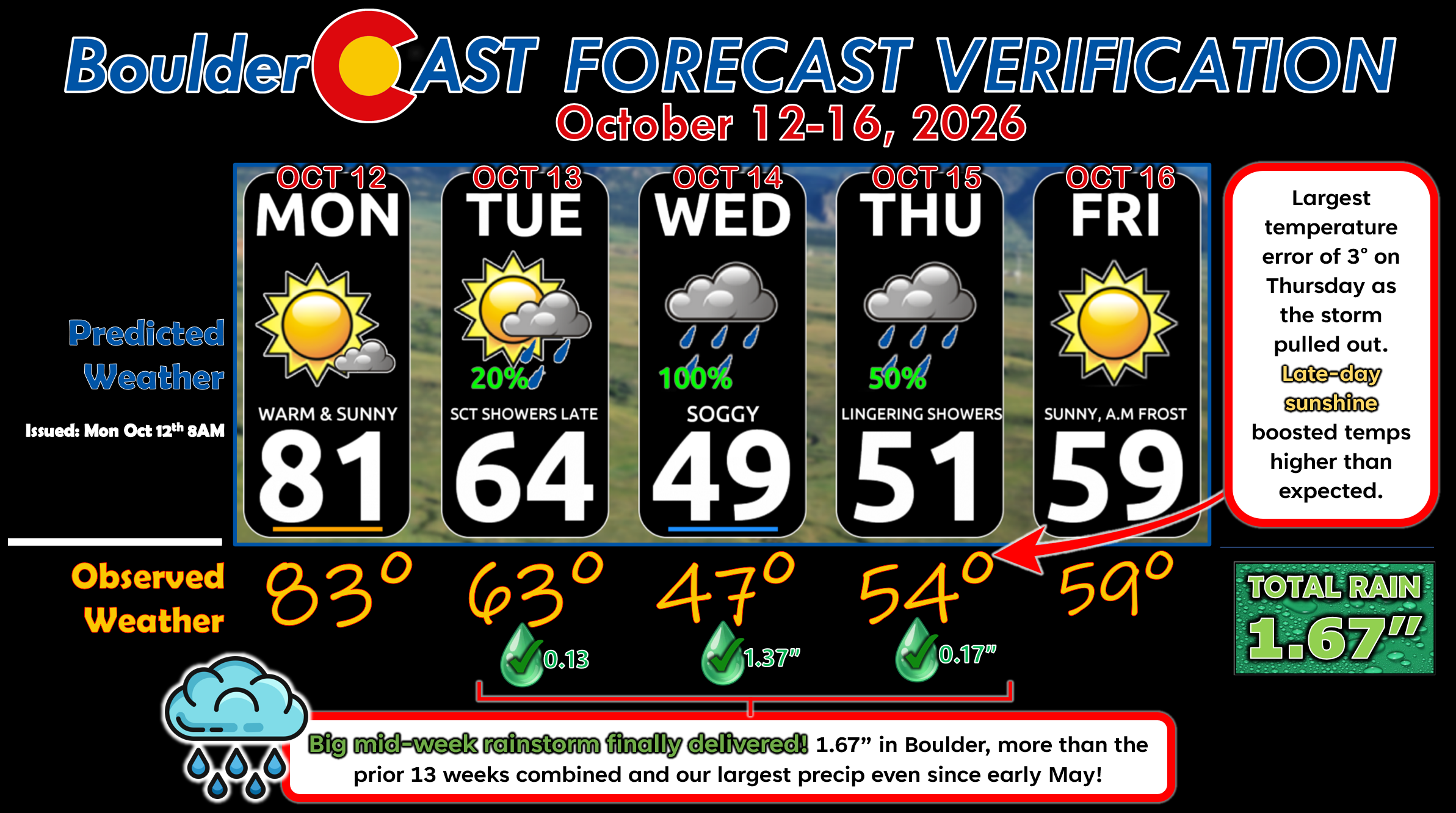
Forecast Verification: October 12-16, 2026 (Last Week)
- Finally a rainstorm delivered! 1.67″ in Boulder spread across three days, our latest precip event since mid-May!
- Largest temperature error was 3° on Thursday as the storm exited, leaving behind late-day sunshine that boosted temperatures slightly higher than forecast.
- Excellent temperature predictions all days given the magnitude of the soggy storm and uncertainties surrounding it.
DISCLAIMER: This weekly outlook forecast is created Monday morning and covers the entire upcoming week. Accuracy will decrease as the week progresses as this post is NOT updated. To receive daily updated forecasts from our team, among many other perks, subscribe to BoulderCAST Premium.
Go Premium, get all the perks.
Daily Forecast Updates
Get our daily forecast discussion every morning delivered to your inbox.
All Our Model Data
Access to all our Colorado-centric high-resolution weather model graphics. Seriously — every one!
Ski & Hiking Forecasts
6-day forecasts for all the Colorado ski resorts, plus more than 120 hiking trails, including every 14er.
Smoke Forecasts
Wildfire smoke concentration predictions up to 84 hours into the future.
Exclusive Content
Weekend outlooks every Thursday, bonus storm updates, historical data and much more!
No Advertisements
Enjoy ad-free viewing on the entire site.
Enjoy our content? Give it a share!





Leave a Reply
You must be logged in to post a comment.