Most of the week ahead in the Front Range will feature dry weather with well above normal temperatures for early December. However, we are closely tracking our next storm system set to arrive on Friday with much colder temperatures returning alongside a good chance of snowflakes. Read on for the latest details on what should be yet another spirited week in Colorado weather!
This week’s highlights include:
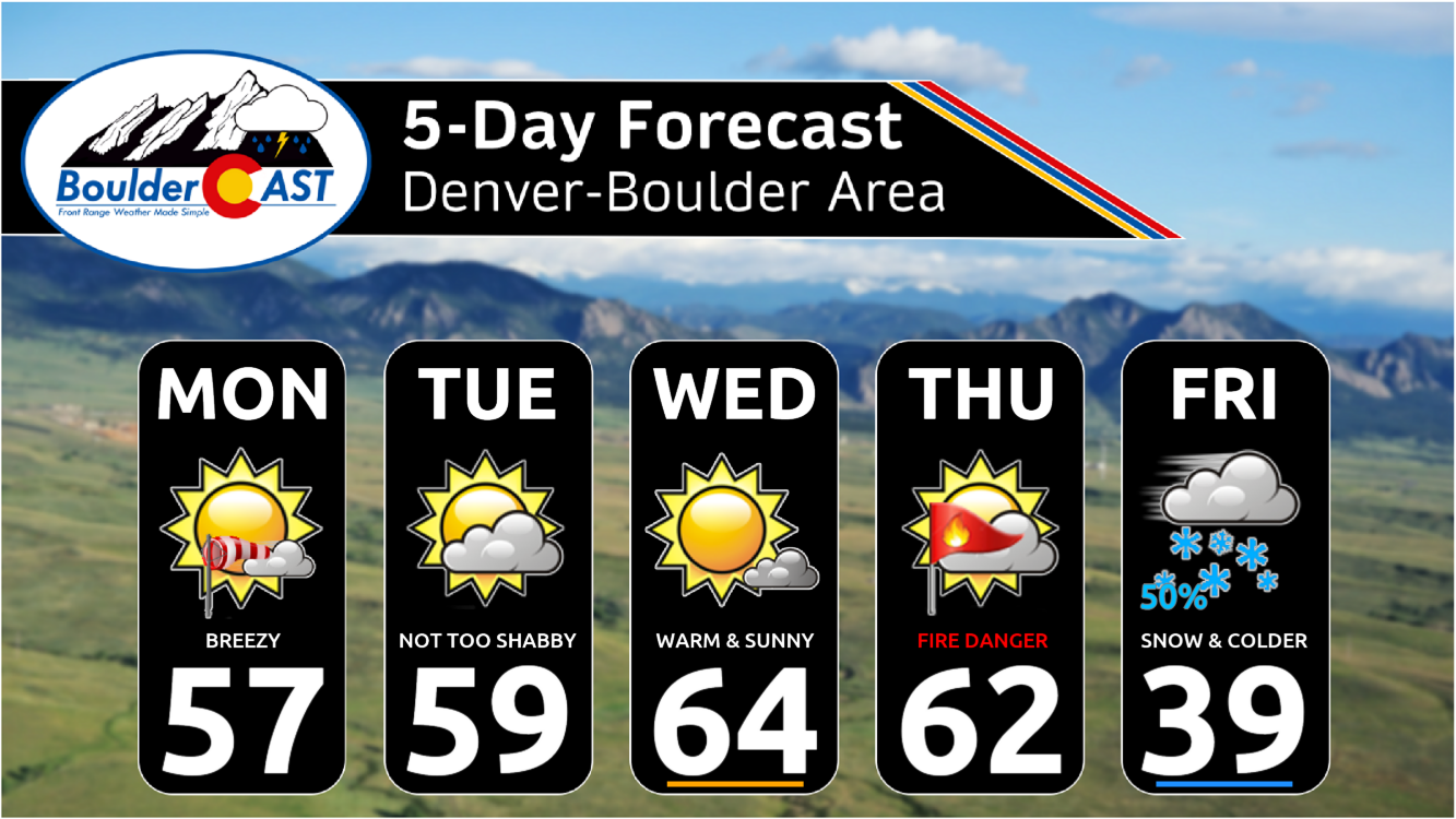
- Temperatures will be some 10 to 15 degrees above normal Monday through Thursday as a ridge of high pressure intensifies over the region
- A Pacific trough is forecast to dig sharply into Colorado on Friday with snowflakes and much colder temperatures to follow
- Right now this appears to be a lighter snow event limited by the storm’s rapid movement, but some signs point to potential brief bands of heavy snow in our area
- After a warm and gusty Thursday with elevated fire danger, Friday should turn cold and snowy with highs falling back below normal
- The upcoming weekend looks mostly dry but cool in the wake of the departing wintry storm
DISCLAIMER: This weekly outlook forecast is created Monday morning and covers the entire upcoming week. Accuracy will decrease as the week progresses as this post is NOT updated. To receive daily updated forecasts from our team, among many other perks, subscribe to BoulderCAST Premium.

Go Premium, get all the perks.
Daily Forecast Updates
Get our daily forecast discussion every morning delivered to your inbox.
All Our Model Data
Access to all our Colorado-centric high-resolution weather model graphics. Seriously — every one!
Ski & Hiking Forecasts
6-day forecasts for all the Colorado ski resorts, plus more than 120 hiking trails, including every 14er.
Smoke Forecasts
Wildfire smoke concentration predictions up to 72 hours into the future.
Exclusive Content
Weekend outlooks every Thursday, bonus storm updates, historical data and much more!
No Advertisements
Enjoy ad-free viewing on the entire site.
Turning quiet under high pressure
Following a weekend of wild weather in the Front Range, including multiple feet of Mountain snow and very strong downslope winds into the Metro area, things turn surprisingly quiet early this week as high pressure builds across the region from the west. A forecast animation of 500mb height anomalies through Thursday is shown below — this is the European ensemble mean forecast. Watch as a strong ridge intensifies quickly over the Rockies Tuesday and Wednesday (deep red shading). The ridge won’t overstay its welcome though — it’s forecast to quickly translate eastward by Thursday with a new trough coming ashore in the Pacific Northwest. This shortwave will be a weather-maker for us on Friday with accumulating snow likely inundating our entire area. Before that happens though, things will be very uneventful over the Front Range throughout the early and middle chunks of the week. Let’s get into that first…
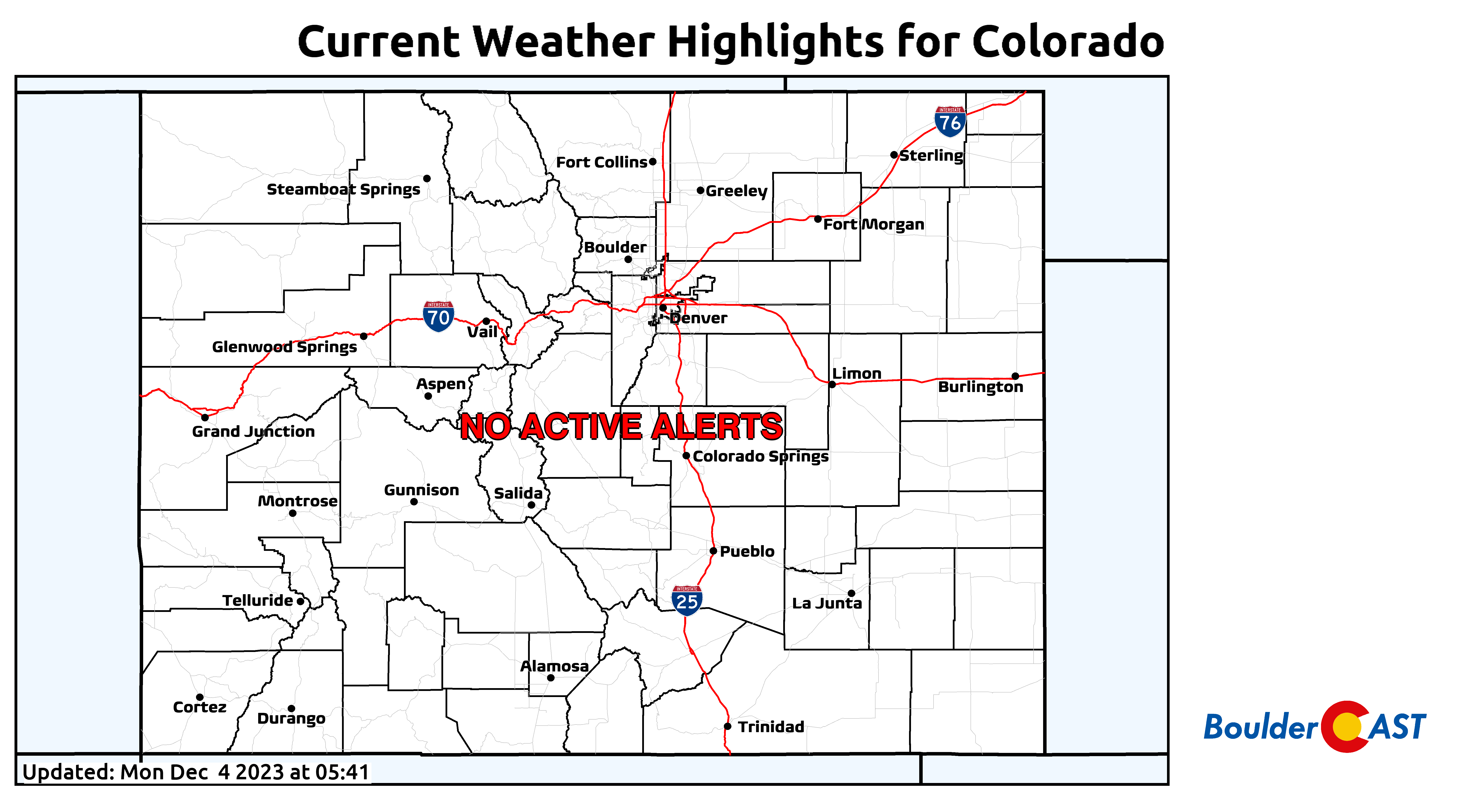
As of early Monday morning, snow has mostly come to an end over the Mountains — there are just a few lingering patches of light snow hugging the highest northwest-facing slopes. All the winter weather highlights have been cancelled early across the state — there are no active alerts right now.
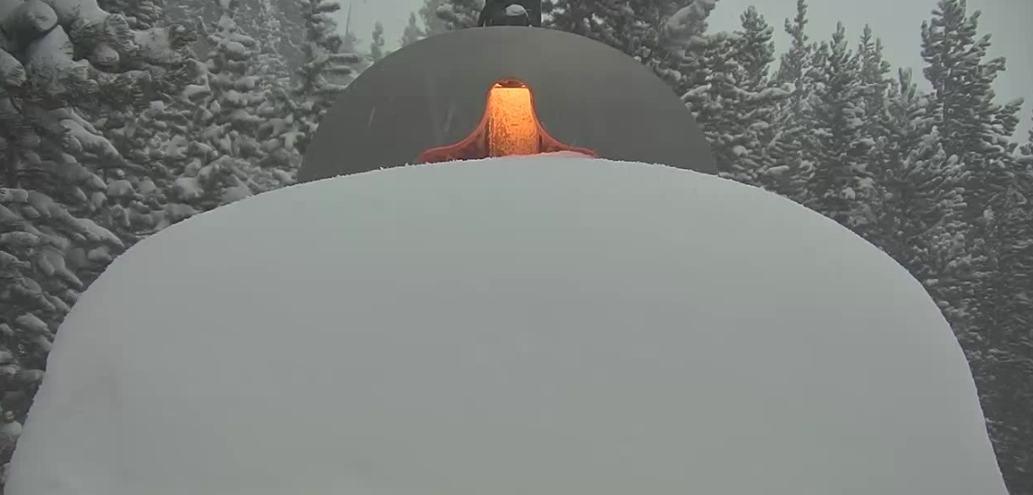
Despite the cancellations, roads don’t look great yet — so plan for dicey driving conditions for at least part of Monday up there. As expected, most of the central and northern ski resorts in Colorado picked up between 1 and 3 feet of snow over the last several days. The image below is from the Eldora Ski Resort snow cam as the sun went down Sunday evening showing more than a foot of fresh snow which fell during the day Sunday.
Powderchasers were certainly flocking to the slopes over the weekend searching for the elusive untouched fresh snow…
I-70 looks like a real treat this morning with near-blizzard conditions. This is the view just a few miles east of the tunnel. Why do skiers do this to themselves? #COwx pic.twitter.com/6jWN4R0fPx
— BoulderCAST Weather (@BoulderCAST) December 3, 2023
A ridge may be on the way, but strong flow still sits over Colorado in the battleground between the departing trough and developing ridge. The 700mb wind forecast for Monday morning below shows the still blustery conditions over particularly northeast Colorado — the southwestern part of the state is already in the clear.
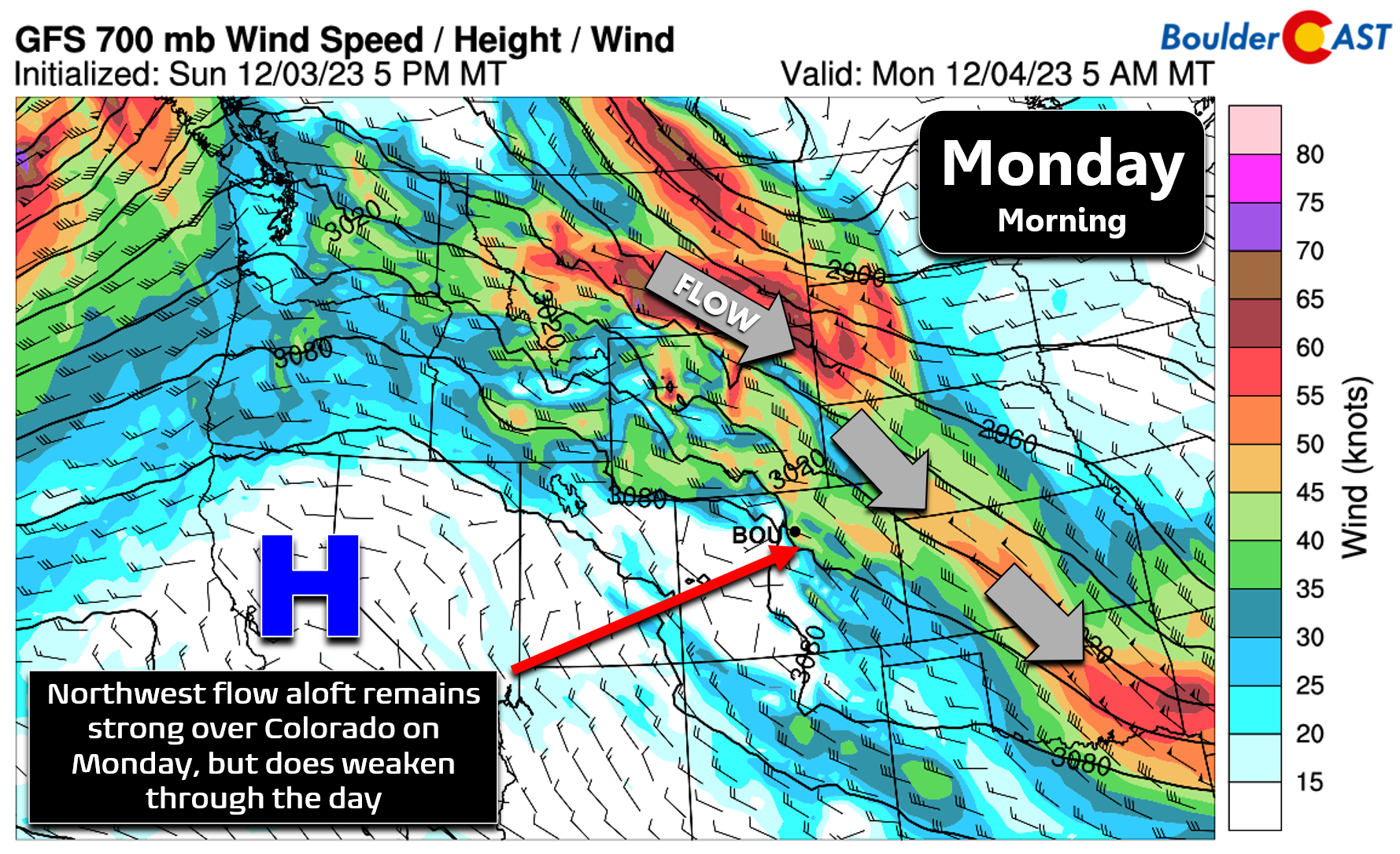
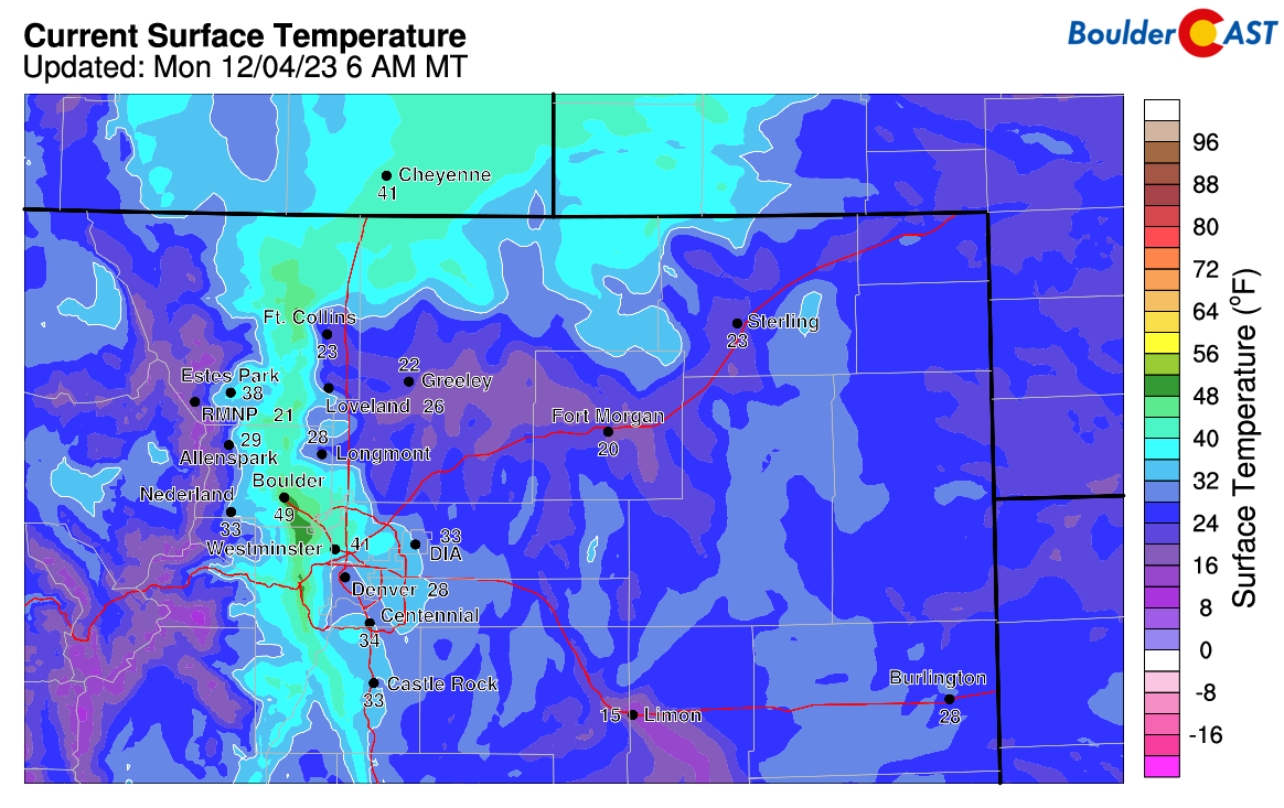
This jet of northwest flow will be slow to fully move out, remaining over northern Colorado during the day Monday leading to continued gusty conditions for us. Downslope winds are strong in the Foothills right now with intermittent gusts making for a warm Monday morning in Boulder and the western suburbs. Current temperatures as of 6AM Monday show more than 20 degrees of spread between Boulder and Longmont!
Gusts of 15-20 MPH will be common across the Denver Metro area on Monday with the wind core still overhead, but watch for up to 75 MPH gusts in the higher Foothills Monday morning and afternoon. With the ridge moving in and the trough exiting, we will see a nice bump in temperatures as well. Most of us should end up in the mid to upper 50s for highs under partly cloudy skies.
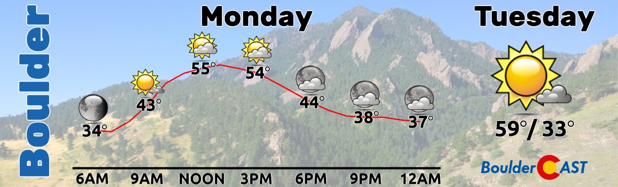
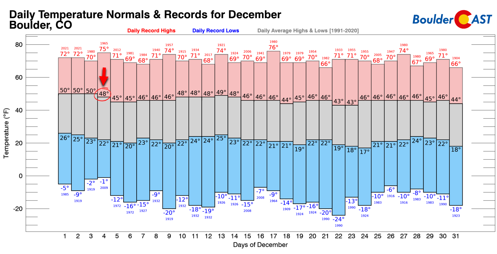
Fun fact: December 4th is the first sub-50° average high temperature in Boulder. Thus, our high temperatures on Monday will be some 10 degrees above normal or so. Climatologically speaking, we don’t get back above 50° until the middle of February!
The warming and drying trend will continue Tuesday into Wednesday as the core of the ridge sets up over the Rockies and intensifies. Both days will feature above normal temperatures in the low to middle 60s. Wednesday will probably be the warmest, sunniest, and tamest day of the week — use that information as you will.
Snow appears likely for Friday
By Thursday, things will begin to change across the area as the ridge departs eastward and a trough of low pressure gains strength over the Pacific Northwest. There is pretty good ensemble support that this trough will tighten and dig sharply into Colorado Friday into Saturday which would bring the return of snow and cold to the entire Front Range.
We won’t focus too much on the specifics at this juncture — it being four days out still — but some models like the GFS are showing a favorable jet stream setup to generate heavy snow bands with northern Colorado ending up in the coveted left exit region of a nearby jet early Friday. This jet forcing would accompany a decent cold front dropping south through the area followed by deep post-frontal upslope.
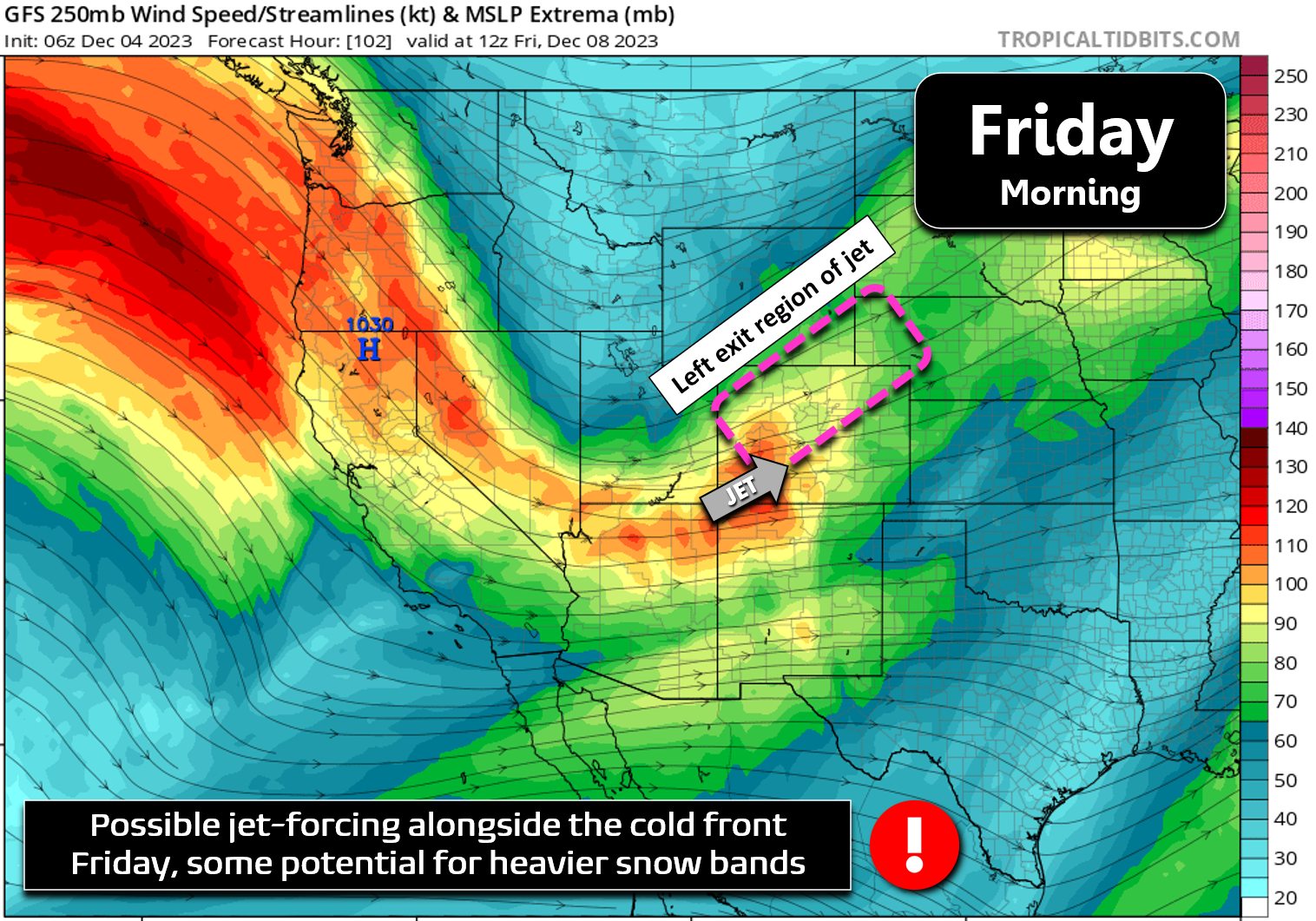
This atmospheric setup results in the potential for a rather brief but possibly intense burst of snow over much of northern Colorado sometime on Friday.
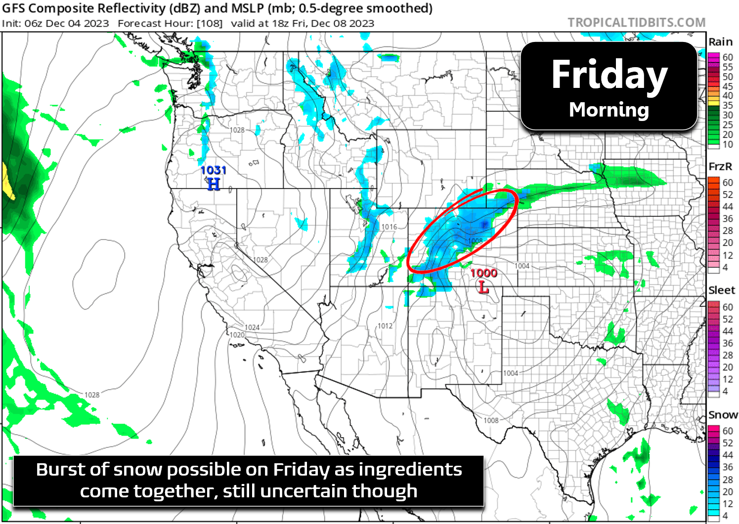
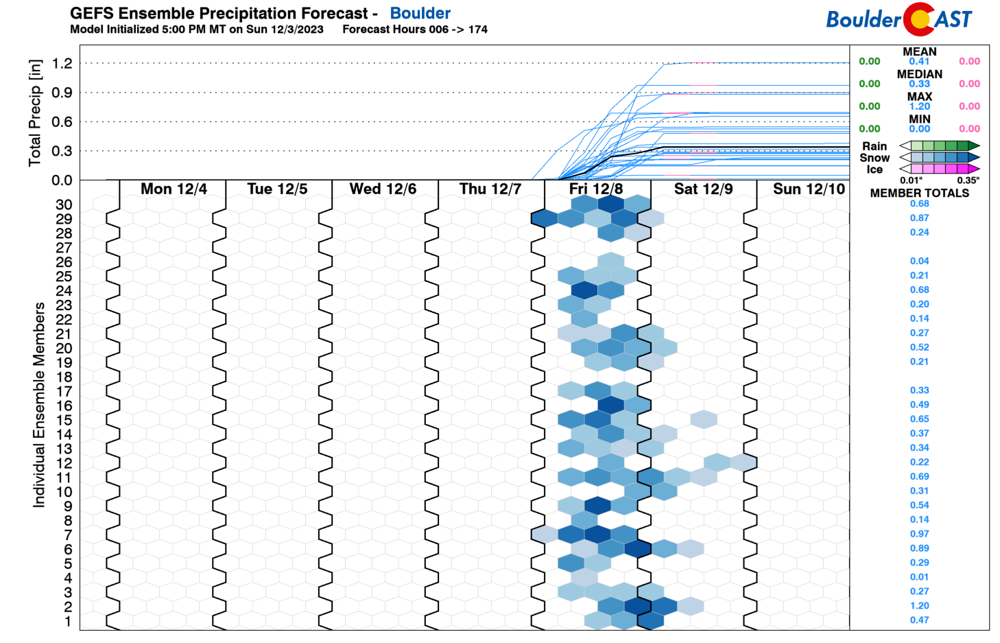
Right now we are not expecting significant snow totals with this one — mostly because the system is moving so darn fast. The GFS and its ensembles are probably the most bullish right now, producing some 2-5″ of snow across our area late week (see precipitation plume forecast below). The European and Canadian suites also show an excellent chance of snow, which is a good sign, but they both come in lighter with just 1-2″ totals.
Regardless of exactly how much snow falls late week, we are expecting a significant cooldown heading into Friday and Saturday with high temperatures dropping back into the 30s and 40s. Leading up to the snow, Thursday will be a day of transition with increasing wave clouds and gusty southwest winds which may prompt some fire weather concerns, especially across southeast Colorado. At the very least, we should be breezier on Thursday but still quite mild for it being December.
Stay tuned as we continue to track the late-week storm system, one likely to bring snowflakes to the Front Range! As always, follow us on Twitter, Threads and Facebook for more punctual weather updates, and be sure to subscribe to our email list for instant notifications when our broader storm updates similar to this one are published. Enjoy!
Get BoulderCAST updates delivered to your inbox:
Forecast Specifics:
Monday: Partly to mostly sunny skies, warmer and breezy with northwest winds gusting 15 to 25 MPH during the day. Highs will top out in the upper 50s on the Plains with upper 40s in the Foothills.
Tuesday: Partly cloudy, light winds and mild with high temperatures in the lower 60s on the Plains and in the upper 40s in the Foothills.
Wednesday: Mostly sunny and quite warm with high temperatures in the middle 60s on the Plains and in the lower 50s in the Foothills.
Thursday: Slightly cooler with increasing wave clouds through the day. Winds will be gusty out of the southwest which may prompt some fire weather concerns, especially for areas south/southeast of Denver. Highs reach the lower 60s on the Plains with lower 50s in the Foothills.
Friday: Much cooler with a front dropping south across the area. Snow will likely develop briefly and may be heavy at times. Generally less than 3″ of snow are expected right now. Temperatures are somewhat uncertain due to the frontal timing, but highs likely top out in the upper 30s to middle 40s and fall into the 20s behind the cold front.
DISCLAIMER: This weekly outlook forecast is created Monday morning and covers the entire upcoming week. Accuracy will decrease as the week progresses as this post is NOT updated. To receive daily updated forecasts from our team, among many other perks, subscribe to BoulderCAST Premium.
Go Premium, get all the perks.
Daily Forecast Updates
Get our daily forecast discussion every morning delivered to your inbox.
All Our Model Data
Access to all our Colorado-centric high-resolution weather model graphics. Seriously — every one!
Ski & Hiking Forecasts
6-day forecasts for all the Colorado ski resorts, plus more than 120 hiking trails, including every 14er.
Smoke Forecasts
Wildfire smoke concentration predictions up to 72 hours into the future.
Exclusive Content
Weekend outlooks every Thursday, bonus storm updates, historical data and much more!
No Advertisements
Enjoy ad-free viewing on the entire site.
Enjoy our content? Give it a share!


You must be logged in to post a comment.