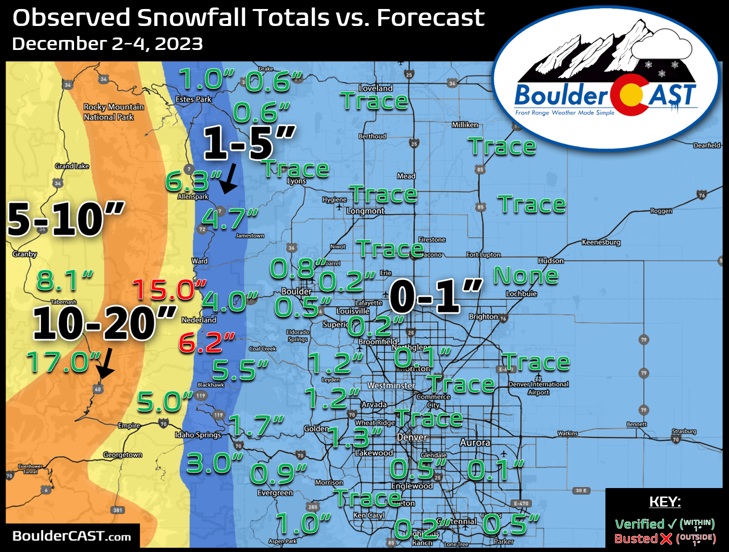
Shown below is our snowfall forecast map issued Saturday morning with actual storm totals overlaid. Greenvalues indicate that our forecast verified to within one inch of the observed snowfall total. Rednumbers did not. Generally 1″ or less fell across the lower elevations where downslope was dominant. Higher up, 1-6″ fell in the Foothills and 8-17″ in the Mountains. Officially, Boulder received 0.5″ and Denver just a trace.
I received a Bachelors of Science in Meteorology from The Pennsylvania State University in 2012 and minored in GIS/Geography. I was also active in Penn State's Campus Weather Service where I provided forecast updates for the Pennsylvania region. I am currently a PhD-track graduate student at the University of Colorado, Boulder where I study winter cloud microphysics and dynamics within winter orographic storms. I also work with NOAA's Physical Science Division (PSD) at their Earth Systems Research Lab (ESRL) as part of my research. My passion lies with mountain meteorology and precipitation research and forecasting. I love to ski and hike in the mountains of Colorado to witness the mountain meteorology first-hand. I also enjoy capturing weather time-lapses and drone footage, all of which can be found on my YouTube page (https://www.youtube.com/channel/UCiB8lhEBaynAOAr1lvJMCyw). For more about my research, check out my website (https://sites.google.com/site/joshaikinsresearch/).
🌧️ Lingering Monsoon Moisture — Lingering Tap One last day of beneficial rainfall …
3-Day Forecast
Did You Know?
Morning rainbows are not unheard of in Boulder; they are just extremely rare. We estimate that 5% or less of our visible rainbows occur in the morning.


You must be logged in to post a comment.