


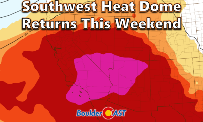
After a lively stretch of monsoon storms and even some flooding across the state, the atmosphere is shifting in a way that favors heat, haze, and a temporary shutdown of our storm pipeline for the Front Range. A stout Southwest heat dome is about to take center stage, triple‑digit temperatures are lining up for Boulder and Denver, and wildfire smoke is poised to make an unwelcome return. We break down the ridge, the records, the smoke, and the eventual cooldown.
What You Need to Know
- 🌧️ Monsoon shift — Monsoon storms fade late-week as high pressure retrogrades west, shutting down monsoonal flow.
- 🔥 Southwest ridge brings the heat— A stout Arizona–SoCal ridge brings 105–120° heat there and sets up an intense (but short) heatwave in the Denver area.
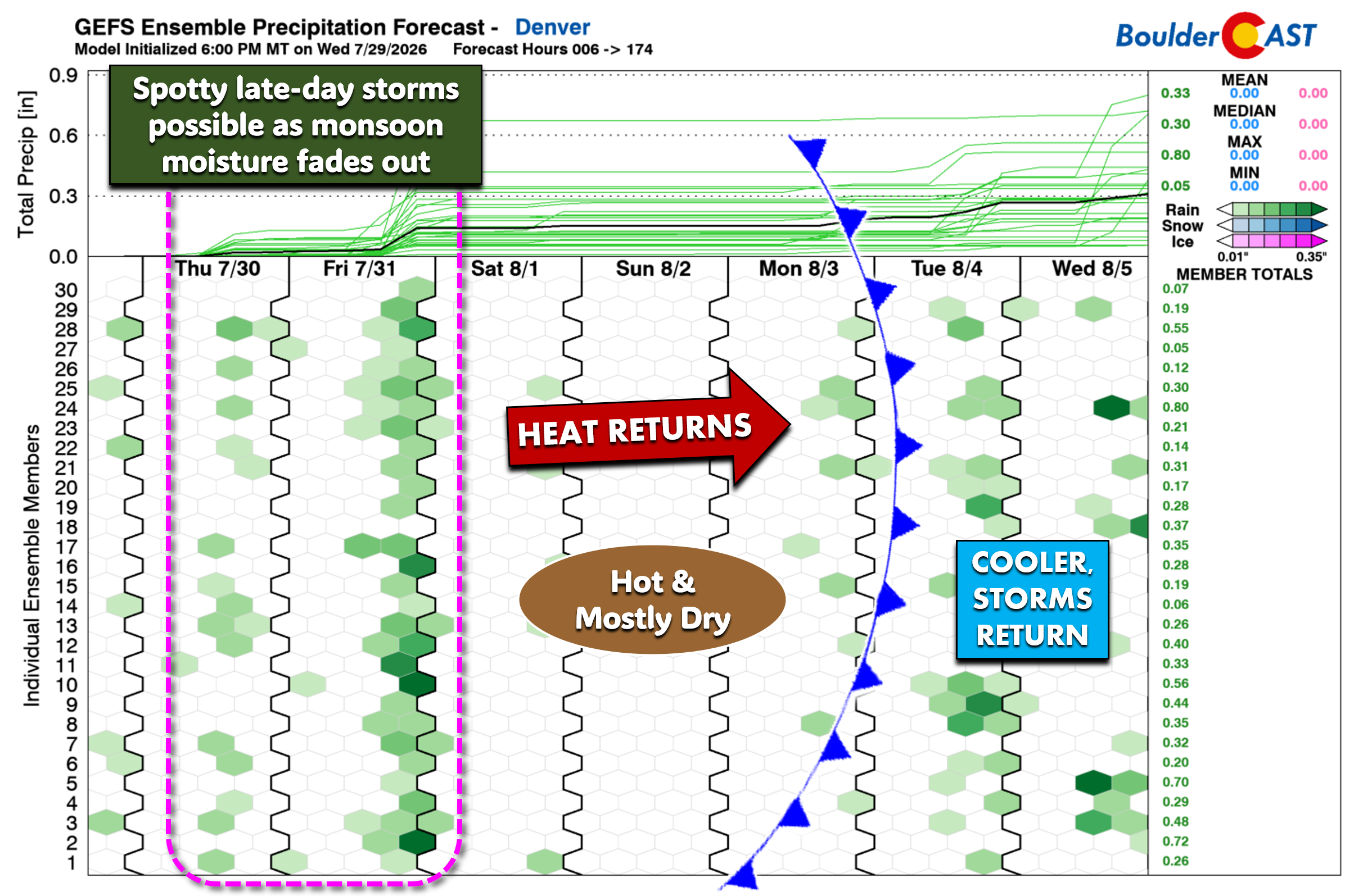
- 🛰️ Drying trend — Water vapor imagery shows drier air heading into Colorado now. Only isolated storms (10–30%) Thu–Fri before moisture drops well below normal this weekend.
- 🌡️ Record heat risk — Boulder and Denver return to triple digits Sunday and Monday, with daily record temps likely to be challenged.
- 🌫️ Smoke + ozone — The shifting pattern will open the door to Pacific Northwest wildfire smoke beginning Thursday night into the weekend; ozone, as always, remains elevated.
- 🏔️ Visibility decline — Thursday’s blue skies and cooler temperatures won’t last as the smoke thickens and heat builds heading into the weekend. Enjoy it!

Go Premium, get all the perks.
Daily Forecast Updates
Get our daily forecast discussion every morning delivered to your inbox.
All Our Model Data
Access to all our Colorado-centric high-resolution weather model graphics. Seriously — every one!
Ski & Hiking Forecasts
6-day forecasts for all the Colorado ski resorts, plus more than 120 hiking trails, including every 14er.
Smoke Forecasts
Wildfire smoke concentration predictions up to 72 hours into the future.
Exclusive Content
Weekend outlooks every Thursday, bonus storm updates, historical data and much more!
No Advertisements
Enjoy ad-free viewing on the entire site.
A Shifting Pattern
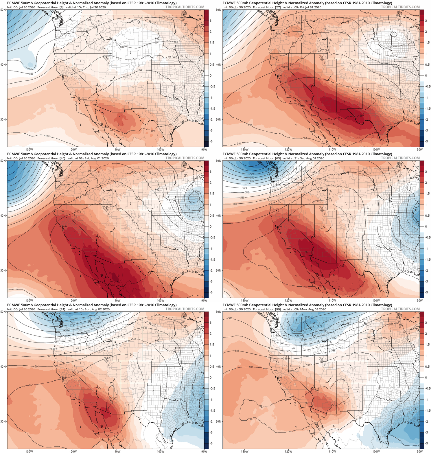
Following several days of lively monsoon action — including pockets of flooding across Colorado — the atmosphere is pivoting today as high pressure over New Mexico begins a steady retrogradation westward. By Friday night, that high will consolidate into a stout ridge centered over Arizona and southern California, then holds firm through the extended period (animation below). This setup will deliver dangerous 105–120° heat to the broader Southwest and, importantly, temporarily shuts down monsoonal flow. Also notice at the tail end of the animation, around Sunday night, a compact shortwave will barrel into the Pacific Northwest, flattening the ridge. That disturbance is the one poised to break our impending heatwave Monday evening — more on that in a moment.
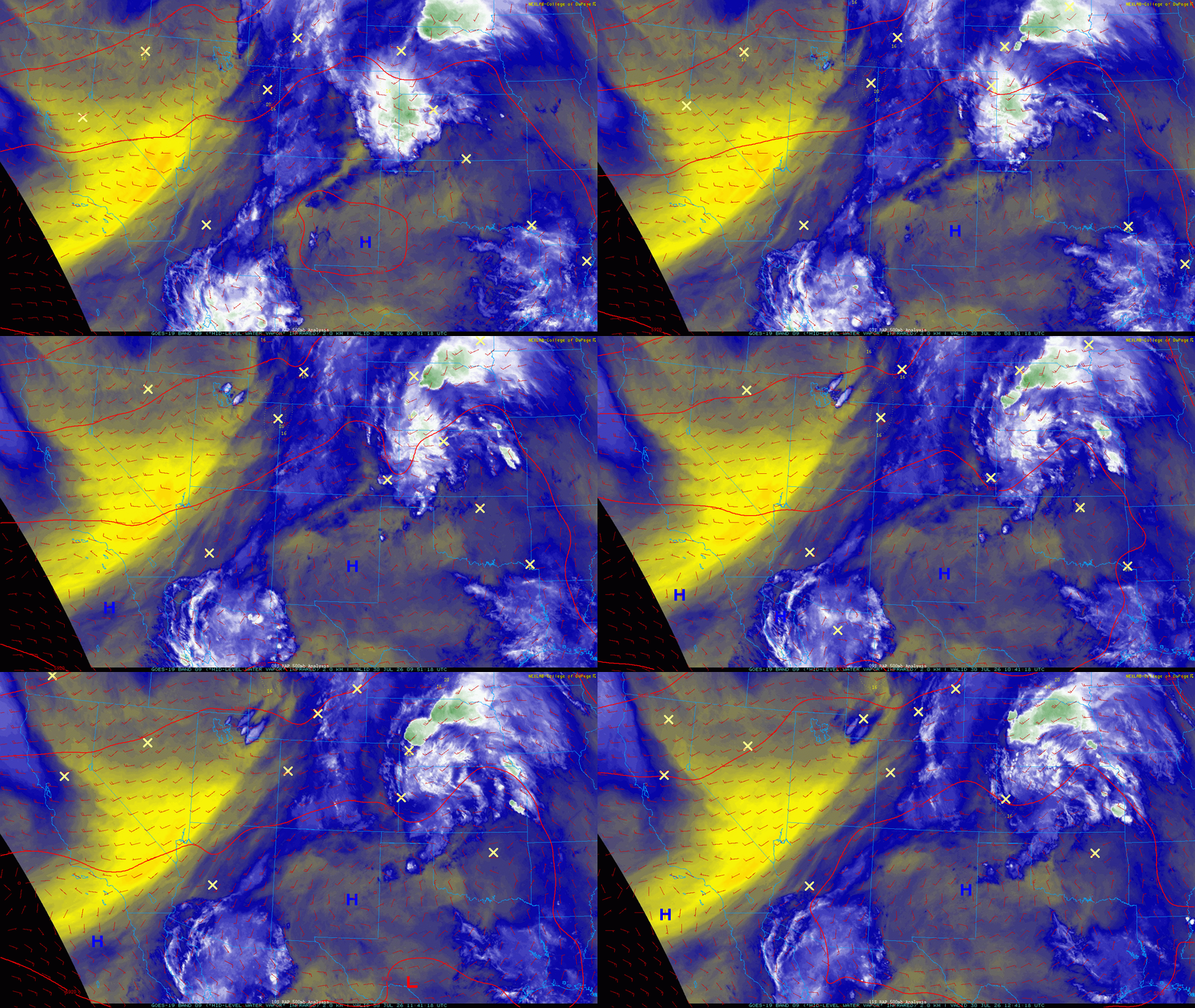
Water vapor imagery Thursday morning shows a thinning monsoonal plume, with dry air punching eastward across the Rockies.
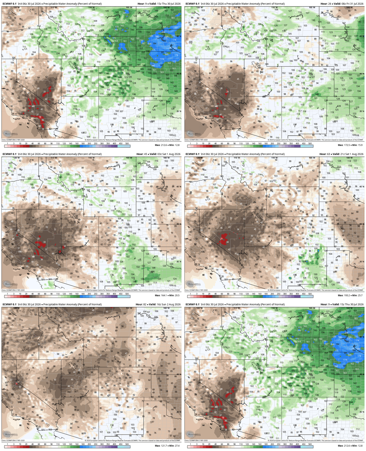
The moisture purge won’t be instantaneous; lingering humidity along the Front Range will still support isolated late-day showers/storms (10–20%) Thursday and Friday. But the drying trend is unmistakable:
- Saturday: Moisture dips below normal
- Sunday–Monday: Moisture becomes well below normal, effectively shutting down precipitation potential
Triple Digits Return Sunday
As moisture fades, temperatures begin a gradual creep back into the 90s, with triple digits likely returning Sunday and Monday for the Boulder–Denver corridor.
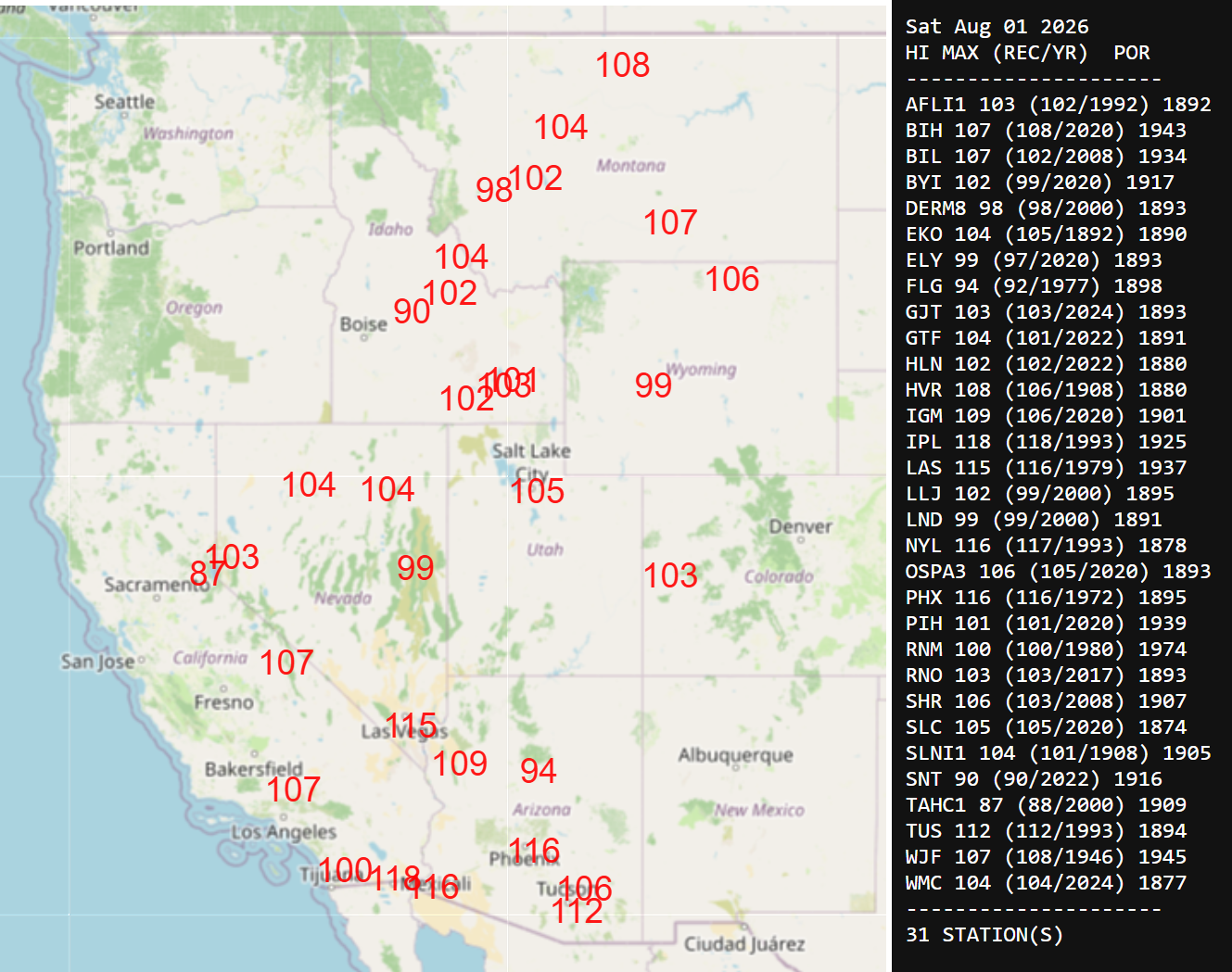
The broader West will see its heatwave peak this weekend into early next week as the ridge broadens and flattens. The following graphics show daily record highs that will be challenged at long-term climate sites Saturday through Monday. For the Front Range, our record dance begins Sunday and continues Monday.
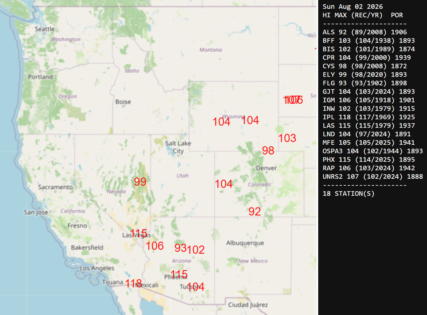
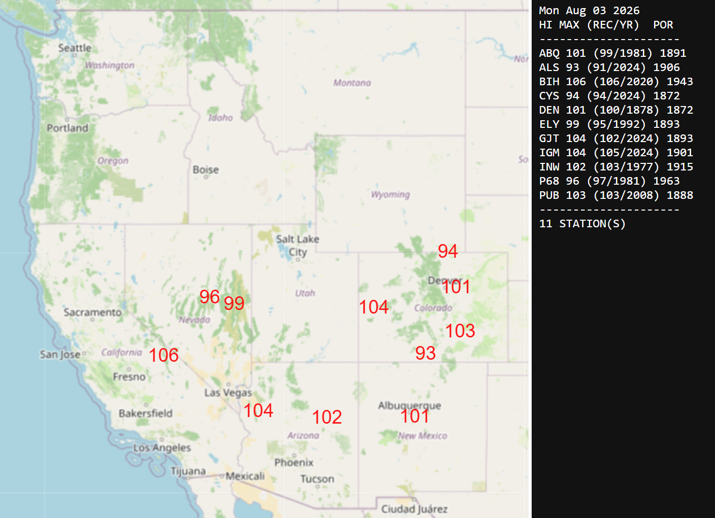
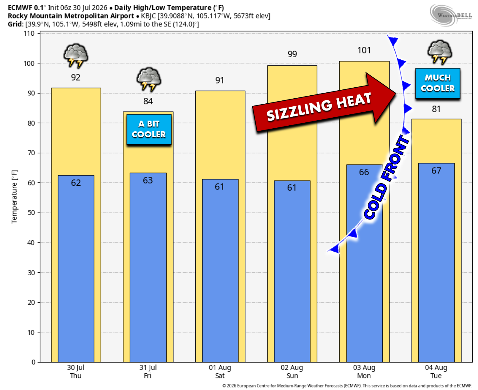
Thursday and Friday will feature 10 to 30% chances for late-day storms, highest on Friday as a weak frontal boundary pools moisture towards the Foothills. A few storms on Friday may be strong to severe with 60 MPH winds and 1″ hail. After a few cooler days in the realm of 90°, we’re forecasting highs to return to the lower 100s by the second half of the weekend. Boulder’s records — 100° Sunday and 99° Monday — are going to be challenged if not broken.
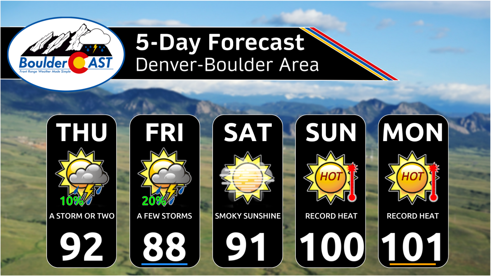
All signs still point toward a brief cooldown delivered by a cold front Monday evening or night. It’s sitting just beyond the four‑day horizon, so timing can change, but confidence is growing that this looming heatwave will be interrupted for at least a day or two early next week. There are hints the ridge could rebuild quickly thereafter with a return of sizzling heat — but that is still uncertain.
Here Comes the Smoke
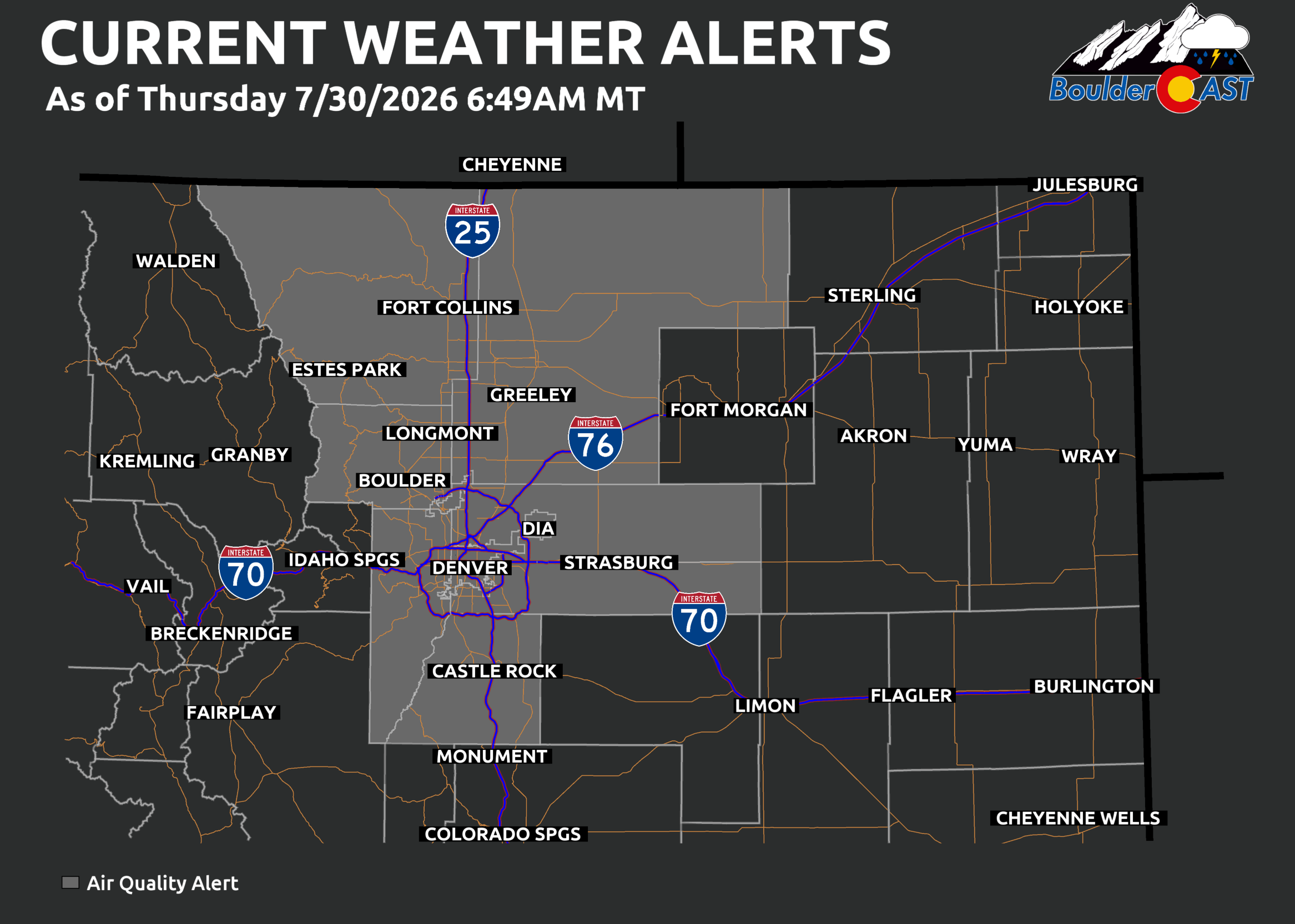
Like many summer days in the Front Range, ozone remains elevated thanks to stagnant flow and local pollution sources. Air Quality Alerts are in effect again Thursday and this will likely continue through Monday.
Up to now, the ridge’s position over Texas/New Mexico has shielded Colorado from the major Pacific Northwest wildfire smoke outbreak. As the ridge shifts west, that protection will erode. Winds are set to reorient from the north and northwest, opening the door for smoke transport into our area. As we discussed in our weekly outlook on Monday, we’re tracking increasing smoke Thursday evening for the Denver area, with substantial haze filling the skies Friday and Saturday (if not longer).
Enjoy Thursday!
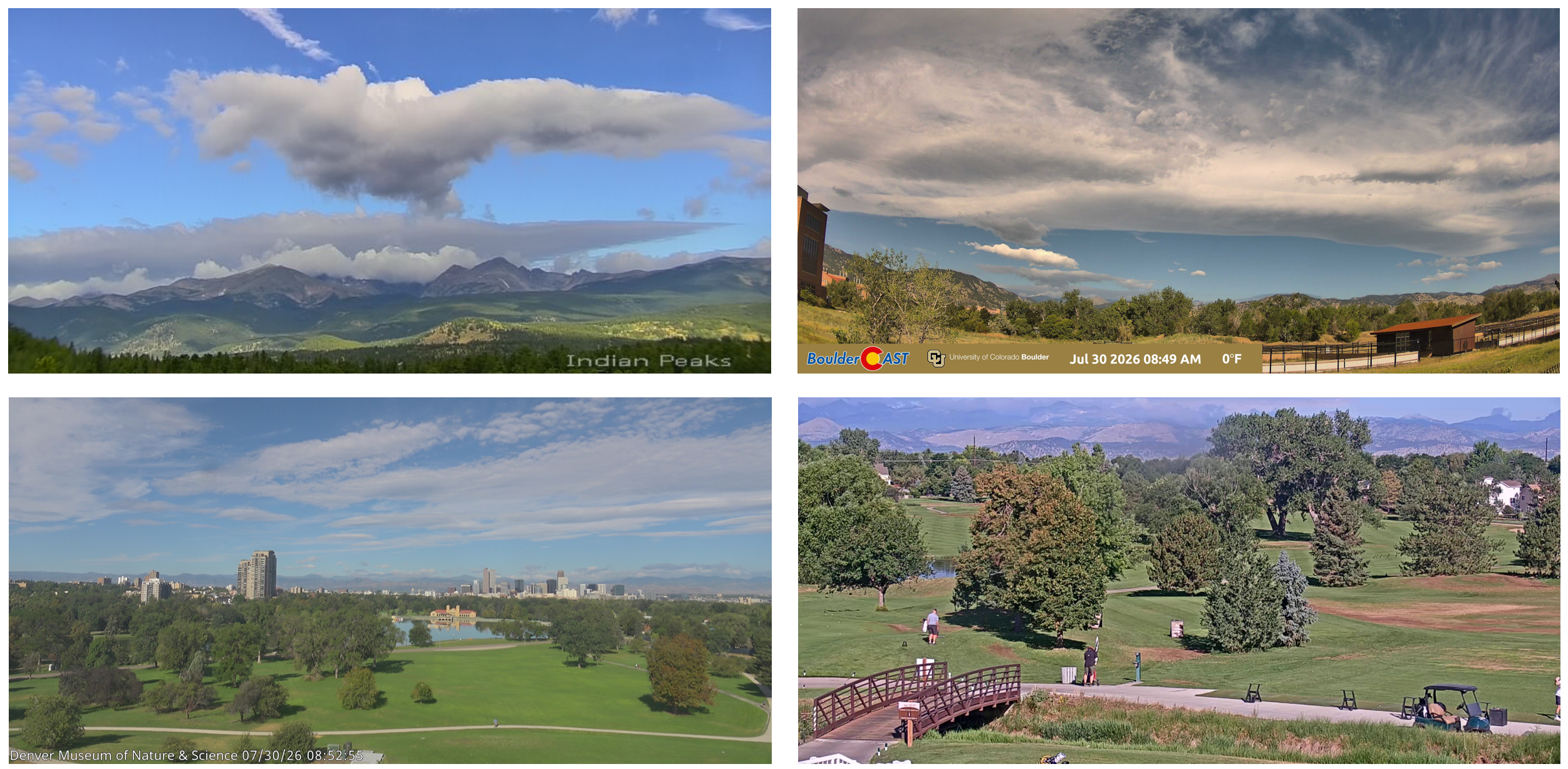
Thursday’s blue skies, relatively “cool” temps, and crisp mountain visibility are temporary. Conditions are set to deteriorate quickly as smoke and heat build in the coming days.
Spread the word, share our crazy Colorado weather:
Go Premium, get all the perks.
Daily Forecast Updates
Get our daily forecast discussion every morning delivered to your inbox.
All Our Model Data
Access to all our Colorado-centric high-resolution weather model graphics. Seriously — every one!
Ski & Hiking Forecasts
6-day forecasts for all the Colorado ski resorts, plus more than 120 hiking trails, including every 14er.
Smoke Forecasts
Wildfire smoke concentration predictions up to 72 hours into the future.
Exclusive Content
Weekend outlooks every Thursday, bonus storm updates, historical data and much more!
No Advertisements
Enjoy ad-free viewing on the entire site.












You must be logged in to post a comment.