


Eastern Colorado just came off a truly blistering weekend, with Denver and Boulder both shattering daily records as temperatures surged past 100°F on back‑to‑back days. Now the pattern is shifting, at least temporarily. An unusually juiced monsoon plume will set the stage for more robust afternoon storms through mid‑week, including a legitimate threat for locally heavy rainfall and burn‑scar flooding. But the faucet will shut off quickly. A rapidly intensifying Southwest heat dome will retrograde into Arizona late‑week, cutting off monsoon flow, drying out northern Colorado, and potentially steering wildfire smoke from the Pacific Northwest into the state as winds shift. By the weekend, the Front Range will sit on the fringe of that expanding heat dome, meaning another round of hot, dry weather and potential triple-digit readings again. Read on for all the details.
This week’s highlights include:
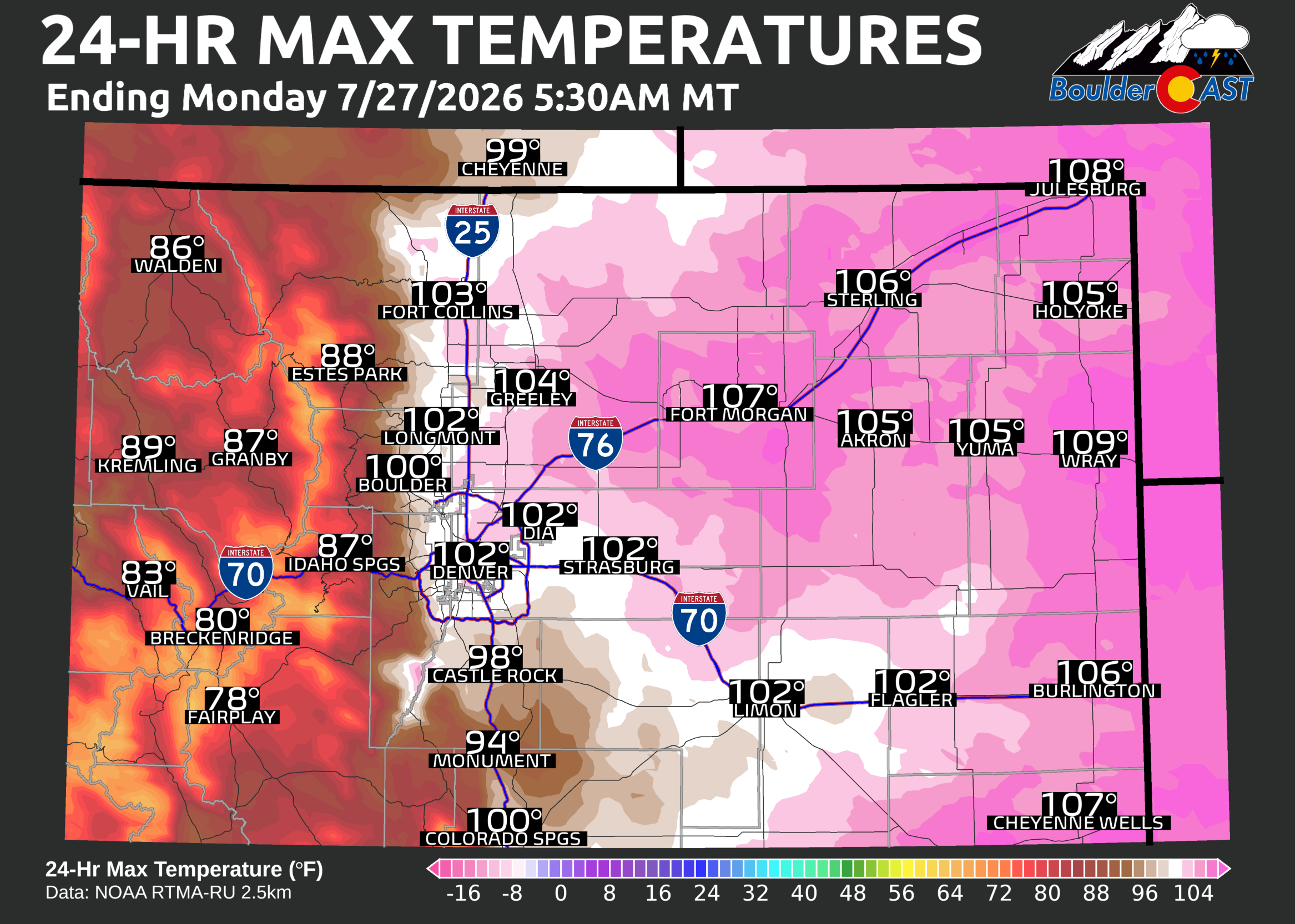
- 🌡️ Record-smashing heat this past weekend: Denver and Boulder surpassed 100° both days over the weekend setting new record highs. Widespread 105–110°F readings baked the lowest elevations Sunday across eastern Colorado.
- ☁️ MCV influence Monday: A mesoscale convective vortex is drifting across the Front Range, delivering clouds but little precipitation.
- 🌧️ Monsoon moisture surges: Precipitable water values run 2–3 SD above normal through Wednesday, supporting hearty bouts of afternoon storms early in the week.
- ⚠️ Heavy rain risk: Tuesday and Wednesday bring the best chances for locally heavy rainfall and burn‑scar flooding.
- 🌵 Late-week monsoon shutdown: Ridge retrogrades into Arizona, forming a dangerous heat dome across the Southwest, turning off the monsoon tap and sharply reducing our storm chances.
- 💨 Smoke may return late-week: Smoke from a huge wildfire outbreak in the PNW may enter Colorado as winds across the West shift late in the week.
- 🔥 Another hot weekend incoming: Front Range stays on the fringe of the dome — expect mid–upper 90s, with a possible run toward 100°F early next week.
DISCLAIMER: This weekly outlook forecast is created Monday morning and covers the entire upcoming week. Accuracy will decrease as the week progresses as this post is NOT updated. To receive daily updated forecasts from our team, among many other perks, subscribe to BoulderCAST Premium.

Go Premium, get all the perks.
Daily Forecast Updates
Get our daily forecast discussion every morning delivered to your inbox.
All Our Model Data
Access to all our Colorado-centric high-resolution weather model graphics. Seriously — every one!
Ski & Hiking Forecasts
6-day forecasts for all the Colorado ski resorts, plus more than 120 hiking trails, including every 14er.
Smoke Forecasts
Wildfire smoke concentration predictions up to 72 hours into the future.
Exclusive Content
Weekend outlooks every Thursday, bonus storm updates, historical data and much more!
No Advertisements
Enjoy ad-free viewing on the entire site.
RECAP: Record-Blasting Weekend Heatwave
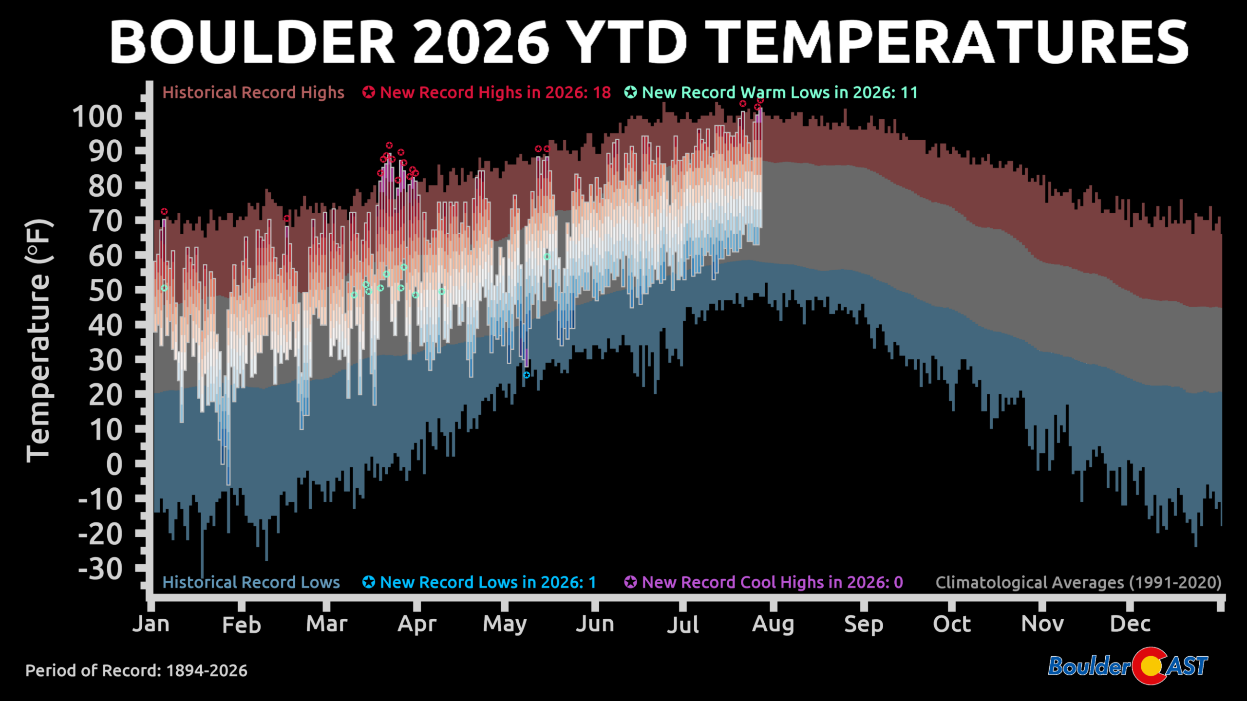
Eastern Colorado didn’t just heat up this weekend — it absolutely baked. Boulder and Denver both blasted past 100°F on Saturday and Sunday, locking in new daily record highs and delivering one of the most intense midsummer heat episodes we’ve seen in years. Sunday was the real punisher: 103°F in Denver and 102°F in Boulder. For Boulder, that’s the hottest reading since 2012 and the 4th hottest day ever recorded. It also marked only the 4th instance of back‑to‑back 100° days in the city’s history — again, something that was last seen in 2012.
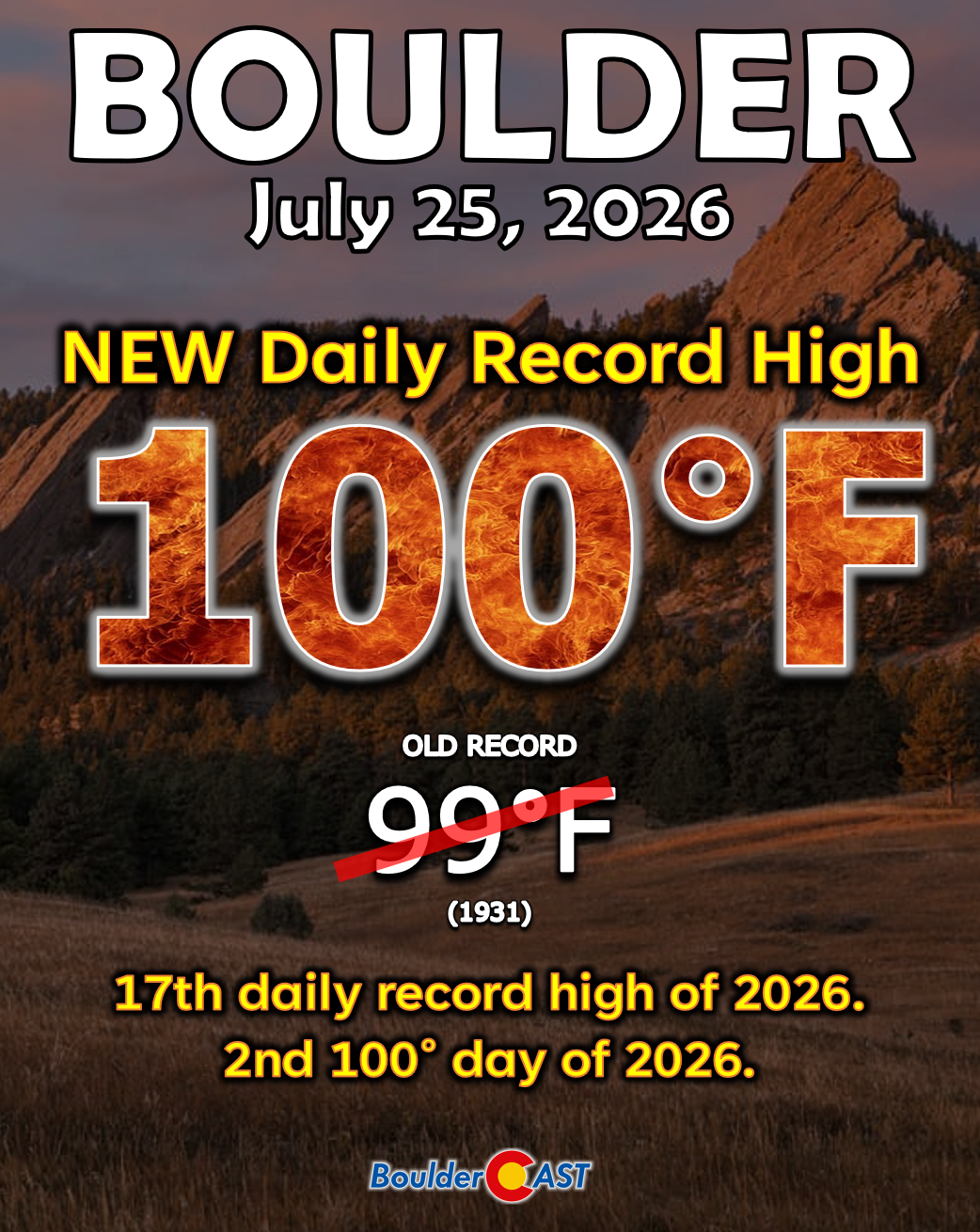
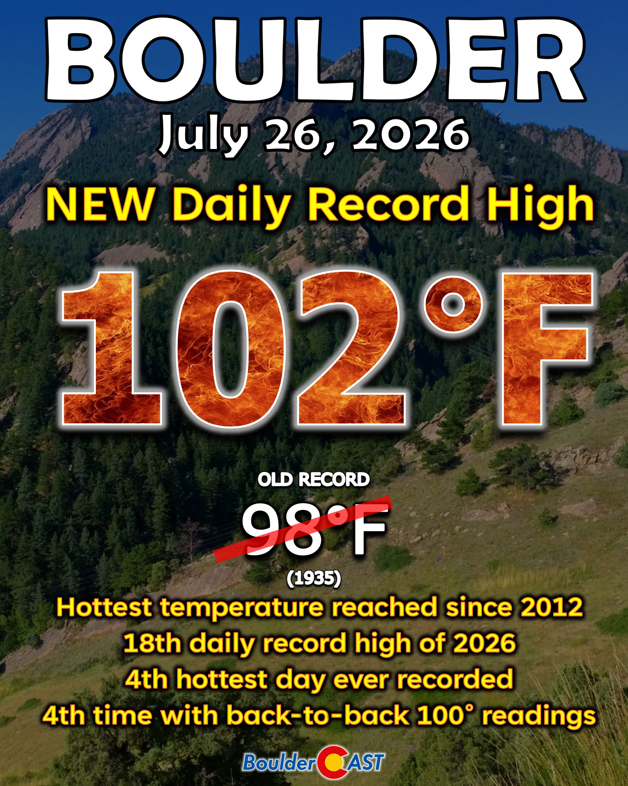
This past weekend marked the 17th and 18th daily record highs that Boulder has tied or broken so far in calendar year 2026, a truly remarkable feat that is unmatched in the historical record. More than half of those came during the Rockies’ unprecedented March heatwave. Boulder has also notched 11 record warm overnight lows in 2026, but hey, at least the climate change denied have that one record low we set in the wake of the damaging May snowstorm to base their arguments upon.
Across the eastern Plains, temperatures surged even higher, with widespread 105–110°F readings from Sterling to Lamar. A truly exceptional heat event.
Fortunately the worst of the heat is now behind us, at least for now. The week ahead will feature cooler, but not cool, temperatures. Let’s dive in!
Cloudy & Cool(er) to Begin the Week
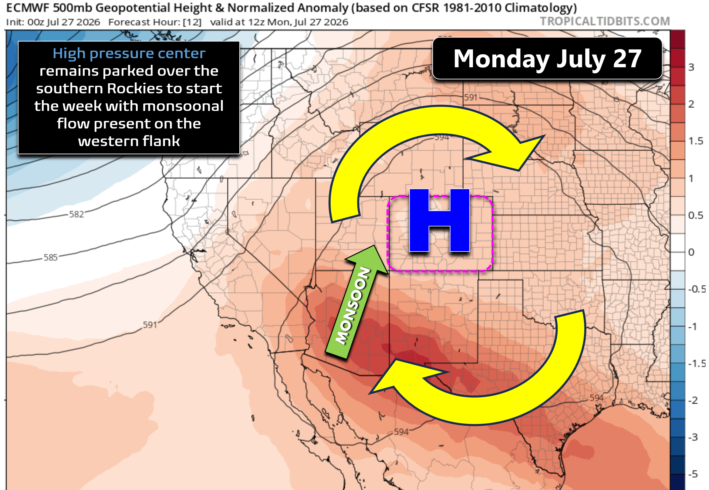
As of Monday morning, guidance keeps the same sprawling ridge that brought the weekend heat anchored over the southern Rockies. Counter‑clockwise flow around the high continues to pump monsoon moisture northward into the Four Corners.
On Sunday, while the Front Range baked in the heat, the San Juans erupted with monsoon storms. That cluster matured into a mesoscale convective vortex (MCV) overnight — now drifting across the Front Range.
Radar looks impressive, but most echoes are evaporating into a dry lower atmosphere.
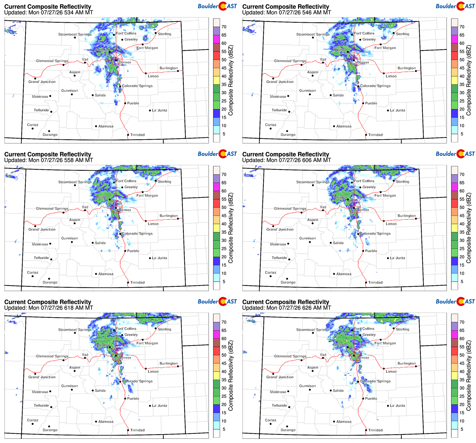
Outside of a few A.M. sprinkles or light showers, this MCV will pass with little fanfare. There will, however, be quite a bit of cloud cover from it, as seen on the Denver webcam Monday morning.

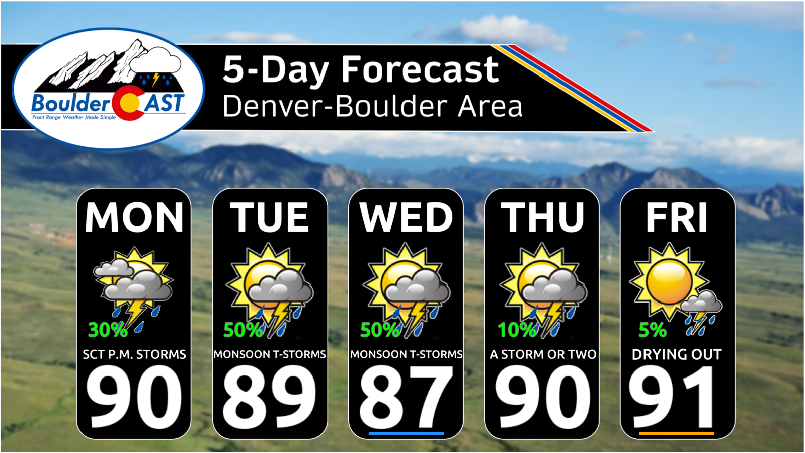
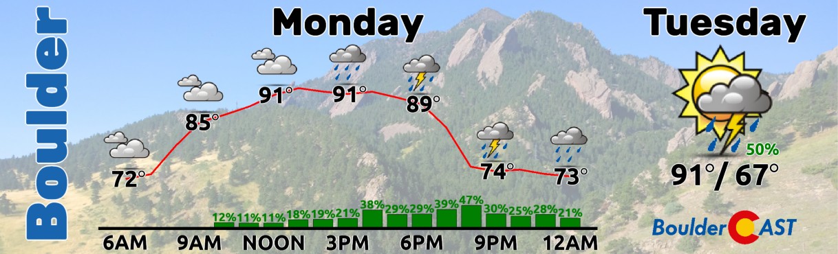
These persistent thick clouds may throw a wrench into our forecast for Monday. On one hand they will keep temperatures down, with highs topping out only in the lower 90s or so. Great news considering the back-to-back 100° days we just endured. However, clouds will also act to stabilize the atmosphere, limiting monsoon storm activity over the region. Nonetheless, there is quite a bit of moisture available for storm development, and any storms that form across the Mountains will have the potential to spread outflows east and kick off some storms in the Denver Metro area as well from mid-afternoon into the late evening. Our chance of rain on Monday is about 30%.
Monsoon Remains Active Through Wednesday
Given the early to mid-week position of the high pressure center over New Mexico and/or west Texas, monsoon moisture will continue to flow northward unabated into Colorado through Wednesday with precipitatable water values through the depth of the atmosphere remaining 2 to 3 standard deviations above normal. That is saying a lot for what is typically the height of monsoon season in the Front Range!
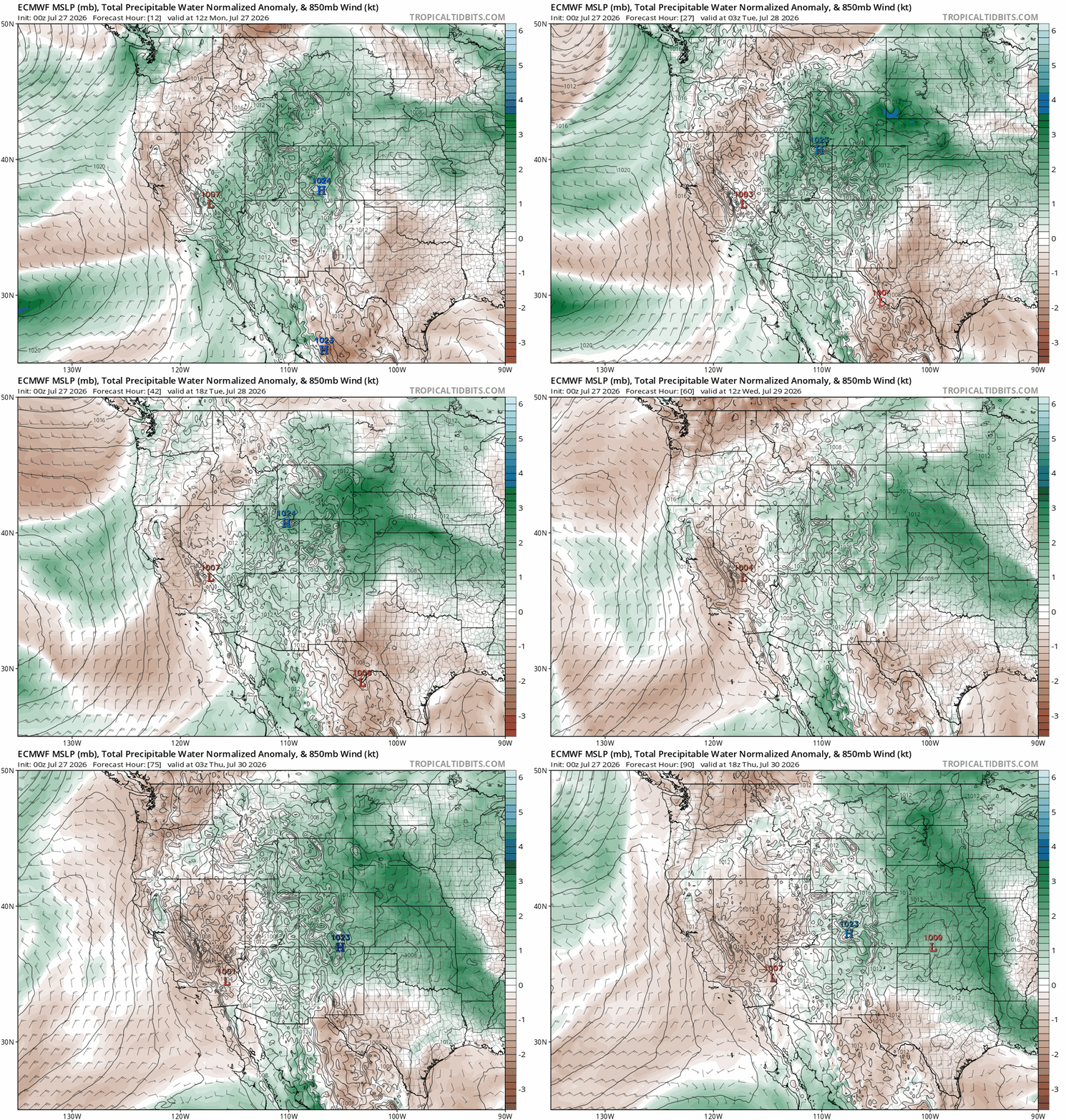
Euro precipitable water anomaly forecast animation from Monday through Thursday showing the persistent monsoonal flow into the Four Corners that will drive our daily wet weather.
Denver’s best chance for monsoon thunderstorm activity, including pockets of heavy rain and burn scar flooding, comes during Tuesday and Wednesday when numerous to widespread showers and storms are expected. Contrary to Monday, these will be more typical monsoon days, with early day sunshine fueling a wave of storm activity coming off the terrain in the late-day periods. Locally heavy rain will be the primary concern, though storm motions look to be around 20 MPH which should be quick enough to prevent any major issues.

Highs these days will be around 90° plus or minus a few degrees. The hotter range of temperatures will be found away from the terrain where skies will remain free of building storm clouds the longest.
Late‑Week Drying as Southwest Heat Dome Expands
Towards the end of the week we will start to see things shift, with the big high pressure center retrograding westward into Arizona and rapidly intensifying into a dangerous heat dome for the entire Southwest.
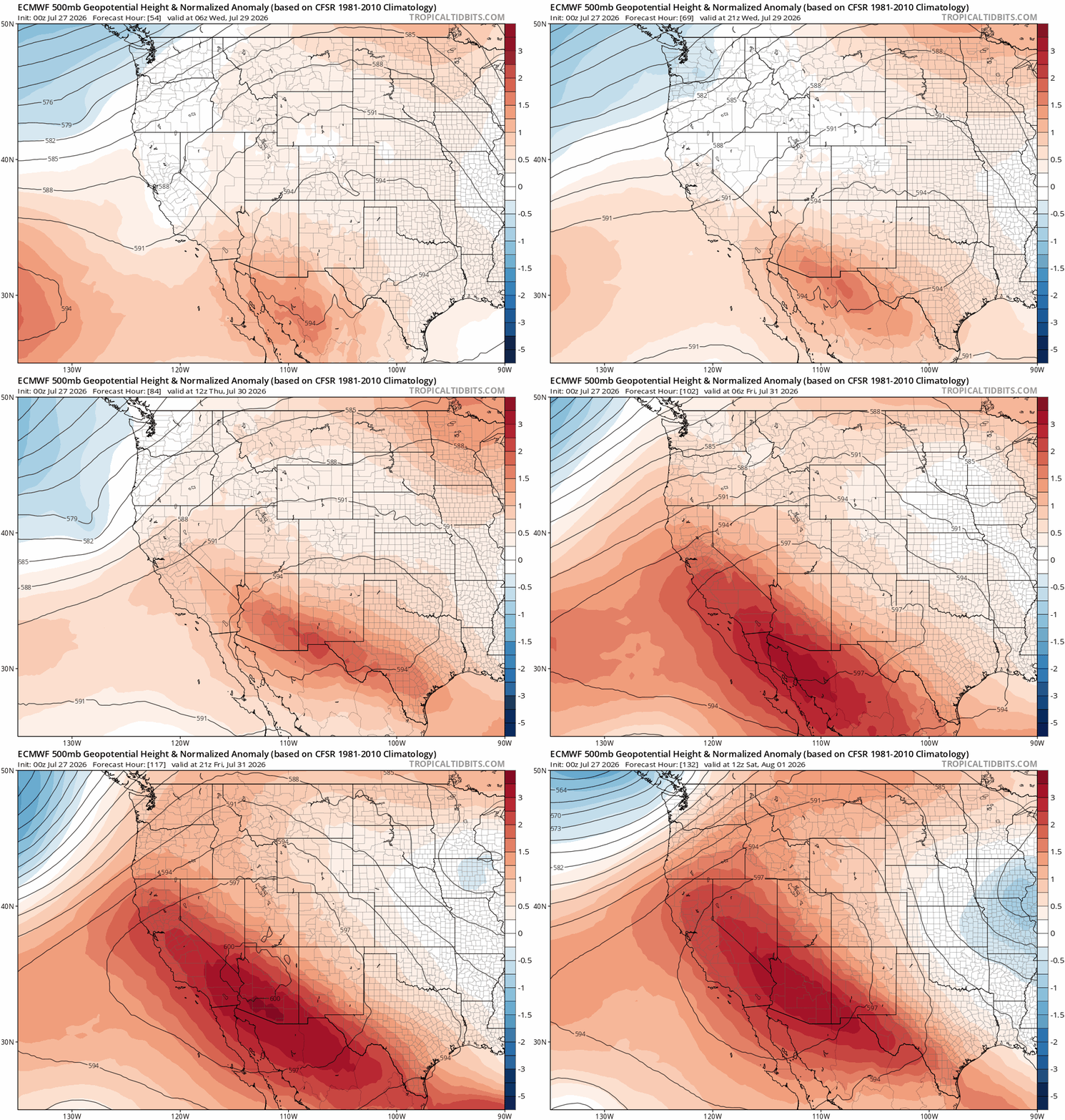
Euro 500mb height anomaly forecast for Wednesday into the weekend showing the expanding Desert heat dome. Colorado ends up on the fringe of this under northwest flow.
Unfortunately this migration of the high pressure center will also turn-off the monsoon tap, greatly reducing precipitation chances across northern Colorado Thursday and beyond. By the weekend, much of the Four Corners will be devoid of moisture and limited to only a few meager isolated storms over the higher terrain. Based on the latest ensemble guidance, monsoon moisture isn’t likely to return to Colorado until around the middle of next week.
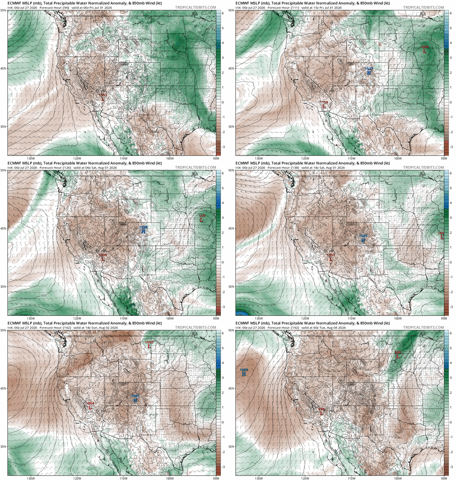
Euro precipitable water anomaly forecast for Thursday through next Monday showing the monsoon tap getting turned off to the Southwest USA.
Thus, our late-week period will feature a decline in storm chances to just isolated coverage for Thursday and Friday (think 5 to 15%). Temperatures will also begin to creep back up into the lower 90s, just a taste of what’s brewing for the weekend ahead.
Another Hot Weekend Ahead
By the weekend, the heat dome will be fully established across the Desert Southwest, with the Climate Prediction Center advertising near 100% chances for above normal temperatures in the Four Corners from Saturday through next Wednesday August 5th. Baking under this intense heat dome, and cut-off from monsoonal flow, the Interior West is expected to be drier than normal. This includes the Front Range.
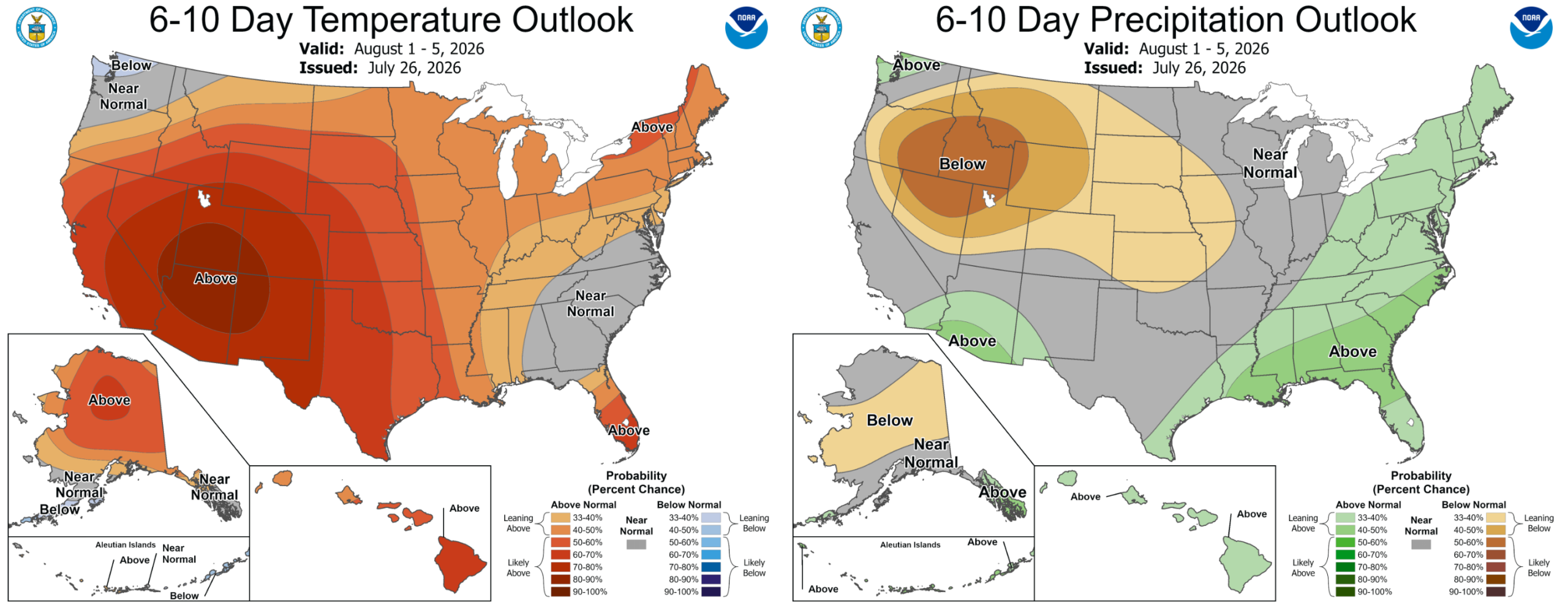
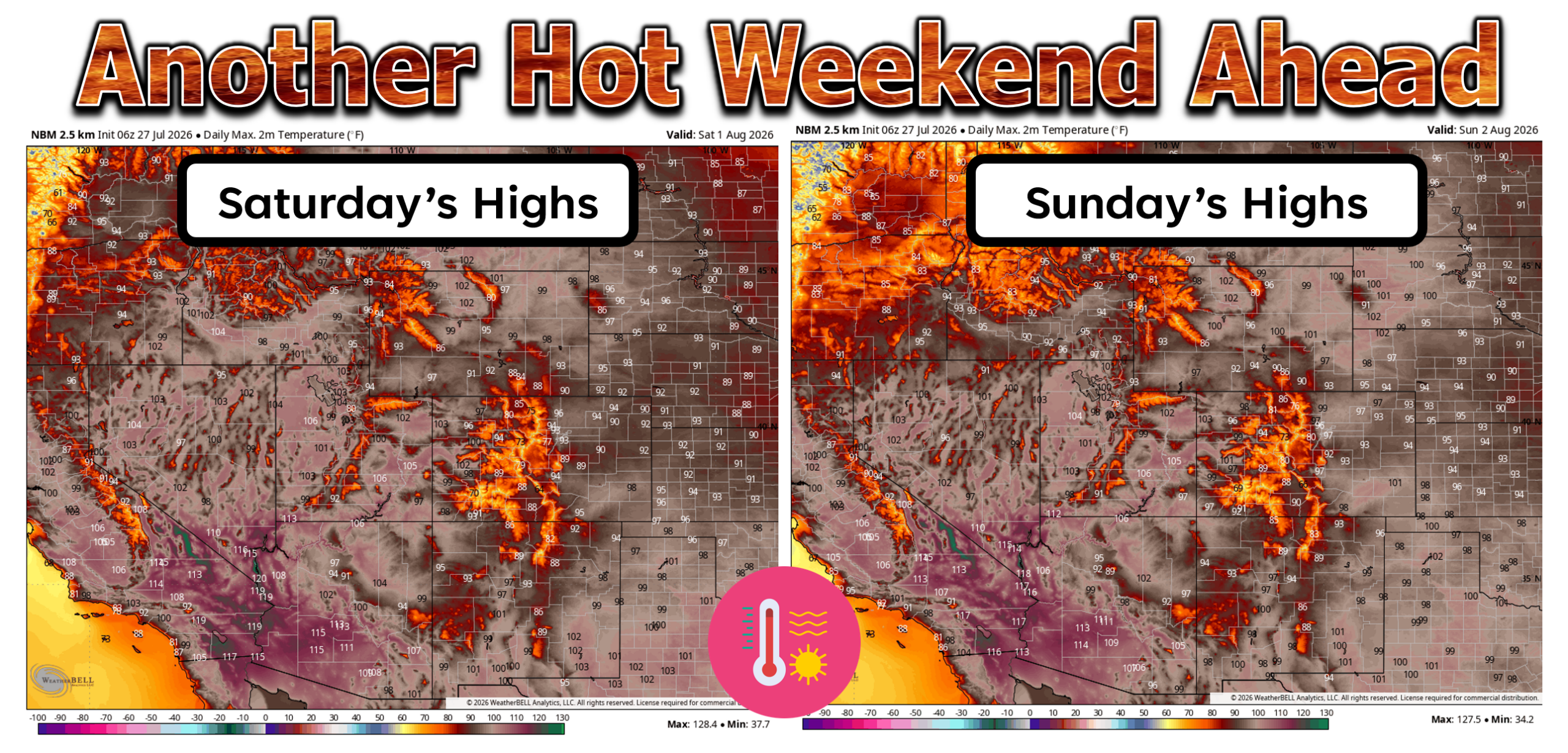
Dangerous temperatures of 105 to 120°F will become widespread in the lower elevations of Arizona, California, Utah, and Nevada, even stretching into the Grand Valley in western Colorado. Death Valley could near 130°. Fortunately the Denver Metro area will be on the fringe of this heat dome, at least as it stands now. While temperatures will certainly be hot here, we’re not expecting anything historic. Highs around here will be in the mid to upper 90s this weekend, with perhaps a run towards 100° coming around Monday August 3rd.
A Return of the Smoke?
We also must mention that there is ongoing massive wildfire outbreak in the Pacific Northwest, with Oregon and Washington having now combined for more than 1 MILLION acres burned. Many of these fires were ignited last week by lightning strikes in volatile fire weather conditions within regions of severe drought.
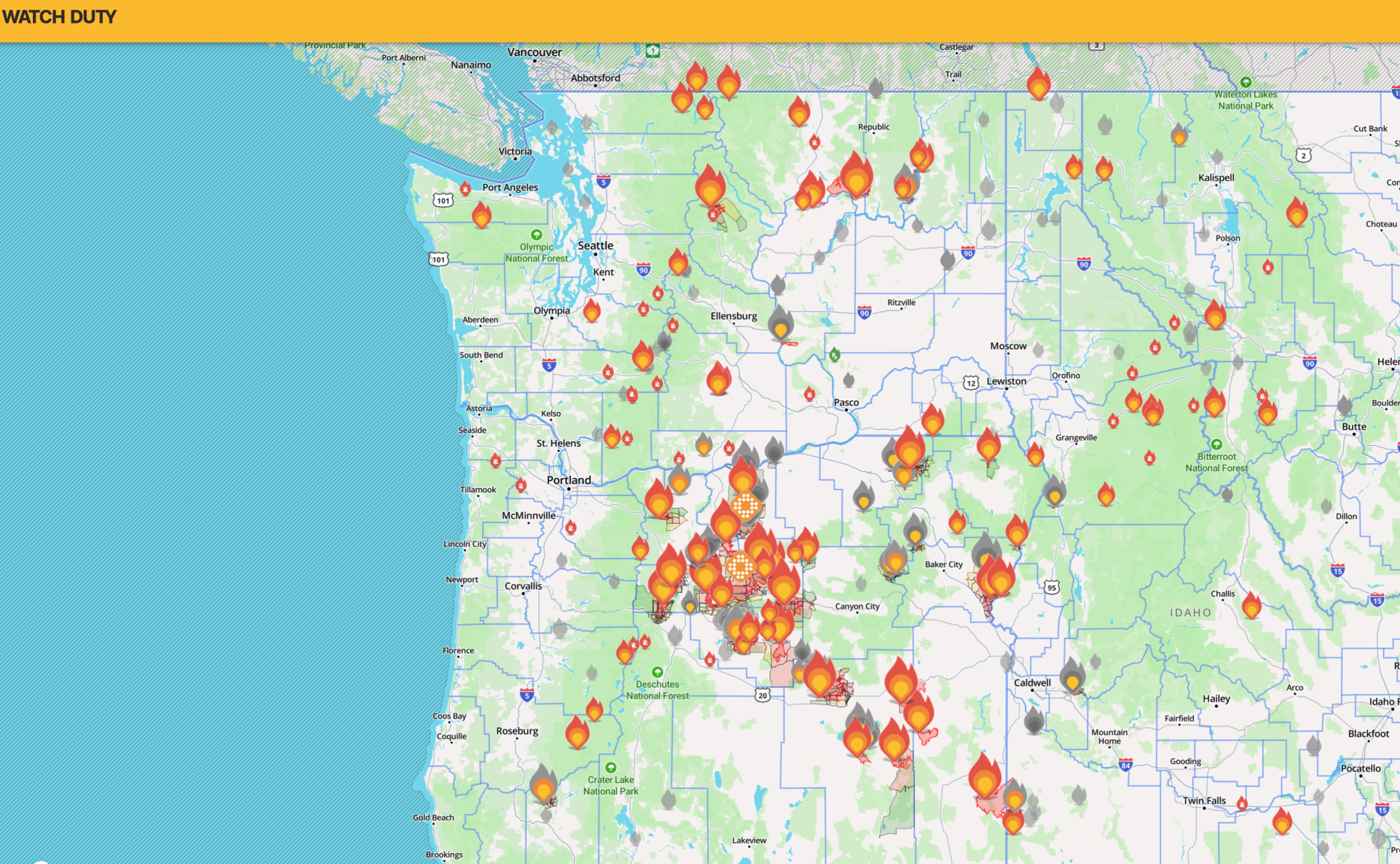
The prevailing wind pattern across North America for the last ten days has kept the insane amount of smoke from these fires well north of Colorado. This will continue to be the case for the next few days. However, as the heat dome shifts late week off to the Desert, our winds aloft will start to take on a more northwesterly component. This will increase the chances for thick smoke to return to the state. Whether that means the smoke comes back Thursday, Friday or Saturday remains to be seen, but just be aware that our recent smoke-free good fortune likely won’t last too much longer. Check our Colorado Smoke Forecast page for the latest.
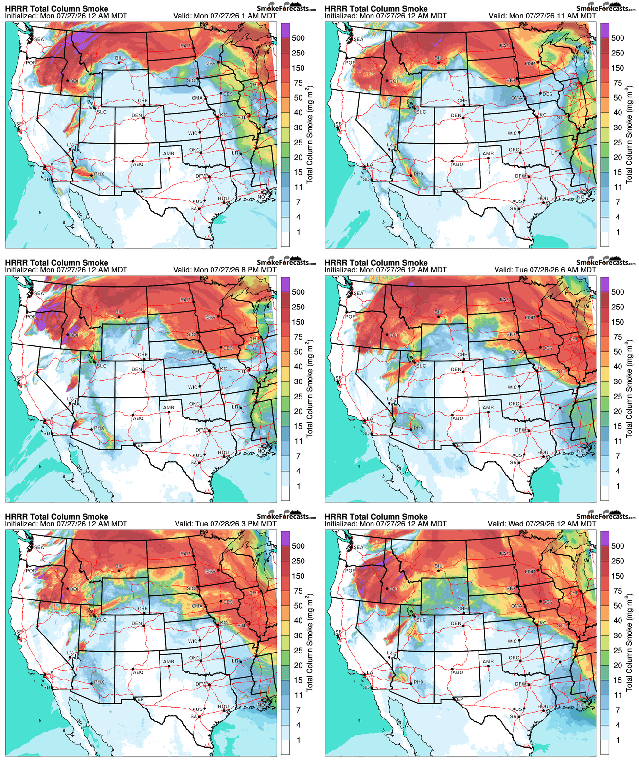
Smoke forecast through Tuesday night. Thick PNW wildfire smoke will stay north of Colorado to start the week, but that won’t last forever.
Bottom Line
Eastern Colorado just endured a record‑setting heat blast. We’ll get a brief “cooler” stretch early this week thanks to clouds and active monsoon flow, followed by a drying trend as a major Southwest heat dome builds. Expect storm chances to fade and temperatures to climb again — with another hot weekend locked in and a potential return to 100°F by early next week. Thick smoke from PNW wildfires may enter the chat late in the week as well.
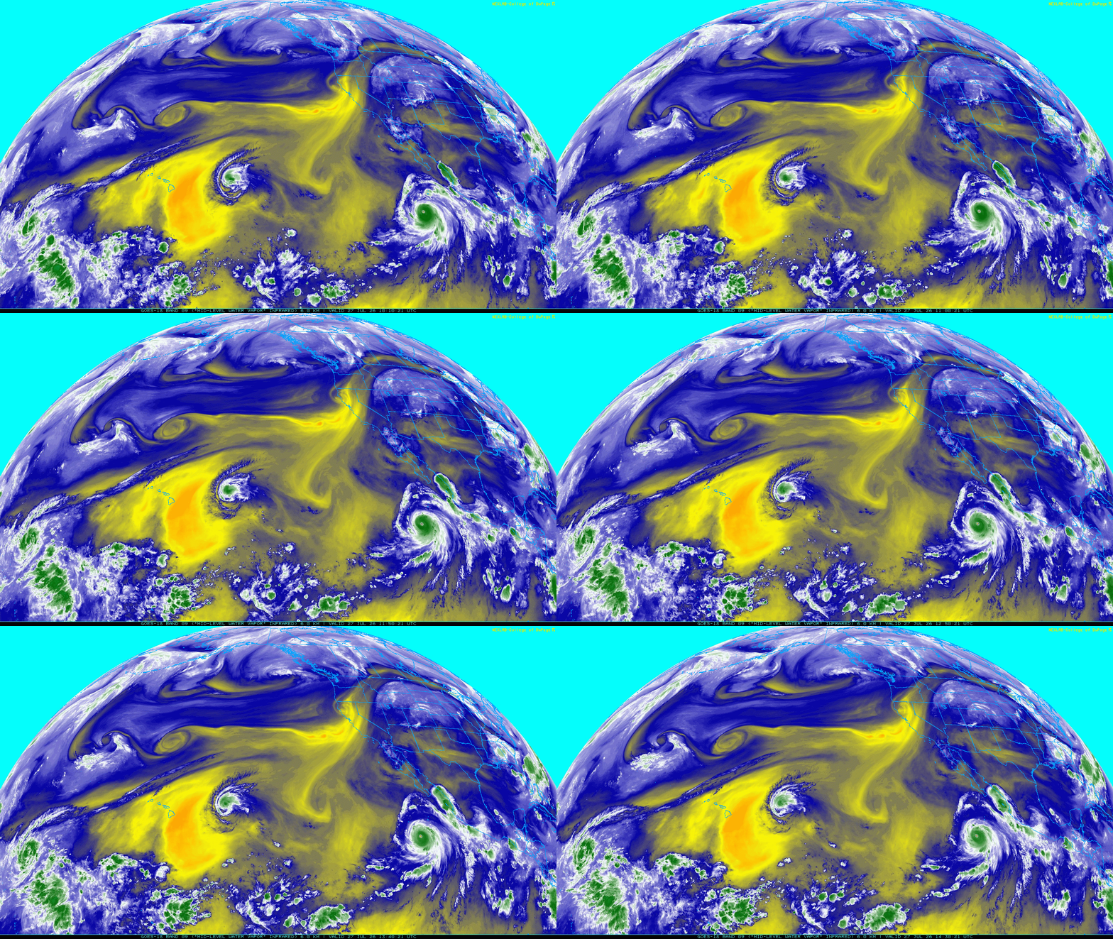
And finally, we leave you with the beautiful view from GOES-West of Category 5 Hurricane Genevieve (south of Baja California) and Hurricane Fausto (near Hawai’i). Neither of these cyclones will play any role in Colorado weather, but hey, the tropics are exciting and there will be plenty of action in the eastern Pacific this summer due to the intensifying El Niño. Have a great week!
DISCLAIMER: This weekly outlook forecast is created Monday morning and covers the entire upcoming week. Accuracy will decrease as the week progresses as this post is NOT updated. To receive daily updated forecasts from our team, among many other perks, subscribe to BoulderCAST Premium.
Go Premium, get all the perks.
Daily Forecast Updates
Get our daily forecast discussion every morning delivered to your inbox.
All Our Model Data
Access to all our Colorado-centric high-resolution weather model graphics. Seriously — every one!
Ski & Hiking Forecasts
6-day forecasts for all the Colorado ski resorts, plus more than 120 hiking trails, including every 14er.
Smoke Forecasts
Wildfire smoke concentration predictions up to 72 hours into the future.
Exclusive Content
Weekend outlooks every Thursday, bonus storm updates, historical data and much more!
No Advertisements
Enjoy ad-free viewing on the entire site.
Enjoy our content? Give it a share!











You must be logged in to post a comment.