After another round of spring snow over the weekend, the pattern will stay somewhat active across the Front Range this week, but with the warmer late April temperatures translating to only rain chances for the lower elevations. Unfortunately it looks like the gloom will stick around into the upcoming weekend as well. Let’s take a look.
This week’s highlights include:
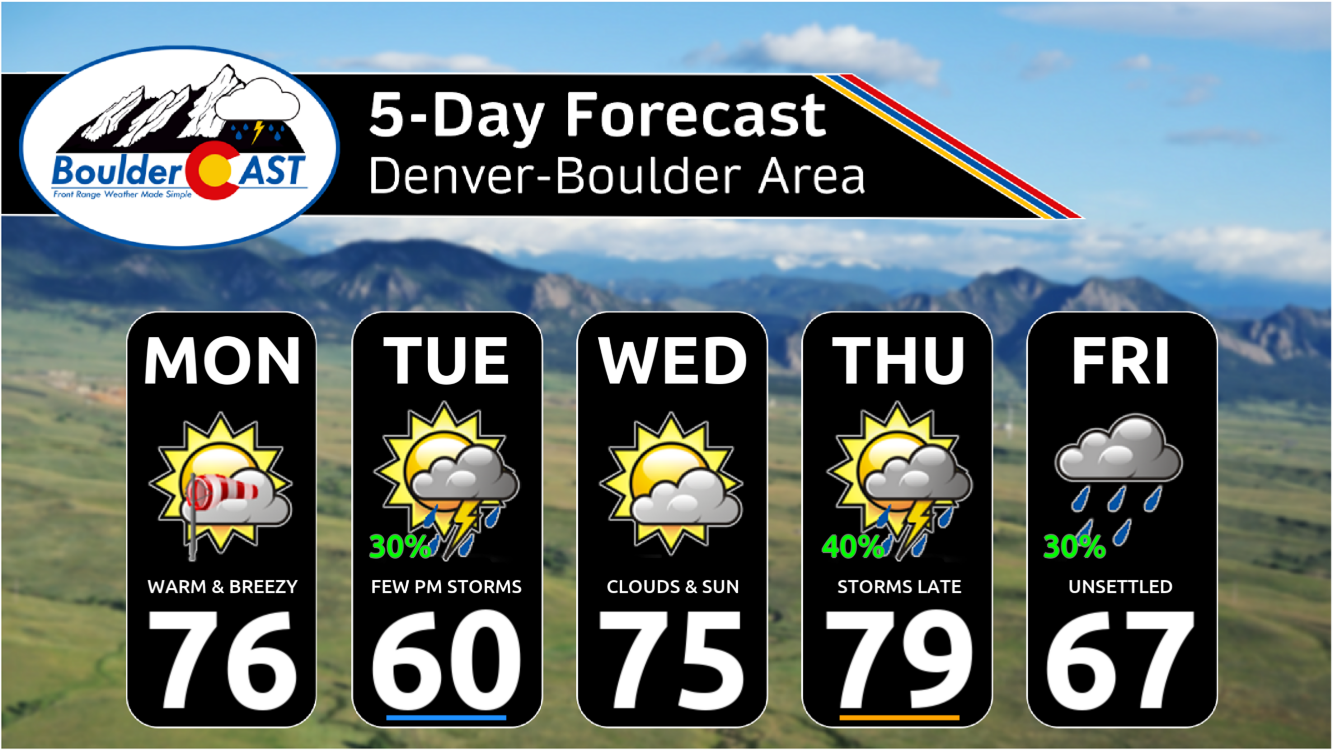
- Warm and breezy Monday with downslope gusts over 30 MPH
- Cooler Tuesday behind a cold front with a chance of late day storms
- Beautiful Wednesday in the 70s and dry
- A series of troughs will begin to impact the Rockies late in the week with unsettled conditions expected
- Staying fairly mild, but chances for rain/storms every day Thursday into the upcoming weekend
DISCLAIMER: This weekly outlook forecast is created Monday morning and covers the entire upcoming week. Accuracy will decrease as the week progresses as this post is NOT updated. To receive daily updated forecasts from our team, among many other perks, subscribe to BoulderCAST Premium.

Go Premium, get all the perks.
Daily Forecast Updates
Get our daily forecast discussion every morning delivered to your inbox.
All Our Model Data
Access to all our Colorado-centric high-resolution weather model graphics. Seriously — every one!
Ski & Hiking Forecasts
6-day forecasts for all the Colorado ski resorts, plus more than 120 hiking trails, including every 14er.
Smoke Forecasts
Wildfire smoke concentration predictions up to 72 hours into the future.
Exclusive Content
Weekend outlooks every Thursday, bonus storm updates, historical data and much more!
No Advertisements
Enjoy ad-free viewing on the entire site.
Warm & mostly dry through Wednesday
After waking up to several inches of snow on Saturday, Sunday was drier and warmer across the area rebounding back into the middle 60s.
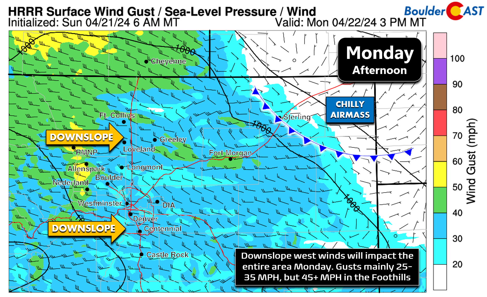
That moderating temperature trend will continue for our Monday as a warmer airmass moves in under ridging and downslope flow. Highs will push into the middle 70s by afternoon.
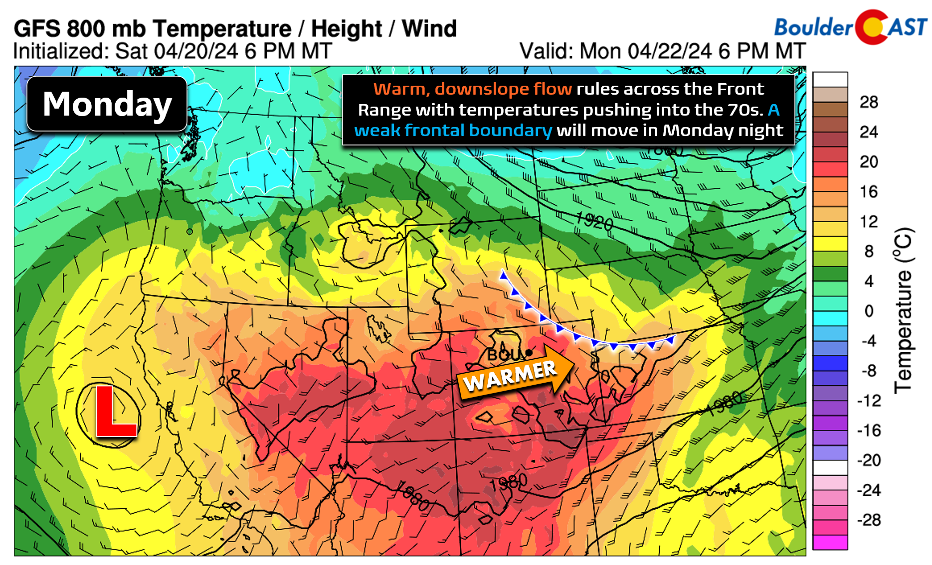
The only real concern for our Monday will be the gusty winds, up to 35 MPH around Boulder and Denver. Fire danger remains low, but the winds will be a nuisance to any outdoor plans!
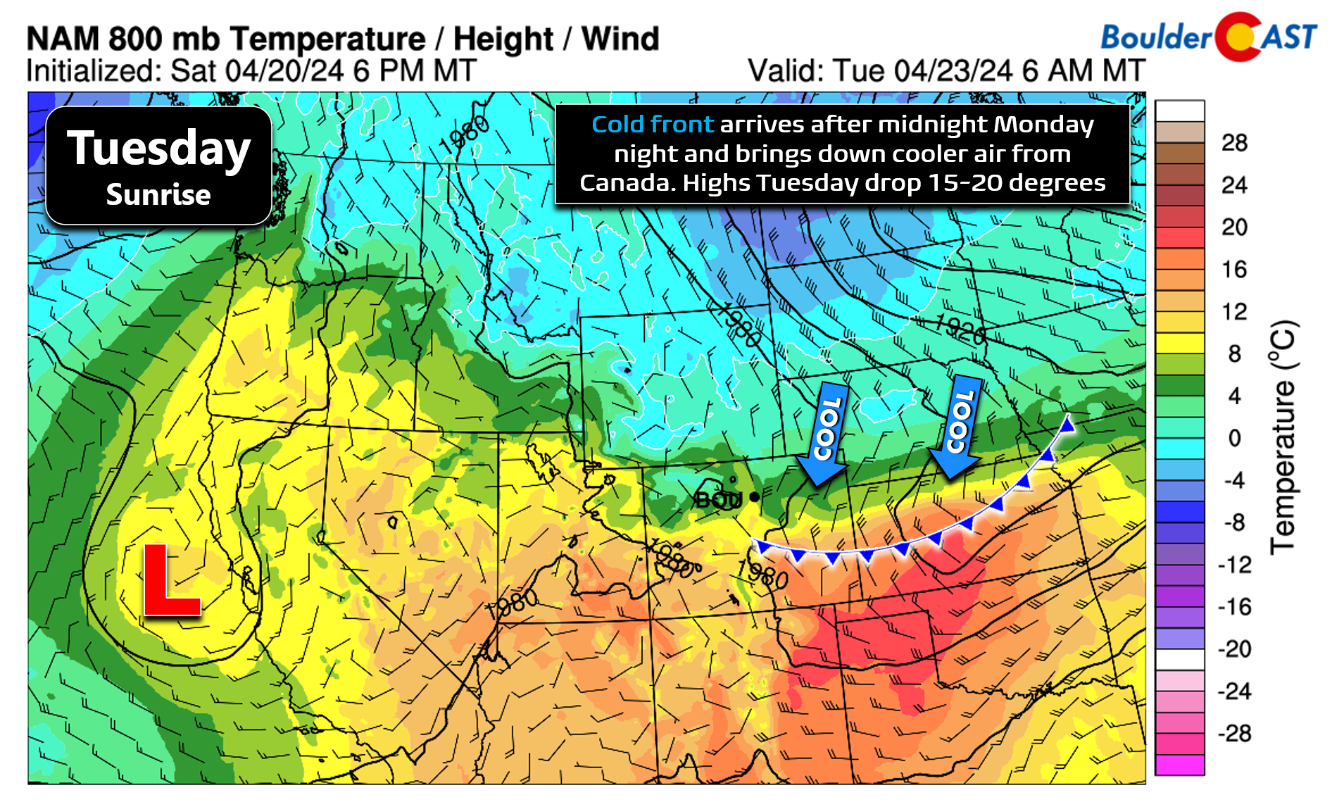
The big warm-up observed on Monday won’t last long. Note above the cold frontal boundary located across far northeast Colorado tied to a system near the Great Lakes. This front will gain momentum and drop south across all of eastern Colorado, passing through the Front Range after midnight Monday night. This will pave the way for a much cooler Tuesday with high temperatures in the upper 50s to lower 60s. The initial frontal passage looks mostly dry, though there will be enough moisture/instability around for widely scattered late-day storms in the wake of the front.
Wednesday will see the warm downslope flow win out again as the cooler airmass gets washed out and whisked eastward. Temperatures will push back well into the 70s with dry conditions.
Turning unsettled late week & for the weekend
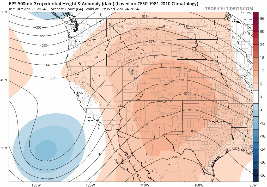
Late in the week, conditions will turn unsettled again across the Rockies as a broad trough drops into the area from the northwest, while also merging with a weak area of low pressure coming across the Baja. Together these two troughs will allow for a cooler end to the week with daily chances for precipitation in our neck of the woods. Now being squarely in late April, it does take a more significant trough to provide enough cold air for snow in the Metro area. This one doesn’t appear to offer enough with late-week precipitation likely to remain as all rain across the lower elevations. Snow will be possible in the Mountains and higher Foothills, though.
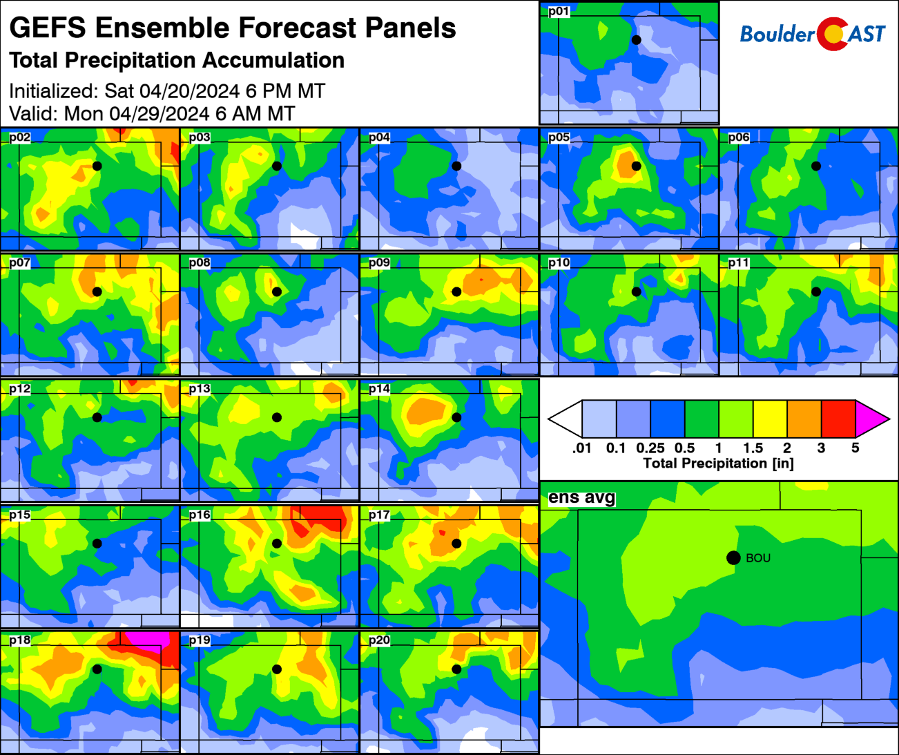
As it stands right now, Thursday and Friday will come with late-day scattered showers and thunderstorms and temperatures staying mild in the 60s and 70s. The latest ensemble runs are riddled with rain showers heading into the weekend as well, though the exact timing/forcing of things is unsurprisingly varied this far out. One or both weekend days could very well be rather soggy — but at least not snowy!
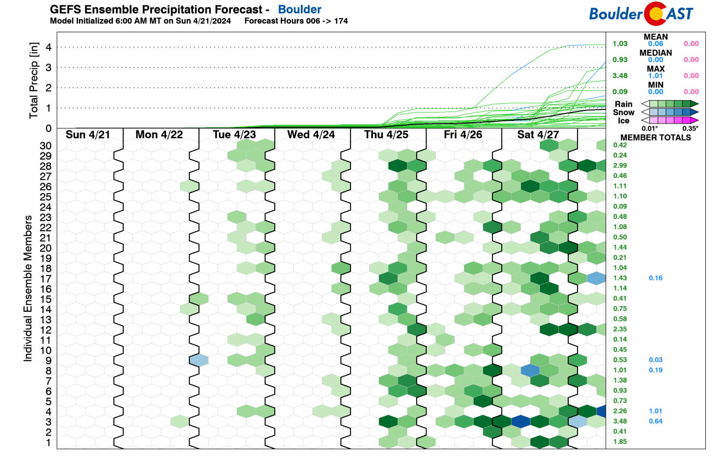
For what it’s worth, the GFS ensemble suite produces an average around 1″ of rainfall in Boulder through Sunday, with areas further north towards Wyoming favored for high amounts.
Enjoy the ups and downs and hopefully by week’s end, the rain!
Happy Earth Day 2024!
![]()
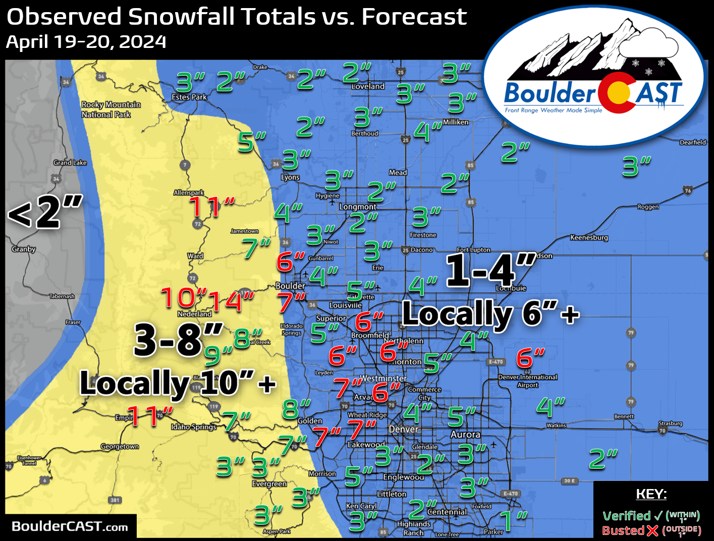
Not a bad snow season with several weeks still to go! On average, about 6" of snow falls after April 21st in #Boulder… #COWx pic.twitter.com/fhEmLjJ1TO
— BoulderCAST Weather 🏔️❄️ (@BoulderCAST) April 21, 2024
Get BoulderCAST updates delivered to your inbox:
Forecast Specifics:
Monday: Warm with wave clouds. Breezy conditions develop during the day with west winds gusting up to 35 MPH on the Plains and up to 50 MPH in the Foothills. Highs reach the middle 70s on the Plains with low 60s in the Foothills.
Tuesday: Partly cloudy and much cooler following a pre-dawn cold front. Widely scattered thunderstorms will develop during the afternoon/evening. Highs around 60 degrees on the Plains and near 50 in the Foothills.
Wednesday: Warmth returns with a mix of clouds and sunshine. Highs top out in the middle 70s across the Plains with lower 60s in the Foothills.
Thursday: Mostly sunny early, but increasing clouds with scattered showers and thunderstorms late day. Highs top out close to 80 degrees on the Plains with upper 60s in the Foothills.
Friday: Partly to mostly cloudy and cooler. A chance of showers. Highs in the 60s on the Plains with 50s in the Foothills.
DISCLAIMER: This weekly outlook forecast is created Monday morning and covers the entire upcoming week. Accuracy will decrease as the week progresses as this post is NOT updated. To receive daily updated forecasts from our team, among many other perks, subscribe to BoulderCAST Premium.
Go Premium, get all the perks.
Daily Forecast Updates
Get our daily forecast discussion every morning delivered to your inbox.
All Our Model Data
Access to all our Colorado-centric high-resolution weather model graphics. Seriously — every one!
Ski & Hiking Forecasts
6-day forecasts for all the Colorado ski resorts, plus more than 120 hiking trails, including every 14er.
Smoke Forecasts
Wildfire smoke concentration predictions up to 72 hours into the future.
Exclusive Content
Weekend outlooks every Thursday, bonus storm updates, historical data and much more!
No Advertisements
Enjoy ad-free viewing on the entire site.
Enjoy our content? Give it a share!


You must be logged in to post a comment.