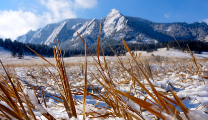
It’s only fitting that the absolutely bonkers 2021-2022 snow season would end with a late-May dumping of snow. We review the lead up to the event, the snowfall totals across the area, and how this snowstorm stacks up historically.
P
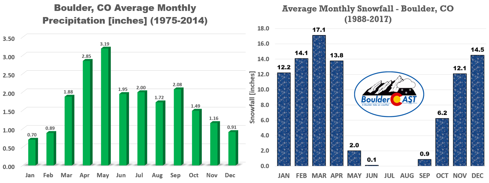
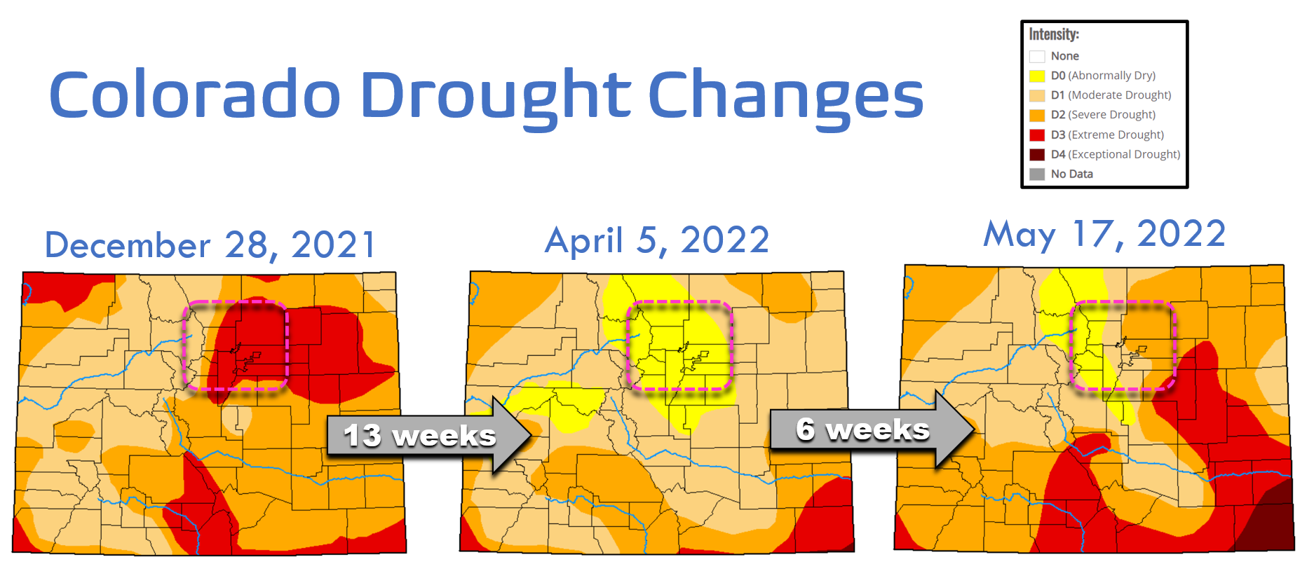
rior to Friday, the last measurable snowfall in Boulder was incredibly two months ago, all the way back in late March. Since then, it has been the driest and least snowy such stretch in the city’s history. This was extra bad news for the drought as this springtime period is usually our wettest and often snowiest time of the year.
After the record snowy start to 2022 (that seems like ages ago, doesn’t it?), we had dug ourselves out of a huge precipitation deficit by early April with drought classifications nearly lapsing across the Front Range. That progress unfortunately was erased by the dearth of precipitation the last eight weeks — Ugh!
Then came this week’s snowstorm, almost entirely out of left field. Though we did have a beat on the system many days ahead of time, there wasn’t great model support for this much snow — except for the American GFS model which was showing a decent snowstorm all along. We’ll skip most of the details surrounding the storm’s evolution in the days leading up to the event — though it was a fun and challenging forecast — ultimately you know how it turned out: wet and snowy!
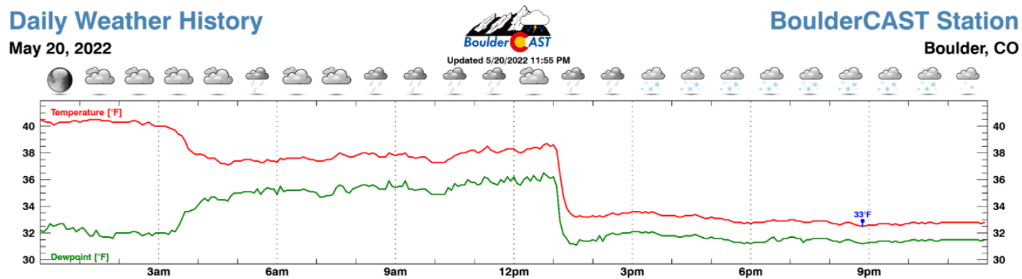
Things kicked off late Thursday evening with the passage of the initial Canadian cold front. This strong boundary dropped the temperature at our station from 81°F to 54°F in just 25 minutes.
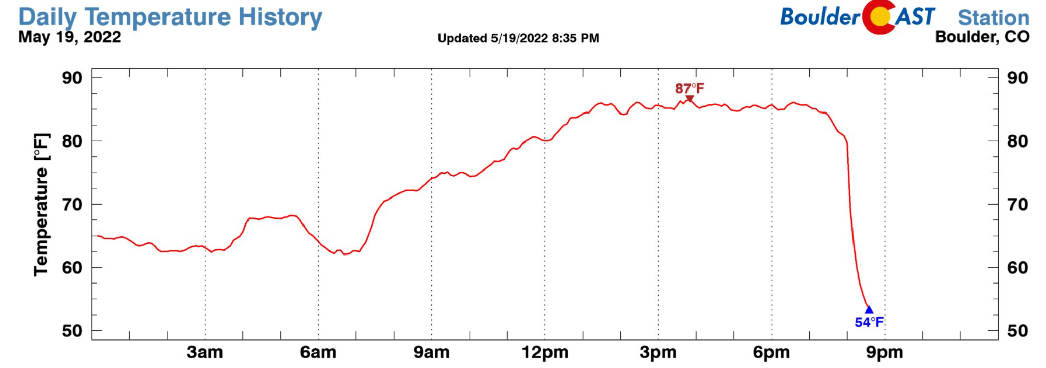
That change of 27°F was the most drastic drop in temperature ever recorded at our station — though our records only go back to 2015. Other weather folk around the region noted that similar historic temperature change records were broken for other stations ranging from Fort Collins to Golden. This system truly was a clash of two seasons, similar in vein to the epic Labor Day snowstorm of 2020.
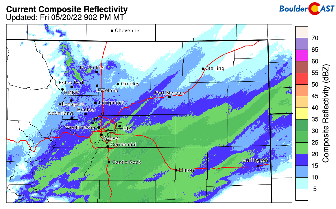
This intense front came packed with a wall of dust which was clearly visible on radar and ominously to the naked eye as it approached and blew through.
Here comes the cold front from the northeast on radar. A wall of dust is leading the way. Goodbye 80s! Hello 🌨 #cowx pic.twitter.com/L8KXNBXqM8
— BoulderCAST Weather (@BoulderCAST) May 20, 2022
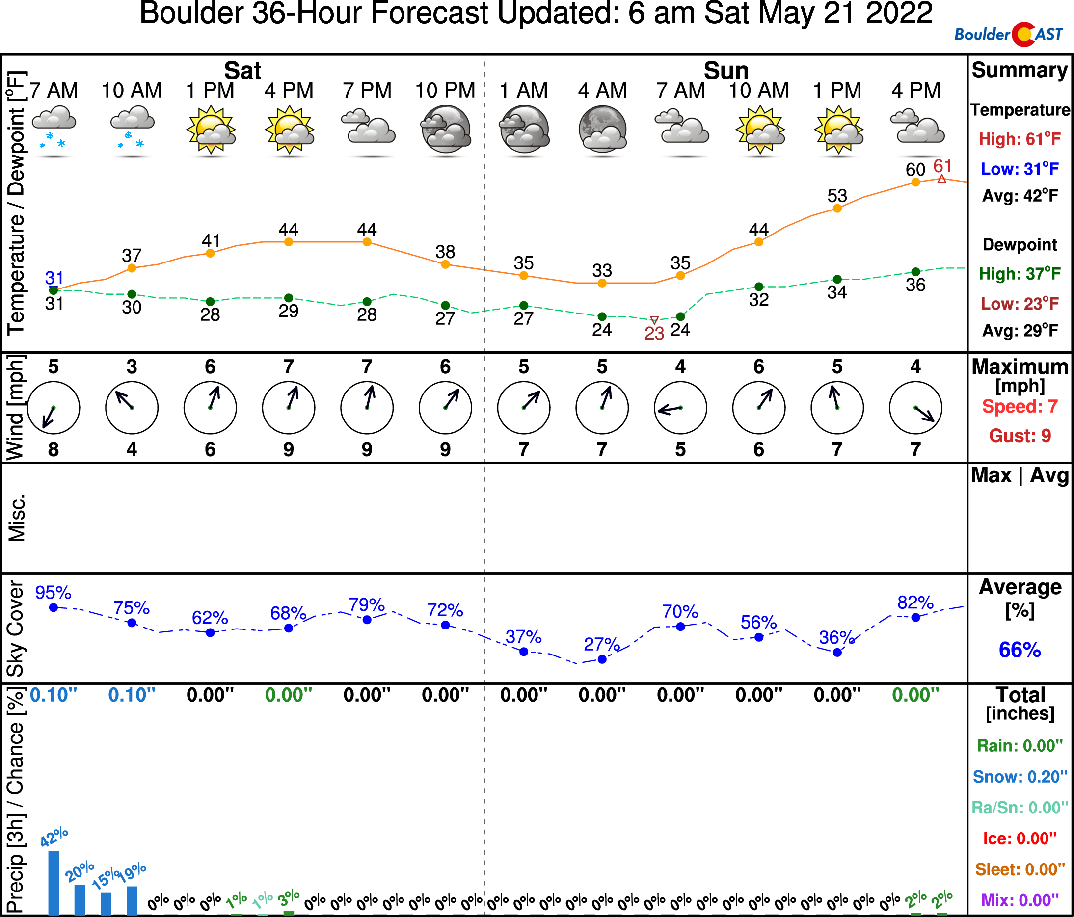
By Friday morning, rain had broken out across the area, with snow already falling in the higher elevations. We got about 0.3″ of rain in Boulder before the change-over to snow occurred early Friday afternoon aided by an anticipated secondary surge of cold air (i.e. another front). You can see this second front in the graphic below passing through around 1PM on Friday. It was this front that took this storm to the next level — from just a rain/snow mix type of event with little fanfare, instead to a late-season impactful snowstorm for nearly the entire Metro area. After this front passed, it was all snow from there on out. Temperatures bounced back and forth between 32 and 33 degrees at our station for the next 19 hours with snow falling continuously.
Whether you realize it or not, we actually somewhat dodged a bullet with this storm. About 24 hours leading up to the event, we started to see shifts in the models — the system was taking a more southern track and precipitation amounts were declining slightly across the Denver Metro area. The animation below shows the precipitation output from the European model in its six runs leading up to the storm’s arrival. Notice how the bullseye over Colorado both shrinks and shifts southward slightly. This same trend was visible in other models as well, though not as pronounced. In the end, we didn’t make too big of a deal about this as we didn’t believe it would change the forecast much for our area. This shift thankfully did take some of the highest-end snow amounts off the table for the Denver area, while at the same time ramping up the storm’s impact for the Palmer Divide and Colorado Springs regions.
Euro model trend forecast animation of precipitation leading up the event. Each timestep is a different model run, showing the southward shift of the storm in time
Heavy snow fell through much of the afternoon and evening on Friday, but luckily began to let up right as the sun set. Here’s a look at the regional radar from the afternoon hours on Friday as heavy snow was falling in Boulder and Denver alike.
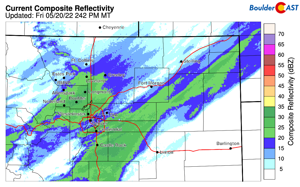
Regional radar animation from Friday afternoon as heavy snow fell across the area
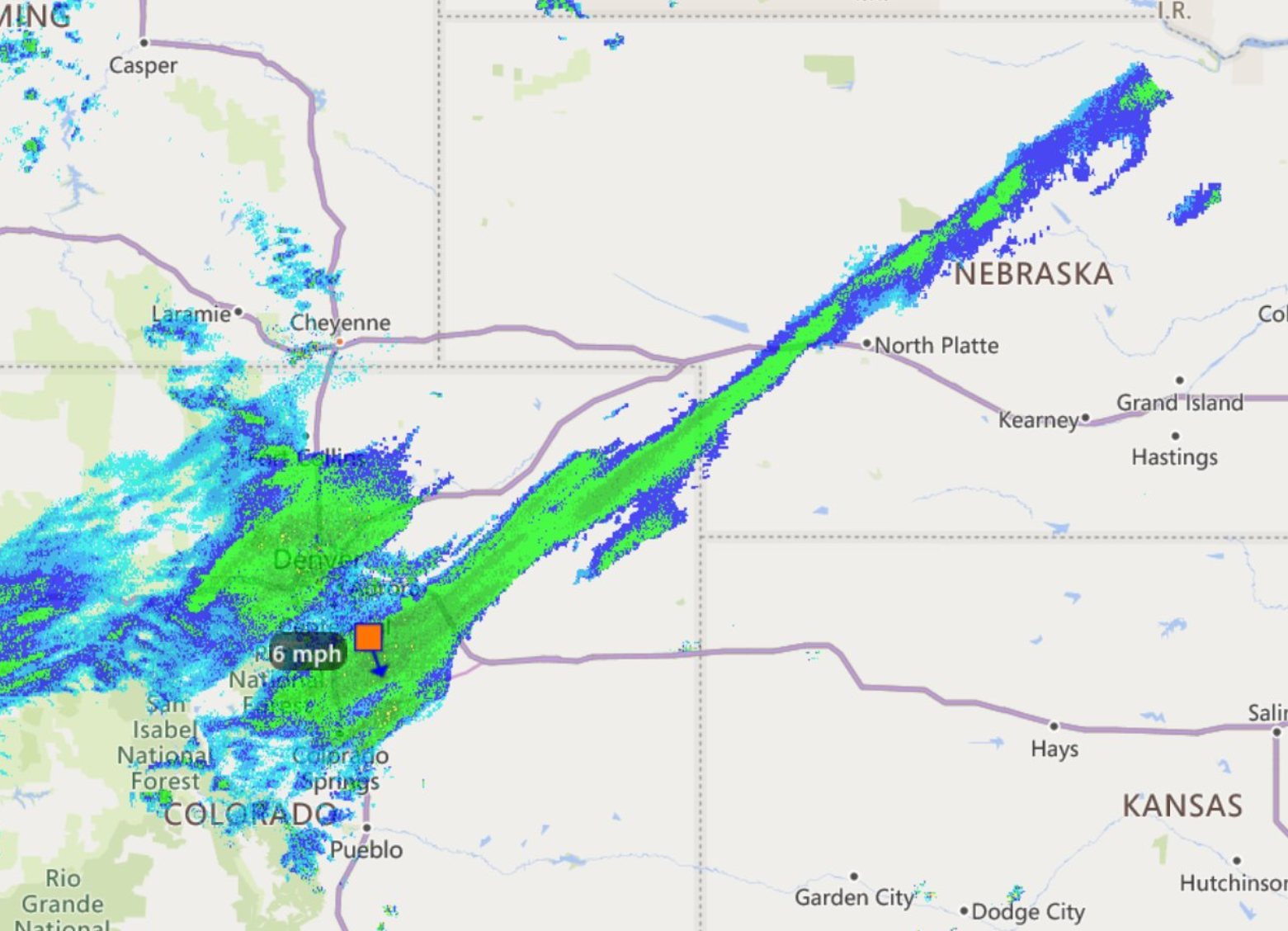
Strong forcing from the overhead jet stream and a nearby stalled mid-level frontal boundary worked in tandem to produce these two epic snow bands. At times, the southern band stretched narrowly in a straight line nearly 400 miles from Denver into eastern South Dakota!
By sunset, the heaviest snow was already taking its planned departure to the south, just as the models had predicted moments prior to the storm’s arrival. This shift to lighter snow overnight likely saved a lot of tree limbs and power outages across the area. Even still, as of writing on this Saturday morning, Xcel was reporting nearly 100,000 homes without power across the Front Range. We’ve also see many reports of downed tree limbs, especially in the western suburbs from Boulder to Arvada to Golden. As you will see in a moment, this makes sense as these areas picked up the most snow.
Regional radar animation from Friday night just after sunset as heavy snow shifted south of the area
Another positive from the overnight period was that temperatures didn’t get quite as cold as models were showing. Some spots did drop below freezing, but many did not. This could have been a lot worse as well — nearly every single model was showing sub-freezing temperatures regionwide. The graphic below shows the observed low temperatures Saturday morning. Considering the added insulation from the wet snow, the impact on our vegetation may be minimal — time will tell.
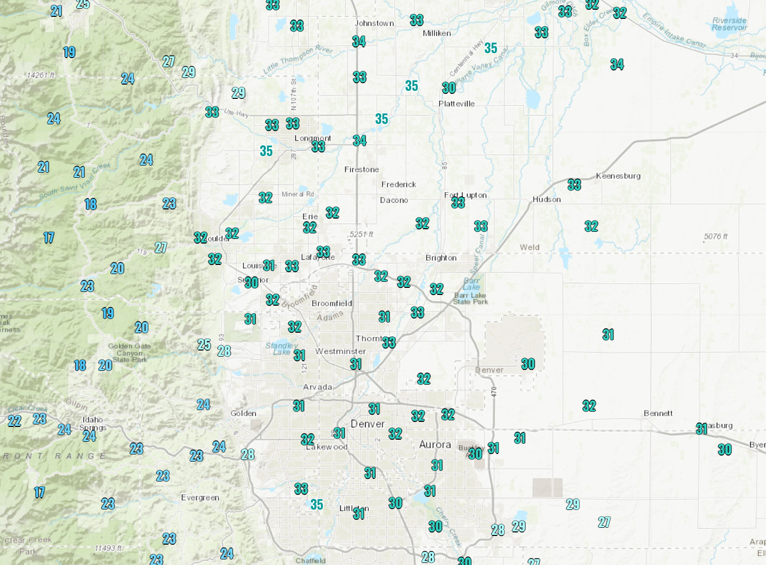
Overnight lows Friday night — many areas thankfully stayed above freezing
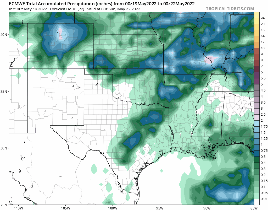
Moving on, let’s first look at the precipitation totals — as it is undeniable this was a much-needed drink of moisture for our area! The western Metro and Foothills appear to be the winners, with 1.5″ or so across the board. Most of the Denver area saw at least 1″ of liquid. This was right in line with model projections and our forecast.
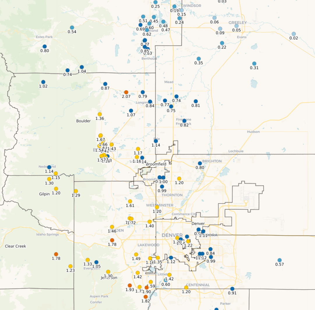
Totals in the northern Foothills were somewhat disappointing though. This is especially true considering they were heavily targeted by the models to receive the most precipitation…
12Z Euro model run doubling down on Boulder County as the big winner from this storm #COWx #Boulder pic.twitter.com/cfziqlbvqb
— BoulderCAST Weather (@BoulderCAST) May 19, 2022
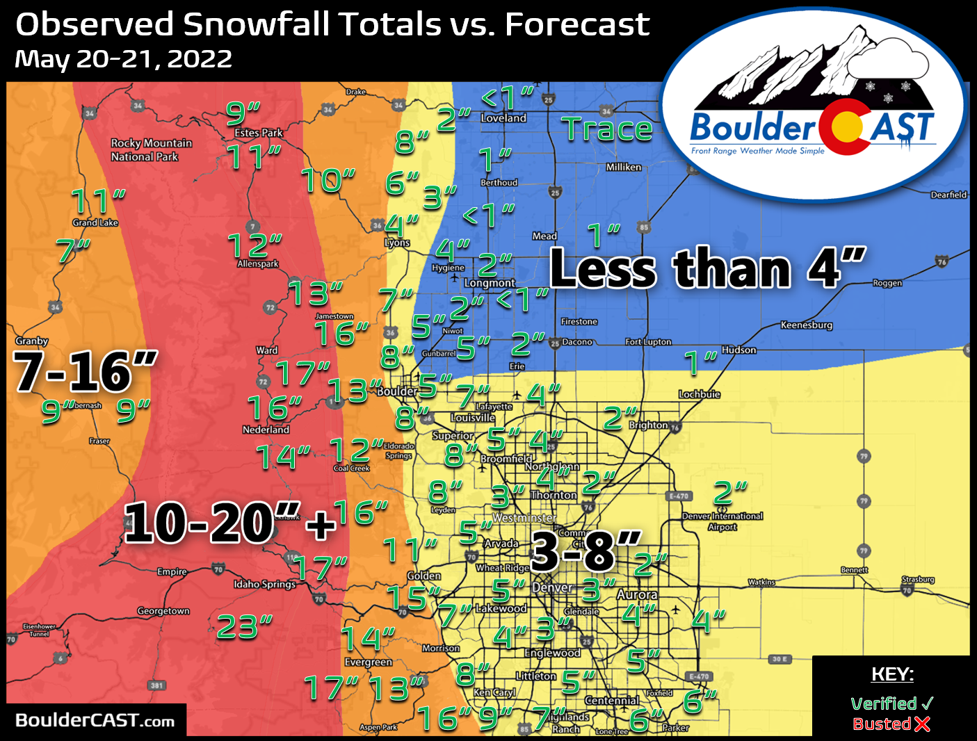
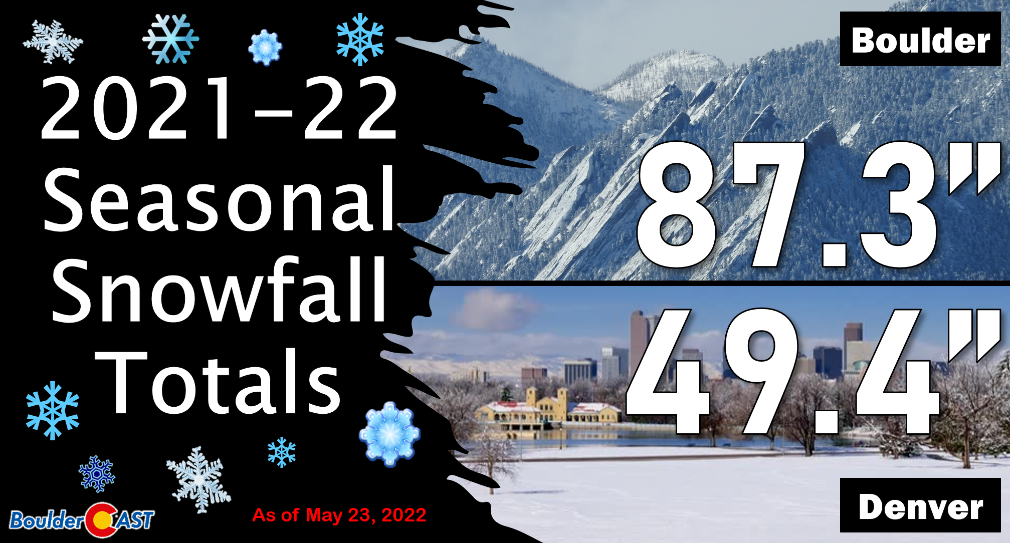
Our snowfall forecast map for the event issued Thursday morning is shown below with storm totals overlaid. Green numbers indicate our forecast verified to within 1″. Red did not. As you can see, anywhere from a trace to 23″ of snow fell across the entire area with excellent forecast verification overall. The heaviest dumping of spring snow occurred in the Foothills of Jefferson and Boulder Counties. Boulder officially reported 8.3″ of snow, while Denver received 2.3″ a DIA (with closer to 3″ downtown).
Shockingly, with the inclusion of this recent storm, against all odds Boulder has pulled off almost an exactly average snowfall season — in a way that was anything but! We have 87.3″ of snow on the season. Our seasonal average is 89.7″.
How does this storm stack up historically? Though it does often snow in the month of May for us, it usually is only a small amount (a couple inches or less). An 8+” snowstorm in Boulder, especially this late in May, is very rare. This will go down as Boulder’s 4th largest May snow event since the late 1940s when daily snow observations became available. There has only been one other time it snowed more later in the season — that was back in 1950.
Boulder’s largest May snowstorms:
- 23.0″ – May 5-6, 1978
- 12.3″ – May 1-2, 2013
- 8.7″ – May 25, 1950
- 8.3″ – May 20-21, 2022
- 6.8″ – May 11-12, 2014
With this late-season snowstorm now in the books, we will celebrate that Boulder managed to evade at least two (lack of) snowfall records thanks to this system:
- Earliest final snowfall of the season: Prior to this event, our last snow was all the way back on March 21st. Had this held up, it would have been the earliest end to a snow season on record. No one wants that record!
- Shortest snow season: If you recall, the 2021-22 snow season started very late with Boulder tying the record for the latest first snowfall. Obviously if we had the latest first snowfall and the earliest last snowfall, that would have made for a record short snow season. Having had snow now on May 21st, we’re no longer even close to this record.
Looking ahead
Some light snow is still dotting the area as of Saturday morning, but sun is mixing in as well. With temperatures on the rise, no additional accumulation is expected for the region as melting will outdo anything else that falls today.
There is some concern that temperatures will plummet below freezing again Saturday night into Sunday morning. This now appears less likely than it did previously. Still, there is a decent chance outlying areas that clear out fully of the clouds will get below freezing. We recommend keeping up any precautions you already have in-place for you plants until at least Sunday afternoon.
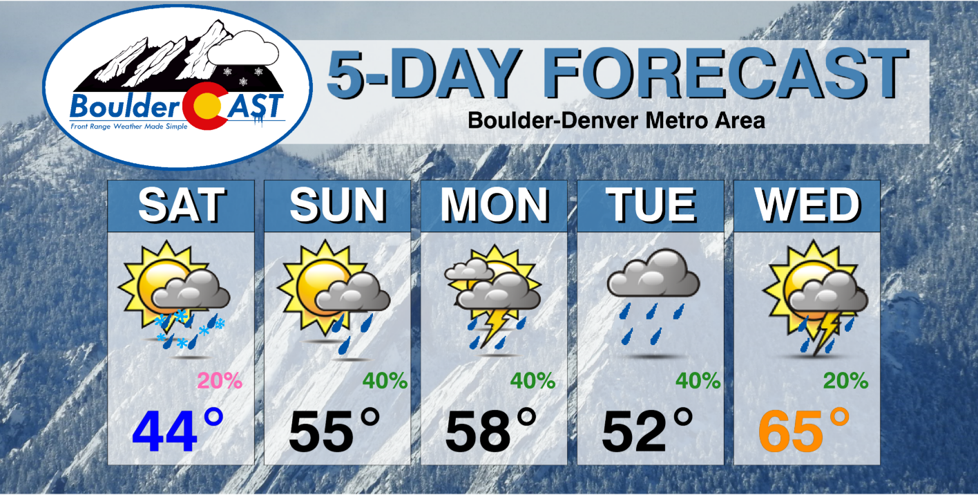
With a trough parked over the northern Rockies, we will remain unsettled in the extended with daily chances of rain and cooler than normal temperatures heading into the middle of next week. It’s about time, right? That’s all for now — enjoy the weekend!
We discuss Boulder and Denver weather every single day on BoulderCAST Premium. Sign up today to get access to our daily forecast discussions every morning, complete six-day skiing and hiking forecasts powered by machine learning, access to all our Front Range specific weather models, additional storm updates and much more!

.
Spread the word, share Colorado’s crazy weather:


You must be logged in to post a comment.