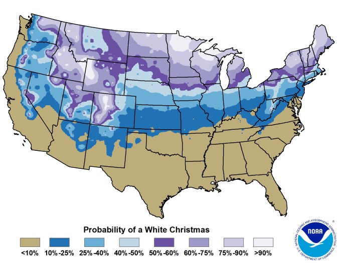
We take a broad look at White Christmas occurrences in Boulder’s historical record and discuss why Christmas Day, out of all days, has the highest probability of snow on the ground. We also give our White Christmas forecast for this year.
Category: Winter Weather (Page 77 of 139)
These posts contain some discussion of the white stuff, whether it be mountain snow pack or a Front Range snowstorm.
After a breezy last couple of days, the holiday week starts out calm and mild for the first official day of winter. A midweek cold snap will ensue, along with a slight chance of snow showers. The Christmas forecast is looking dry, although there are signs that a more active pattern could develop for late December.
Shown below is our snowfall forecast map with actual storm totals overlaid in boxes. Green boxes indicate that our forecast verified to within one inch of the observed snowfall. Red did not (there are no red).
In an almost identical setup to what transpired this past Monday, another weak storm system will progress across Colorado Thursday night into Friday afternoon. Once again the storm’s track and speed will greatly limit snowfall potential in the Denver Metro area. However, there will be a sprinkle of accumulation to close out the week in some locations. Let’s quickly take a look.
A progressive northwest flow pattern in Colorado this week will lead to generally unsettled conditions for the area with frequent shots of light snow. The Mountains will stand the best chances of accumulation, but some will spill across the Denver Metro area as well. Read on for more details.
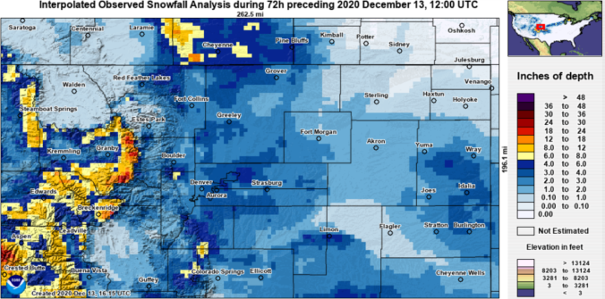
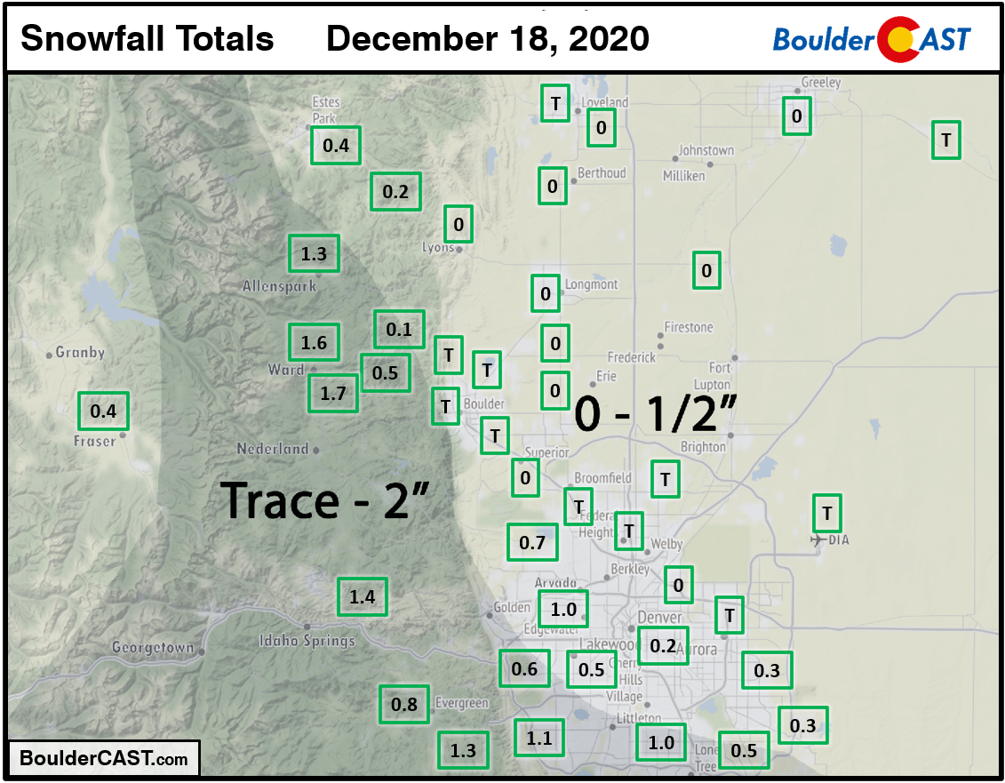
We take a look at regional snow totals from the past few days as the dry pattern finally came to an end for Front Range Colorado.
Winter has resettled into the area following a weak storm system yesterday when light snow accumulations were reported across the entire Denver Metro area. Yet another period of widespread light snow will move into the Front Range Saturday evening. We’re predicting slightly larger totals from this next storm. Read on to find out how much snow to expect and also more about the next chance of winter weather which we are already tracking for late Monday.
Change is on the horizon for the Boulder and Denver area. Today will be the last warm day before a cold front arrives early Thursday morning followed by two (yes two!) light snow events taking us right into the weekend. Let’s have a look at the timeline and preliminary snowfall amounts as winter weather returns to the Front Range.
UPDATED 6:00AM Thursday: Added our snowfall forecast map for the first wave of snow falling Thursday night through Friday night.

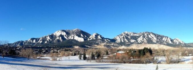
Live View of Boulder

Current Conditions

Live Radar

Recent Premium Posts

This Weekend in Colorado Weather: Early-Season Heat Ramps Up — First 90s of the Year on the Horizon
🌬️ West–northwest flow Thursday supports high‑based convection with gusts to 35 MPH; virga …
BoulderCAST Daily – Wed 06/03/26 | Scattered P.M. storms again as moisture peaks for the week
🌬️ Weak westerly flow aloft today with no major synoptic features nearby; only …
BoulderCAST Daily – Tue 06/02/26 | Storms Reload This Afternoon, But With Noticeably Less Bite
❄️ Monday delivered lots of hail to northeast Colorado, with one supercell tracking …
3-Day Forecast

Trending Content

© 2026 Front Range Weather, LLC
You must be logged in to post a comment.