A progressive northwest flow pattern in Colorado this week will lead to generally unsettled conditions for the area with frequent shots of light snow. The Mountains will stand the best chances of accumulation, but some will spill across the Denver Metro area as well. Read on for more details.
This week’s highlights include:
- A somewhat active northwest flow pattern will fuel a pipeline of weak storms for Colorado through the week
- Another wave of light snow is expected Monday evening and night for the Metro area, up to 2″ may stick
- Dry but cool most of Tuesday through Thursday with highs in the 30’s to lower 40’s
- Another system could reach the area on Friday, appears to be yet another meager snowfall
DISCLAIMER: This weekly outlook forecast is created Monday morning and covers the entire upcoming week. Accuracy will decrease as the week progresses as this post is NOT updated. To receive daily updated forecasts from our team, subscribe to BoulderCAST Premium.

A furious assault of frivolous weather systems
If you didn’t get your allotted amount of snow over the last several days, there’s still some hope! An unsettled weather pattern, at least compared to the last few weeks, will persist in one form or another into the weekend with a setup favorable for frequent, albeit minor snowfall events across Colorado. Any involved low pressure systems should be weak and the ones that fail to turn winds to an upslope direction across our area will have trouble producing much if any snowfall east of the Continental Divide considering the meager dynamics at play.
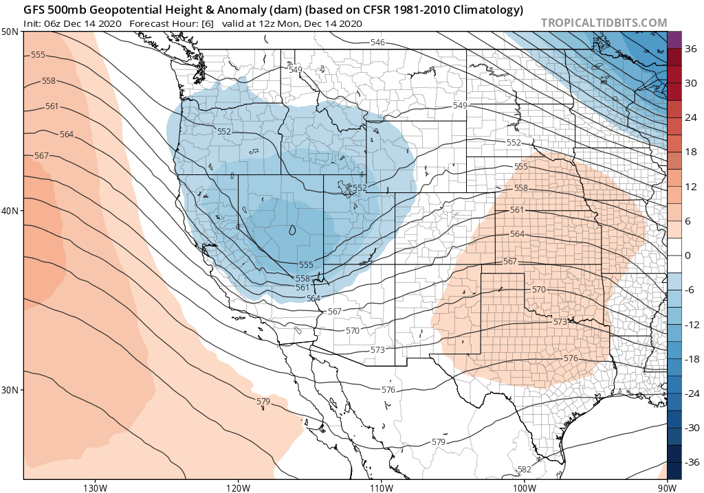
GFS 500mb height anomaly forecast animation covering Monday morning through Friday evening
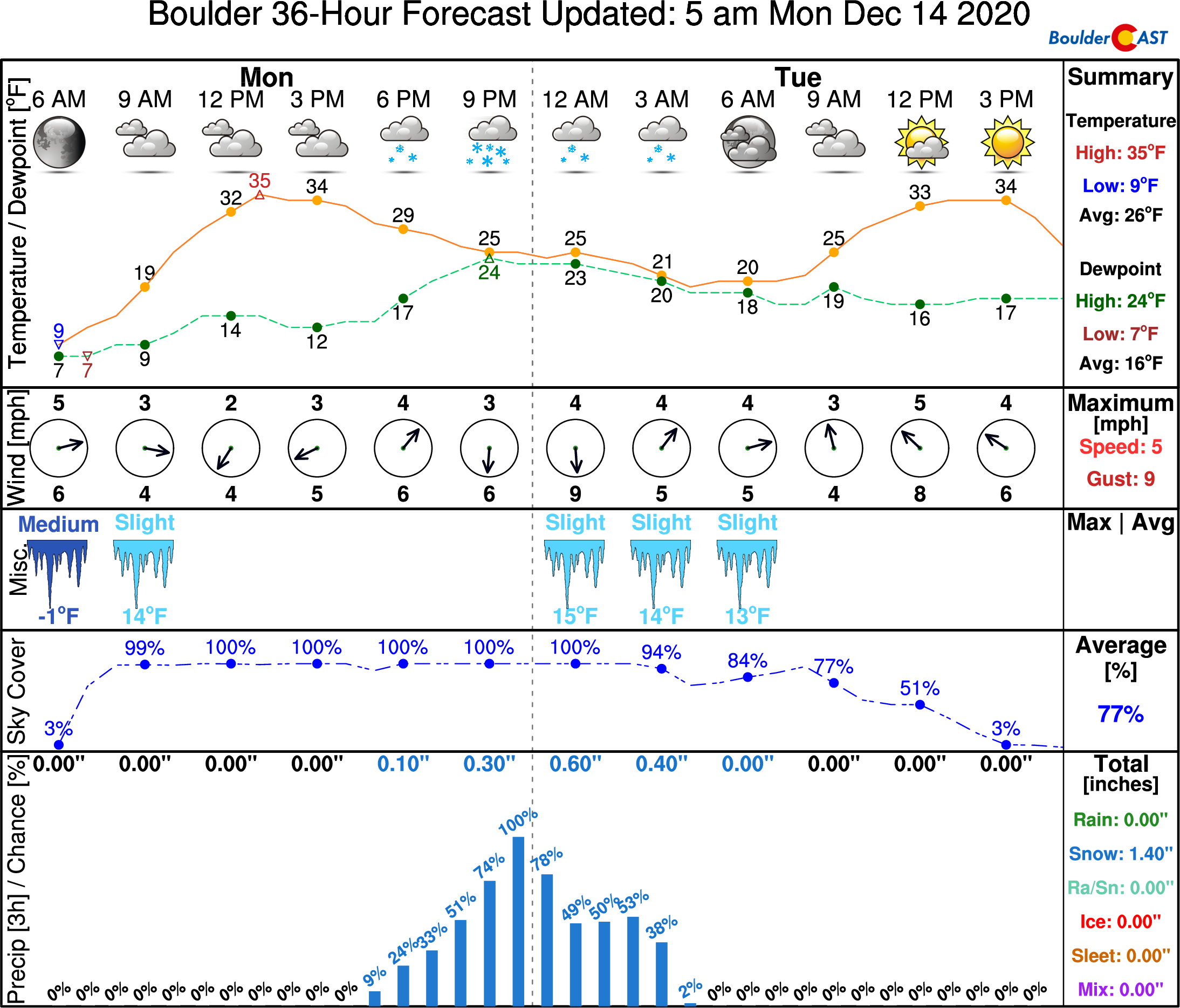
The first round of light snow will quickly take shape late Monday evening into early Tuesday. However, keep your expectations low. This snow will accompany a weak storm system pushing across Colorado from the northwest. It will produce light snow in the Mountains through the afternoon, before slinging very light snow across the lower elevations later this evening.
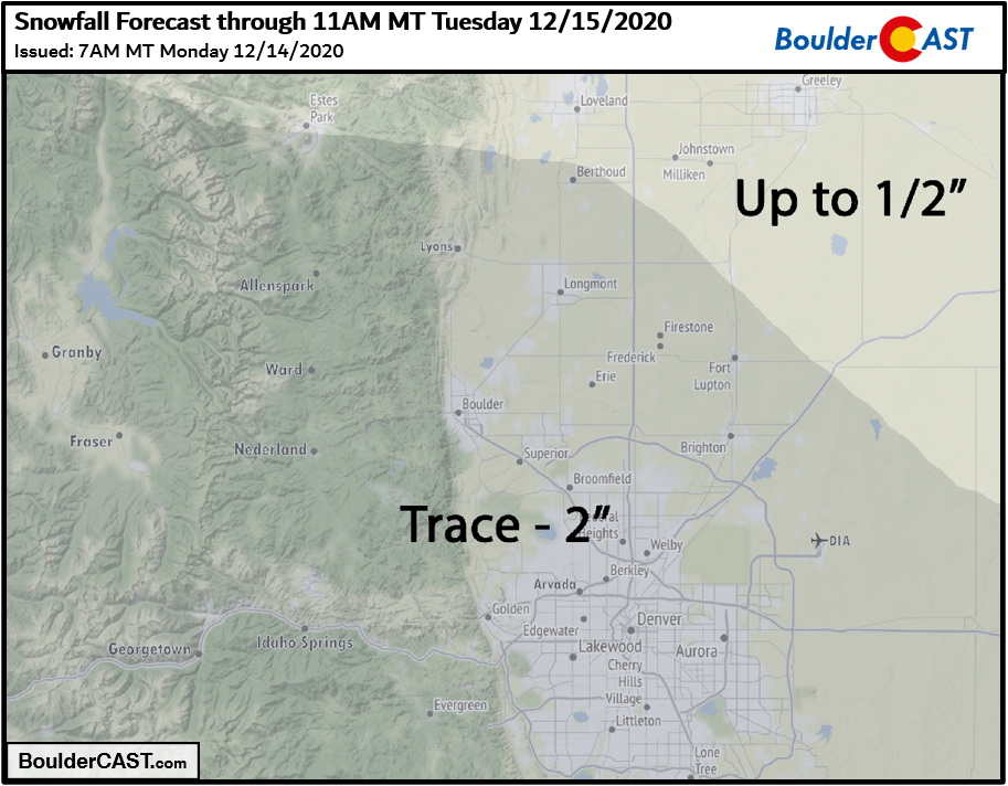
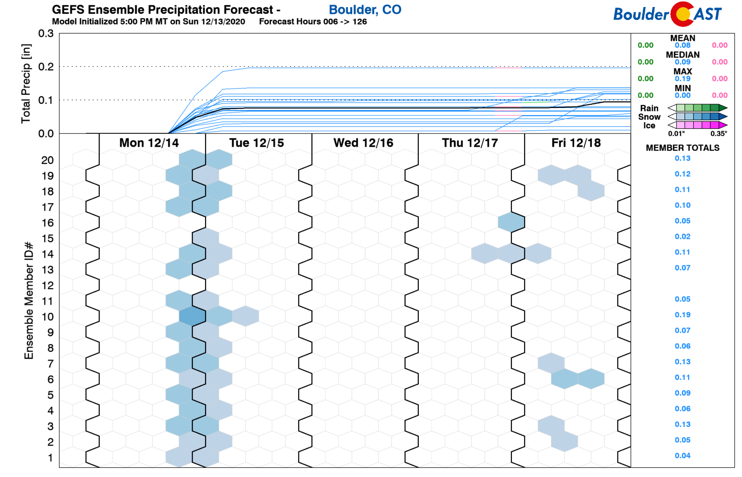
The track of this storm is such that most of the energy will be south of Denver, not unlike what transpired over the weekend. We’re only expecting a dusting up to 2″ for the Boulder/Denver area as the system will be quick to depart. With the southern track, the Palmer Divide stands the best chance of seeing more significant snow totals…perhaps 2 to 4″ there.
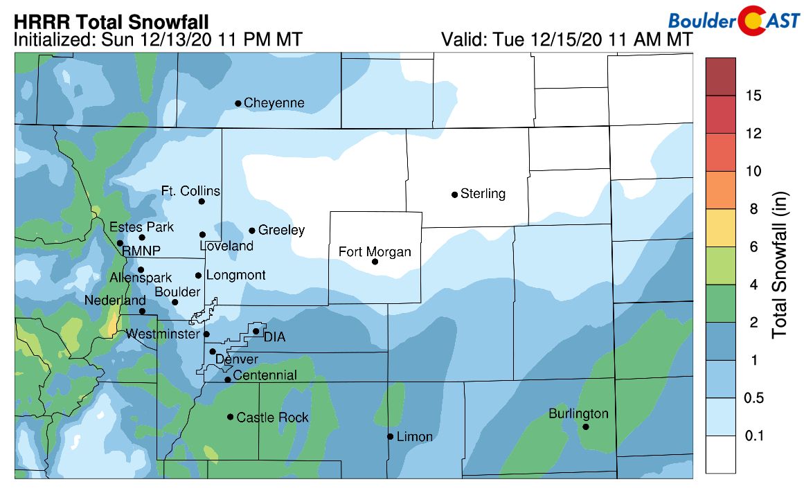
The latest HRRR model-derived snowfall forecast map through Tuesday morning
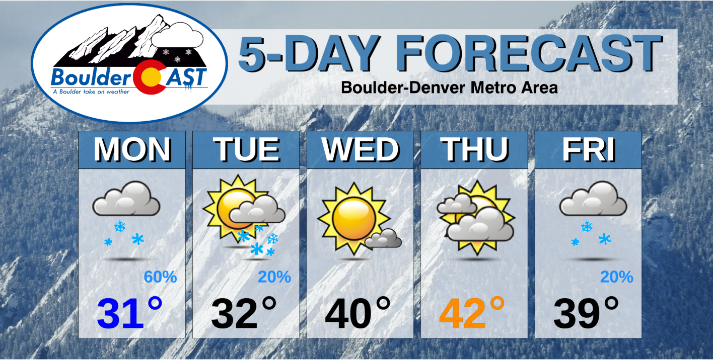
Our snowfall forecast map for the event is shown below. Highs on Monday will be in the lower 30’s with lots of clouds. The best chance of snow will be from Monday evening until Tuesday early morning. There could be snowflakes around late in the Monday evening commute, but roadways will be just wet.
Expect a few lingering flurries early Tuesday morning. However, it will dry out quick with some sun by late afternoon. For temperatures, it will be similarly chilly in the lower 30’s.
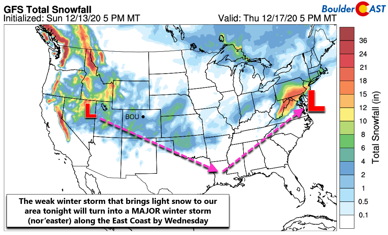
A fun fact: The weak low pressure producing the snow Monday night in our area will progress into the Deep South late Tuesday and then northward along the East Coast late Wednesday as a major winter storm called a nor’easter. Areas from Boston to New York to Washington DC could see upwards of a foot of snow later this week!
The next system in the pipeline will arrive on Wednesday and it appears to only generate some light snow showers across the Mountains with dry weather across the Metro area under downslope flow. With sunny skies, we’ll warm back to near 40 degrees. Thursday will be similar with more clouds and temperatures in the lower 40’s.
Finally, to end the week another storm may move across the Great Basin and into Colorado sometime on Friday. It’s a long ways away for now and on the surface, appears to be a light snow-maker for primarily the Mountains.
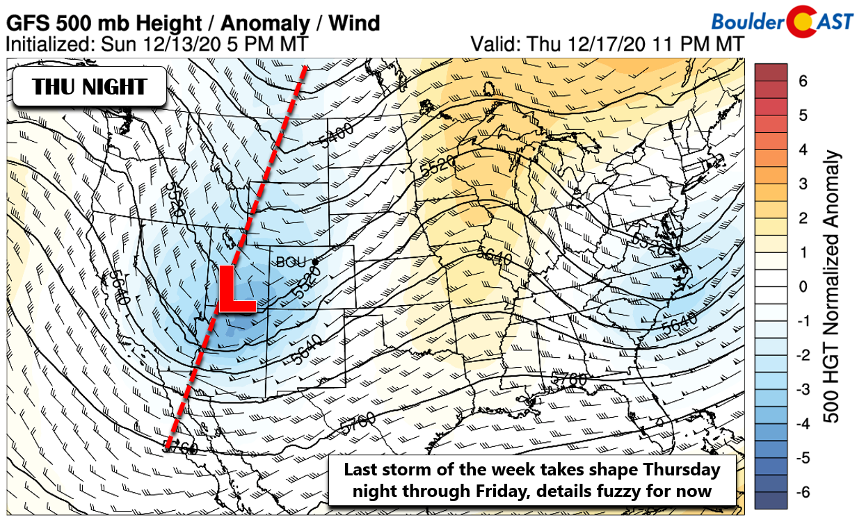
GFS 500mb height anomaly forecast for Thursday night showing another weak storm entering Colorado from the west/northwest
We will include a slight chance of snow across the Plains as well since the track could change a little, but prospects for much accumulation are quite low right now. We’ll end the week with highs on Friday in the middle 30’s to lower 40’s with a few snowflakes possible.
As always, if there is a snow-maker worth our time later this week, we will follow up with updates…
Forecast Specifics:
Monday: Some morning sun, then overcast through the rest of the day. Light snow will develop in the early evening and continue through the night. Total accumulations of a dusting up to 1″ possible. Highs in the lower 30’s on the Plains and middle 20’s in the Foothills.
Tuesday: A few morning flurries or light snow showers, then mostly cloudy. There could be a few peeks of sunshine before sunset. Highs remain cold in the low to middle 30’s on the Plains and in the middle 20’s in the Foothills.
Wednesday: Partly to mostly sunny and dry. Highs near 40 degrees for the Plains and upper 20’s in the Foothills.
Thursday: Mostly cloudy skies and seasonal with highs in the lower to middle 40’s on the Plains and lower 30’s in the Foothills.
Friday: Overcast and cooler with a slight chance of snow showers. Highs in the 30’s across the Plains with upper 20’s in the Foothills.
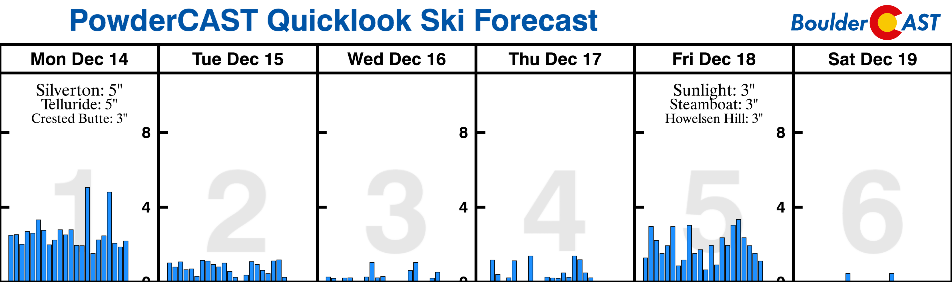
Mountains: The progressive northwest flow over the central Rockies will allow for a handful of weak and quick-moving waves to impact Colorado this week. This will lead to chances for snow in the Mountains every 36 hours or so through the week with light accumulations in most mountain ranges. Overall though, most ski resorts will see less than 6″ total through the week, with few exceptions. Find daily updated forecasts for all the Colorado ski resorts over at our PowderCAST page.
Help support our team of Front Range weather bloggers by joining BoulderCAST Premium. We talk Boulder and Denver weather every single day. Sign up now to get access to our daily forecast discussions each morning, complete six-day skiing and hiking forecasts powered by machine learning, first-class access to all our Colorado-centric high-resolution weather graphics, bonus storm updates and much more! Or not, we just appreciate your readership!
.
Spread the word, share the BoulderCAST forecast!
.


You must be logged in to post a comment.