



Category: Winter Weather (Page 74 of 161)
These posts contain some discussion of the white stuff, whether it be mountain snow pack or a Front Range snowstorm.
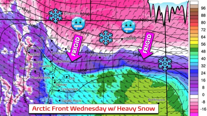
More snow is on the way to the Front Range for midweek, but it comes with strong winds beforehand. An Arctic front will slam the area on Wednesday bringing a rapid drop in temperatures alongside some moderate to heavy bands of snow across the entire area. We discuss how strong the winds will be, when the frigid airmass and snow will arrive, and how much snow will pile up.
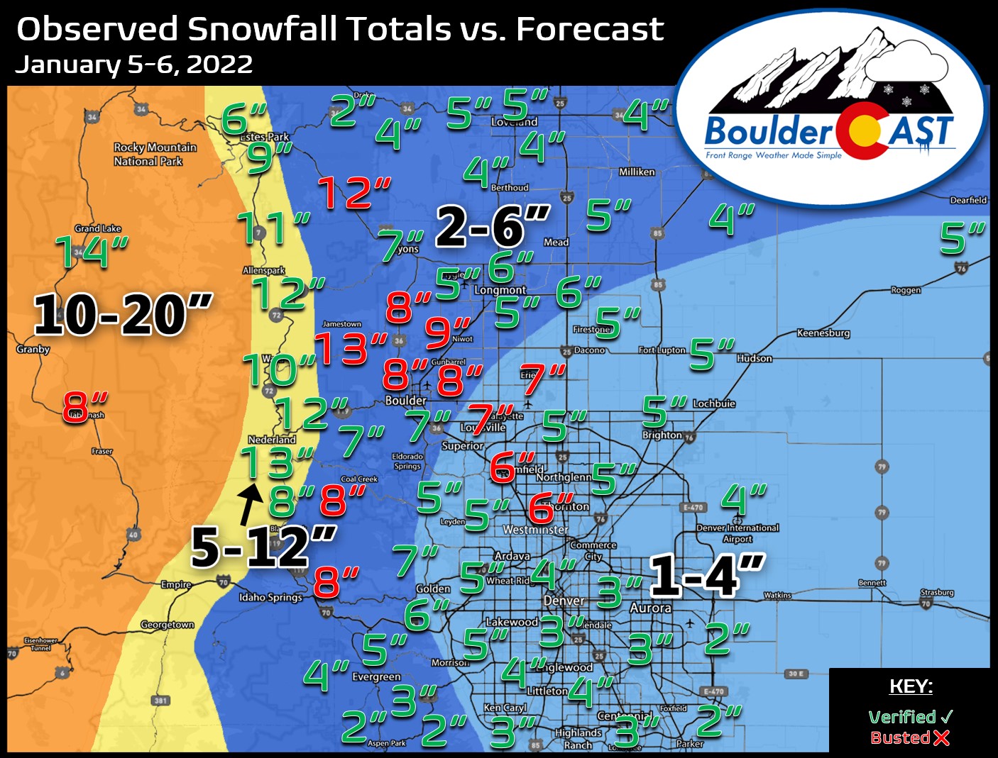
Premium Storm Update (1/5/22 7:00AM): We do a final check on the latest model runs and confirm that the rift in outcomes still exists. We give our final thoughts on the storm and how the model disagreement plays into forecast snow amounts . READ HERE.
Happy New Year! After a welcomed snowstorm to end 2021, 2022 starts out somewhat quiet with temperatures close to seasonal normals. That, however, changes abruptly come Tuesday with another windy day followed by unsettled, cold, and wintry conditions beginning midweek. Our next snow event is taking shape for Wednesday evening into Thursday favoring potential banded snowfall, though it may end up too far north. We discuss all of this, as well as when we might expect to see warmer weather return.
December 2021 was another extremely warm and dry month for the Front Range which ultimately contributed to the Marshall Fire tragedy. Here’s a quick and colorful graphical recap of our weather during December and how it relates to climatology.
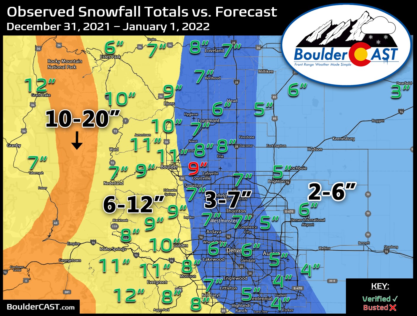

Hooray! The New Year’s Eve snow event is confirmed and whether you like it or not is coming in on the higher-end of initial predictions as models continue to slow the storm down and usher in the bitter cold air to the Front Range. How much snow are we expecting? Will New Year’s Eve travel be significantly impacted? And how cold will it get? We have a lot to discuss so let’s get right into it!
Premium Storm Update (12/31/21 6:00AM): We do final check on the latest model runs and take a look at some of the more in-depth aspects of the event including a forecast time series of the upslope profile. READ HERE.

Our state has benefited greatly from the recent atmospheric river event with snowpack thankfully getting back close to normal for now. However, things remain dreadfully dry east of the Continental Divide. The week ahead will offer generally cooler than normal temperatures across the Denver area with continued Mountain snowfall really piling up. We are also tracking a potential Arctic outbreak and some snow just in time to ring in the New Year. Here’s the latest.
Live Radar

Recent Premium Posts

BoulderCAST Daily – Sun 11/08/26 | Mild November Weather Continues, Even With A Cold Front Midweek
☀️ Sunny and warm for early November – Temperatures in the middle to …
BoulderCAST Daily – Sat 11/07/26 | A Pleasant Weekend With Dry Weather For a While…
☀️ Sunny and Pleasant – Highs in the lower 60s this afternoon trend …
BoulderCAST Daily – Fri 11/06/26 | A Cloudy End to the Week But Mild Temps Stay Strong
🌨️ Light Mountain Snow – Some light mountain snow showers possible today – …
3-Day Forecast

Trending Content


© 2026 Front Range Weather, LLC
You must be logged in to post a comment.