An unsettled weather pattern the last few weeks has brought heavy snow to the Mountains and a couple of decent snow events to the Denver Metro area as well. We’re now starting to get back on-track for snow. However, the week ahead will be mild and sunny for the most part, but we are watching a system set to move in on Friday for cooler temperatures and a chance of light snow.
This week’s highlights include:
- A stagnant ridge pattern sits overhead bringing quiet weather statewide through most of the week
- Sunny and mild conditions are expected through Thursday with no chance of precipitation
- A late-week cold front may bring light snow to the Metro area, but models have been trending drier
- Snowpack has exploded across the Mountains in recent weeks, but the pipeline has dried out for now
- A potentially more active pattern is shaping up next week
DISCLAIMER: This weekly outlook forecast is created Monday morning and covers the entire upcoming week. Accuracy will decrease as the week progresses as this post is NOT updated. To receive daily updated forecasts from our team, among many other perks, subscribe to BoulderCAST Premium.

Back on track!
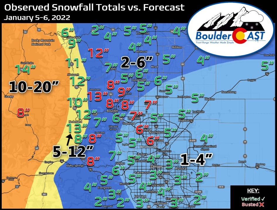
After a brutally dry fall and slow beginning to the snow season, we’re now thankfully starting to get back on track. With the help of a second snowstorm in just six days last week, both Boulder and Denver are now chipping away at their snowfall deficits. Shown below is a regional map of snowfall totals from last week’s storm (Wednesday into Thursday morning). The official report in Boulder was 6.3″ from this event, but as you can see there were even higher totals observed across much of eastern Boulder County — up to 9″. As much as 13″ piled up in the Foothills to the west. Denver officially recorded 4.5″ of snow from this one at DIA which was a rare situation where the airport saw more snow than downtown.
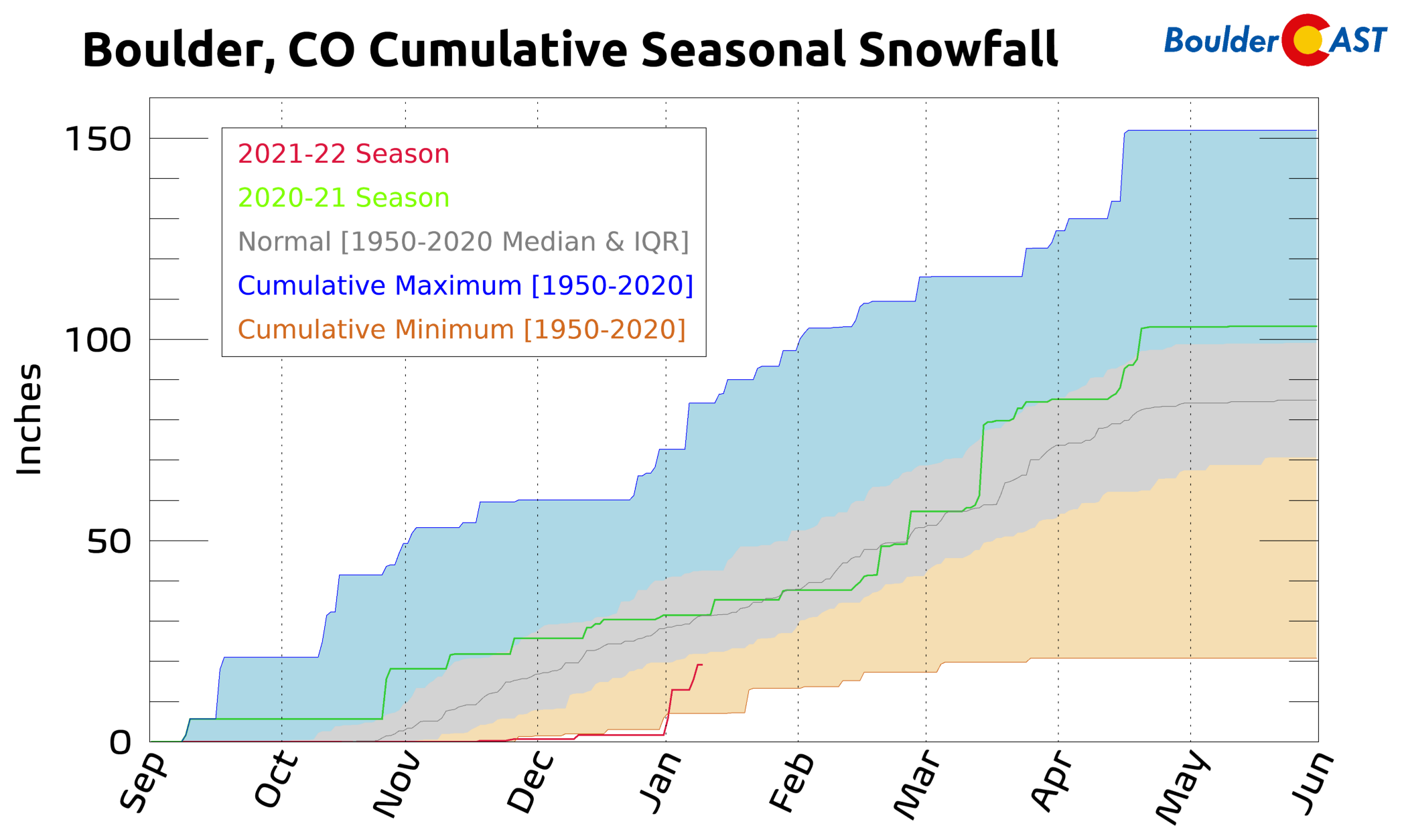
Seasonal totals climb to 19″ and 10″ in Boulder and Denver, respectively.
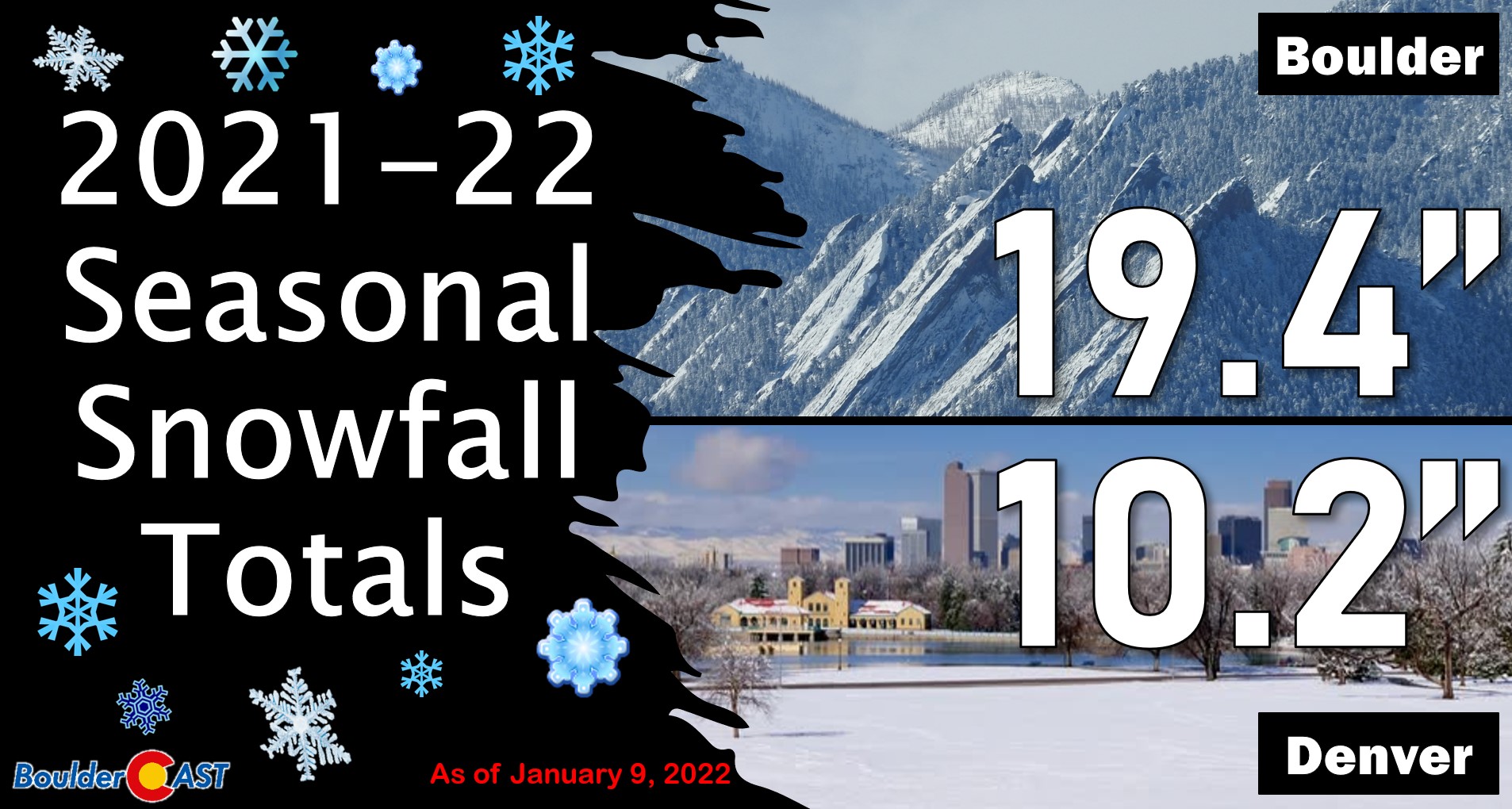
While both cities remain below normal for the season, we’re headed in the right direction at least! As you can see in the graphic below, Boulder is no longer setting a cumulative seasonal snowfall minimum record with each passing day.
A mild & quiet week….until Friday
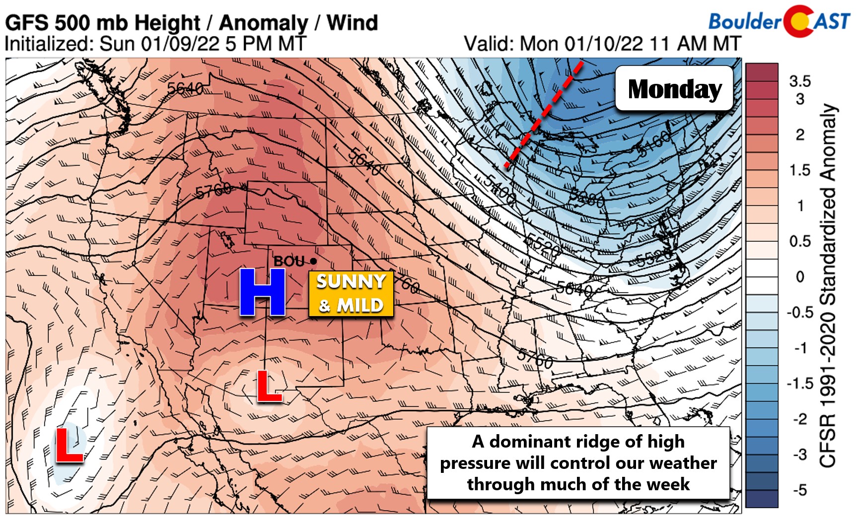
In contrast to the first week of 2022, the upcoming one will be quiet and fairly mild thanks to a developing ridge of high pressure across the West. As of Monday morning, a large ridge is noted in the 500mb map below across the central Rockies with widespread positive height anomalies everywhere. Further south, a weak low pressure resides along the Mexican border. This setup, with a high pressure directly north of a low pressure, is called a rex pattern and often can result in a stagnant situation with tranquil weather. That will be the case somewhat this week as Colorado will rest in a warm and dry northwest flow for an extended period of time. Get ready for sunshine!
This isn’t a true rex block pattern because it doesn’t persist nearly long enough, likely because that low pressure to the south is on the weaker side. In any case, the GFS forecast animation below shows how this ridge is expected to evolve through Friday night. It’s only towards the very tail-end the animation that we see a weak trough make an appearance and try to drop across Colorado. This feature will be our main weather-maker for the week — and a minor one at that.
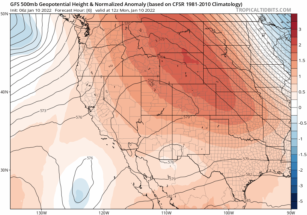
GFS 500mb height anomaly forecast animation from Monday through Friday evening showing a persistent ridge
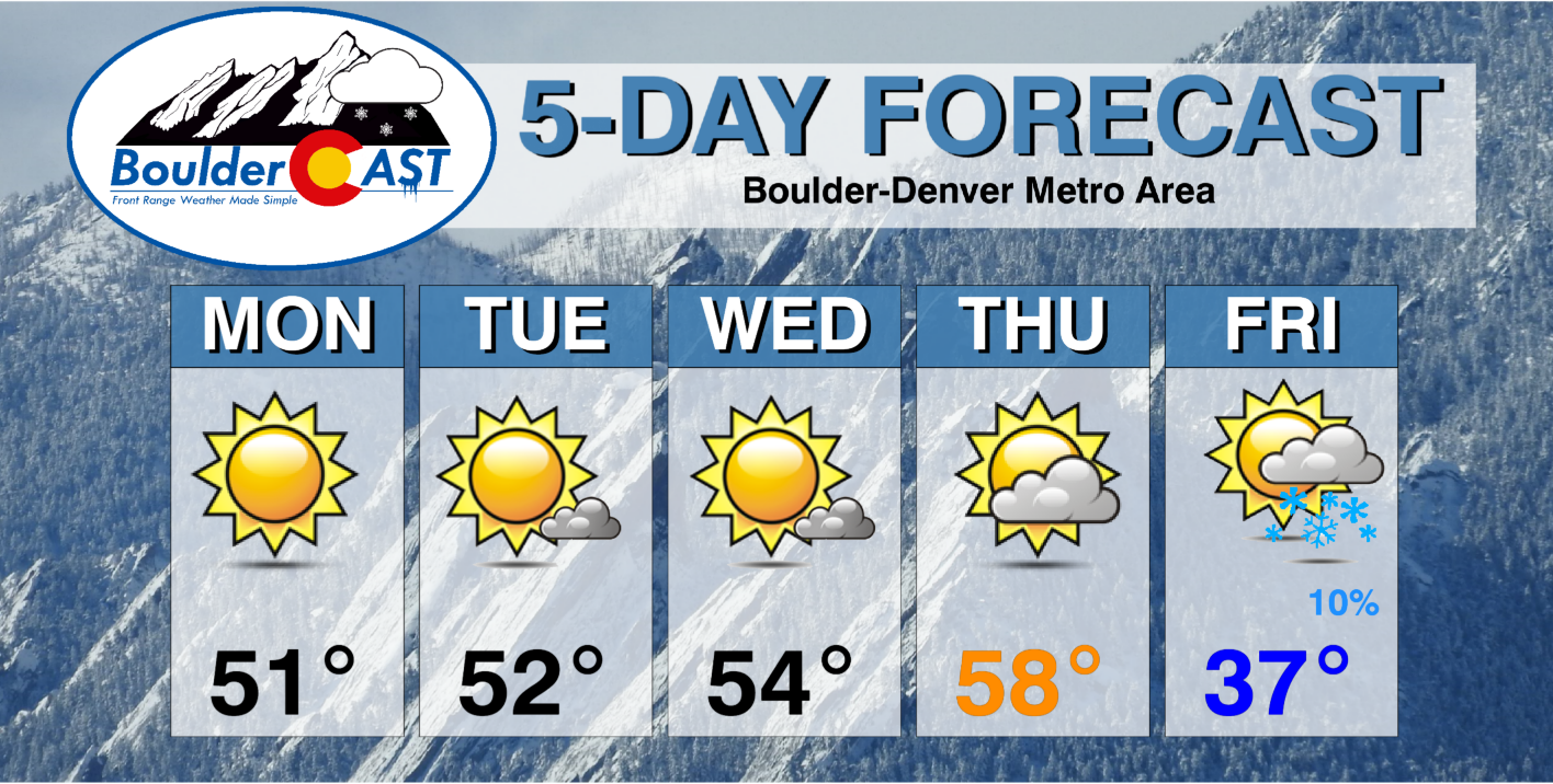
Under this ridge pattern, expect plenty of sunshine through Thursday with temperatures warming above normal. Overall, high temperatures this week will be the most challenging aspect of the forecast as localized terrain effects and lingering snowpack will lead to sizable spatial variability across the Denver Metro. As usual, areas from Longmont to Greeley will be the coldest — perhaps 10 to 20 degrees colder each day — whereas areas south and east of Denver will be much warmer. In general, though, look for temperatures early in the week to be in the 40’s to middle 50’s. By Thursday, most areas will trend into the middle 50’s to middle 60’s.
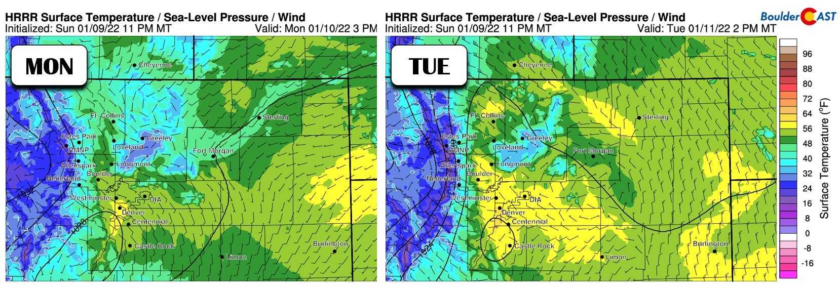
Watch for large spatial variability in temperatures this week!
As mentioned, the only real weather to watch comes late in the week when a tiny trough may finally be able to bust through the ridge pattern. Models continue to reduce the impacts from this trough for our state and have been trending weaker and further north over the last day or two. While we’re fairly sure this late-week trough will usher in cooler temperatures, any precipitation east of the Mountains looks minimal but is still uncertain.
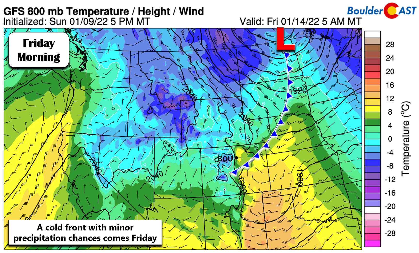
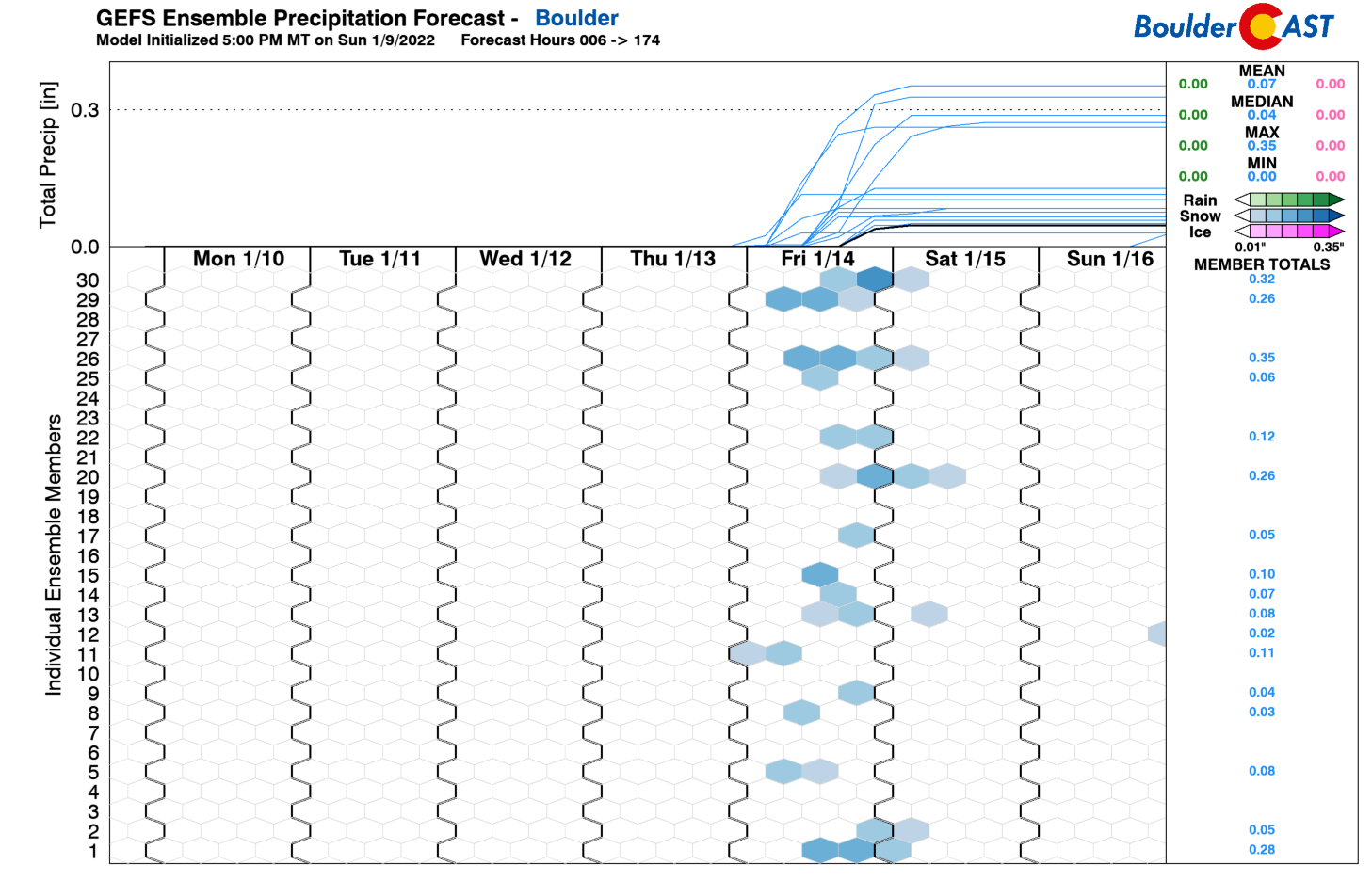
The ensembles are showing a decent signal for snow to end the week in the Front Range, but amounts are coming in quite low — the mean and median snowfall indicated are less than 1″ for Boulder. Other models are even drier than this.
For now, plan on a cooldown Friday with more clouds and a slight chance of snow showers. If models keep their current trend, this may very well be a non-event for us. Expect high temperatures to fall back into the upper 30’s to 40’s Friday and for the upcoming weekend.
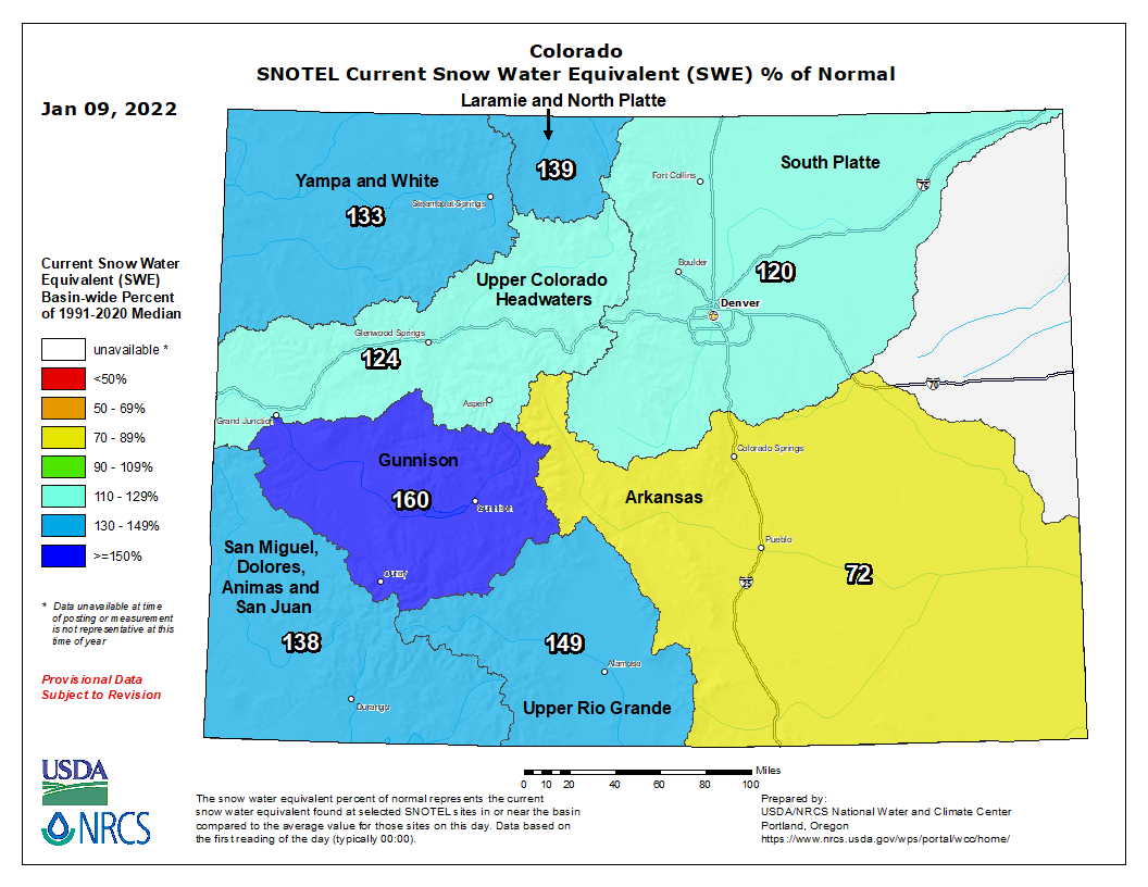
Multiple weeks of heavy snow in the Mountains has led to heaps of snowpack for the state as a whole — only the Arkansas Basin is still reporting below normal snowpack. Unfortunately this week will be quiet in the Mountains as well with these numbers on the decline for the time being.
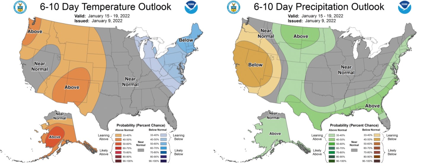
There are indeed signs of a more active pattern for us next week, but that’s far from certain right now. The Climate Prediction Center has elevated chances for warmer and wetter than normal conditions this weekend into next week for much of Colorado. Most of this signal around precipitation comes from a potential (still uncertain) snow event around the middle of next week.
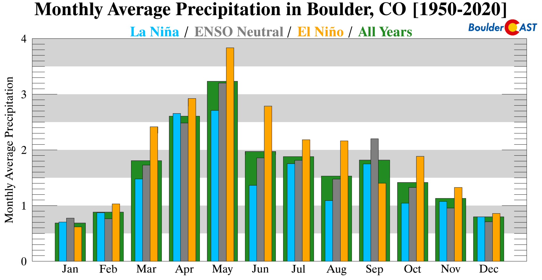
Let’s keep our expectations in check, though. January is our driest month of the year, La Niña or not…
Stay up to date with Colorado weather and get notified of our latest forecasts and storm updates:
Forecast Specifics:
Monday: Sunny and mild with highs in the upper 40’s to lower 50’s on the Plains and upper 30’s in the Foothills.
Tuesday: Mostly sunny and mild with highs in the upper 40’s to middle 50’s on the Plains and lower 40’s in the Foothills.
Wednesday: Mostly sunny and quiet. Temperatures in the low to middle 50’s on the Plains with lower 40’s in the Foothills.
Thursday: A mix of clouds and sun and warmer. Highs in the upper 50’s to lower 60’s on the Plains with middle 40’s in the Foothills.
Friday: Partly cloudy and cooler with a slight chance of snow showers. Highs around 40 across the Plains with lower 30’s in the Foothills.
Mountains: After several weeks of heavy snowfall, dry and warm weather will be in place across the state’s Mountains this week with above normal temperatures and minimal to no snowfall for most Mountain ranges. Similar to the Plains, the only concern will be the Friday/Saturday event which may bring light accumulations to the central and northern Mountains. Steamboat would be the most likely resort to see any snow from the late-week trough. The good news is that travel conditions in the High Country will be much better this week!
Help support our team of Front Range weather bloggers by joining BoulderCAST Premium. We talk Boulder and Denver weather every single day. Sign up now to get access to our daily forecast discussions each morning, complete six-day skiing and hiking forecasts powered by machine learning, first-class access to all our Colorado-centric high-resolution weather graphics, bonus storm updates and much more! Or not, we just appreciate your readership!
Spread the word, share the BoulderCAST forecast!


You must be logged in to post a comment.