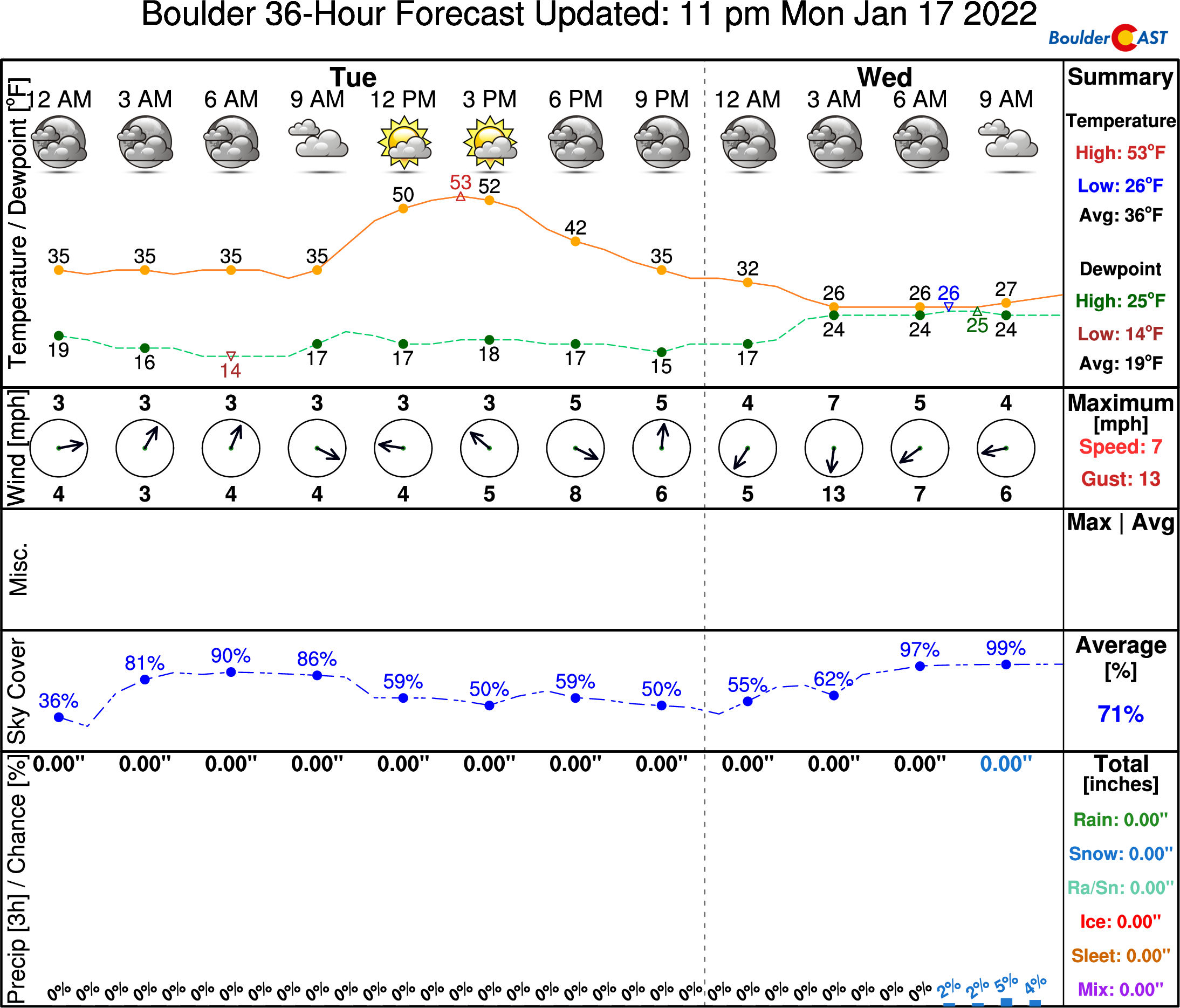
⦁❶⦁ One last mild day in the 50’s before things turn colder for the rest of the week
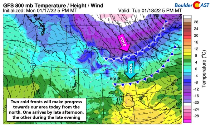
⦁❷⦁ Two cold fronts will arrive today, the second of which this evening will usher in a shallow Arctic airmass
⦁❸⦁ Freezing fog and drizzle will develop late tonight into Wednesday with a light glaze of ice making for slick travel in spots
⦁❹⦁ There will be another chance of winter weather on Friday (light snow)
Do you want the latest BoulderCAST Daily forecast discussion delivered to your inbox every single morning? If so, join BoulderCAST Premium where we talk Boulder and Denver weather every single day.

O
ne more fairly mild day is expected ahead of our next weather change as two cold fronts will arrive later today and tonight — the second one brings the Arctic punch that will kick off wintry weather across much of the Front Range. Clouds will keep temperatures a few degrees cooler than yesterday with most areas landing in the 50’s this afternoon (with some 40’s from Longmont to Greeley) with light and variable winds.
Keep an eye on the cold fronts, though! The first one is progged to arrive during the afternoon hours, with a second stronger front to follow before midnight. These fronts will bring an end to the milder weather for the time being. It likely won’t be as warm as today until late in the weekend or next week.
The second front will be the one to usher in a shallow Arctic airmass and upslope flow to eastern Colorado. Winds will turn fully easterly by Wednesday morning.
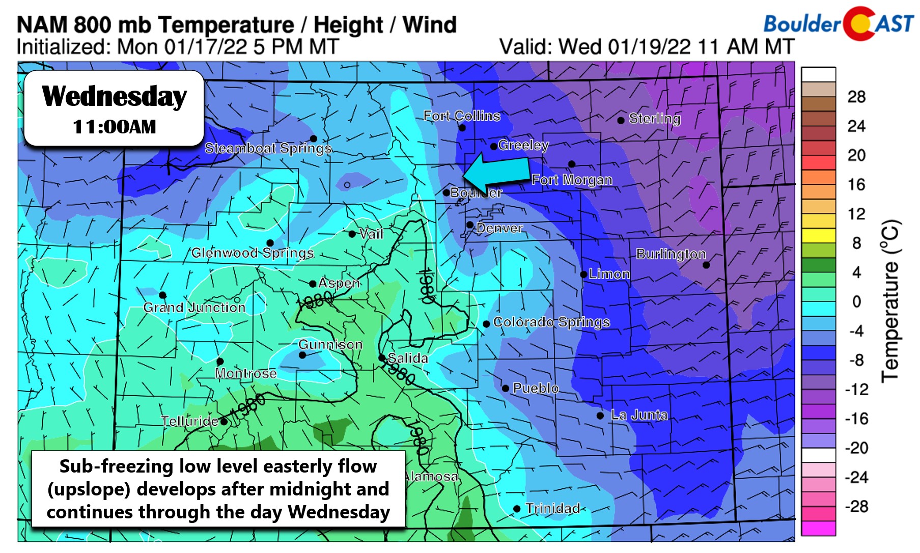
Near-surface temperature and wind forecast for midday Wednesday
There are actually no models explicitly showing this will be a freezing drizzle event for us — they mostly all have just very light snow. However, from experience with how these scenarios play out, we know better. One key aspect of this event is that there will be NO upper-level features in the atmosphere to help produce any lift across our area. Basically this would be a non-event if our terrain was not a slight slope upward from east to west. Upslope in response to the easterly flow is the only forcer here and the reason for our expectation that this will be mainly freezing fog and drizzle for the region.
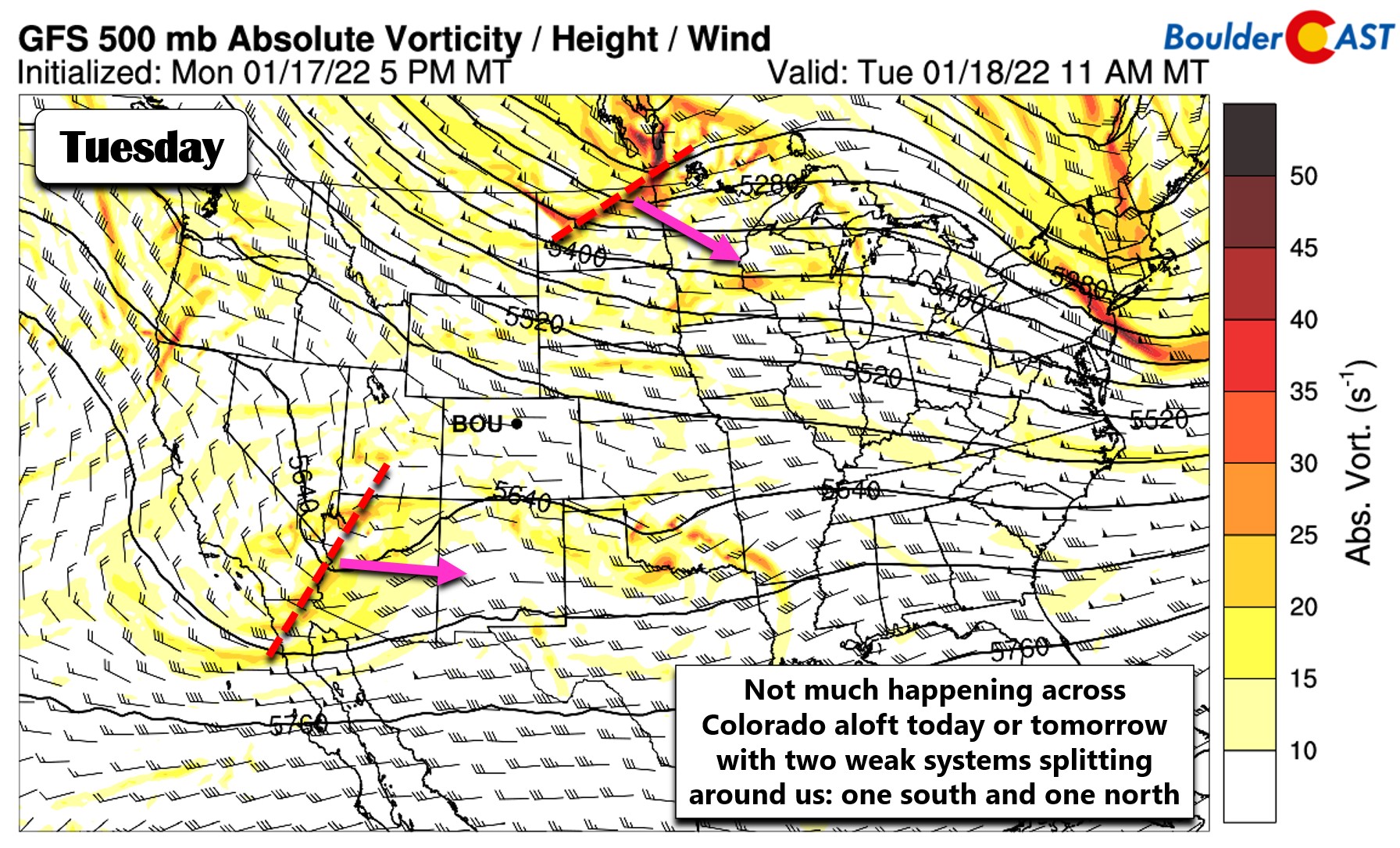
GFS 500mb vorticity and height forecast for today
The forecast sounding for Wednesday morning (shown below) has freezing drizzle written all over it. Note that there is a shallow saturated and upslope layer near the surface which stays below freezing but not too cold. This is the Arctic airmass banking up against the terrain. Above this, there is a capping inversion and then a dry layer aloft. This basically means all the precipitation will be generated in the very shallow surface layer which, though below freezing, is too warm for snow crystals to form. The result will be a period of prolonged freezing fog and freezing drizzle across the Denver and especially Boulder areas.
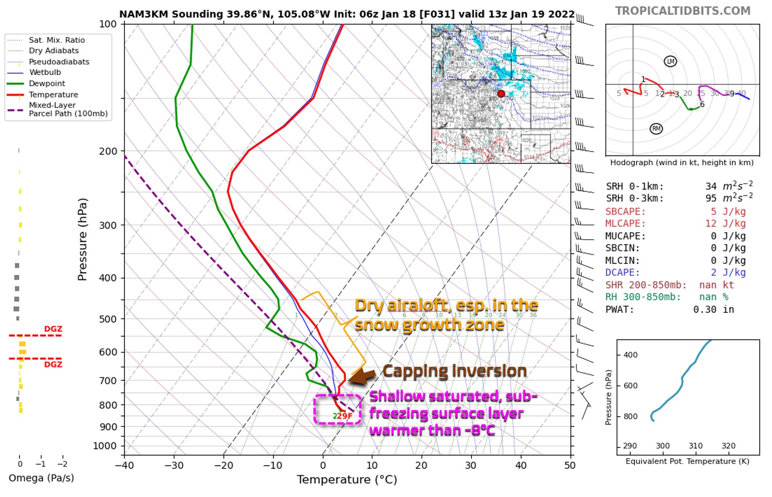
High-resolution NAM forecast sounding for 6AM Wednesday in the north Denver Metro
From what we are seeing, the surface layer will fully saturate after midnight tonight but well before sunrise on Wednesday. We could see a slick commute with a light glaze of ice developing through the morning. As Wednesday progresses, the Arctic airmass will grow deeper and colder across our area which will allow for a change-over to flurries or snow pellets. Boulder is more likely to remain somewhat warmer and thus has a higher chance of freezing drizzle persisting longer. Denver and areas east will turn over to flurries earlier.
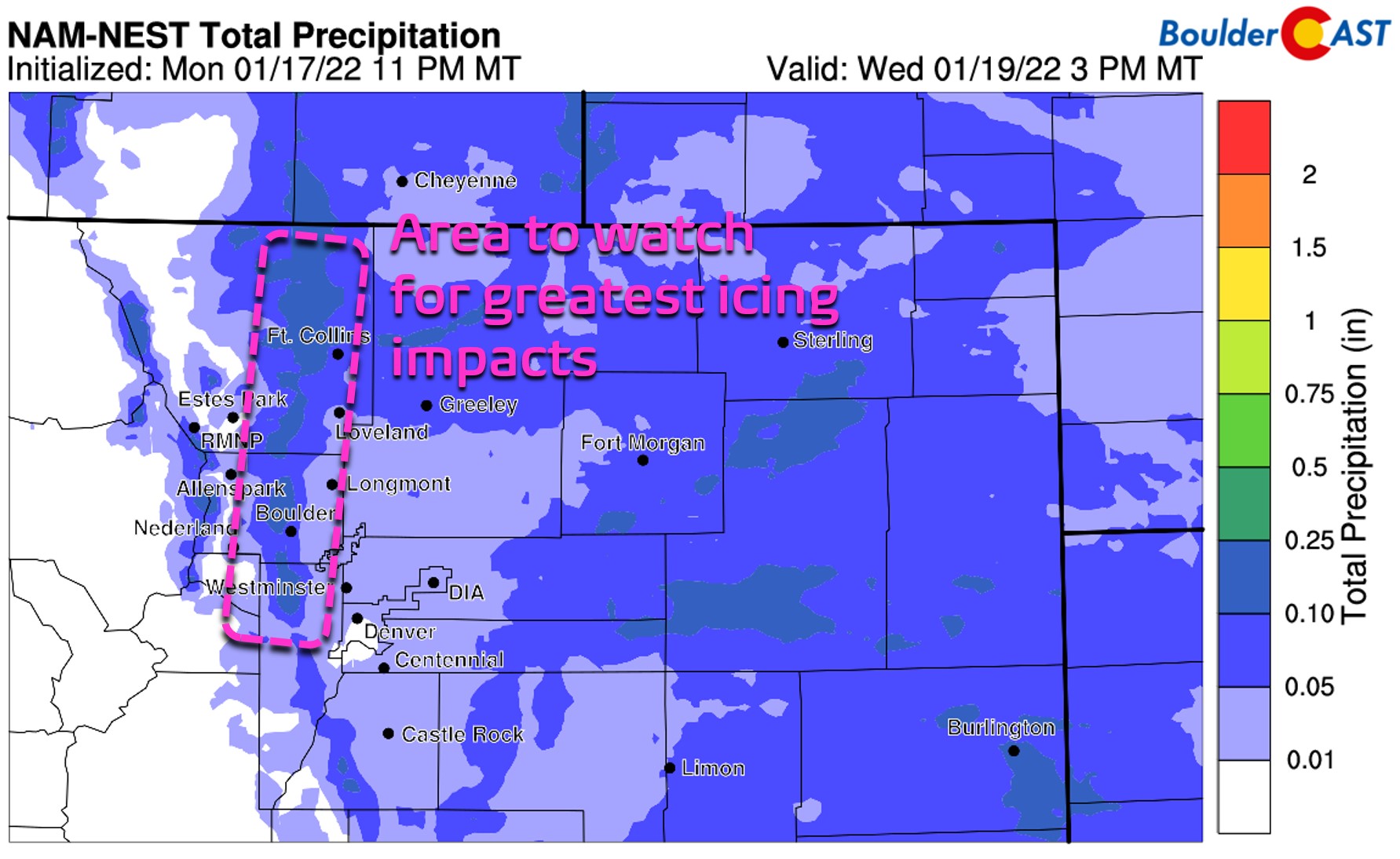
NAM total precipitation forecast through Wednesday afternoon. This will be mainly ice around Boulder/Denver, but snow further east
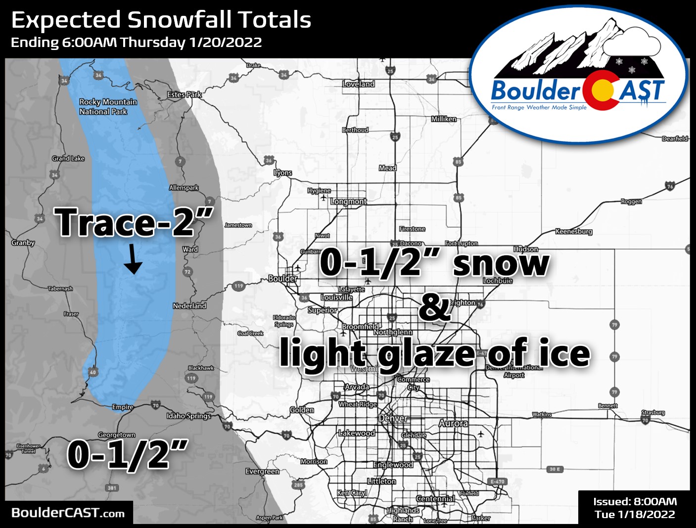
All in all, expect a much colder day Wednesday with highs in the mid 20’s to around 30 degrees across the area. Low clouds, fog, and light precipitation will be falling through the day — likely starting as freezing drizzle for everyone changing over to flurries eventually. Be careful with traveling as sidewalks and bridges/overpasses will likely become slick. Snow accumulations should be 1/2″ or less in areas that do see some flakes on Wednesday. The Mountains could see up to 2″ at best from this moisture and lift-lacking system.
P.S. There is more winter weather in the works for us on Friday (light snow). More on that later in the week as we need to get through this icing event first!
Remember, our daily forecasts are Premium content. Periodically, we open this forecast up to all of our readers. Today is one of those days!
Help support our team of Front Range weather bloggers by joining BoulderCAST Premium. We talk Boulder and Denver weather every single day. Sign up now to get access to our daily forecast discussions each morning, complete six-day skiing and hiking forecasts powered by machine learning, first-class access to all our Colorado-centric high-resolution weather graphics, bonus storm updates and much more! Or not, we just appreciate your readership!


You must be logged in to post a comment.