After a surprisingly warm Friday, temperatures cool off for the weekend as our next weak storm system arrives from the northwest. The main impact will be light Mountain snow, but there’s also a brief chance of snow in portions of the Metro area Saturday afternoon and evening. Let’s take a look.
We discuss Boulder and Denver weather every single day on BoulderCAST Premium. Sign up today to get access to our daily forecast discussions every morning, complete six-day skiing and hiking forecasts powered by machine learning, access to all our Front Range specific weather models, additional storm updates and much more!

T
he erosion of the shallow Arctic airmass happened quickly Friday morning across the Denver Metro area as westerly downslope brought rapidly rising temperatures from west to east. At one point in the morning, there was a nearly 30°F temperature difference between our station in north Boulder and Gunbarrel! That’s only about a distance of 4 miles or so. Over the course of the morning, many areas saw their temperature rise some 40 degrees in just a couple hours!
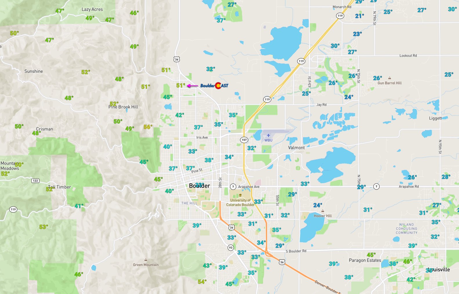
Temperatures observed around 9AM Friday morning (1/7/22)
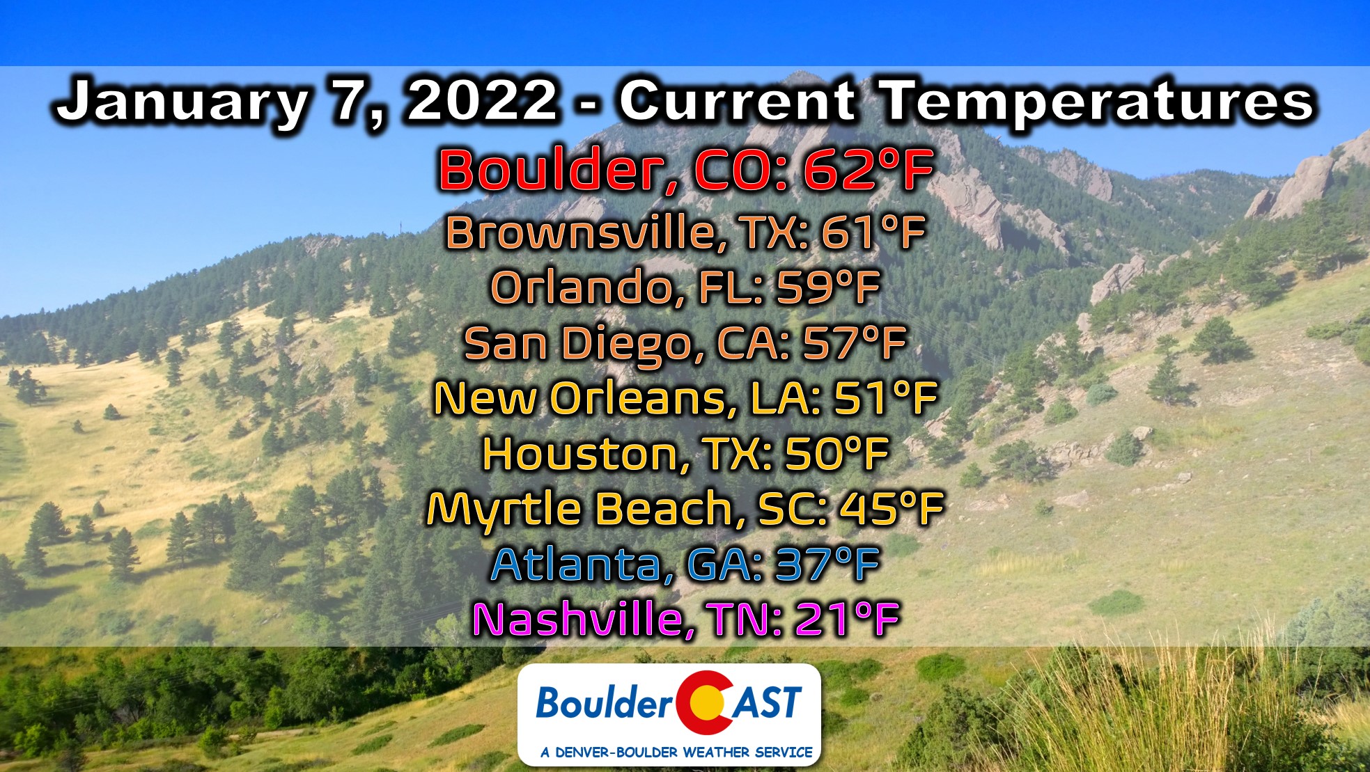
By Friday afternoon, Boulder had cracked the 60-degree mark and was warmer than most of the Gulf Coast and Deep South which were now under the gun of the departed cold airmass.
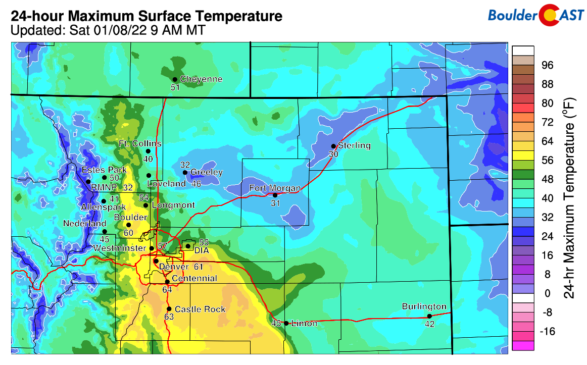
Here’s a look at high temperatures from Friday — below freezing near Greeley but in the low to middle 60’s in Denver and Boulder.
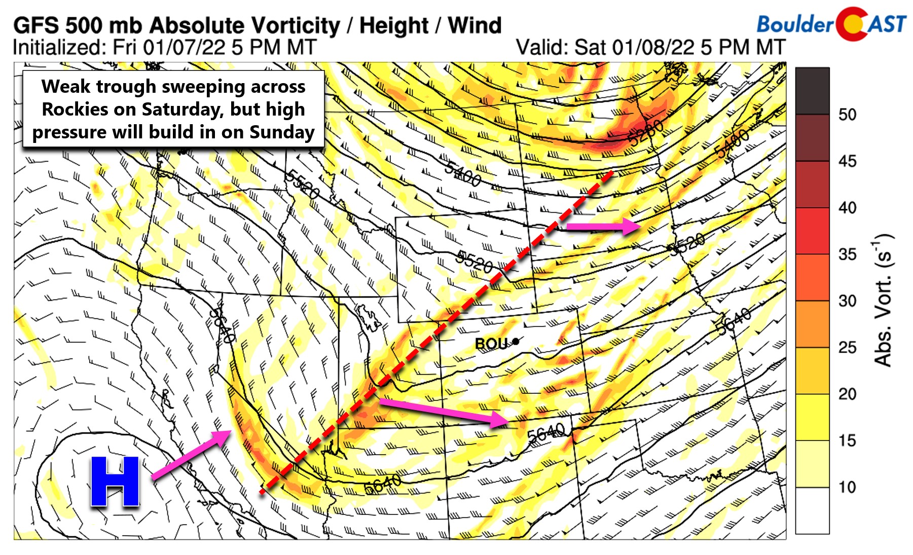
The warmest weather is behind us now, though, as a surface cold front has dropped through the Denver area early Saturday morning. We’ll see high temperatures much closer to normal in the low to middle 40’s. This cold front is tied to a weak storm system moving through the area from the northwest. The trough is currently in Utah as of Saturday morning but light to moderate snow is already falling ahead of it in the Mountains of Colorado.
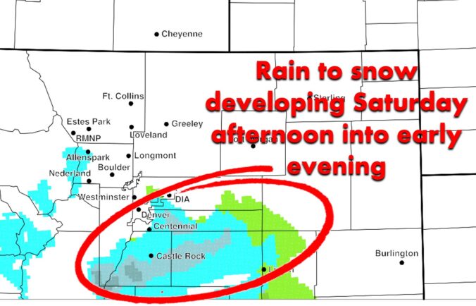
Some precipitation will accompany a secondary cold front moving in this afternoon, but everything looks to be aligning south and east of the Boulder area. High-resolution models have rain (yes rain!) and snow developing south of I-70 this afternoon into the early evening. As temperatures fall, any raindrops will change over to all snow. Across the Palmer Divide it will be cold enough right off the bat for snow.
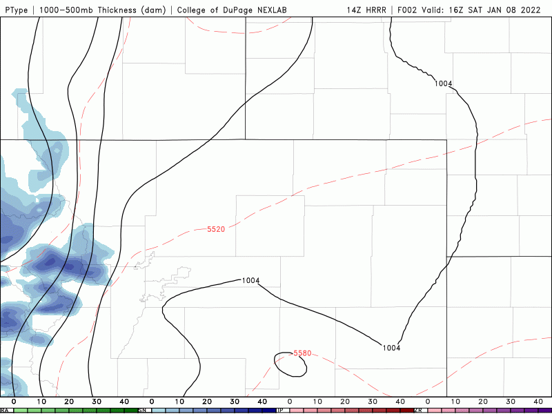
HRRR model simulated radar precip type animation showing the developing rain/snow Saturday afternoon and evening
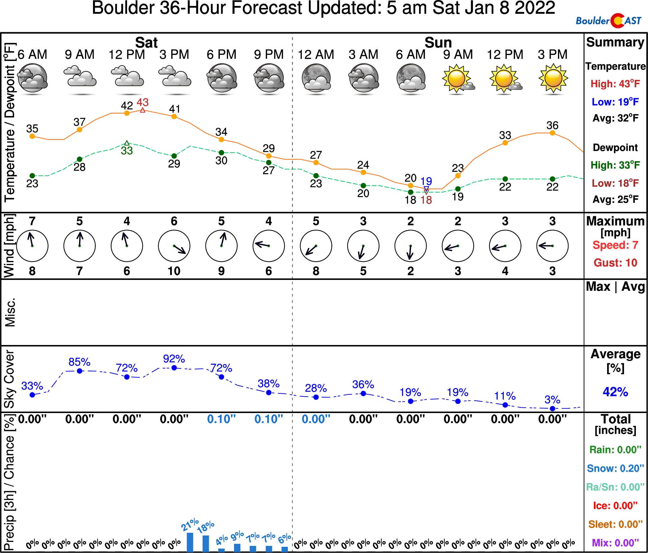
Boulder looks to remain almost completely dry from this event with just very minor chances of precipitation in the afternoon and evening.
Whereas locations south and east of Denver like Centennial have better chances of precipitation and could see light snow accumulations.
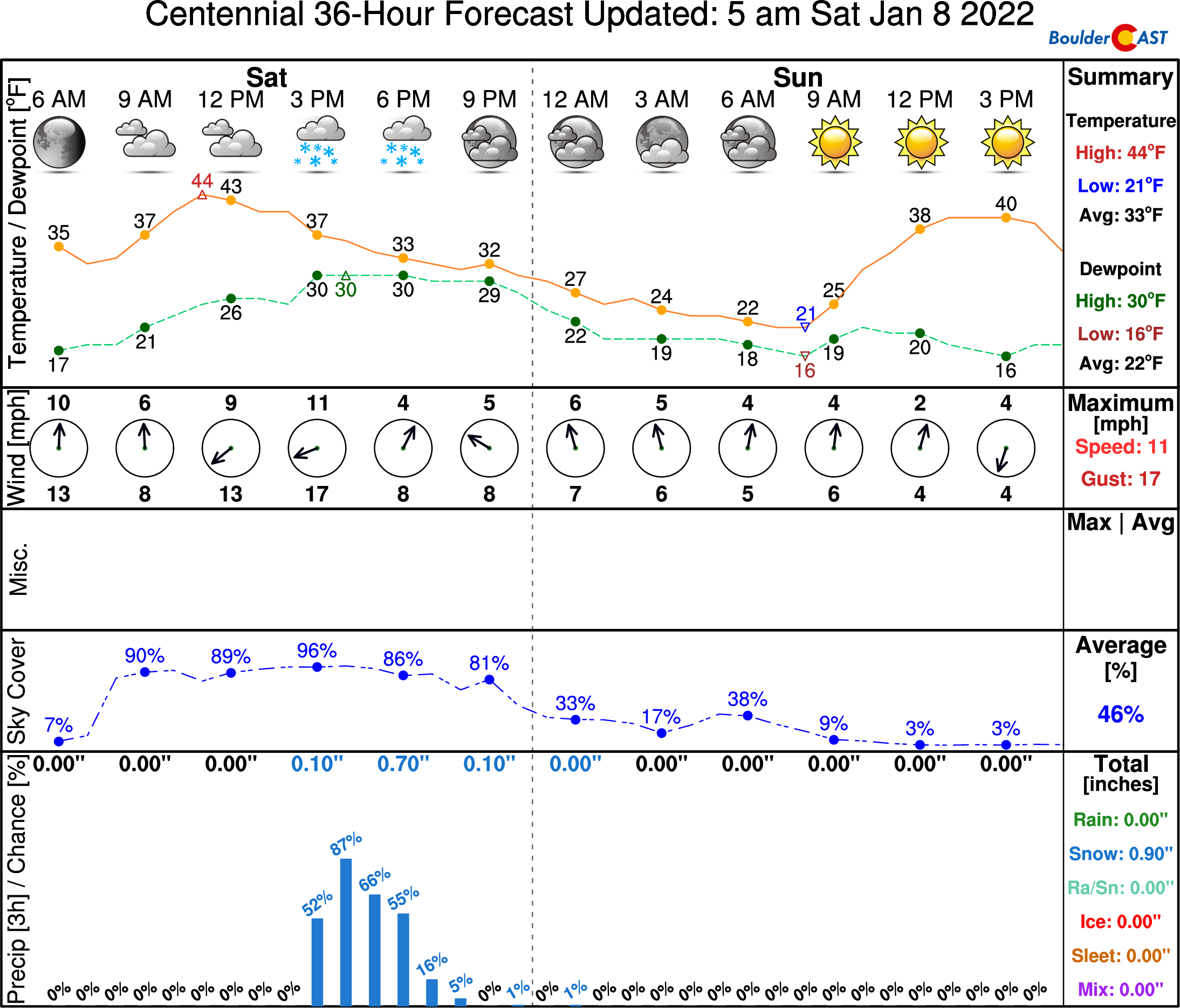
This will only be a quick hit of precipitation — just a few hours. Snow will wrap up promptly around early evening with dry conditions expected the rest of the night and weekend ahead. Highs Sunday will be in the upper 30’s to lower 40’s with bountiful sunshine.
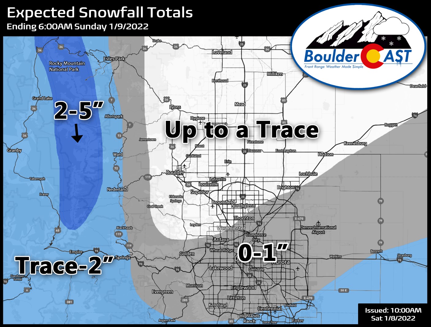
Our snowfall forecast map for this event is shown below. The Mountains will do best from this fast-moving disturbance, but don’t be surprised if you see some snow stick across the far southern and eastern Metro area!
Get BoulderCAST in your inbox:
Help support our team of Front Range weather bloggers by joining BoulderCAST Premium. We talk Boulder and Denver weather every single day. Sign up now to get access to our daily forecast discussions each morning, complete six-day skiing and hiking forecasts powered by machine learning, first-class access to all our Colorado-centric high-resolution weather graphics, bonus storm updates and much more! Or not, we just appreciate your readership!
Enjoy our content? Give it a share!


You must be logged in to post a comment.