Our weather will shift sharply colder for Friday as two systems merge across eastern Colorado bringing a chance of rain and snow to the area. Upslope will be marginal and favor areas south and west of Denver, mainly in the Foothills. However, there is still some hope for light accumulations in Boulder and Denver, too. Let’s take a look at the timing of things, the potential impacts, and our regional snowfall forecast map.
At a Glance:
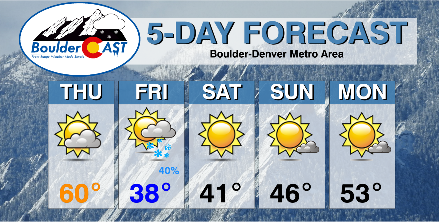
- After one more warm day Thursday, things turn colder on Friday with a chance of snow
- Two storm systems will merge across eastern Colorado on Friday, before eventually driving a winter blast to the Deep South and East Coast
- Gusty winds much of the day with the strongest gusts of 35+MPH expected east of Interstate 25
- Wind directions will favor Jefferson County and the Palmer Divide for the best upslope and thus the most precipitation
- Temperatures will be marginal across the lower elevations so there may be a rain/snow mix early on, and only wet accumulations
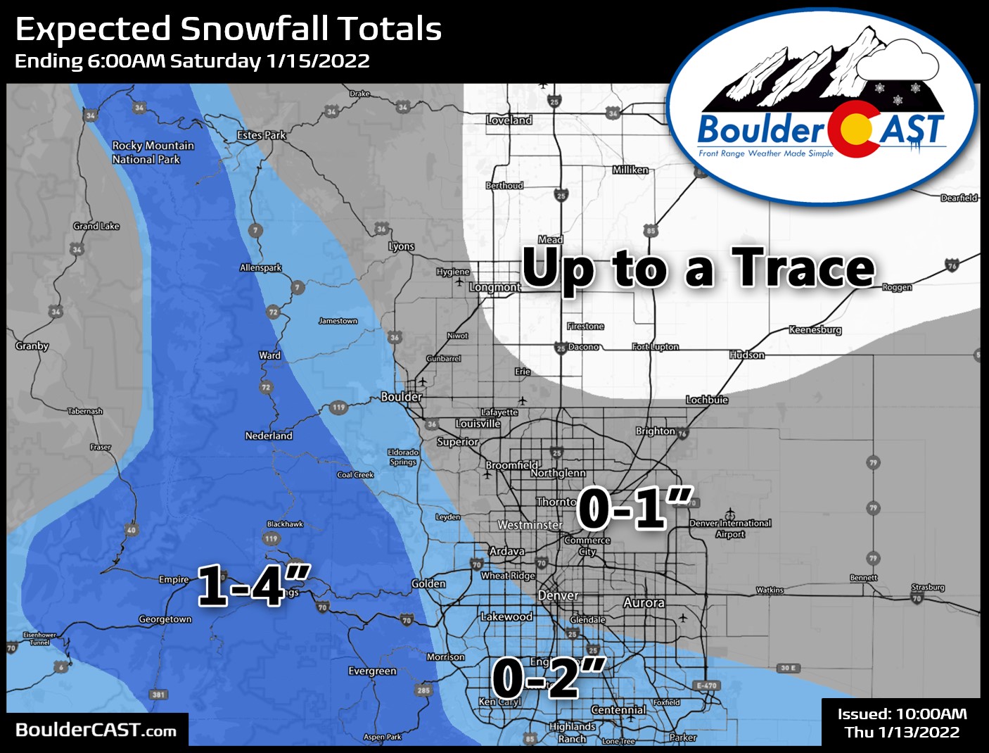
- Snow accumulations up to 4″ in the Mountains and Foothills, with nothing at all up to 2″ across the lower elevations (highest west and south)
We discuss Boulder and Denver weather every single day on BoulderCAST Premium. Sign up today to get access to our daily forecast discussions every morning, complete six-day skiing and hiking forecasts powered by machine learning, access to all our Front Range specific weather models, additional storm updates and much more!

T
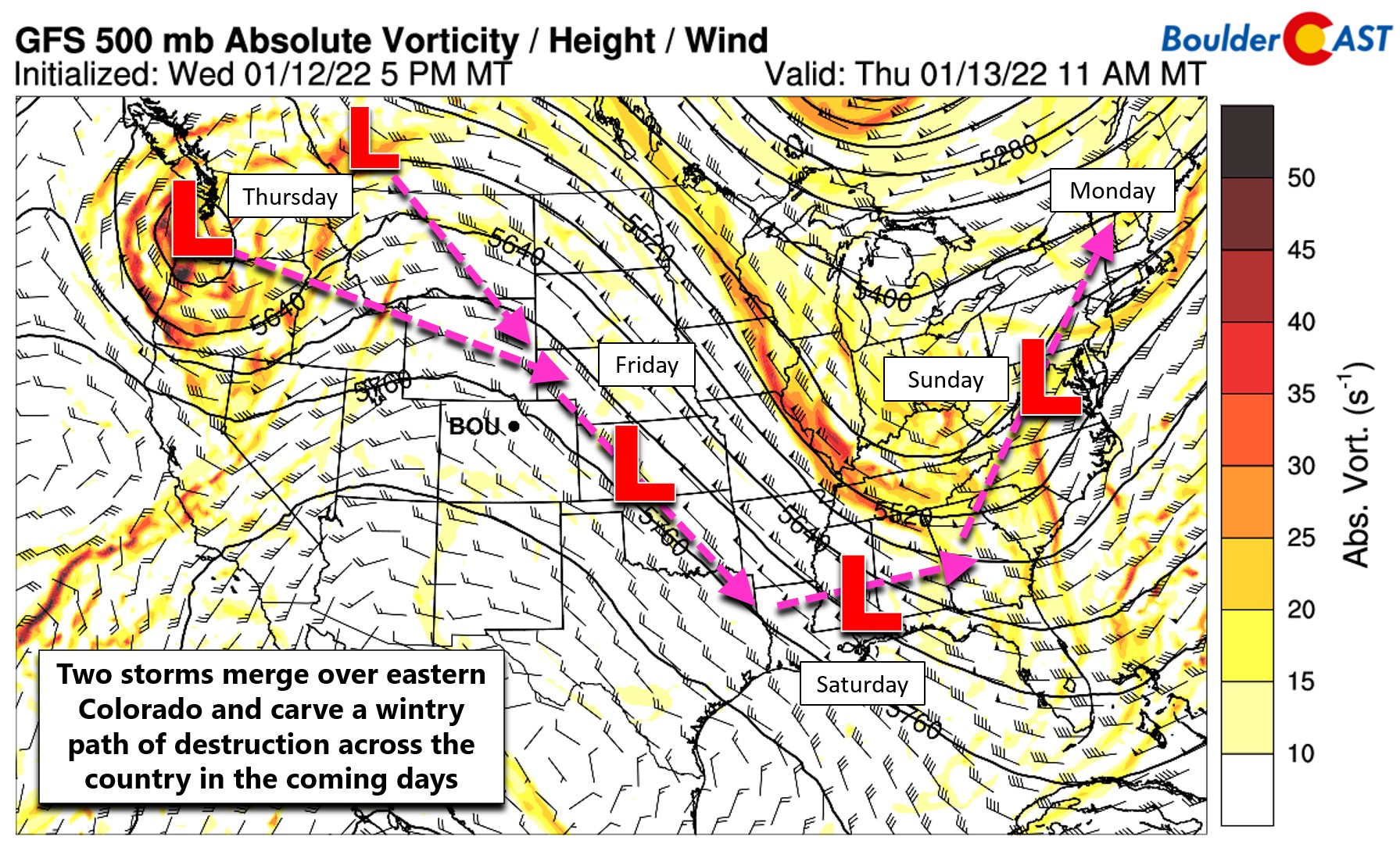
emperatures have been above normal most every day this week so far, largely landing in the 50’s to lower 60’s across the Denver Metro area. That will change on Friday as a winter storm system drops southward and across Colorado. There will actually be two disturbances merging over the eastern portions of our state and Kansas on Friday — both of which are shown below. Note the stronger Pacific Northwest system and a weaker but colder one arriving from the Canadian prairies. After this conglomerated storm exits our area, it will carve a path across much of the country eventually morphing into a major nor’easter heading up the East Coast Sunday into Monday.
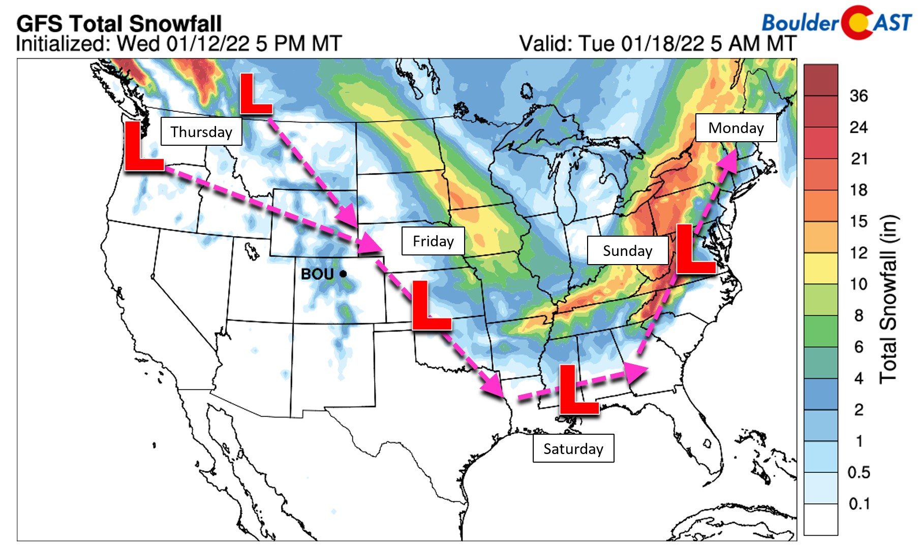
The wintry “path of destruction” to the north of the low pressure is easy to identify in the latest GFS model-derived snowfall forecast for the next five days. Front Range Colorado and our Mountains are only catching a small piece of this complex system!
With all of this knocking on the door, yes Thursday will be the last warm day for the time being with temperatures getting into the lower 60’s for most of the Boulder-Denver area. High clouds will be on the increase as well through the day but things will be downright pleasant so get outside and enjoy it if you can!
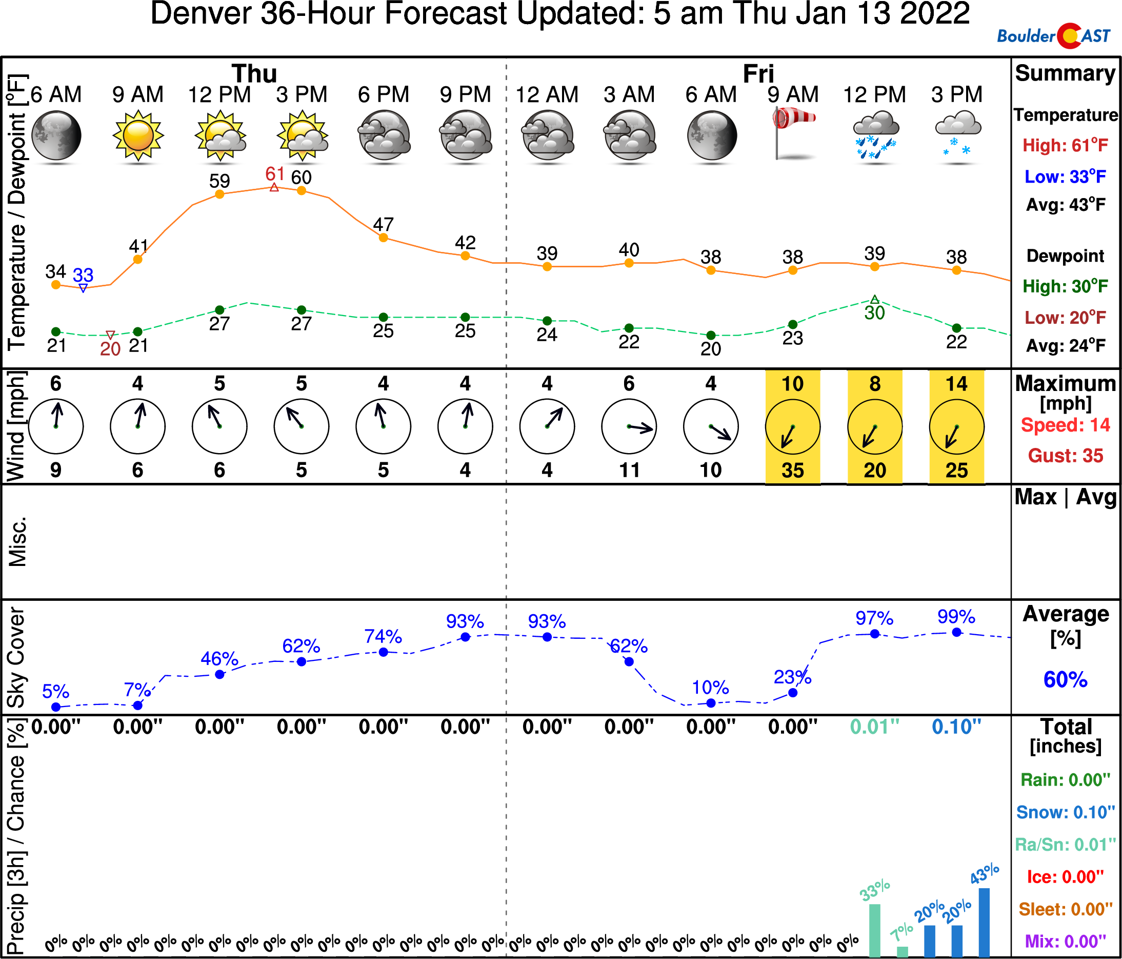
The initial cold front from the Pacific branch will arrive before sunrise on Friday. The colder Canadian punch will hold off until around midday or early afternoon. High temperatures will be in the morning hours and then falling into the 30’s thereafter.
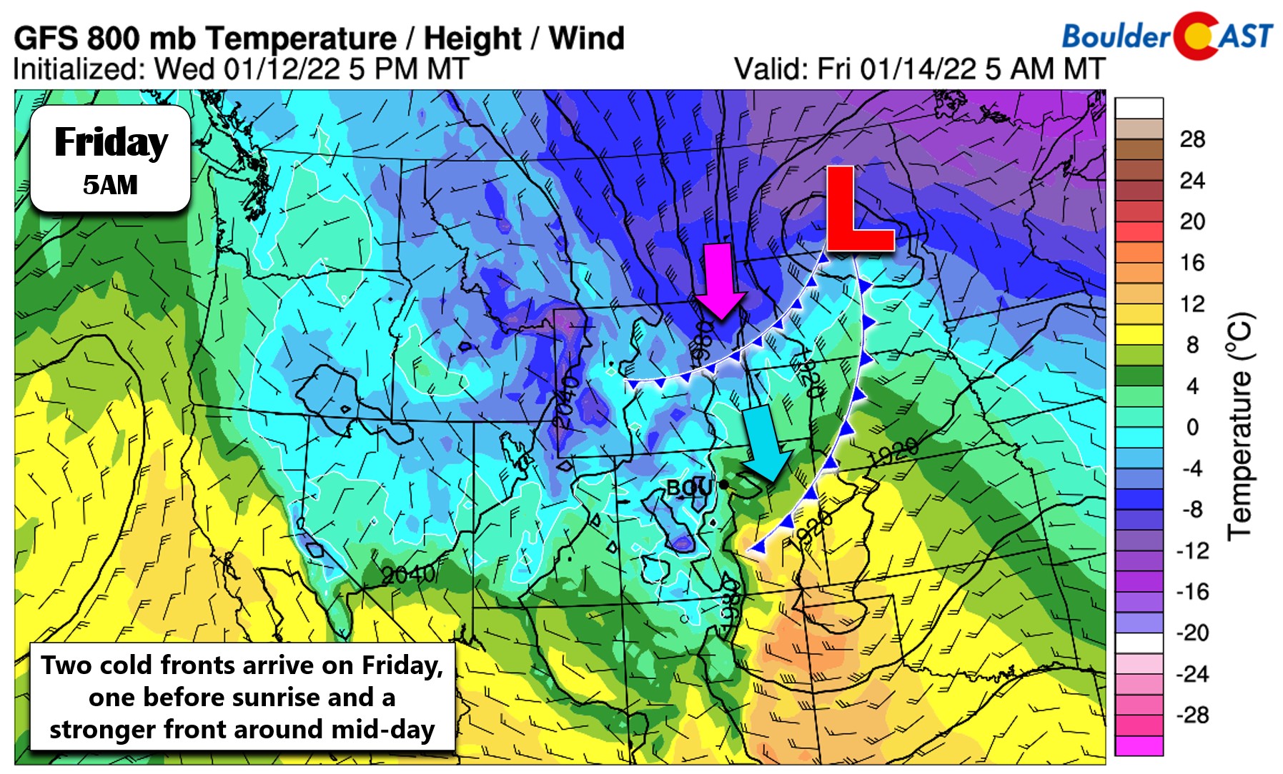
The first front will bring gusty and predominantly north or northwesterly winds to the Front Range. The second will usher in colder air and more northerly and even slightly northeasterly winds across parts of our area — that is upslope! North winds will be blustery through the day, especially east of I-25.
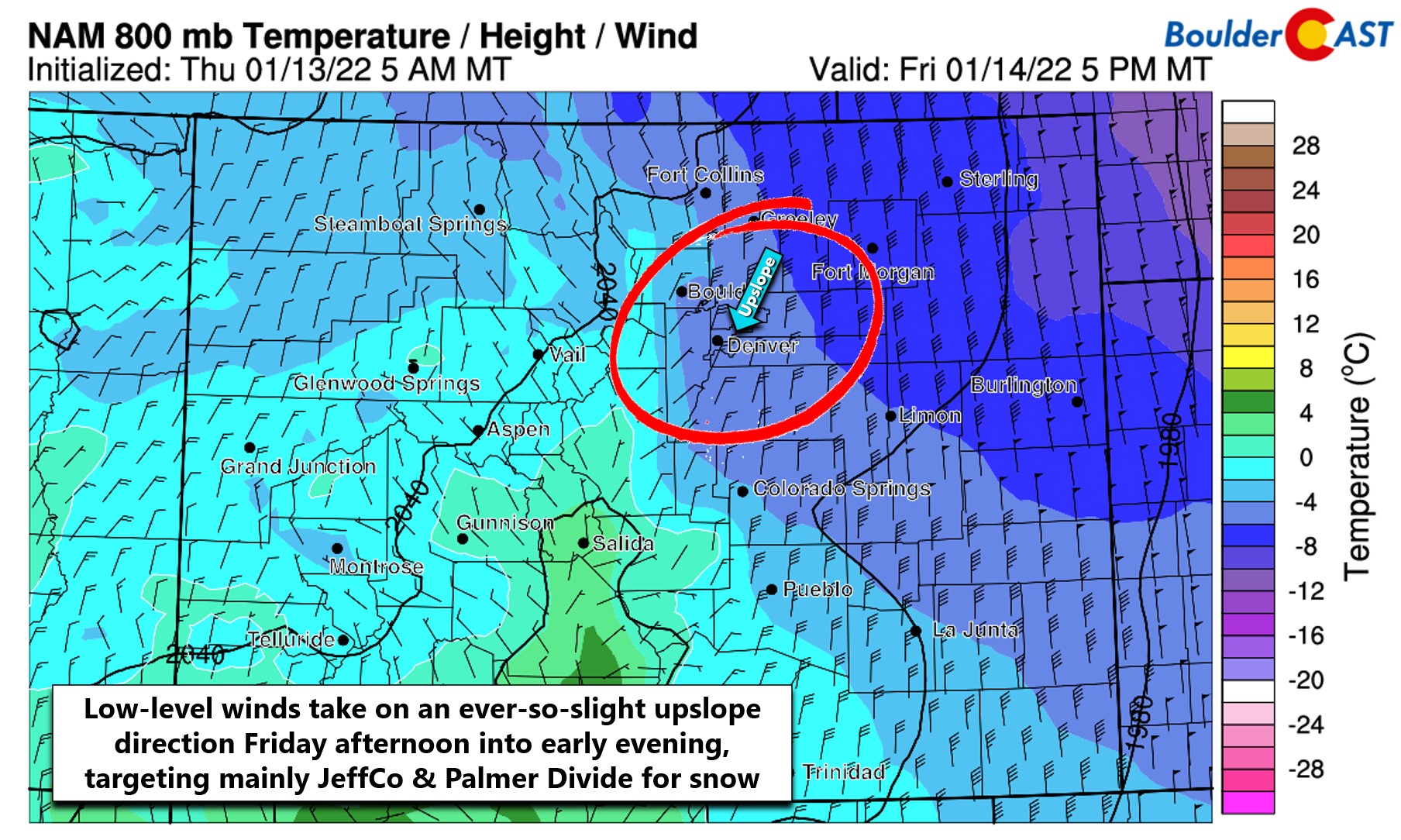
The best chance of precipitation will be from late morning Friday through the afternoon and into the early evening. Just about every model is targeting Jefferson County and the Palmer Divide, which makes sense given the wind directions which favor those areas.
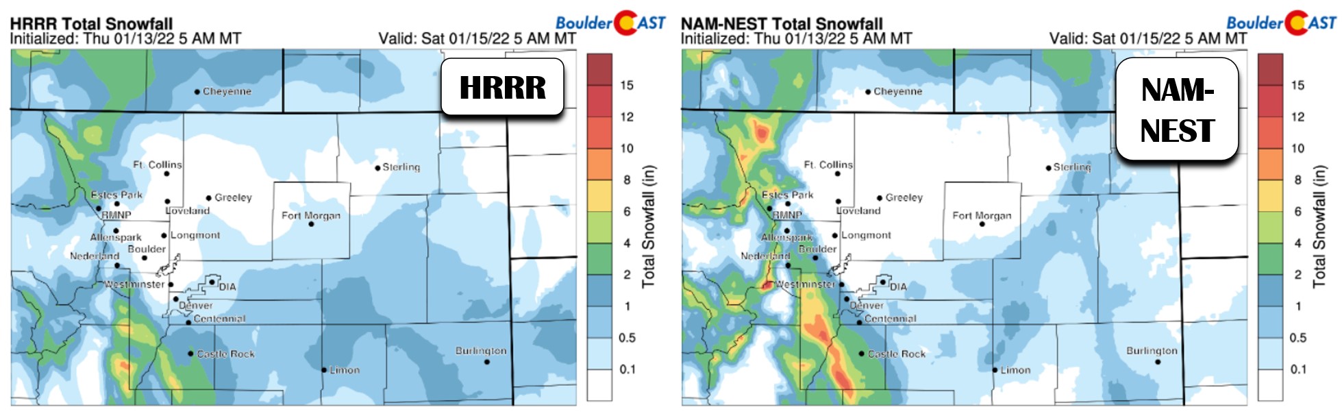
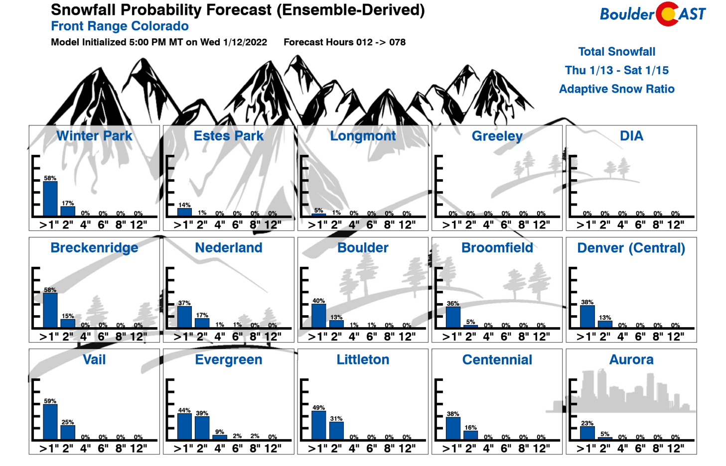
We expect to see the highest snow totals — up to 4 inches — in the higher terrain of Jefferson and Douglas Counties. Temperatures will be marginal across the Denver area staying near or above freezing through the day Friday. Thus any snow accumulation will be wet and confined to the grassy surfaces. Our latest Snowfall Probabilities show this south and west bias and we feel capture the range of outcomes quite well.
Our snowfall forecast map for the event is shown below. Because of the weak nature of this storm and the upslope direction, the further northeast you go chances increase for seeing absolutely nothing at all from this system.
Our weather quiets back down quickly Saturday and beyond with another lengthy dry stretch in the works. Look for plenty of sunshine this weekend with highs moderating back near and above normal. Our next chance of precipitation won’t come until the middle of next week at the earliest…
Get BoulderCAST updates delivered to your inbox:
Help support our team of Front Range weather bloggers by joining BoulderCAST Premium. We talk Boulder and Denver weather every single day. Sign up now to get access to our daily forecast discussions each morning, complete six-day skiing and hiking forecasts powered by machine learning, first-class access to all our Colorado-centric high-resolution weather graphics, bonus storm updates and much more! Or not, we just appreciate your readership!
Enjoy our content? Give it a share!


You must be logged in to post a comment.