
A review of the snow totals from Wednesday evening and night as a prolonged period of generally light snow impacted the Front Range.
Category: Winter Weather (Page 69 of 139)
These posts contain some discussion of the white stuff, whether it be mountain snow pack or a Front Range snowstorm.
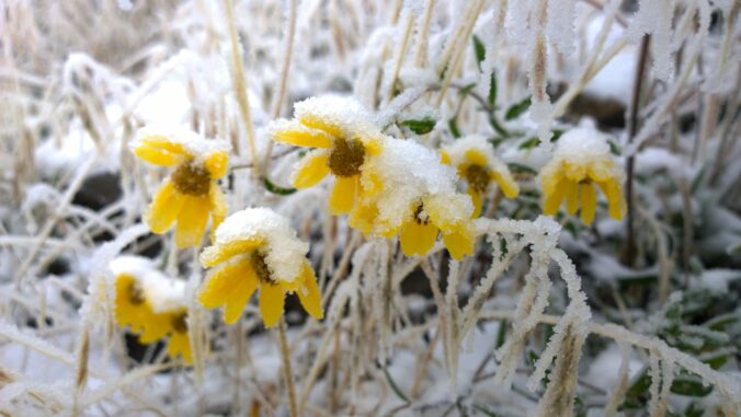
A late-season Arctic cold front ushered in bitter cold temperatures on Monday morning and eventually a dumping of fluffy snow for the entire Front Range Monday evening. We review the snow totals and record cold temperatures. We also give our preliminary snowfall forecast for the next system in the pipeline set to arrive during the day Wednesday.
Updated Wednesday 4/21/21 7:00AM: Amended snowfall forecast map. For more details and additional discussion, check our latest Premium forecast from Wednesday morning HERE.

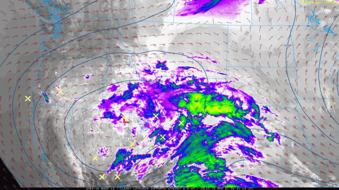
This week kicks off with a bang as widespread moderate to heavy snow will develop Monday afternoon and evening across the Front Range as an impressive but ultimately quick-moving Arctic cold front impacts the region. Watch out for deteriorating travel conditions Monday afternoon into Monday night. Another storm will arrive around mid-week with additional snowfall accumulations likely. Our weather will remain unsettled heading into the weekend, but with more rain than snow expected. Read on for our complete forecast of the week ahead.
Heavy wet snow fell across the entire Front Range Thursday evening and lingered into early Friday with widespread tree damage being reported. How much snow fell and why was the tree damage so extensive? When is the next snowstorm taking shape? Let’s take a look.
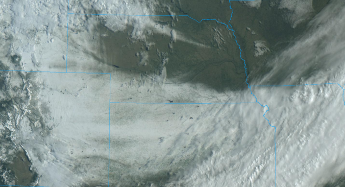
The pesky trough that produced cold and gloomy weather all week long for us will finally push across Colorado Thursday night into Friday. This passage will produce widespread showers from late afternoon Thursday into the overnight. It will begin as rain, but quickly change to snow with several inches of accumulation likely for the Denver Metro area. Let’s take a closer look at this storm and where the most snow will fall. Continue reading

The light and patchy snow that fell Tuesday morning was just a taste of what’s to come the rest of the week with daily chances for winter weather lasting all the way into the weekend. Of immediate concern is our next chance of snow Tuesday evening into Wednesday morning which will be more fruitful in most locations. We discuss the timing and amounts of this next wave of snow and also look ahead to what may come later on in the week.
Continue reading

This week will be gloomy and unsettled with several chances of snow through Friday, though some rain will mix in at times. Temperatures are forecast to remain below seasonal normals under persistent upslope flow and overcast skies. Overall, it should be an active weather week for much of Colorado. Let’s take a look.
April has been an incredibly warm month so far in the Front Range, but that will change next week as a major pattern shift takes hold. Gloomy and unsettled conditions will spread in Tuesday and beyond with daily chances for rain and snow. Due to marginal temperatures, the highest probably of significant snow accumulations will be in the Foothills, but just about everywhere will see snow at times. Let’s take a quick look at the still evolving forecast for next week.

Live View of Boulder

Current Conditions

Live Radar

Recent Premium Posts

BoulderCAST Daily – Wed 06/03/26 | Scattered P.M. storms again as moisture peaks for the week
🌬️ Weak westerly flow aloft today with no major synoptic features nearby; only …
BoulderCAST Daily – Tue 06/02/26 | Storms Reload This Afternoon, But With Noticeably Less Bite
❄️ Monday delivered lots of hail to northeast Colorado, with one supercell tracking …
BoulderCAST Daily – Sun 05/31/26 | Dry and warm today but rain chances increase this week
🌦️ Overall dry and warm Sunday, though cannot rule out a very widely …
3-Day Forecast

Trending Content

© 2026 Front Range Weather, LLC