This week kicks off with a bang as widespread moderate to heavy snow will develop Monday afternoon and evening across the Front Range as an impressive but ultimately quick-moving Arctic cold front impacts the region. Watch out for deteriorating travel conditions Monday afternoon into Monday night. Another storm will arrive around mid-week with additional snowfall accumulations likely. Our weather will remain unsettled heading into the weekend, but with more rain than snow expected. Read on for our complete forecast of the week ahead.
This week’s highlights include:
- Cold on Monday with morning drizzle turning to widespread snow during the afternoon and evening
- Snow will be heavy at times with totals of 3-9″ expected across the lower elevations
- Record cold values will be challenged Tuesday morning as we drop into the teens…Brr!!
- Snow returns Wednesday into Wednesday night with additional accumulations likely
- The unsettled and chilly weather continues late-week into the weekend, though with moderating temperatures precipitation type will shift to rain
DISCLAIMER: This weekly outlook forecast is created Monday morning and covers the entire upcoming week. Accuracy will decrease as the week progresses as this post is NOT updated. To receive daily updated forecasts from our team, subscribe to BoulderCAST Premium.

Heavy snow Monday evening!
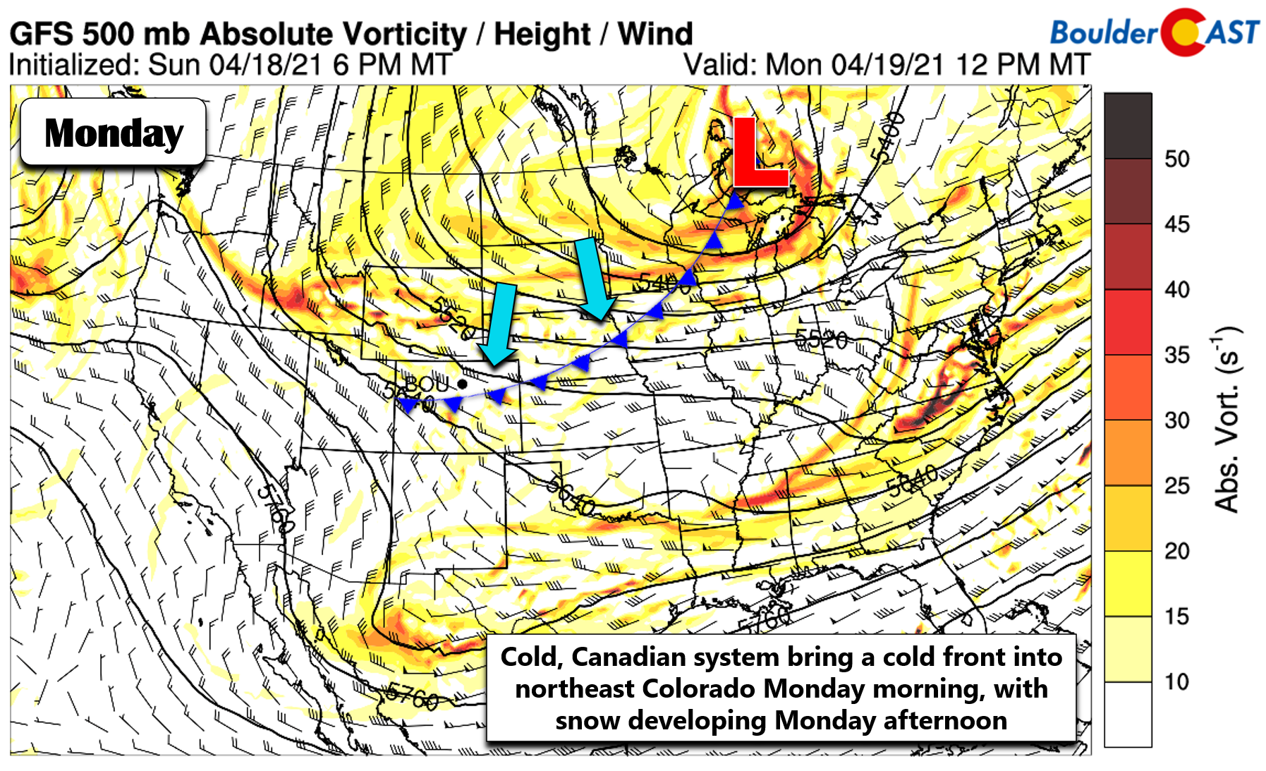
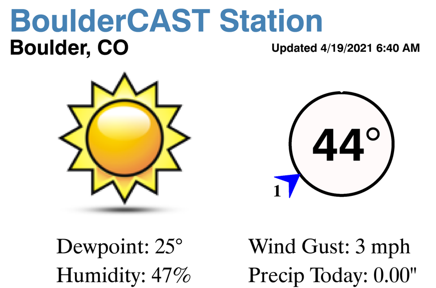
We begin with the most active weather of the week as a strong Canadian cold front dives southward into northeast Colorado Monday morning. Temperatures are in the lower 40’s across the Denver Metro area, but that will change as the front plows southward through the morning hours. As of 6:30AM Monday, the cold front was located just to the northeast of the Metro area.
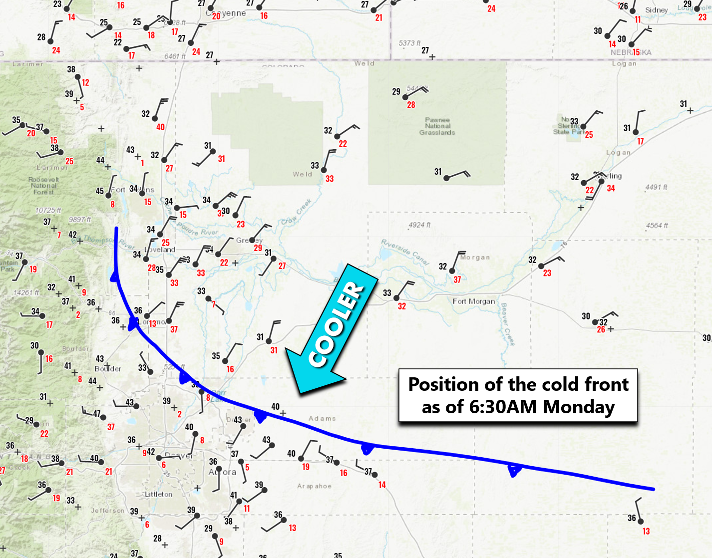
This impressive cold front is tied to a large Canadian system in the Great Lakes, with a trailing, positively-tilted trough axis stretching back westward into the Rockies. As we discussed a few days ago, the source region for the air on the backside of this front is the Arctic Circle, so you know it’s going to turn very cold for us..at least by mid-April standards.
We can get a peek at just how impressive the dynamics are along this trough axis and front from this morning’s infrared satellite animation. The intense line of lift, clouds and precipitation will sag southward and into our area by Monday afternoon spreading widespread snow back into the Denver Metro area.
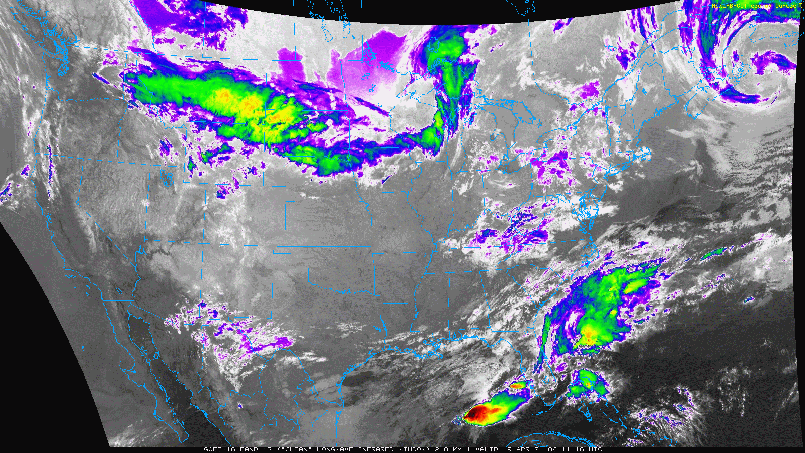
GOES-East infrared satellite animation from Monday morning
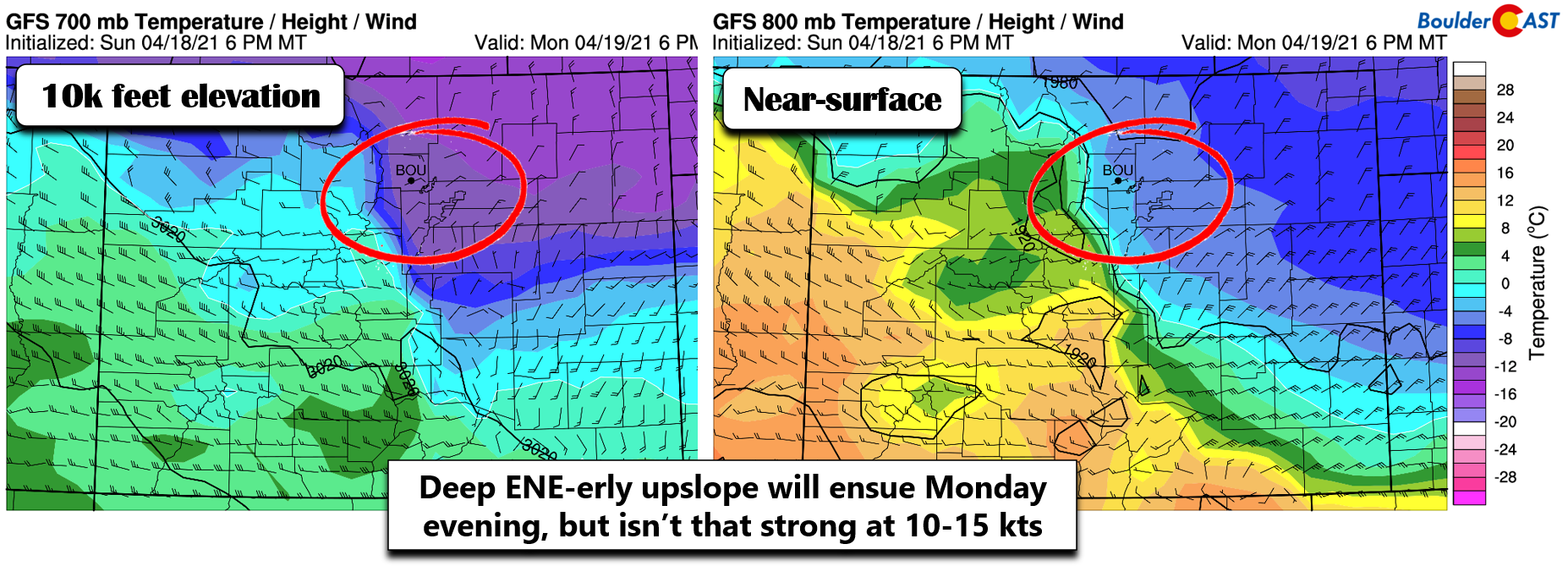
The system will lay out all the cards for snow on the table later today, with strong frontogenesis, deep upslope (see below), an influx of warm air and moisture aloft, large-scale lift from the trough axis as well as possible jet stream interactions. It truly has it all in terms of forcings for snowfall in our area. The only downside is how short-lived the entire event will be — with roughly only about a 9 to 12-hour window for snow. What a shame!
Nonetheless, let’s lay out the timeline. The warmest temperature on Monday is likely already behind us with lower to middle 40’s being observed in the pre-frontal airmass around sunrise.
Temperatures will drop a tad behind the cold front and recover very little through the day with cold air advection from the north underway and widespread low clouds and pockets of drizzle.
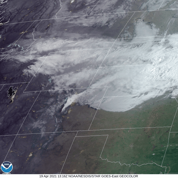
Visible./IR satellite composite animation from Monday morning showing the Arctic front surging southward across eastern Colorado
By early to middle afternoon, widespread snow will break out across the northern Front Range and spread south through Denver as all of the forcings begin to align. Moderate snow will likely encompass the entire area by late afternoon into early evening. This could make for a slushy and slick evening commute in spots, depending on just how heavy the snow is early on.
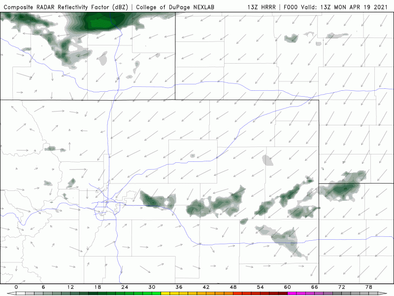
HRRR model-simulated radar animation for Monday into Monday night. A swath of heavy snow will quickly drop southward through the Metro area.
Pockets of heavy snow will be possible through the late afternoon and evening with snowfall rates greater than 1″ per hour. Snow will begin to taper off from north to south around midnight Monday night and be gone fully by sunrise Tuesday.
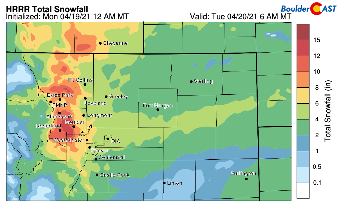
Despite the short-lived nature of this event, snowfall rates will be fairly intense from late Monday afternoon through the evening hours, so there is the potential for significant accumulations. We caution you to not be caught off guard by the intensity of the snow later today! The high-resolution HRRR model (shown below) and global GFS model agree that Boulder and the western Metro area will see greater than 6″ of snow from this system, with more like 3-6″ for areas around Denver and eastward.
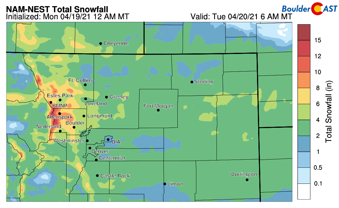
The NAM-NEST (shown below) and European models predict slightly lesser amounts of 4-8″ in Boulder and 2-5″ in Denver. The Euro model in particular has been struggling with snowfall events in our area lately, so we will lean a little harder towards the GFS in our forecast.
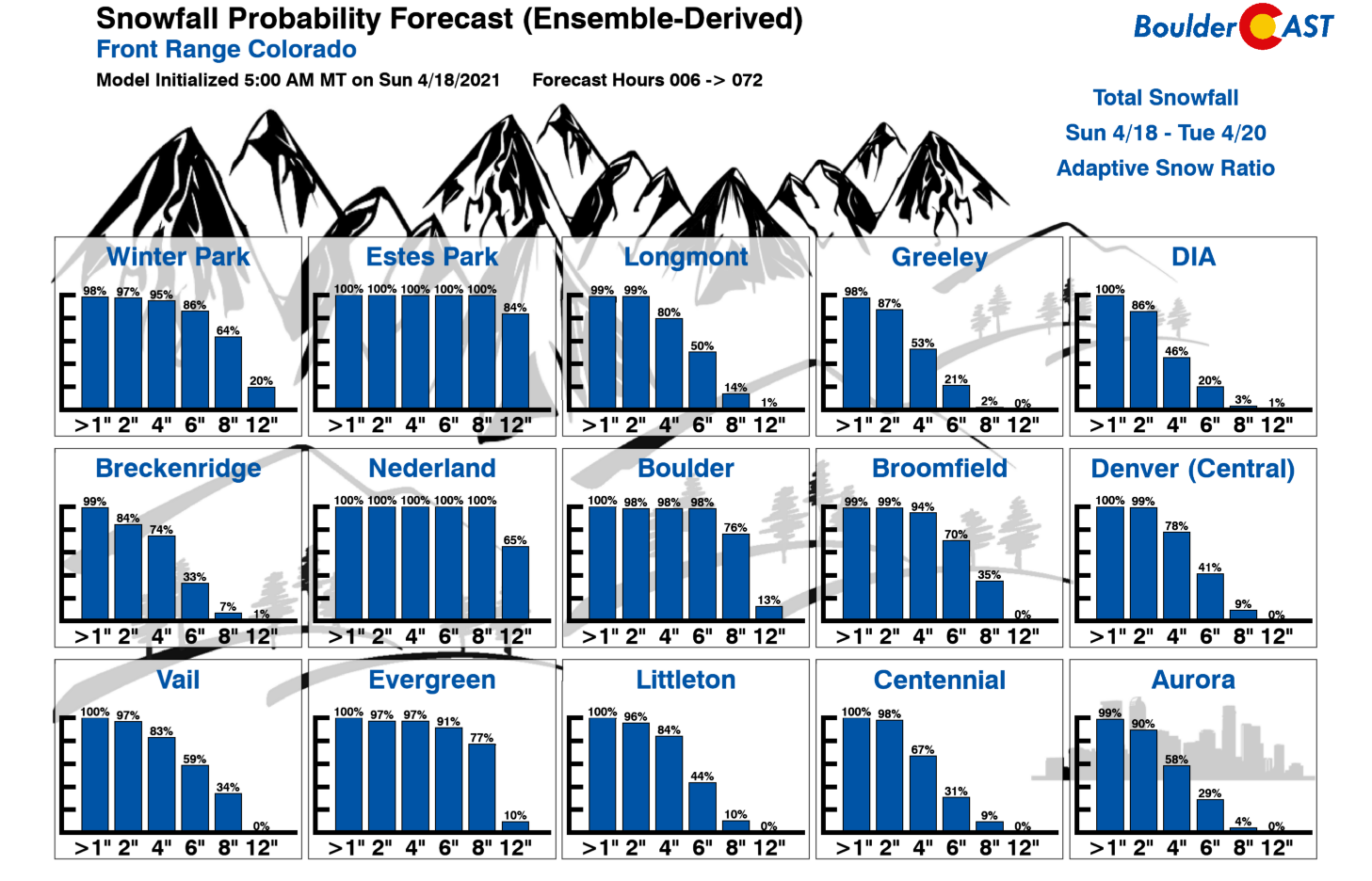
Our Snowfall Probabilities also suggest that this event will be on the higher-end of model guidance, with nearly a 100% chance of 6″ or more of snow in Boulder, with only a 41% chance of the same happening in downtown Denver.
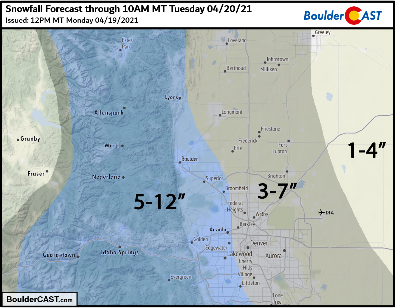
Our snowfall forecast map for the event is shown below. This encompasses all snow falling through Tuesday morning. Generally we are expecting between 5 and 12″ for Boulder, Golden, Littleton and the Foothills, with 3-7″ for areas along and east of Interstate 25.
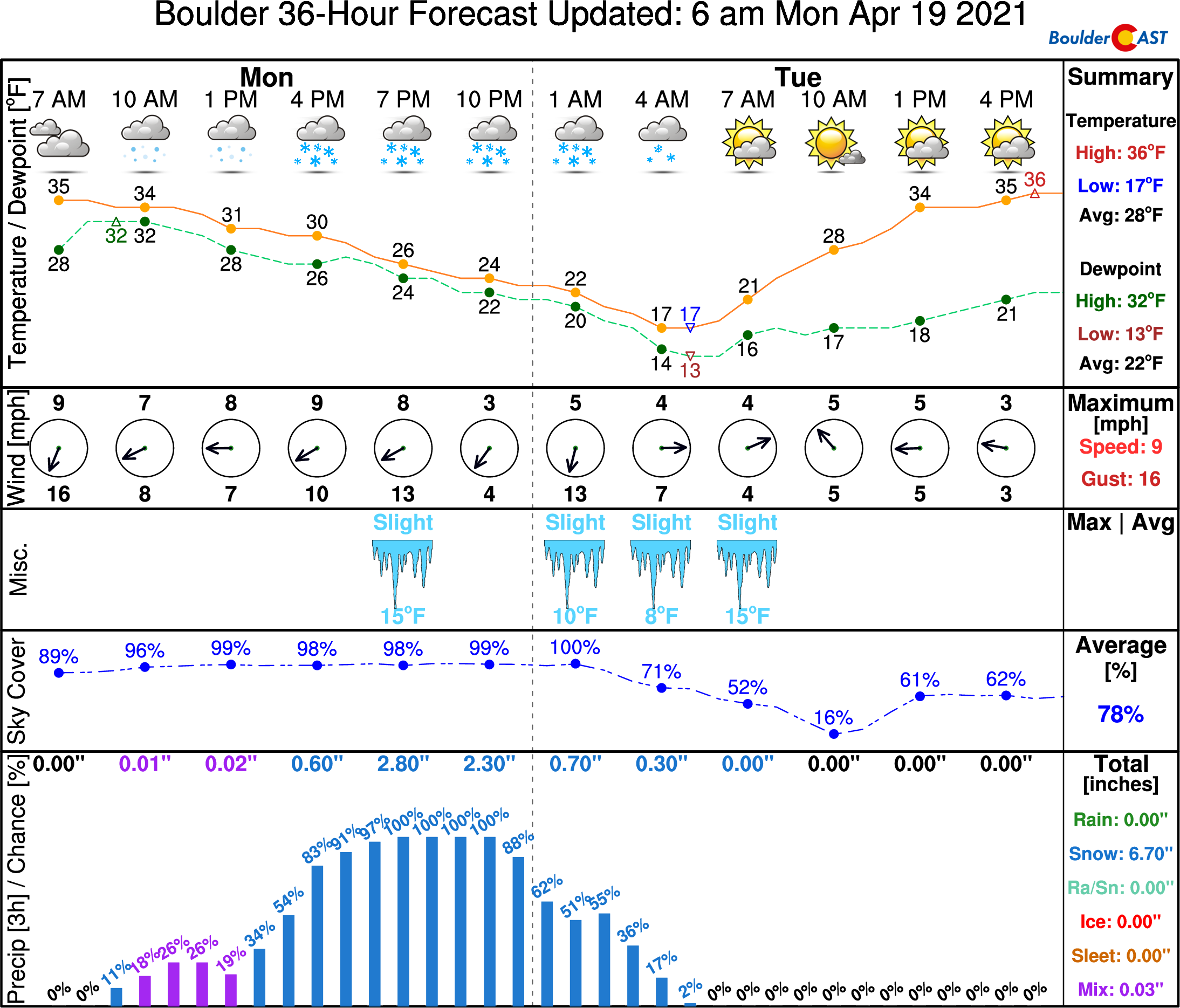
With snow expected to quickly clear out, record lows will be challenged Tuesday morning with temperatures dropping into the teens. Brr!! The record low to beat in Boulder for April 20th is 15°F. Our forecast calls for a low of 18°F. Tuesday will be fairly quiet for the area as we sit between storm systems for the time being, but we’ll still be under chilly northerly flow from the expansive Great Lakes low. Expect lots of sunshine with highs remaining much cooler than normal around 40 degrees.
Another chance of snow Wednesday
The forecast graphic below shows a large-scale picture of the middle atmosphere Monday evening. At this point, widespread heavy snow will be underway across the Front Range as we’ve already discussed. However, we do want to point out a secondary storm system to the west that will be coming ashore Monday night into the Pacific Northwest. The system will dive southward and then drift across Colorado on Wednesday bringing with it another chance of snow.
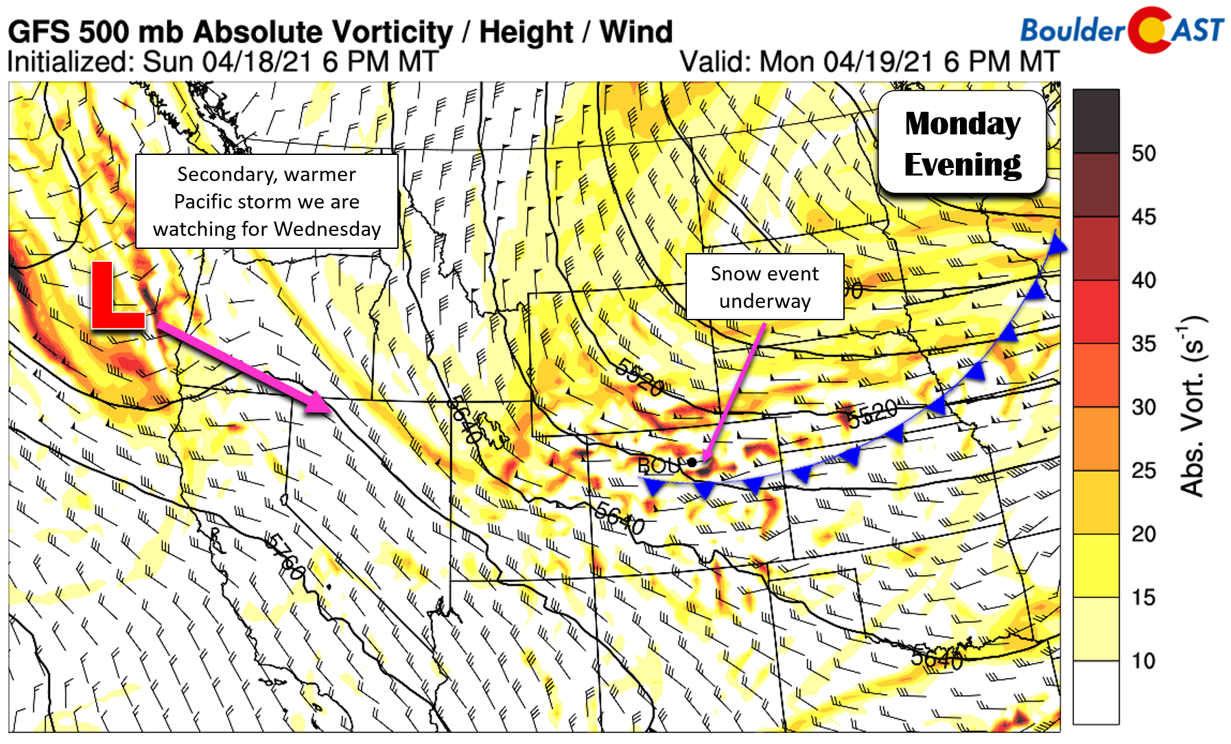
The dynamics with this second system will not be as strong as Monday’s event, but the window for snowfall will be much longer…so it does have that going for it. We could see light snow (or perhaps drizzle) break out as early as Wednesday morning, with snow lingering all the way through Wednesday night. It will be cold enough for snow nearly the entire time, though we can’t imagine much accumulation stacking up during the daytime hours on Wednesday giving the strong April sun and overall lighter snowfall rates. It’s still a little too early to diagnose this system fully, but do know that more snow is likely Wednesday with a few inches of accumulation possible Wednesday night into early Thursday. Highs will remain very cold in the 30’s on Wednesday as well.
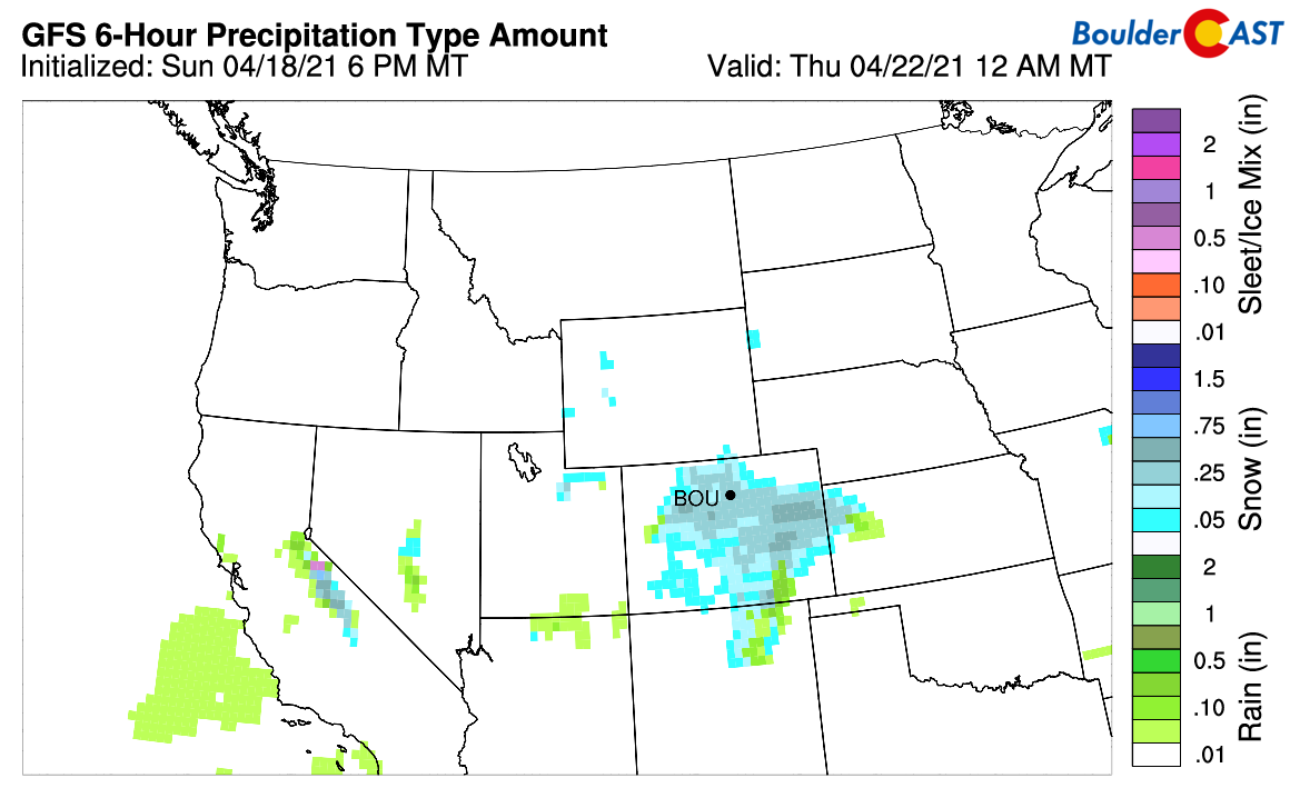
Precipitation forecast for Wednesday evening. Widespread light snow may be falling across much of Colorado
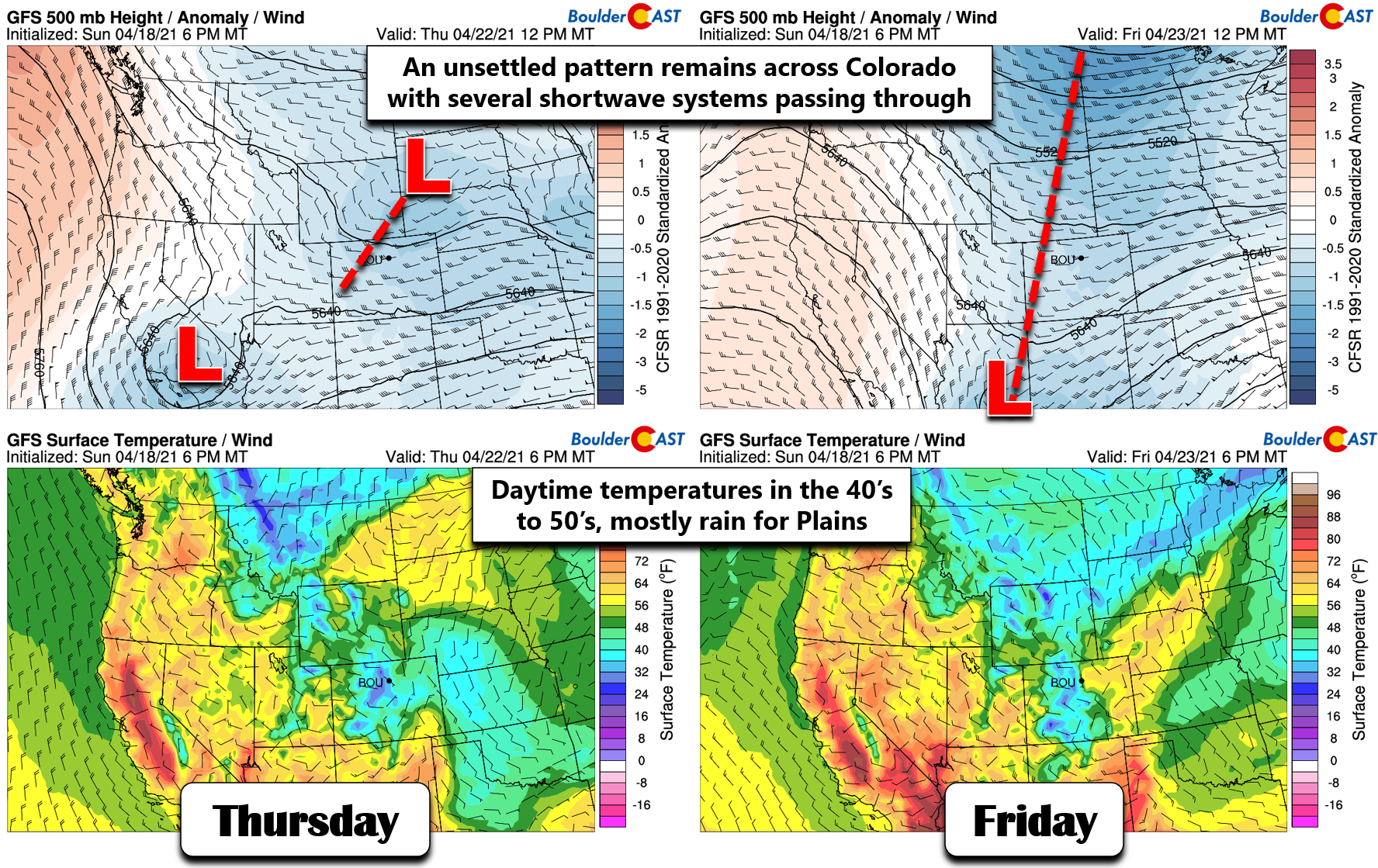
Unsettled, chilly, and rainy late-week
Late in the week, conditions will continue to remain active for Colorado with weak shortwaves embedded in a larger troughy pattern across the western United States. There’s too many small moving parts in the flow to say for sure what will transpire Thursday and Friday, but the general rule of chilly and unsettled springtime weather will still reign king. The airmass should moderate enough that any late-week precipitation will largely fall in the form of rain across the lower elevations, with some snow as you go up in elevation west of town. Highs Thursday will be in the upper 40’s with temperatures pushing well into the 50’s on Friday.
While the weather isn’t great by any stretch of the imagination this week, it will offer daily chances for much-needed precipitation, a necessary sacrifice at this point to continue to chip away at the drought. Have a good week and do watch out for deteriorating travel conditions Monday afternoon and evening!
Stay up to date with Colorado weather and get notified of our latest forecasts and storm updates:
We respect your privacy. You can unsubscribe at any time.
Forecast Specifics:
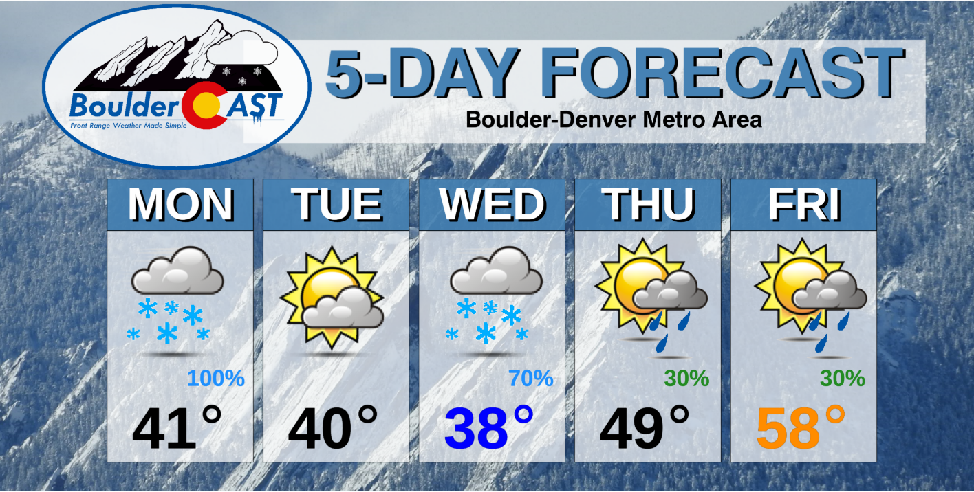
Monday: Overcast and cold with gusty winds behind a morning cold front. Light drizzle is possible through the morning. Snow will quickly develop in the afternoon and continue into the evening. Snow could be heavy at times with travel conditions deteriorating rapidly. Expected snow amounts by Tuesday morning range from 3-6″ around Denver to 4-10″ in Boulder and the Foothills. Highs in the upper 30’s on the Plains and in the 20’s in the Foothills.
Tuesday: Possibly a few lingering light snow showers around sunrise, then quickly clearing skies. Highs around 40 degrees on the Plains and in the upper 20’s in the Foothills.
Wednesday: Mostly cloudy and cold with light snow throughout the day and evening. Several inches of accumulation will be possible Wednesday night. Highs in the upper 30’s on the Plains and upper 20’s in the Foothills.
Thursday: Possibly a few lingering snowflakes in the morning, then partly cloudy with scattered rain showers in the afternoon/evening. Highs in the upper 40’s on the Plains and middle 30’s in the Foothills.
Friday: Partly cloudy and somewhat warmer with a chance of late day rain showers. Highs in the upper 50’s on the Plains with middle 40’s in the Foothills.
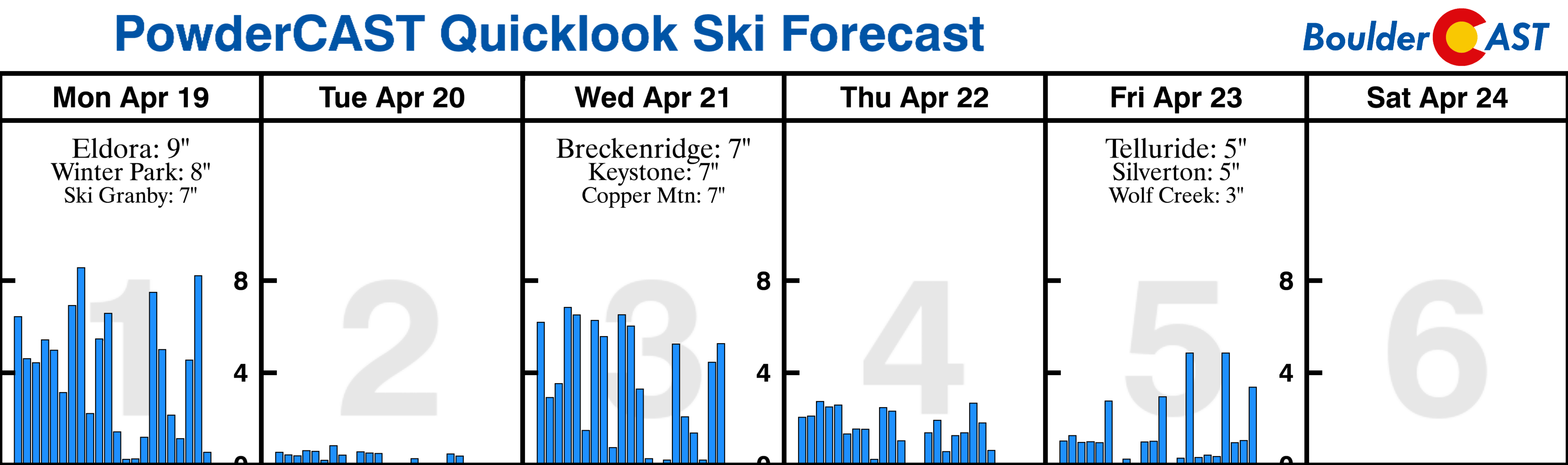
Mountains: Snow will be present in the Mountains nearly every day this week, even on Tuesday though it will be lighter. The most widespread accumulations will occur in the Front Range Mountains Monday and across much of Colorado on Wednesday. Though most ski resorts are closed up now, this week’s snow will offer some decent back country potential.
Help support our team of Front Range weather bloggers by joining BoulderCAST Premium. We talk Boulder and Denver weather every single day. Sign up now to get access to our daily forecast discussions each morning, complete six-day skiing and hiking forecasts powered by machine learning, first-class access to all our Colorado-centric high-resolution weather graphics, bonus storm updates and much more! Or not, we just appreciate your readership!
.
Spread the word, share the BoulderCAST forecast!
.


You must be logged in to post a comment.