Heavy wet snow fell across the entire Front Range Thursday evening and lingered into early Friday with widespread tree damage being reported. How much snow fell and why was the tree damage so extensive? When is the next snowstorm taking shape? Let’s take a look.
We discuss Boulder and Denver weather every single day on BoulderCAST Premium. Sign up today to get access to our daily forecast discussions every morning, complete six-day skiing and hiking forecasts powered by machine learning, access to all our Front Range specific weather models, additional storm updates and much more!

At a Glance:
- An organized band of heavy snow dumped on the Front Range much of Thursday evening, with lighter snow lingering into early Friday
- Snow totals of 3 to 9″ were reported across the Denver Metro area and Foothills
- Widespread tree damage occurred due to the exquisitely wet nature of the snow
- Cold and unsettled weather will stick with us through the weekend and much of next week as well
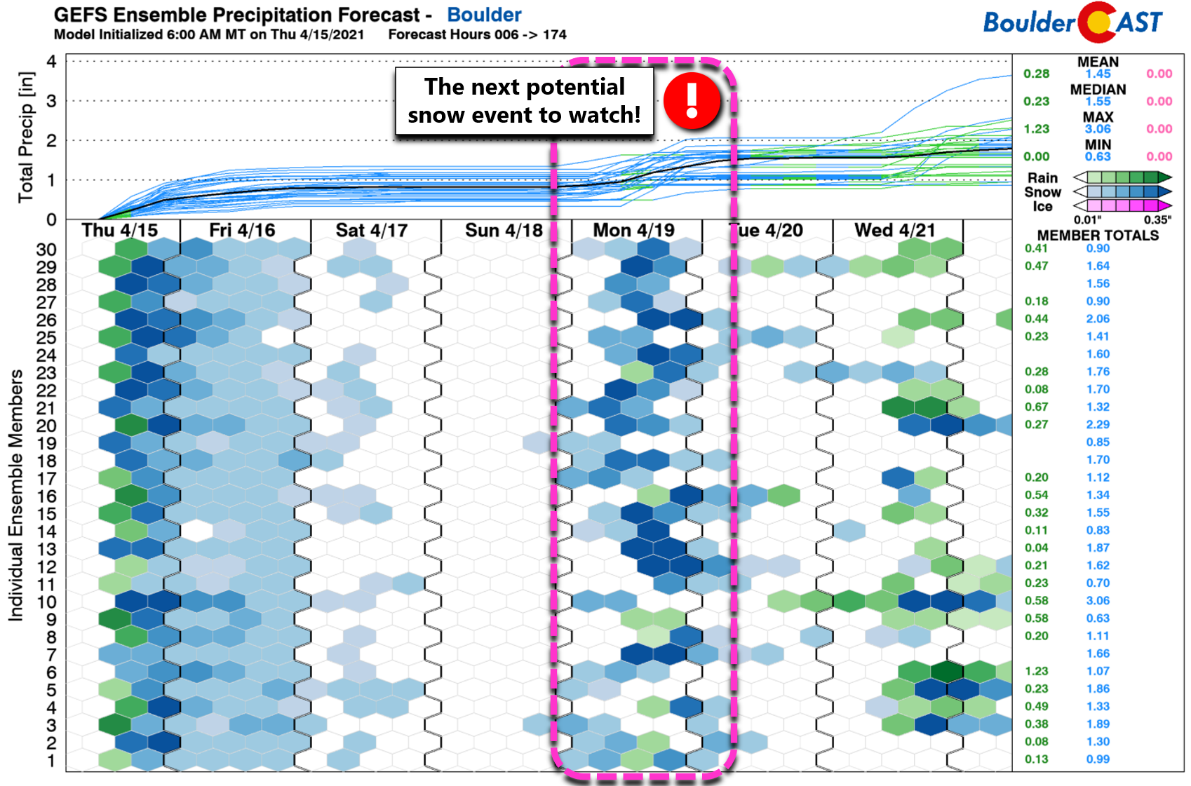
- Next potential impactful snow event is taking shape for Monday
W
hat began as a few pockets of convective snow showers across the Mountains Thursday afternoon quickly escalated into a solidified band of very heavy and wet snow across the Denver Metro area by early Thursday evening. The radar animation below is from around 6PM Thursday when some of the heaviest snow was falling up and down the Front Range.
Radar animation from Thursday evening (4/15/21)
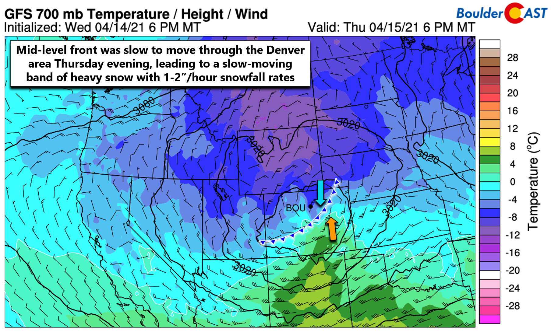
This band of snow produced 1 to 2″ per hour snowfall rates, lining up from southwest to northeast across Denver and Boulder for several hours before shifting eastward later in the evening. This positioning tracked right along with a strong, slow-moving mid-level cold front. That is, a cold front not at the surface, but one slightly higher up in the atmosphere. The effect is the same though: warm moist air collides into cold dense air and gets forced upward fueling the intense snowfall rates. There may also have been very minor jet enhancement Thursday evening, but that wasn’t nearly as influential as the sharp lift along the cold front. There were also numerous lightning strikes with this storm, but those were mainly south of the Front Range in the “warmer” sector of the storm. Surely, though, thundersnow was observed in a few spots across Colorado yesterday, perhaps near Colorado Springs!
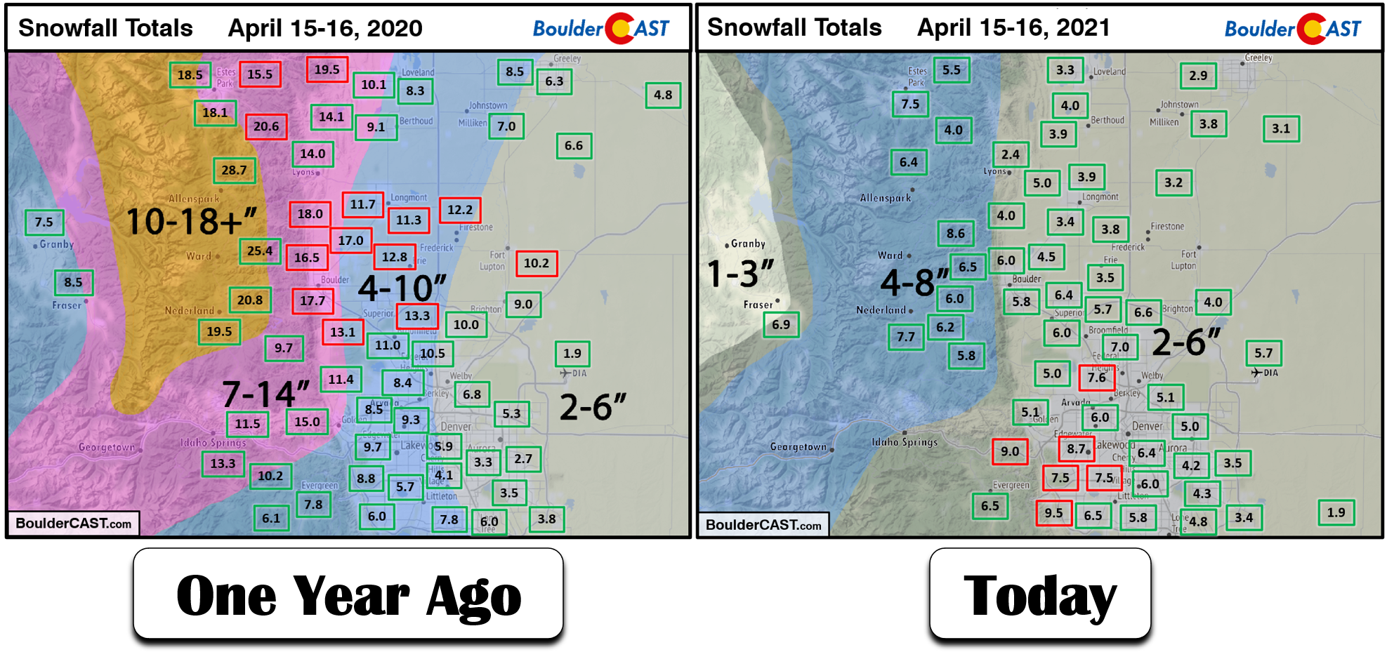
When it was all said and done, anywhere from 3 to 9″ of snow fell across the entire Front Range. The heaviest amounts occurred in southwest Denver around Lakewood and Littleton. Our snowfall forecast map for the event is shown below with storm totals overlaid in boxes. Green boxes indicate our forecast verified to within 1″. Red did not.
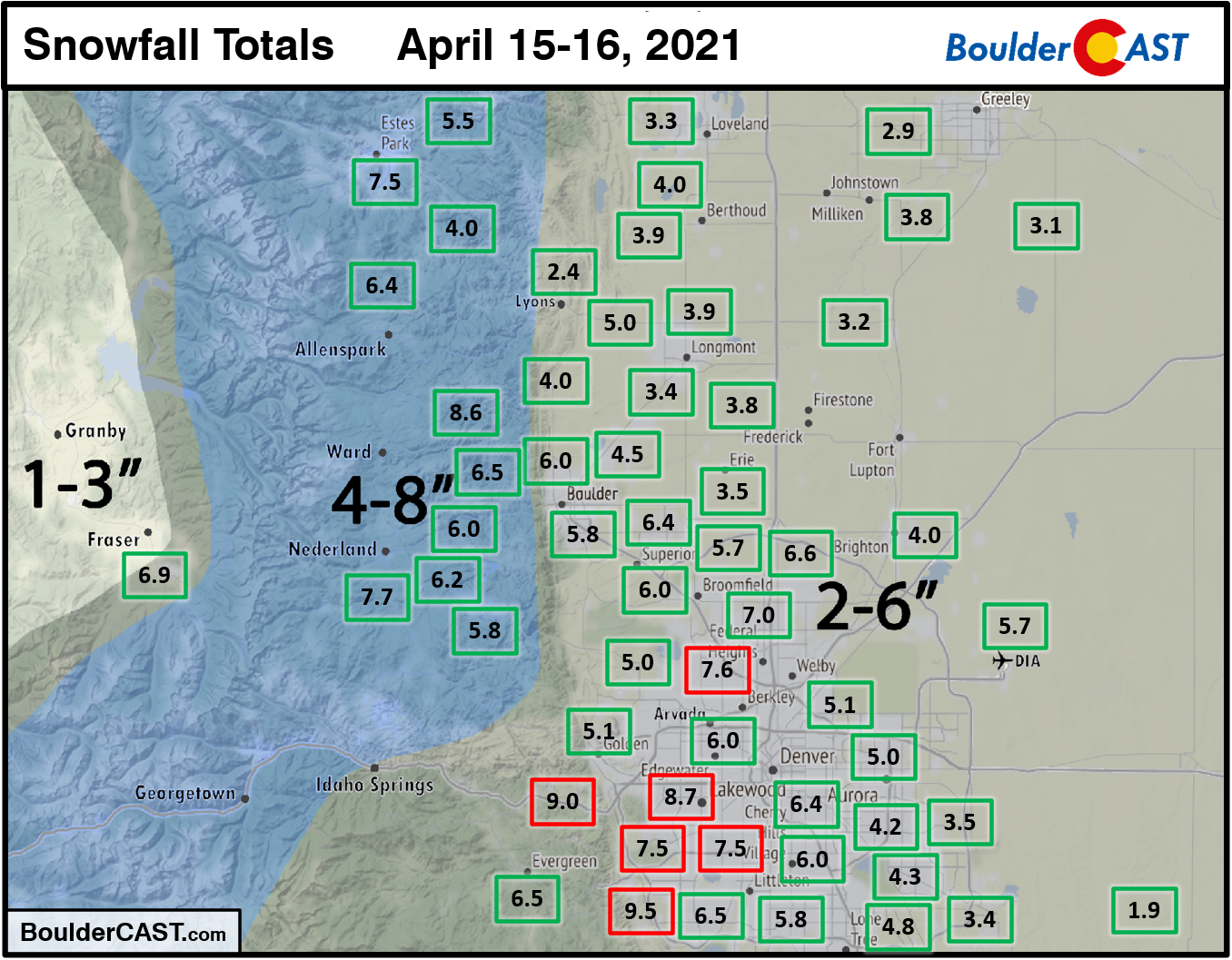
Our forecast verified fairly well, except in those areas southwest of Denver that saw slightly booming totals. It’s not a complete bust though, as we did mention that snow totals up to 8″ could occur in localized areas.
Excerpt from pre-storm forecast discussion: Considering the chance for a brief period of rain at the onset and how wet the snow will be thereafter, most of the Denver Metro area should pick up several slushy inches of snow this evening and overnight, generally 2-6″but with some 8″ totals not out of the question depending on how the heavier showers materialize this evening.
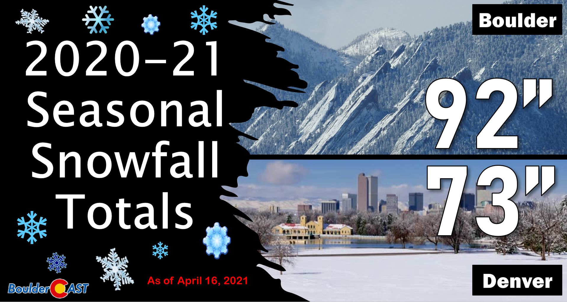
Boulder officially reported 5.8″ of snow from this event, while Denver notched 5.7″. Light snow is still falling as of Friday morning, so these totals may go creep up a few tenths of an inch through the day. Overall though, most of the accumulating snow is already behind us. Both cities can now boast of an above normal snow season!
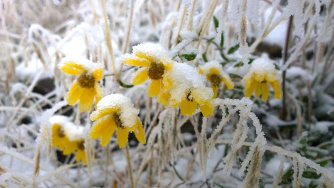
More so than expected, there has been widespread reports of tree damage from this storm, owing to the very heavy consistency to the snow that fell.
There seems to be even more trees down with this storm that brought 5-6 inches compared to the blizzard last month that brought 27 inches!
This snow is ridiculously HEAVY.#cowx #4wx
Photos by @eddiecastro55 near 13th Ave & Franklin St in Capitol Hill pic.twitter.com/XuaBvDxlX5— Ashton Altieri (@AshtonCBS4) April 16, 2021
Based on the snow observations from this event (both frozen and melted!), the snow to liquid ratios ranged from 6:1 to 8:1 across the Metro area. That is about as heavy as snow gets in our area and surely contributed to the pervasiveness of tree damage! Below are just a few random observations.
- Boulder: 5.8″ snow, 0.75″ liquid = 7.7 ratio
- Louisville: 5.8″, 0.80″ liquid = 7.7 ratio
- Longmont: 3.8″ snow, 0.50″ liquid = 7.6 ratio
- Denver: 7.0″ snow, 0.95″ liquid = 7.4
- Aurora: 4.5″ snow, 0.70″ liquid = 6.4 ratio
- Arvada: 7.0″ snow, 0.85″ liquid = 8.2 ratio
- Littleton: 7.5″ snow, 0.90″ liquid = 8.3 ratio
- Englewood: 6.0″ snow, 0.85″ liquid = 7.0 ratio
- Brighton: 4.0″ snow, 0.48″ liquid = 8.3 ratio
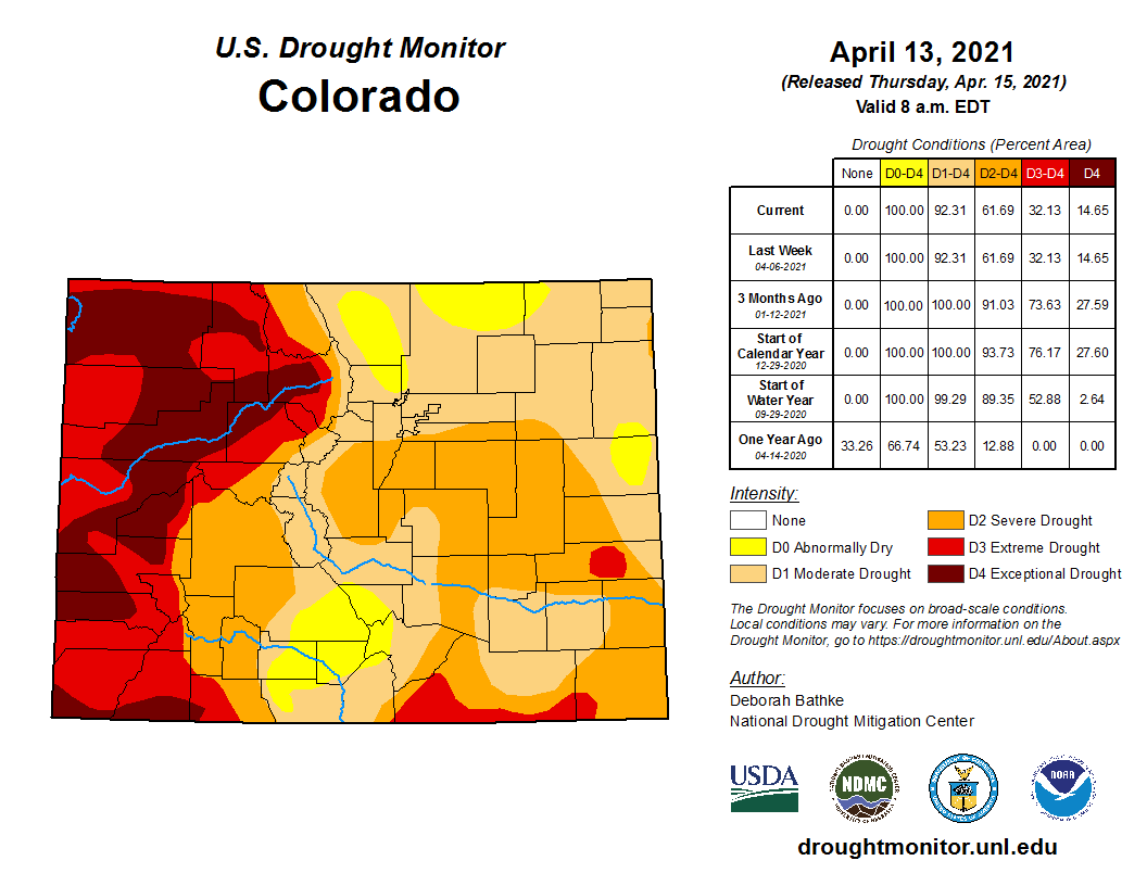
More importantly, for drought concerns at least, this storm delivered the goods with 0.5 to 1.0″ of moisture falling. This will certainly help our region continue to chip away at the ongoing widespread drought.
Staying cool and stormy
For those of you with a good memory, you might recall that it snowed on this very same day last year. While Denver saw about the same amount of snow then as now, Boulder certainly got slammed much harder last year piling up 18″!
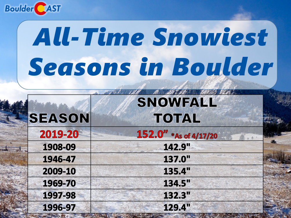
That mid-April snowstorm one year ago turned out to be the final flakes of the season, one which ended up being Boulder’s snowiest season on record.
2021 will not suffer the same fate as 2020 with no snow falling after April 16th! We wish we could pass along our thoughts on a swift transition back to beautiful spring weather, but that’s just not the case here. Despite being plagued by the same pesky low pressure system this entire week, it’s not quite done with us yet. The main storm has actually split into two different pieces. The one responsible for last night’s snow is exiting eastward now into Kansas. That’s a relief! However, a secondary piece has broken off to the west and lingers in far southwest Wyoming (see the animation below).
It won’t be until Saturday night that we can finally put this slow-moving storm system in our rear-view mirror. Until then, cold and unsettled weather will persist with light snow hanging on for Friday and then flaring up again slightly on Saturday. Less than 1″ of additional accumulation is expected through Saturday night across the lower elevations, with 1 to 5″ in the Foothills. With minimal snow across the Plains, the cold will be the story in the coming days with highs mostly in the 30’s and 40’s. This is some 20 to 30 degrees below normal! Sunday looks to be the best day, though Saturday could turn out half-way decent as well if you can mind the chill.
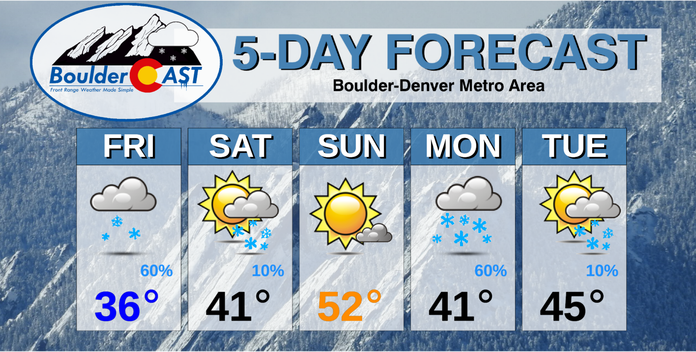
The next system to watch is expected to drop southward out of Canada and arrive to the Boulder area sometime on Monday. It should offer a quick-shot of deep upslope, cold temperatures, jet-forcing and most likely accumulating snow for much of the Front Range. This storm is still located over far northern Canada and the Arctic Ocean, though, so there’s plenty of time for that forecast to be fine-tuned.
That’s all for now. Happy snowy Friday!
We discuss Boulder and Denver weather every single day on BoulderCAST Premium. Sign up today to get access to our daily forecast discussions every morning, complete six-day skiing and hiking forecasts powered by machine learning, access to all our Front Range specific weather models, additional storm updates and much more!
.
Spread the word, share Colorado’s crazy weather:


You must be logged in to post a comment.