The polar jet stream took a major dive this week rolling out the red carpet for a series of storm systems that brought record-setting cold as well as significant late-season snow to the Front Range. We take a look at the snowfall totals, new cold and snow records, and look ahead to a stretch of warmer temperatures.
We discuss Boulder and Denver weather every single day on BoulderCAST Premium. Sign up today to get access to our daily forecast discussions every morning, complete six-day skiing and hiking forecasts powered by machine learning, access to all our Front Range specific weather models, additional storm updates and much more!

Key Highlights from This Post:
- Many Front Range cities reported 1 to 3 feet of snow this week
- Record cold accompanied the snow, too
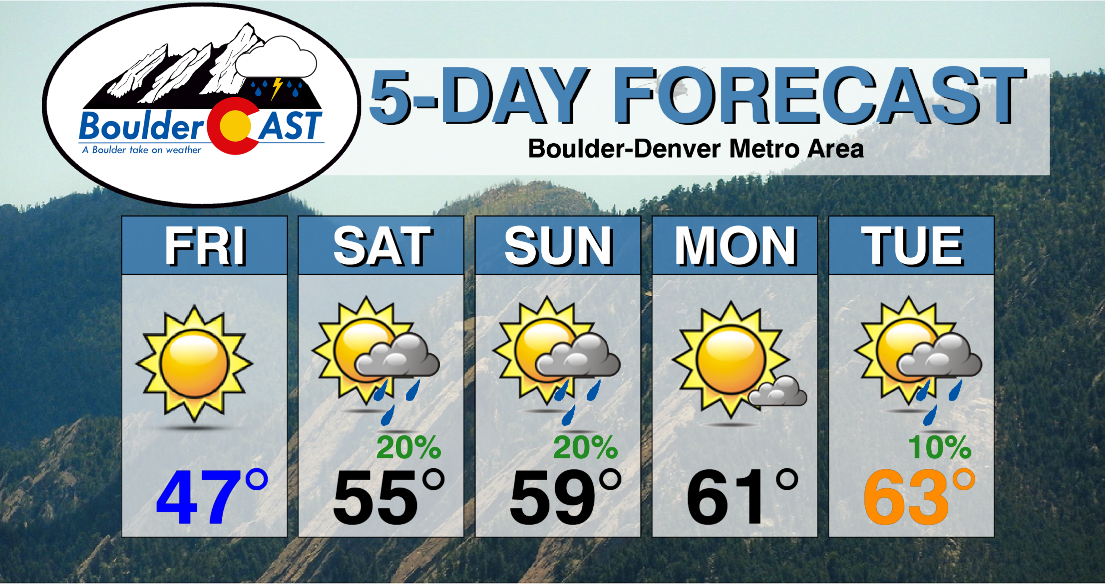
- Looking forward to warmer temperatures and slight chances for rain
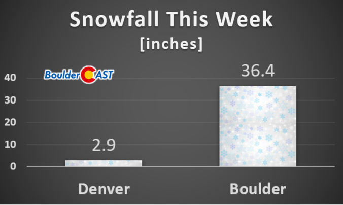
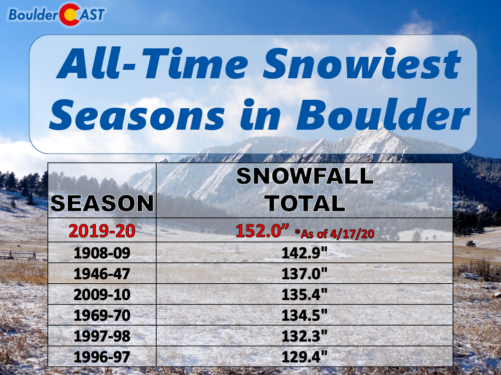
For Boulder, this snow season rocketed from an above average one to THE snowiest on record in a matter of days, reporting at total of 36.4″ of new snowfall this week and a seasonal total of 152.0″. Boulder now holds the trophy for snowiest city in America this year!
Here’s a look at some of the 5-day snow totals from across the Denver Metro area this week:
- Jamestown: 37″
- Boulder (official): 36.4″
- Nederland: 33″
- Estes Park: 28″
- Louisville: 25″
- Erie: 22″
- Longmont: 21″
- Broomfield: 18″
- Firestone: 17″
- Lakewood: 15″
- Loveland: 14″
- Thornton: 14″
- Greeley: 13″
- Littleton: 12″
- Denver (downtown): 10″
- Aurora: 7″
- Denver (official): 2.9″

In addition to the new seasonal snowfall record that Boulder set this week, there were plenty of others records set to go around:
- April 12th:
- New daily snowfall record of 8.8″ (old value 7.5″ from 1991)
- April 13th:
- New daily record low maximum of 27°F (old value was 38°F)
- April 14th:
- New record low temperature of 10°F (old value 14°F from 2014)
- April 16th:
- New daily snowfall record of 16.9″ (old value 6.5″ from 2016)
- April 17:
- New record low temperature of 9°F (old value 17°F from 1901)
- New record for the latest single digit temperature (old date was April 12 1997)
With winter now in the rear-view mirror, the weather will turn markedly warmer for the foreseeable future. While the Pacific storm track appears to remain active with frequent systems likely to impact Colorado in some form or another, it won’t be anything like what we saw this past week with milder temperatures translating into higher snow levels and only slight chances for late-day rain showers across the lower elevations around Boulder and Denver. Snow will largely remain confined to the higher Mountains.
We’ll be back on Monday with our regularly scheduled weekly outlook. Have a good weekend!
Spread the word, share the BoulderCAST snow forecast!


You must be logged in to post a comment.