
The light and patchy snow that fell Tuesday morning was just a taste of what’s to come the rest of the week with daily chances for winter weather lasting all the way into the weekend. Of immediate concern is our next chance of snow Tuesday evening into Wednesday morning which will be more fruitful in most locations. We discuss the timing and amounts of this next wave of snow and also look ahead to what may come later on in the week.
At a Glance:
- A slow-moving trough of pressure to our northwest will bring chilly and unsettled weather for the rest of the week and even into the weekend
- Rain/snow showers will quickly change to all snow Tuesday evening across the Metro area then and linger into Wednesday morning
- More rain/snow late Wednesday and Wednesday night
- The primary concern for widespread snow remains Thursday evening into Friday afternoon with a cold, more upslope-driven event targeting the Front Range
DISCLAIMER: This outlook forecast was created Saturday morning and covers the next few days. Accuracy will decrease as time progresses as this post is NOT updated. To receive daily updated forecasts from our team, subscribe to BoulderCAST Premium.

T
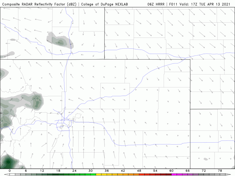
he first wave snowfall has largely tapered off already this morning across the Front Range. If you’re located along or south of Interstate 70, you’re probably thinking “what wave of snowfall?” Yes, the first wave mainly impacted just the northwestern Denver Metro area…specifically near and west of Boulder. The radar animation below shows that the bulk of the snow earlier this morning was indeed in Boulder County, with generally just flurries or nothing at all elsewhere.
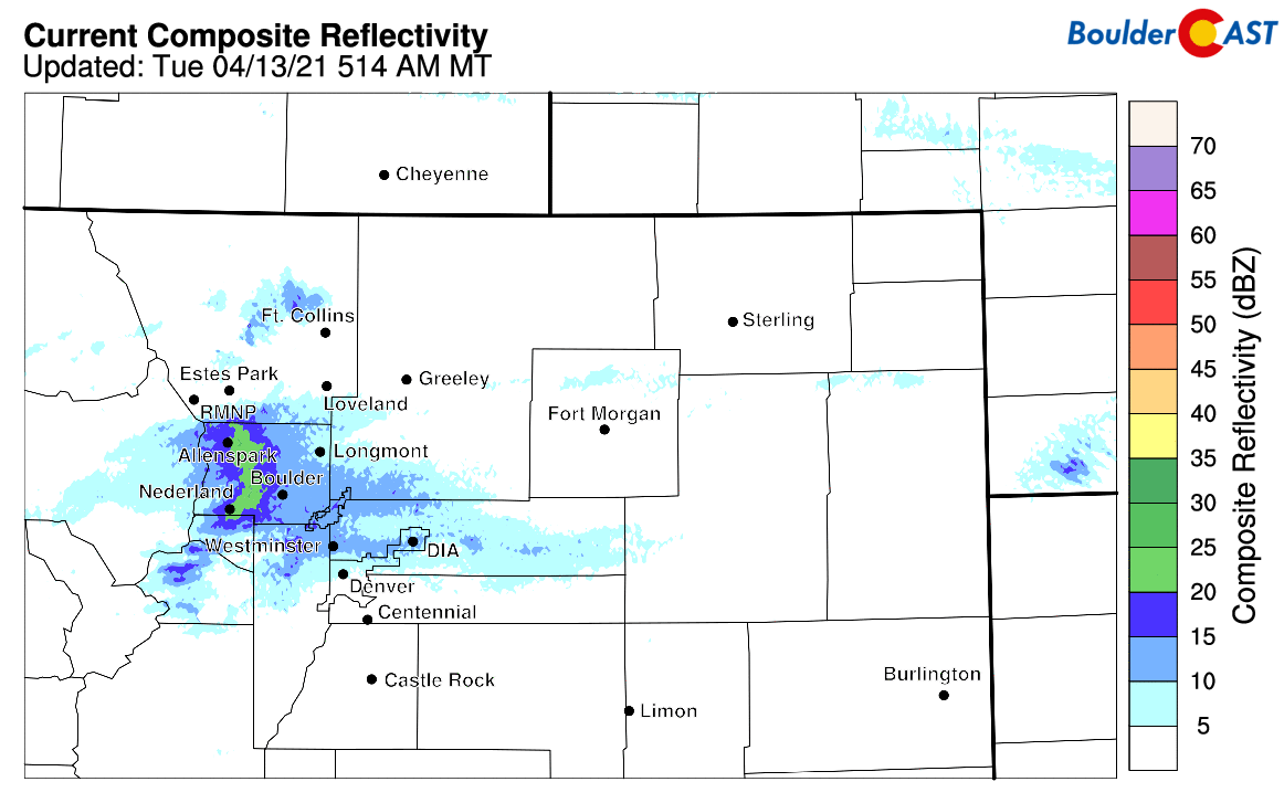
Radar animation from early Tuesday morning showing the snow primarily focused in Boulder County
A light dusting of accumulation stuck to the grassy surfaces here in Boulder, while areas higher in elevation to the west saw some slightly slick and snow-covered roadways.
A look at the conditions in the #Boulder area this morning. Just wet in town, but some snow-covered roadways above 8000 feet.
More regional webcams: https://t.co/L0VLejKuY3#COwx #Boulderwx #Snow pic.twitter.com/jlSwAutgbe
— BoulderCAST Weather (@BoulderCAST) April 13, 2021
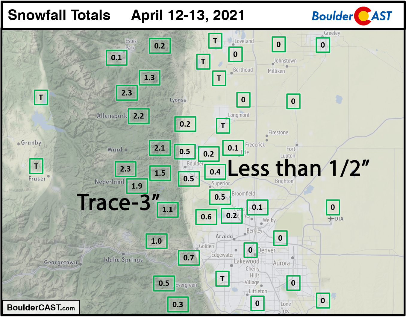
Shown below is our snowfall forecast map for the first wave of snow issued Monday morning with actual snowfall totals overlaid in boxes. Green boxes indicate that our forecast verified to within one inch of the observed snowfall. As you can see, very meager snowfall was reported across the lower elevations, with just around a half inch observed from Rocky Flatts northward through the city of Boulder. However, 1-3″ fell in the Foothills just to the west where light snow persisted most of Tuesday morning.
The first round of snow has mostly tapered off through the morning with mostly cloudy, cool and gloomy conditions going to hold on for the rest of the day. Highs on Tuesday will be in the 40’s across the lower elevations and around 30 degrees in the Foothills.
Don’t get too excited….the chances for snow this week are far from over. The closed low pressure system, that which we highlighted as a spoiler for our weather this entire week, is still located far to the west in Oregon. Over the next several days, this cut-off low pressure will slowly sag south and east, pushing eastward across Colorado on Friday or Saturday. Until that passage happens, we’ll be stuck in a unsettled pattern with daily chances for precipitation…truly April (snow) showers!
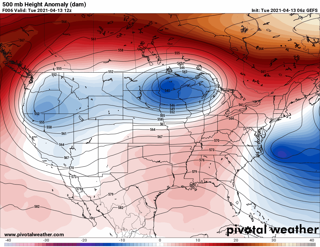
GFS ensemble mean 500mb height forecast animation from today through Friday night showing the slow-moving cut-off low to our west
The second wave of snow this week will quickly redevelop Tuesday afternoon across the Foothills, firing initially due to the solar heating and cold air aloft in the higher terrain. These developing snow showers will spread eastward across the Boulder/Denver area through the late afternoon and evening. There could be some rain at the onset, but temperatures will cool fast enough this evening that most of what falls should be a wet snow.
HRRR model simulated radar animation from Tuesday afternoon into Wednesday morning.
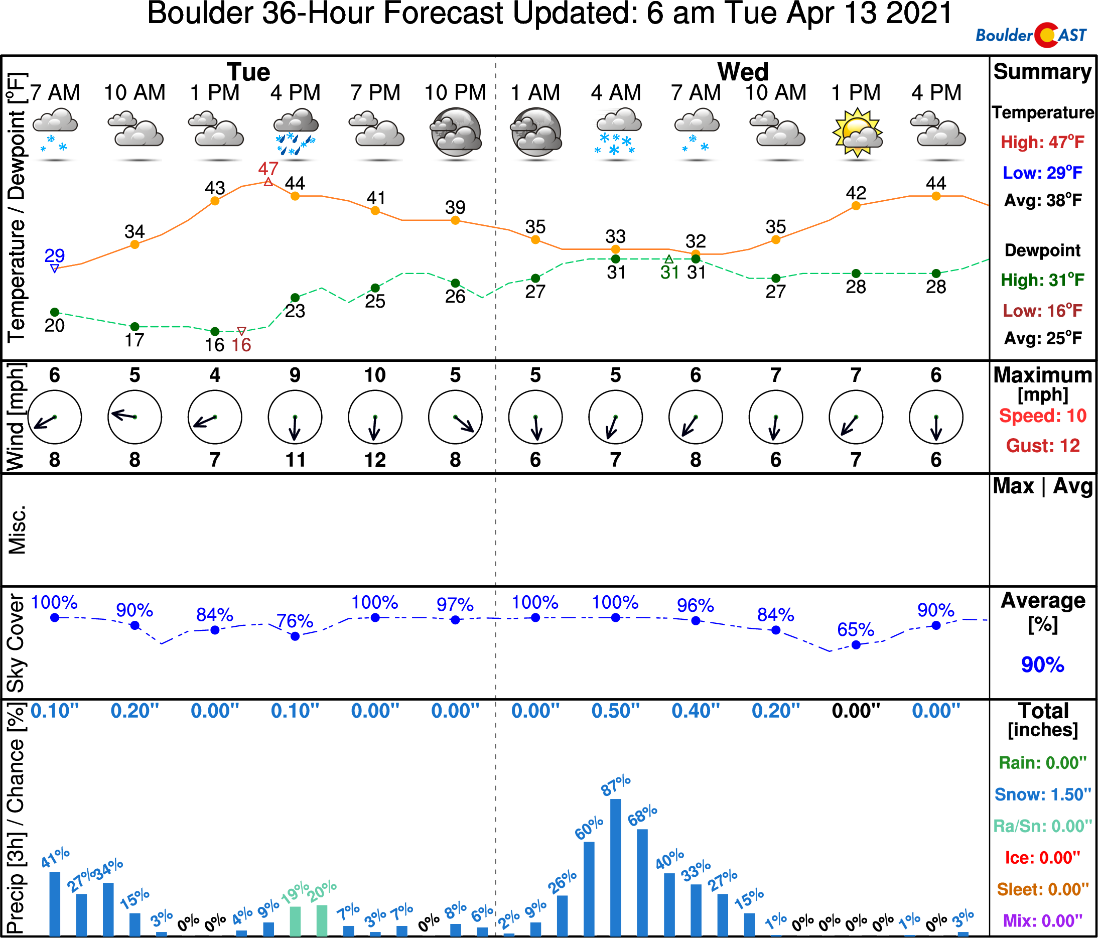
Tuesday night’s snow will again primarily be focused in the Foothills, with anywhere from 3 to 8″ of snow anticipated by Wednesday morning above 6500 feet elevation. Across the western Metro area, we’re expecting 1 to 3″, with less than 1″ for areas further east. Most, if not all, the accumulation will be on grassy and elevated surfaces on the Plains. Our snowfall forecast map is shown below covering snow falling through Wednesday around mid-day.
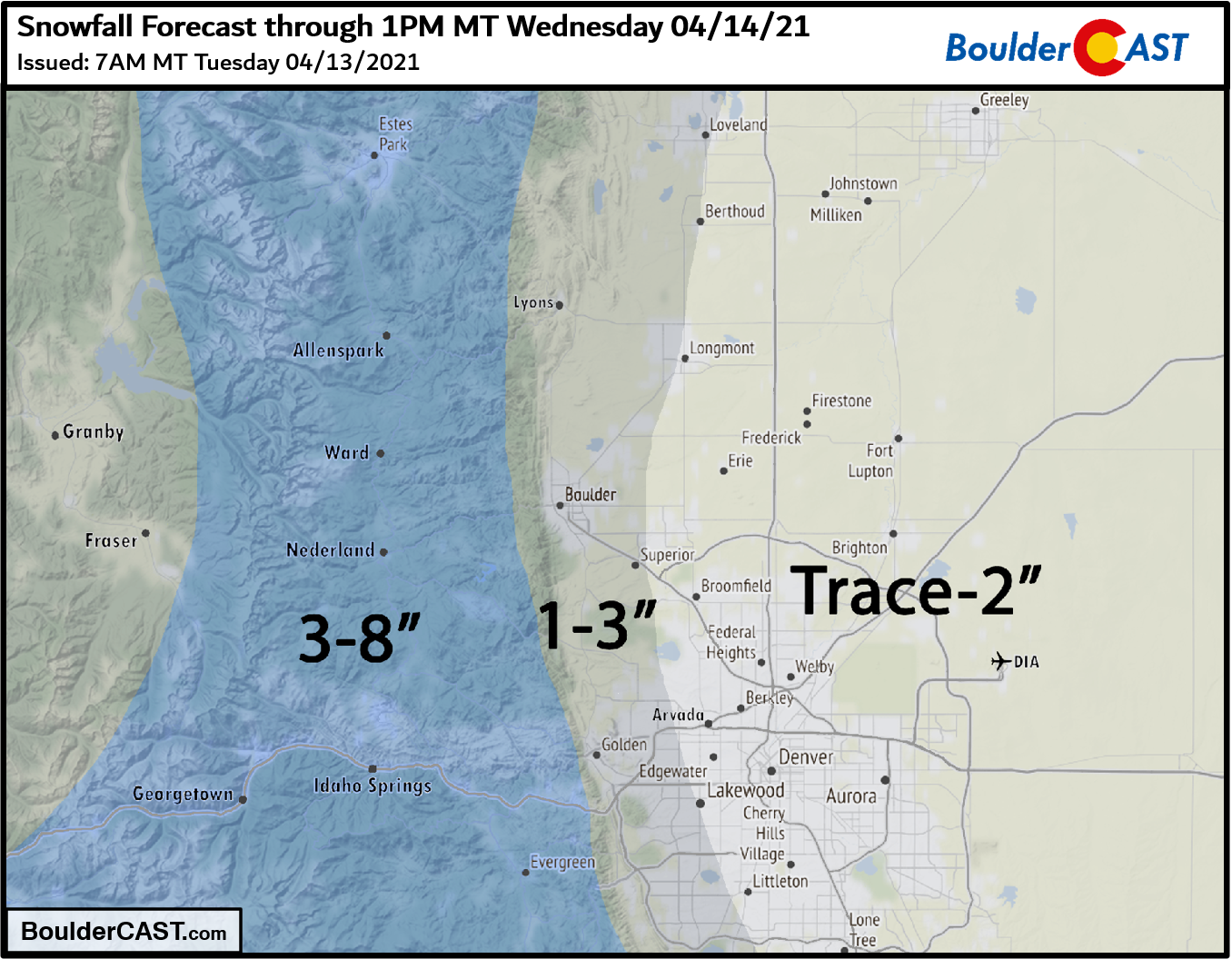
With the threat of several inches of spring snow in the Foothills, the National Weather Service has posted Winter Weather Advisories which includes the Front Range Mountains and Foothills of Boulder and Larimer Counties (but not Jefferson County).
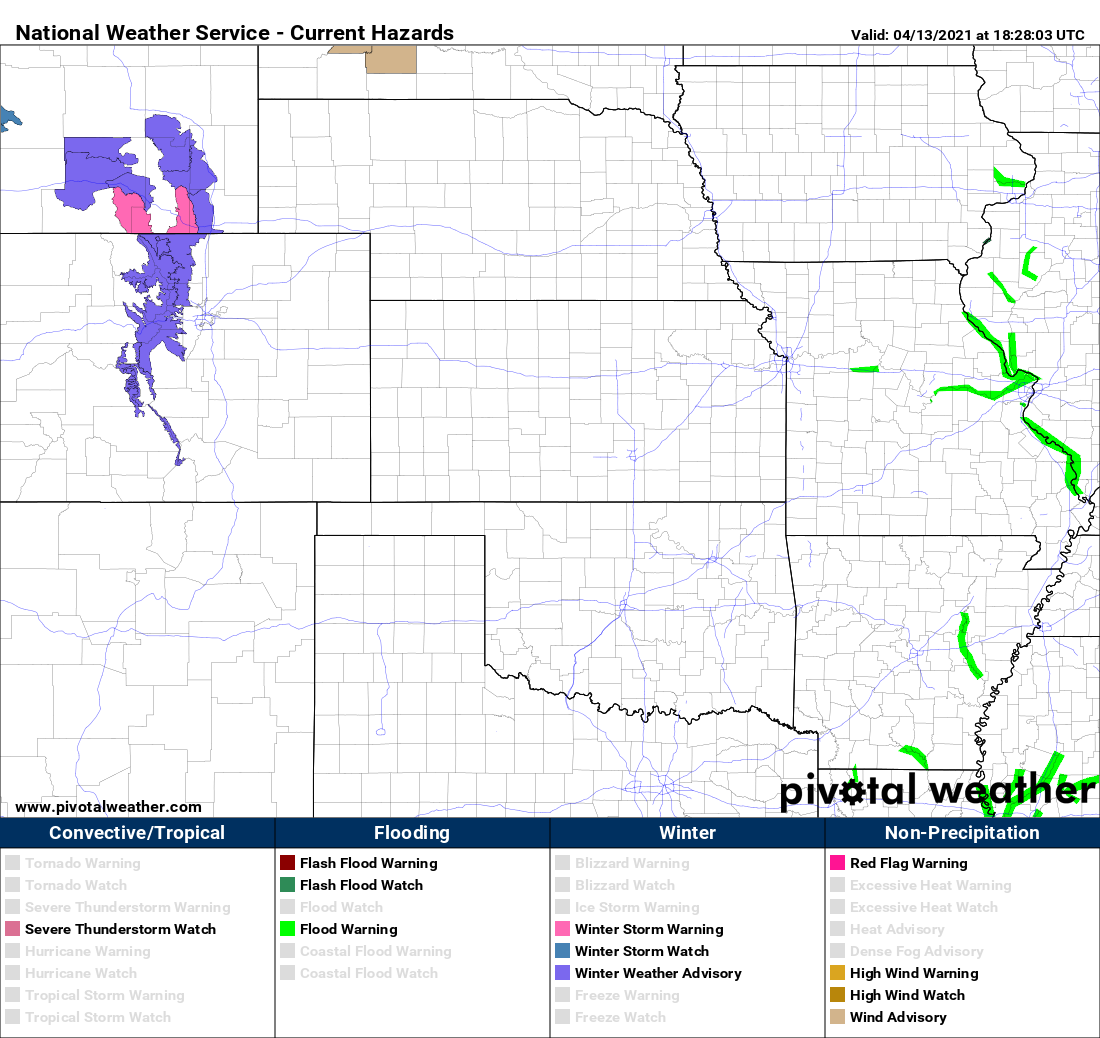
Current weather highlights posted as of Tuesday afternoon
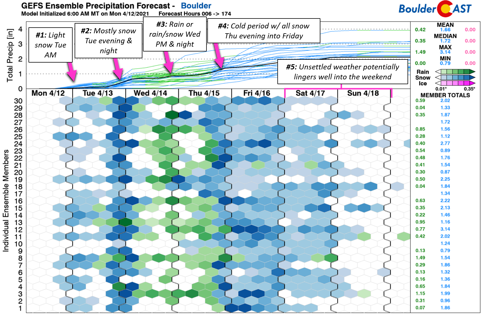
With that aforementioned pesky trough lingering to our west, unsettled weather will continue the rest of the week. We’ll have a third chance of precipitation Wednesday afternoon into the nighttime, though it should be a little warmer then with most of that failing in the form of rain for the lower elevations. The fourth and likely main event for the week still appears to be slated for Thursday evening into Friday afternoon when colder air and more favorable upslope will overlap for us. There’s still quite a bit of uncertainty in this feature as of now, but both the GFS and European models are indicating a 3 to 7″ type of snow event for Boulder and Denver. That’s all for now. Let’s get through Snow Event #2 before we start talking too much about #3, 4, and 5….
Stay up to date with Colorado weather and get notified of our latest forecasts and storm updates:
We respect your privacy. You can unsubscribe at any time.
Help support our team of Front Range weather bloggers by joining BoulderCAST Premium. We talk Boulder and Denver weather every single day. Sign up now to get access to our daily forecast discussions each morning, complete six-day skiing and hiking forecasts powered by machine learning, first-class access to all our Colorado-centric high-resolution weather graphics, bonus storm updates and much more! Or not, we just appreciate your readership!
.
Spread the word, share the BoulderCAST forecast!


You must be logged in to post a comment.