A late-season Arctic cold front ushered in bitter cold temperatures on Monday morning and eventually a dumping of fluffy snow for the entire Front Range Monday evening. We review the snow totals and record cold temperatures. We also give our preliminary snowfall forecast for the next system in the pipeline set to arrive during the day Wednesday.
Updated Wednesday 4/21/21 7:00AM: Amended snowfall forecast map. For more details and additional discussion, check our latest Premium forecast from Wednesday morning HERE.
We discuss Boulder and Denver weather every single day on BoulderCAST Premium. Sign up today to get access to our daily forecast discussions every morning, complete six-day skiing and hiking forecasts powered by machine learning, access to all our Front Range specific weather models, additional storm updates and much more!

At a Glance:
- An Arctic cold front produced widespread bands of heavy snow Monday evening and night across the Front Range
- Snow totals of 2 to 16″ were reported across the area, with the highest amounts in the Foothills
- As skies cleared Tuesday morning before sunrise, record cold temperatures were observed in spots including Boulder
- Sunny but unseasonably cold weather will unfold Tuesday
- Spotty snow showers return Wednesday into Wednesday night, but accumulations will be fairly light
Q
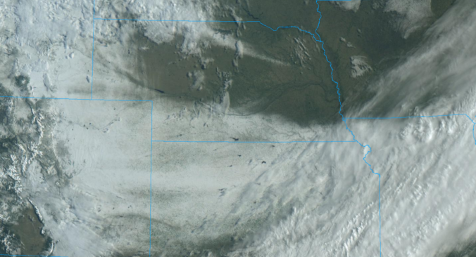
uite the swath of spring snow remains in the wake the Arctic boundary that plowed through eastern Colorado yesterday, which today continues its trek across the nation. Not a single location east of the Continental Divide in Colorado was spared from the snow on Monday, as visible from GOES satellite imagery this morning.
GOES-East visible satellite animation from Tuesday morning as the sun rose (4/20/21)
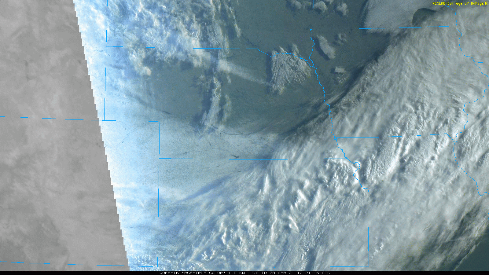
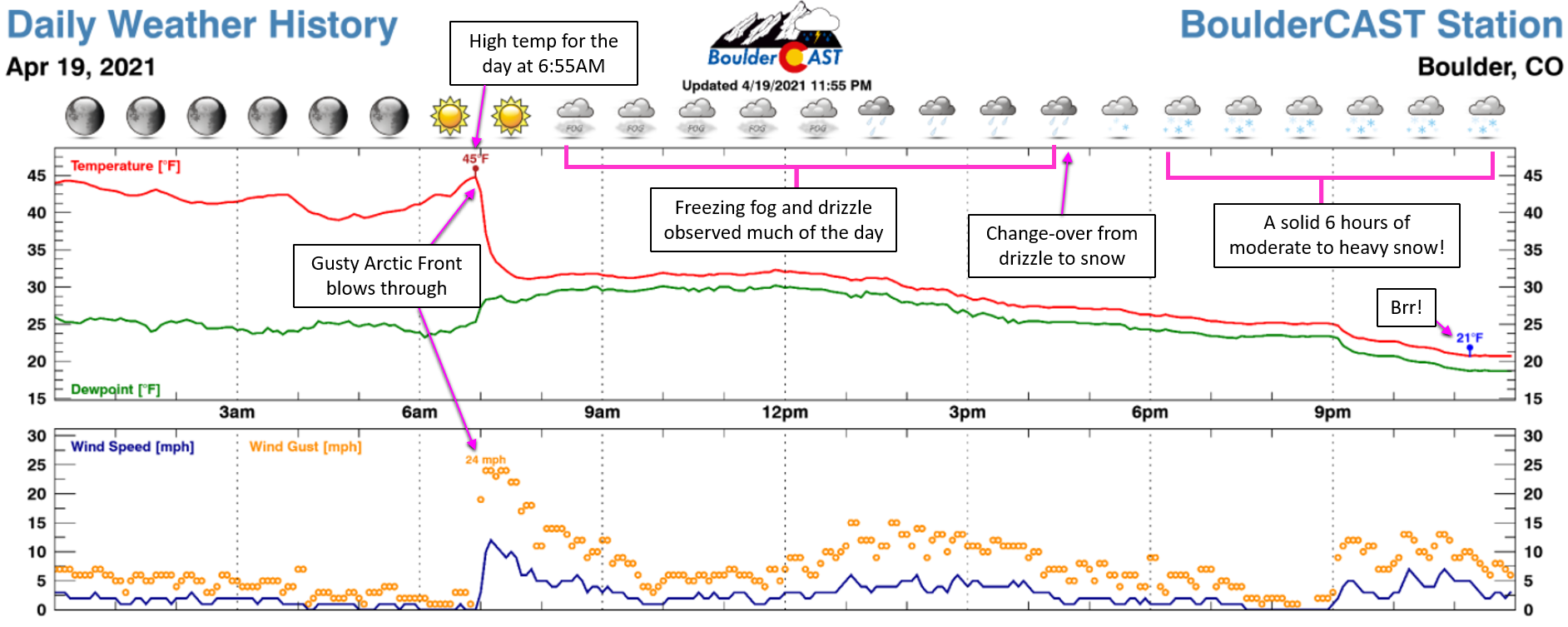
It was very much a wintery spring day on Monday. The Arctic front blasted southward through the Denver Metro area just after sunrise Monday morning with low clouds, fog and drizzle unfolding thereafter. It was like scene out of the Twilight Zone with extremely reduced visibility at times!
GOES-East visible satellite imagery from Monday morning as the Arctic airmass and trailing stratus deck pushed southward
A full change-over to snow occurred during the afternoon for the northern Front Range and around 4PM Monday in Boulder specifically. The advertised heavy snow held off just long enough in most cases to save the evening commute for the bulk of the Denver area.
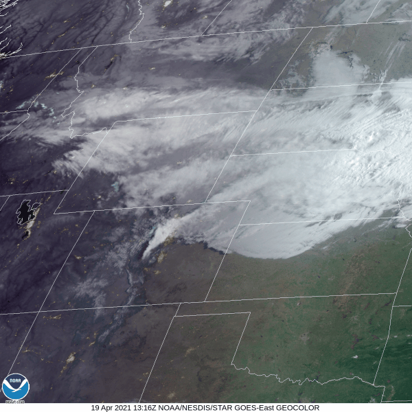
However, there was a solid six-hour near-continuous window of moderate to heavy snow in Boulder. Amazingly, about 9″ of snow piled up in just six hours. That’s an average snowfall rate of ~1.5″ per hour for a long period. There was definitely some waxing and waning of snow intensity during this timeframe, with some bursts producing 2 to 3″ per hour snowfall rates at times. The radar animation below is from around 8PM Monday evening, a moment when heavy snow was falling just about everywhere from Boulder to Colorado Springs.
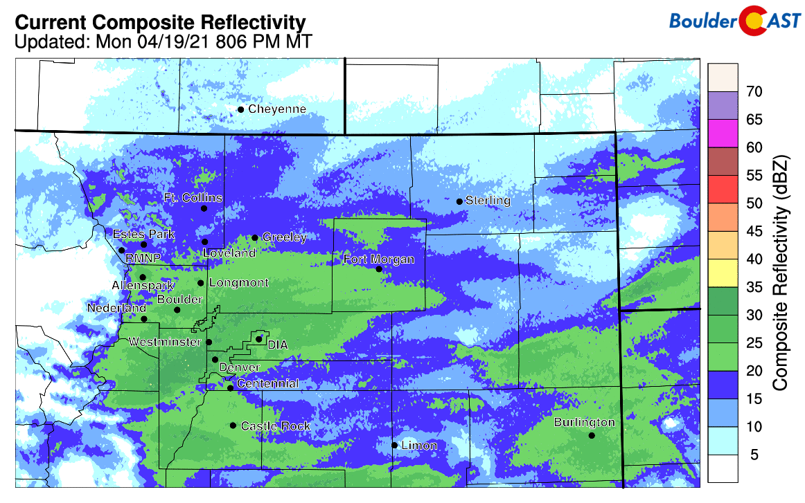
Radar animation from Monday evening with widespread heavy snow falling (4/19/21)
As quickly as the snow arrived, it departed Monday night around midnight with skies clearing by Monday morning. It’s not very common that we get to wake up to a beautiful snowy view of the Flatirons right at sunrise following a big winter storm. Usually the low clouds and upslope hang on a little longer. This was not the case with this system, as you can see below…
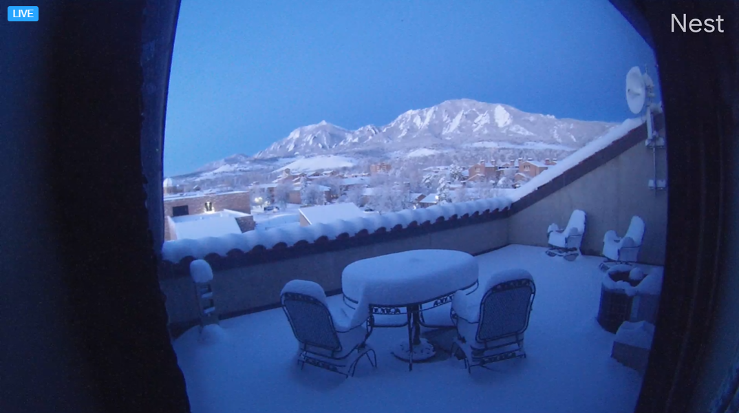
The view from CU Boulder around sunrise Tuesday (4/20/21)
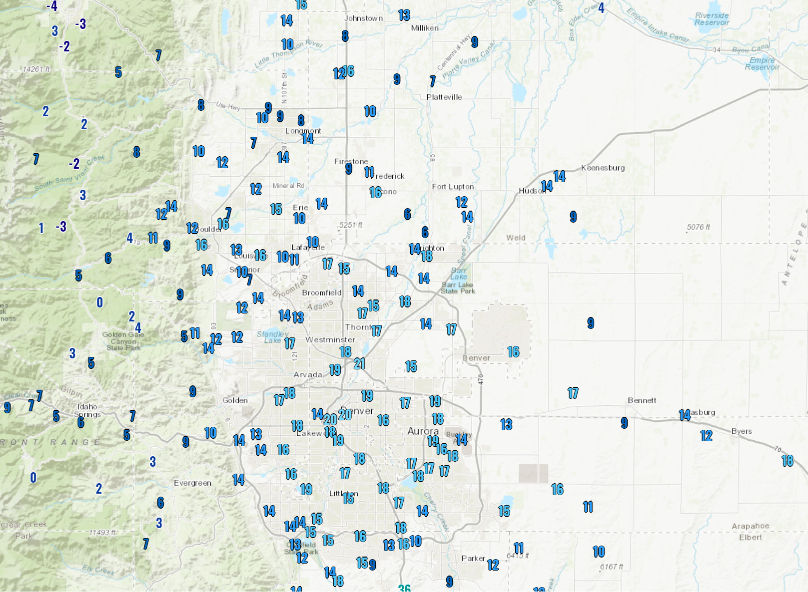
By the time the snow wrapped up late Monday night, anywhere from 2 to 16″ of snow had fallen across the entire Front Range. The heaviest amounts occurred in the higher terrain of western Boulder County. Our snowfall forecast map for the event is shown below with storm totals overlaid in boxes. Green boxes indicate our forecast verified to within 1″. Red did not.
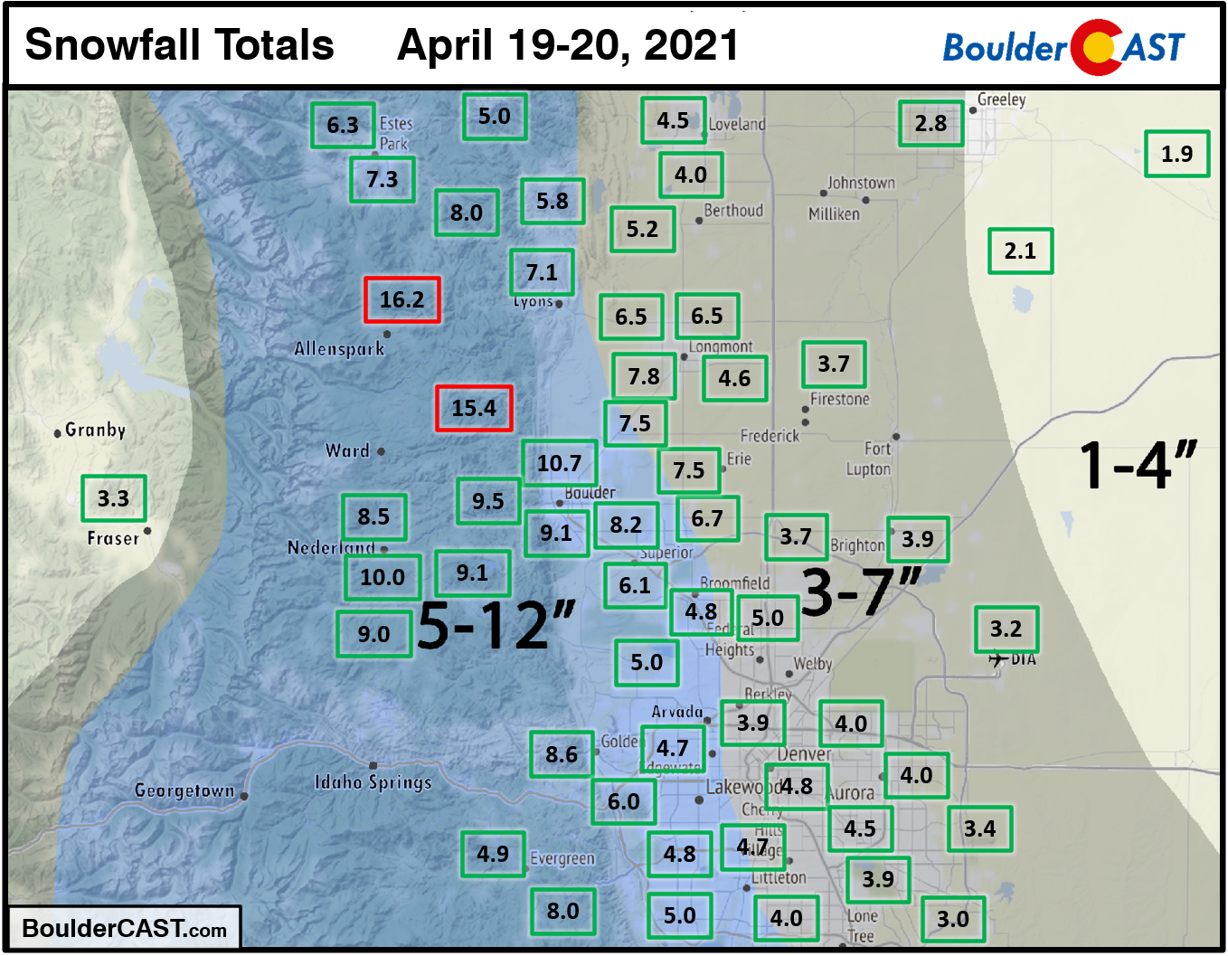
Boulder officially reported 9.1″ of snow from this event, more or less smack in the middle of our forecast range. Denver officially notched 3.2″ at DIA, but totals were closer to 5″ near downtown. Overall, we had good forecast verification across the entire Front Range, with the exception being the being the hardest hit locations of western Boulder County that picked up a few extra inches. A quick check of these observations there indicate snow to liquid ratios were close to 18:1 (16″ of snow containing 0.9″ of liquid). We were not expecting ratios that high in the Foothills, mainly because it was so cold up there as the heavy snow fell Monday evening. Typically we’ll see snow ratios tank when temperatures get that cold, but that obviously wasn’t the case last night!
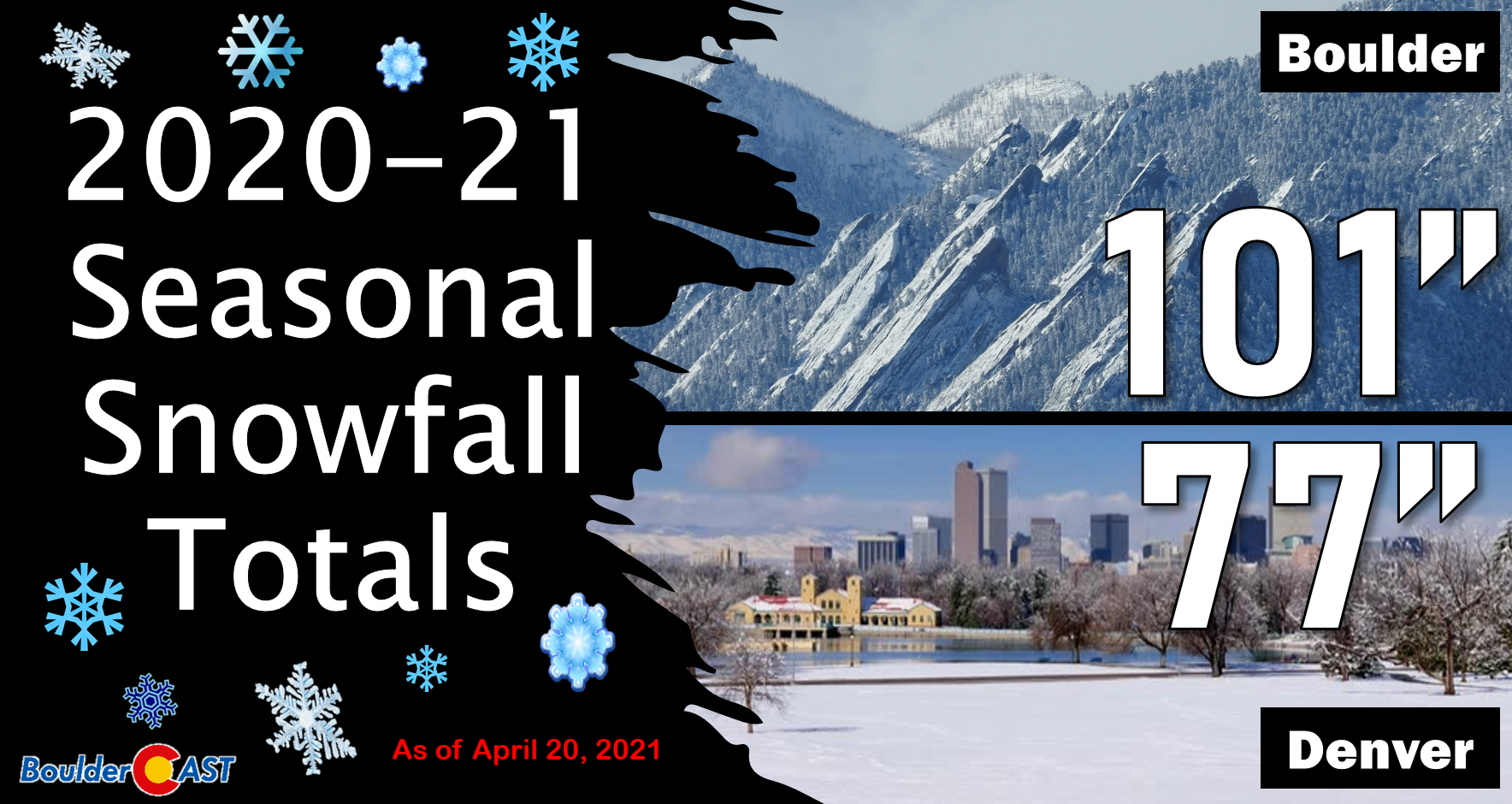
This winter storm brings Boulder’s seasonal snowfall total to 101″, with 77″ now for the season in Denver…both of which are well above normal. Interestingly, this is now Boulder’s second consecutive 100″ snow season, only the 5th time that’s happened since the late 1800’s.
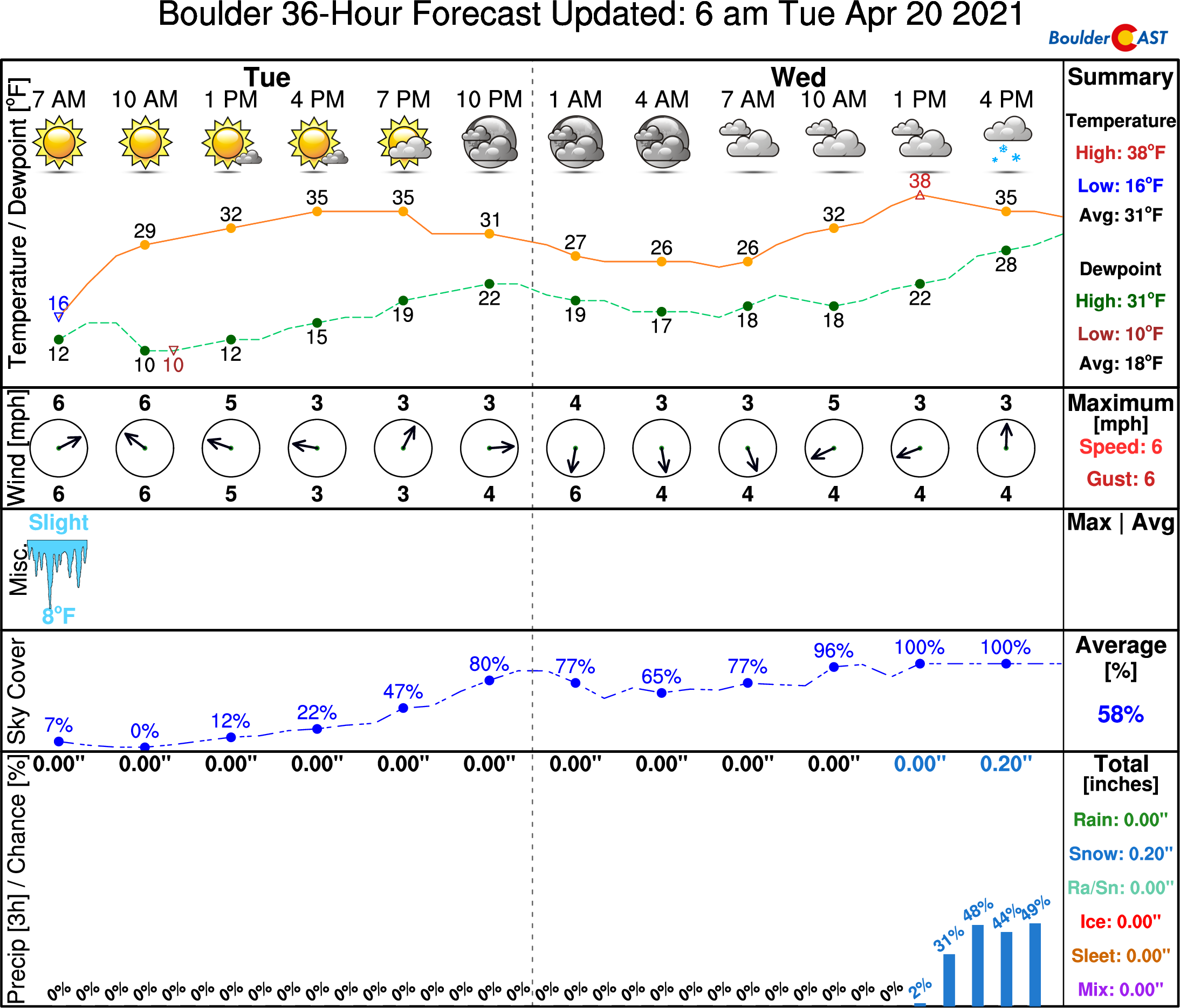
With skies quickly clearing as the snow ended Monday night, temperatures plummeted into the teens and single digits across the lower elevations by sunrise Tuesday, with near or even below zero readings in the Foothills! Boulder set a new record low for April 20th at 10°F, making this the latest ever occurrence of such a temperature on record. The prior record for the data was 15°F set back in 1966. As you can see from the graphic below, observed low temperatures were quite variable as the bitter cold Arctic air sloshed and pooled here and there. Even just in Boulder, temperatures were highly variable. For example, CU Boulder (14°), NCAR Foothills Lab (16°), BoulderCAST Station (17°), and Boulder Airport (16°) were all warmer than the official observed low temperature by several degrees. The morning minimum at DIA was 16°F which was several degrees shy of Denver’s existing record.
Morning low temperatures from Tuesday 4/20/21
Looking ahead to just a little snow!
With the Arctic front already surging south and east away from our area, sunshine will be the story on Tuesday with just a few afternoon/evening clouds expected. Don’t be fooled by the allure of sunshine though! Eastern Colorado will remain entrenched within the Arctic airmass today with highs expected to only reach the middle to upper 30’s across the lower elevations.
Our next storm system will arrive during the day Wednesday from the west-southwest. It’s much weaker overall compared to last night, but it will be able to tap into the colder air that’s already situated across our area to produce light snow during the day Wednesday into Wednesday night. The incoming storm will mainly be forced by middle and upper atmospheric dynamics, consisting of weak large-scale lift from the trough (below – top left) and also pockets of more intense lift associated with the right-entrance region of the overhead jet (below – top right).
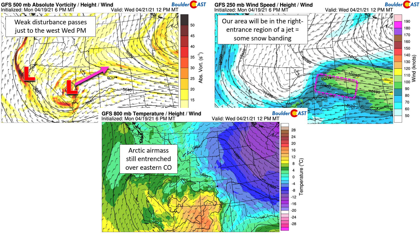
The storm will be lacking support at the surface in the form of upslope or a true cold front, so this event won’t be anything major for us. The upper-level forcing should produce spotty snow showers, some of which may actually be heavier bands given the jet streak in-play. However, anything that does materialize across the lower elevations will be falling into a somewhat dry lower atmosphere that isn’t all that cold during the daytime Wednesday. Remember, there’s no cold front here. It’s just the chilly remnants of a two-day old Arctic airmass which will have moderated. The result will be scattered snow showers much of the day Wednesday into Wednesday night. With temperatures largely above freezing, little accumulation is expected. Higher up in the Foothills, the accumulation potential is greater and it’s possible a few inches could stick by Thursday morning there.
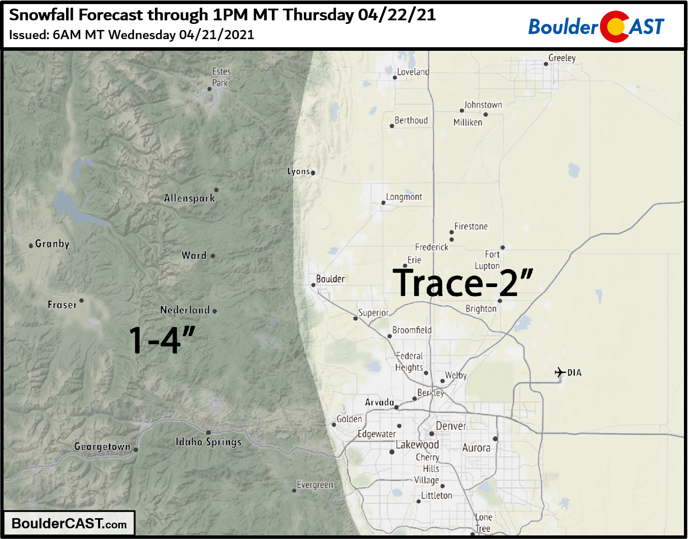
Our snowfall forecast map for the event it shown below. This covers snow falling Wednesday into Thursday morning. Overall, Wednesday’s storm will be more of a nuisance than anything substantial for Boulder or Denver.
Hang in there… warmer weather is on the horizon (finally!). We’ve just got a few more chilly, snowy and rainy days to go!
We discuss Boulder and Denver weather every single day on BoulderCAST Premium. Sign up today to get access to our daily forecast discussions every morning, complete six-day skiing and hiking forecasts powered by machine learning, access to all our Front Range specific weather models, additional storm updates and much more!
.
Spread the word, share Colorado’s crazy weather:


You must be logged in to post a comment.