
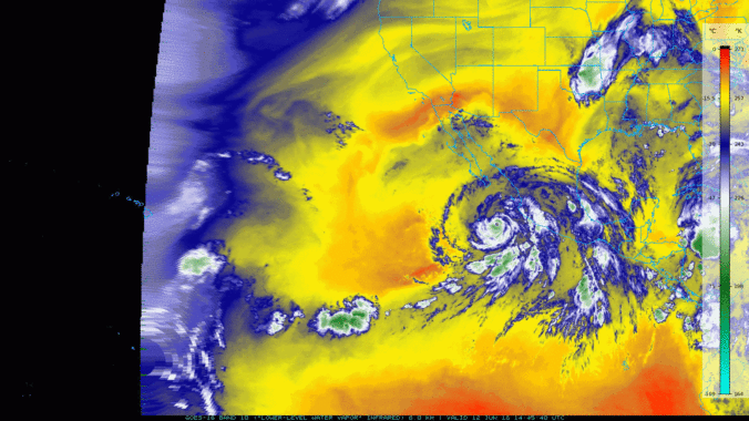
A recap of yesterday’s hailstorms, a discussion of today’s forecast which contains more hail, and a look at the eye of Category 4 Hurricane Bud from GOES-16.
Category: Weather in the News (Page 9 of 16)
These posts cover interesting weather phenomena from around the world, and won’t be specific to Boulder County. However, Earth is very diverse in the world of weather, so you will surely learn a thing or two.
Today was the 17th consecutive day of above average temperatures and dry conditions in Boulder and Denver. It’s about time for a change…don’t you think? Several atmospheric ingredients will be coming together over the next several days to bring cloud cover, much cooler temperatures, and the potential for significant rainfall to the state of Colorado. The atmospheric moisture content statewide will be close to all-time record levels for the month of June. With so much moisture involved, some areas could see heavy rainfall capable of producing flash flooding. Read on for details.
A brief reprieve from the heat will begin our week thanks to a cold frontal passage. Unfortunately, it won’t last long with temperatures quickly returning back into the 90’s. We also discuss a potential wet upcoming weekend dependent upon how the remnants of Hurricane Bud evolve over the coming days. Read on for more details.
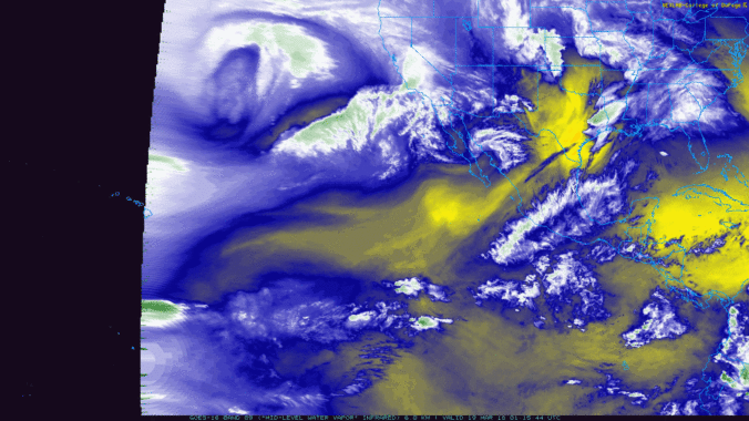
Several favorable atmospheric components aligned to produce very strong winds across the Metro area Tuesday afternoon and evening. We look at the peak wind gusts and also check out the view from the space borne GOES-16 weather satellite.
Even with thick high-level clouds overhead, yesterday saw “Fair” weather conditions reported across the Metro area, but what does this actually mean? As it turns out, “Fair” weather can signify a lot of things, with one critical caveat.
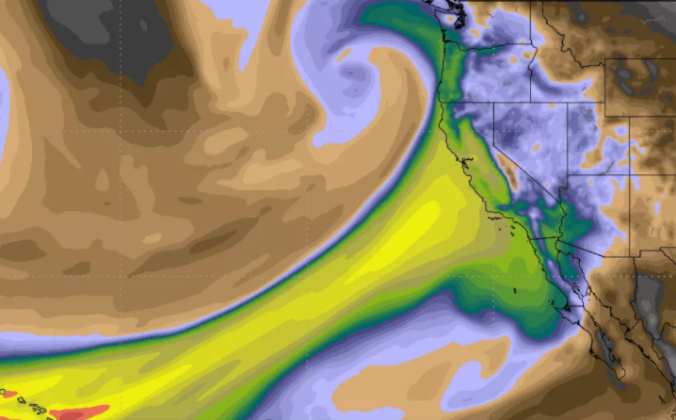
The Pineapple Express was back at it again this past weekend. Another round of soaking rain struck California, with all that tropical moisture translating into heavy mountain snow across northern Colorado.
As we mentioned in our weekly outlook, a true atmospheric river event is underway, pumping deep tropical moisture into the southwestern United States right now! The moisture influx will mainly be impacting California and Nevada, but Colorado won’t escape totally unscathed. Plus we take a look ahead to a soggy/snowy forecast for early next week.

The GOES-16 weather satellite launched on November 19, 2016 and began collecting revolutionary data with a higher temporal, spatial, and spectral resolution than ever before. From the raging wildfires in Montana, to a close-up on the eye of Hurricane Maria, GOES-16 has captured truly awe-inspiring results in 2017. What do you think?

Live View of Boulder

Current Conditions

Live Radar

Recent Premium Posts

BoulderCAST Daily – Wed 11/05/25 | Relatively cooler today, but far from cool by November standards
🌡️ Cooler but still mild today: A weak cold front has pushed south, …
BoulderCAST Daily – Tue 11/04/25 | Soaring into the 70s today, but a tad cooler tomorrow behind another dry cold front
🌡️ Morning temperature split: Thanks to weak downslope winds, some areas are waking …
This Week in Colorado Weather: November 3, 2025
Sunday’s record-breaking November heat will give way to a dramatic cooldown on Monday, …
3-Day Forecast

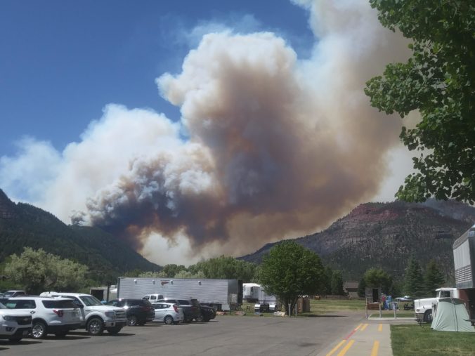
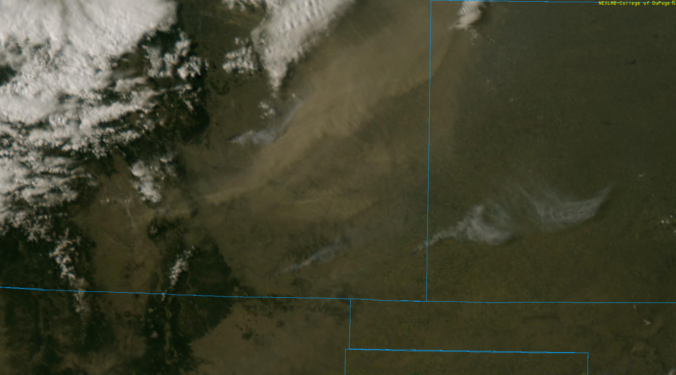
LATEST SMOKE FORECAST

Trending Content


© 2025 Front Range Weather, LLC