As we mentioned in our weekly outlook, a true atmospheric river event is underway, pumping deep tropical moisture into the southwestern United States right now! The moisture influx will mainly be impacting California and Nevada, but Colorado won’t escape totally unscathed. Plus we take a look ahead to a soggy/snowy forecast for early next week.
Let the river flow!
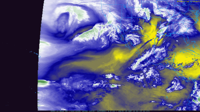
The river is clearly visible on the precipitable water (PW) anomaly map below. Locations in southern California are reporting record PW in the atmosphere this morning, near 1.50 inches. To put this into (an arguably unrelated) perspective, PW during the height of the September 2013 flood in Colorado was only about 1.4 inches in Boulder.
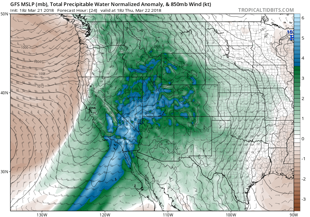
GFS precipitable water anomaly map for this afternoon showing an atmospheric river flowing into Southern California.
This set-up is bringing an absolute deluge of precipitation to California beginning yesterday and continuing through the day today. Here is a look at the current radar across southern California.
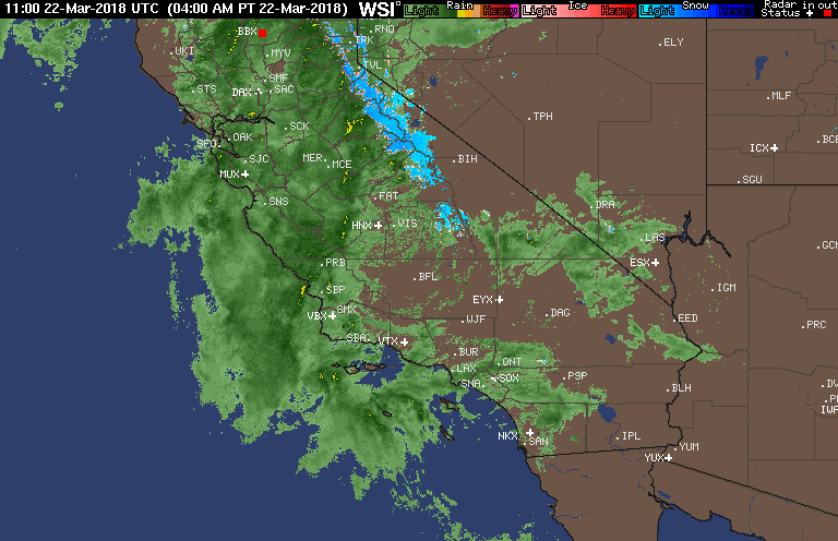
Radar as of 7:00 AM Thursday across southern California.
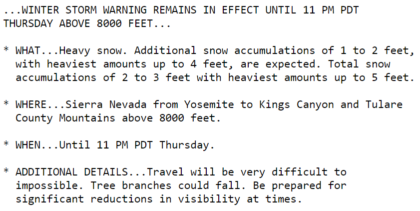
Widespread flooding is anticipated across the lower elevations with 2 to 10″ of rain projected to fall. Atmospheric river events are notorious for causing mudslides in California. It really is a dangerous situation, especially for folks in the burn scars of any semi-recent wildfires. This storm is even bigger and more intense than the one that impacted the state in early January, killing 21 people.
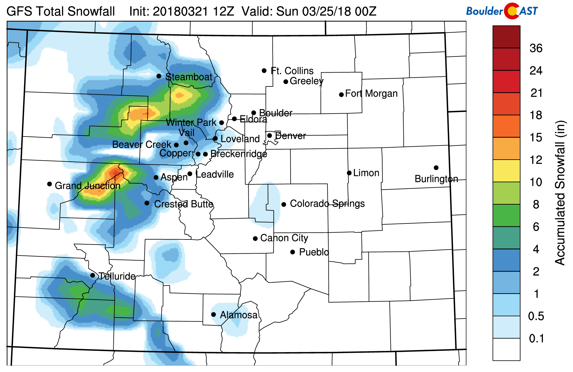
In the higher elevations, 2 to 5 feet of snow is expected throughout the Sierras.
GFS model snowfall forecast showing the heavy snow expected across the Sierras.
We don’t know about you, but these snowstorms in the Sierras always make us jealous…
Source: NWS-Los Angeles
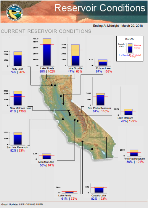
The moisture influx into California is not a recent development. A favorable pattern shift in late February has been hammering the state for nearly four weeks now. The media has scandalously started calling it the “March Miracle”, California’s savior from a drought and wildfire-ridden summer. Guess what? Water reservoirs are mostly sitting above normal (see below) and many ski resorts in the state are touting snow base depths of more than 120″ (10 feet). Still, snowpack in the Sierras sits at about 65% of normal right now. Contrary to most media coverage of weather in California you’ve probably heard, they don’t absolutely NEED this precipitation. It may end up hurting more than it helps (mudslides and explosive vegetation growth to fuel wildfires down the road).
Things will quiet down across southern California by early Friday morning.
How does Colorado fare in this?
For our region, all that moisture will mainly feed into a bit of cloud cover overhead today. Despite this, temperatures are likely to reach into the lower 70’s this afternoon across the Metro area. Obviously the moisture will not translate into the same magnitude of snow for our Mountains. Still…we are expecting many areas to pick up 3 to 8″ later tonight through the day Friday. This will mainly be for western Colorado. Closer to Boulder/Denver, the Front Range peaks are only looking at 1 to 2″ at most.
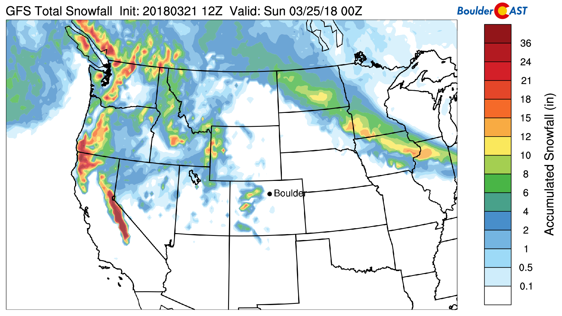
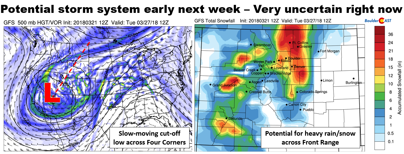
On a continued snowy note, we are watching the potential for a significant weather system to impact our state early next week as a large Pacific trough comes ashore. There is a lot of variation in the models right now, particularly in the ensembles. Everything hinges on how and where the upper-low cuts-off across the Four Corners region. If things align correctly, we may see soggy impacts as a slow-moving system churns to our south and west. If it heads too far south, the forecast will be drier and warmer.
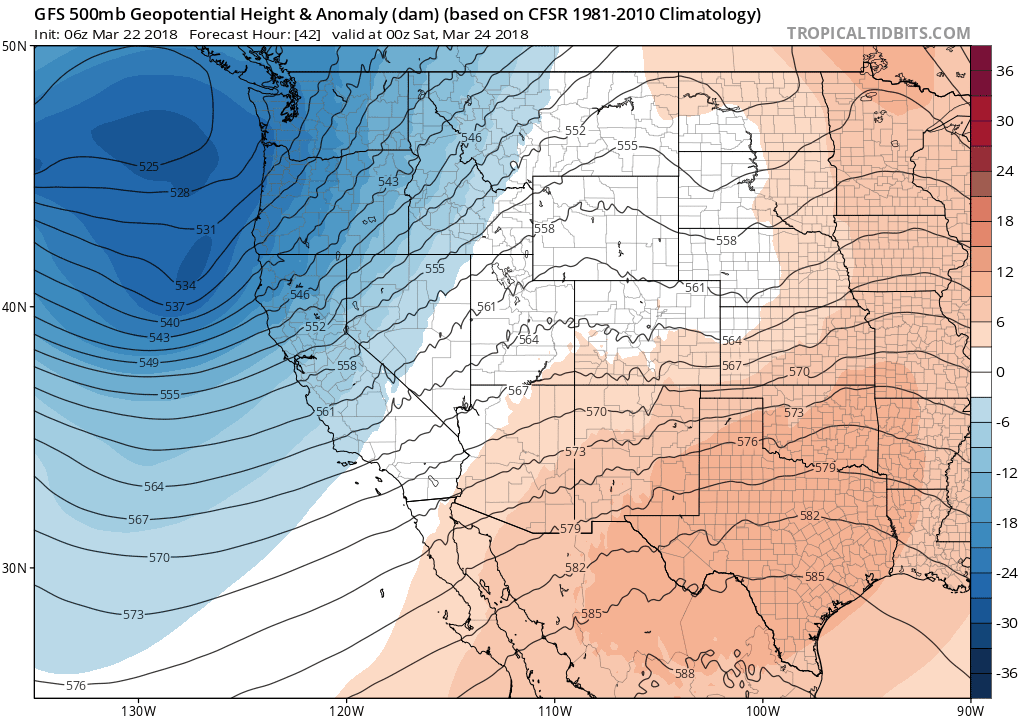
GFS 500 mb height anomaly forecast over the next 7 days.
The last several runs of the GFS pummel the Front Range with heavy wet snow Monday evening into Tuesday night, a very long time. As a result, 1 to 2 feet of snow are modeled for the Plains and Foothills alike. The Euro model isn’t quite as bullish with snow amounts, but it actually has a solution not far off from the realm of the GFS. However, considering we’re closing out the month of March, we’re not as eager as the models to believe this will be cold enough to be a mainly snow event for us just yet.
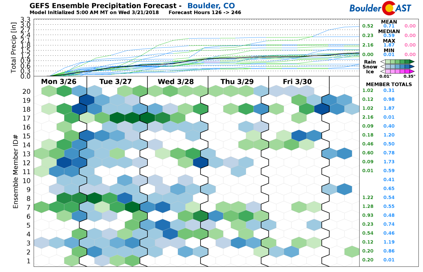
The GFS ensemble precipitation forecast in Boulder for next week is shown below. The only agreement in the members is that there isn’t any agreement! Amounts, type (rain or snow), duration and timing are highly uncertain.
For now, plan for a warm and quiet next several days. Highs through Sunday will be at least 65 degrees or better. Regardless of how the storm evolves early next week, we expect relatively good chances of rain or snow Monday through Wednesday for the Front Range. As always, we’ll continue to monitor things over the weekend for you. Check back for updates or subscribe.
Share this content:
.


You must be logged in to post a comment.