Following yesterday evening’s rain and snow, the week ahead will turn much quieter, including another warming trend with highs pushing back into the 70’s later in the week. We detail the week ahead, as well as the time-frame when our next snowstorm may occur.
Week starts off chilly…
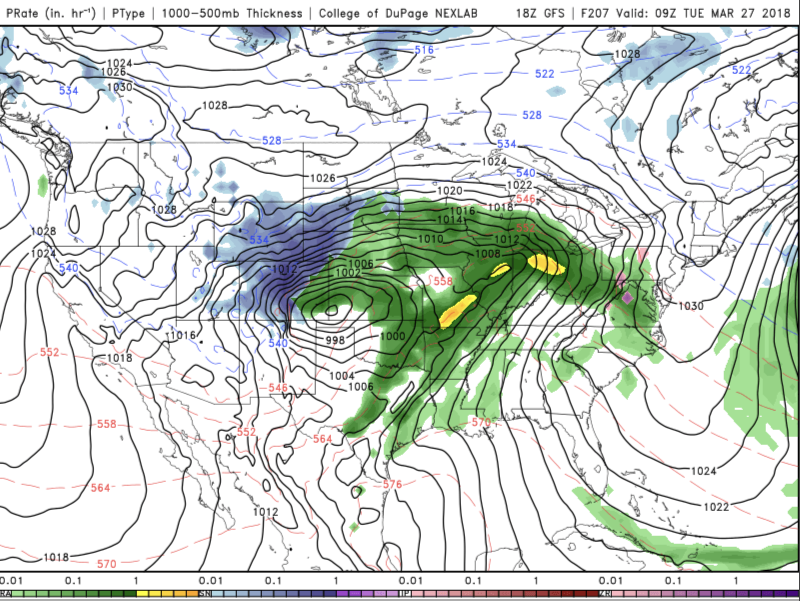
What a reminder of how quickly Front Range Colorado weather can change! Rain turned to snow yesterday evening with portions of the area picking up to 5″ of wet snow. Some ski resorts, like Winter Park, saw nearly 12″ of snow. The system responsible has pushed off to our east into Missouri today (see below image). In its wake, cloudy skies will give way to sunshine this afternoon as we remain under a cool airmass and northerly winds. Temperatures will tip out in the middle 40’s. And while forecast models are showing some light snow/showers in the afternoon, much of us should remain dry for today. The High Country will likely pick up a few more inches, but generally in the 1-2″ range.
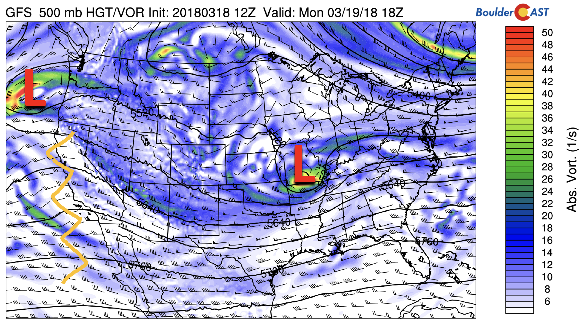
GFS 500 mb absolute vorticity for today
The image above, highlighted in orange, shows a ridge of high pressure out over California today. This ridge is going to make its way eastward through the week, successively warming temperatures through Thursday. On Tuesday, we should get back into the 50’s.
Beautiful from Wednesday onward
Starting Wednesday, we will start to see the full effects of the ridge of high pressure. Below shows that by mid-day Wednesday, it should be parked right over Utah and western Colorado, with an area of low pressure out over the Eastern Pacific. The storm which brought us snow Sunday will bring snow for the Northeast. Although this ridge will produce pleasant temperatures foe our region, the yellow arrow reminds us that the pattern is conducive to high cloudiness from time to time thanks to decent fetch of Pacific moisture over the Desert Southwest. That may hinder highs a few degrees each day – but certainly nothing to worry about.
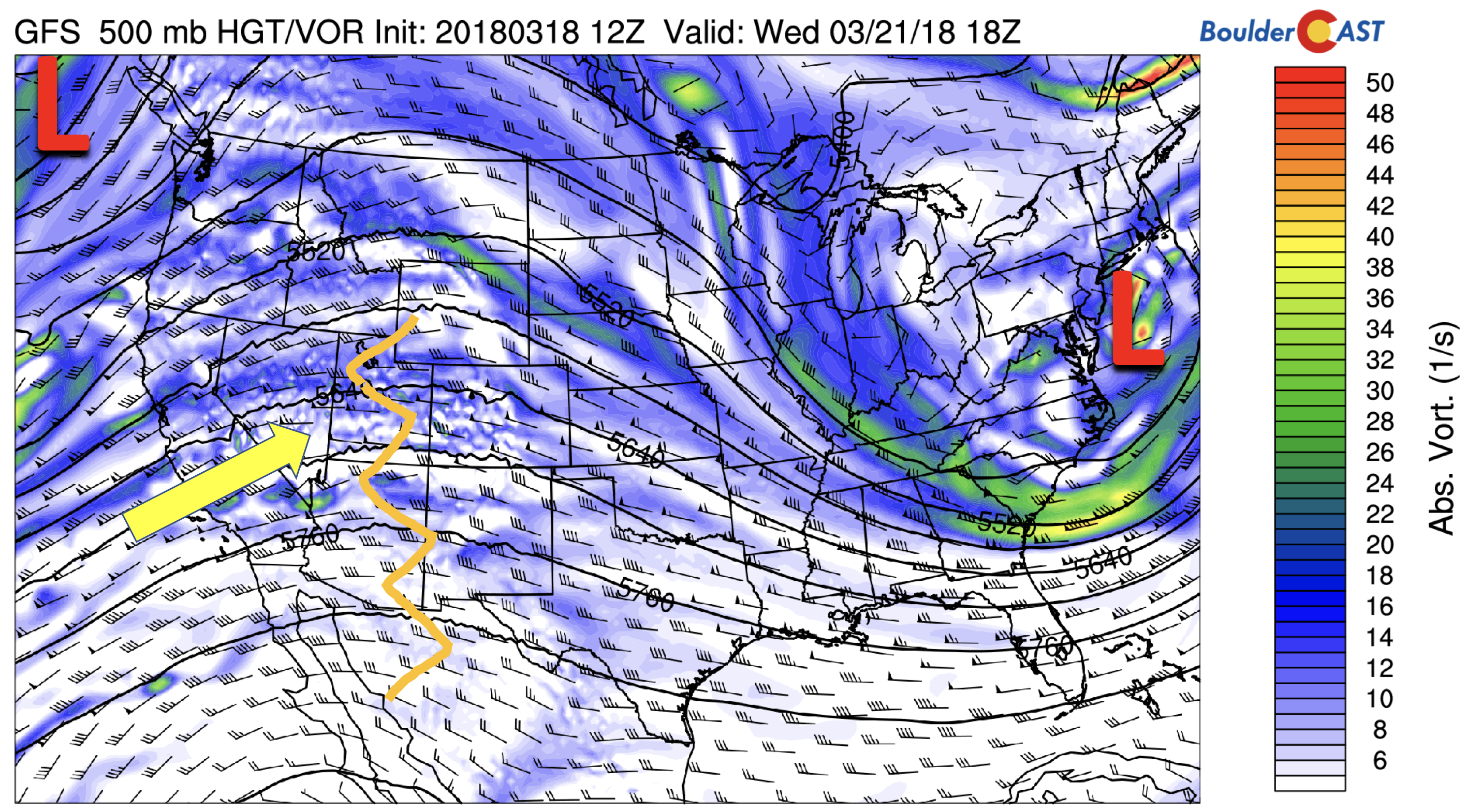
GFS 500 mb absolute vorticity on Wednesday
How warm will we get? The maps below show the warmth progged to reach us Wednesday (left) and Thursday (right). Compared to where we were at on Monday, with low-level airmass temperatures near freezing, the airmass warms to around 10 degC Wednesday, and close to 13 degC Thursday. That should easily get us into the 60’s Wednesday and 70’s on Thursday. Also of note below is an area of low pressure in the Pacific Northwest that moves inland mid-day Thursday. This will be something to watch for Friday…more on that below.
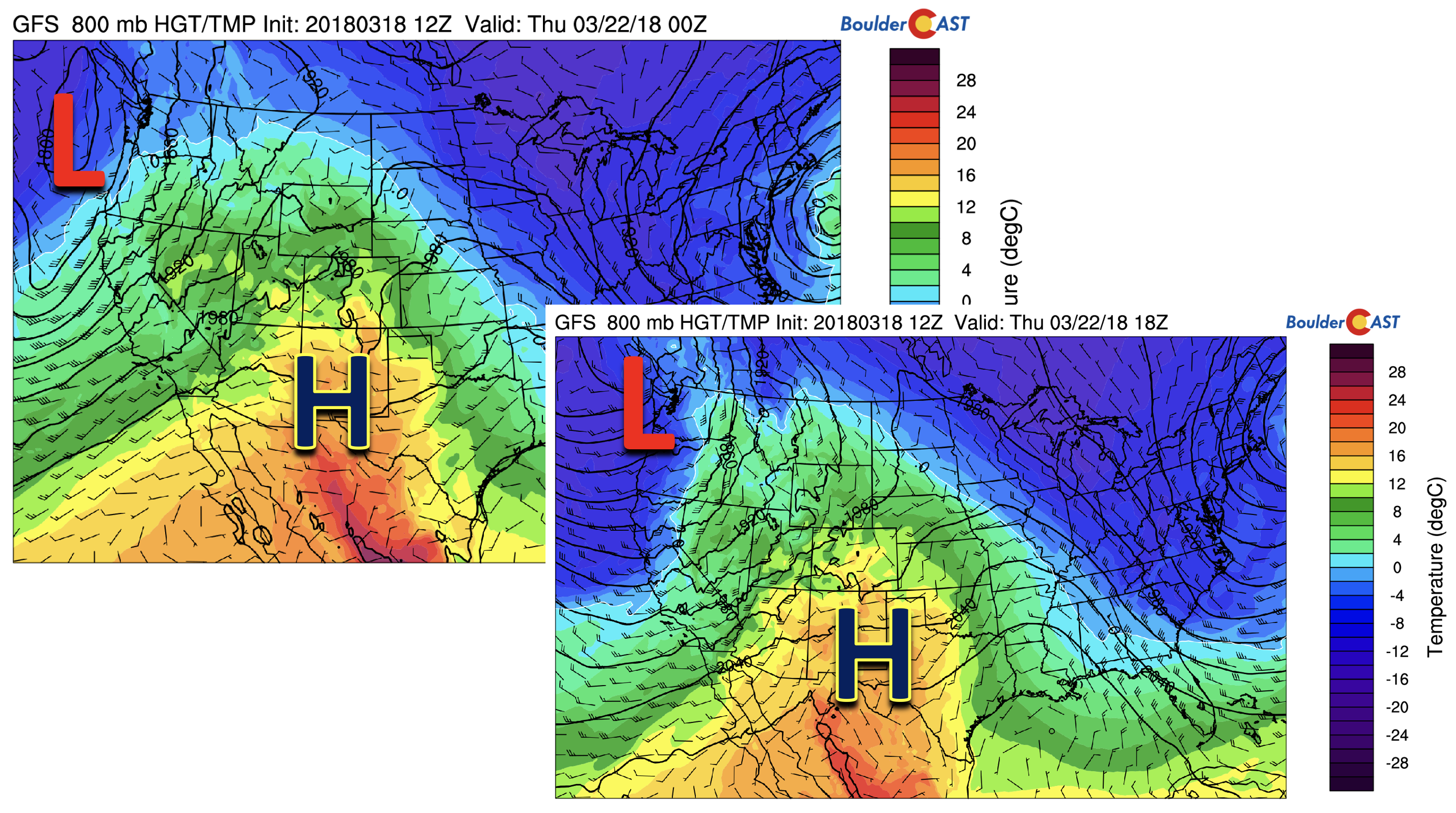
GFS 800 mb temperature and wind for Wednesday (left) and Thursday (right)
Friday ends mild with a chance of wind…
On Friday, the aforementioned storm system in the Pacific Northwest moves into Montana, with a lee trough stretching from Nebraska, through Colorado, and into New Mexico. While the system won’t directly lead to wet weather for the Plains, it will likely make for a gusty afternoon out of the west with temperatures similar to Thursday’s highs.
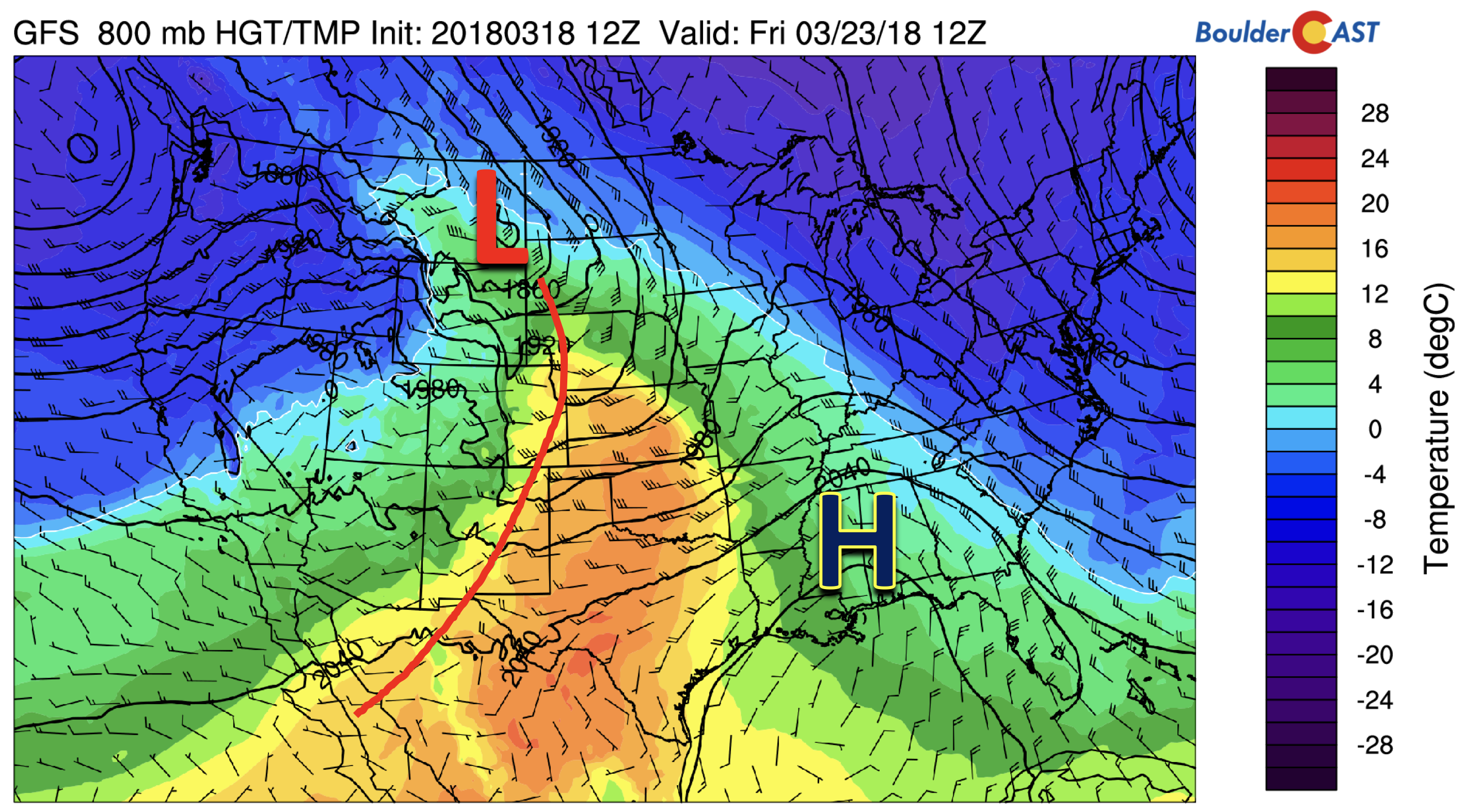
GFS 800 mb temperature on Friday
The same system above on Friday pushes through California mid-day and evening Thursday. A strong “atmospheric river” event, so-named due to its tap of subtropical moisture, will create more wet and snowy weather across the West Thursday.
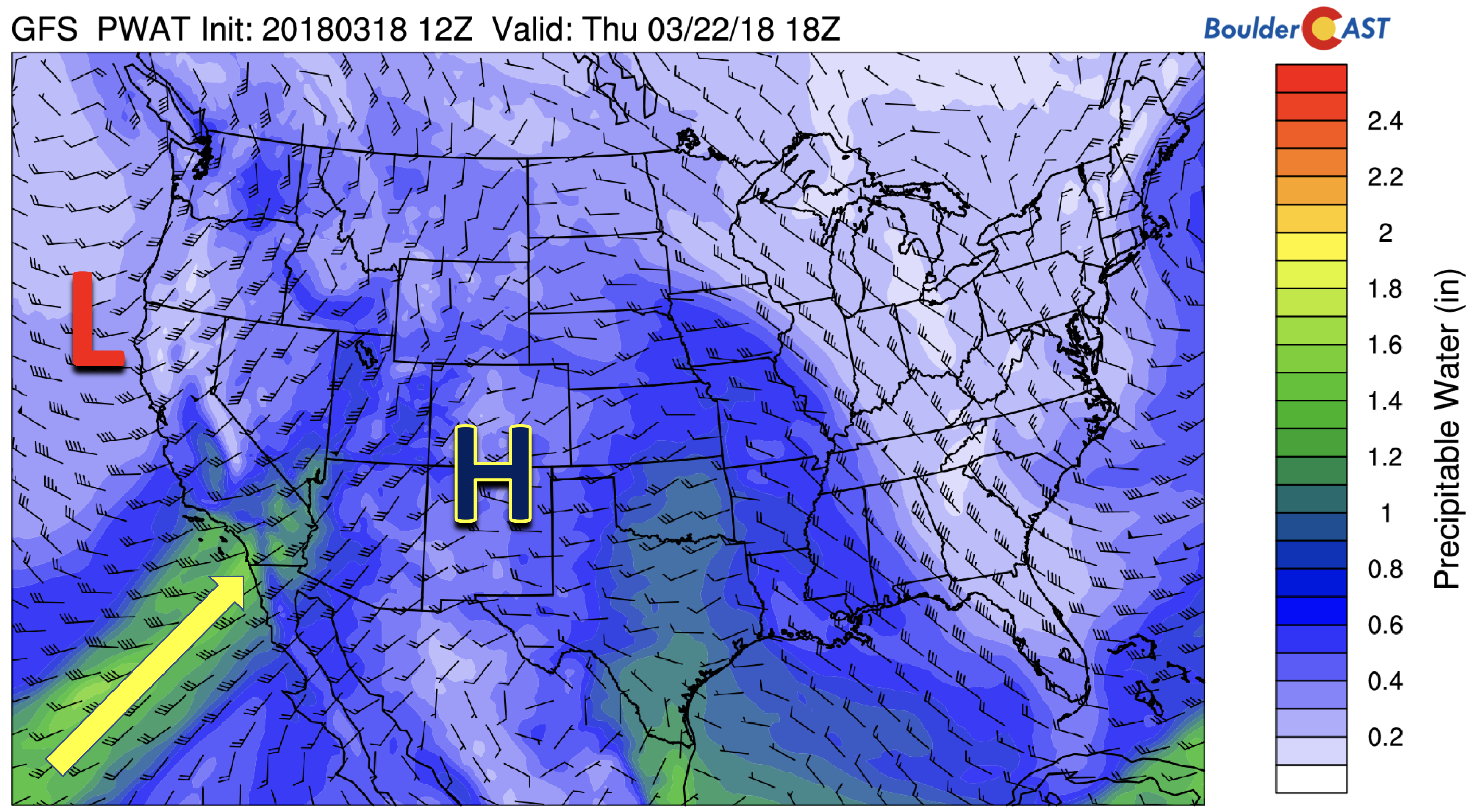
GFS precipitable water Thursday
The maps below show how expansive the system is and the large number of states it will affect. Rainfall will be present across much of the West Thursday, with snowfall in the Sierras due to the atmospheric river. The system approaches Colorado on Friday, with snowfall reaching the High Country for another round of great skiing conditions to end the week! The lower elevations could see a few widely scattered rain showers Friday afternoon and evening.
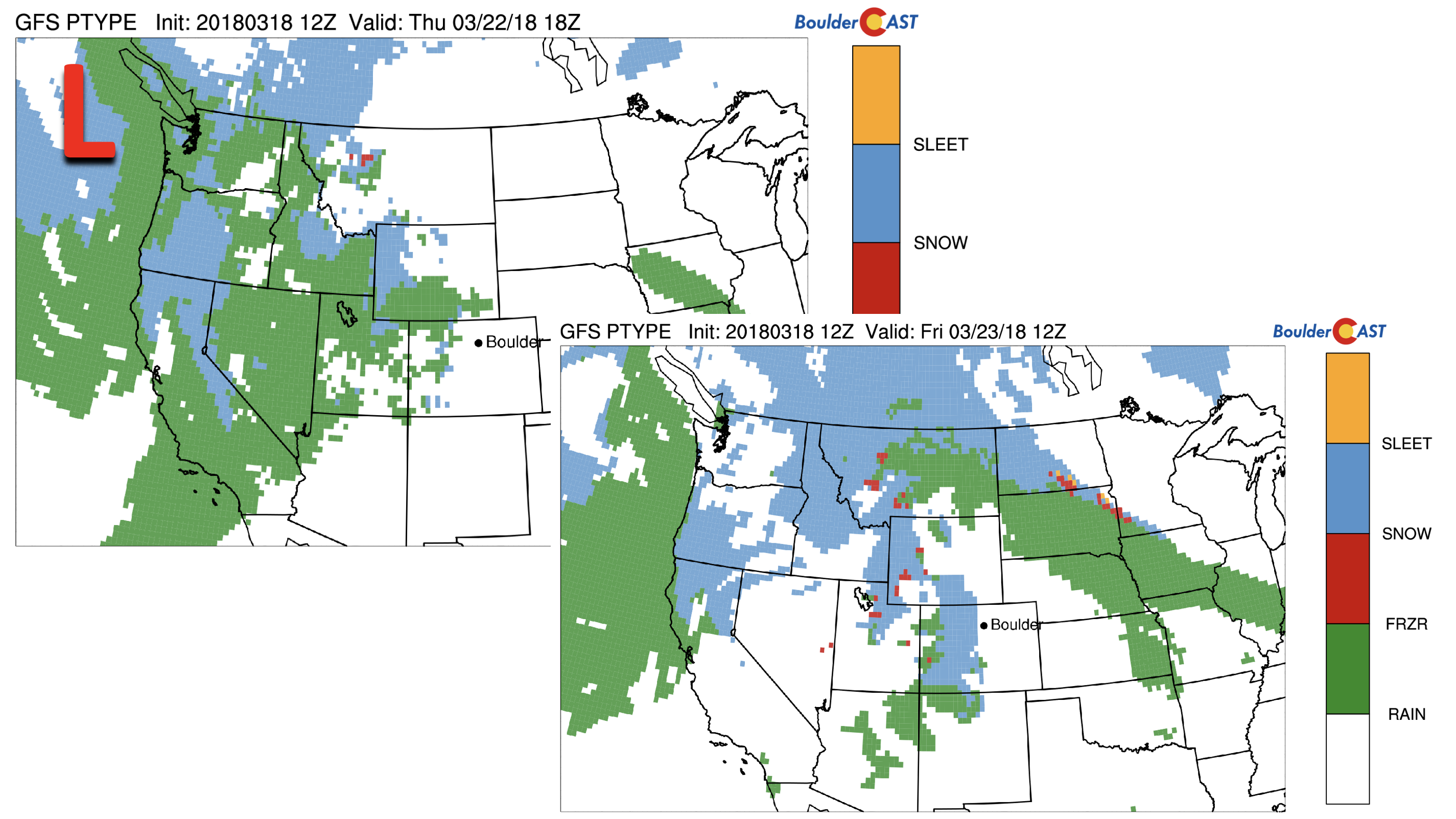
GFS precipitation type Thursday (left) and Friday (right)
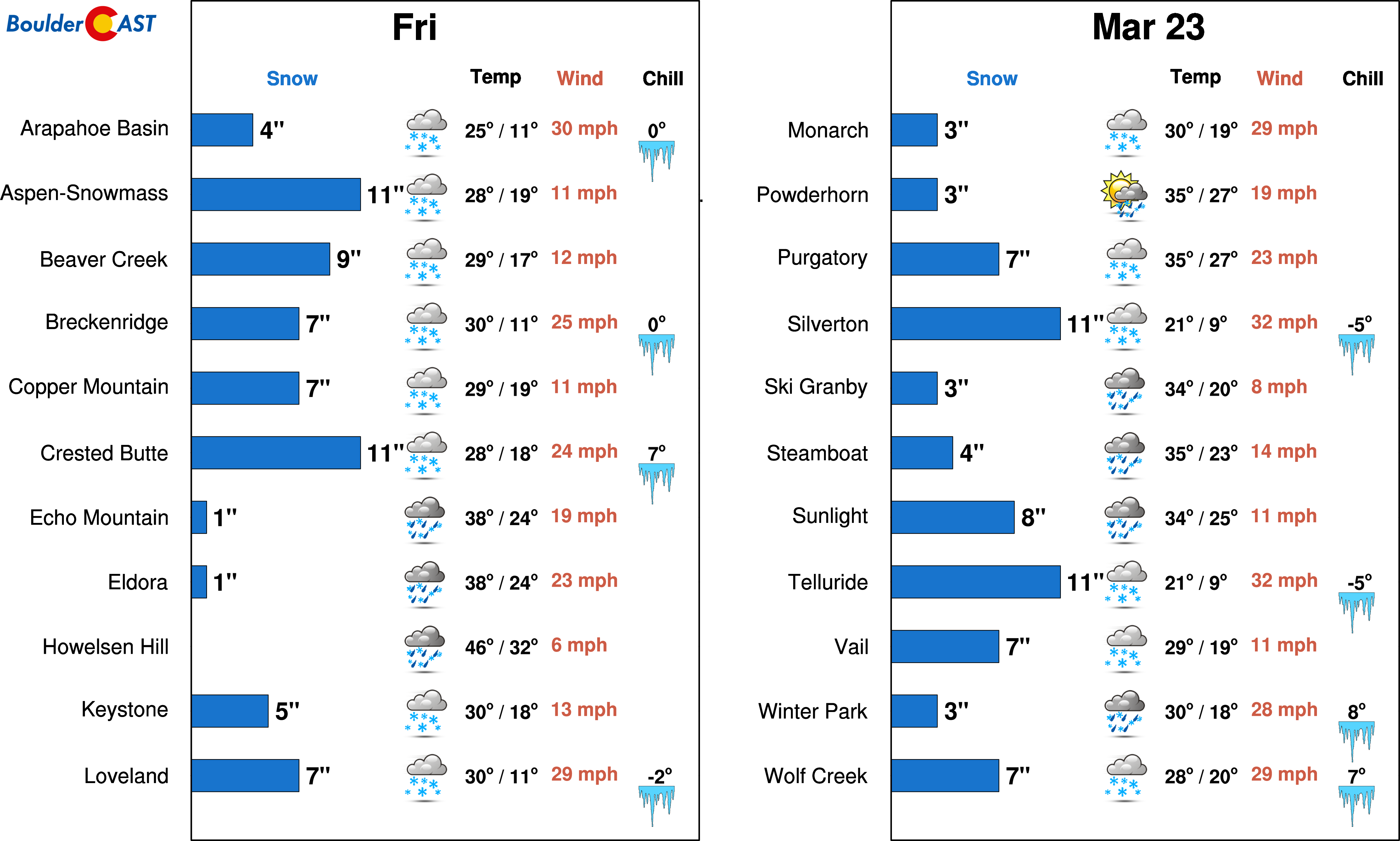
Current indications point the anywhere from 5-12″ of powder in the Mountains Friday. This is likely to change, but its something to get excited about if you’re a skier!
As we go into the weekend, the pattern turns active, at least from current model trends. The image below shows the GFS model run from last night, which depicts a very similar track storm as Sunday’s that engulfs the entire state Monday into Tuesday, with much of the area seeing moderate to heavy snow. This forecast pattern, however, was not seen in the earlier runs. Hence, its quite uncertain at the moment what may happen early next week, but it is something to keep an eye on as we go through the week. Stay tuned!
GFS sea-level-pressure and precipitation type next Monday evening
Forecast Specifics:
Monday: Morning clouds giving way to patchy sunshine. A few extremely isolated rain/snow showers may be around during the afternoon. Most areas will be dry. Look for highs in the middle 40’s on the Plains with low 30’s in the Foothills.
Tuesday: A mix of clouds and sunshine with temperatures in the low to middle 50’s for the Plains with low 40’s in the Foothills.
Wednesday: Lots of high clouds will be around so expect mostly cloudy skies. High temperatures twarming into the middle 60’s for the Plains and in the middle 50’s in the Foothills.
Thursday: A few high clouds, but expect some sunshine throughout the day. This will be our warmest day of the week. Look for high temperatures in the lower 70’s for the Plains and in the upper 50’s in the Foothills.
Friday: Increasing clouds with breezy west winds possible. There is a slight chance of evening rain showers. Highs likely a few degrees cooler than Thursday in the mid to upper 60’s for the Plains and mid to upper 50’s in the Foothills.
High Country: Another 1-2″ of snow may fall in the High Country on Monday under residual moist northwest flow. This is on top of the 6-12″ that fell on Sunday. After today though, the week turns quiet, with the next shot of snowfall Thursday night and Friday, with the potential for 5-12″ at many ski resorts. Find the latest forecast for all your favorite Colorado ski resorts on our PowderCAST page.
DISCLAIMER: This weekly outlook forecast was created Monday morning and covers the entire upcoming week. Accuracy will decrease as the week progresses as this post is NOT updated. To receive daily updated forecasts, subscribe to BoulderCAST Premium.

.
Share our forecast!


You must be logged in to post a comment.