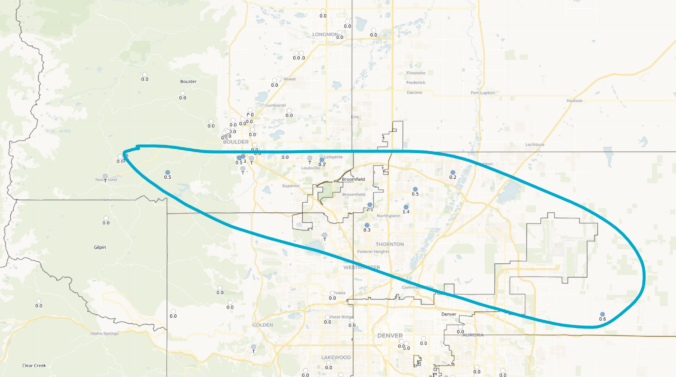
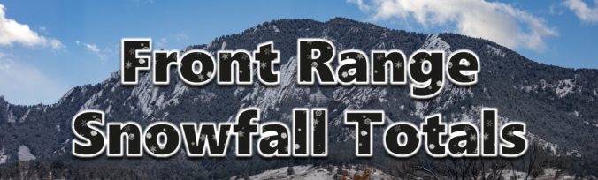
Light snow fell once again across the entire Front Range Monday night into Tuesday, with most locations picking up 2 to 5 inches of fluffy accumulation, a tad less than forecast in some spots. We briefly review both the snow totals from this single storm and the seasonal ones.
Category: Verification (Page 6 of 51)
These posts take a look back at recent weather events, like snow storms or severe weather outbreaks, and evaluate how the forecast played out. We evaluate how well the models predicted what actually occurred, and offer insight into what can be learned and applied moving forward.

The entire Front Range woke up to picturesque conditions today on Sunday as overnight light snow and freezing fog coated nearly every surface in a dusting of ice crystals — turning local communities into unique snow globes. We review the snow totals from the wintry event, one which produced at most a dusting in the Denver Metro area, but up to several inches in the Mountains and areas to the east.
Northwest flow aloft will keep the start of 2025 cool and largely dry for the lower elevations. However, ridging aloft will allow for milder temperatures by the latter part of the week. The High Country will cash in on more snow Thursday and Saturday, perfect for skiers looking to start the New Year right. We also recap the brief high wind event that occurred on Monday.
Yesterday on Christmas Day, a deluge of rain dumped on the western Denver Metro area during the afternoon and evening, but amazingly not a single snowflake fell across most of the lower elevations as temperatures remained several degrees too warm for frozen precipitation. This led to the first “Rainy Christmas” that most of us have ever experienced. As expected, a white Christmas was enjoyed by those in the higher terrain where temperatures were colder. We recap the holiday raindrops and snowflakes, including a look at just how rare Christmas rain really is and if it will be the new normal in a warming climate.
A short-lived period of light to moderate snowfall accompanied the passage of a quick-moving shortwave disturbance Monday evening, mostly impacting the southern and western Metro area. We briefly review the snowfall totals across the region.
A midweek winter storm brought light accumulating snow to the Denver Metro area on the Wednesday before Thanksgiving, with considerably more powder piling up in the Mountains. We briefly review the snow totals across the Front Range.
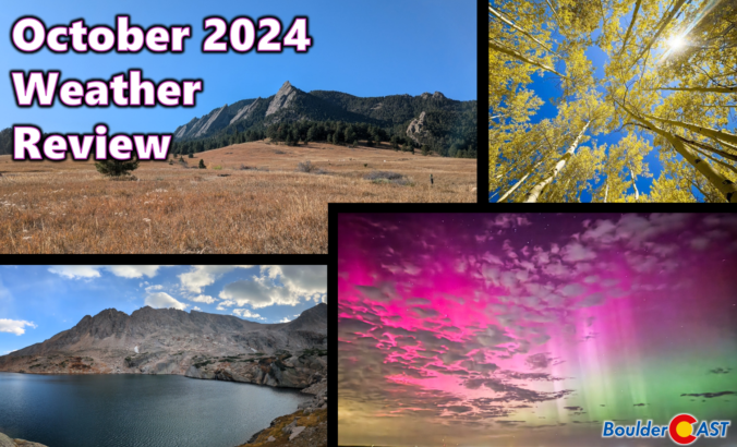
October was yet another exceptionally warm and dry month in the Front Range, with most areas landing more than six degrees above average while receiving very little if any precipitation. The period of May to October only produced 4.64″ of precipitation in Boulder, the driest such stretch in recorded history. It’s no surprise that drought has further expanded across the region. In contrast to our boring weather, space-related activity was booming in October with multiple nights of auroras lighting up Colorado’s skies and a multi-week comet display. Here’s a quick and colorful graphical recap of our weather during October and how it relates to climatology.

Live View of Boulder

Current Conditions

Live Radar

Recent Premium Posts

BoulderCAST Daily – Sun 12/14/25 | A warmup after the chilly yesterday afternoon
🌡️ Warmth Returns with no sight of snow: Highs return close to 60 …
BoulderCAST Daily – Sat 12/13/25 | Highs in the 60s this weekend!
🌡️ October Warmth in December: Highs typical for late October will be in …
This Weekend in Colorado Weather: The December that has felt like October continues with bone dry warmth persisting into next week
🌬️ Two more breezy days ahead with gusts 15–25 MPH before the jet …
3-Day Forecast

Trending Content

© 2025 Front Range Weather, LLC