After a round of rain and thunderstorms Wednesday, everyone changed over to heavy snow Wednesday night with a dense blanket of sludge now covering the entire area as of Thursday morning. Though there will be a slight lull in the action for a few hours here, moderate to heavy snow is expected to redevelop soon with snow continuing non-stop into Friday morning. We are only now at approximately the halfway point of the storm. We take a look at how much snow has fallen already and discuss how much more is still to come!
T
he storm has performed about as well as can be expected with such a complex and atypical atmospheric setup unfolding across the Front Range this week. Rain showers and even some accumulating hail-producing thunderstorms began to develop Wednesday afternoon, with heavy snow immediately dumping up in the Foothills.
For once it's hail, not graupel. #cowx pic.twitter.com/yUcxsVhyvi
— BoulderCAST Weather 🏔️❄️ (@BoulderCAST) March 13, 2024
Numerous lightning strikes were observed in the area, with most occurring in SE Denver and into Aurora late Wednesday.
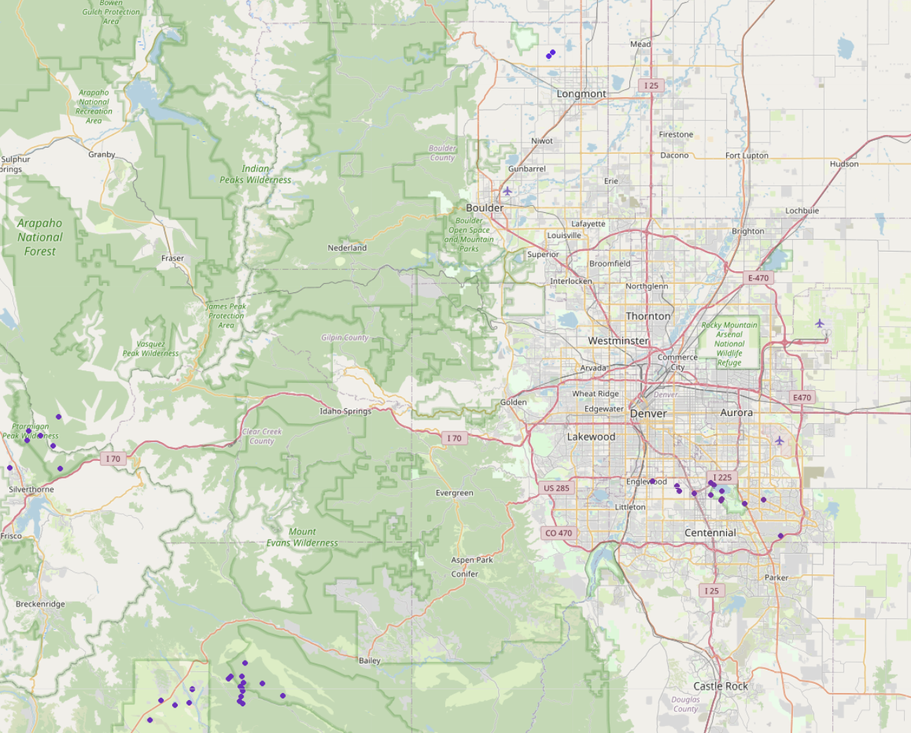
Map of observed lightning strikes on Wednesday (each purple dot)
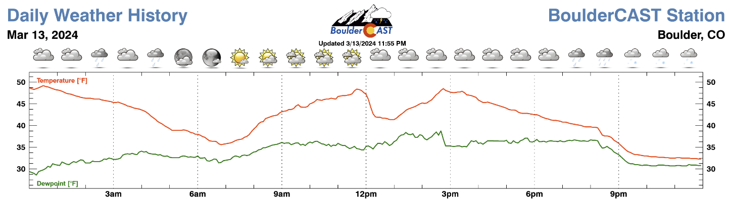
Throughout Wednesday evening, the precipitation became more widespread with rain changing to wet snow approximately right on schedule, with the change-over happening in southern Denver first and latest on the north and northeast side of the city. In Boulder, we changed over to snow between 9 and 11PM, depending on elevation.
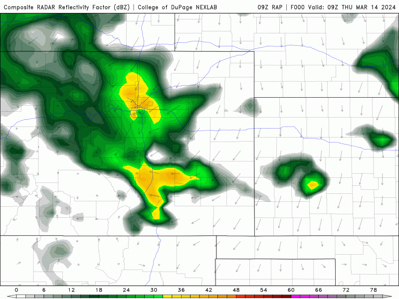
The radar animation below spans from 6PM Wednesday to 6AM Thursday when clearly a widespread deluge of precipitation was falling across the entire area. Snowfall rates were frequently between 1-2″ per hour, with some 3+” per hour rates reported in the colder spots.
As of about 7:00 AM Thursday, snowfall totals across the region range from less than 1″ (near Greeley), to 5-12″ in Boulder and Denver, to over 2 feet already in the higher Foothills!
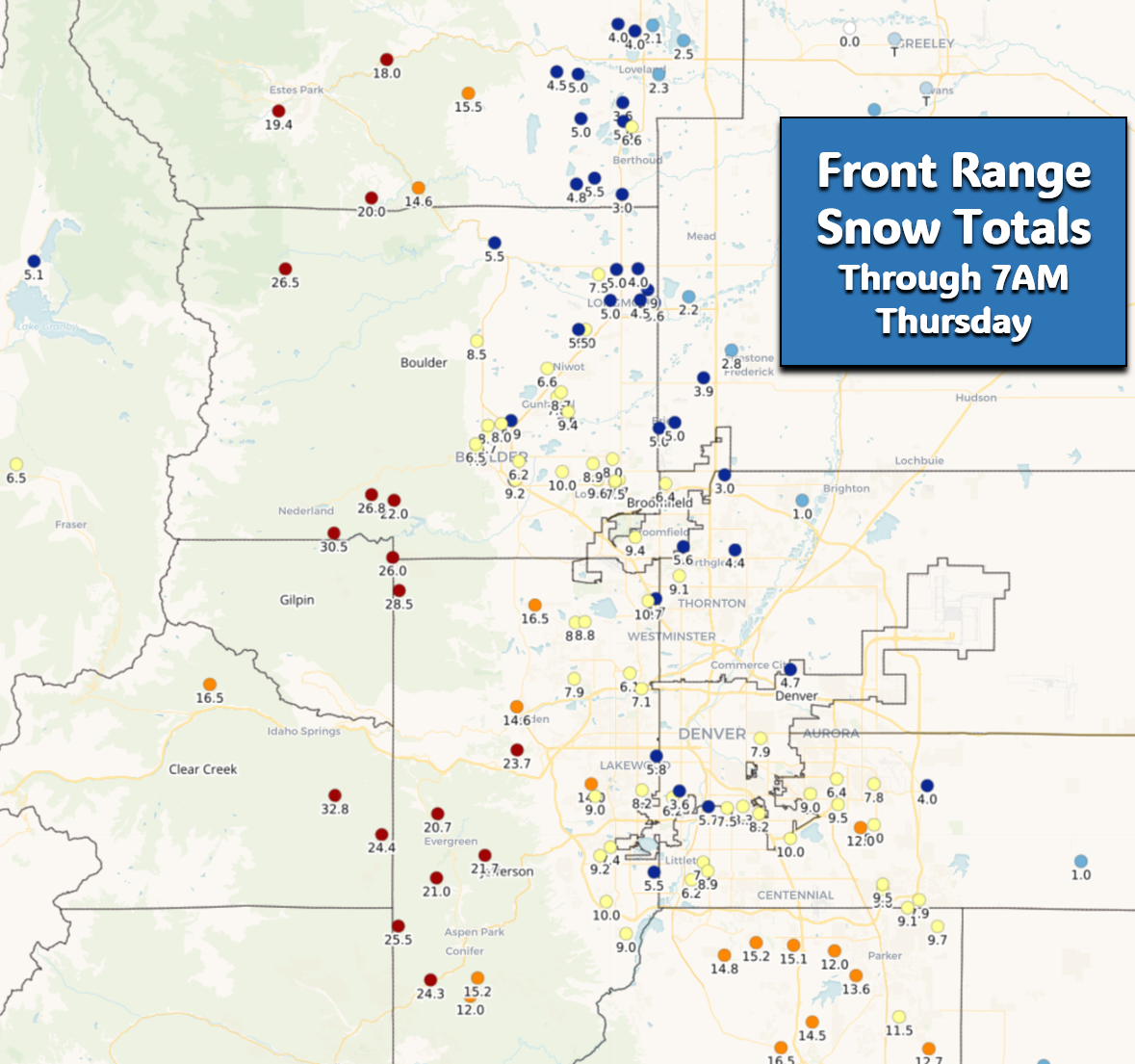
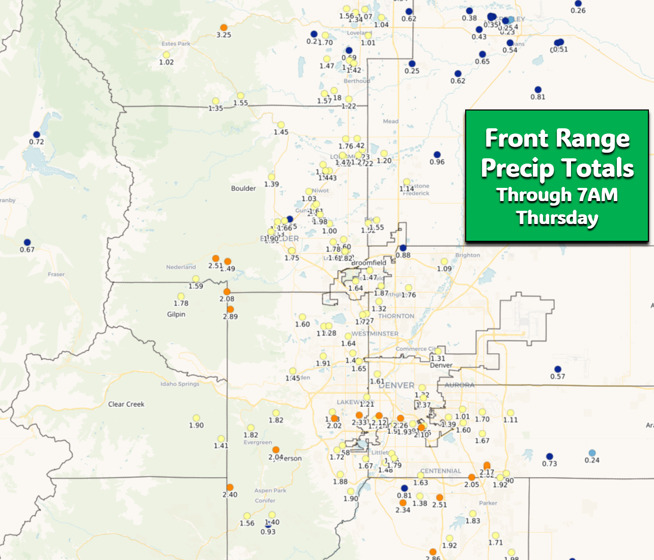
As far as raw moisture (rain + melted snow water), most of the area has already picked up over 1″, with 1.5 to 2.5″ in and near the Foothills!
We’re also getting reports of total power outages in the Foothills where more than 18″ of snow has fallen. Down in town, the power is constantly flickering. That is not surprising at all — one wonderful reader sent us this photo from South Boulder where power lines are fully encased in a “tube” of sludge!
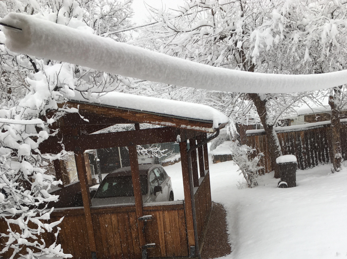
Photo credit: Laura O. in Boulder
Despite some sentiment that this snowstorm is underperforming, it’s actually right in-line with our forecast so far. If you recall, we mentioned the change-over to snow would occur between 6 and 10PM. Indeed most of the southern Metro are changed over before 8PM following intense rain and thunderstorms Wednesday evening. The northern Metro area around Boulder and Longmont definitely took a bit longer as we were warmer and missed the heavier rain early on, but it was still near or slightly after 10PM when we changed over here.

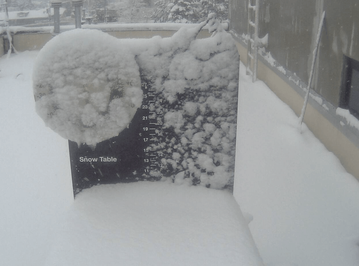
We had also expected about 4-10″ of snow to be on the ground by sunrise Thursday and that’s more or less where we are now based on co-op reports and our own measurement!
📏 Just shy of 8" in the grass at 715am. Let's call it 7.8" #cowx #boulderwx pic.twitter.com/tf7eIU6ANB
— BoulderCAST Weather 🏔️❄️ (@BoulderCAST) March 14, 2024
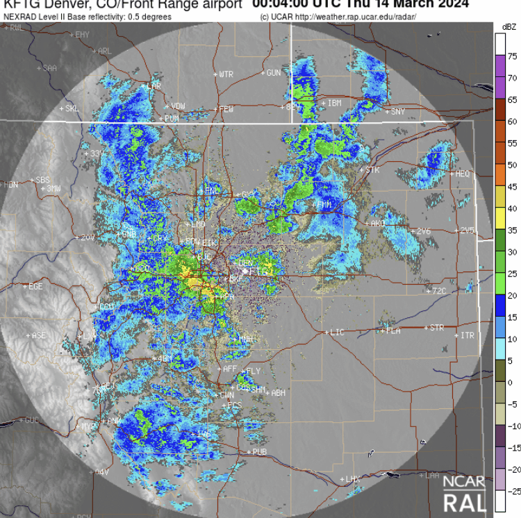
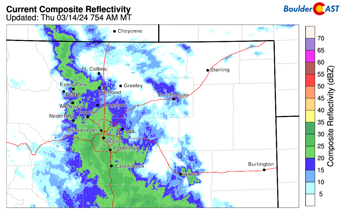
Keep in mind, this is a long-duration storm and it is far from over in the Metro area and Foothills — this is actually still not quite the halfway point yet. Light to moderate snow continues to fall across most of the area as of early Thursday, but there will be a slight lull in the action by mid to late morning lasting a few hours (though snow probably won’t fully stop). You can see the temporary back edge of the snow pushing southwest through the Metro area now on radar.
Don’t be fooled though by the brief lull as snowfall is expected to quickly redevelop by early afternoon and continue all the way into Friday morning. Snow will be heavy at times with rates greater than 1″ per hour, especially in and near the Foothills. Here’s a look at the simulated radar animation from the HRRR model for the rest of the event:
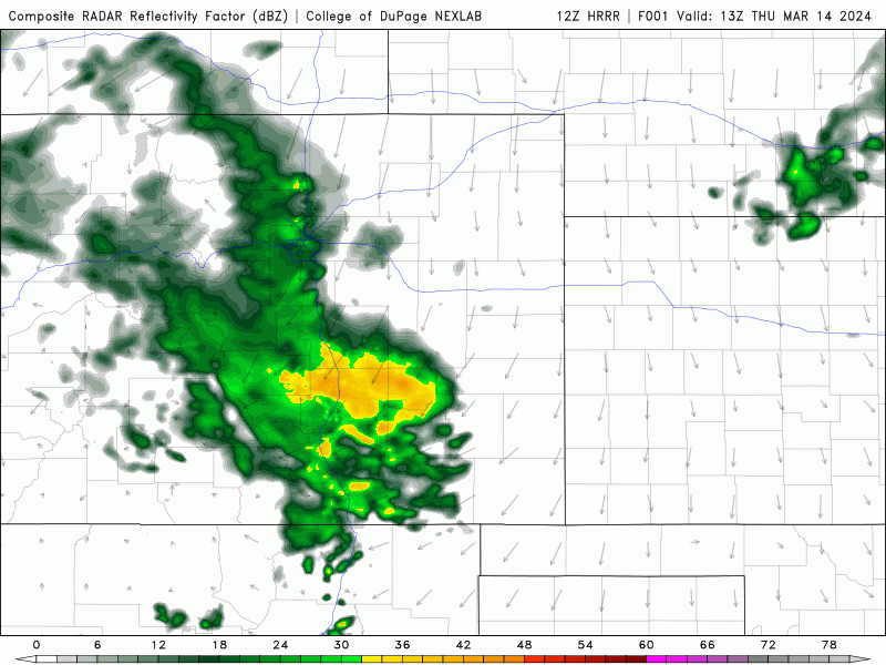
The future radar from the RAP model is very similar, too, with many hours of accumulating snow to go!
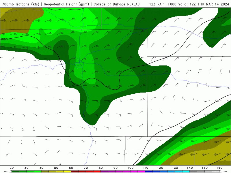
Winds aloft flowing towards the terrain will be strongest Thursday morning (~45MPH from the northeast), decreasing in intensity through the day (reduced to 20-30 MPH). However, as you can see in the 700mb wind forecast animation below, we do anticipate winds to turn from northeasterly to almost due easterly this afternoon. Thus, despite the decrease in raw wind speed, the more efficient easterly direction should keep similarly strong upslope dynamics in-play well into Thursday evening and night. The eastern direction may also allow a weak barrier jet to form helping to enhance snowfall rates in the Metro area.
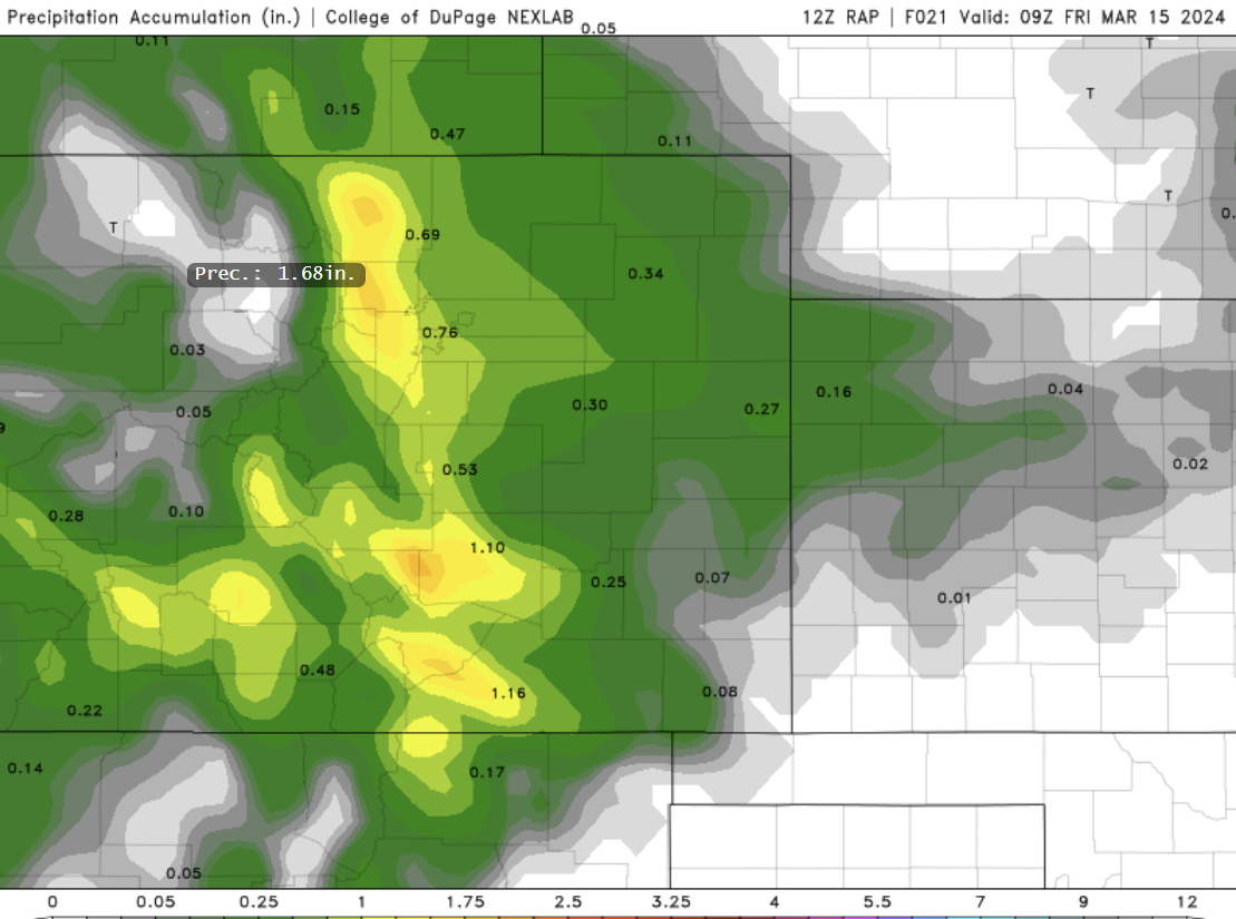
Short-range guidance has honestly been pretty good so far honestly, and most of those models still dump another 0.5-1″ of liquid on the Denver area, with 1-2″ in and near the Foothills. Below is just one example precipitation forecast still to come from the RAP:
As far as additional accumulation between now (Thursday morning) and the end of the storm (Friday morning/afternoon), it’s a bit tricky of a forecast. With snow letting up here this morning a bit, we will see melt/compaction rates outpace the accumulation rate in many areas. Actual snow depth may decrease through the day, helped along by the mid-March sun scattering through the clouds. However, accumulation should eventually win out this afternoon and continue to pile up all the way into Friday morning.
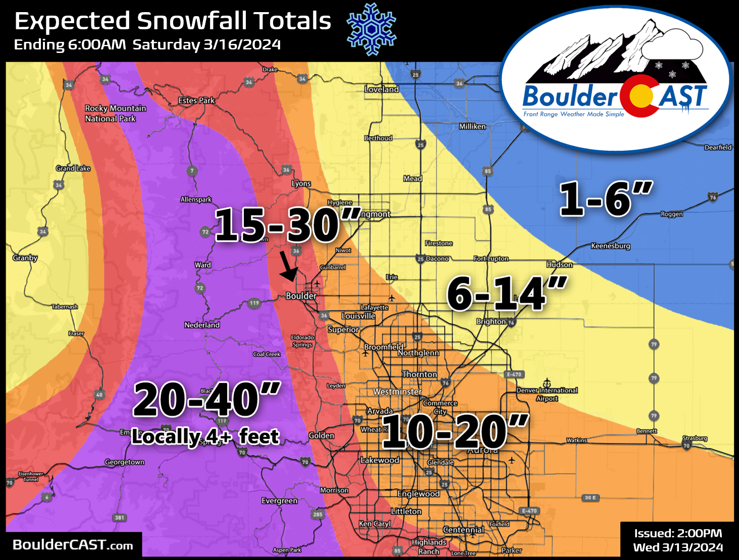
This is what we are expecting now for additional snow amounts:
- 4-10″ in most of Denver, lowest northeast towards DIA
- 6-13″ in the far western and southern suburbs of Denver, and also in Boulder
- 10-20″ in the Foothills
So as you can see, this storm is far from a bust as things appear to be on-track right now. There may be a few underperforming locations when things are all said and done — those will be areas that stayed a tad too warm last night. However, considering what is still to come, busted totals should be the exception rather than the rule. Our snowfall forecast map remains unchanged. We will say that the absolute top-end of our forecast ranges is probably not attainable at this point. That would have required a quicker change-over to snow last night across the lower elevations.
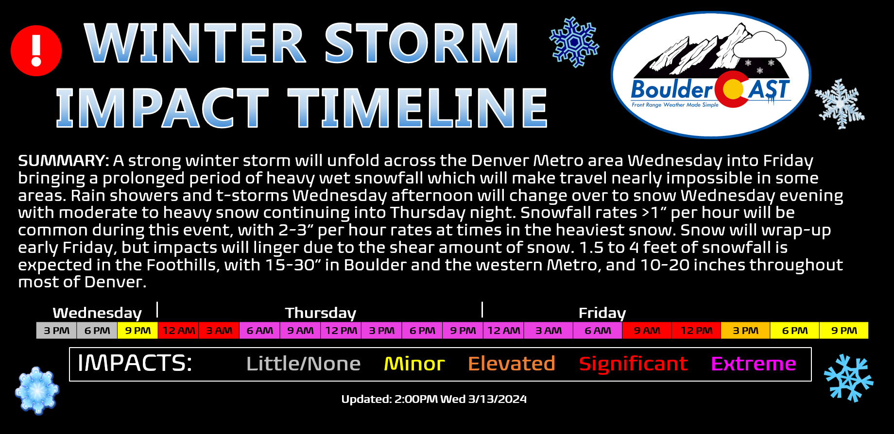
Here’s where we stand now and what is expected over the next 36 hours.
CURRENT STORM TIMELINE:
- Thursday: After a brief lull in the snow during the late morning (snow probably will never come to a full stop), snow will redevelop by afternoon and continue into the evening, heavy at times with rates >1″ per hour. Daytime accumulations of 2-6″, but there will be significant melting/compaction ongoing so we may not see actual snow depth increase all that much.
- Thursday night: Moderate to heavy snow will continue into the evening but should decrease in intensity as the night wears on. Light snow will linger into the morning. Another 3-7″ of snow is expected overnight.
- Friday: Snow will come to an end during the morning to midday, but travel will still be challenging until roads are cleared properly. Less than 2″ of accumulation is expected after sunrise on Friday.
If you haven’t noticed already, the snow we have out there is absolute sludge. If you can, shoveling several times throughout the event will make things go a lot easier. Perhaps once now, once Thursday evening, and then one final time Friday morning. Well, that’s our plan, at least!
Our winter storm impact timeline also remains unchanged, though the Extreme impacts are likely going to be limited to the colder Foothills/Mountain communities where 1.5 to 2.5 feet of snow has already fallen, roads are covered in deep snow and power outages are already ongoing.
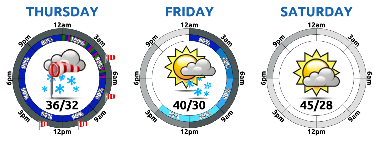
Temperatures will be trending slowly upward Friday into the weekend as we dry out. The weekend ahead looks nice, albeit chilly.
That’s all for now. Be sure to follow us on Twitter, Facebook, and Threads for additional updates as this winter storm continues to dump on the Front Range through all of Thursday and into early Friday. Enjoy the snow and happy Pi Day!
![]()
Get BoulderCAST updates delivered to your inbox:

Go Premium, get all the perks.
Daily Forecast Updates
Get our daily forecast discussion every morning delivered to your inbox.
All Our Model Data
Access to all our Colorado-centric high-resolution weather model graphics. Seriously — every one!
Ski & Hiking Forecasts
6-day forecasts for all the Colorado ski resorts, plus more than 120 hiking trails, including every 14er.
Smoke Forecasts
Wildfire smoke concentration predictions up to 72 hours into the future.
Exclusive Content
Weekend outlooks every Thursday, bonus storm updates, historical data and much more!
No Advertisements
Enjoy ad-free viewing on the entire site.
Enjoy our content? Help us out and give it a share:


You must be logged in to post a comment.