In dramatic fashion, an intense snow squall blew up over Boulder Tuesday morning and spread across the entire Denver Metro area leading to brief whiteout conditions just after the morning commute window. The heavy snowfall ended as quickly as it began, leaving behind rather unimpressive snowfall totals in the Front Range. However, as they say, it’s not about where you end up — it’s about how you got there! We discuss the crazy weather that unfolded on Tuesday and take a look at the snowfall totals.
T
he snowfall forecast for Tuesday morning was rather nebulous, even just moments before the powerful snow squall exploded over Boulder around 9AM local time. The weather gods were torn on whether or not a heavy snow band would hit the Denver area (championed by the global models), or if downslope flow coming off the terrain would bring mostly dry conditions (incorrectly suggested by the short-range high-res models). The main squall line coming across the Continental Divide out of Wyoming dissipated around sunrise on Tuesday and for a brief moment, it seemed like we may actually escape whiteout conditions.
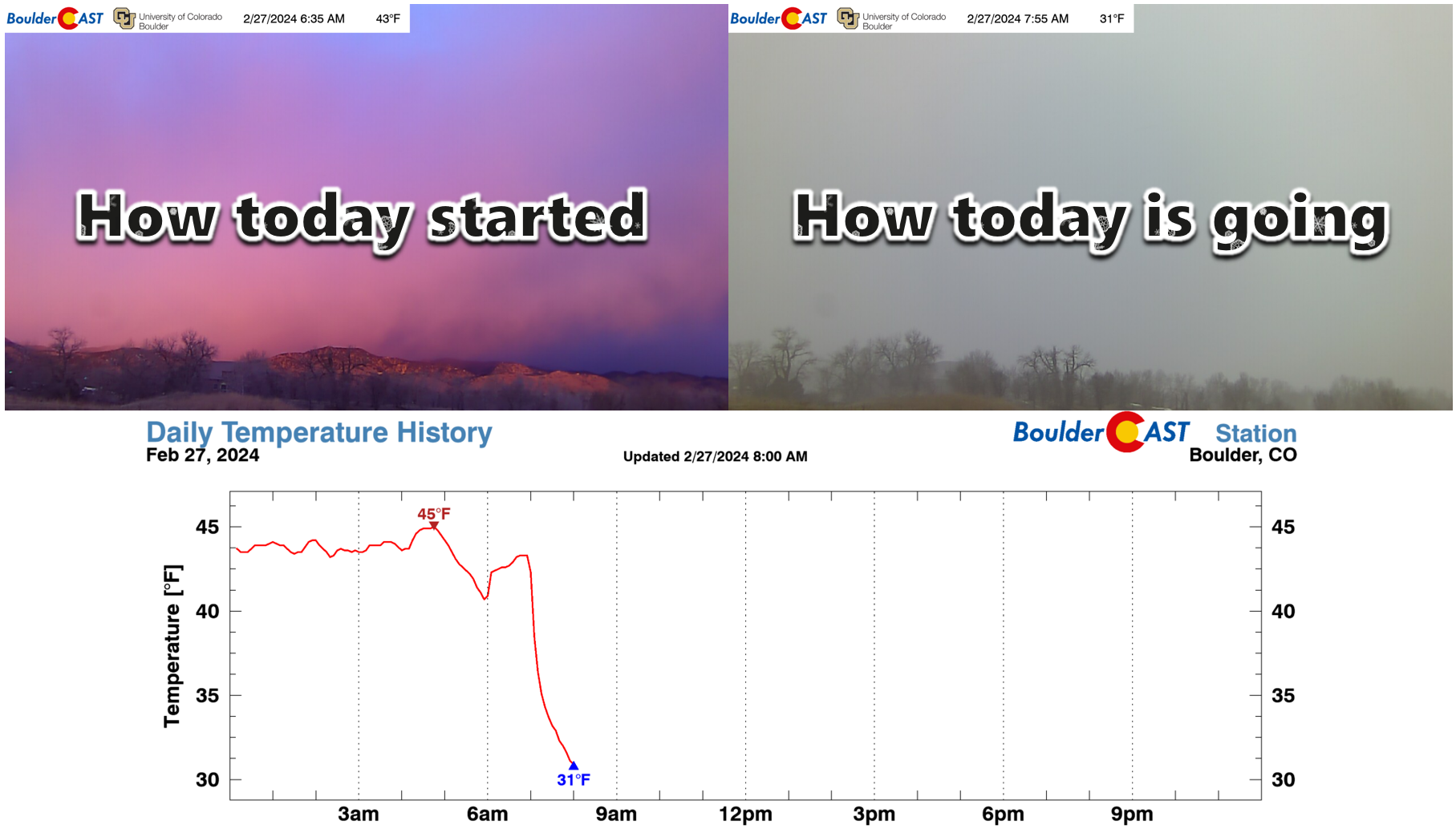
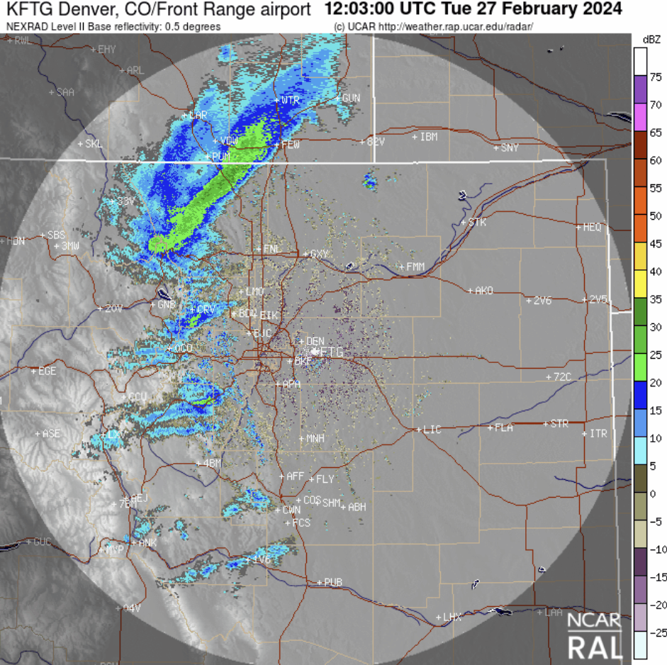
Unfortunately, shortly afterwards the band essentially reformed along a low-level Arctic frontal boundary coming in from the east (see temperature drop above) which merged with downslope flow coming in from the northwest — creating the perfect convergence zone which ultimately was aided by the upper-level jet stream. The intense snow band spawned in the blink of an eye and was only about 20 miles wide, but some 150 miles long. It rapidly spread eastward across the entire Denver Metro area. Check out Tuesday morning’s radar animation below. Whomp!
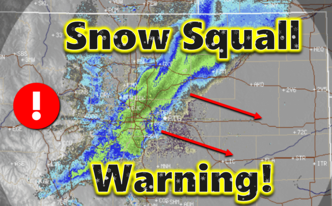
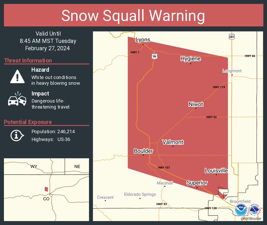
The core of the band had snowfall rates close to 2″ per hour combined with wind gusts of around 40 MPH leading to whiteout conditions and dangerous travel. That National Weather Service issued numerous Snow Squall Warnings Tuesday morning as the band stampeded across all of eastern Colorado. Snow Squall Warnings were introduced only a few years ago due to how dangerous they can be for travel on roadways. Tuesday was the first time that Boulder and Denver were ever included in one.
Here is a timelapse of the snow squall moving through our location. Interestingly, the winds roaring during the heaviest snow were actually coming from the east, against the direction of movement of the squall line.
A few travelers were able to capture the stunning snow squall line as it approached Denver International Airport. The heavy snow and white out conditions unsurprisingly led to a several-hour-long complete ground stoppage at the airport.
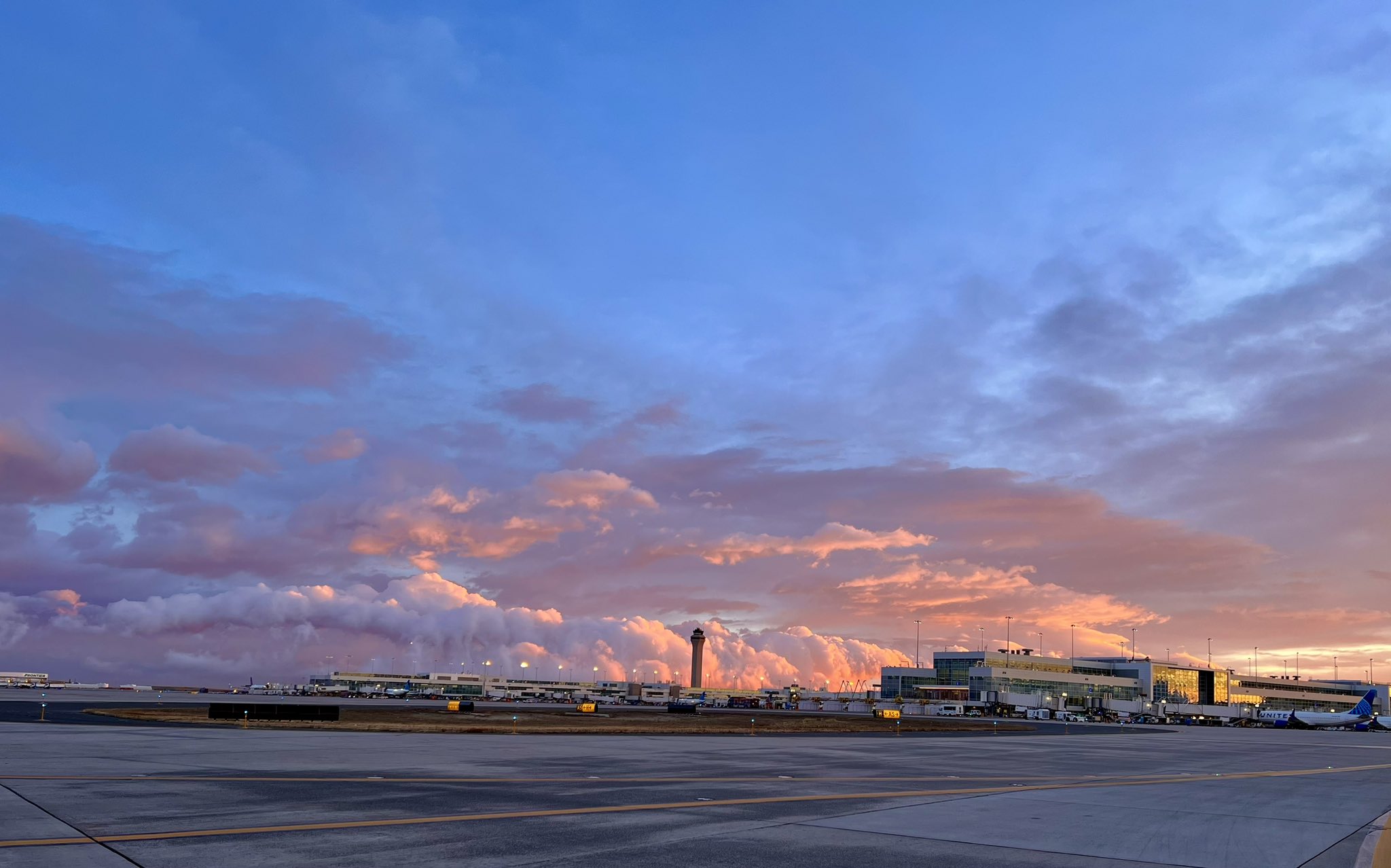
Photo by @petelubes on X
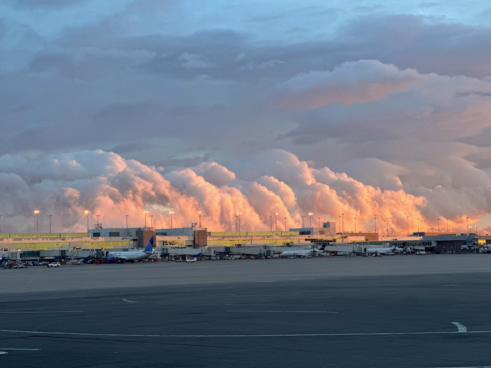
Photo by Chris Cannon
Fortunately, the snow squall vacated the area to the east just as quickly as it had formed!
She gone! 👋❄️ #COwx pic.twitter.com/KPilTfLXgH
— BoulderCAST Weather 🏔️❄️ (@BoulderCAST) February 27, 2024
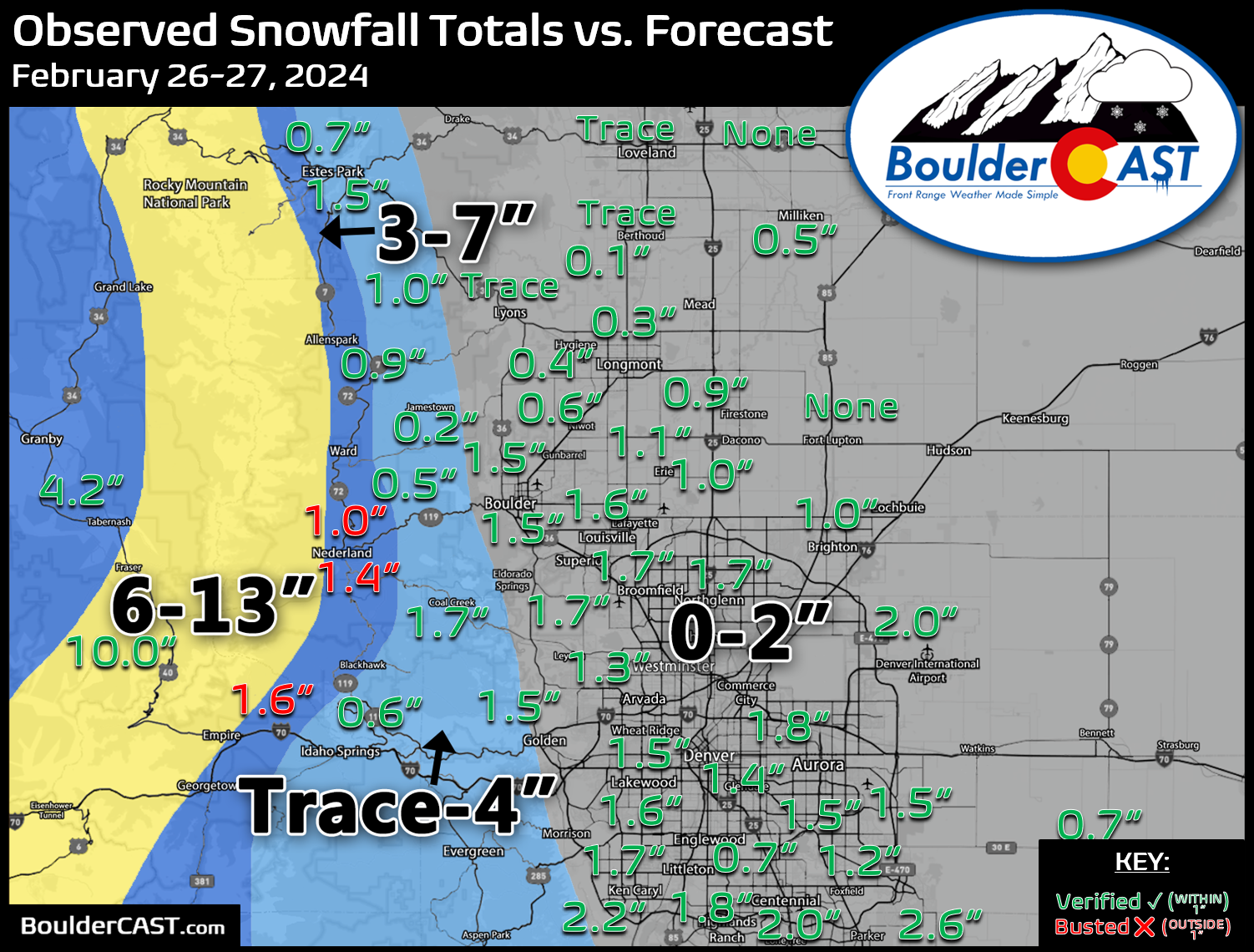
This rapid departure prevented any one area from seeing too much snow on Tuesday. In fact, as you can see below, the highest snowfall total reported east of the Continental Divide was just 2.6″ east of Parker! Shown below is our snowfall forecast map issued Monday morning with actual storm totals overlaid. Green values indicate that our forecast verified to within one inch of the observed snowfall total. Red numbers did not. In general, most of the Metro area picked up a very quick 1 to 2 inches of snow as the band blasted through. Lesser amounts, even bordering on no snow at all, fell across northern areas like Loveland and Greeley. Officially, Boulder received 1.5″ of new snow from this intense squall, while Denver (DIA) recorded 2.0″.
By the time the sun set on Tuesday, it was definitely difficult to tell a fury of snow had ravaged the area just eight hours prior — Colorado weather at its absolute finest!
Today in Colorado 🌨️🌞
7AM: Beautiful sunrise
8AM: Epic heavy snow band
9AM: Snow stops, still drab.
10AM: First peeks of sun
12PM: All sun and snow is melting away!
1PM: And the roads are dry…5PM: Will we be able to even tell it snowed? #COWX
— BoulderCAST Weather 🏔️❄️ (@BoulderCAST) February 27, 2024
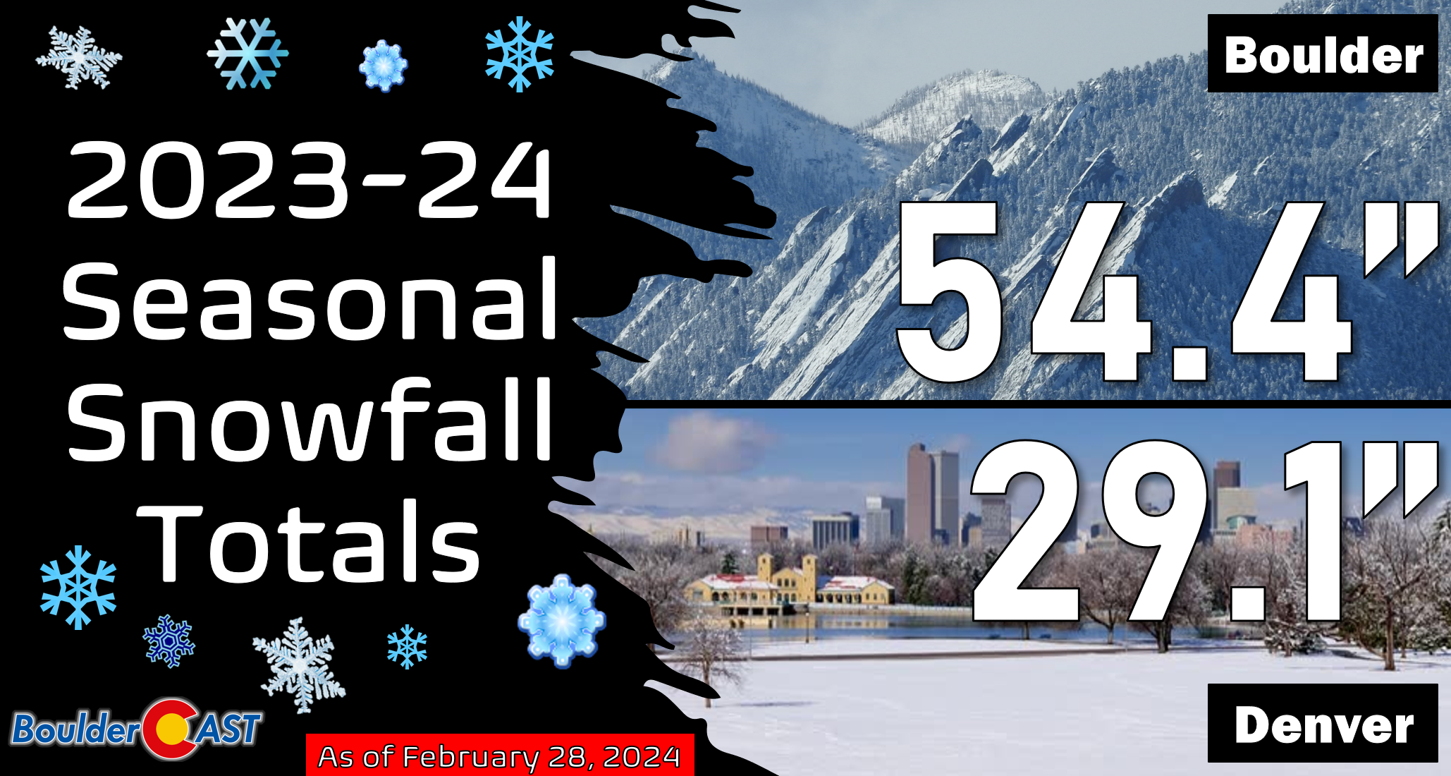
Updated seasonal snowfall totals for Boulder and Denver are shown below.
If you are somehow tired of the cold and snowy weather already, you’re in luck — there are at least four gorgeous and relatively warm days ahead before cooler temperatures and a chance of snow return late in the upcoming weekend. Enjoy!

Go Premium, get all the perks.
Daily Forecast Updates
Get our daily forecast discussion every morning delivered to your inbox.
All Our Model Data
Access to all our Colorado-centric high-resolution weather model graphics. Seriously — every one!
Ski & Hiking Forecasts
6-day forecasts for all the Colorado ski resorts, plus more than 120 hiking trails, including every 14er.
Smoke Forecasts
Wildfire smoke concentration predictions up to 72 hours into the future.
Exclusive Content
Weekend outlooks every Thursday, bonus storm updates, historical data and much more!
No Advertisements
Enjoy ad-free viewing on the entire site.
Spread the word, share Colorado’s crazy weather:


You must be logged in to post a comment.