The upcoming week will offer what we consider classic Front Range springtime weather with high fire danger Monday preceding a snowy system on Tuesday. Latest model guidance keeps amounts on the light side for the Metro area, but the Mountains will see heavy snow, strong winds and dangerous travel. Things turn quiet for the second half of the week, but another storm system is expected to bring more snow for the upcoming weekend. Let’s take a look.
This week’s highlights include:
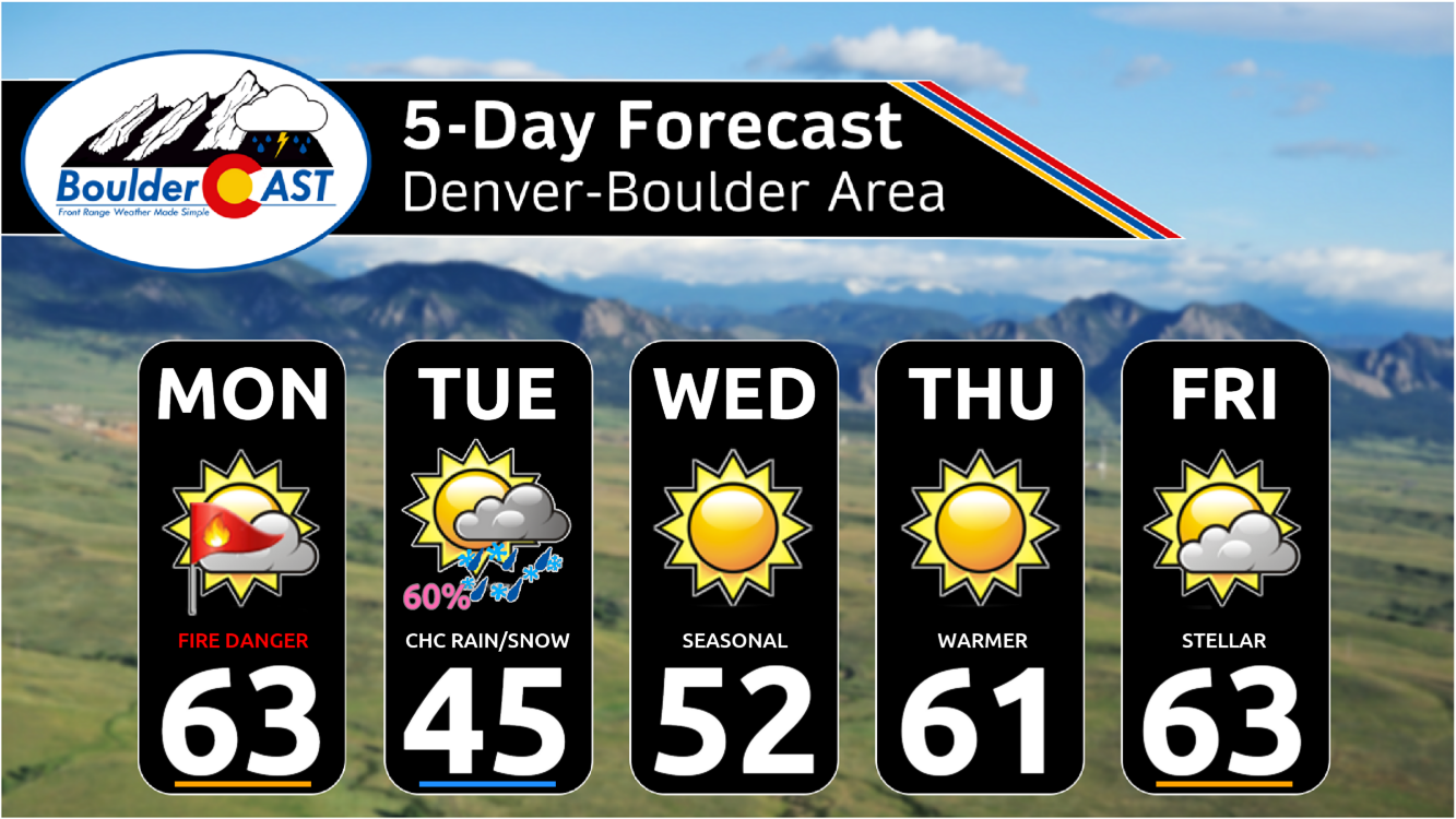
- Fire Danger on Monday: Yet another day of high fire danger on Monday due to very low humidity, dry fuels, and strong winds from the west-southwest. Red Flag Warnings are posted for all of eastern Colorado.
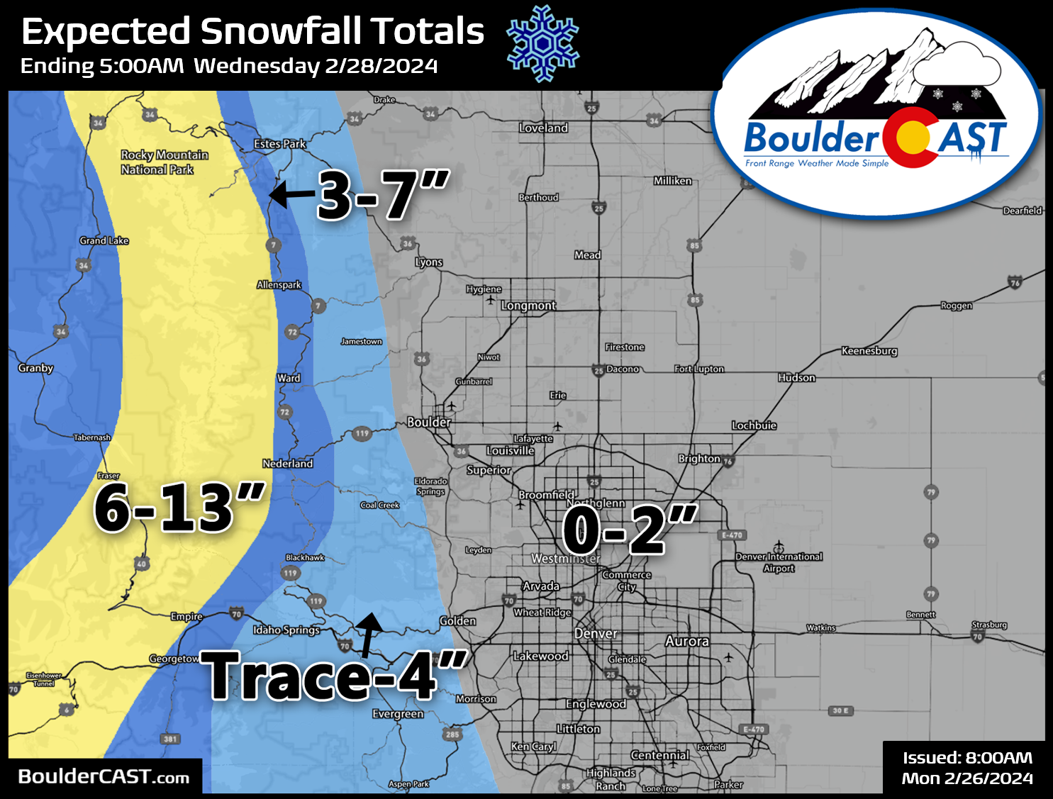
- Snow on Tuesday: A Pacific trough and associated cold front will bring snow to the Mountains and the Denver Metro area on Tuesday, with possible snow squalls and heavy bands (mainly in the Mountains). We expect only minor impacts from the snow in the Denver Metro area, with a trace to 2 inches of accumulation. However, significant snowfall and travel hazards will be in play across the Mountains, with up to a foot of snow along the Continental Divide.
- Quiet Weather for the Rest of the Week: Expect a return to sunny and mild conditions on Wednesday with temperatures in the lower 50s. Even warmer temperatures are expected Thursday through Saturday with 60s for highs.
- More Snow Next Weekend: Another storm system arriving on Sunday will likely bring snow back to the area.
DISCLAIMER: This weekly outlook forecast is created Monday morning and covers the entire upcoming week. Accuracy will decrease as the week progresses as this post is NOT updated. To receive daily updated forecasts from our team, among many other perks, subscribe to BoulderCAST Premium.

Go Premium, get all the perks.
Daily Forecast Updates
Get our daily forecast discussion every morning delivered to your inbox.
All Our Model Data
Access to all our Colorado-centric high-resolution weather model graphics. Seriously — every one!
Ski & Hiking Forecasts
6-day forecasts for all the Colorado ski resorts, plus more than 120 hiking trails, including every 14er.
Smoke Forecasts
Wildfire smoke concentration predictions up to 72 hours into the future.
Exclusive Content
Weekend outlooks every Thursday, bonus storm updates, historical data and much more!
No Advertisements
Enjoy ad-free viewing on the entire site.
Fire danger continues Monday!
If you can look beyond the fire danger and pesky winds, this past weekend’s weather was otherwise pretty good in the Front Range — well, at least it was better than the prior three weekends which were cold and snowy!
The wind never stops #cowx #boulder pic.twitter.com/2f3hQD0MKj
— BoulderCAST Weather 🏔️❄️ (@BoulderCAST) February 25, 2024
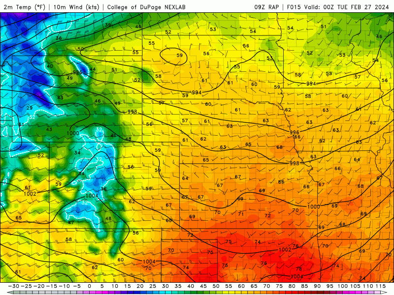
We begin our week on this Monday warm and windy again with high fire danger across all of eastern Colorado. The subtropical jet stream remains positioned directly over the region, with winds aloft screaming in from the southwest at over 150 MPH up at the jet stream level.
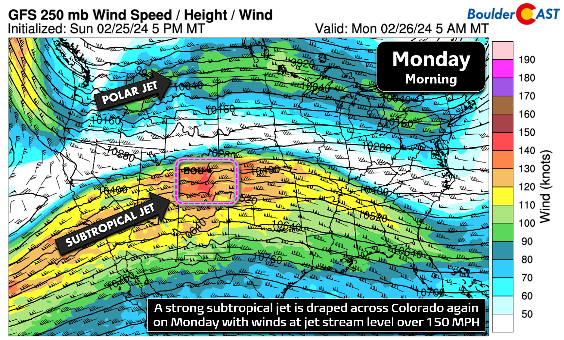
As we head through our Monday, our next storm system tied to the polar jet stream will draw closer from the northwest allowing for better mixing of the fierce winds aloft down to the ground. Things are relatively quiet in Boulder as of writing early Monday morning, but boy that will change through the day! Widespread wind gusts of 30 to 50 MPH are expected to develop during the morning and continue through sunset or so. This is similar to how things went down over the weekend, but the winds on Monday will be more widespread, more persistent and pack a bigger punch.
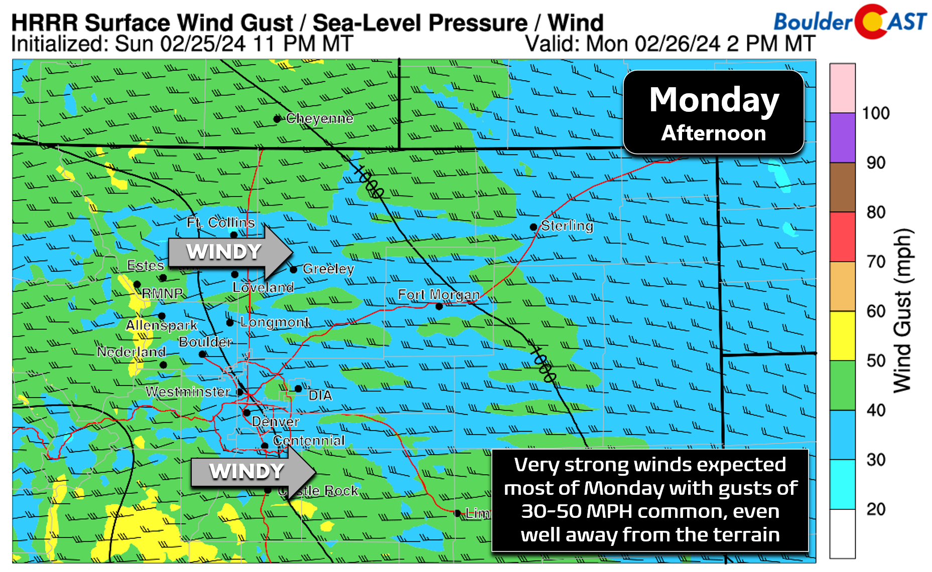
At the same time, relative humidities will drop below 20% across all of eastern Colorado beneath 6000 feet elevation Monday afternoon, setting the table for another day of elevated to critical fire danger.
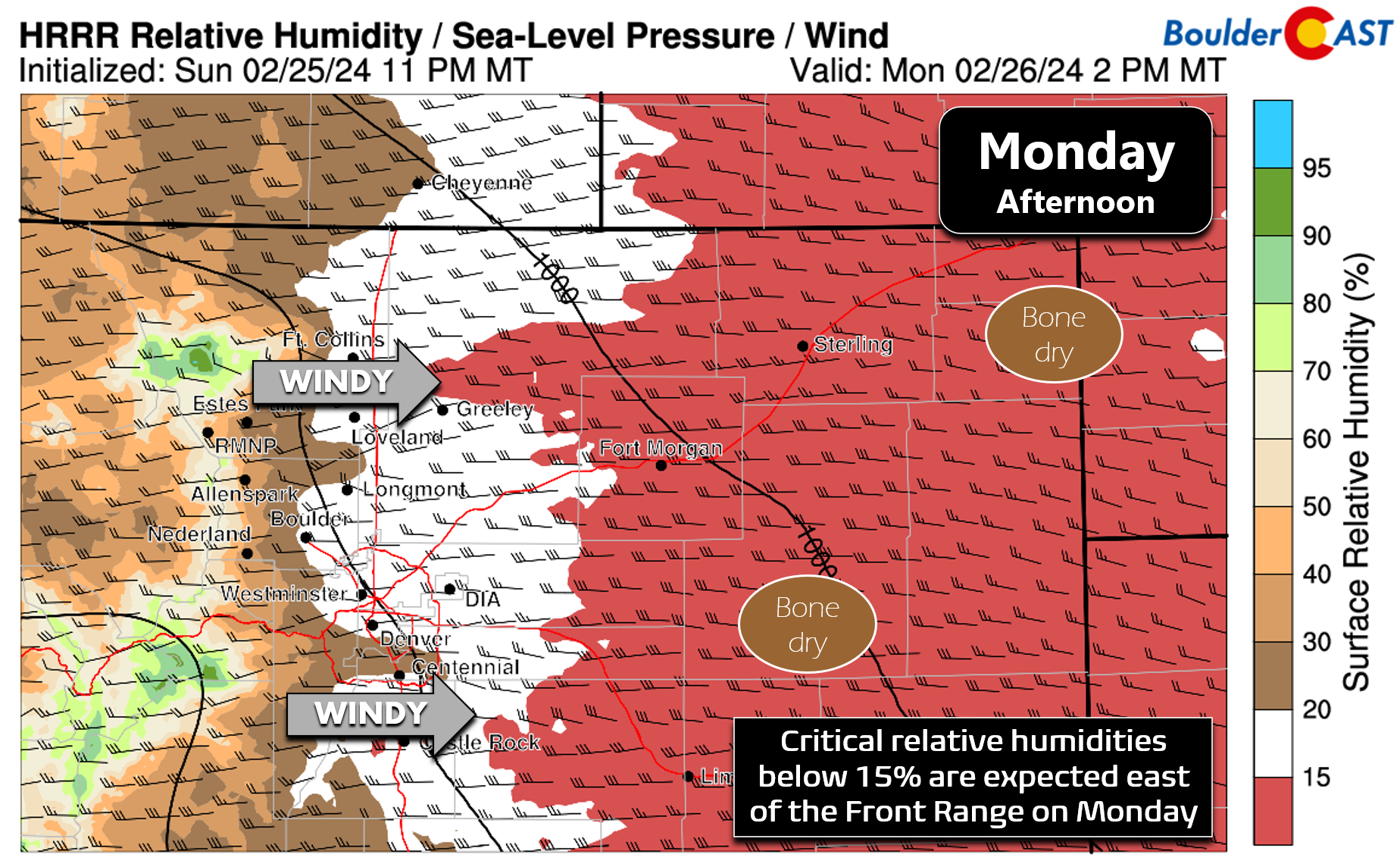
The greatest fire risk on Monday will be east of Interstate 25 where humidities will be lowest, with the diciest conditions across far southeast Colorado. Still there will be plenty of danger in the immediate Denver Metro area as well.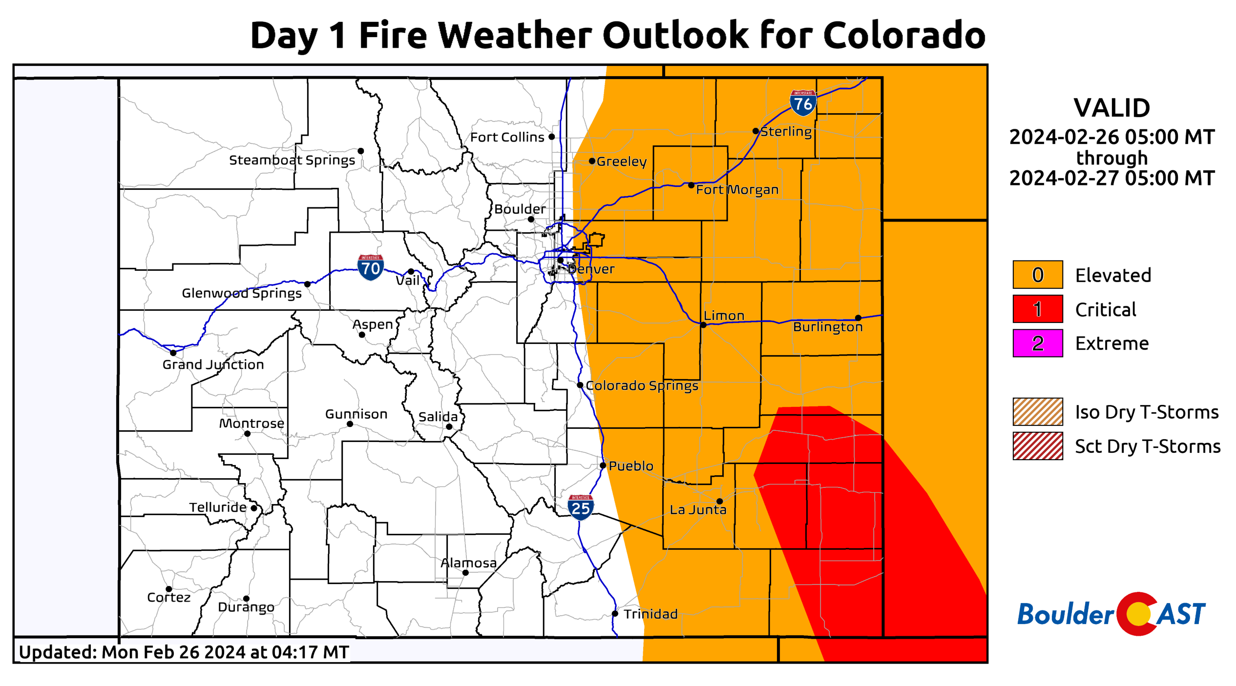
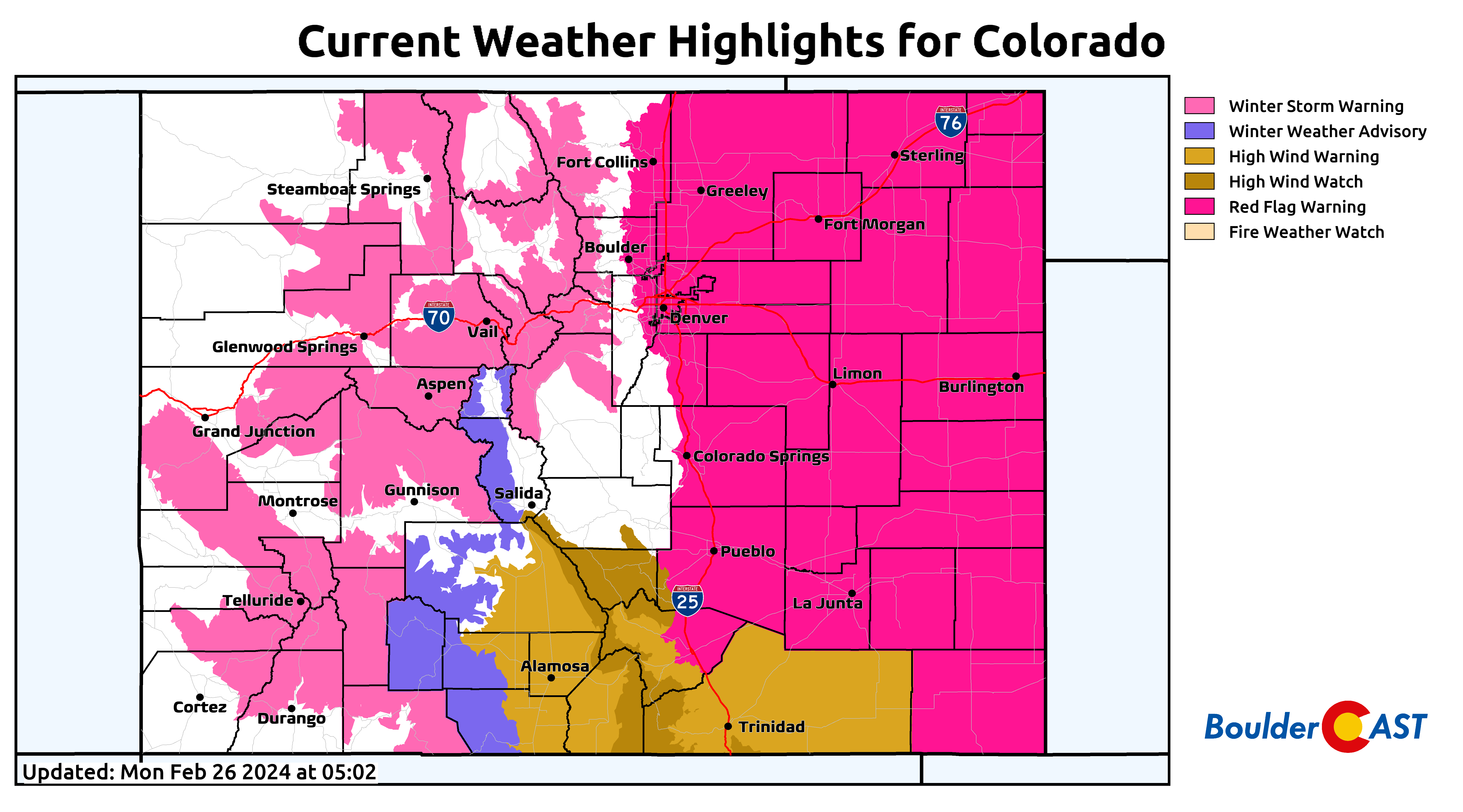
Red Flag Warnings are posted on Monday for the third day in a row. Our active alert map of Colorado sure is busy today!
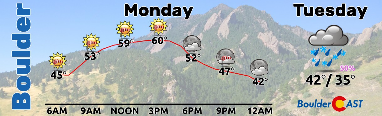
Highs will be in the low to middle 60s on Monday with strong and persistent west-southwest winds, especially between 10AM and 4PM. Winds will die down somewhat after sunset into Monday night.
Much colder with a chance of snow on Tuesday
As mentioned a bit earlier, our next storm system is already approaching quickly from the northwest. We’ve been discussing this one daily on BoulderCAST Premium since at least last Thursday. This next system can be seen in the GOES-East water vapor animation below from Monday morning. The broad trough is making steady progress through the Pacific Northwest right now and it has its eye on the Centennial State!
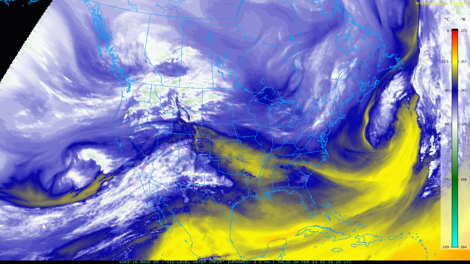
The trough will continue to sweep southeastward early in the week, bringing a range of impacts to Colorado late Monday into Tuesday before exiting east of our area by early Wednesday morning.
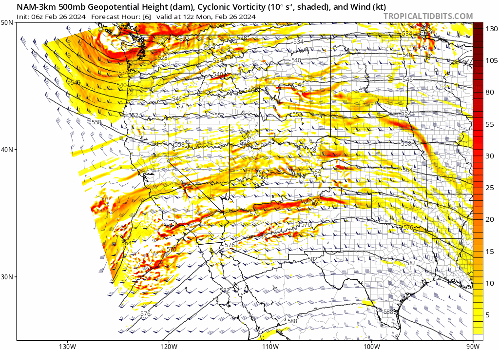
Through the day Monday there will be some scattered snow showers in the Mountains across Colorado — these are mainly associated with moisture from the subtropical jet stream. Only a couple inches of accumulation are expected on Monday, but the strong winds will create blowing snow and dangerous travel — hence the issuance of Winter Storm Warnings in the Mountains. More widespread and heavier snow will arrive into the state Monday night through Tuesday afternoon as the Pacific trough blows past. There could even be a few snow squalls at times as mid-level instability will be elevated with this trough.
A cold front will push through the Denver Metro area Tuesday morning around sunrise or so. The general progression of the broader front will be from the northwest, but on the Plains there will be a surge of cold northeasterly upslope before that.
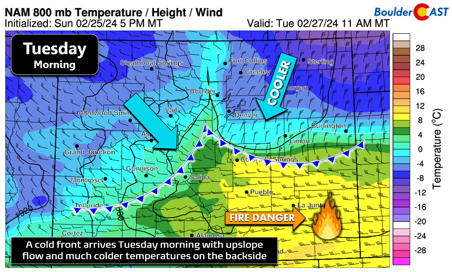
This will set the stage for a much colder Tuesday with rain changing to snow across the lower elevations as the cold front progresses southward. A combination of the post-frontal upslope flow and mid-level frontogenesis will lead to a short period of precipitation chances across the Boulder-Denver area, with perhaps even a band or two of heavier snow around these parts Tuesday morning.
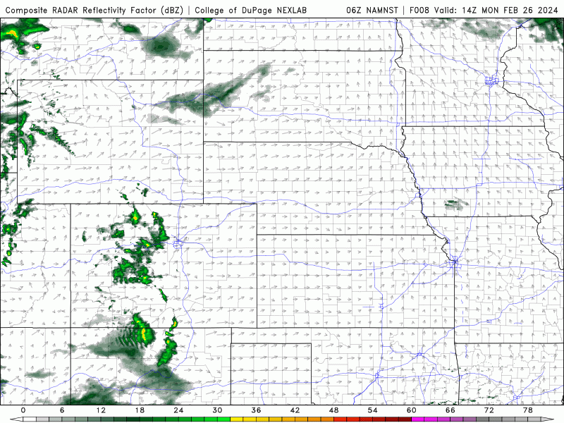
While this was always expected to be a rather minor snowfall event, models have trended downwards in regards to potential snow amounts in recent runs — with all models now showing less than 0.25″ of moisture coming our way. The usually reliable HRRR model (lower left panel below) has almost no precipitation in the Denver Metro area right now, which seems unrealistic — though it is supported by essentially every short-range model. The more bullish global models have only 1-3″ of snowfall for us on the highest end. Overall impacts from any rain/snow showers should be minor as pavement temperatures are very warm and air temperatures will be above freezing if and when precipitation materializes.
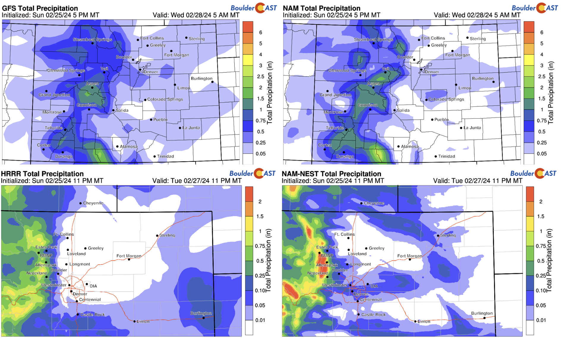
Based on everything we are seeing, we are leaning towards only a minor brush of snow from the system east of the Continental Divide with a trace to 2″ of wet accumulation possible across the lower elevations. Temperatures will be above freezing all day, even potentially rebounding into the 40s by Tuesday afternoon if downslope flow is able to kick back in. The Mountains will be the real winner from this system with moderate orographic snows and embedded snow squalls racing through during the day Tuesday. Upwards of a foot of snow is possible along the Continental Divide — expect dangerous travel conditions in the Mountains Monday through Tuesday night, especially over the mountain passes where winds will be howling. 3-7″ of snow is possible in the higher Foothills to the west along Peak-to-Peak Highway.
Things clear out quickly Tuesday evening and night with temperatures falling well into the teens by daybreak on Wednesday morning.
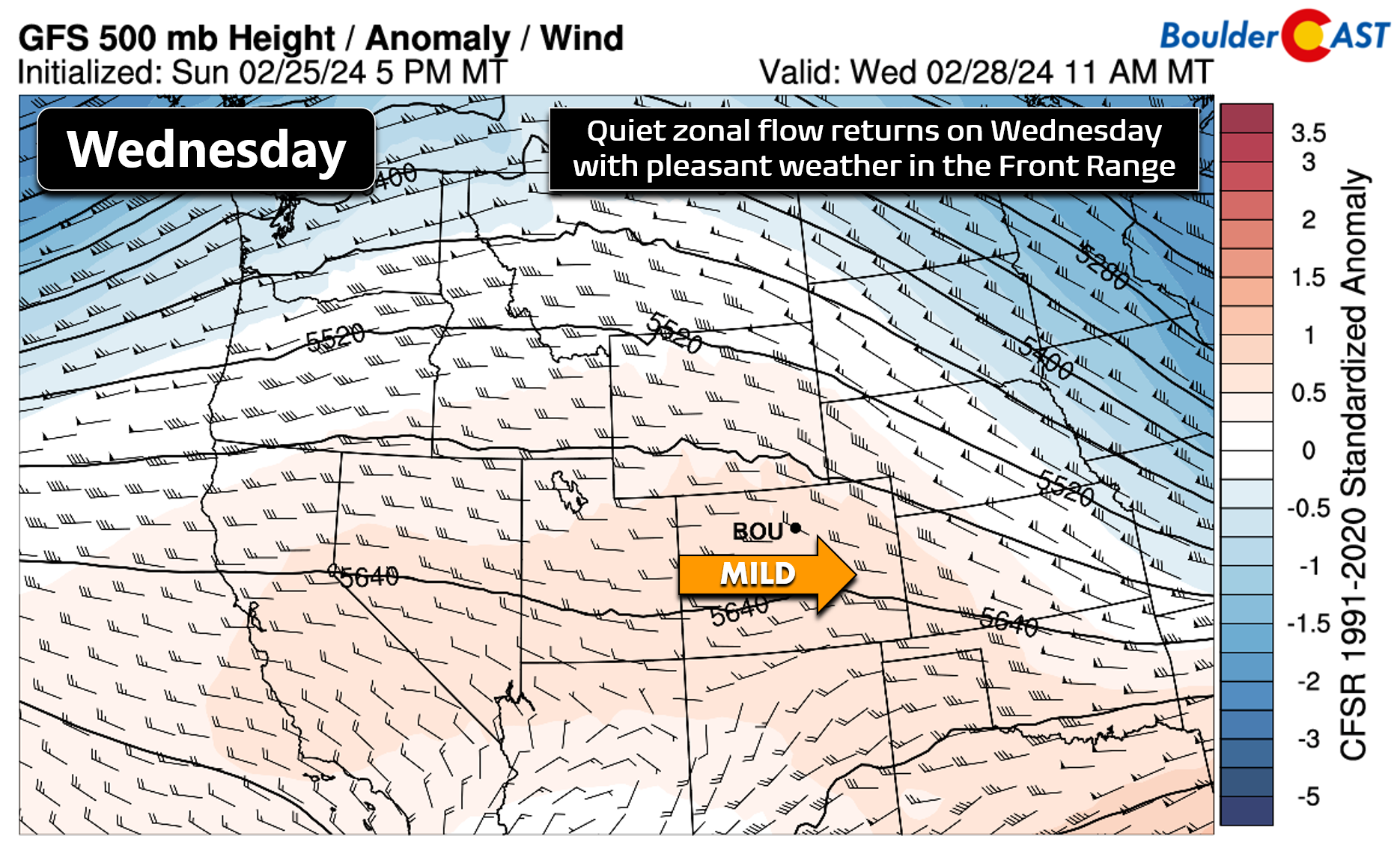
Quiet weather Wednesday and beyond
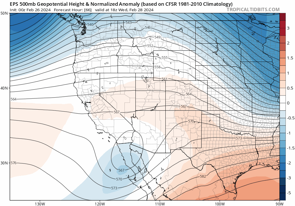
Relatively quiet weather is anticipated across the region following the departure of the early week trough. Weak zonal flow will setup across Colorado on Wednesday leading to a nice rebound in our temperatures and sunny skies — highs Tuesday will be in the lower 50s.
Things will stay peaceful throughout the rest of the work-week with increasingly strong southwest flow working into Colorado ahead of the next storm system. This broad trough will take its time getting here — not likely to land into the Front Range until Saturday night or sometime Sunday during the upcoming weekend. Temperatures on Thursday and Friday will warm further into the lower 60s with varying amounts of sunshine.
Have a great end to February and start to March — the first day of which marks the beginning of meteorological spring!
Get BoulderCAST updates delivered to your inbox:
Forecast Specifics:
Monday: Partly to mostly sunny, dry and windy leading to high fire danger during the day. Winds will gust 30 to 50 MPH much of the day from the west-southwest. Highs in the low to middle 60s on the Plains with 50s in the Foothills.
Tuesday: Breezy and colder following the passage of a front near sunrise. Scattered rain showers changing to snow showers in the morning, with potentially a few heavy snow bands around as well. Total snow accumulations up to 2″ possible, though many areas will see a trace to 1″. Highs in the lower 40s on the Plains with middle 30s in the Foothills.
Wednesday: Sunny and quiet with temperatures rising back into the lower 50s on the Plains and into the upper 30s in the Foothills.
Thursday: Sunny skies and continued quiet. Temperatures warm further into the lower 60s on the Plains with upper 40s in the Foothills.
Friday: Staying quiet with a few wave clouds around. High temperatures will be above normal in the lower to middle 60s on the Plains with lower 50s in the Foothills.
Weekend: Saturday will be warm and breezy ahead of our next storm system (maybe close to 70°). Sunday turns colder with a decent chance of snow late in the day.
DISCLAIMER: This weekly outlook forecast is created Monday morning and covers the entire upcoming week. Accuracy will decrease as the week progresses as this post is NOT updated. To receive daily updated forecasts from our team, among many other perks, subscribe to BoulderCAST Premium.
Go Premium, get all the perks.
Daily Forecast Updates
Get our daily forecast discussion every morning delivered to your inbox.
All Our Model Data
Access to all our Colorado-centric high-resolution weather model graphics. Seriously — every one!
Ski & Hiking Forecasts
6-day forecasts for all the Colorado ski resorts, plus more than 120 hiking trails, including every 14er.
Smoke Forecasts
Wildfire smoke concentration predictions up to 72 hours into the future.
Exclusive Content
Weekend outlooks every Thursday, bonus storm updates, historical data and much more!
No Advertisements
Enjoy ad-free viewing on the entire site.
Enjoy our content? Give it a share!


You must be logged in to post a comment.