A tiny recap of the two-phase snow storm Friday into Saturday, including a map of the verified snowfall totals.
This two-part winter storm delivered localized heavy convective snow Friday night (and even some thundersnow!), with totals of 3 to 12″ being reported in a narrow swath northwest of Denver stretching from Golden to Greeley by sunrise Saturday.
The train of convective snow delivered Friday night! A narrow swath of 3-10" of wet snow fell in the highlighted area! Sadly it ended up just to the east of #Boulder and to the west of #Denver…. #COWX https://t.co/qt6FSmskag pic.twitter.com/cVcrOEqDCd
— BoulderCAST Weather 🏔️❄️ (@BoulderCAST) February 10, 2024
An additional 1-2″ of snow fell throughout Saturday into Saturday evening as widespread and persistent light snow continued throughout the second part of the winter storm.
⌛️Snow has been falling almost continuously for the last 24 hours in much of the Denver Metro area. With the sun down, light snow will start to accumulate better now, even on roadways. Watch for some slick spots through the overnight. Snow ends around midnight or so #COWx pic.twitter.com/QCh7el9AqZ
— BoulderCAST Weather 🏔️❄️ (@BoulderCAST) February 11, 2024
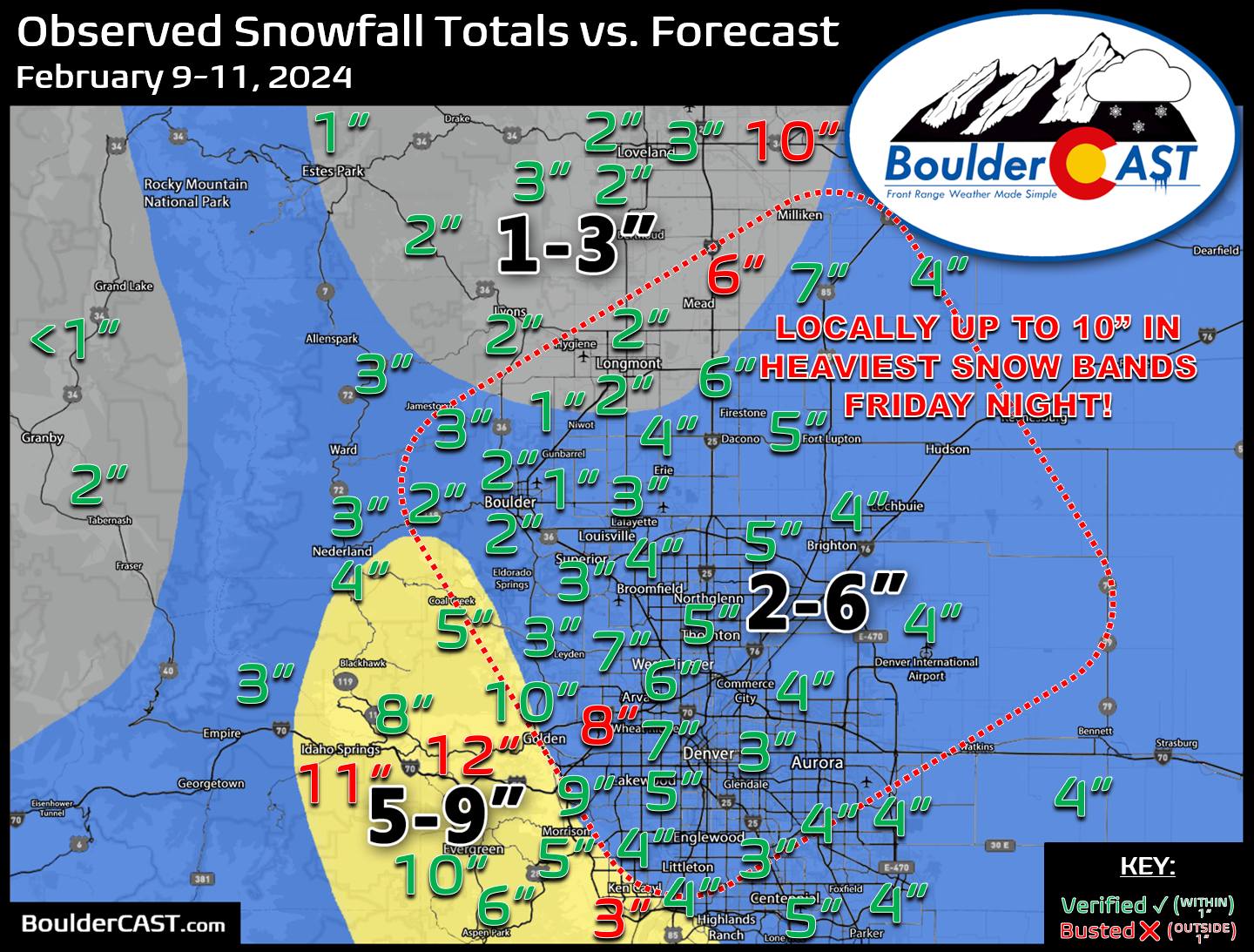
Shown below is our snowfall forecast map issued Friday morning with actual storm totals overlaid. Green values indicate that our forecast verified to within one inch of the observed snowfall total. Red numbers did not. When considering both parts of the winter storm, generally 2 to 6″ of snow fell across the lower elevations, though localized totals of up to 12″ were noted near Greeley and just west of Golden, owing to the unpredictable pockets of heavy snow Friday night. Officially, Boulder received 2.2″ of new snow from this weekend’s storm, while Denver (DIA) recorded 3.7″.
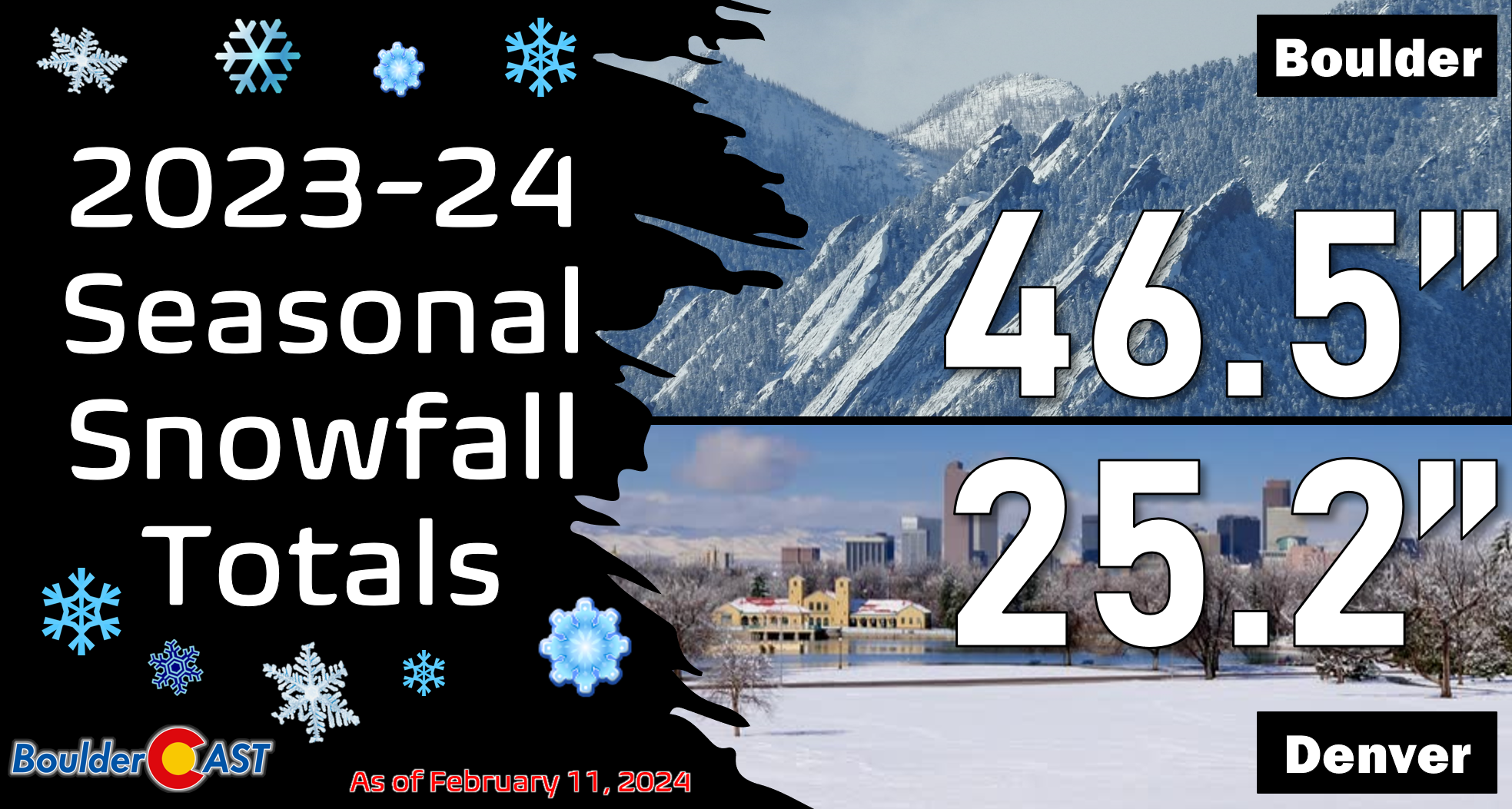
Updated seasonal snowfall totals are shown below.


You must be logged in to post a comment.