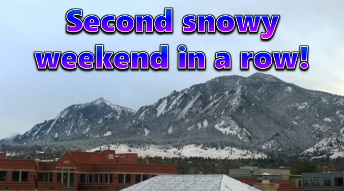
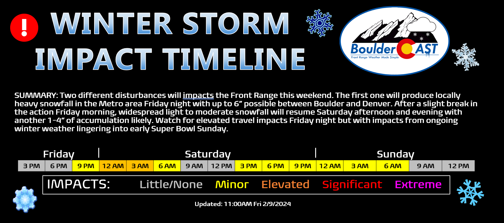
After a largely quiet work-week with seasonal temperatures and dry conditions across most of the Front Range, winter weather will make a return for the second weekend in a row! A series of disturbances will impact Colorado over the next couple days seeding the return of snow to the area. Winter weather will come in two parts — the first Friday night with locally heavy convective snowfall expected. A second wave of more widespread, but lighter snow will develop Saturday behind a weak cold front. Let’s take a look at the latest forecast for Super Bowl weekend, including our expected snowfall totals and the timing of the worst travel conditions.
At a Glance
- Winter Weather Returns For the Weekend: A two-part winter storm will bring snow to the Front Range of Colorado for the second weekend in a row.
- First Wave: The first wave of snow will occur Friday night, with locally heavy convective snow showers expected somewhere between Boulder and Denver, leading to a dusting to 4″ of snow for most areas, but locally up to 10″.
- Second Wave: The second wave of snow will arrive Saturday afternoon, with widespread light to moderate snow continuing into Saturday night, ending around midnight. This wave will favor areas south and southwest of Denver, with another dusting to 3″ of snow for most, up to 5″ for the hardest hit locations.
- Travel Impacts and Beyond: Travel impacts are possible Friday night and Saturday, especially in areas that get hit by the heavier snow showers. Conditions will improve on Sunday, with sunshine returning and no travel issues for Super Bowl party-goers. Temperatures will remain below normal heading into next week.

Go Premium, get all the perks.
Daily Forecast Updates
Get our daily forecast discussion every morning delivered to your inbox.
All Our Model Data
Access to all our Colorado-centric high-resolution weather model graphics. Seriously — every one!
Ski & Hiking Forecasts
6-day forecasts for all the Colorado ski resorts, plus more than 120 hiking trails, including every 14er.
Smoke Forecasts
Wildfire smoke concentration predictions up to 72 hours into the future.
Exclusive Content
Weekend outlooks every Thursday, bonus storm updates, historical data and much more!
No Advertisements
Enjoy ad-free viewing on the entire site.
Two weekends in a row with snow!
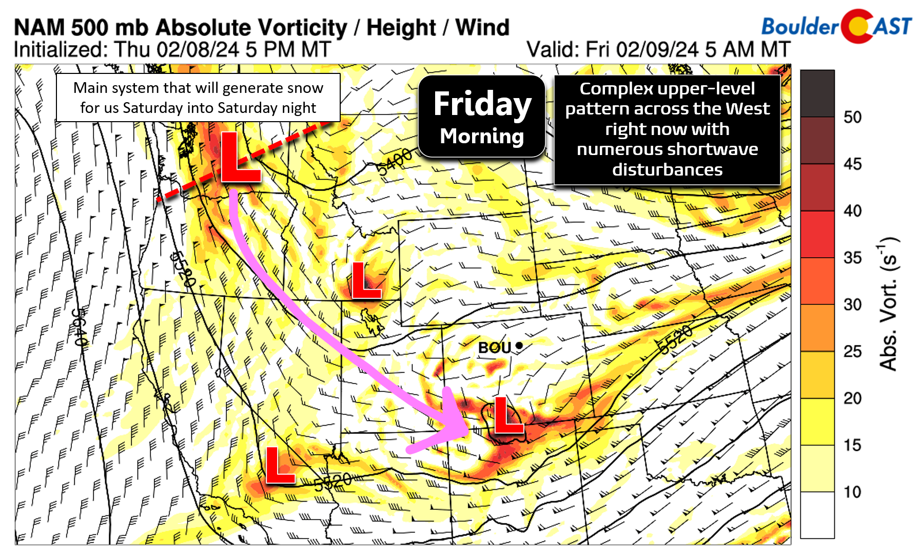
Right now the atmosphere is quite active across the West with a complex upper-level pattern containing at least four shortwave disturbance embedded in a broader trough. These generally weak systems will work in tandem to produce several waves of snow across the Front Range throughout the next 48 hours or so. We’ve been talking about this late-period snow chance all week long, so this should not be coming as a surprise.
As of Friday morning, the first weak upper-level disturbance is brushing across across far southwest Colorado. This system will lead to some clouds through our area today with a chance of widely scattered flurries or snow showers throughout the day as well.
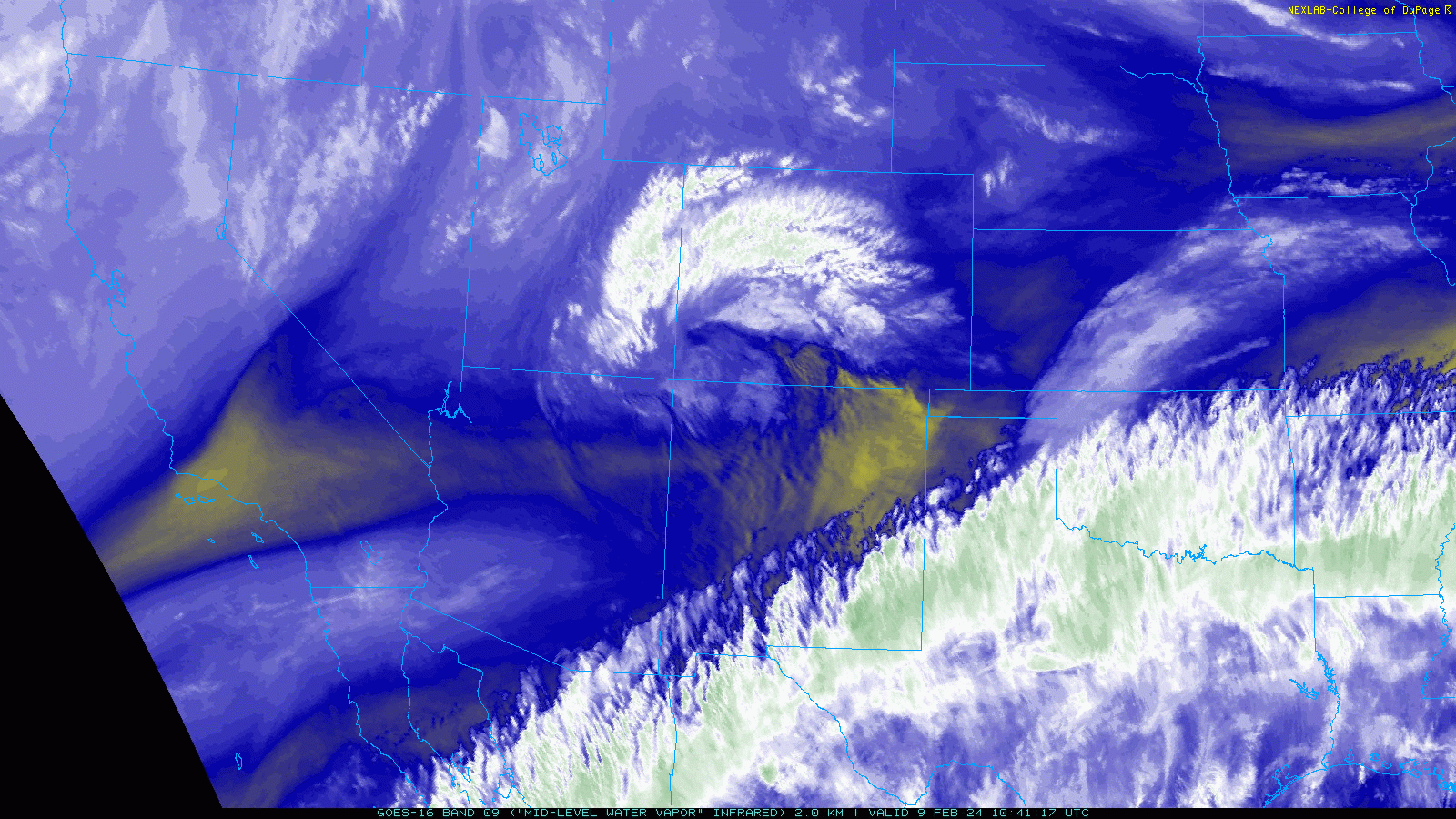
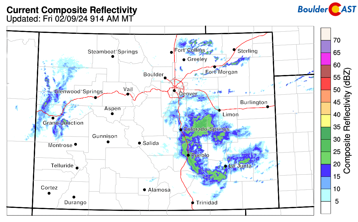
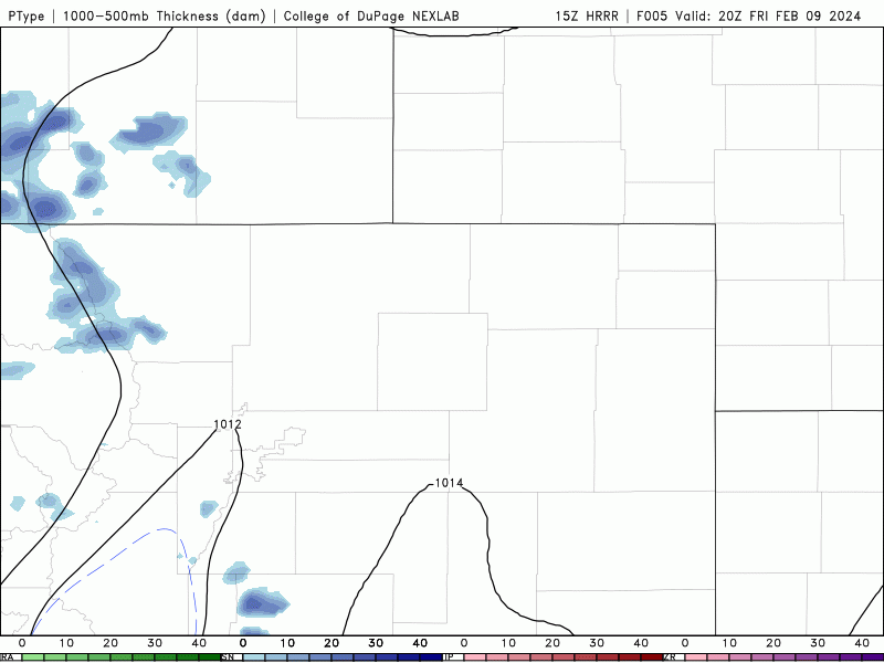
The upper-level low pressure is rather small and will lead to snowfall moreso across southern Colorado, rather than our area, but it is something to watch through our Friday as there is a dabble of instability in the atmosphere to help enhance things. Note the more widespread, heavier precipitation ongoing across southern Colorado on Friday morning’s radar animation:
Overall, expect partly to mostly cloudy skies on Friday with a few brief snow showers developing from time to time. Most of us will see just a trace or less of snow as temperatures push into the low to middle 40s on Friday. The higher Foothills locations could see a quick inch or so from any snow showers on Friday.
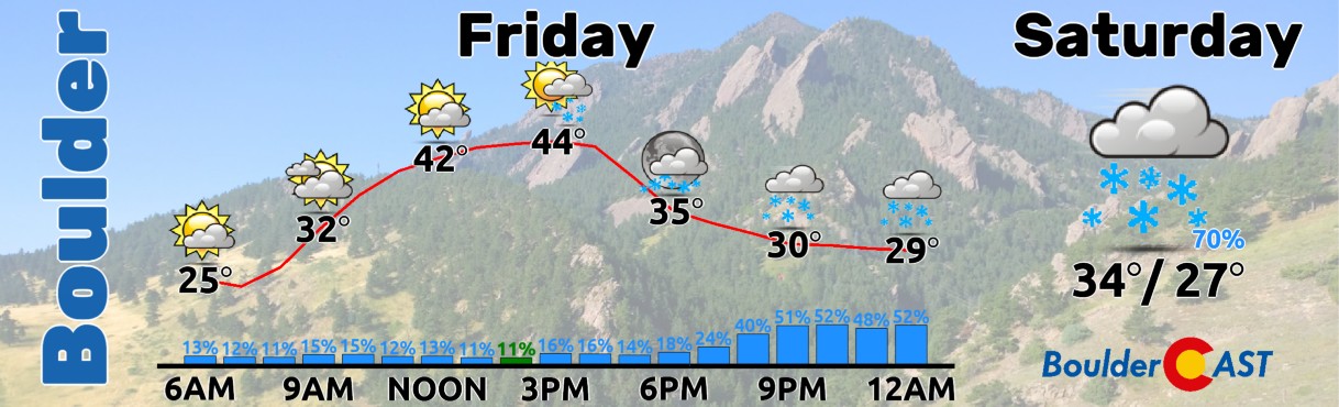
As shown in our timeline above, Friday evening and night the chance of snow will increase across the area as a weak surface low pressure forms just east of Denver and pushes towards Nebraska by Saturday morning. Short-range models are showing slow-moving convective snow showers forming to the northwest of this developing low, with these showers tracking directly across the western/northern Denver Metro area overnight. Here’s a look at the HRRR model-simulated precipitation forecast animation:
Due to their convective nature, any snow showers will have moderate to heavy snowfall rates exceeding 1″ per hour. For what it’s worth, latest runs of the HRRR model have the bullseye for heavier snow occurring in the neighborhoods between Boulder and Denver:
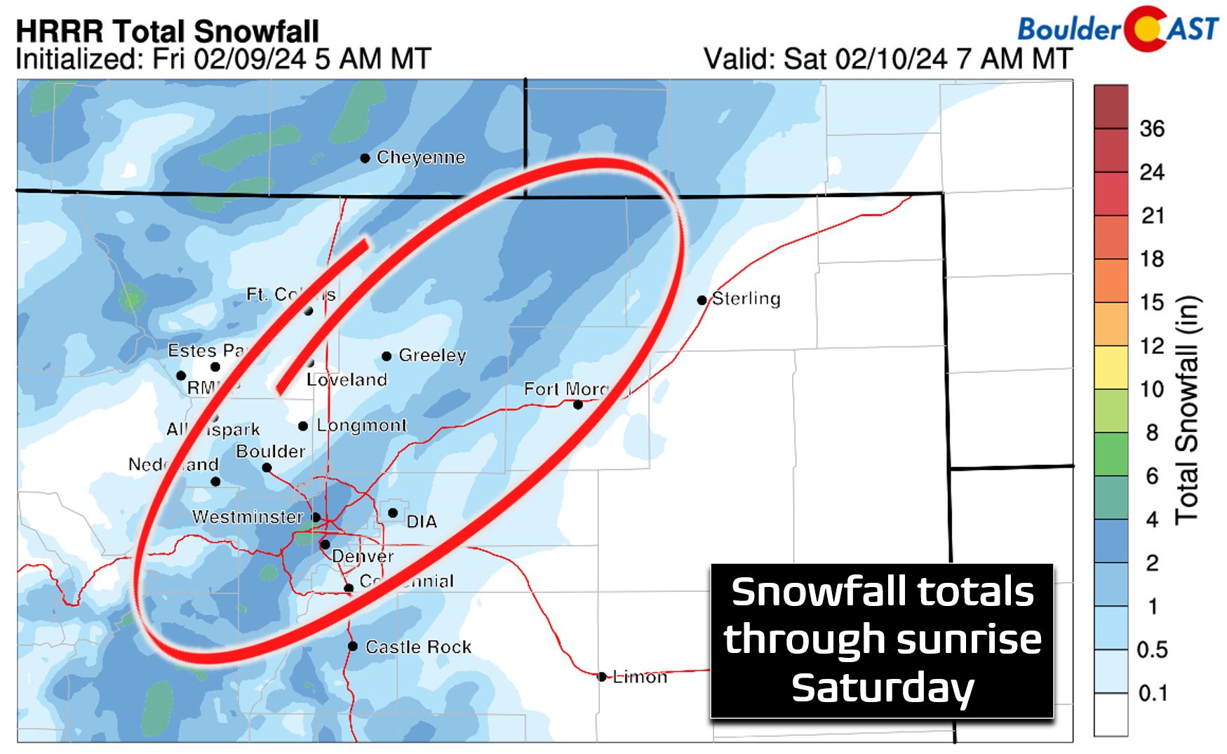
Another short-range model, the RAP, places the swath of heavier snow in a similar location between Boulder and Denver, but its amounts are a tad higher (see below).
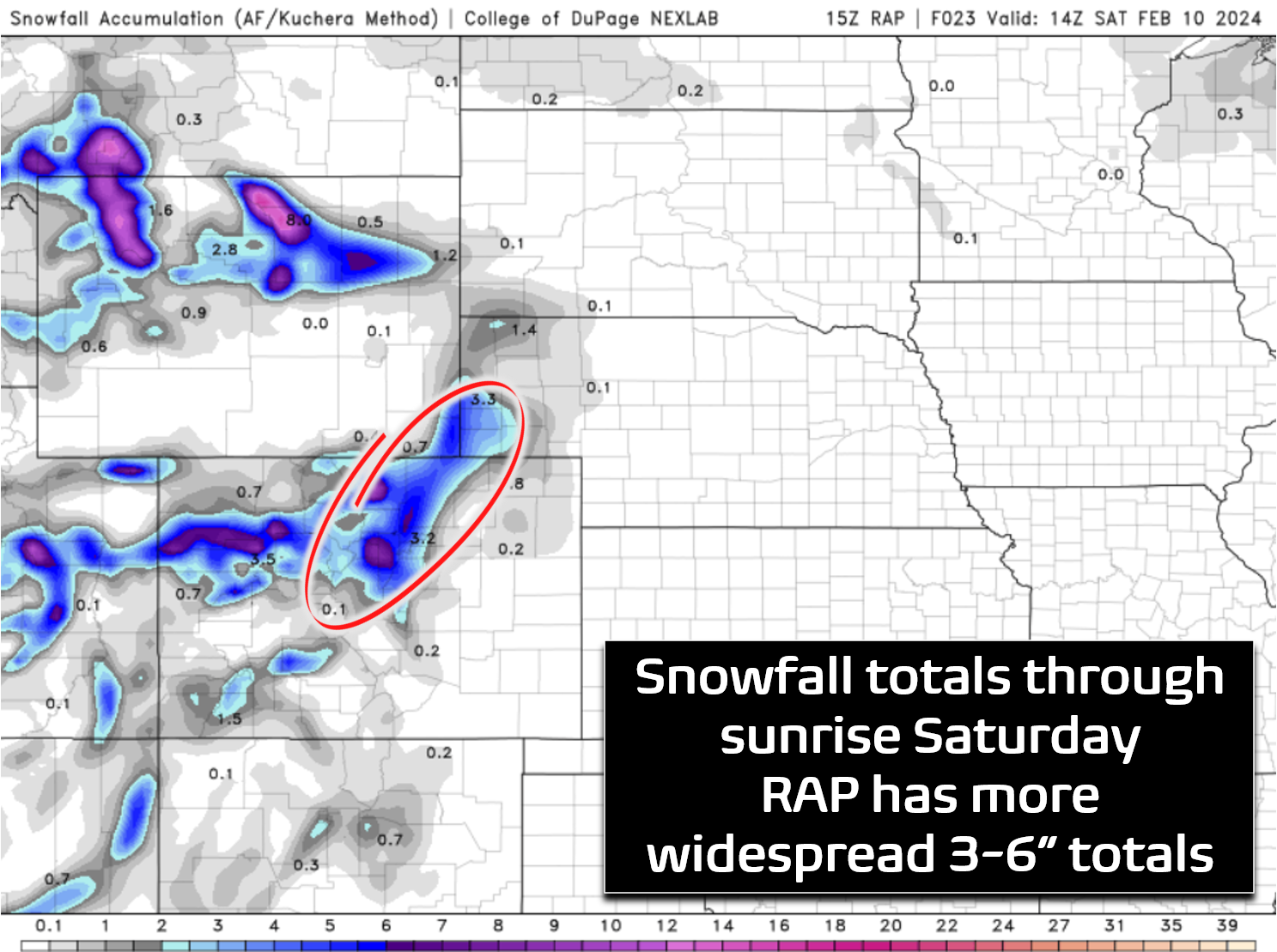
Since this is such a fine-scale feature, we will rely on short-range models to gauge upper-end snow amounts. Generally the snow showers Friday night will lead to a dusting to 4″ across the Metro area by sunrise Saturday. However, we can’t rule out localized 4-8″ snowfall totals for areas that get hit by multiple convective cells. This is most likely to occur somewhere between Longmont and Denver — for cities including Boulder, Arvada, Westminster, Broomfield, Superior and Thornton. However, there is still quite a bit of uncertainty where exactly this persistent train of snow showers may set up. It really could be anywhere in the northern Metro!
Snow continues Saturday
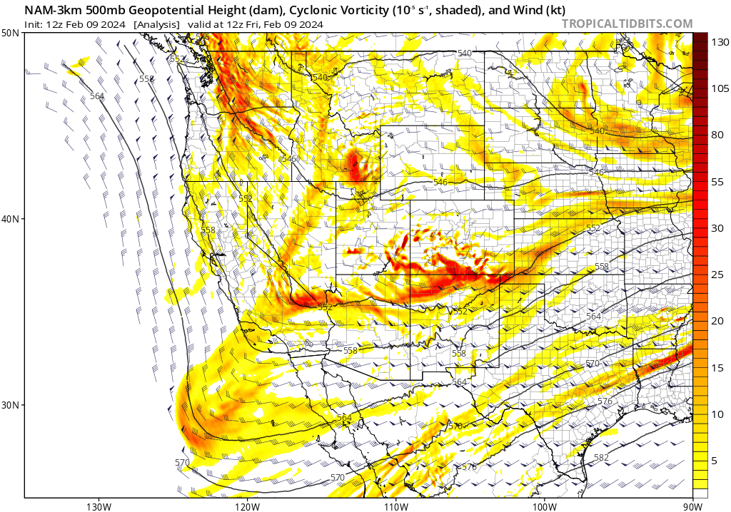
Things perhaps get more interesting on Saturday as the main storm system swoops in through the Four Corners and passes south of our area Saturday afternoon into Sunday morning. This one will once again involve a storm taking a less than ideal, “too far south” track across the southern Rockies. The 500mb vorticity forecast animation below shows how the broader complex pattern may evolve in the coming days. Note in particular the primary storm which spawns near Las Vegas and moves east across far northern New Mexico.
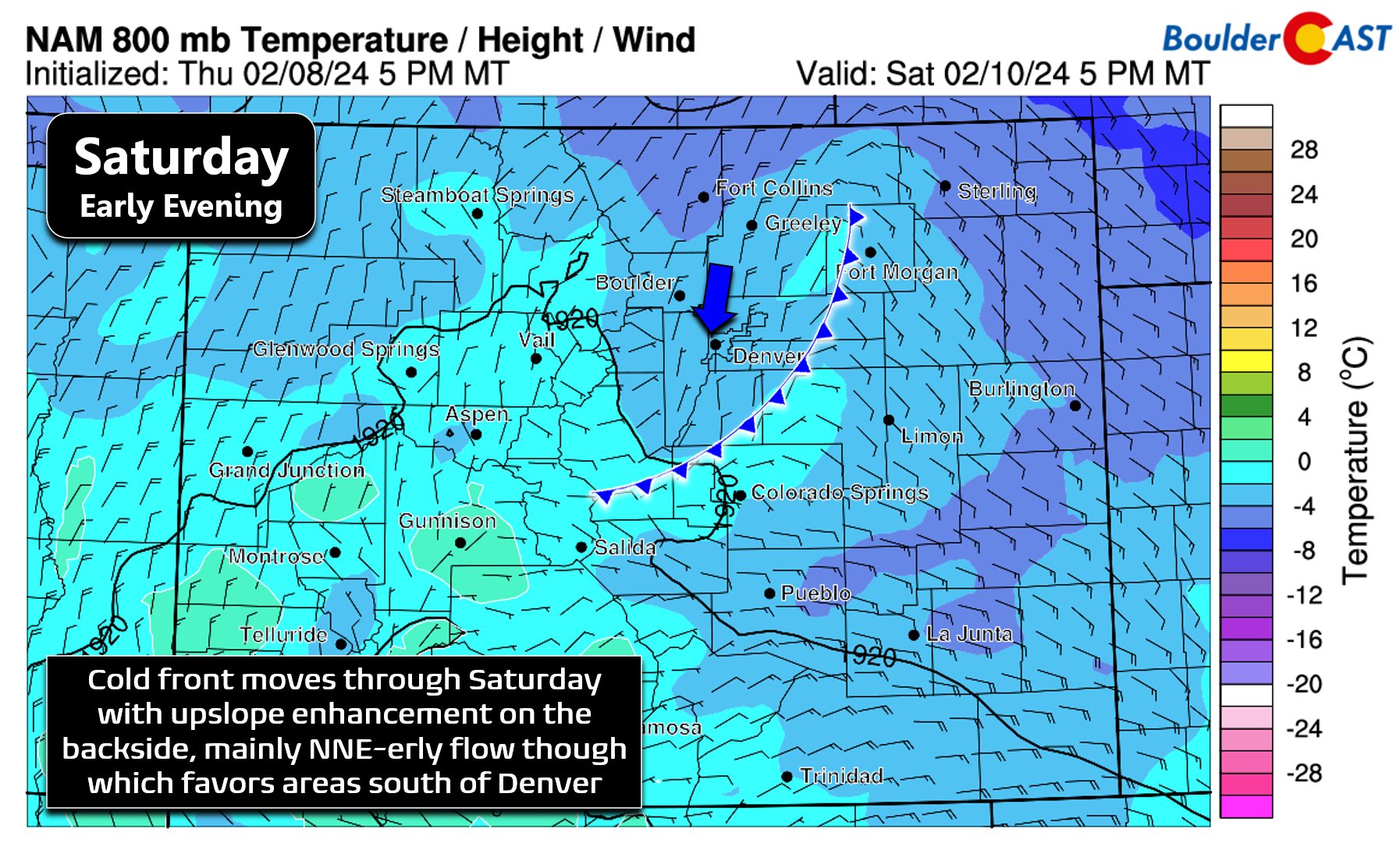
Energy from this storm will arrive right on the heels of the departing surface low pressure from Friday night. There may be a lull in the action across the Metro area Saturday morning, but it should be short-lived with snow increasing again by late morning or afternoon as a surface cold front pushes through the Front Range. This will usher in upslope flow, though with it being north-northeasterly, this upslope will generally favor areas south and southwest of Denver, more so than Boulder.
Widespread light snow with embedded pockets of moderate snow will continue through Saturday afternoon into Saturday night, ending around midnight for the area as much drier air works in from the northwest. This secondary wave should bring a more widespread helping of snowflakes to the entire area but may only amount to a dusting to 3″ of additional accumulation, with perhaps 2-4″ for the luckiest and hardest hit locations south and southwest of Denver.
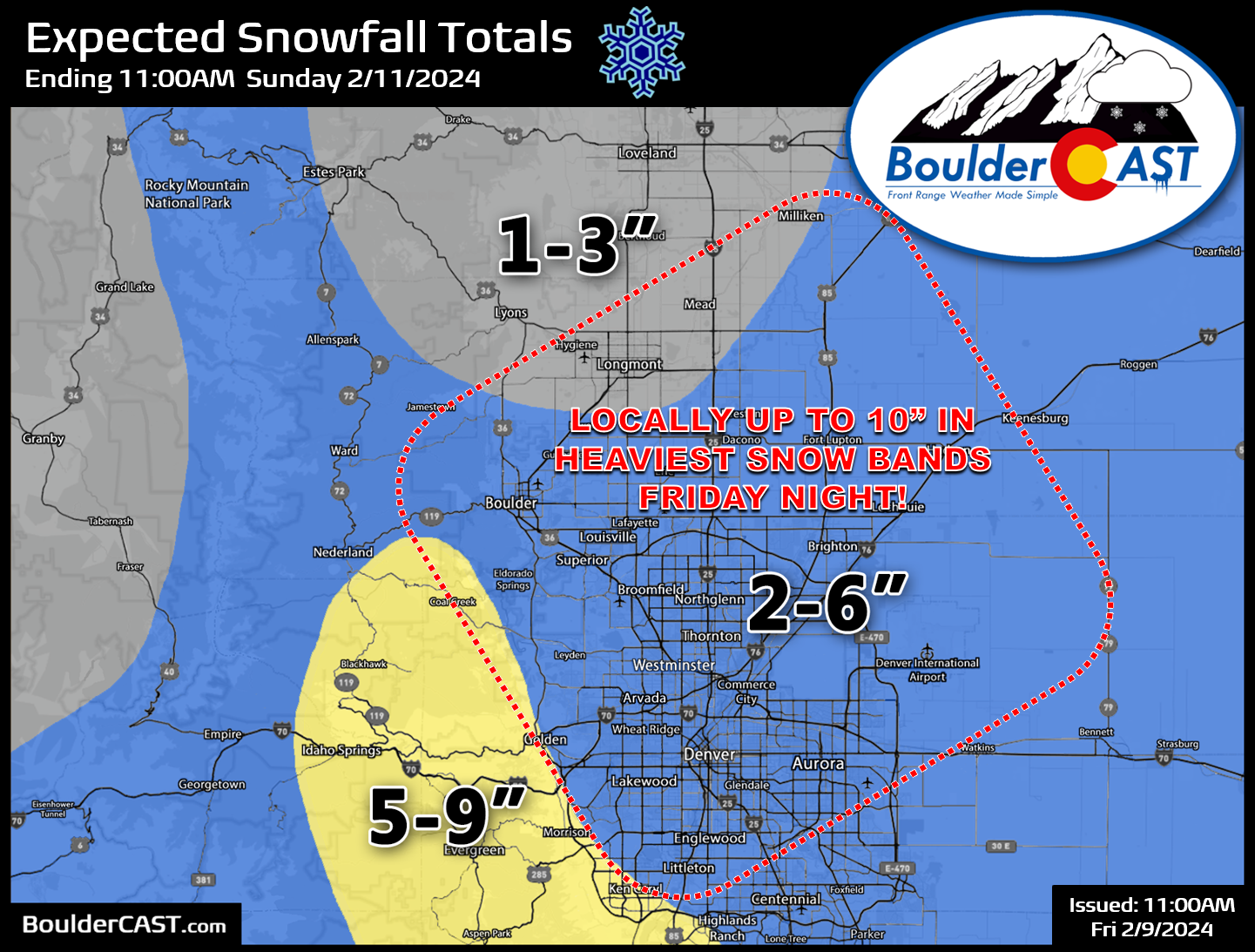
Between the two distinct systems impacting the Front Range over the next few days, snowfall totals will generally range from 1 to 6″ across the lower elevations, with higher totals of 5 to 9″ expected in the southern Foothills in parts of Jefferson and Boulder Counties. Our snowfall forecast map for the entire, two-part event is shown below. This covers all snow falling through Saturday night. There will probably be some locally higher totals across the Boulder-Denver Metro area (up to 10″). However, it’s difficult to pointpoint where exactly that will be. Booming snow totals should be the exception, rather than the rule, but definitely keep a close eye as things evolve!
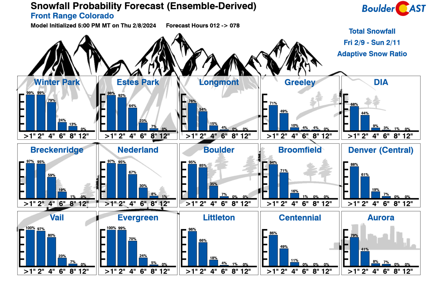
Our latest Snowfall Probabilities indicate relatively high odds for 2″ of snowfall this weekend in most of the Metro area, but the coarser ensemble resolution is likely failing to capture the outcomes resulting from the small-scale heavier snow showers. Chance for greater than 6″ are very low, likely too low in these ensembles.
Elevated travel impacts are possible Friday night in areas that get hit hardest by the convective snow showers, but lesser impacts will linger through Saturday into Saturday night with light snow continuing for much of the area. As mentioned, snow will end Saturday night for all with conditions improving on Sunday. There won’t be any travel issues Super Bowl Sunday afternoon or evening. We’re not sure either team is worth cheering for, but at least party-goers will not be slowed down by Mother Nature.
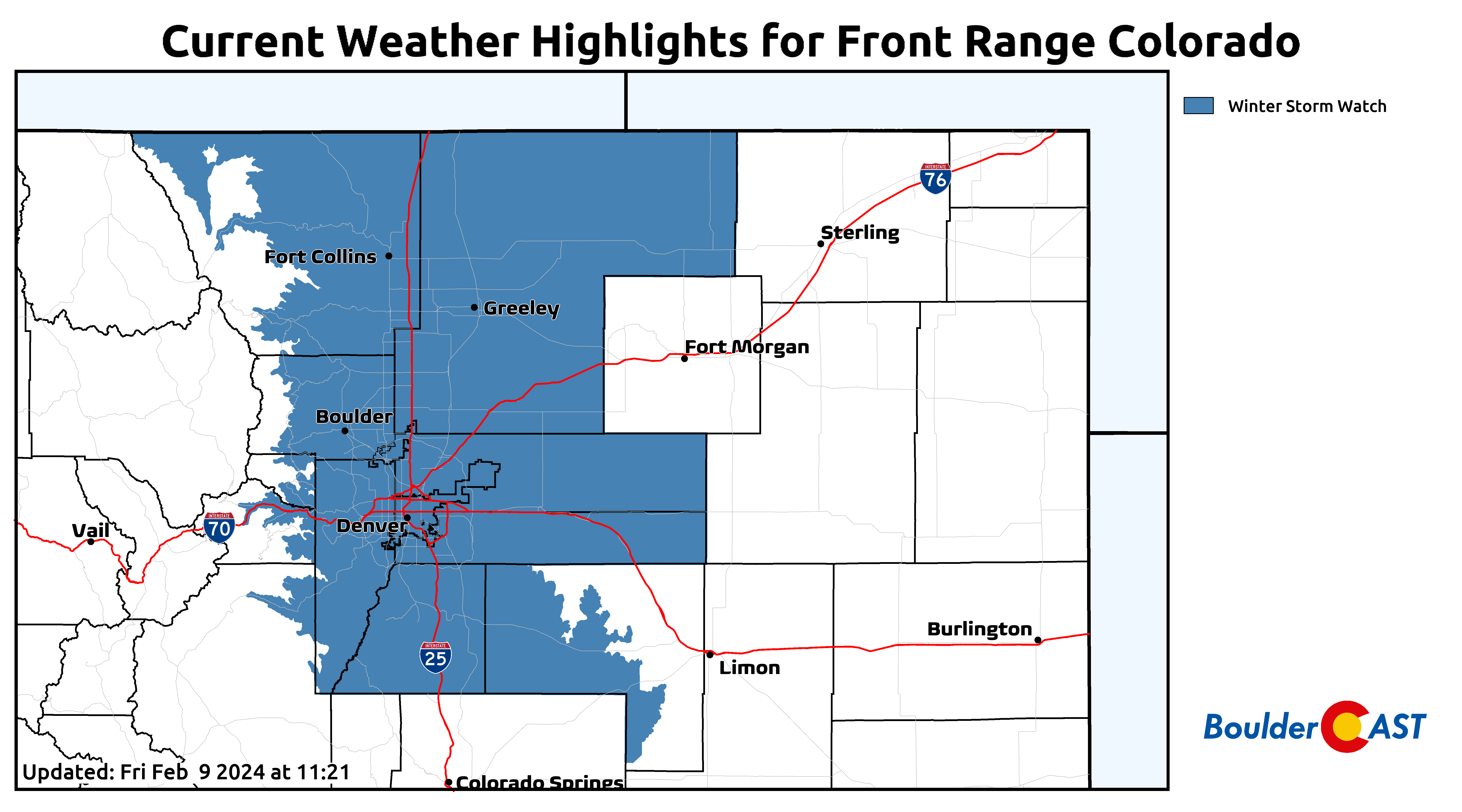
As of writing Friday morning, there is currently a Winter Storm Watch posted for the entire Front Range. This is likely to get downgraded to a Winter Weather Advisory for Denver, Boulder and some of the Foothills. Some areas that we expect lower totals are likely to just see the Watch cancelled entirely with no replacement. Sorry Fort Collins and Estes Park!
Beyond the snow, our weather will shift quiet again Sunday into next week with sunshine returning in earnest to the Front Range. Temperatures will remain below normal, though.

Be sure to follow us on Twitter, Facebook, and Threads for on-the-fly updates as this two-part winter storm unfolds across the Front Range this weekend. We’ll also have an additional mid-storm discussion posted Saturday morning on BoulderCAST Premium. Enjoy the return of snow this weekend — but if snowflakes aren’t exactly your thing, perhaps you can look forward to witnessing Taylor Swift’s reaction to EVERY single play on Sunday instead?

Get BoulderCAST updates delivered to your inbox:
Go Premium, get all the perks.
Daily Forecast Updates
Get our daily forecast discussion every morning delivered to your inbox.
All Our Model Data
Access to all our Colorado-centric high-resolution weather model graphics. Seriously — every one!
Ski & Hiking Forecasts
6-day forecasts for all the Colorado ski resorts, plus more than 120 hiking trails, including every 14er.
Smoke Forecasts
Wildfire smoke concentration predictions up to 72 hours into the future.
Exclusive Content
Weekend outlooks every Thursday, bonus storm updates, historical data and much more!
No Advertisements
Enjoy ad-free viewing on the entire site.
Enjoy our content? Help us out and give it a share:


You must be logged in to post a comment.