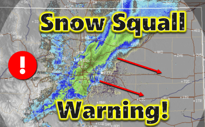
In dramatic fashion, an intense snow squall blew up over Boulder Tuesday morning and spread across the entire Denver Metro area leading to brief whiteout conditions just after the morning commute window. The heavy snowfall ended as quickly as it began, leaving behind rather unimpressive snowfall totals in the Front Range. However, as they say, it’s not about where you end up — it’s about how you got there! We discuss the crazy weather that unfolded on Tuesday and take a look at the snowfall totals.
Category: Verification (Page 11 of 53)
These posts take a look back at recent weather events, like snow storms or severe weather outbreaks, and evaluate how the forecast played out. We evaluate how well the models predicted what actually occurred, and offer insight into what can be learned and applied moving forward.

Well, most of us are waking up and having to shovel snow for the third Saturday in a row! This tiny recap post covers our latest winter storm, including a map of the verified snowfall totals and where we stand season-to-date against climatology.
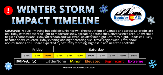
After a rather quiet week with seasonal temperatures, winter weather will return to the Front Range for the third weekend in a row as colder air and a quick shot of light accumulating snow arrive Friday evening and night. We discuss the atmospheric setup about to unfold, the potential snowfall amounts across the Metro area and Foothills, as well as when travel will be most impacted.
Update (Friday 2/16/24 8:00AM): We’re now seeing a better signal of stalled convergence/jet-forcing briefly sitting over the Denver area Friday evening, combined with a continued expectation for very fluffy snow ratios. Thus, we’ve bumped up snow amounts across the Metro area. Please check the updated snowfall map and storm impact timeline near the end of this post. We talk about this shift and much more in Friday morning’s Premium discussion HERE.
A tiny recap of the two-phase snow storm Friday into Saturday, including a map of the verified snowfall totals.
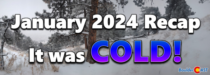
The beginning of 2024 was completely opposite to the conclusion of 2023, with temperatures taking a sharp colder turn as multiple Arctic outbreaks slammed the Front Range. Warmer temperatures toward the end of the month saved January from being one of the all-time coldest here. There were also several light snow events during the month, but nothing substantial — not surprising as January is our driest month of the year after all. Here’s a quick and colorful graphical recap of our weather during January and how it relates to climatology.
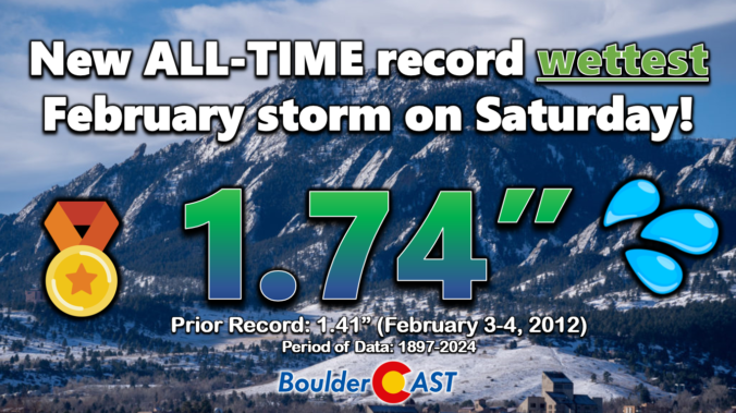
Well, our snowfall forecast for the sloppy weekend storm ended up being a tad off in many areas. Hopefully our in-depth discussions in the days leading up to the event highlighted that the exact outcome of this warmer-than-usual storm was highly uncertain. We first review the record-breaking precipitation and snowfall totals across the Front Range. Then we discuss what went wrong with the forecast and dive into the finer details of this implausible moisture-infused winter storm.
With the Great Arctic Blast of 2024 starting to wrap up across Front Range Colorado, the weather week ahead will be comparatively less eventful. However, there are multiple disturbances lined up in the coming days which will bring waves of moderate to heavy snow in the Mountains as well as a small chance of wintry precipitation to the Metro area. A thawing trend will ensue in the coming days, but temperatures won’t get back above normal until late in the weekend or early next week.
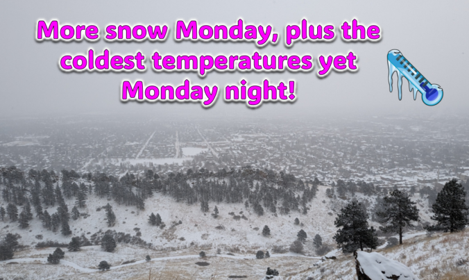
Just when you might have thought things were turning warmer, a secondary Arctic front and more snow will arrive to the Front Range on Monday. Additional snow accumulations and slick travel are expected during the day with the coldest temperatures we’ve seen yet developing Monday night. Let’s take a look at the latest as the ongoing Arctic blast delivers one final blow on MLK Day!

Live View of Boulder

Current Conditions

Live Radar

Recent Premium Posts

BoulderCAST Daily – Sun 05/31/26 | Dry and warm today but rain chances increase this week
🌦️ Overall dry and warm Sunday, though cannot rule out a very widely …
BoulderCAST Daily – Sat 05/30/26 | A stray shower today as most activity resides well east of Denver
🌦️ Spotty showers today, mainly well east of the Denver Metro area, where …
BoulderCAST Daily – Fri 05/29/26 | A Marginal Risk of Severe Isolated Storms
🌦️ Spotty showers this afternoon, mainly noon and 4 PM, with highs in …
3-Day Forecast

Trending Content

© 2026 Front Range Weather, LLC