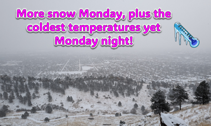
Just when you might have thought things were turning warmer, a secondary Arctic front and more snow will arrive to the Front Range on Monday. Additional snow accumulations and slick travel are expected during the day with the coldest temperatures we’ve seen yet developing Monday night. Let’s take a look at the latest as the ongoing Arctic blast delivers one final blow on MLK Day!
At a Glance
- Arctic Blast Round #2: A secondary Arctic front will bring more snow and even colder temperatures to the Front Range on Monday
- Temperature Drop: The area has been below 10°F for 48 hours, with an even colder air mass arriving early Monday
- Snow Accumulation: Light snow is expected from 6AM to 6PM Monday, with 1 to 3 inches of accumulation predicted
- Extreme Cold Warning: Temperatures may drop to -10 to -20°F Monday evening, with a Wind Chill Warning in effect through Tuesday morning

Go Premium, get all the perks.
Daily Forecast Updates
Get our daily forecast discussion every morning delivered to your inbox.
All Our Model Data
Access to all our Colorado-centric high-resolution weather model graphics. Seriously — every one!
Ski & Hiking Forecasts
6-day forecasts for all the Colorado ski resorts, plus more than 120 hiking trails, including every 14er.
Smoke Forecasts
Wildfire smoke concentration predictions up to 72 hours into the future.
Exclusive Content
Weekend outlooks every Thursday, bonus storm updates, historical data and much more!
No Advertisements
Enjoy ad-free viewing on the entire site.
More snow, more cold for Monday
As of writing Sunday evening, we’ve now been below 10°F for 48 straight hours, a timer that begin with the original Arctic frontal passage Friday evening. Saturday saw a daytime high temperature below zero in Boulder. Sunday was warmer, but still only reached the single digits across the area.

It did snow most of Sunday morning in Boulder with another 1″ or so of accumulation.
The sun is out in Denver, but it just keeps snowing here in #Boulder! ☃️ #cowx pic.twitter.com/HJ7bKMpBij
— BoulderCAST Weather (@BoulderCAST) January 14, 2024
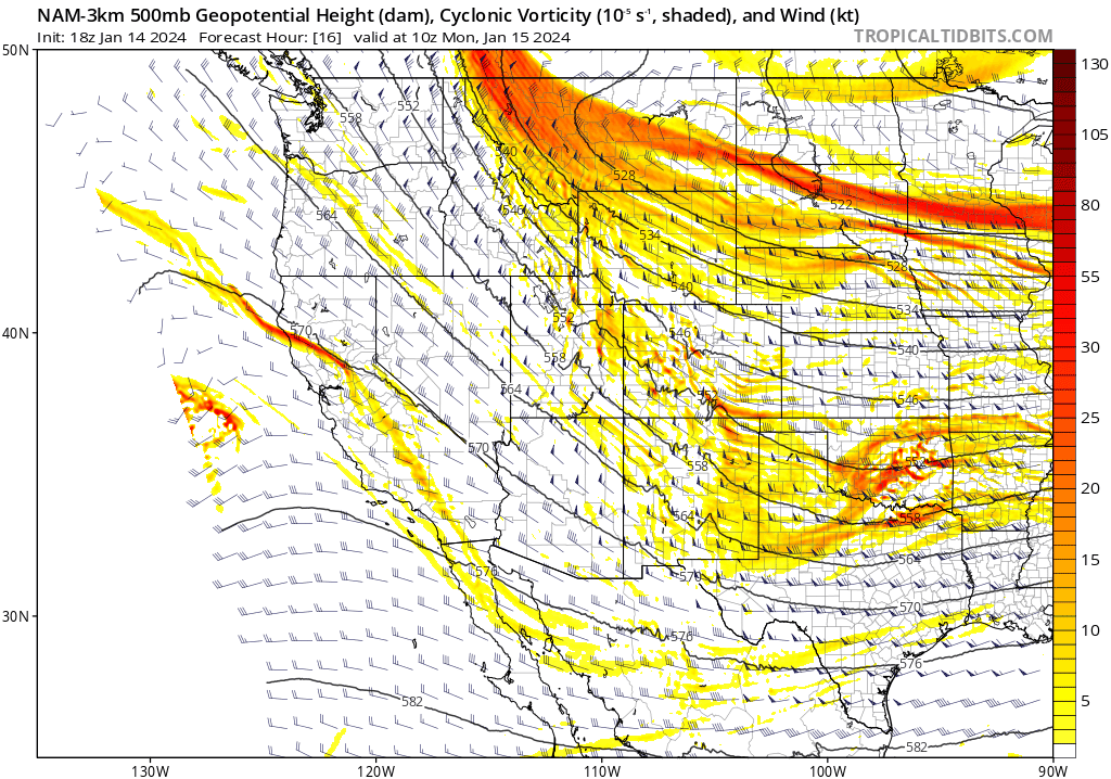
While it may seem like we are now squarely headed in a warmer direction, don’t be fooled. An even colder airmass will arrive early Monday as a secondary Arctic front drops into eastern Colorado. This one is associated with a shortwave, clipper-type disturbance embedded in the broader northerly flow — and it’s coming straight at us from northern Canada.
The front itself will move through in the early morning hours on Monday, but it’ll be subtle. It’s effects will be felt more so over time, rather than immediately, as bitter cold Arctic air oozes into the Front Range all day Monday.
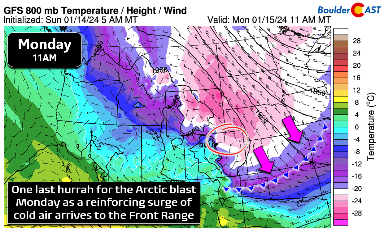
We’ll start our Monday slightly below zero degrees across the lower elevations and we won’t warm up much at all as the day progresses. We may even see temperatures slowly drop during the day through the negative single digits into the negative teens by evening.

Wind chills will be in the -10s and -20s during the day Monday as north or northeast winds pick up again behind the front. Just remember that we still have a Wind Chill Warning in effect continuously through Tuesday morning. Prolonged exposure without adequate attire will not go well for anyone!

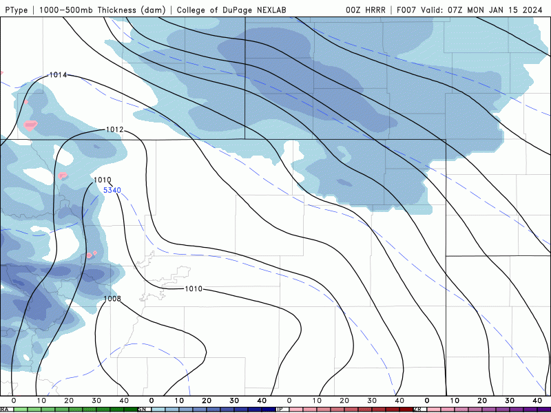
In addition to the continued frigid temperatures on Monday, we will see light snow once again spread across the entire Front Range from the north, with a focus mainly from 6AM to 6PM Monday. The animation below is the HRRR model precipitation forecast, which shows a broad area of generally light snow enveloping the Metro area Monday morning. While it previously looked like there might be some decent jet stream interaction, that appears like less of a factor now with things not aligning properly aloft. Thus, were not likely to see many heavier snow bands show up across the Metro area. This should be an almost exclusively light snow event.
With that said, temperatures will be very cold and snow ratios will be elevated somewhat (between 12:1 to 15:1). With generally 0.1 to 0.25″ of moisture expected across the area, this will translate into an inch or three of snow accumulation.

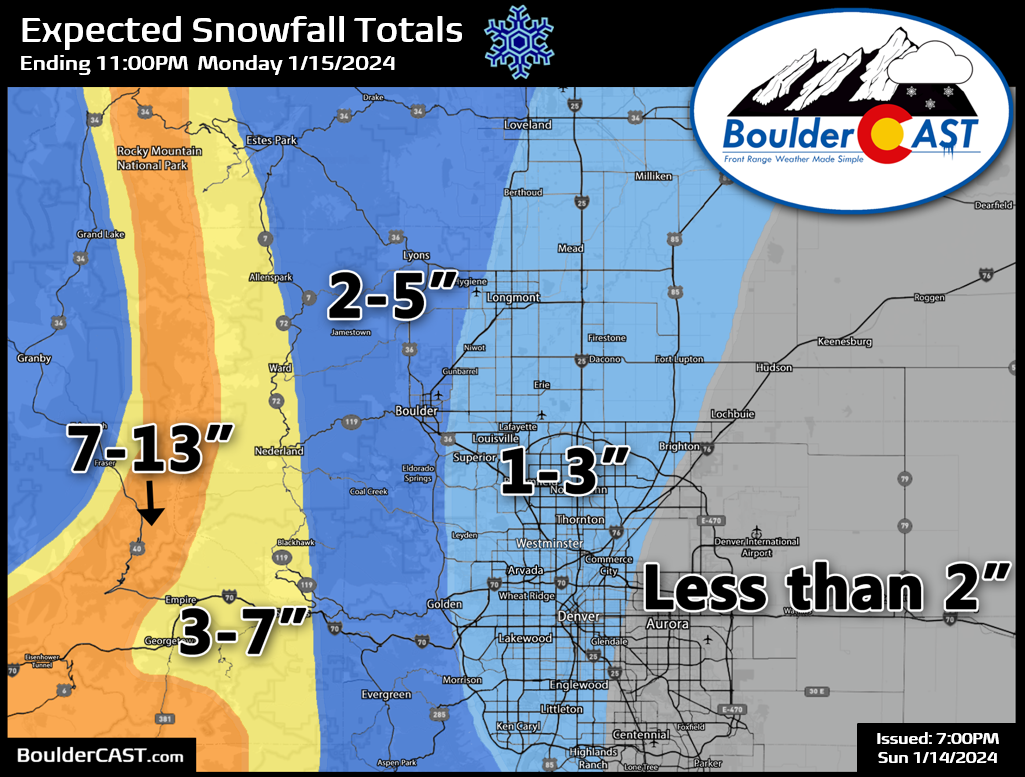
Our snowfall forecast map for Monday’s final wave of light snow associated with the ongoing Arctic blast is shown below, covering all snowflakes Sunday night through Monday evening. Generally we are expecting a dusting to 4″ across the Metro area, highest around Boulder and lowest southeast of Denver. Up to another foot of snow may fall along the already hard-hit Continental Divide by the time things are all said and done with this system. Travel conditions will remain slick all day Monday as light snow falls onto very cold roadways. Given the light accumulations, it shouldn’t be too bad, but definitely expect slick and snow-covered roadways to develop again (or if you’re in Boulder, roads were never clear this weekend at all and they will stay that way!).
As the snow comes to an end Monday evening and skies clear out, the Arctic blast will deliver a figurative “coup de grâce” with temperatures likely to plummet further than anything we’ve seen thus far! The interaction of the Arctic air with our topography will still make for a challenging, somewhat uncertain forecast regarding just how cold everyone gets Monday evening and night. The Euro model has our entire area dropping down to -15 to -25°F (shown below). This seems plausible as skies will clear out over fresh snow and the core of the coldest Arctic air is parked over the area.
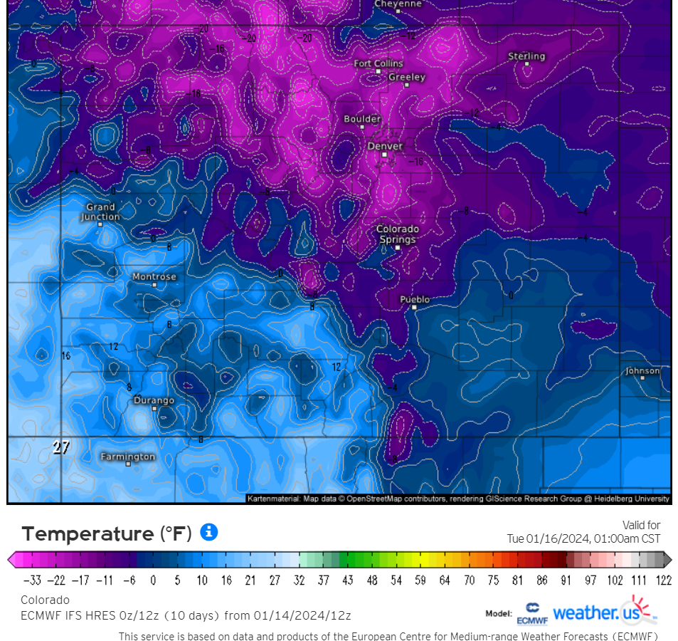
Euro model forecast low temperatures Monday night
The short-range HRRR model shows less widespread temperatures below -15°F, with readings that cold only in the lowest elevation river valleys in the northern Front Range. However, the HRRR model is not great at predicting more than 30 hours out. We’ll have to see how this situation evolves, but local topography will likely create some nasty temperature differences from neighborhood to neighborhood Monday night!

HRRR forecast low temperatures Monday night.
For now, we think more widespread extreme cold is the more likely outcome. Plan on low temperatures ranging from -10 to -20°F Monday evening and night, coldest in the northern Front Range river valleys. Places like Greeley, northeast Longmont and Loveland could see temperatures colder than this — truly dangerous stuff!
That’s all for now. Check back with us on Tuesday morning for our (delayed) weekly outlook. The good news is the week ahead will indeed be warmer. Woohoo! The bad news is that it won’t exactly be what you would normally consider “warm”! Be sure to follow us on Twitter, Threads, or Facebook for real-time updates in the days ahead, or join us on BoulderCAST Premium for in-depth daily updates every morning.
Get BoulderCAST updates delivered to your inbox:
Go Premium, get all the perks.
Daily Forecast Updates
Get our daily forecast discussion every morning delivered to your inbox.
All Our Model Data
Access to all our Colorado-centric high-resolution weather model graphics. Seriously — every one!
Ski & Hiking Forecasts
6-day forecasts for all the Colorado ski resorts, plus more than 120 hiking trails, including every 14er.
Smoke Forecasts
Wildfire smoke concentration predictions up to 72 hours into the future.
Exclusive Content
Weekend outlooks every Thursday, bonus storm updates, historical data and much more!
No Advertisements
Enjoy ad-free viewing on the entire site.
Enjoy our content? Help us out and give it a share:


You must be logged in to post a comment.