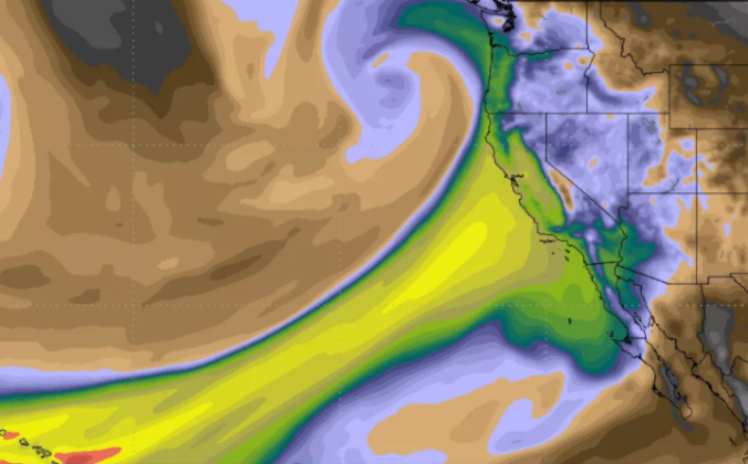
The Pineapple Express was back at it again this past weekend. Another round of soaking rain struck California, with all that tropical moisture translating into heavy mountain snow across northern Colorado.

Forecasts focused on the many ski resorts of NE Colorado.

The Pineapple Express was back at it again this past weekend. Another round of soaking rain struck California, with all that tropical moisture translating into heavy mountain snow across northern Colorado.
Following a relatively quiet stretch of weather, things are about to take a cold and snowy turn for the Metro area on Friday as a strong cold front moves into the region. Read our complete forecast covering the timing of those chilly temperatures and potential snow amounts.
Premium Storm Update (Fri April 6 at 12:30 PM) April snow and VERY cold temperatures have arrived: READ NOW
A quick round-up of precipitation and snow totals from Wednesday’s over-producing winter event.
A secondary weather system will bring a return of rain and snow to our region on Wednesday. This system is slightly warmer and weaker than the one earlier in the week. Nonetheless, some accumulating snow is possible later tonight. Read on for details.
Monday evening’s wet snow brings us closer to normal precipitation for the month of March. We review the snow totals from across the region and discuss our next chance of snow.
We have gotten numerous requests to streamline your ability to monitor upcoming winter weather. To answer this call, we’d like to introduce you to SnowTracker, a new hub that consolidates a wealth of weather information related to forecasting and tracking Mother Nature’s most wintry moments. SnowTracker acts as a focal point to keep an eye on developing winter storms for Colorado and what is already on the ground.
Available information includes…
SnowTracker will be seasonally available on BoulderCAST during the months of September through May. Please do enjoy!
.
Despite the warm weather of late, snow is once again headed to our region Monday evening and night. We provide details on the timing and potential snowfall amounts for this quick-moving spring storm.
Premium Storm Update (Mon Mar 26 at 7:00 AM) Minor northward adjustments for tonight’s rain/snow: READ NOW
PowderCAST 2.0 is now available
Prior to this winter, we completed a major upgrade to our PowderCAST suite of ski forecasts! Here are some of the NEW features we’re most excited about:
As a special bonus for our fellow skiers, use the promo code SKI to save 15% on an annual subscription.
Finding the next “POW Day” is now easier than ever with PowderCAST 2.0. We hope you enjoy!
© 2025 Front Range Weather, LLC
You must be logged in to post a comment.