Despite the warm weather of late, snow is once again headed to our region Monday evening and night. We provide details on the timing and potential snowfall amounts for this quick-moving spring storm.
Premium Storm Update (Mon Mar 26 at 7:00 AM) Minor northward adjustments for tonight’s rain/snow: READ NOW
THE SET-UP
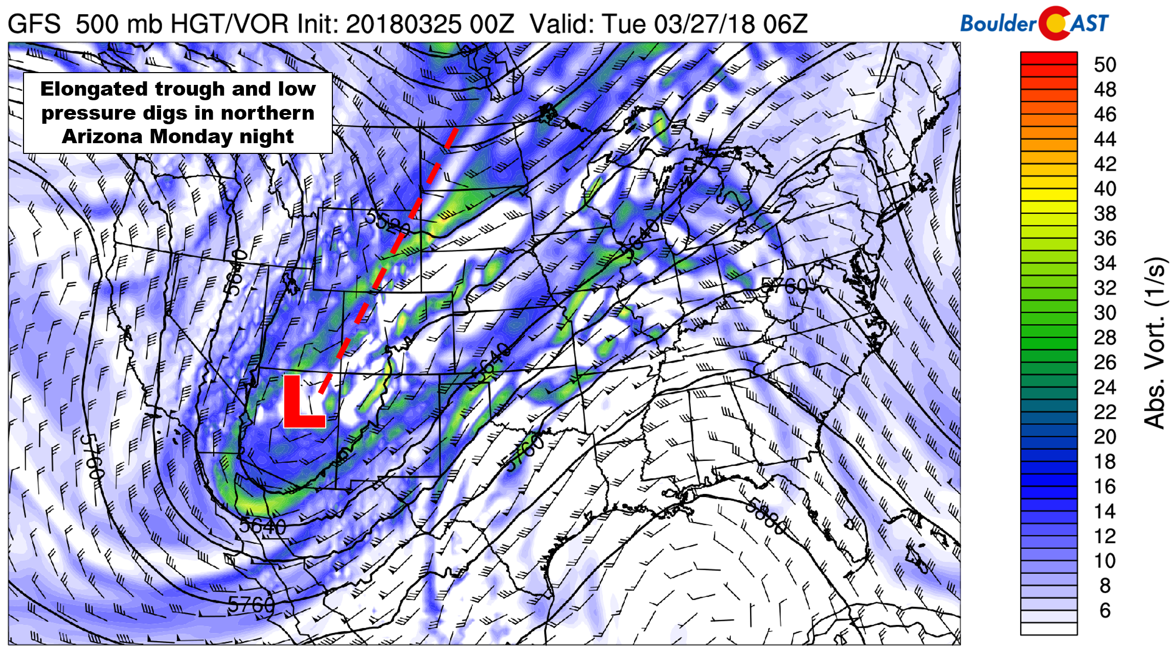
A deep trough of low pressure has come ashore into the Pacific Northwest on Sunday. This Pacific trough played a large part in the atmospheric river event last week, helping to funnel tropical moisture northward into California. It is no longer packing anywhere near the amount of moisture that it was back then…but as the system moves into northern Arizona Monday evening, it will bring brief but favorable conditions for rain and snow to the Denver Metro area. The 500 mb vorticity map below for Monday night shows the position of the low pressure and elongated trough stretching northeastward.
UPSLOPE
We’re expecting a brief window of widespread precipitation beginning late Monday afternoon continuing until after midnight Monday night. The precipitation will be driven by large-scale lift from the trough combined with deep upslope behind a cold front banking up against the Foothills and Palmer Divide. The forecast maps below for midnight Monday night show temperatures and winds at 800 mb (left) and 700 mb (right).
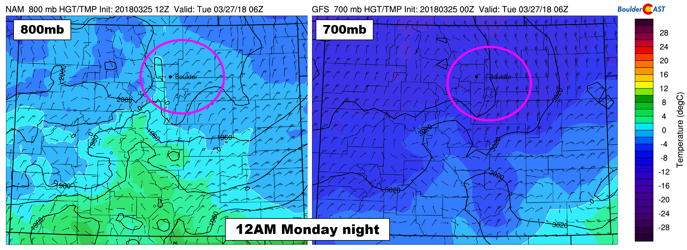
Of note is the direction of the upslope circled in pink. At 800 mb (a few hundred meters above ground level), we see the ideal northeasterly upslope direction. However, higher up in the atmosphere at 700 mb, winds are northerly or north-northeasterly. This wind direction will help focus the heavier precipitation towards the southern Metro area, where northerly winds are upslope into the Palmer Divide. All models agree quite well on this facet of the storm. The northern part of the Metro area, especially those not near the Foothills, won’t see much from this event.
TEMPERATURES
As is so often the case in late March, temperatures will also be a factor for this storm. Afternoon highs on Monday are expected to be in the low to middle 50’s across the lower elevations. Precipitation for the Plains will begin as rain and then change to snow during the evening hours as colder air moves in from the north.
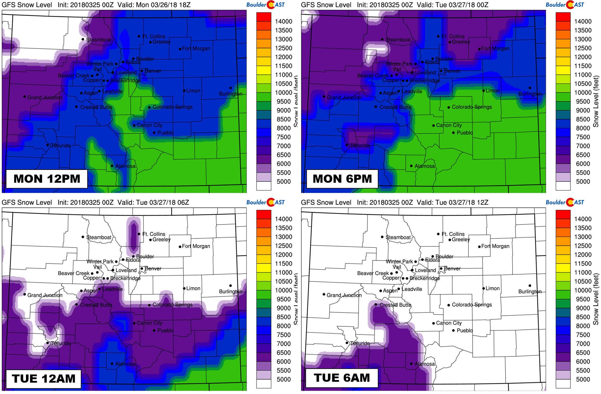
The timeline of GFS model-derived snow levels is shown below. They will start near 8,000 feet Monday afternoon, then fall to below 5,000 feet through the evening. This will turn rain over to snow for all elevations before midnight.
There is plenty of cold air with this system, but as always, it’s going to be a question of change-over timing. The window for moderate precipitation will be from 6:00 PM to 3:00 AM Monday evening. Many locations will be changing-over during this window. Once the change-over happens, temperatures will remain “warm” in the low to middle 30’s across the Plains.
TIMELINE
- MONDAY MORNING: Monday will begin with foggy conditions and possibly partly cloudy skies. Thick clouds will build through the late morning and early afternoon.
- MONDAY AFTERNOON: Temperatures across the lower elevations will climb into the 50’s before the front arrives. Precipitation should begin to form by mid-afternoon, thanks to daytime heating and as a cold front arrives. It will be rain at the onset across the Plains and lower Foothills. For areas above about 8,000 feet, it will be all snow. With CAPE values reaching ~250 J/kg, a few isolated lightning strikes can’t be ruled out in the late afternoon before the front arrives.
- MONDAY EVENING: Widespread precipitation will continue through the evening, mainly across the southern and western Metro area. Snow levels will be falling during this time. Most areas should fully change-over to snow between 5:00 PM and 10:00 PM. Snowfall rates could approach 1″ per hour before midnight across the southern Metro area.
- MONDAY NIGHT: Light snow will continue after midnight, but will quickly wind down before sunrise Tuesday as upslope ceases and drier air filters in.
- TUESDAY: Morning clouds will give way to sunny skies in the afternoon. The snow will melt as temperatures climb into the 40’s.
SNOW AMOUNTS
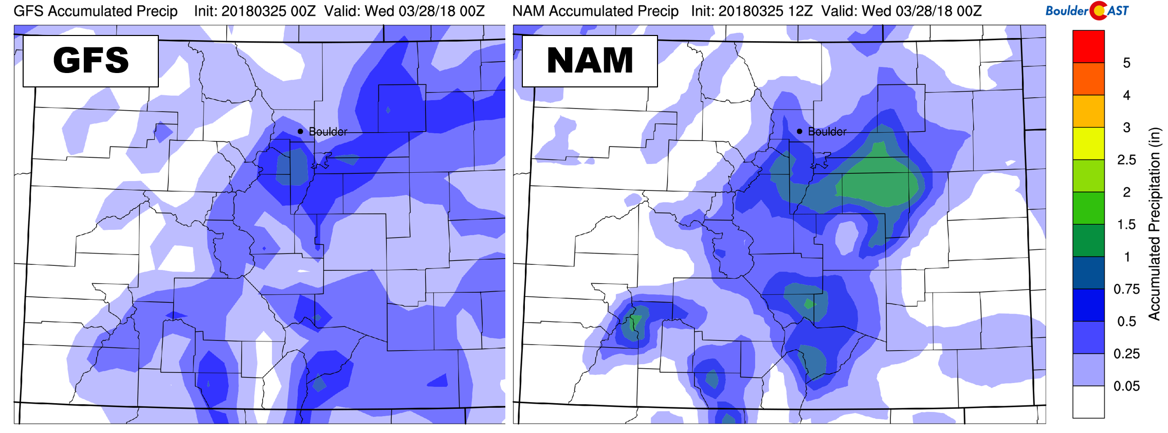
The good news is that models are in relatively good agreement on precipitation amounts. 0.4 to 0.8″ are projected across south and southwest parts of the Metro area…..with 0.1 to 0.4″ for the northern areas.
However, the snowfall forecast is tricky for this storm due to several hours of uncertainty in change-over times across the Plains. The biggest snow totals are expected across the Palmer Divide and the Foothills of Jefferson County, in the 4 to 8″ range, with up to 10″ in a few locations. These areas will see mostly snow and cash in on the best upslope. Across the heart of Denver and Boulder, snow totals will be mostly in the dusting to 4″ range. Given the warmth with this storm, this snow will be the heavy wet variety and will mainly accumulate on grassy and elevated surfaces. Think snow ratios of 8:1 or 10:1. Rush hour impacts Monday evening will be minimal, and the same goes for Tuesday morning.
Our snowfall forecast map is shown below:
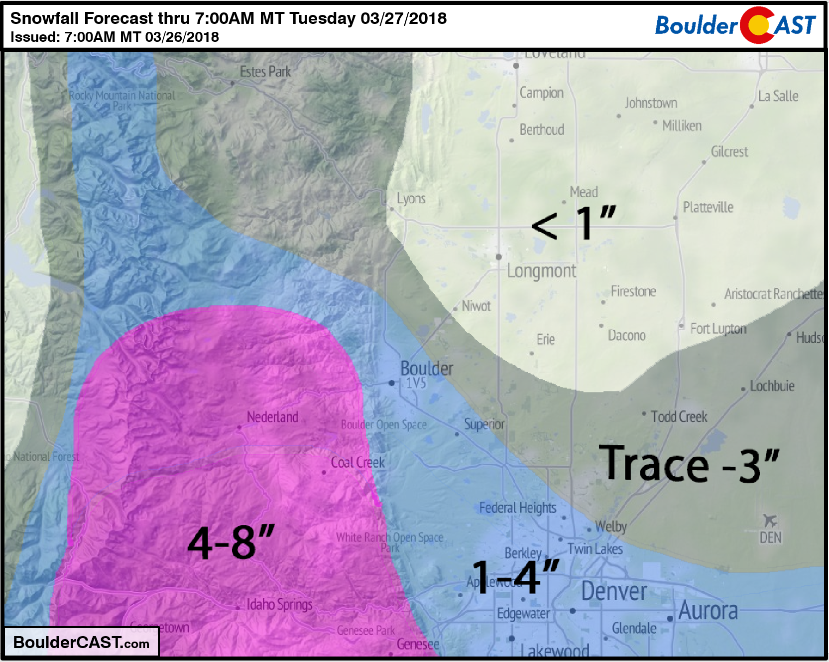
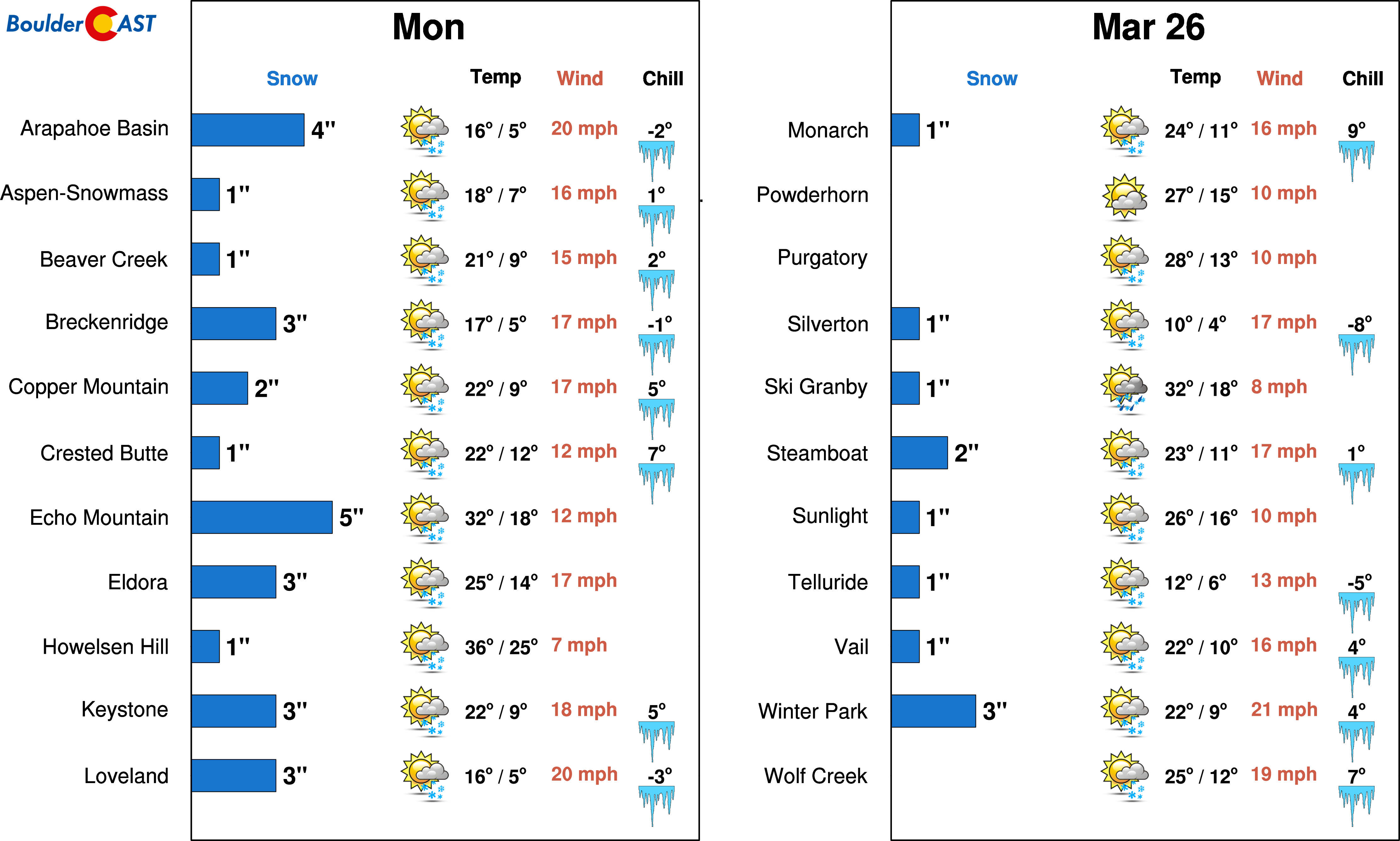
The ski resorts of northern Colorado will see light accumulations from this event, generally 1-4″. The best forcing for snow will indeed be near and east of the Continental Divide.
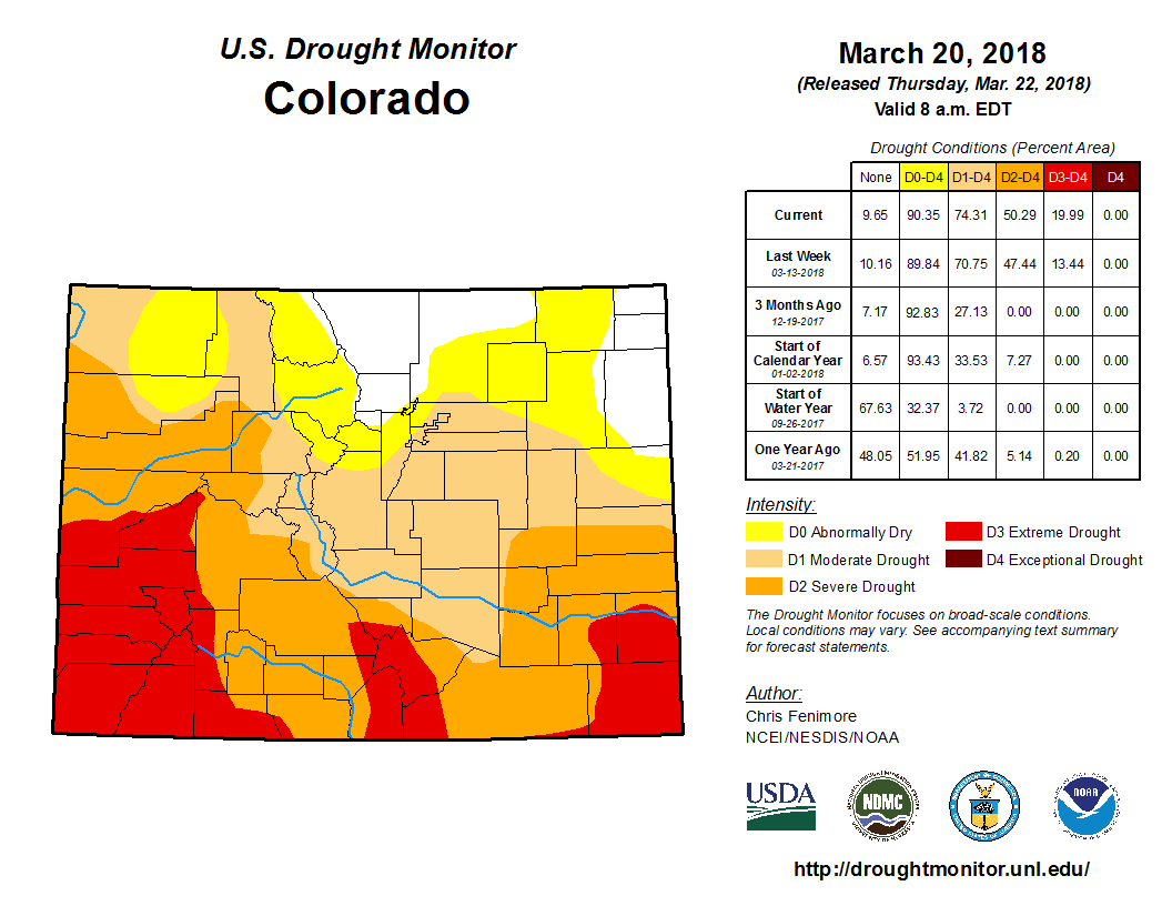
The crucial benefit from this storm will be the moisture, regardless of it falling as rain or snow. Currently 75% of Colorado is experiencing drought. We’ll take anything we can get at this point…
That’s all for now. Just a heads up the we are also tracking another snowy system embedded in the northwest flow for Wednesday night into Thursday, one which may ultimately favor the northern half of the Metro area. More on this one later in the week!
Spread the word, share this forecast:
.


You must be logged in to post a comment.