


After a rather humid, sticky week and weekend, the weather will shift Monday with winds and drier air persisting through the first half of the week. Afternoon thunderstorm chances are quite low, but increase towards the weekend with a major pattern shift in store for the weekend which could bring some moisture and a drop in temperatures.
Category: Forecast (Page 65 of 169)
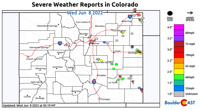
⦁❶⦁ Tuesday was an active severe weather day across Colorado with widespread very large hail, 75+ MPH wind gusts, and numerous tornadoes reported
⦁❷⦁ Today will be mostly sunny and seasonal with highs around 80 degrees
⦁❸⦁ A heatwave is taking shape tomorrow and will last into early next week with daytime highs well into the 90s expected
A series of subtle disturbances through midweek with an approaching cold front will favor increased chances of scattered showers and storms Monday through Wednesday. Highs will largely reside near normal through this period. A ridge of high pressure will start to settle into Colorado by the end of the week, resulting in drier conditions and intensifying heat.
The weather this week remains cool and unsettled as we transition from May into the month of June. Memorial Day will be cool and gusty, but at least it will be dry for any outdoor plans including the Bolder Boulder. We are watching a widespread upslope rain event Tuesday into Wednesday which will be cold enough to produce some late-season snow in the Foothills. Late week we warm back up with daily chances for late-day thunderstorms. Read on for our full forecast outlook of the week ahead.
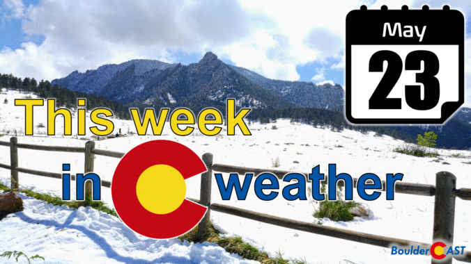
The week starts off unsettled, cloudy, and chilly as a series of mid-level systems keep the Front Range in a persistent upslope flow. Showers, and at times, thundershowers, will be isolated to scattered over the Plains and Foothills through Tuesday. Temperatures may get cold enough for some flakes to fall in the Foothills. Drier conditions with temperatures rising into the 80s and 90s take hold by late week.
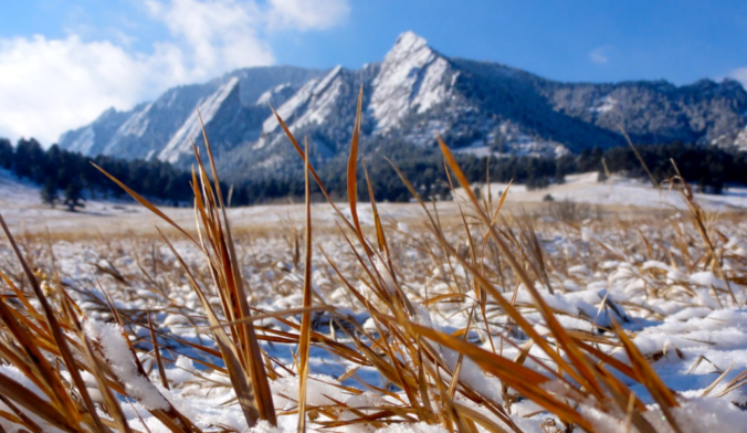
It’s only fitting that the absolutely bonkers 2021-2022 snow season would end with a late-May dumping of snow. We review the lead up to the event, the snowfall totals across the area, and how this snowstorm stacks up historically.
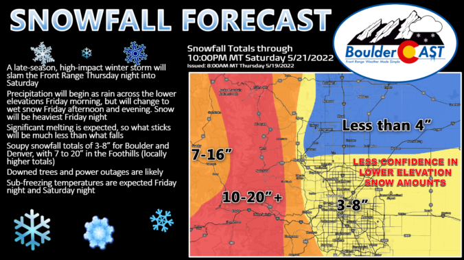
Models have stuck to their guns overnight and our confidence has increased that a widespread, significant winter storm will impact the Front Range Friday into Saturday. This system could produce more than 2″ of much-needed moisture across the area. Unfortunately, a good chunk of this will be falling in the form of heavy wet snow which will have damaging impacts across the area from downed trees and power outages. Sub-freezing temperatures are also expected to impact sensitive plants. Here’s the latest on the storm, including how much snow to expect, how cold it will get, and a few ideas to prepare for this late-season taste of winter!
Just when it seemed we had the shortest snow season and earliest last snowfall records in the bag, Mother Nature is about to throw a late-spring wrench into the forecast! A winter storm is heading for Colorado and it will bring snow to everyone Friday into Saturday even across the lower elevations in Boulder and Denver. While the Foothills communities should brace for a major damaging snow event, some crucial aspects of the forecast remain fuzzy which has allowed only low confidence in the exact snow amounts for the immediate Metro area. Let’s take a look at the latest details and go over our preliminary snowfall expectations and impacts.

Live View of Boulder

Current Conditions

Live Radar
Latest Smoke Forecast

Recent Premium Posts

BoulderCAST Daily – Wed 07/15/26 | The Ridge Rules the Rockies as Hot, Dry Pattern Holds Firm
🔥 Heat dome setup continues — A strong, stationary 500 mb ridge keeps …
BoulderCAST Daily – Tue 07/14/26 | The Front Range Continues to Bake Under Expansive Ridge
🔥 Heat streak continues — Boulder hit 97°F for the third time in …
BoulderCAST Daily – Sun 07/12/26 | Hot weather for a good chunk of the coming week
🥵 🔥 Heat for a good chunk of the week: Upper 90s through …
3-Day Forecast

Trending Content



© 2026 Front Range Weather, LLC