The weather this week remains cool and unsettled as we transition from May into the month of June. Memorial Day will be cool and gusty, but at least it will be dry for any outdoor plans including the Bolder Boulder. We are watching a widespread upslope rain event Tuesday into Wednesday which will be cold enough to produce some late-season snow in the Foothills. Late week we warm back up with daily chances for late-day thunderstorms. Read on for our full forecast outlook of the week ahead.
This week’s highlights include:
- Partly sunny, gusty and cool for the Memorial Day holiday
- A significant upslope storm is in the works Tuesday into Wednesday with widespread rain expected for the entire area
- Snow levels drop close to 7500 feet with perhaps the last chance of snow of the season for the higher Foothills
- Highs only in the 50s for the first day of June on Wednesday
- A pattern shift late-week — warmer with a slight chance of late-day thunderstorms Thursday and beyond

DISCLAIMER: This weekly outlook forecast is created Monday morning and covers the entire upcoming week. Accuracy will decrease as the week progresses as this post is NOT updated. To receive daily updated forecasts from our team, among many other perks, subscribe to BoulderCAST Premium.

A cool & gusty Memorial Day
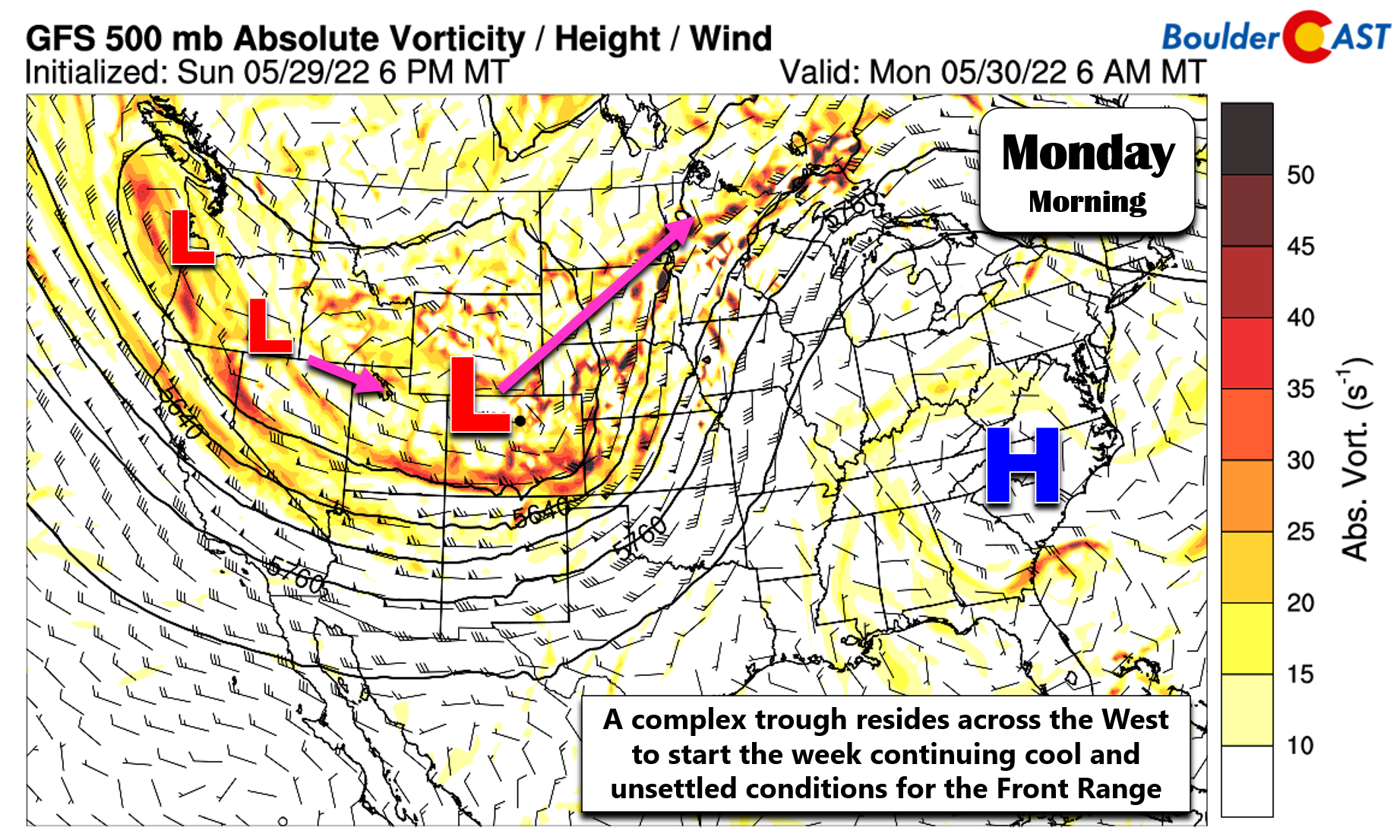
The week begins with a complex pattern across the western United States, one consisting of a deep trough digging into Colorado with a series of low pressure systems lined up back into the Pacific Northwest.
The leading low pressure is currently the strongest, and is the one responsible for the widespread showers, thunderstorms, and photogenic mammatus clouds we had on Sunday.
Some mammatus clouds trailing behind the line of storms earlier. Not amazing ones, but it barely rains anymore. Beggars cant be choosers! #cowx pic.twitter.com/o4DNZhjyF2
— BoulderCAST Weather (@BoulderCAST) May 30, 2022
A look at the infrared satellite imagery from early Monday morning is shown below — it really highlights the “wave train” present across the West right now. Note also the line of convection across the upper Midwest — the deep red (cold) cloud tops. These are some early morning severe thunderstorms developing along the frontal boundary!
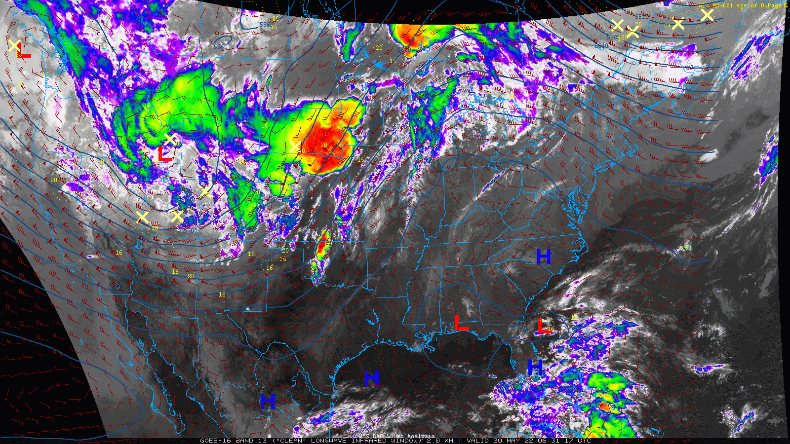
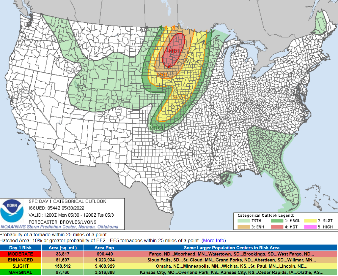
This unstable area will only get worse through the day Monday with the Storm Prediction Center indicating Moderate Risk for tornadic thunderstorms in parts of the Dakotas and Minnesota. If you have any family in that area, it may not be a bad idea to shoot them a warning.
Closer to home though, we’ll actually be fairly quiet on Monday as the first low pressure departs to the northeast kicking off a brief period of subsidence across the Front Range. The jet stream is draped across southern Colorado and it will be inching northward through the day. The increasing flow aloft in combination with the subsidence will lead eventually to a breezy day overall for the Metro area.
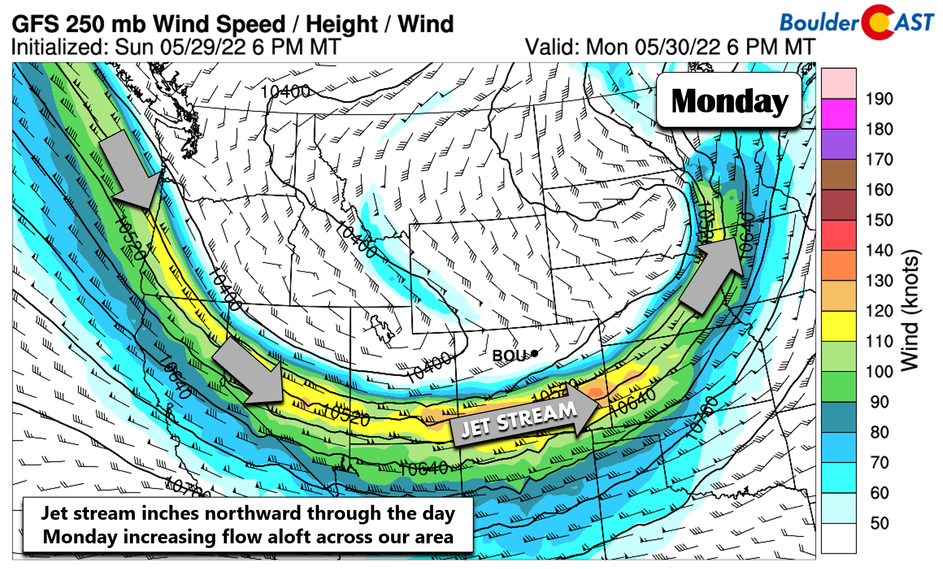
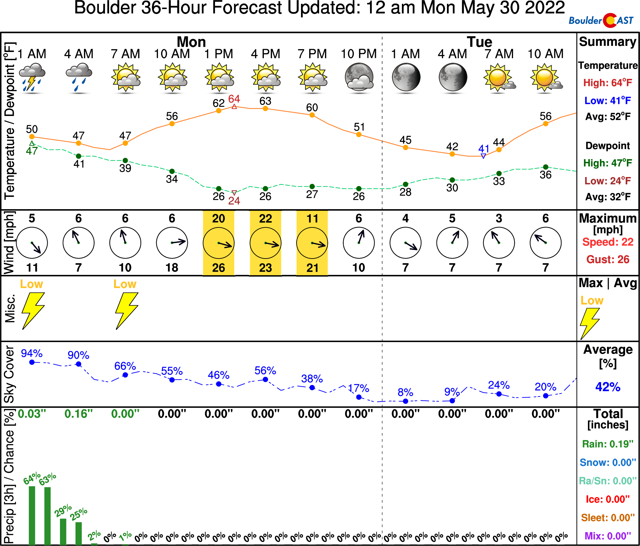
If you’re participating in the Bolder Boulder 10K race today, conditions are close to perfect for running with cool and dry conditions expected from morning into early afternoon. Winds will increase during the afternoon hours, though, with gusts of 20 to 35 MPH ramping up. Expect highs in the middle 60s with partly sunny skies. There is a slight chance of a few isolated showers or weak thunderstorms north and northeast of Denver — nothing that would ruin any outdoor activities though.
A soaking storm Tuesday into Wednesday
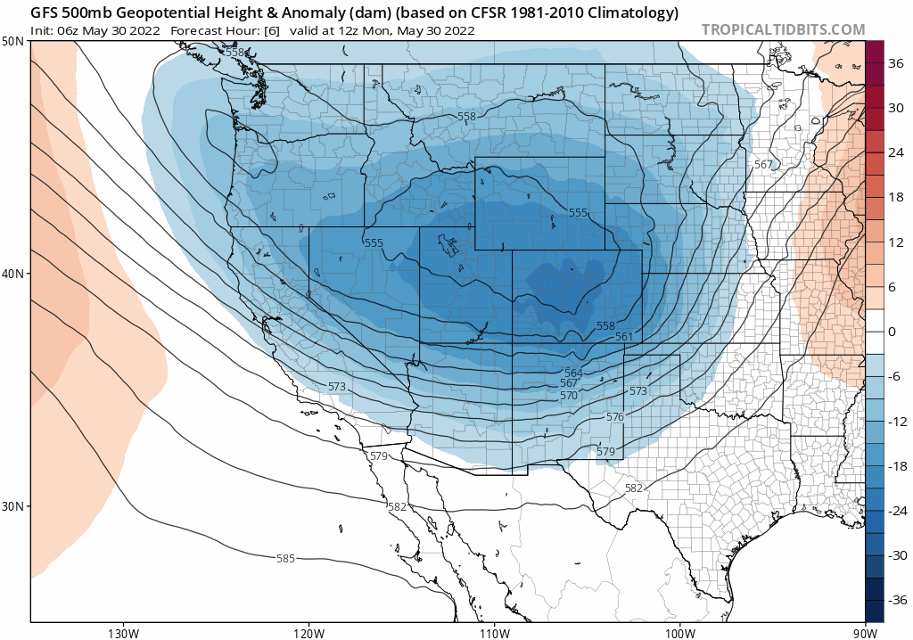
The subsequent low pressure systems waiting in the wings will actually merge in the coming days as they begin impacting Colorado Tuesday into Wednesday. The GFS 500mb height anomaly animation below shows the merger. Also notice how the trough stalls out across Utah, Wyoming and Colorado though the duration of the animation. This will put the Front Range in the ideal location for upslope-aided precipitation Tuesday afternoon into Wednesday morning.
Tuesday will be just slightly warmer than Monday as a cold front will work southward across the area during the day. It looks to arrive during the afternoon hours with upslope commencing on the backside. The combination of upslope, the overhead jet stream, and the approaching low pressure will seed the development of widespread showers and thunderstorms across the area.
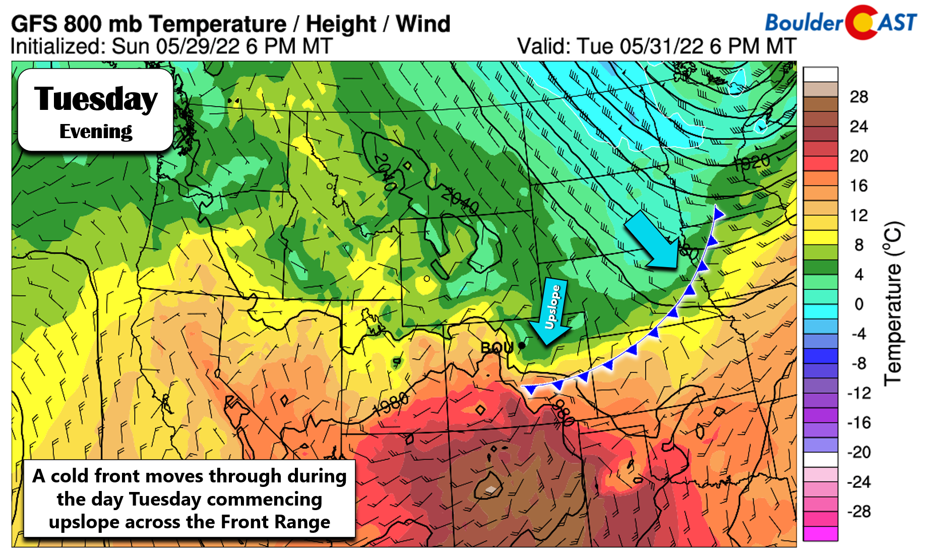
The upslope behind the front is not that strong, but it will deepen up to at least 10,000 feet elevation by the evening hours on Tuesday.
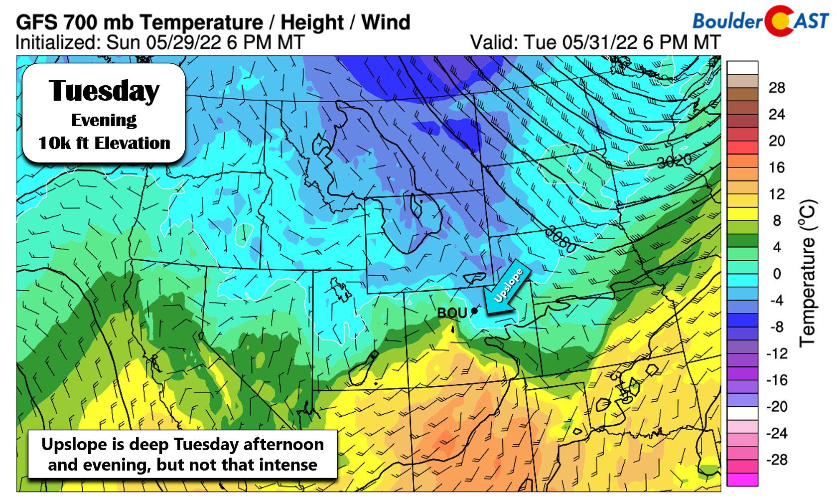
Considering it’s late May, moisture is becoming much more plentiful in the atmosphere. The upslope will help to pool the moisture up against the terrain across the Front Range.
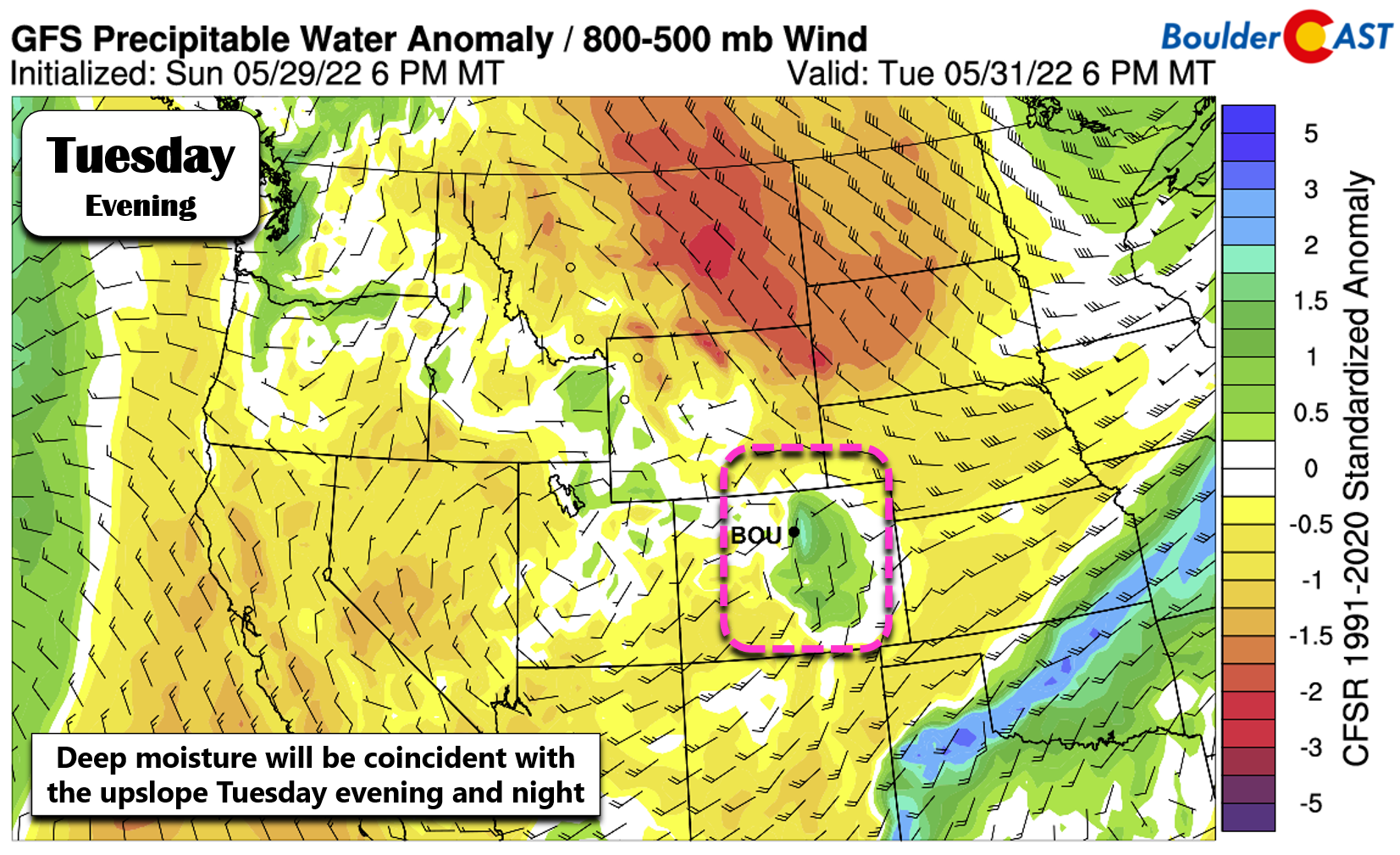
All of this is discussion is our long-winded way of saying it’s going to rain! The primary window for widespread rainfall across the area will be between Tuesday afternoon and Wednesday morning — about 18 hours’ worth! There will be some thunderstorms mixed in at times, especially near the onset on Tuesday afternoon/evening, but overall this will be a stratiform type of precipitation event.
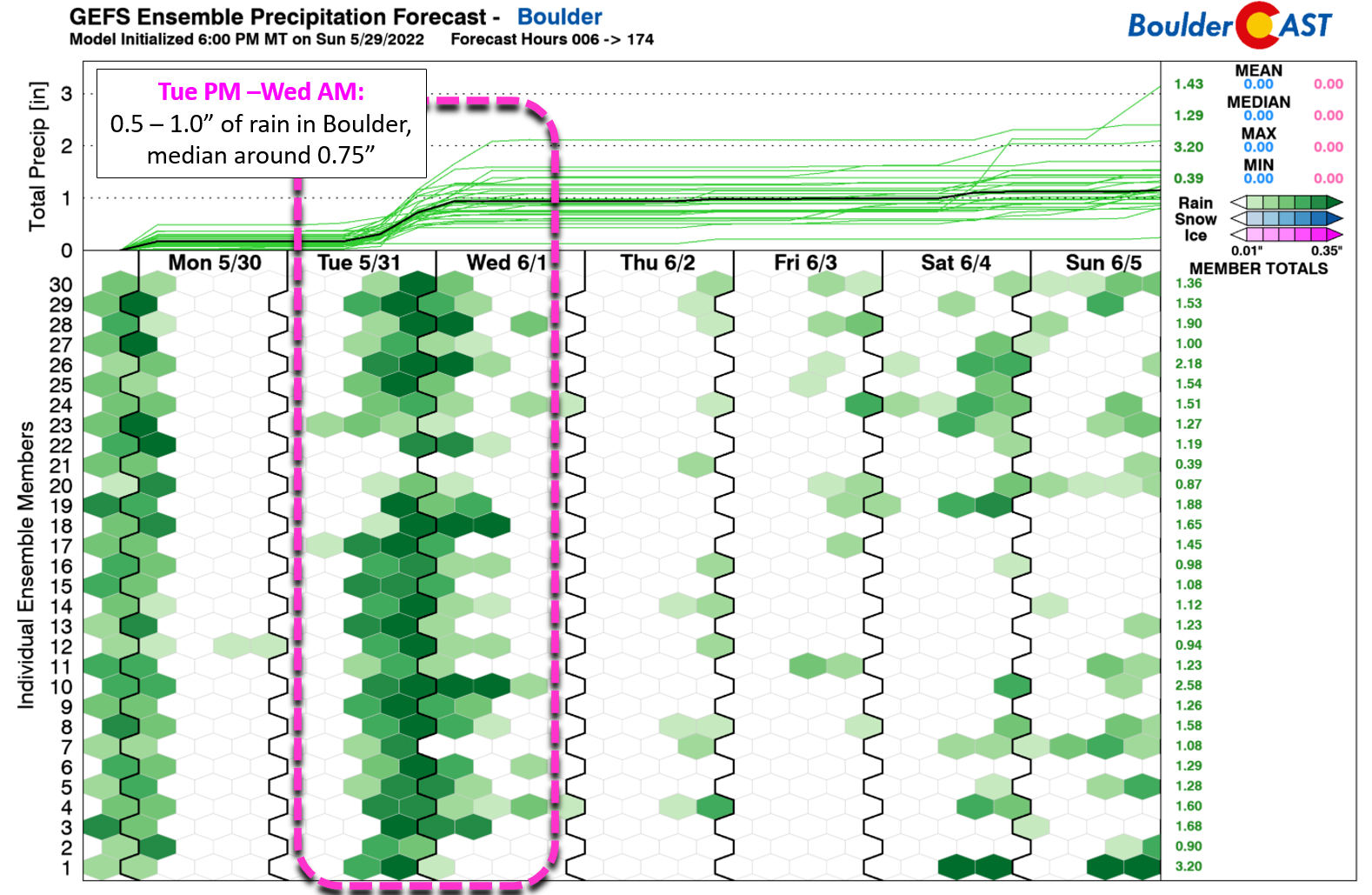
The GFS ensemble suite is currently predicting 0.5 to 1.1″ of rain in Boulder, with a median value around 0.75″. While not a super-soaker by any means, a solid rain event is in the works — we’ll take any moisture we can get!
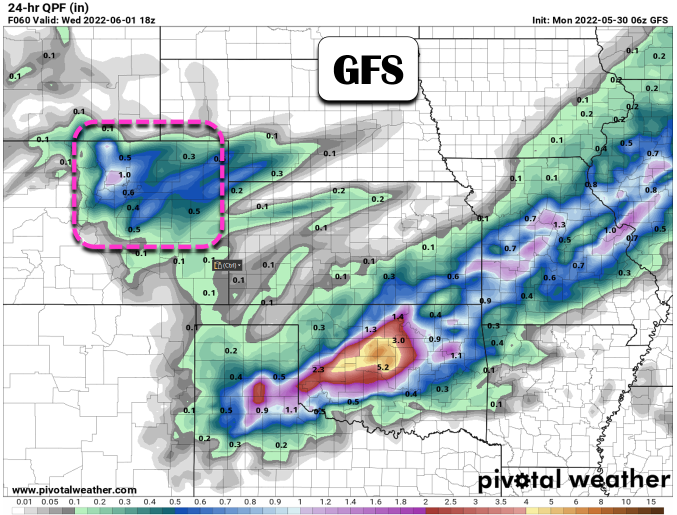
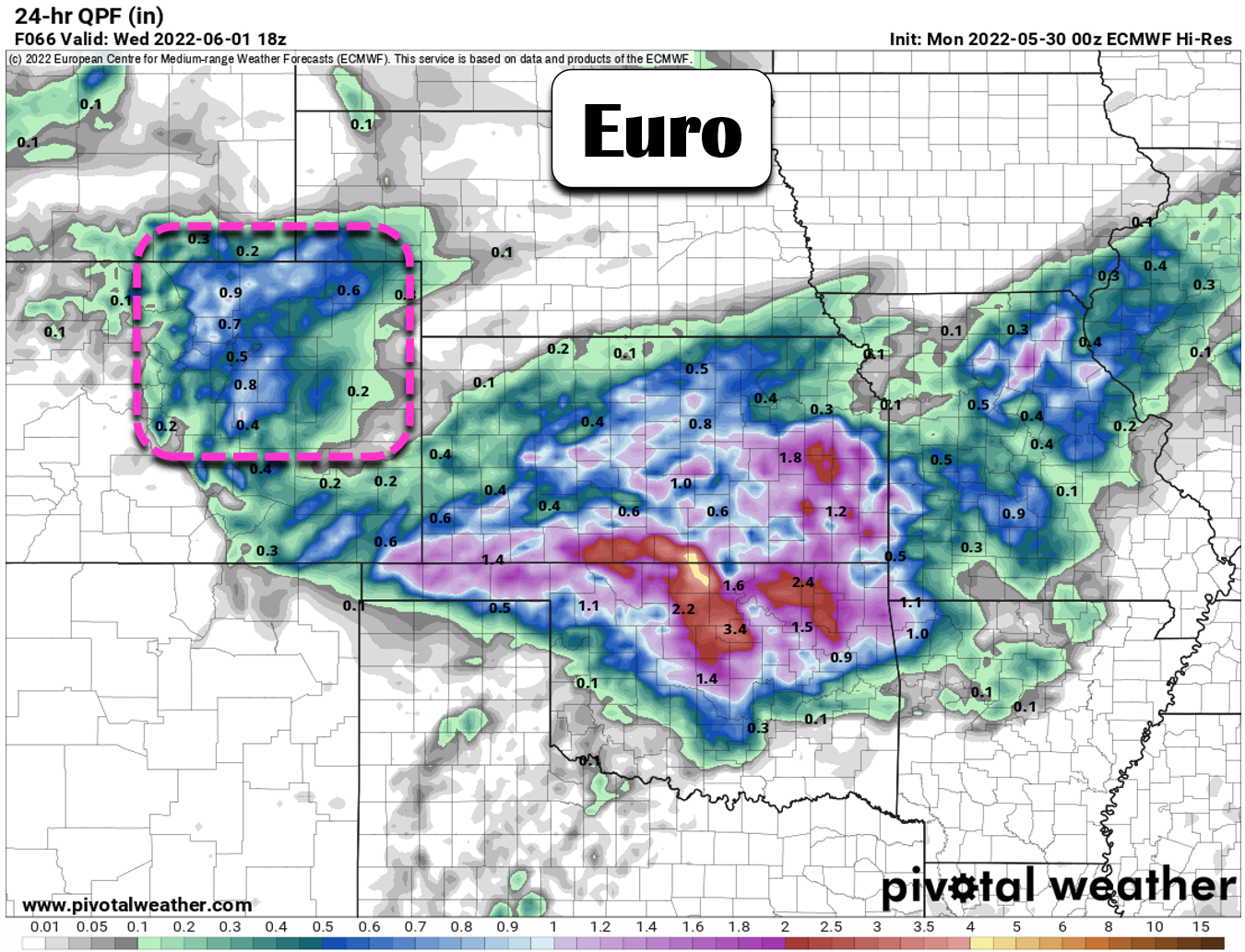
Here’s is the spatial precipitation forecast from the operational GFS model. All of northeast Colorado stands to see good moisture from this system, with upslope as usual focusing the higher totals along the terrain.
The European model is coming in a little lower, but just barely. Regardless of your exact location, everyone should pick up 0.5 to 1.0″ of moisture through Wednesday.
Our last comment on this mid-week system is the potential for snowflakes in the higher Foothills — perhaps the last time we will be talking about those there until the autumn. As the chilly upslope sets in Tuesday evening and night, snow levels drop down close to 7500 feet elevation.
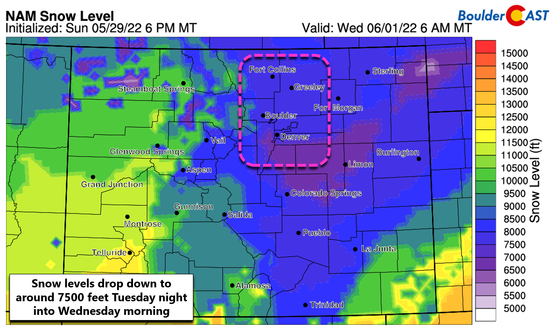
While minimal or no accumulation is expected below ~8000 feet elevation, those higher than that could see a few inches of wet snow. Our best guess right now is that 2 to 6″ will fall in these areas. The focus will be on Boulder and Larimer Counties along and west of Peak to Peak Highway (Indian Peaks, RMNP, and James Peak area should see some fresh snow).
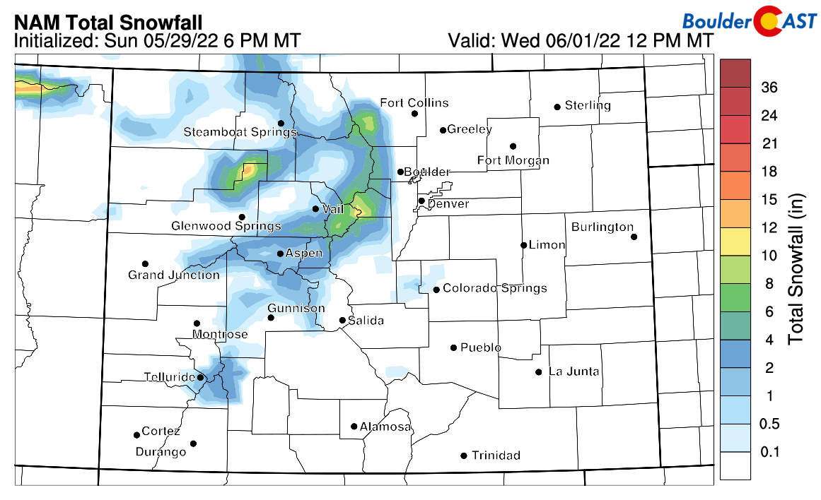
NAM model snowfall forecast through Wednesday. A few inches possible in the higher Foothills
Expect highs in the mid to upper 60s Tuesday, with temperatures falling through the afternoon with rain and storms developing. Rain showers come to an end Wednesday morning with skies turning sunny through the afternoon. Temperatures will only be in the 50s for highs to kick off the month of June!
Turning warmer with late-day storms Thursday & beyond
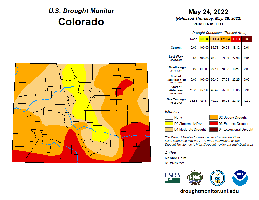
Towards the end of the week, a ridge of high pressure will spread into the area from the west bringing warmer temperatures but also advecting in some moisture for the region. Highs on Thursday will return to the lower 70s, with possible 80s to follow by Friday and into the weekend ahead. Each day, however, will include a risk of late-day showers and thunderstorms popping up thanks to the embedded moisture and strong June sun. At this early juncture, nothing looks too impressive with storm coverage expected to be isolated or widely scattered. Perhaps we can get lucky to catch a few storms to help with the drought, but this really isn’t a drought-busting type of pattern shaping up for the extended.
Have a good week!
Stay up to date with Colorado weather and get notified of our latest forecasts and storm updates:
Forecast Specifics:
Memorial Day Monday: A mix of clouds and sunshine with gusty winds in the afternoon and early evening. Winds will gust 20 to 35 MPH at times. High temperatures in the middle 60s for the Plains with low 50s in the Foothills.
Tuesday: A mild morning ahead of a cold front moving in during the afternoon. Widespread showers and a few thunderstorms develop during the afternoon and continue through the overnight. Highs in the 60s on the Plains with 50s in the Foothills. Rain turns to wet snow late Tuesday night in the higher Foothills with a few inches of accumulation possible.
Wednesday: Lingering low clouds and spotty rain or drizzle in the morning. Then dry with partly sunny skies by afternoon. Temperatures only in the 50s across the Plains with lower 40s in the Foothills.
Thursday: Mostly sunny with widely scattered afternoon and evening thundershowers. Highs in the lower 70s on the Plains with near 60 in the Foothills.
Friday: Much warmer, partly sunny and isolated late-day thunderstorms. Temperatures top out in the lower 80s across the Plains with upper 60s in the Foothills.
Help support our team of Front Range weather bloggers by joining BoulderCAST Premium. We talk Boulder and Denver weather every single day. Sign up now to get access to our daily forecast discussions each morning, complete six-day skiing and hiking forecasts powered by machine learning, first-class access to all our Colorado-centric high-resolution weather graphics, bonus storm updates and much more! Or not, we just appreciate your readership!
Spread the word, share the BoulderCAST forecast!


You must be logged in to post a comment.