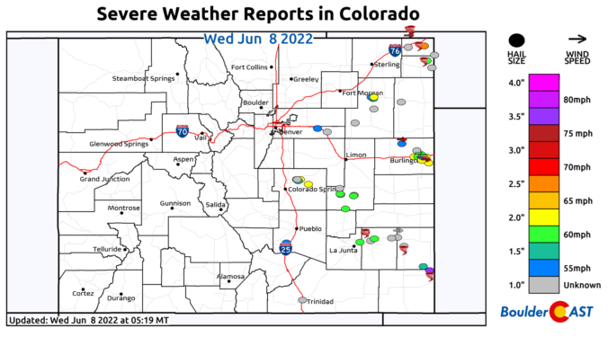
⦁❶⦁ Tuesday was an active severe weather day across Colorado with widespread very large hail, 75+ MPH wind gusts, and numerous tornadoes reported
⦁❷⦁ Today will be mostly sunny and seasonal with highs around 80 degrees
⦁❸⦁ A heatwave is taking shape tomorrow and will last into early next week with daytime highs well into the 90s expected
Do you want the latest BoulderCAST Daily forecast discussion delivered to your inbox every single morning? If so, join BoulderCAST Premium where we talk Boulder and Denver weather every single day.

Y
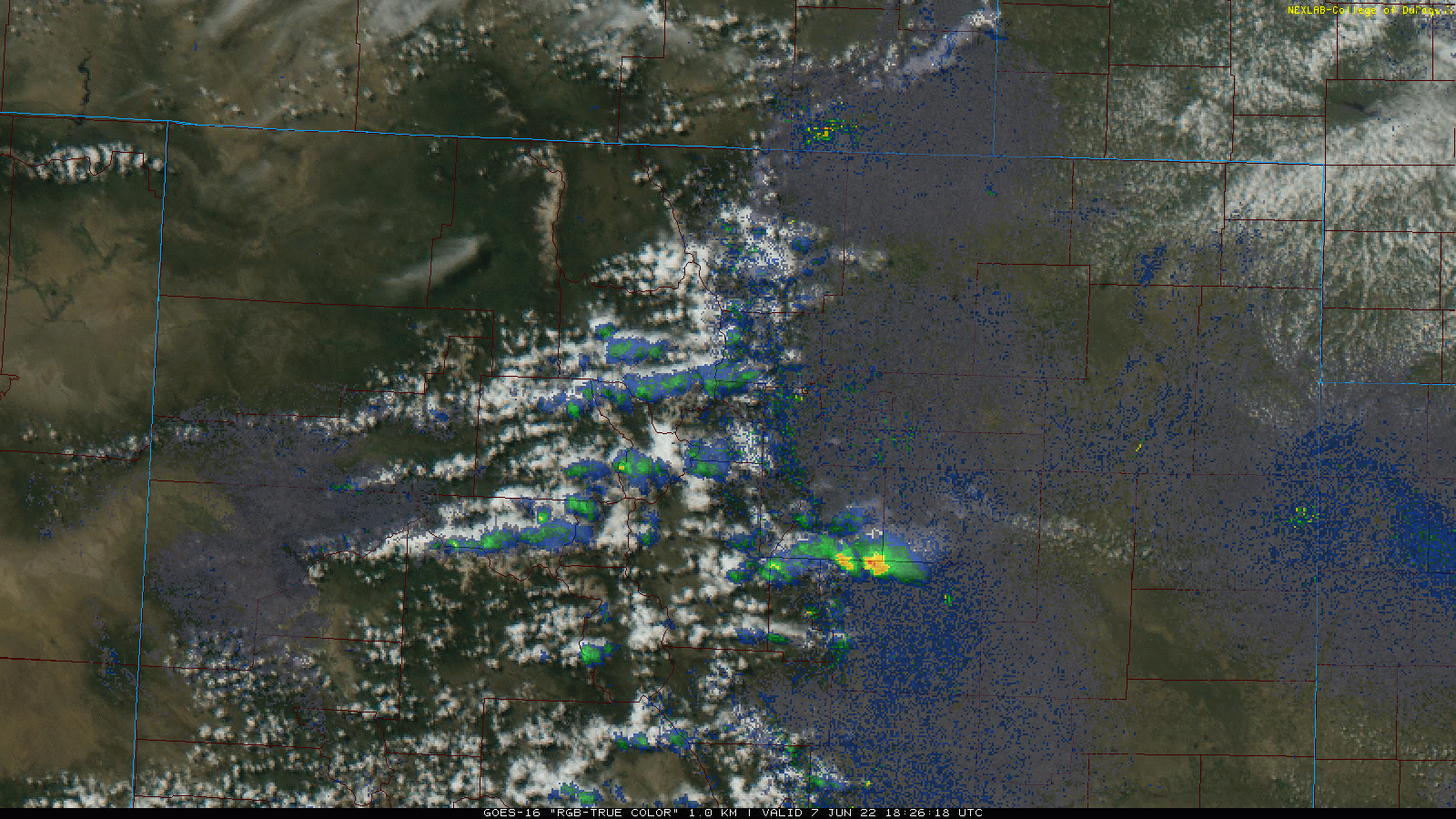
esterday was filled with fireworks across eastern Colorado — the kind set off by Mother Nature! As shown in the combo radar/satellite animation below from Tuesday evening, there were at least 8 discrete and long-lasting supercells raging across the eastern half of our state at the same time.
Luckily, as we anticipated, all the action missed the Denver Metro area. Out east there was hail up to baseballs in size, 75+ MPH wind gusts, and numerous tornadoes were reported. Tuesday was one of the most active severe weather days in a long time for the Centennial State. The storm reports statewide are shown below.

A cold front moved through last evening around 8:30 PM from the northeast. It briefly produced a few sprinkles across the area along with a layer of low clouds — those have mostly dissipated already though. The radar animation below shows the front approaching the Boulder-Denver area!
Cold front inbound! 💨 #cowx pic.twitter.com/eXSf1QGD6c
— BoulderCAST Weather (@BoulderCAST) June 8, 2022
As a result of the front sagging southward, today will be slightly cooler but also drier as all of the lift has vacated the area. Look for highs around 80 degrees with mostly sunny skies.
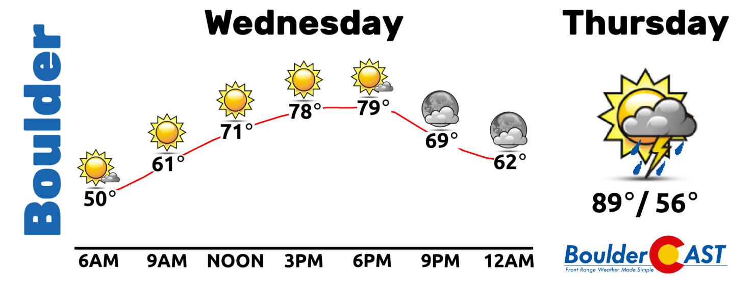
Tomorrow the heat dial gets turned up as high pressure starts to encroach into the Front Range from the west. We’ll get close to 90 degrees with isolated storms returning into the picture on Thursday. This will only be a sampler of the toasty weather to come, though. The center of high pressure is projected to intensify across New Mexico and Arizona during the upcoming weekend. This will set the stage for a lengthy period of hot weather — our first true heatwave of 2022!
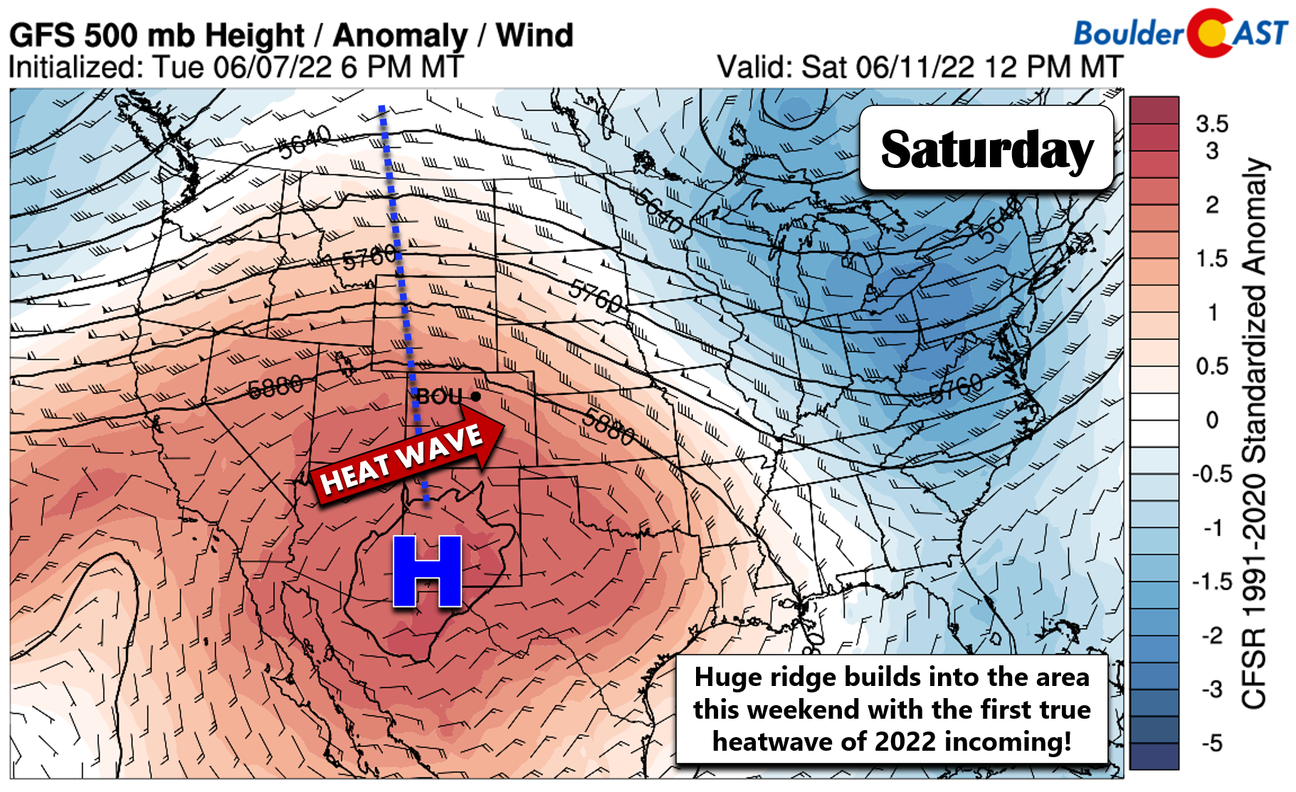
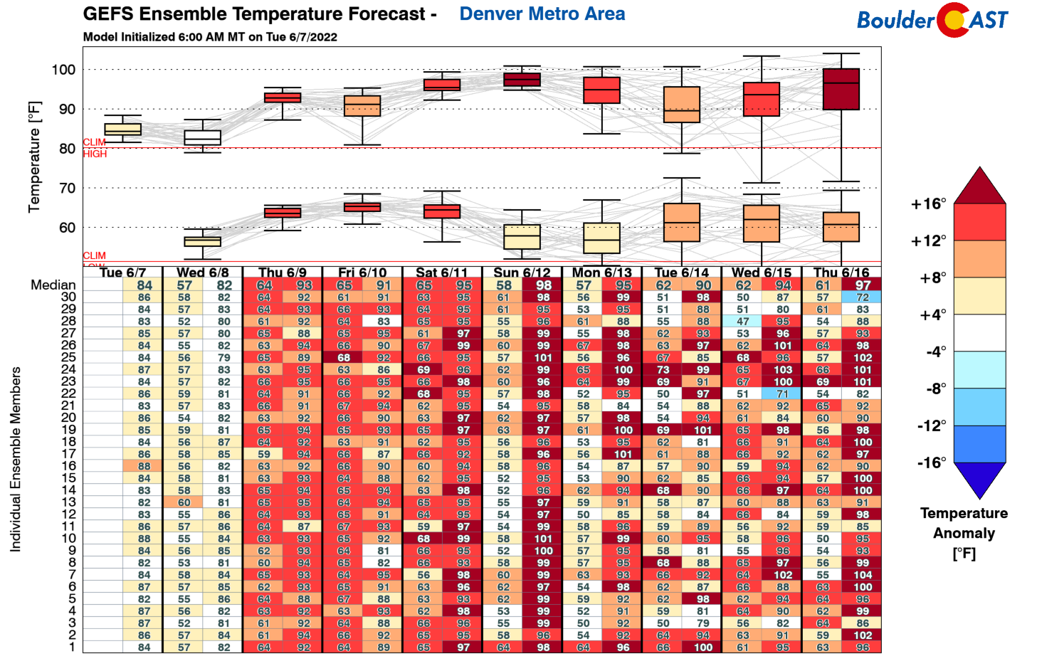
The GFS ensembles have highs in the Denver Metro area generally reaching the mid to even upper 90s Saturday through Monday, with some signs that the 90s will stick around well into next week. It is a good idea to verify your cooling solution (air conditioning or swamp cooler) is functional ASAP before our temperatures really start to take off in the coming days….
Remember, our daily forecasts are Premium content. Periodically, we open this forecast up to all of our readers. Today is one of those days!
Help support our team of Front Range weather bloggers by joining BoulderCAST Premium. We talk Boulder and Denver weather every single day. Sign up now to get access to our daily forecast discussions each morning, complete six-day skiing and hiking forecasts powered by machine learning, first-class access to all our Colorado-centric high-resolution weather graphics, bonus storm updates and much more! Or not, we just appreciate your readership!


You must be logged in to post a comment.