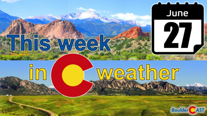
After a fairly wet weekend, this week starts off drier as monsoon moisture gets shunted away to the south. This change will be accompanied by near-average temperatures in the upper 80s to around 90 degrees. Following a stronger cold front, an unsettled and cooler pattern will take hold for the end of the week with temperatures dropping back into the 70s. For once, our weekly outlook does not include any extreme heat!
Category: Forecast (Page 64 of 169)
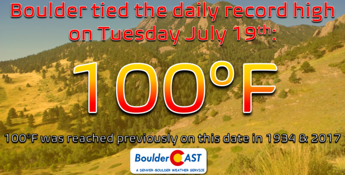
On a day which should have been slightly cooler than recent times on paper, Boulder officially reached 100 degrees Tuesday afternoon. However, other reliable weather sensors around the city came in several degrees cooler and more in-line with forecasts. We take a look at the temperatures measured around the area and weight on what will ultimately go down in the books as a record high temperature and the city’s first triple-digit reading in over two years.

Another brutally hot week is expected across the Front Range with a ridge of high pressure staying the course over Colorado. With this, temperatures will remain above normal for the next six days or more, including a couple chances at reaching triple digits. Thunderstorms will be around throughout the week, but as usual they will be fairly spotty and will offer little reprieve from the ongoing heatwave and drought. A slight pattern shift early next week should revive the monsoon for the Desert Southwest, but whether that propagates into Colorado remains to be seen.
The week starts off cooler than normal and a breath of fresh air behind a frontal passage. The reprieve from the heat is short-lived, unfortunately, as a strong mid-level ridge of high pressure builds back in as the week progresses. This pattern change will lead to temperatures getting hot once again to near the century mark by week’s end, along with increasing afternoon/evening storms in the monsoonal flow.

With the monsoon getting suppressed and a hot pattern taking hold this weekend, both Saturday and Sunday could get Boulder to the elusive 100-degree mark for the first time in nearly two years. We discuss the cause of this heatwave, how hot it will get around Boulder and Denver this weekend (and next week), and when we expect cooler temperatures to arrive.
We hope you had a great Fourth! The Southwest monsoon remains active through the middle part of the week with good chances for rain in Boulder and Denver, especially Tuesday and Wednesday. Unfortunately, the pattern shifts late in the week suppressing the flow of monsoon moisture into Colorado. This will cause drying for us, but also a spike into triple-digit temperatures for the weekend. Read on for our full outlook of the week and weekend ahead.
The arrival of the North American summer monsoon varies substantially from year to year, depending greatly on the weather patterns of Mexico, the southeast USA, and the tropical eastern Pacific Ocean. We don’t have to wonder anymore — the monsoon has already commenced in the last few days, about two weeks ahead of schedule. Hooray! We discuss the current state of the monsoon, what’s happening with that pesky La Niña, and what to expect in the coming months across Front Range Colorado.
The heat returns this week, but thankfully so do the storm chances. Highs start out near normal but reach potential record highs by midweek. Our storm chances increase Wednesday through Friday as better moisture spreads into the state, some of which will be tied to Tropical Storm Celia off the Baja coastline. Read on for all the details.

Live View of Boulder

Current Conditions

Live Radar

Latest Smoke Forecast

Recent Premium Posts

BoulderCAST Daily – Wed 07/15/26 | The Ridge Rules the Rockies as Hot, Dry Pattern Holds Firm
🔥 Heat dome setup continues — A strong, stationary 500 mb ridge keeps …
BoulderCAST Daily – Tue 07/14/26 | The Front Range Continues to Bake Under Expansive Ridge
🔥 Heat streak continues — Boulder hit 97°F for the third time in …
BoulderCAST Daily – Sun 07/12/26 | Hot weather for a good chunk of the coming week
🥵 🔥 Heat for a good chunk of the week: Upper 90s through …
3-Day Forecast

Trending Content

© 2026 Front Range Weather, LLC