On a day which should have been slightly cooler than recent times on paper, Boulder officially reached 100 degrees Tuesday afternoon. However, other reliable weather sensors around the city came in several degrees cooler and more in-line with forecasts. We take a look at the temperatures measured around the area and weight on what will ultimately go down in the books as a record high temperature and the city’s first triple-digit reading in over two years.
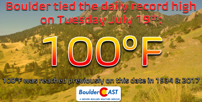
With little fanfare or run-up, the city of Boulder officially hit 100-degrees on Tuesday tying the existing record high for July 19th in the process. Despite Denver doing so four times already this summer, this was Boulder’s first triple-digit outing in 2022!

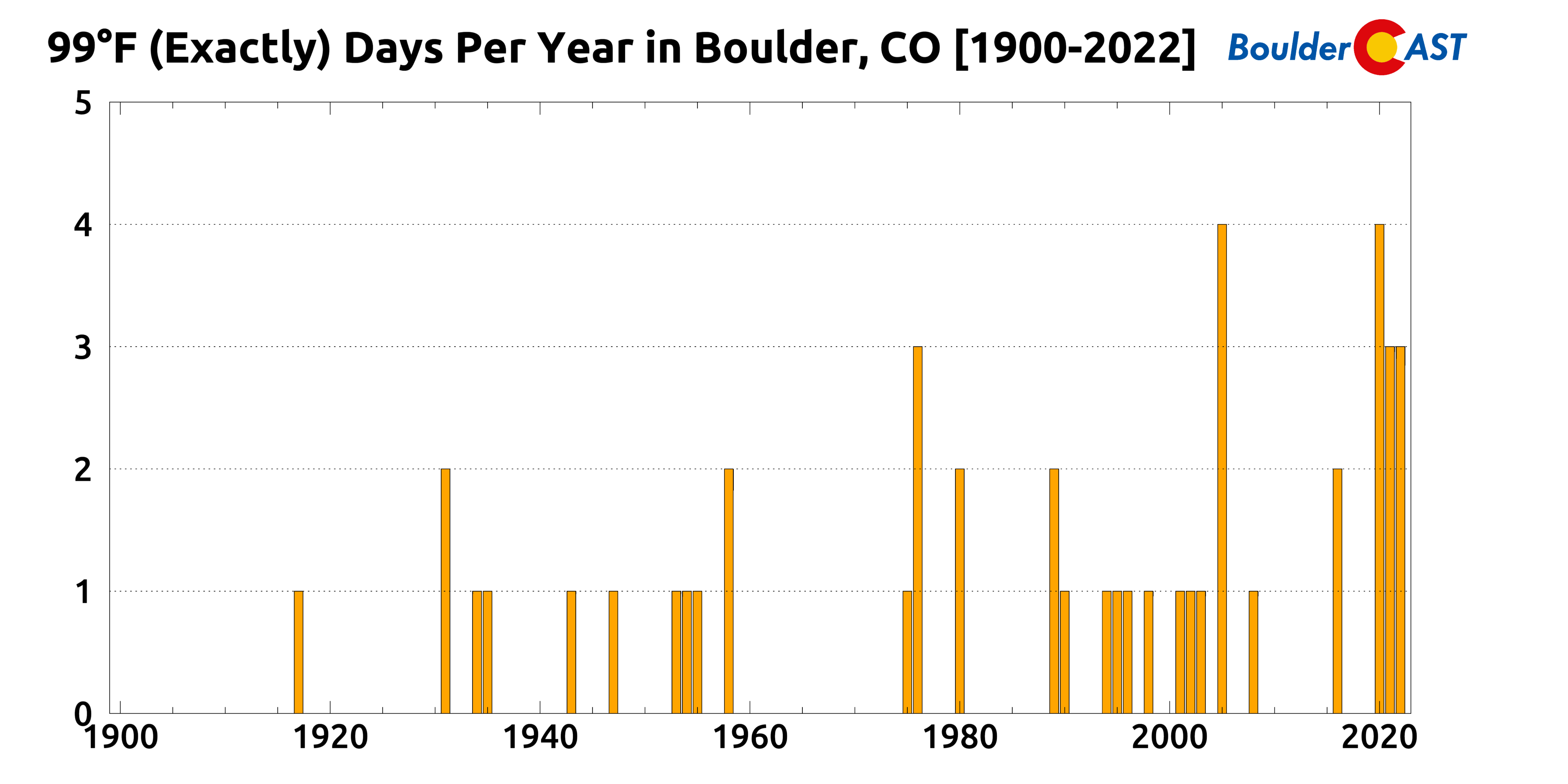
Prior to Tuesday, Boulder’s last 100-degree reading was just over two years ago on July 18, 2020. Between then and now, the mercury somehow topped out at exactly 99°F eight different times. It seemed like the official thermometer was somehow getting “stuck” at 99°, since many other locations around Boulder were reading in the low 100s on some of those days. Afternoons where the temperature peaked at exactly 99° have been extremely common lately — it’s happened a prolific 10 times in just the last two and a half summer seasons! Compare that to the previous 21 years which all combined had the same amount of 99° days recorded (1999-2019). That’s just crazy to think about!
Tuesday’s triple-digit reading certainly caught us off guard. There really wasn’t any reason to expect quite THAT hot of a temperature. If you recall, our predicted high for Tuesday put forth in our usual weekly outlook on Monday was only 95°F. We’re rarely that far off one day in advance!
Heck, in our Tuesday morning Premium forecast discussion we even lowered our projected high for the day to 94°F since a “cold” front was technically moving through during the morning hours.
If we look at the gamut of high temperatures from around the city of Boulder on Tuesday, we see that the official climate station (behind the NIST building off South Broadway) recorded the highest reading of them all at 100° on the dot. Other observations from around the city generally ranged from 95 to 99°F. The usual stations we trust for reliable temperature observations topped out notably lower on this day — 95° (CU ATOC on campus), 96° (NCAR Foothills Lab near 47th & Iris), 99° (Boulder Airport off Valmont), and 97° (our station in far northwest Boulder).
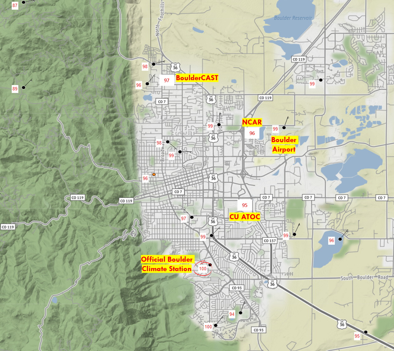
Observed high temperatures across the city of Boulder on Tuesday July 19, 2022
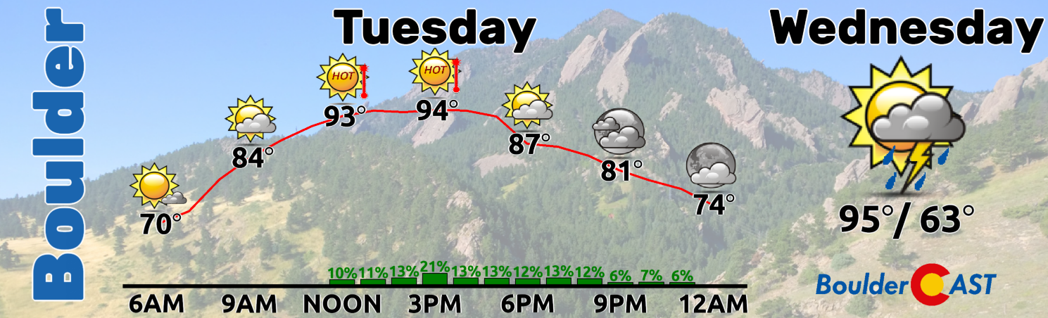
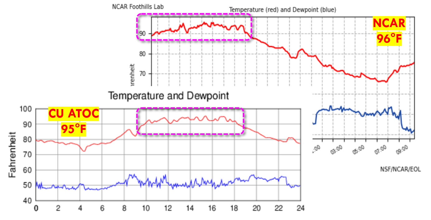
As you can see below where we aligned both NCAR and CU ATOC’s temperature graphs for the day, neither even got close to 100° on Tuesday with both reaching the middle 90s.
Are we suggesting the official station’s 100° observation is inaccurate? Not really, though we have raised this question before when it reported a rare late-season 100-degree reading in September of 2019. Small-scale spatial variability in temperature of a few degrees is common and expected, especially in pseudo-urban areas such as Boulder where land-use and coverage varies greatly from block to block. The 100-degree reading on Tuesday was indeed the highest in the city, but it wasn’t a complete outlier or totally unreasonable.
On a similar note, Denver International Airport, which is Denver’s official climate station, often catches a lot of flak for being so far away and thus misrepresenting the meteorological happenings actually occuring in Denver proper. This is particularly true with snowstorms where DIA famously sees way less than downtown Denver most of the time. We posted this comical Tweet related to this subject following the Groundhog Day 2022 Snowstorm:
We spent hours combing through a dozen or more models, gauging ensemble spreads, checking vertical temps, projecting ice crystal types, and starting way too closely at wind barbs. What a waste! Ultimately, today's snow forecast was THIS easy 🤣#COwx pic.twitter.com/rBvQkHjjx9
— BoulderCAST Weather (@BoulderCAST) February 2, 2022
Interestingly, DIA only reported a high of 97°F on Tuesday — three degrees lower than Boulder. As we have mentioned many times before, Boulder is almost always cooler than DIA during the summer months, usually by a couple of degrees. There are a few notable reasons for this observed temperature shortcoming:
- #1 CLOUDS: Summertime cumulus clouds and storms routinely build over Boulder earlier in the day than Denver as they almost always initiate over the higher terrain first and move eastward. This allows Denver to capitalize on more solar heating during the late morning and early afternoon.
- #2 ELEVATION: Boulder is slightly higher in elevation than Denver, which has cooling implications in the daytime. For summer heat, lower elevation is better. Just look at Death Valley!
- #3 TERRAIN PROXIMITY: Boulder’s closeness to the Foothills tends to produce a weak upslope breeze during summer mornings which has a slight cooling effect. As the sun rises to the east, it strikes the eastern slopes of the Foothills/Mountains at the most efficient angle. This creates what is known as a valley breeze which is similar to a sea breeze. Both are created due to differential heating of two nearby locations. It’s not until around midday that the sun rises high enough to reduce the differential heating and kill off the valley breeze.
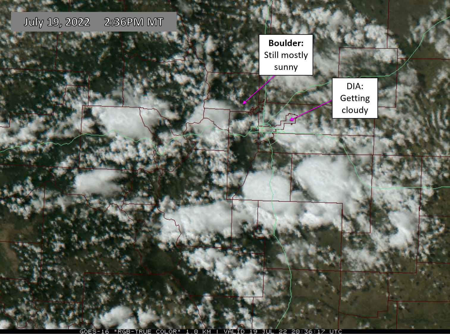
Why was DIA uncharacteristically cooler than Boulder on Tuesday? Well, for one the skies turned somewhat cloudy near DIA earlier in the day than they did in Boulder which is uncommon (see visible satellite below from Tuesday afternoon). Furthermore, as we mentioned before, a cold front did enter into northeast Colorado early Tuesday morning. This front was very weak and was tied to a low pressure system way up in North Dakota. A temperature change was hard to detect in our area from this weak front. DIA, and areas closer to Nebraska, were more strongly impacted by this front than Boulder (but still just barely). These two facets likely contributed to DIA ending up cooler (on paper) than Boulder on Tuesday.
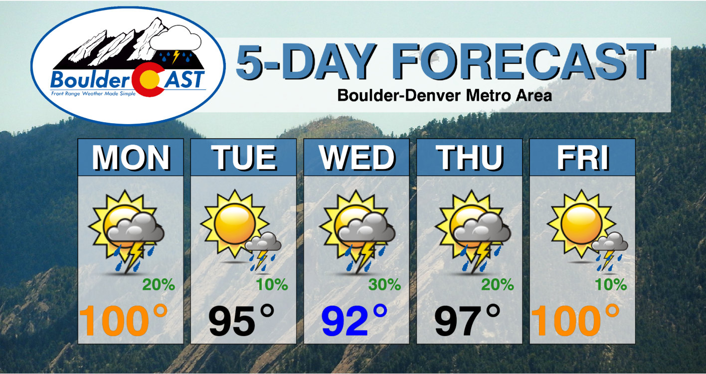
In any case, our first 100-degree day of 2022 is indeed in the books. Boulder only averages about one such day every two years, so we’re not very likely to see another one unfold this summer, at least according to climatology that is.
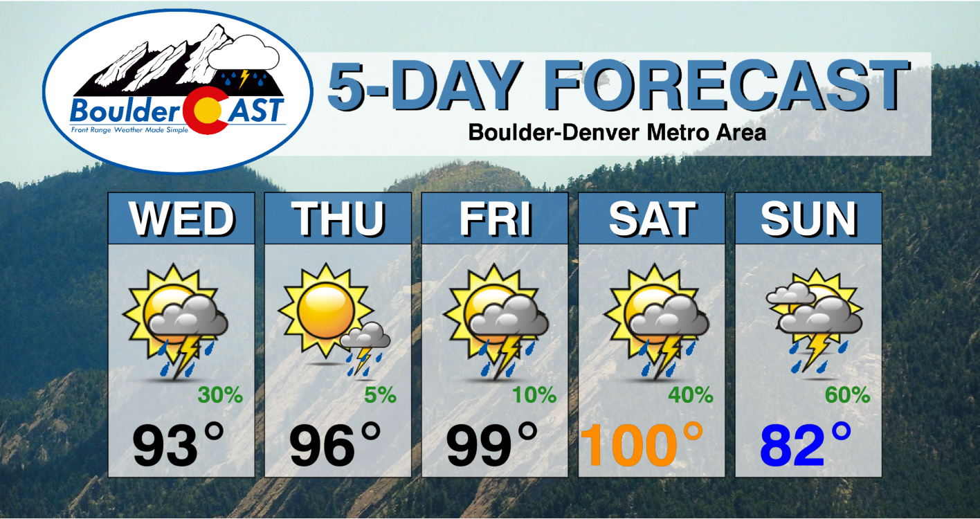
Mother Nature does have other plans it seems. The ongoing heatwave is expected to intensify further in the coming days with Friday and Saturday looking like potential triple-digit candidates once again. Furthermore, the monsoon will be revived this weekend with a much-needed cold front turning things drastically cooler come Sunday — possibly even below average for late July!
Stay up to date with Colorado weather and get notified of our latest forecasts and storm updates:
We respect your privacy. You can unsubscribe at any time.
Help support our team of Front Range weather bloggers by joining BoulderCAST Premium. We talk Boulder and Denver weather every single day. Sign up now to get access to our daily forecast discussions each morning, complete six-day skiing and hiking forecasts powered by machine learning, first-class access to all our Colorado-centric high-resolution weather graphics, bonus storm updates and much more! Or not, we just appreciate your readership!

.


You must be logged in to post a comment.