As of Wednesday morning, the heaviest snow is now behind us, but this snowstorm is not completely over and done with yet. We review the snow totals so far, discuss how much more to expect through the day, and take a look at what is shaping up to be the coldest night of the season ahead.
O
vernight snowfall did not play out exactly as expected with the Denver Cyclone taking near total control of snow production across the entire Denver Metro area. This is something discussed, but we were not 100% sure it would actually come to fruition. Below is a graphic included in our forecast issued back on Monday — a depiction from the HRRR model showing the swirling Denver Cyclone developing during the overnight period.
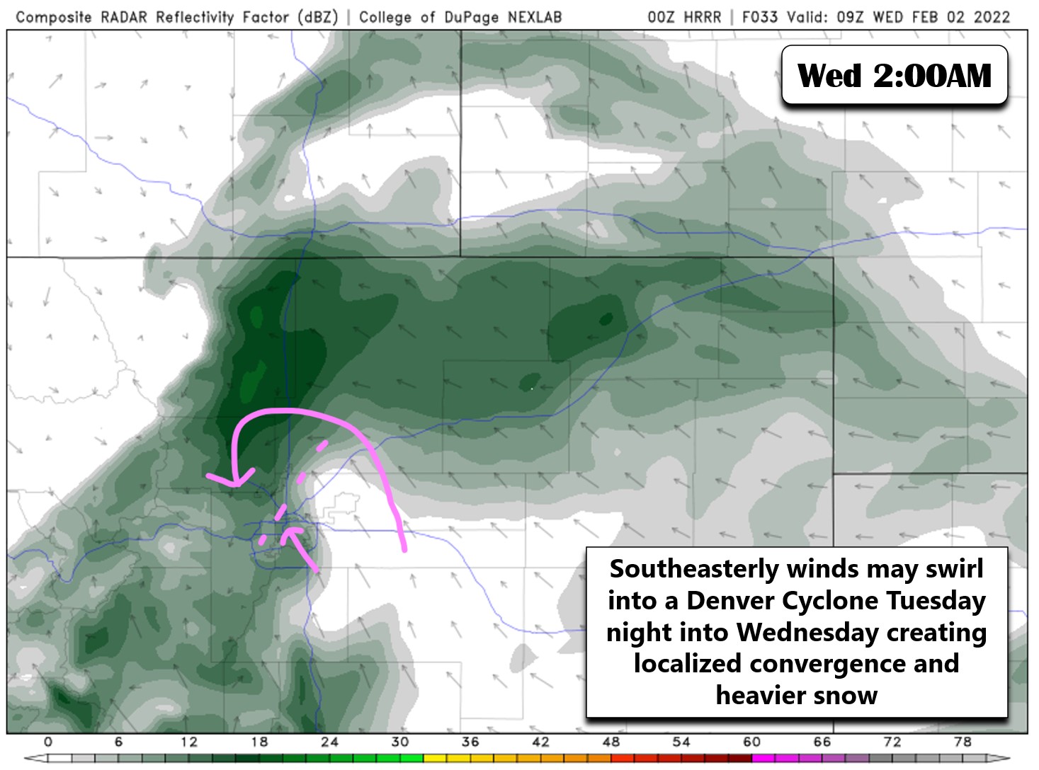
Unlike other sources including the local news that reacted to this feature as it was unfolding Tuesday night, we warned you about the havoc it could wreak on the area’s forecast more than 30 hours before it developed. This is a snippet from our forecast discussion posted Monday evening.
- One thing we will need to watch closely with the southeasterly winds will be the potential for the terrain to induce a Denver Cyclone during the event. These swirling winds have been known to create localized convergence in the Metro area leading to pockets of heavy snow, usually north and northwest of Denver towards Boulder. The high-resolution HRRR model is just starting to zero-in on this storm and it’s already showing the potential turning and converging winds late Tuesday night. The model shows something similar again during the day Wednesday — this is something to watch closely!
While we didn’t know exactly if the Denver Cyclone would form the following night or not, we were able to recognize the small-scale pattern that can create it, its subtle signature in the high-resolution models and the type of impact it could have should it develop. Even as it was occuring, predicting where the resulting band of heavy snow would move to and how long it would last is near impossible. It’s doubtful that anyone had “Commerce City” on their Denver Cyclone bingo card before this snowstorm commenced! You know the outcome. Yes, the convergence band of snow did form Tuesday night and eventually landed in Commerce City where it persisted for several hours dumping heavy snow after firing near Boulder around 11PM Tuesday night. Snowfall rates in this band were close to 2″ of fluff per hour at times early on! Here’s a look at the radar animation during the overnight period. The influx of moisture coming from the east and southeast got entirely consumed by this heavy snow band preventing it from reaching the Foothills and Boulder area overnight. This definitely cut into our snowfall totals a bit.
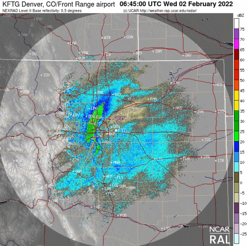
Regional radar animation from last night showing the slow eastward progression of the heavy snow band
Here’s a closer look at the low-level winds from the overnight period. Note how the everything swirls and converges in a line between Boulder and Denver. This is the Denver Cyclone in action! This situation also happened last February where parts of Denver picked up more than foot of snow from a similar setup that majorly busted our forecast!
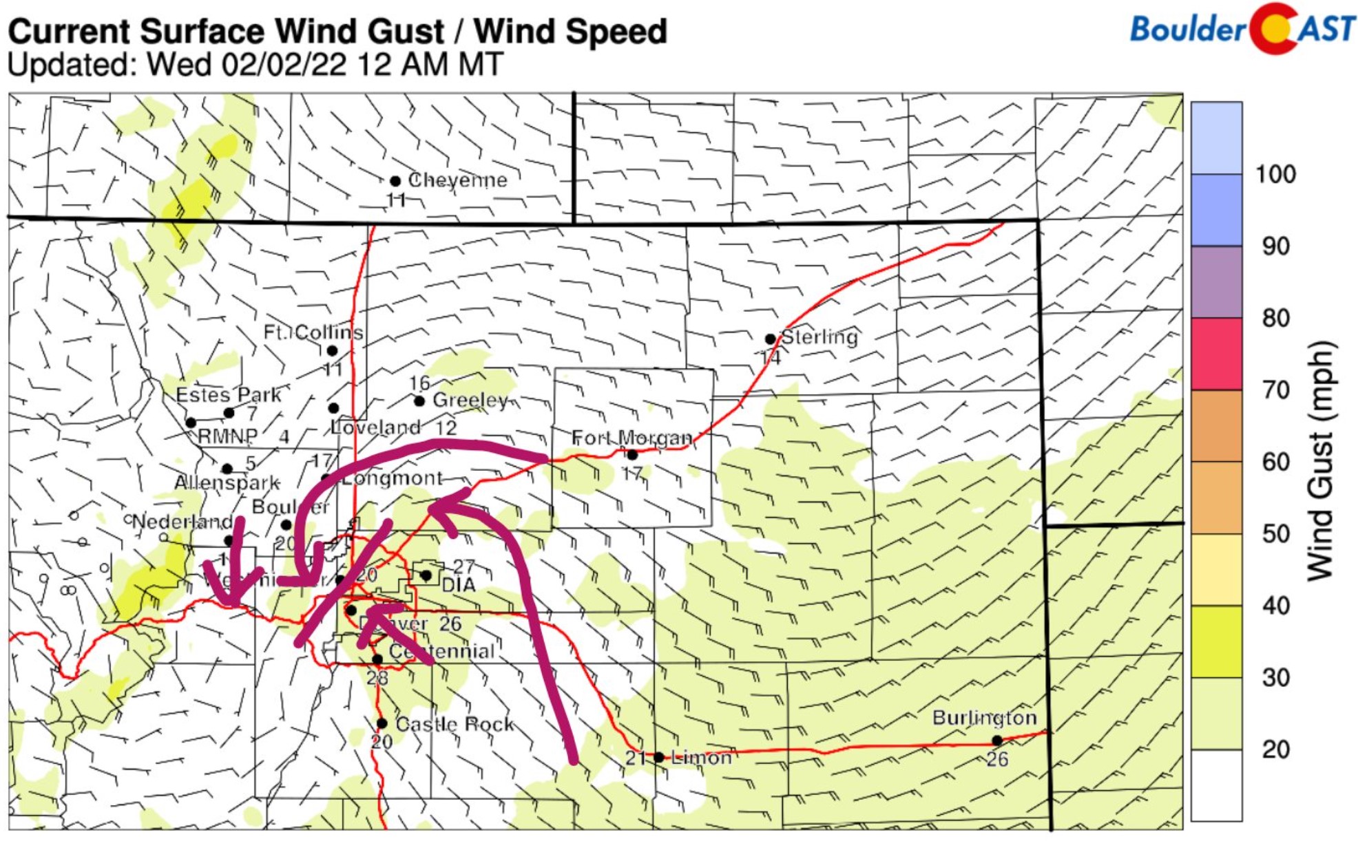
Surface wind observations from midnight Tuesday night showing the Denver Cyclone circulation and the convergence northwest of Denver
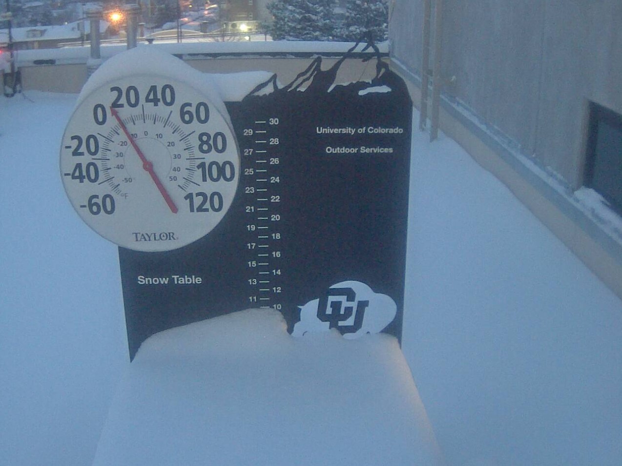
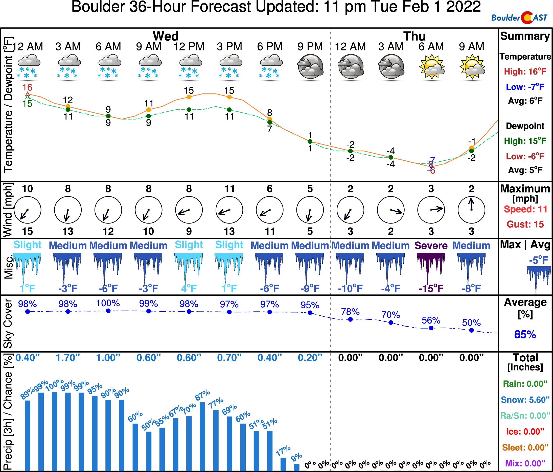
As of 7:00AM Wednesday, anywhere from 2 to 11″ of snow has fallen across the Front Range cities and Foothills. Boulder snow reports thus far are landing between 8 and 11″. The snow table at CU Boulder has a solid 9 to 10″ this morning.
Totals range from 5 to 9″ in the Denver area, though localized spots that sat under that heavy snow band overnight are a bit higher. As expected, Denver officially reported only 2.1″ of snow so far thanks to DIA’s unfortunate geographic existence! Check out the regional snowfall observations below.
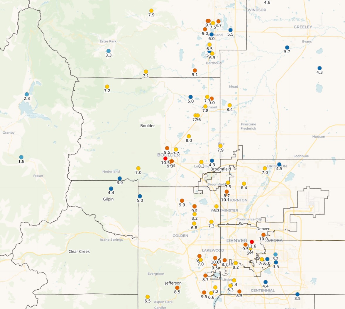
Early morning snow reports from across the Denver area, as of 7AM Wednesday 2/2/22
We’re still not done with the snow yet though. Despite the lull in the action this morning, light snow is expected to continue on and off through the rest of the day before fully wrapping up this evening sometime. Additional snowfall will be fluffy but it won’t amount to much accumulation — just an inch or two in most cases. The high-resolution HRRR model keeps the chance of light snow around through about 6PM in Denver and closer to 10PM in Boulder — which seems reasonable if not a bit optimistic. The atmosphere is somewhat unstable today with cold air at the surface, but even colder air aloft. Thus we could see embedded pockets of more moderate snow develop at times. The model below is trying to pick up on that aspect.
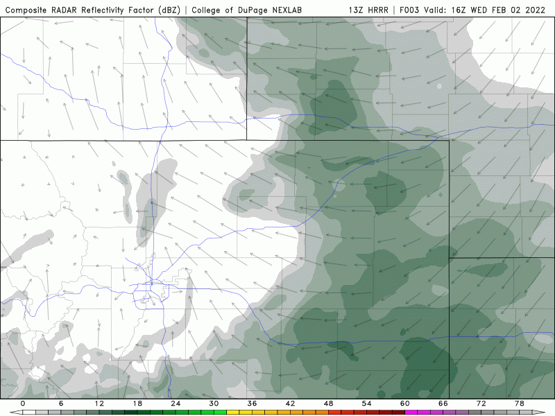
HRRR model simulated radar animation from Wednesday morning into the evening
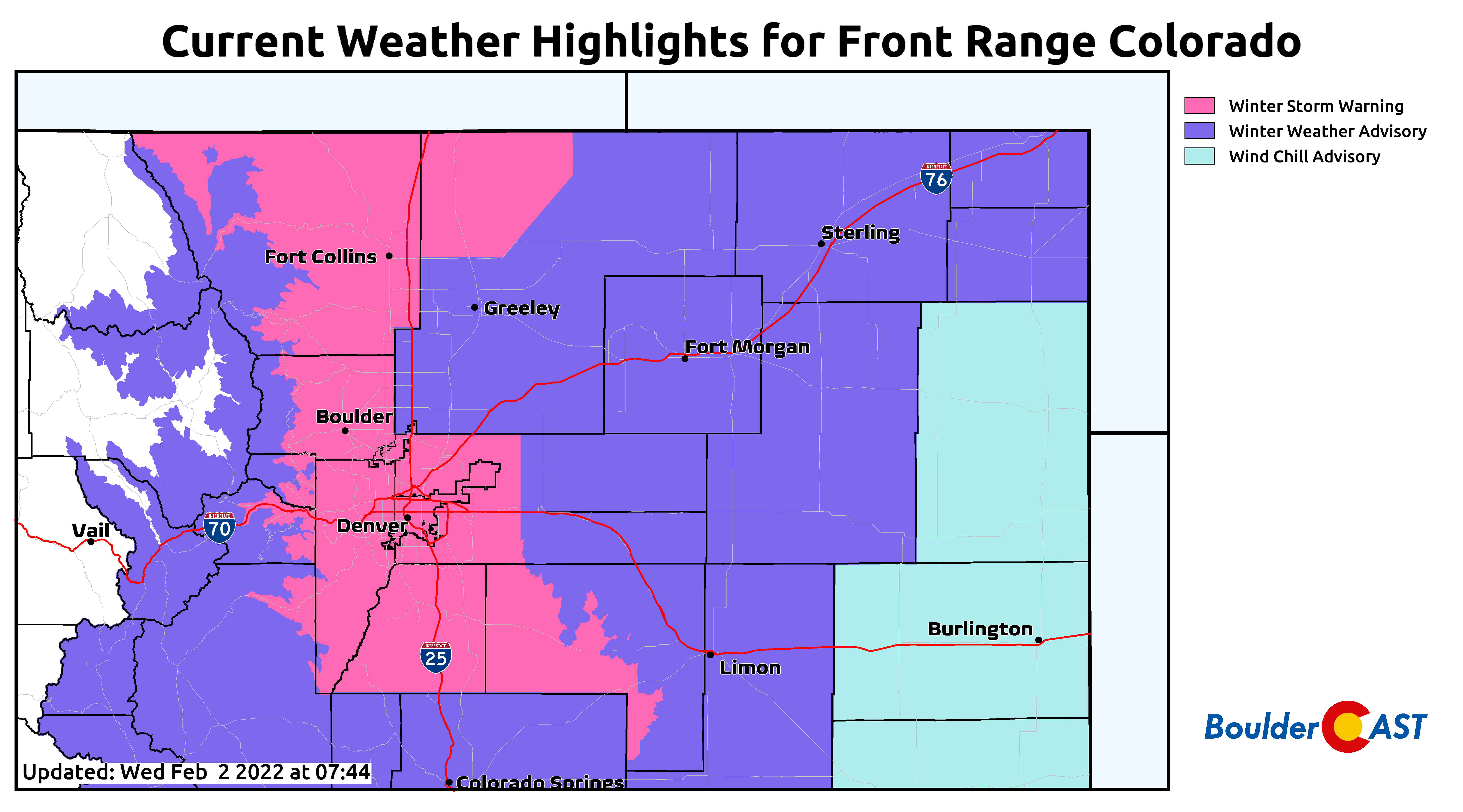
Despite the fact that most of the snow is over and done with, Winter Storm Warnings remain in effect for most of the area through this evening.
After the snow tapers off tonight, skies will clear somewhat setting the stage for one of the coldest nights of the season. Every single model has temperatures dropping below zero for the entire area so confidence is high. We expect most areas to land in the negative single digits, but low-lying and typical cold spots will likely be even colder than that.
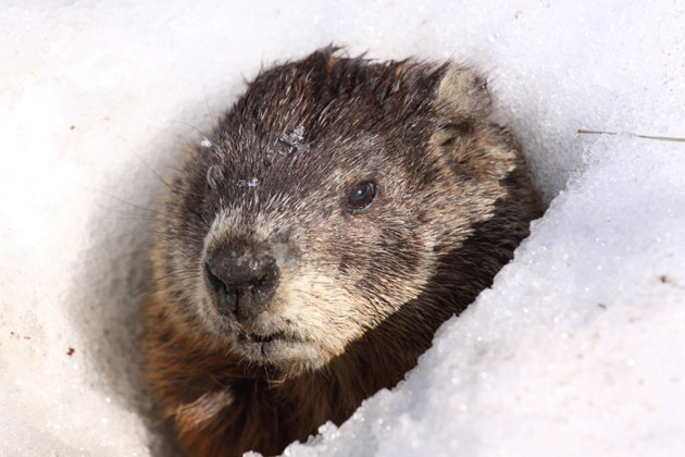
Finally, I wanted to wish you all a Happy Groundhog Day! Most folks in Colorado don’t appreciate or fully understand this holiday, but being a meteorologist growing up within an hour’s drive of Punxsutawney Phil in southwestern Pennsylvania, this is a marginally more meaningful day to me. Marginally. I still never watched the movie….
Enjoy!
Get BoulderCAST updates delivered to your inbox:
Help support our team of Front Range weather bloggers by joining BoulderCAST Premium. We talk Boulder and Denver weather every single day. Sign up now to get access to our daily forecast discussions each morning, complete six-day skiing and hiking forecasts powered by machine learning, first-class access to all our Colorado-centric high-resolution weather graphics, bonus storm updates and much more! Or not, we just appreciate your readership!

Enjoy our content? Give it a share!


You must be logged in to post a comment.