Sunday’s record-breaking November heat will give way to a dramatic cooldown on Monday, with temperatures plunging 20 to 30 degrees and wave clouds rolling in over the Front Range. The week ahead stays dry and mostly mild, but a few weak cold fronts will stir up some wind and day-to-day temperature swings. And while the forecast looks quiet for now, ensemble models are starting to hint at a colder, potentially snowier shift next week.
This week’s highlights include:
- 🔥 Record-smashing heat hit Boulder and Denver Sunday, with highs in the 80s and gusty downslope winds.
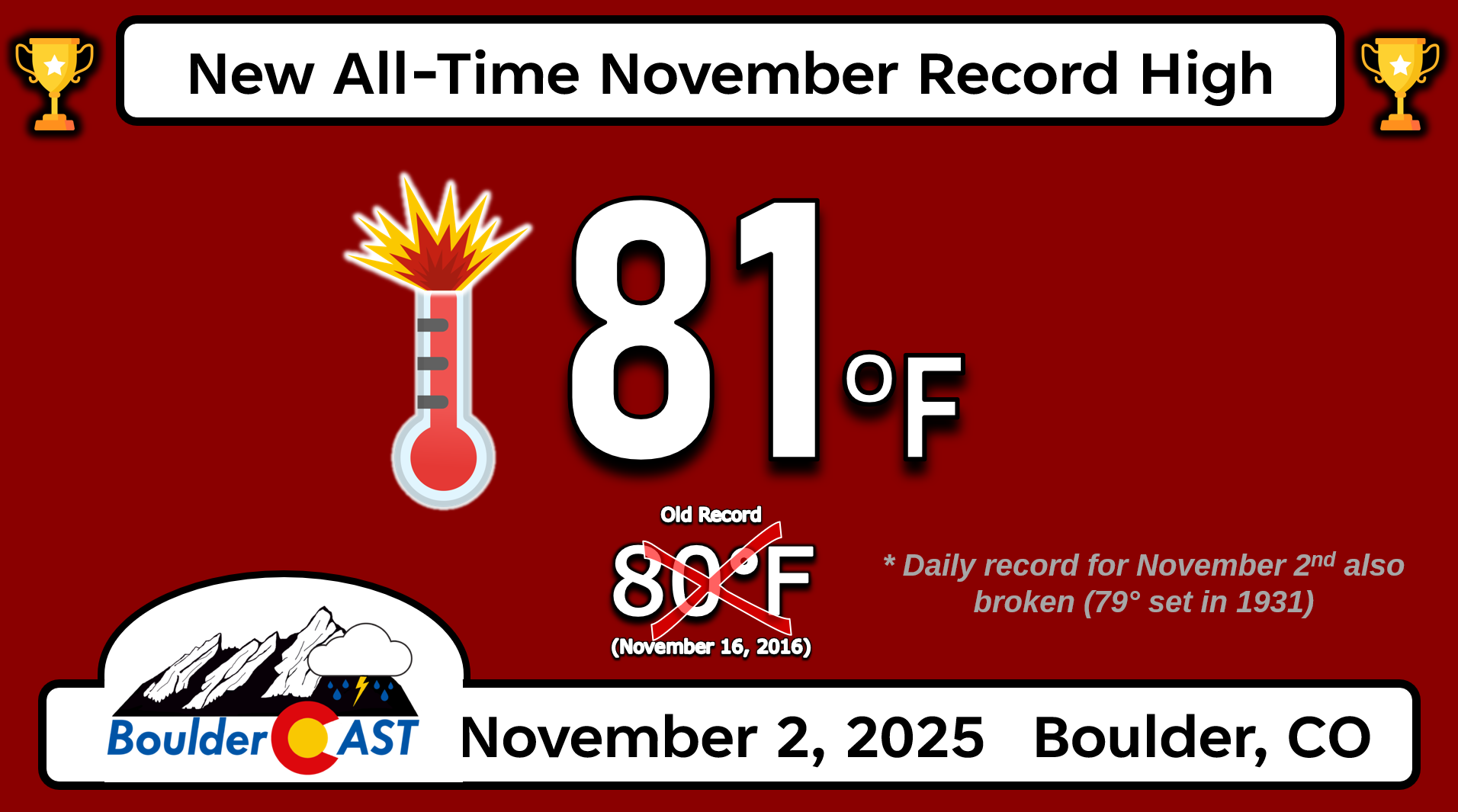
- 📈 Boulder hit 81°F while Denver soared to 83°F—new all-time November record highs for both cities.
- 🌬️ A backdoor cold front, increased cloud cover, and a Denver Cyclone will drop our temps 20–30°F for Monday. Hello 50s!
- 🌡️ The week ahead stays dry and mostly mild, with weak cold fronts nudging temps up and down. We’ll generally be in the 60s and 70s Tuesday and beyond.
- ❄️ Models hint at a colder, snowier pattern next week (Nov 13–18), with over half of Euro ensemble members showing snow in Boulder/Denver.
DISCLAIMER: This weekly outlook forecast is created Monday morning and covers the entire upcoming week. Accuracy will decrease as the week progresses as this post is NOT updated. To receive daily updated forecasts from our team, among many other perks, subscribe to BoulderCAST Premium.

Go Premium, get all the perks.
Daily Forecast Updates
Get our daily forecast discussion every morning delivered to your inbox.
All Our Model Data
Access to all our Colorado-centric high-resolution weather model graphics. Seriously — every one!
Ski & Hiking Forecasts
6-day forecasts for all the Colorado ski resorts, plus more than 120 hiking trails, including every 14er.
Smoke Forecasts
Wildfire smoke concentration predictions up to 72 hours into the future.
Exclusive Content
Weekend outlooks every Thursday, bonus storm updates, historical data and much more!
No Advertisements
Enjoy ad-free viewing on the entire site.
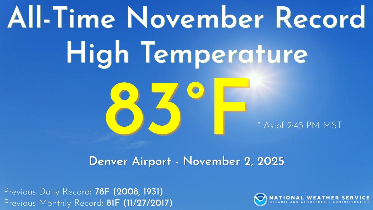
New all-time November temperature records set on Sunday
Sunday brought a surprising burst of heat to Boulder and Denver, thanks to strong downslope winds teaming up with a warm high-pressure ridge. Temperatures surged into the 80s across the lower elevations, rewriting the record books in the process.
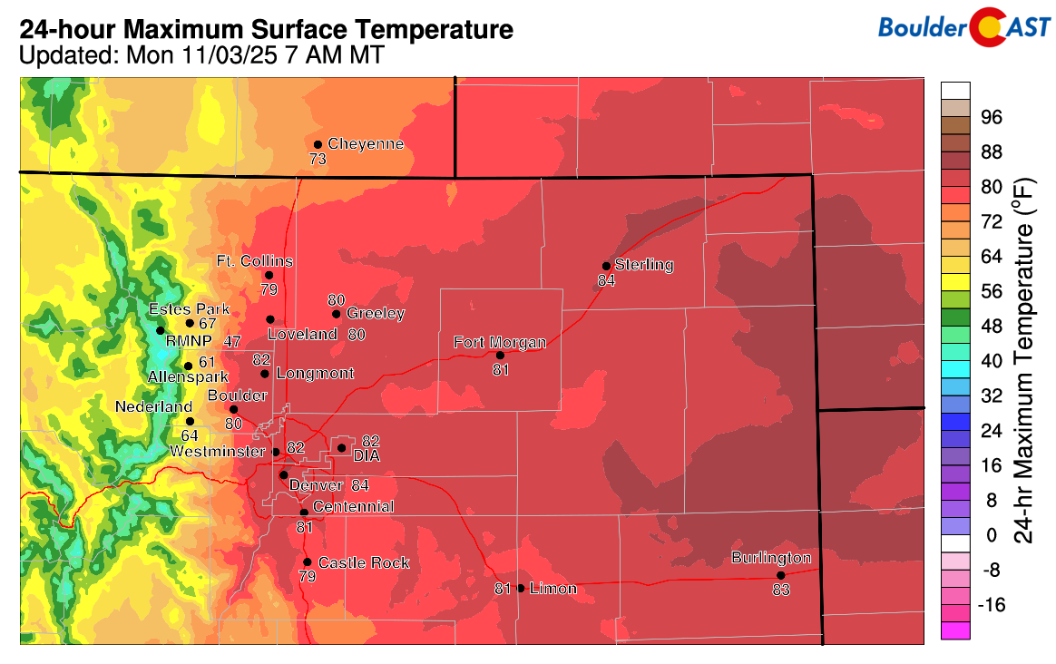
Approximate high temperatures on Sunday November 2, 2025
Boulder hit 81°F, setting a new all-time high for November, with gusts topping 30 MPH.
Denver went even further, reaching a scorching 83°F and breaking its own monthly record.
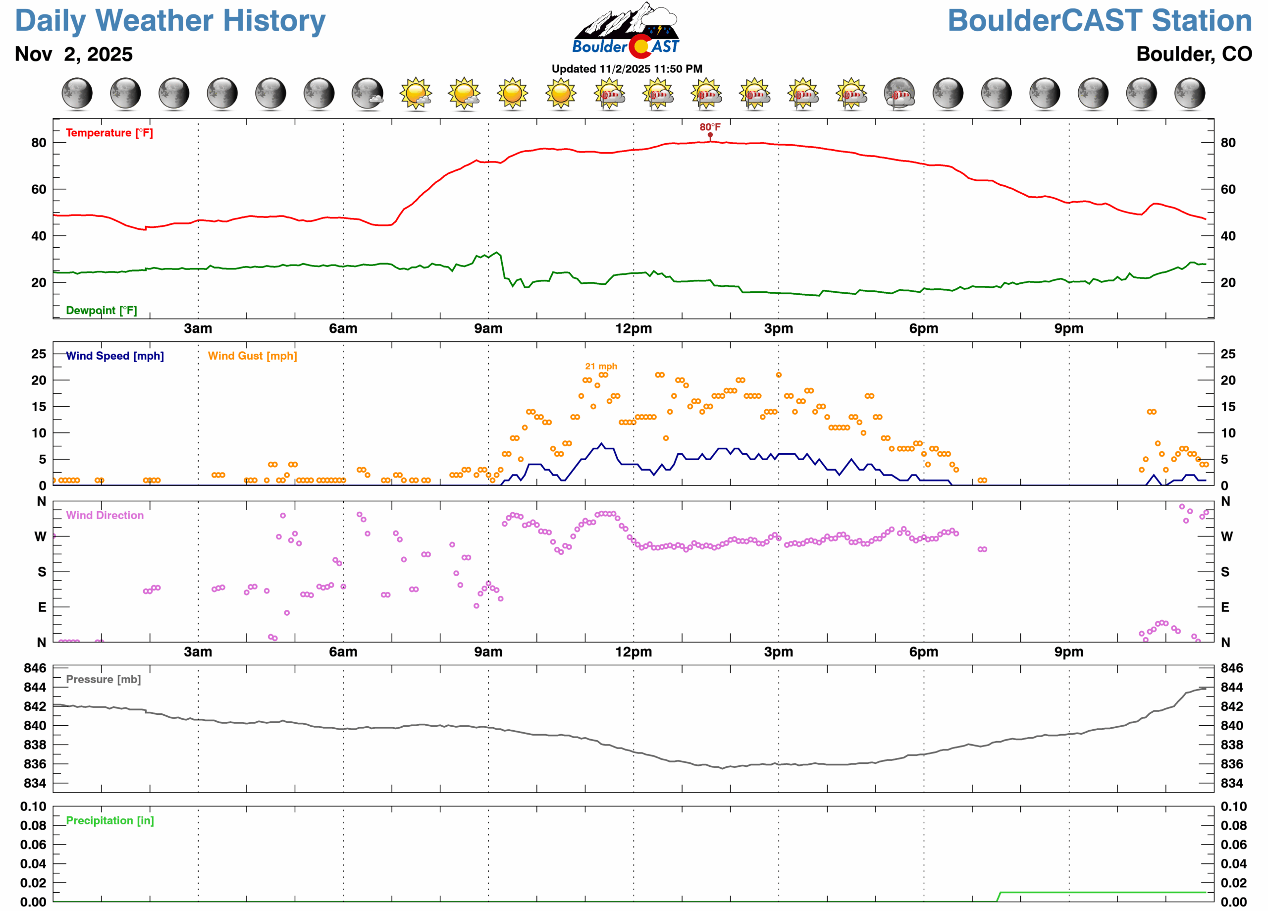
BoulderCAST Station, with only 11 years of data, tied its November high of 80°F—matching the mark set back in 2016—the day before a record late first snowfall.
That heat spike is now behind us, and while we’ll stay fairly warm this week, we’re not expecting any more record-breaking highs in the near term.
Dramatically cooler on Monday
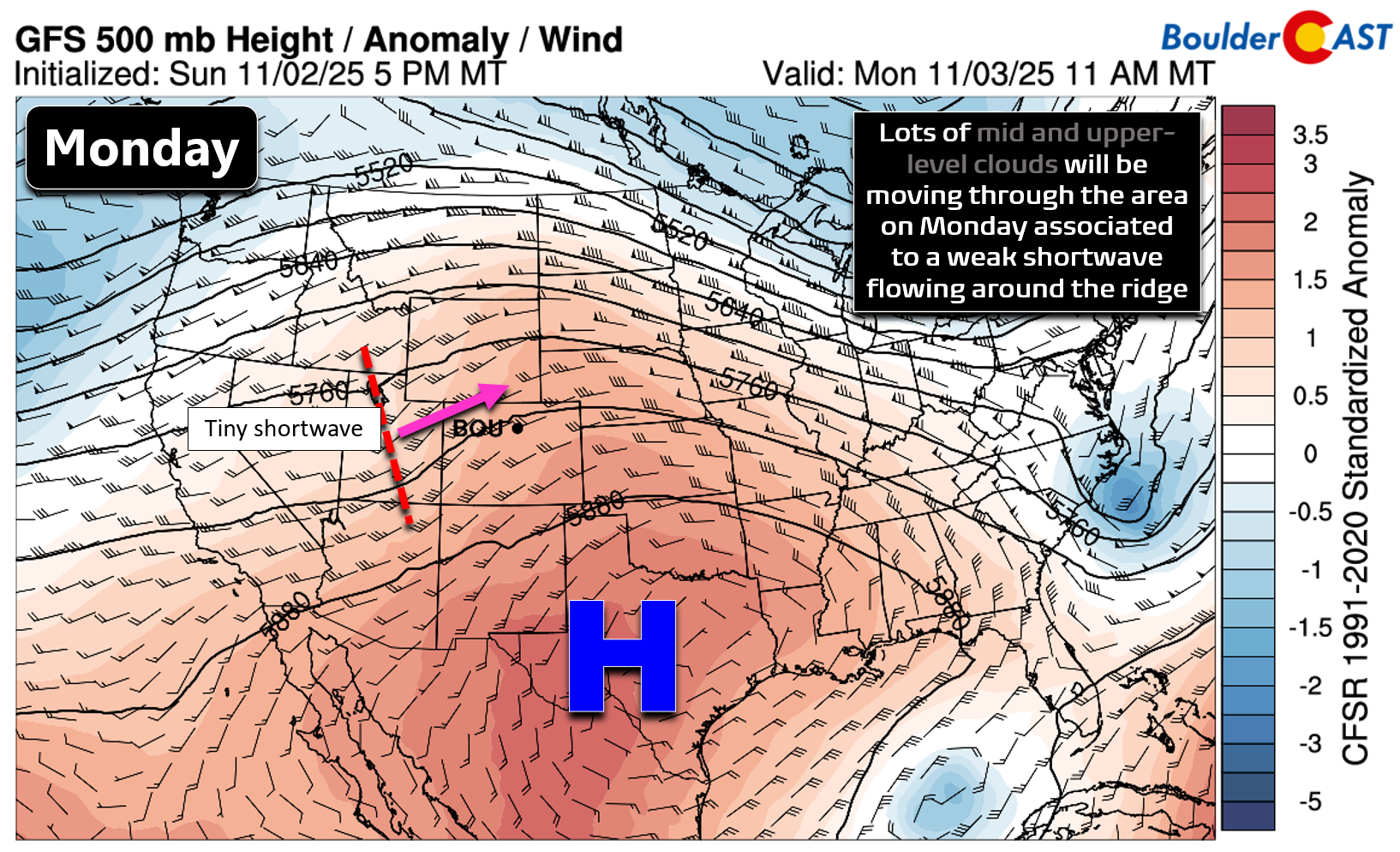
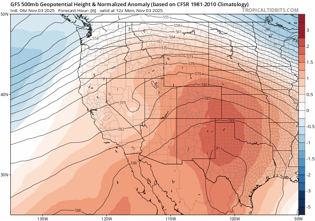
We begin the week still largely under the influence of high pressure which is parked over Texas as of Monday morning. There is a weak shortwave approaching from the west-southwest, riding along the northwest periphery of the ridge. This system and its associated cloud cover will be passing across Colorado through the day Monday leading to mostly cloudy skies.
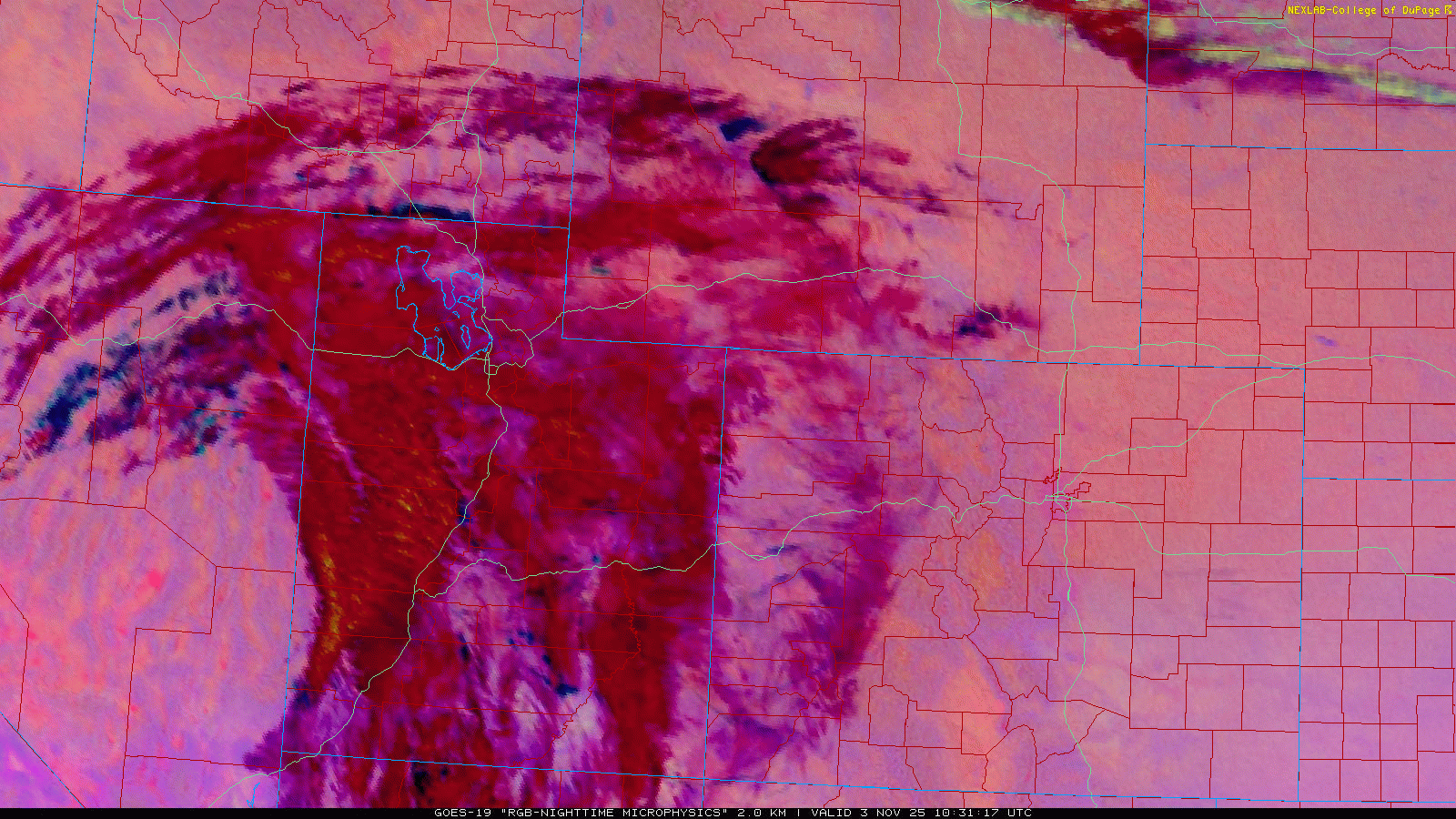
Satellite imagery from GOES-East shows thickening cloud cover early Monday, with wave clouds forming over Boulder as moisture interacts with the Continental Divide.
At the surface, a backdoor dry cold front moved through the lower elevations overnight, and resulting southeasterly flow will help facilitate a Denver Cyclone pattern through our Monday. This shifts in the winds and increased cloud cover will put an end to very warm weather, knocking temperatures down 20 to 30 degrees (!) for our Monday compared to the record highs we saw on Sunday.
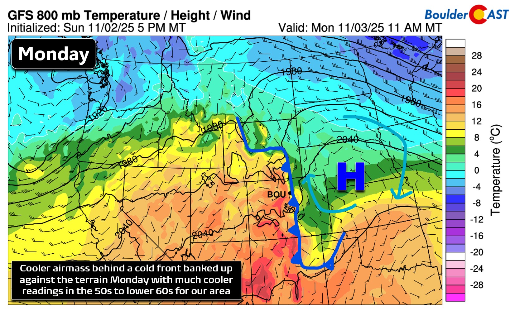
Expect highs in the 50s across Boulder and Denver, with low 60s possible east of I-25. Clouds will dominate early but should thin out by late afternoon, leading to clear skies Monday night.
A dry rest of the week with warm temperatures
Looking ahead, the rest of the week brings quiet, dry weather across the Front Range. A protective ridge of high pressure will remain in place to our south, with occasional weak shortwaves brushing by to the north.
These will push dry cold fronts through the area Tuesday night, Wednesday night, and again Friday night, though the timing and intensity may shift. Temperatures will fluctuate slightly day to day, but overall we’ll stay on the mild side for early November.
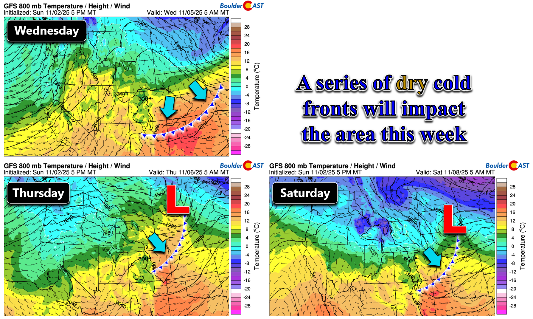
One thing is clear: none of these passing disturbances or fronts this week will generate any precipitation east of the Mountains. We continue to see essentially no chance for precipitation, rain or snow, across the lower elevations throughout the next seven to nine days.
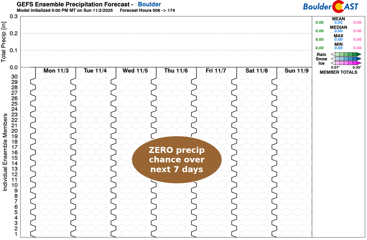
The northern Mountains might catch a few light snow showers this week, especially favored peaks west of the Divide near Steamboat, but accumulations will be minimal (a couple inches or less).
After Monday’s cooldown, Tuesday rebounds nicely with highs in the mid-70s. The rest of the week settles into the 60s, with each dry front nudging temps slightly. One of the shortwaves exiting Thursday could bring gusty downslope winds as it departs.
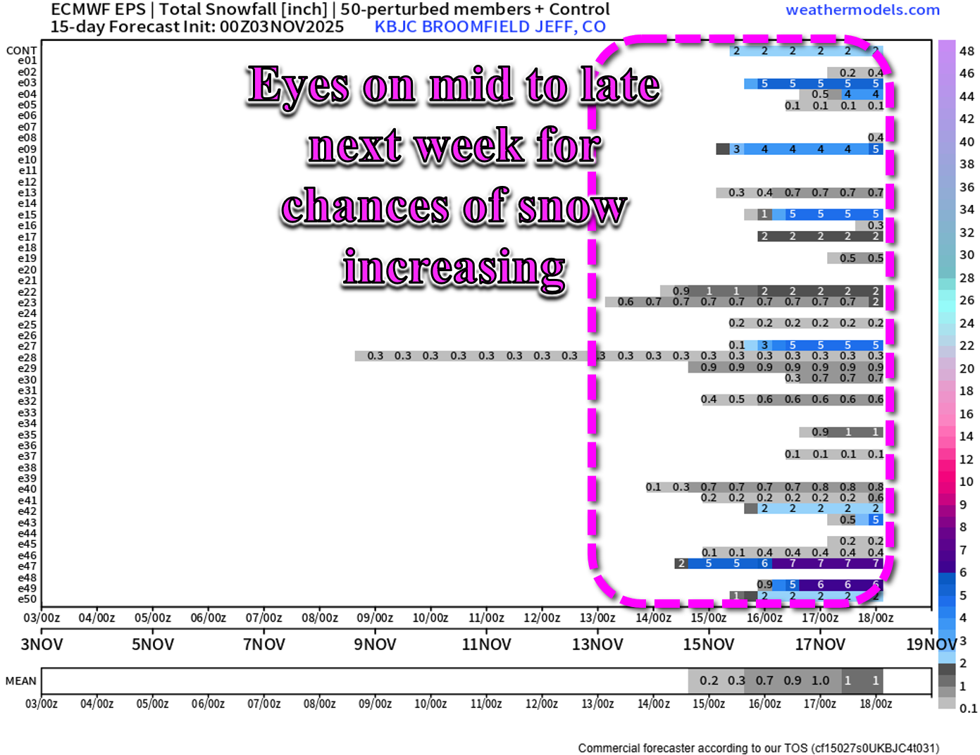
While the dry stretch continues, there’s a glimmer of change on the horizon. Ensemble guidance is starting to hint at a shift toward colder, more seasonal weather next week. Between November 13–18, more than half of the European ensemble members show accumulating snow in the Denver area. It’s early, and nothing’s locked in yet, but it’s the first real signal of winter we’ve seen in a while. Stay tuned—and enjoy the mild stretch while it lasts!
Forecast Specifics:
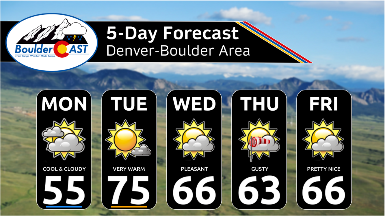
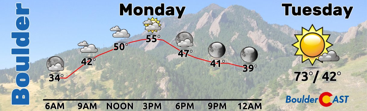
Monday: Mostly cloudy and cool with highs in the middle 50s on the Plains (60s east of Denver) and upper 40s in the Foothills.
Tuesday: Very warm temperatures return under mostly sunny skies and a few afternoon breezes. Highs soar into the middle 70s on the Plains, with lower 60s in the Foothills.
Wednesday: Partly cloudy and somewhat cooler behind a cold front. Highs top out in the middle 60s (Boulder) to lower 70s (east of Denver). The Foothills will be in the 40s to lower 50s.
Thursday: Partly cloudy and mild with gusty downslope winds from the west-northwest. Highs reach the low to middle 60s on the Plains with lower 50s in the Foothills.
Friday: Partly cloudy and pleasant to end the week. Temps stay in the middle 60s on the Plains with lower 50s in the Foothills.
Weekend: Likely business as usual on Saturday with highs in the 60s. Sunday turns sharply cooler around 50° following yet another dry but stronger cold front.
DISCLAIMER: This weekly outlook forecast is created Monday morning and covers the entire upcoming week. Accuracy will decrease as the week progresses as this post is NOT updated. To receive daily updated forecasts from our team, among many other perks, subscribe to BoulderCAST Premium.
Go Premium, get all the perks.
Daily Forecast Updates
Get our daily forecast discussion every morning delivered to your inbox.
All Our Model Data
Access to all our Colorado-centric high-resolution weather model graphics. Seriously — every one!
Ski & Hiking Forecasts
6-day forecasts for all the Colorado ski resorts, plus more than 120 hiking trails, including every 14er.
Smoke Forecasts
Wildfire smoke concentration predictions up to 72 hours into the future.
Exclusive Content
Weekend outlooks every Thursday, bonus storm updates, historical data and much more!
No Advertisements
Enjoy ad-free viewing on the entire site.
Enjoy our content? Give it a share!


You must be logged in to post a comment.