The weather pattern is shifting as we speak across the West and with several southern-track storms set to impact our area in the coming week or so. The first arrives on Thursday, but unfortunately it is coming in a bit too far south with things largely bypassing the Denver Metro area. Still there will be some amount of wintry weather to end the week. Let’s take a look at the latest forecast for not only the storm knocking on the door, but the next one gearing up for late in the weekend.
At a Glance
- This post discusses the weather forecast for the West and Front Range Colorado, focusing on the impact from a series of southern-track storms.
- The first storm arrives on Thursday, but it is too far south to produce much snow across the Denver Metro area. It will bring much colder air, low clouds, patchy freezing mist, and flurries. The best chance for accumulating snow is southeast of Denver and in the Mountains.
- The next storm is expected late in the weekend, but it may also be too far south to produce significant snowfall.
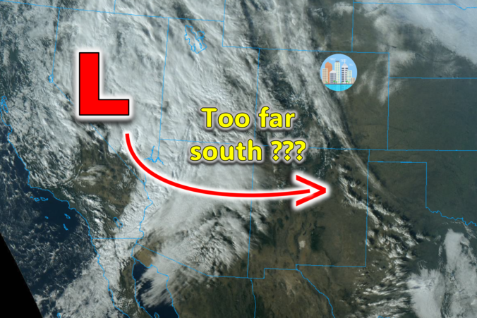
How far south is too far south?
We mentioned in this week’s Colorado weather outlook that a pattern shift is about to unfold across the western United States with the southern storm track becoming more active in the days ahead and at least into next week. A more busy southern storm track is something we’ve been anticipating since it is more common during El Niño. This winter is entertaining one of the strongest El Niños on record after all, so it was only a matter of time.
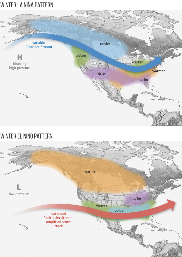
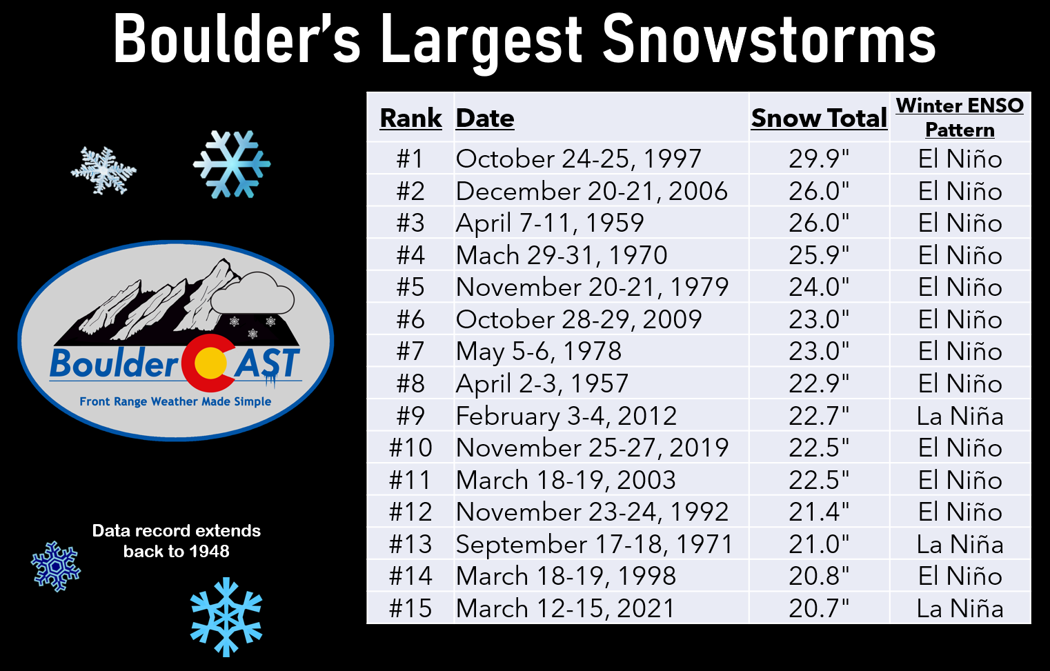
An active southern storm track is more favorable for wet/chilly weather across the Gulf Coast, the Desert Southwest and, sometimes, Colorado. Southern-track, El Niño-infused low pressure systems are responsible for most of the biggest snowstorms in Boulder’s history:
This isn’t always the case though. Sometimes these coveted southern-track storms can end up trekking TOO far south — this will be the case with the wintry storm knocking on our door right now. Currently the first system (of several) we are tracking has broken off from the main jet stream along the Canadian Border — it’s now spinning over Nevada as of writing Wednesday evening.
Over the next 24 to 48 hours, it will move southeast across Las Vegas, the Grand Canyon, and eventually central New Mexico bringing a mix bag of winter weather to much of the southwestern United States.
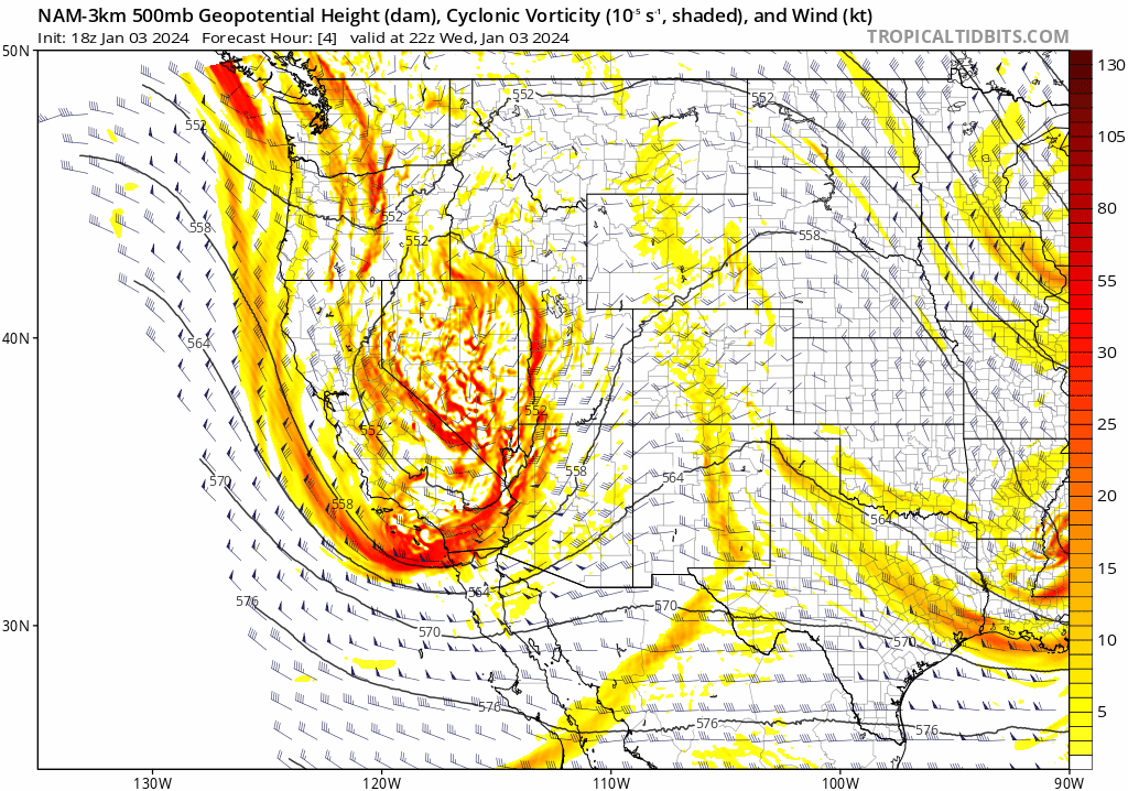
Unfortunately (for those hoping for much precipitation in the Front Range), this track is just a bit too far south given the storm’s size. Most of the energy and best easterly flow (upslope) will reside across New Mexico and far southern Colorado.
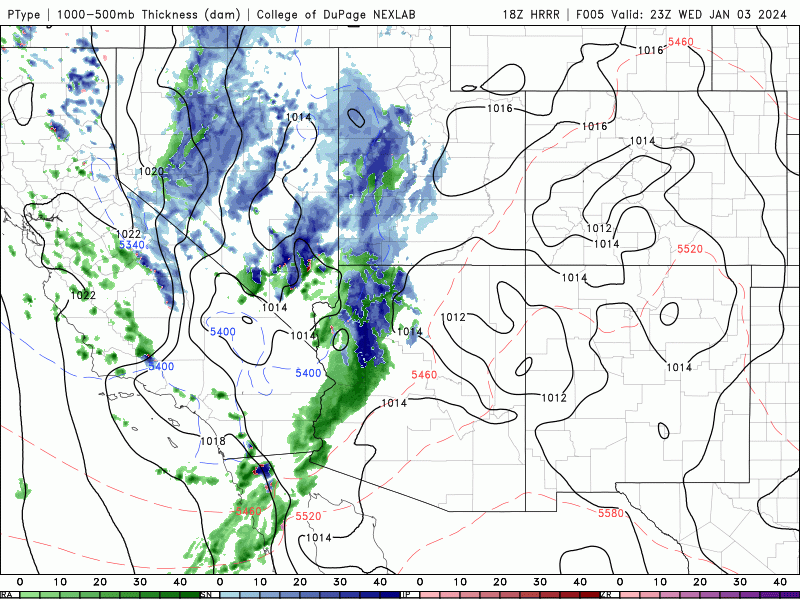
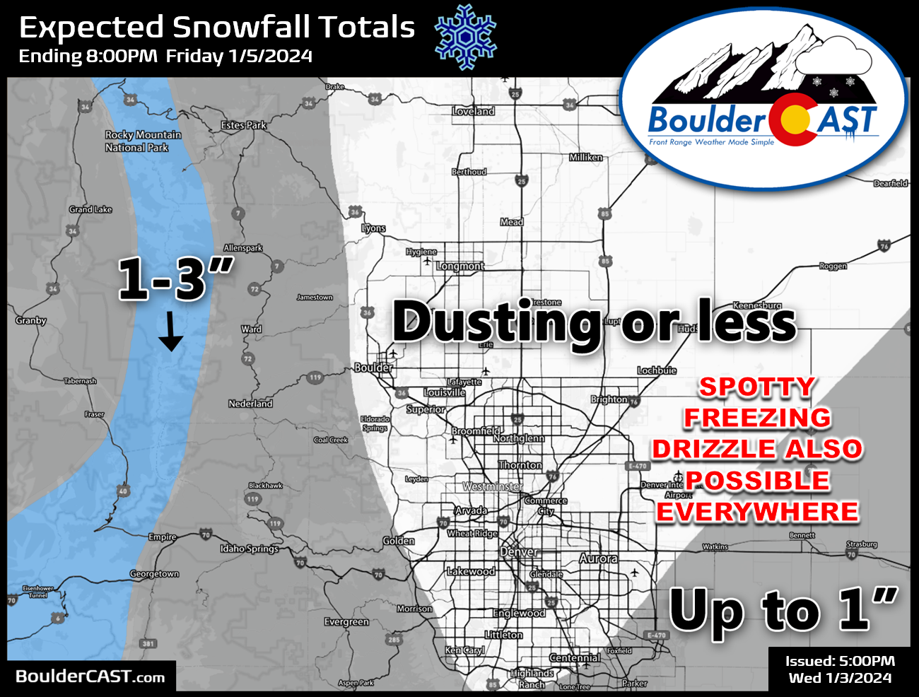
Still, much colder air will get slowly slurped into the Denver Metro area late Wednesday night into Thursday morning as a surface low develops across eastern New Mexico. High temperatures for us on Thursday will be around the freezing mark at best, perhaps even in the 20s. Low clouds, patchy freezing mist, and flurries will all be on the table throughout Thursday. Though for most of us, it will just be a very cold and raw day but largely dry. As the storm wraps up and temperatures fall further Thursday evening, this will be the best chance for light accumulating snow with a focus southeast of Denver. Our snowfall forecast map for this first storm is shown below. As mentioned, most areas will see just a dusting or less with perhaps even no snowflakes at all around Boulder. The best chance for seeing accumulating snow will be southeast of Denver and in the Mountains.
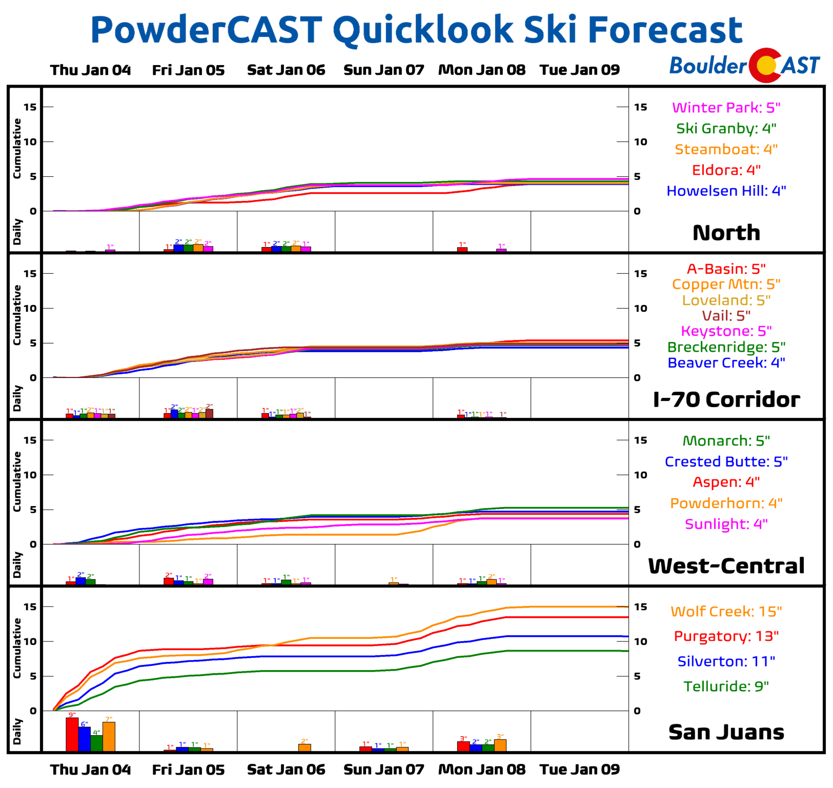
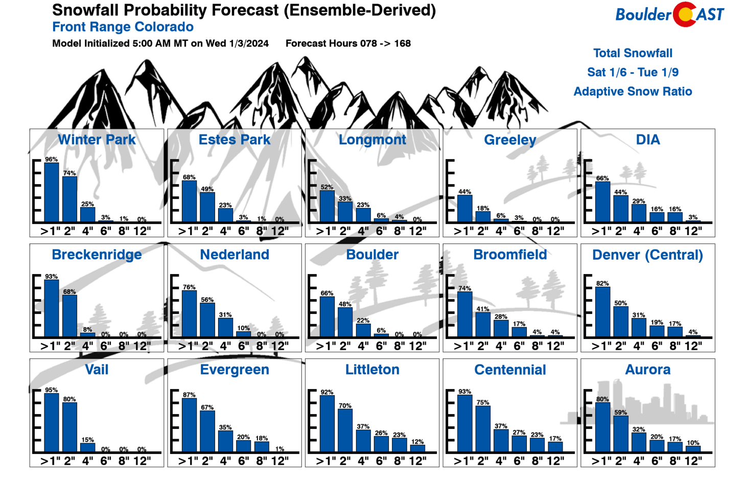
Skiers hoping for decent powder will need to head southwest this weekend and next week — as usual with these southern-track storms, southwest Colorado will offer the best conditions:
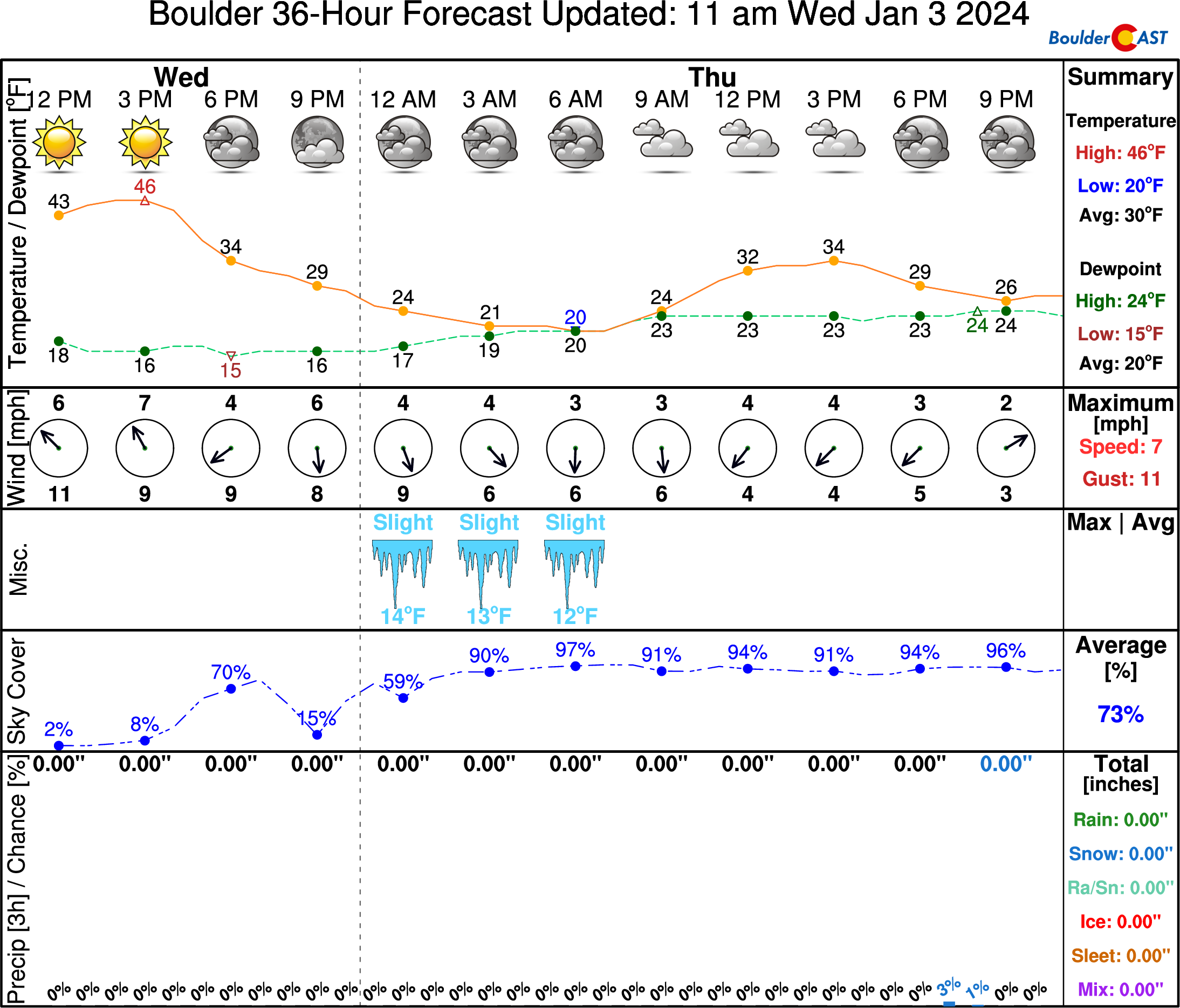
Here’s the outlook for Boulder on Thursday — cold and gloomy for sure, but overall basically dry. Isolated freezing mist and perhaps a few flurries will be possible Thursday afternoon and evening.
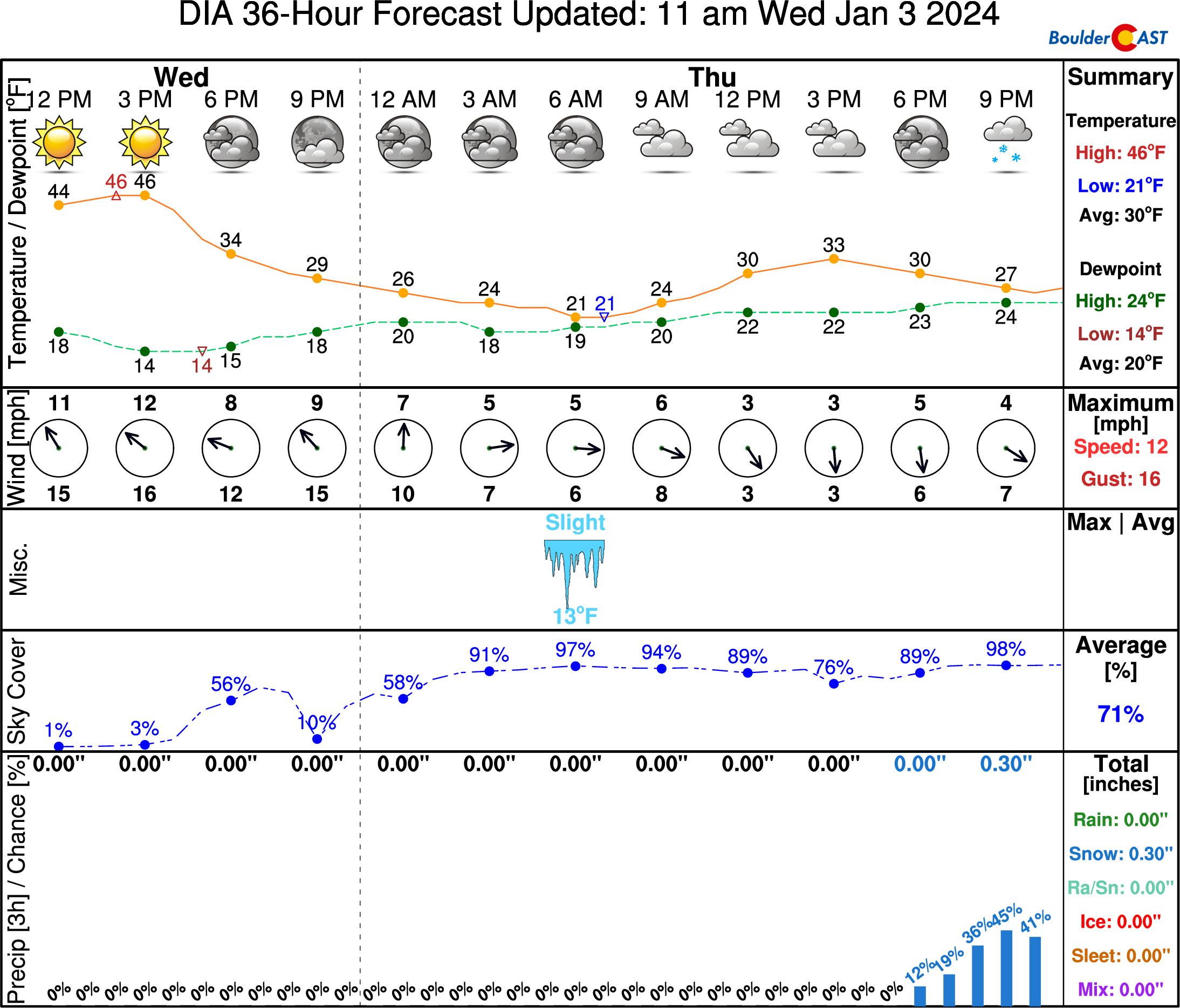
Further south and east, the outlook for snow at DIA is barely more wintry. There’s a better chance out that way for a light dusting or so of snow Thursday evening into the overnight. Be aware that roads could become slick Thursday evening and night in the southeastern burbs.
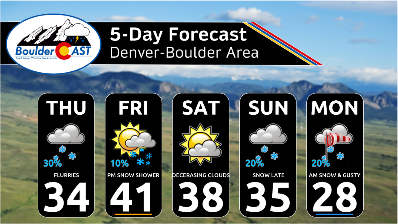
Overall, this system will mostly miss the Denver area in terms of the snow, but the cold will certainly make for a change considering the mild start we’ve had to 2024 so far! Colder weather will stick around on Friday as the storm exits with highs in the 30s. A few instability snow showers may also roll of the higher terrain during the late-day period Friday, but minimal accumulation/impact is expected for the lower elevations.
The next major southern-track low pressure we are watching will enter the picture late in the weekend — basically Sunday into Monday. It certainly looks intriguing on paper, and in our latest Snowfall Probabilities (below). However, we have a feeling this one may skirt just a bit too far south again as that has been the model trend with it so far. We’re likely to see some type of accumulation Sunday night into Monday, but probably not that much.
We’ll continue to monitor this onslaught of southern track storms and will pass along any pertinent updates to you. Perhaps Mother Nature will surprise us with the next storm, but probably not…
Stay tuned and subscribed!
Get BoulderCAST updates delivered to your inbox:

Go Premium, get all the perks.
Daily Forecast Updates
Get our daily forecast discussion every morning delivered to your inbox.
All Our Model Data
Access to all our Colorado-centric high-resolution weather model graphics. Seriously — every one!
Ski & Hiking Forecasts
6-day forecasts for all the Colorado ski resorts, plus more than 120 hiking trails, including every 14er.
Smoke Forecasts
Wildfire smoke concentration predictions up to 72 hours into the future.
Exclusive Content
Weekend outlooks every Thursday, bonus storm updates, historical data and much more!
No Advertisements
Enjoy ad-free viewing on the entire site.
Enjoy our content? Help us out and give it a share:


You must be logged in to post a comment.