
Our late‑week spring storm delivered a far more impressive performance than early models suggested. What looked like a modest, fast‑moving system slowed down, reorganized, and ultimately dumped a surprisingly healthy swath of heavy, wet snow across the Front Range. From booming Foothills totals to a rare over‑performance at DIA, this one had plenty of action worth unpacking. Let’s take a look at how the storm evolved, where our forecast missed the mark, and just how quickly we’ll be warming back into the 70s.
O
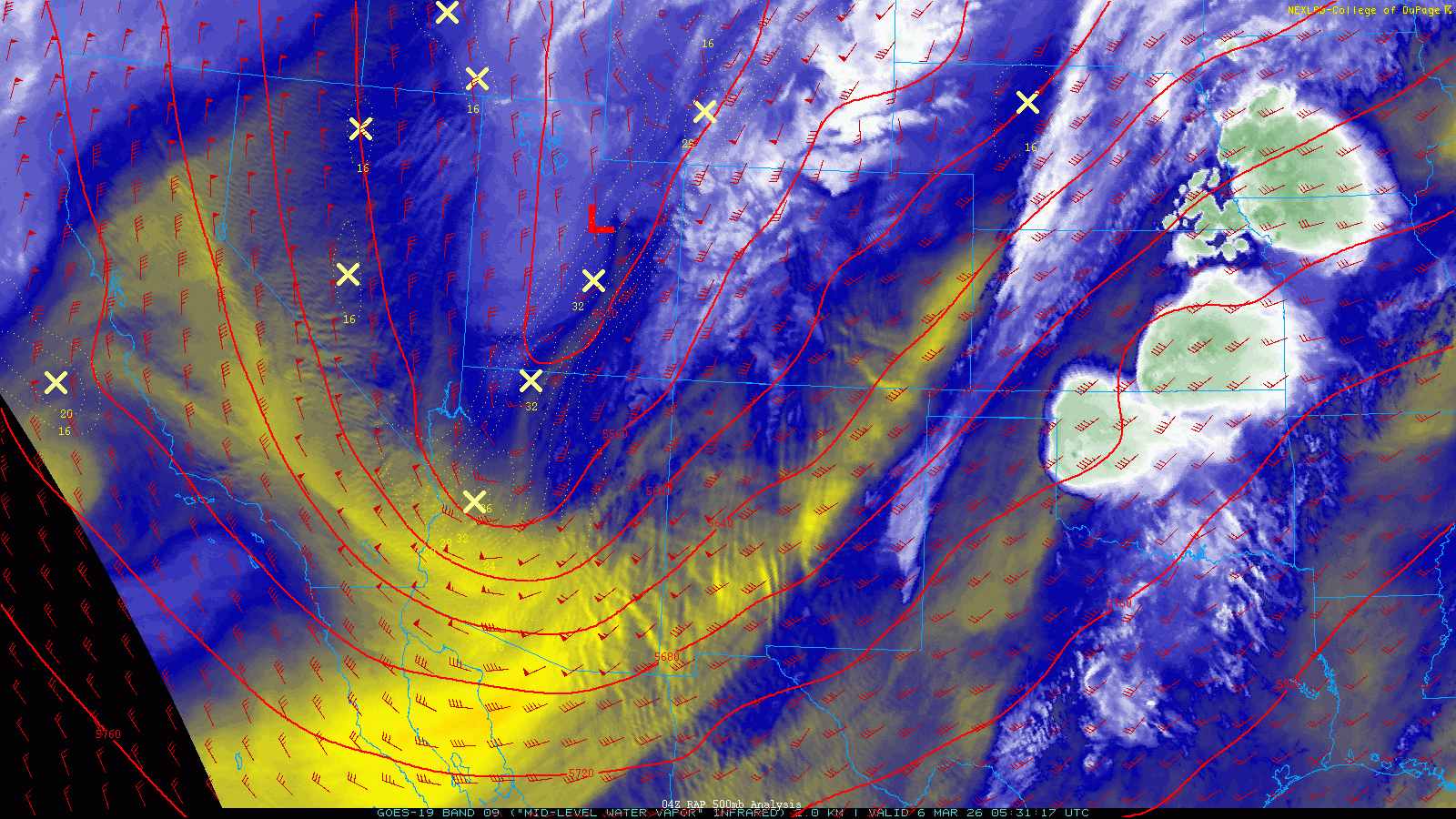
ur spring snowstorm really came together in classic Colorado fashion—messy, slow, and full of last‑minute surprises. What began as a compact disturbance sliding in from the Pacific Northwest stalled squarely over Colorado on Friday, refusing to budge until it fractured into two pieces Friday night. One chunk was swept northeast into the jet stream, while the other peeled off and spun itself into a closed low over Arizona.
The upward trend
By Thursday evening, short‑range guidance started flashing neon signs that this storm was trending stronger and slower than earlier projections. We highlighted this exact possibility in Thursday morning’s forecast discussion:
There are really no “complete miss” solutions, but roughly a quarter of (ensemble) members foretell a more robust precipitation event—something to watch as the storm evolves.
That upward trend only sharpened Thursday night. A subtle deceleration of the system meant the ingredients for moderate to heavy snow would linger over the Denver Metro for several hours—long enough to matter.
By early Friday morning, with the “boom” scenario gaining credibility, we nudged snowfall totals upward across much of the Front Range as the National Weather Service added a late Winter Weather Advisory for the lower elevations. The one area we held back on was south of Denver, where temperatures and upslope looked primed for a bigger hit. In hindsight, that was our one miss—the southern suburbs ended up cashing in big.

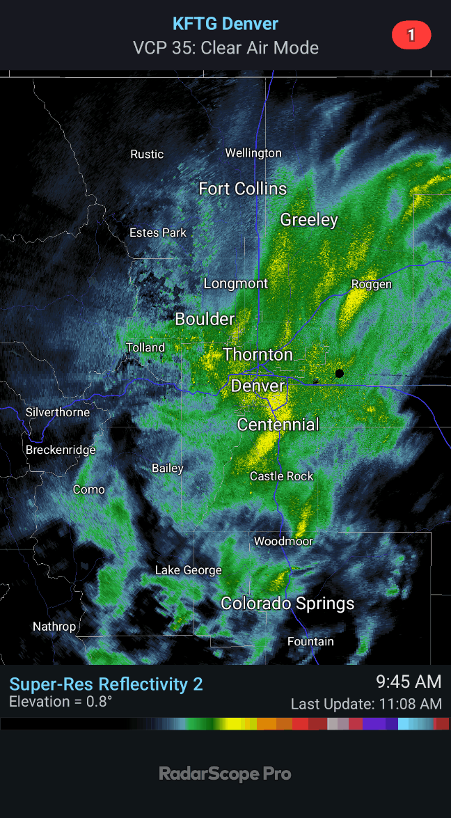
Heavy, wet snow blossomed Friday morning
Snow began early Friday with a brief rain/snow mix at the onset for many lower‑elevation locations. Once the column cooled, bands of heavy, wet snow dumped across the area:
- South and southeast Denver Metro: Snowfall rates over 1″ per hour at times
- Foothills: Colder temps and better ratios meant 2–3″ per hour at times
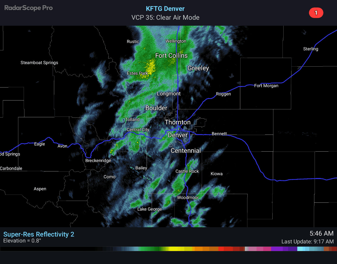
This was a classic springtime winter storm setup—big, sloppy flakes at lower elevations and absolute hammering in the Foothills. Eldora benefited from these heavy rates, racking up a storm-best 18 inches of snow, with their snow stake appearing completely buried by Friday afternoon.

Eldora snowstake, Friday afternoon
Forecast verification: mostly solid, one notable miss
Our snowfall forecast map issued early Friday morning is shown below with storm totals overlaid. Green values indicate our forecast verified, Yellow values mean the observed total was just outside our forecast, while Red was a busted forecast (more than 1″ off). As expected, the storm’s bullseye set up south of Denver into the Palmer Divide and west into the Foothills. Totals included:
- 5–11″ south of I‑70 down into the Palmer Divide
- 9–14″ in the Foothills from Estes Park southward

Officially Denver (DIA) recorded 8.5″ of snow on Friday, owing to some heavier bands that setup Friday morning out that way, a rare situation where the airport actually received more snow than downtown Denver.
Boulder officially recorded 3.6″ of snow, with accumulation varying quite a bit across town owing to the well-forecast intrusion of warm/dry air from the north and east.
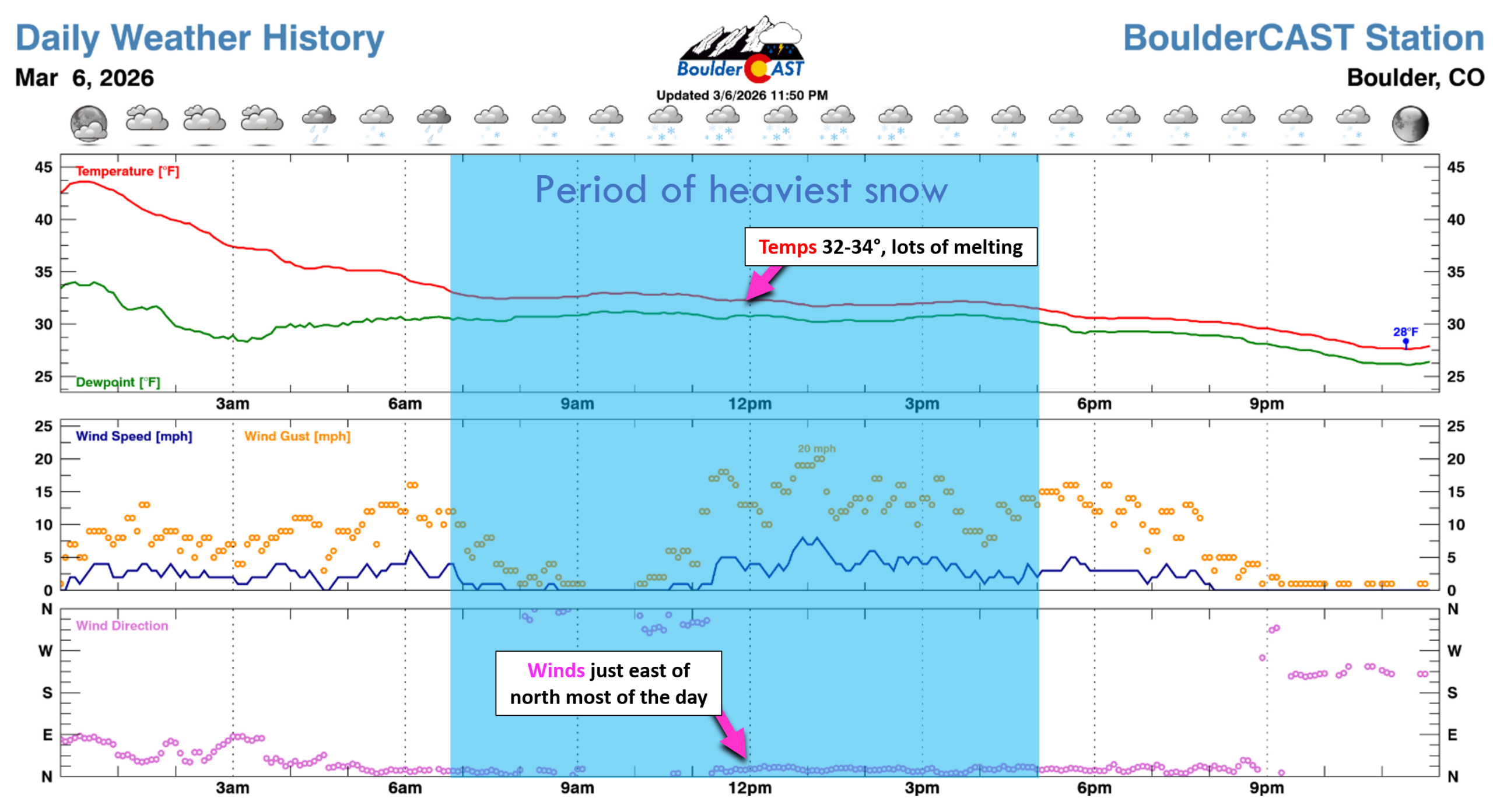
Saturday morning satellite imagery tells the story beautifully: nearly all of northeast Colorado is snow‑covered except the warm‑tongued pocket from northeast Boulder County into eastern Larimer and Weld. It snowed there, but very little stuck.
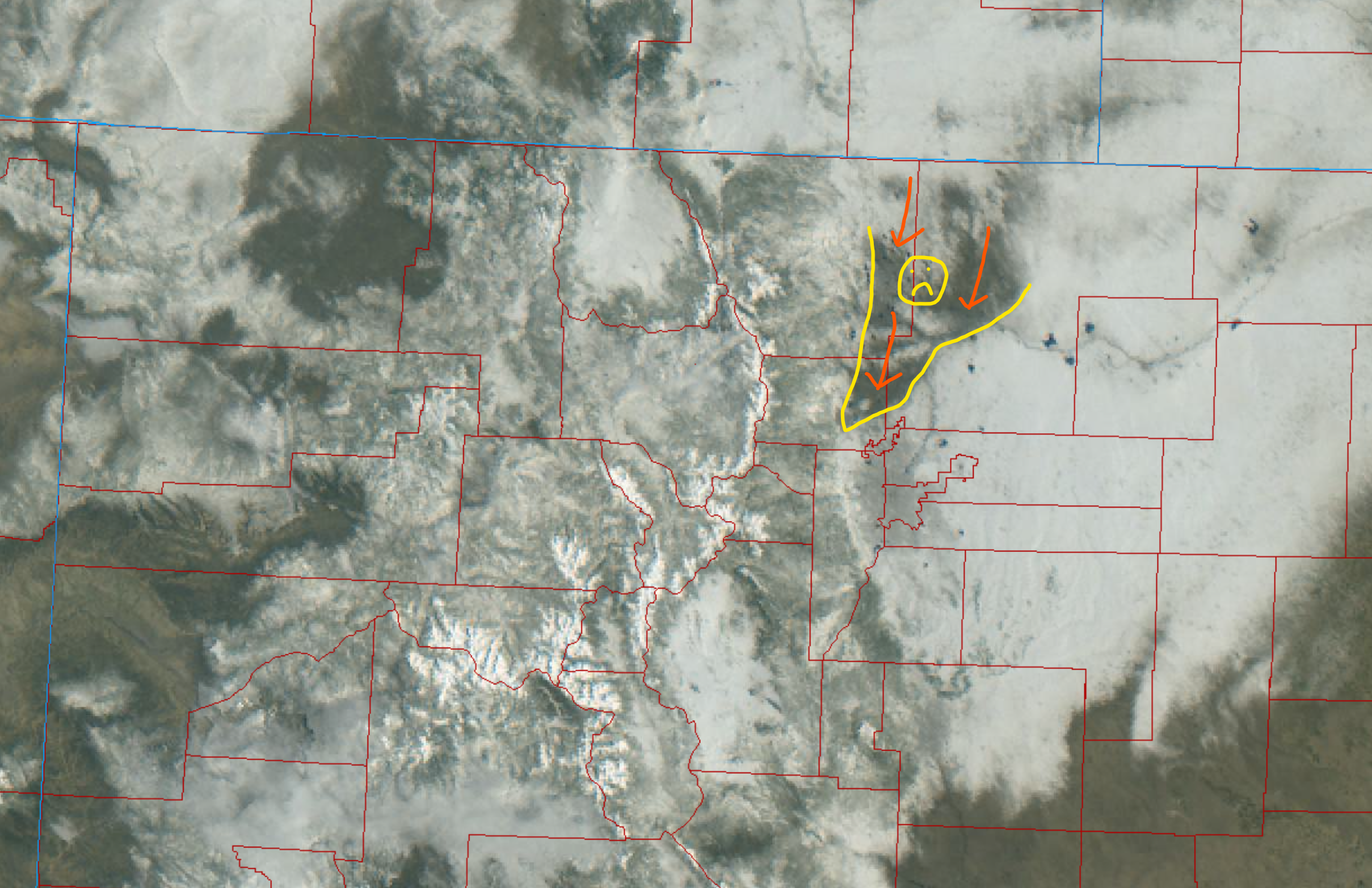
View of northern Colorado from GOES-East Saturday morning showing the extent of fresh snow cover
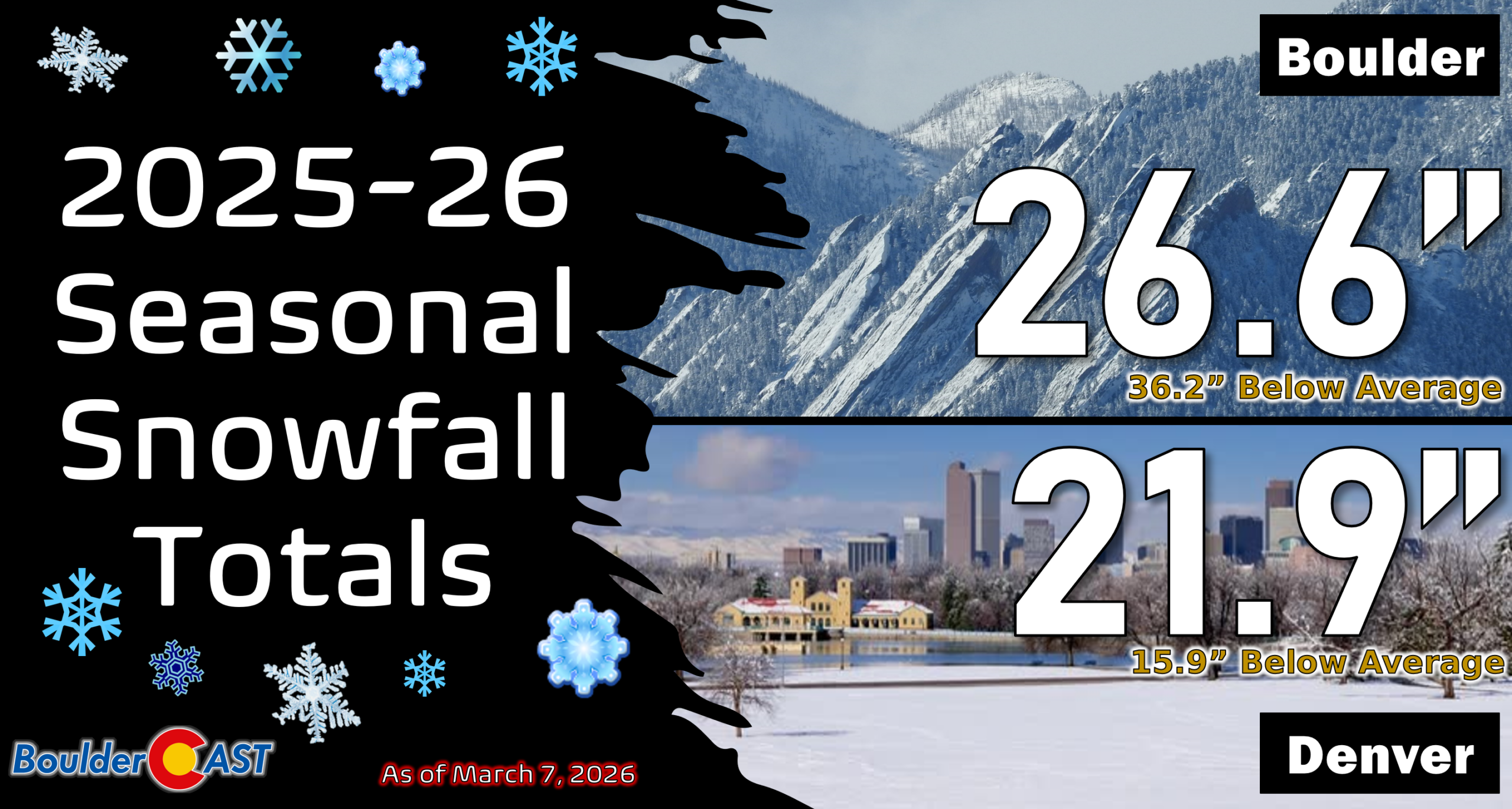
Seasonal context: still running behind
Despite this storm’s respectable output, both cities remain well below normal for the season:
- Boulder at 26.6″ (41% of normal)
- Denver at 21.9″ (58% of normal)
You can find a recap of all the winter storms so far in the 2025-2026 snow season HERE.
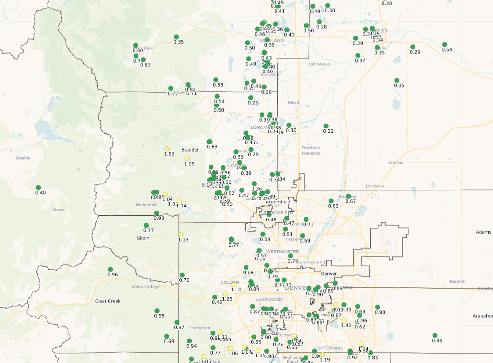
Moisture: the real win
Liquid totals were impressive and aligned closely with the late‑stage model trends:
- 0.4″ to 1.1″ across most of the Front Range
- Highest amounts: south of Denver + Foothills
- Lowest amounts: Longmont northeastward
This is a meaningful shot of moisture for our ongoing drought and should tamp down fire concerns—at least temporarily.
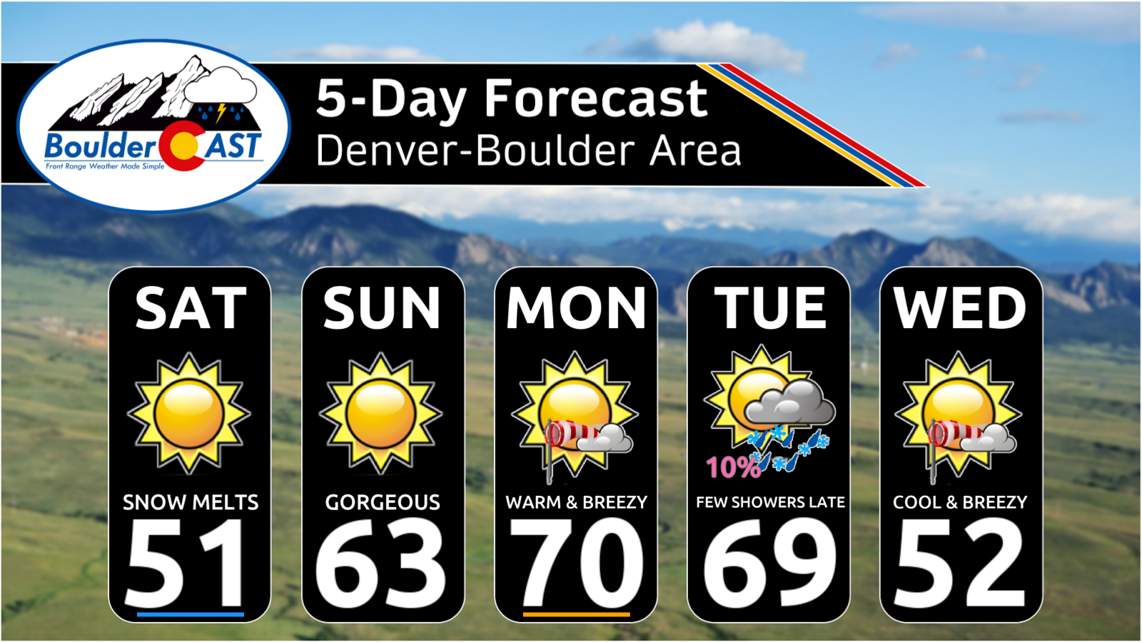
In the end, this spring storm was a reminder that even in a low‑snow season, Colorado can temporarily still flip the script when the ingredients line up just right. The moisture was the real prize, though, offering a welcome boost for our parched landscape and South Platte Basin snowpack before we warm rapidly into the 60s and 70s in the days ahead. As always, we’re already tracking what comes next, with nothing substantial in the pipeline outside of a small chance for rain/snow showers around the middle of the upcoming week. We’ll have all the details on the largely warm and windy week ahead in our usual Monday morning outlook. For now, enjoy the fresh snow, the quick melt, and the brief but misguided feeling that this winter might still have a little fight left in it.
Spread the word, share our crazy Colorado weather:

Go Premium, get all the perks.
Daily Forecast Updates
Get our daily forecast discussion every morning delivered to your inbox.
All Our Model Data
Access to all our Colorado-centric high-resolution weather model graphics. Seriously — every one!
Ski & Hiking Forecasts
6-day forecasts for all the Colorado ski resorts, plus more than 120 hiking trails, including every 14er.
Smoke Forecasts
Wildfire smoke concentration predictions up to 72 hours into the future.
Exclusive Content
Weekend outlooks every Thursday, bonus storm updates, historical data and much more!
No Advertisements
Enjoy ad-free viewing on the entire site.


Leave a Reply
You must be logged in to post a comment.