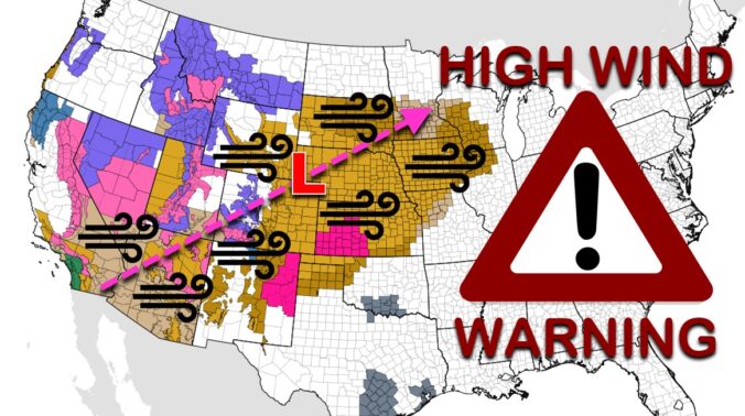
Batten down the hatches! A significant and potentially historic wind event is about to unfold across the Front Range on Wednesday with gusts reaching up to 100 MPH. A band of heavy snow will also race across the state during the morning hours creating dangerous travel, especially in the Mountains. Let’s review the setup, the timing of the snow and strongest winds, and the potential snow amounts and impacts across the area.
At a Glance:
- A potent weather system will race across the central Rockies on Wednesday bringing big changes to our weather
- A near-perfect setup for widespread damaging winds is looking likely from Wednesday morning into the afternoon
- Gusts up to 100 MPH possible in the Foothills, and around Boulder and Golden, with 65 MPH gusts possible in the Denver area
- Power outages, downed trees, blowing dust, high fire danger, difficult travel and structural damage are all a concern with this system
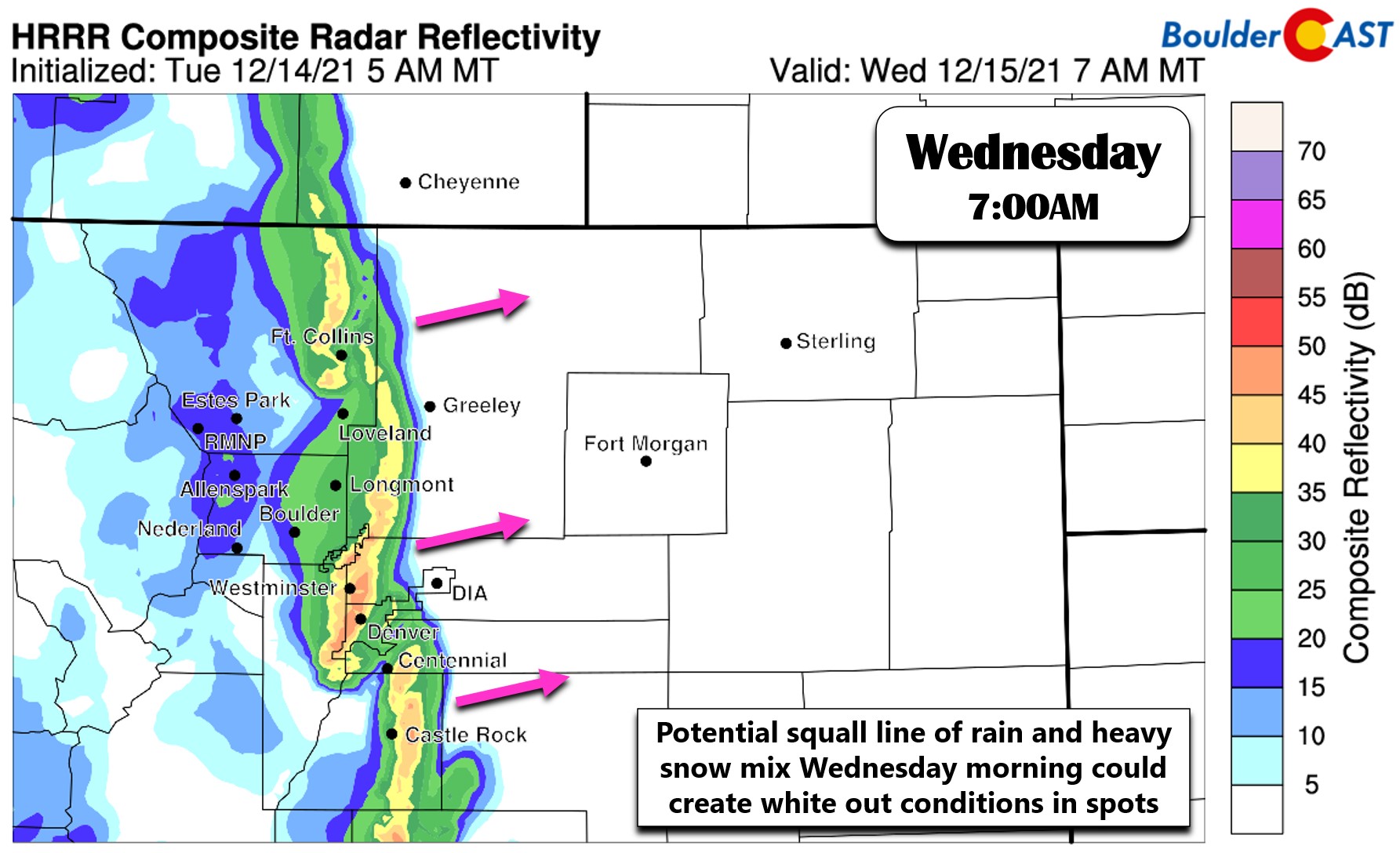
- A snow squall moves across the Mountains in the morning hours creating extremely dangerous travel with whiteout conditions
- The snow squall may reach the Denver Metro area, but may weaken. Watch for brief rain mixing with heavy snow during the morning commute!
We discuss Boulder and Denver weather every single day on BoulderCAST Premium. Sign up today to get access to our daily forecast discussions every morning, complete six-day skiing and hiking forecasts powered by machine learning, access to all our Front Range specific weather models, additional storm updates and much more!

A
potentially historic high wind event is looking fairly likely for the Front Range during the day Wednesday as a dynamic shortwave trough races across the central Rockies at an absolutely blistering pace. The NAM forecast animation below shows the disturbance in question rushing from southern California Tuesday evening into Minnesota over the course of just 24 hours — that’s a distance of 1600 miles equating to an average traversal speed of ~70MPH.
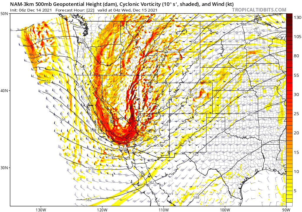
High-resolution NAM forecast of 500mb height and vorticity from Tuesday evening into Wednesday evening.
There are lots of factors at play here helping to set the stage for damaging winds Wednesday. In fact, the weather models are all advertising a near-perfect setup for a high wind event in the Front Range with strong west winds just above the surface, mountain wave enhancement, strong cold air advection aloft creating impressive near-surface lapse rates, and potent subsidence from the passing trough and nearby jet streak. All of these ingredients will help to force the fast-moving winds just above the surface downward making for a wild day of wind on Wednesday for us.
A deep surface low pressure is forecast to rapidly intensify across the northeastern corner of Colorado Wednesday morning which results in a rather impressive pressure gradient across the Front Range Mountains and also the entire state. This will help fuel the widespread nature of the strong winds during the day Wednesday.
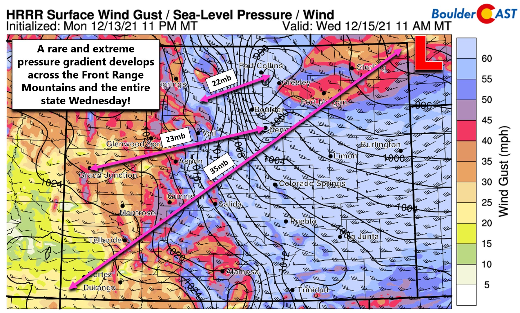
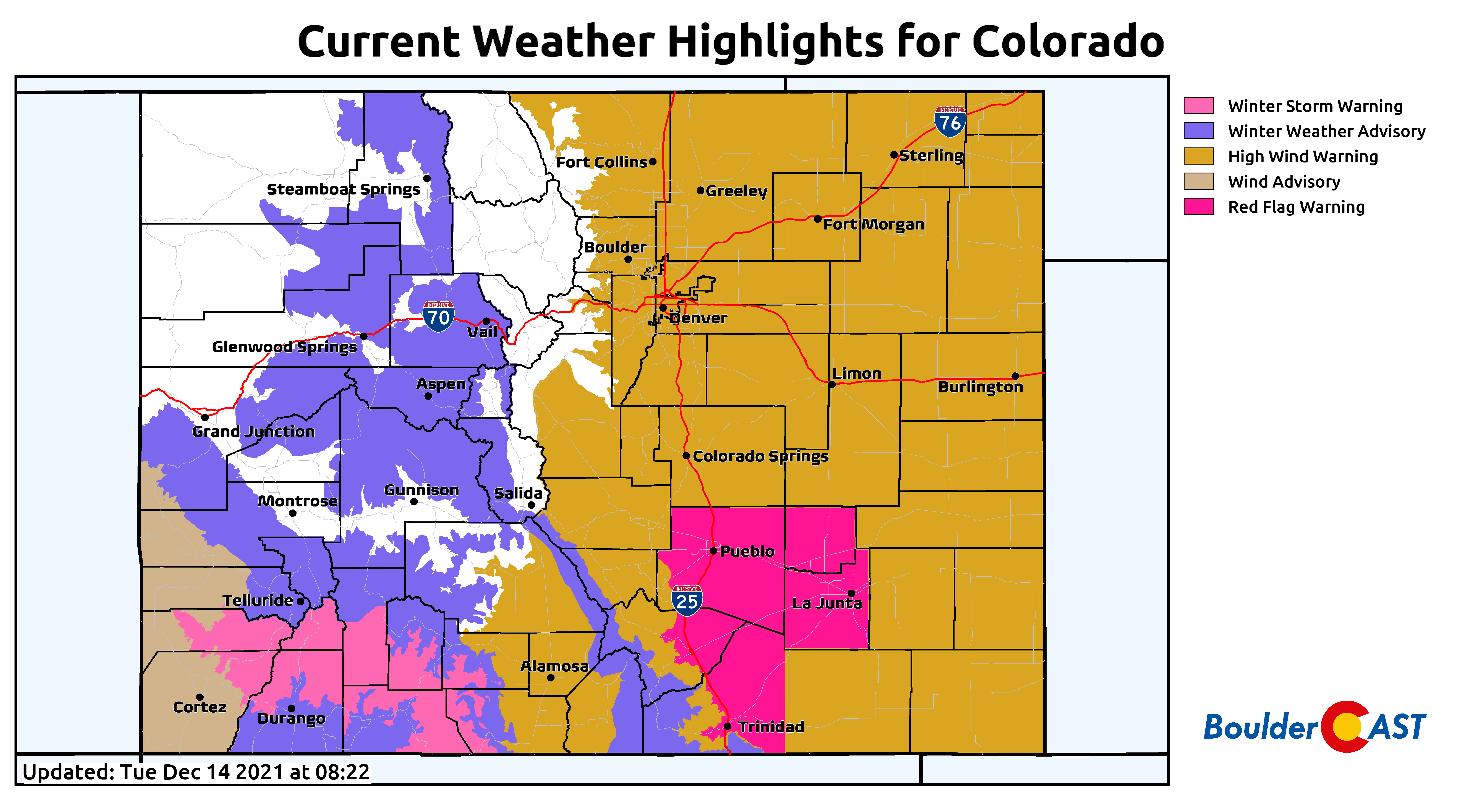
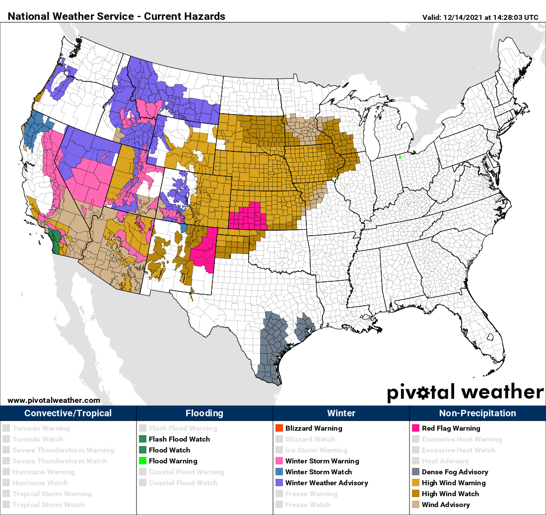
Everywhere east of the Mountains is currently under a High Wind Warning which appears blatantly warranted the way models have trended over the last day or so! We continue to see the ingredients for a widespread bora-type wind event with post-frontal cold air rushing down from the Continental Divide and sweeping across all of eastern Colorado. This large-scale setup will combine with localized mountain wave enhancement in and near the Foothills to produce potentially historic wind gusts from Fort Collins, to Boulder, to Golden. We’re talking widespread gusts of 65 to 85 MPH in these areas, with top end gusts possibly reaching up to 100 MPH! Expect a plethora of impacts during the day Wednesday due to these winds — downed trees, power outages, blowing dust, high fire danger, difficulty driving high-profile vehicles, tumbling patio furniture and trampolines and other structural damage.
This breadth of impacts from this system will stretch far beyond just Colorado. In fact, the National Weather Service has issued wind-related highlights in 19 different states across the western and central United States from this system!
The worst of the wind in the Front Range will be from the moment the cold front passes around sunrise Wednesday through the mid-afternoon hours. After that, the pressure gradient weakens as the low pressure moves into Nebraska and the winds will start the wane in our neck of the woods. However, continued mountain wave activity could keep strong winds roaring in and near the Foothills into the evening hours.
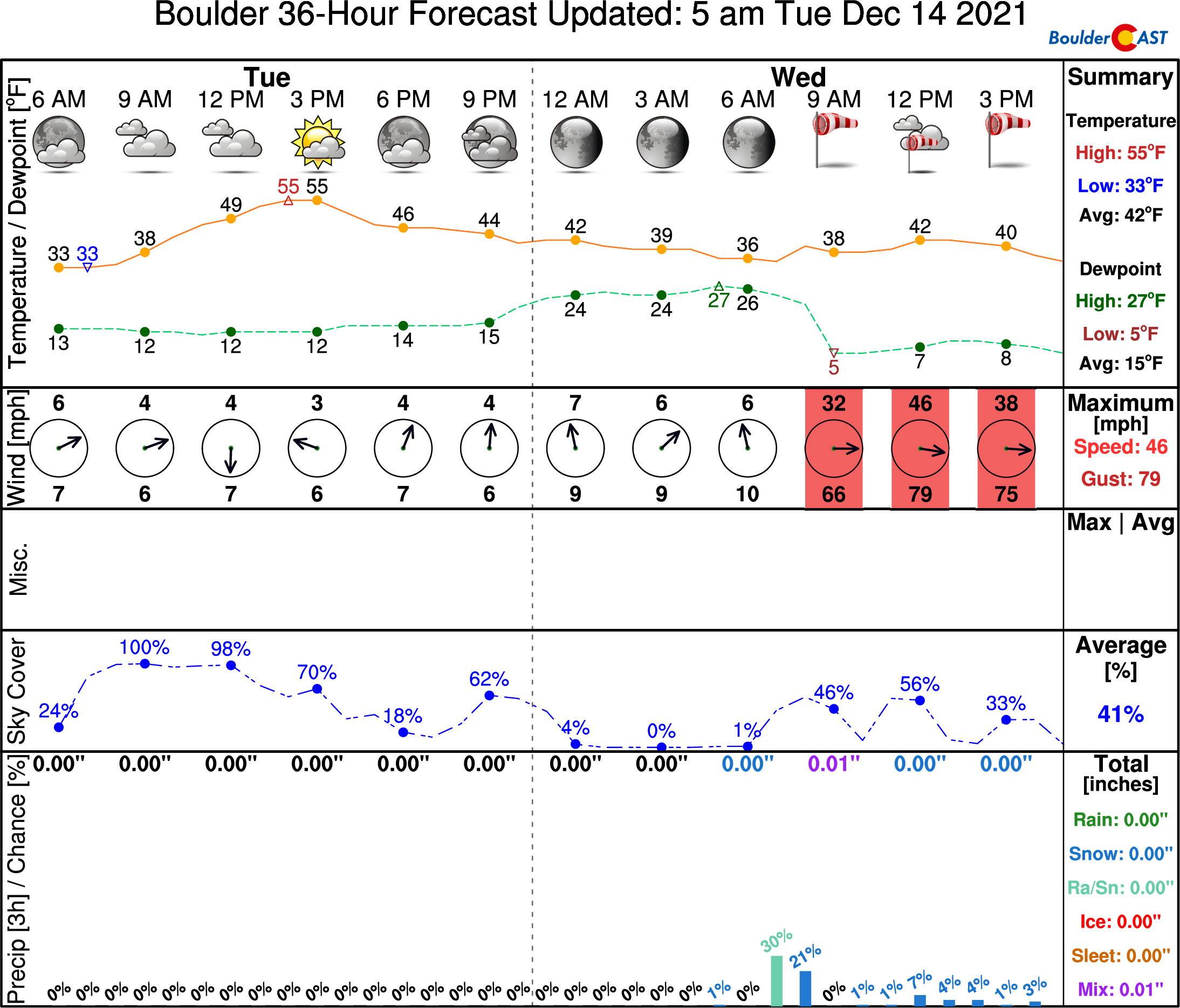
Here’s our latest timeline forecast for Boulder. Yikes, those 80 MPH gusts!
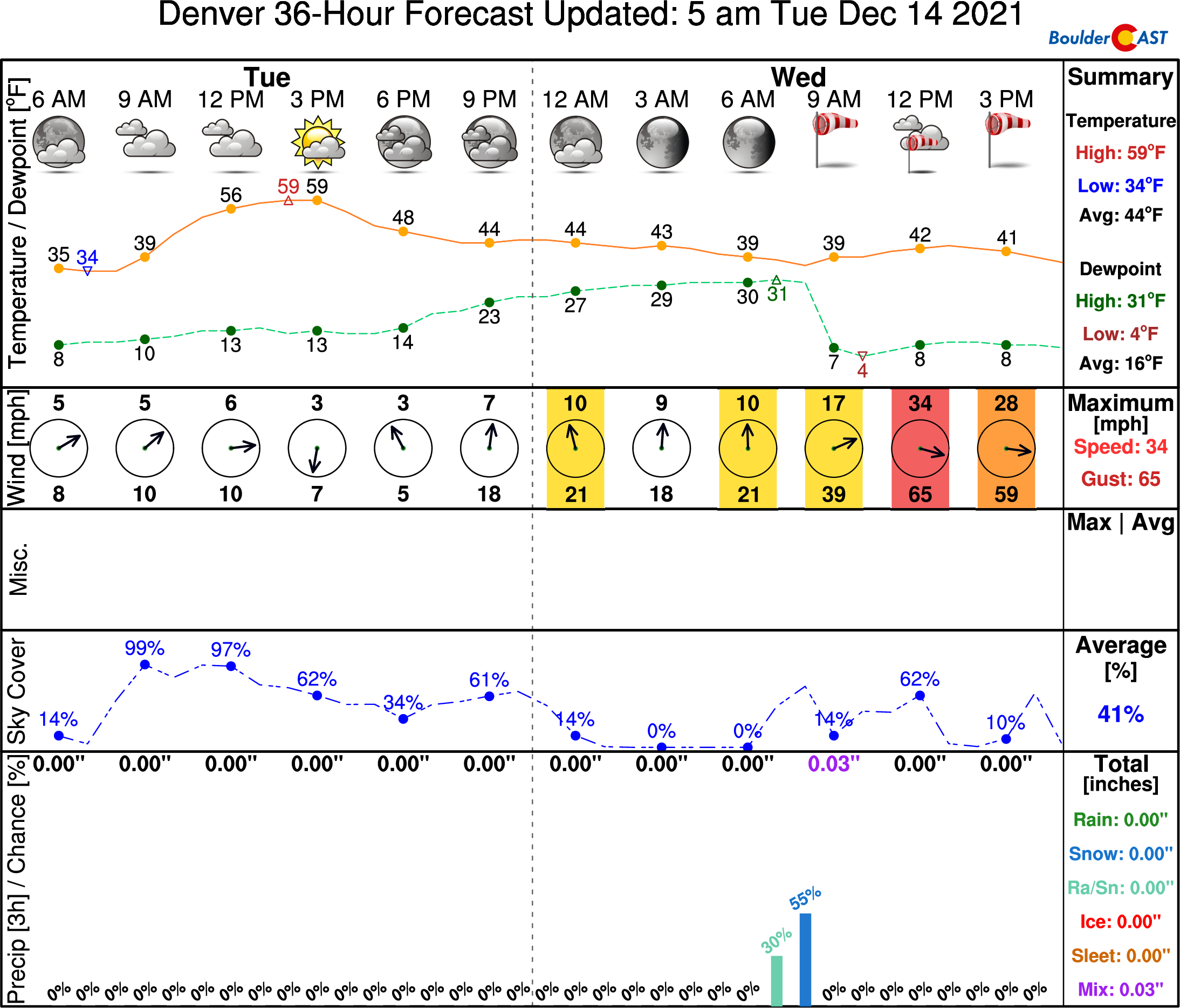
For Denver, winds won’t be as strong but certainly are still noteworthy and could be damaging.
In addition to the extreme winds, high-resolution models are indicating that a convective snow squall will accompany the cold front as it blows from west to east across the state early Wednesday morning. This squall, if it pans out, will be capable of producing white out conditions and dangerous travel in the Mountains.
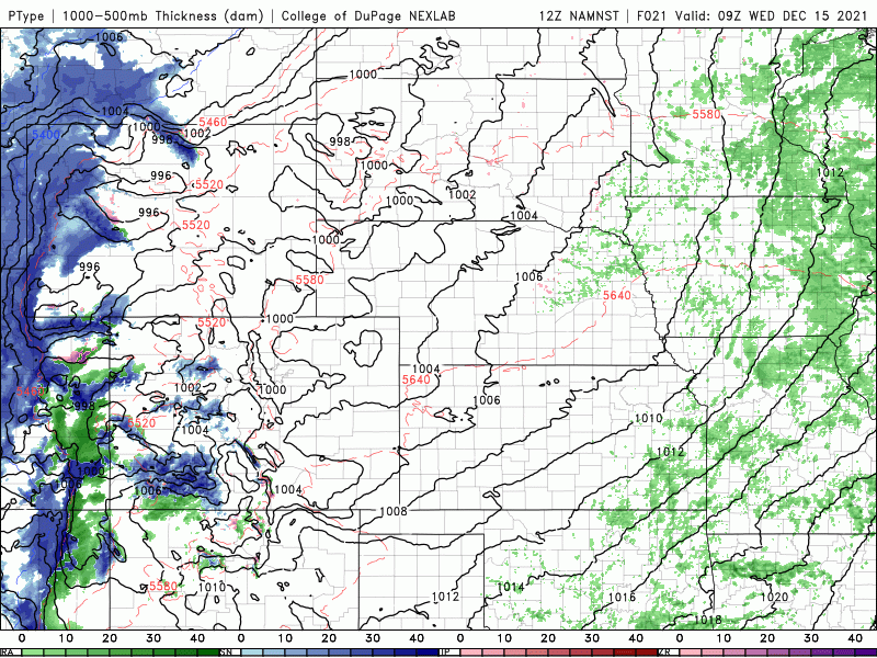
NAM-NEST model precipitation forecast animation for Wednesday showing the band of rain/snow pushing across Colorado in the morning.
However, this squall is projected to weaken as it moves eastward into the Boulder-Denver area. Still, we are seeing some model support for this squall to maintain form as it moves through the Denver Metro which could create a brief period (less than 30 minutes) of whiteout conditions during the morning rush hour timeframe.
Expect 1/2″ or less of accumulation in the Denver Metro area as the rain/snow squall passes through Wednesday morning. That’s about it for precipitation with this system — it’s a rather moisture-starved trough and certainly won’t help the drought situation east of the Continental Divide.
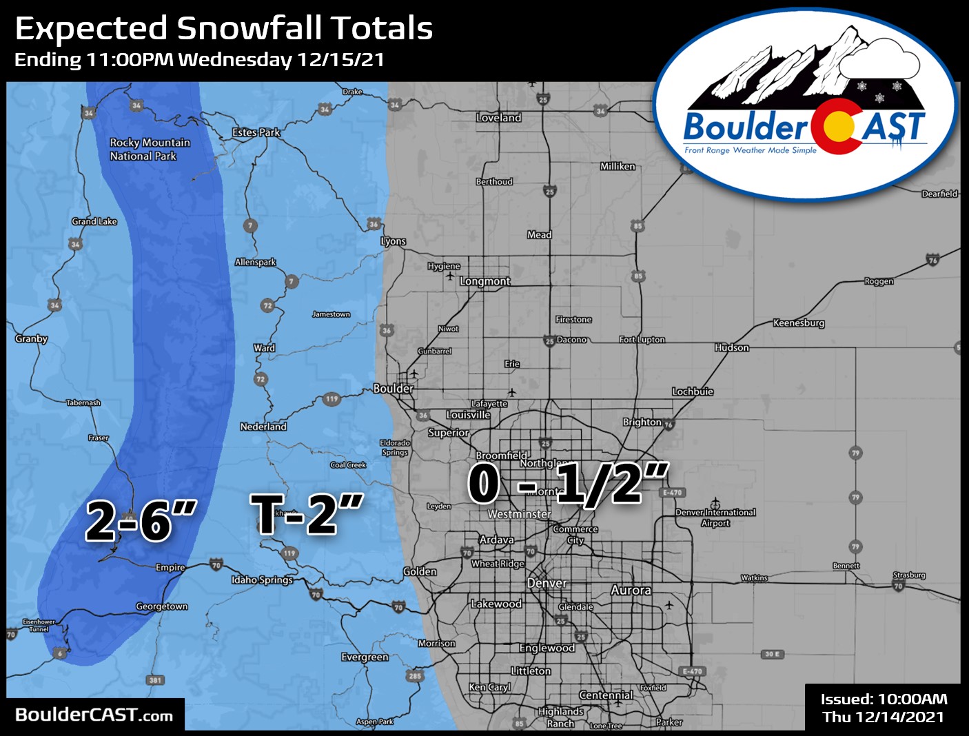
Mountain areas will see brief moderate to heavy snowfall during the morning and early afternoon with the aforementioned snow squall and then from weak orographics afterwards. Combined with the strong winds, travel will become difficult during the day so do use caution. Most mountain areas can expect 1 to 6″ of snowfall across central and northern Colorado. The pre-trough moist southwest flow will dump heavier snow in the San Juans Tuesday afternoon into early Wednesday with more than a foot in the cards there.
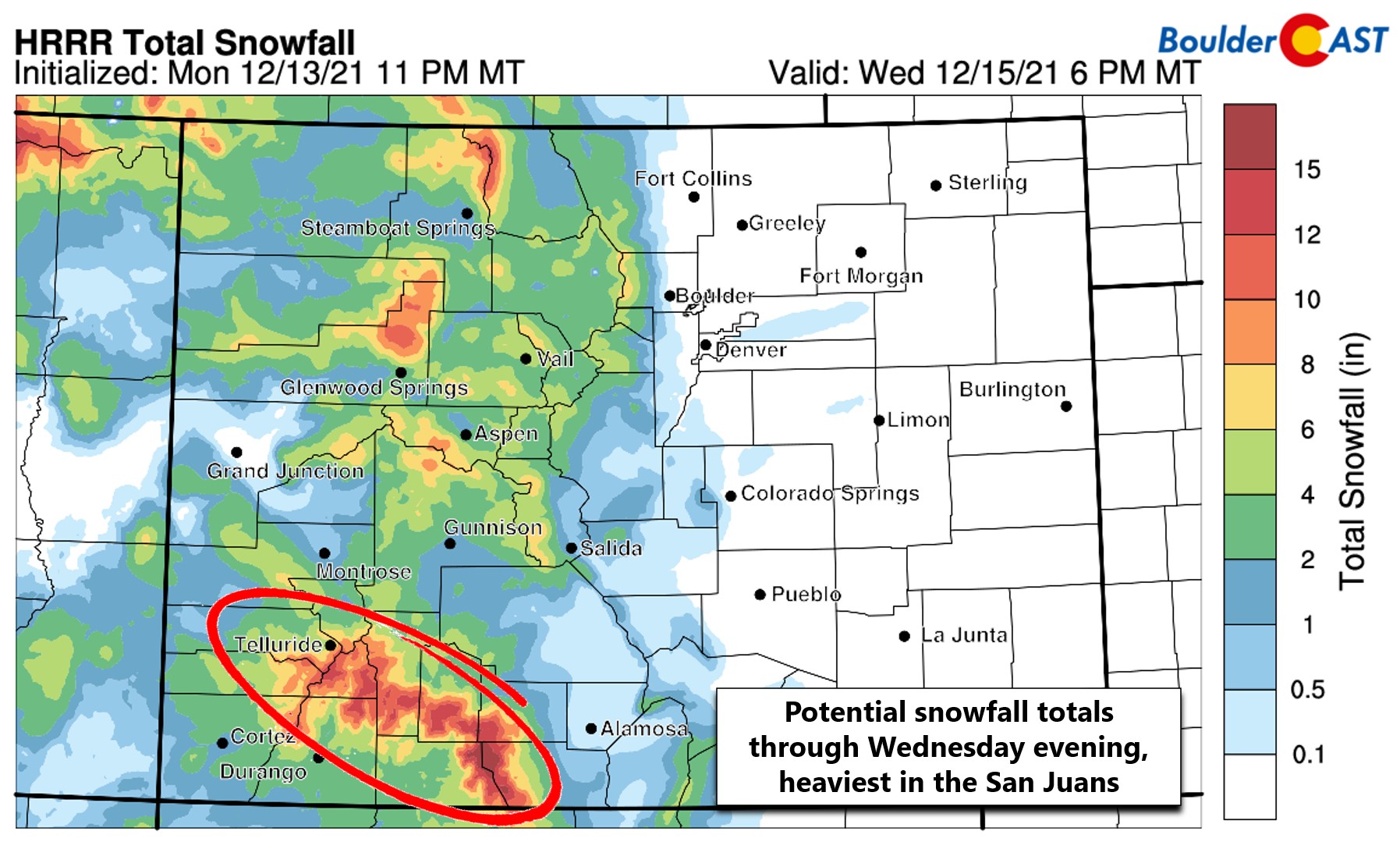
Winter Storm Warnings are in effect for the San Juans for 8-14″ of snow. Elsewhere in the High Country Winter Weather Advisories are in effect, mainly due to the expected strong winds which will accompany the snow causing reduced visibilities and hazardous travel.
All in all, plan for a wild weather day Wednesday, with wind being the most concerning aspect to watch out for around Boulder and Denver. We can’t stress this enough — on paper this wind event may be the most extreme to hit Boulder in the last decade! Batten down the hatches and let’s just hope that the 70 to 100 MPH wind gusts are not as widespread as we are expecting from this historic storm…
Help support our team of Front Range weather bloggers by joining BoulderCAST Premium. We talk Boulder and Denver weather every single day. Sign up now to get access to our daily forecast discussions each morning, complete six-day skiing and hiking forecasts powered by machine learning, first-class access to all our Colorado-centric high-resolution weather graphics, bonus storm updates and much more! Or not, we just appreciate your readership!
Enjoy our content? Give it a share!


You must be logged in to post a comment.