
Welcome to the month of July! Read our forecast for the upcoming week, including details on the Fourth of July holiday’s chance for thunderstorms.
Hot and dry June
June 2018 was scorching across the Front Range, officially finishing as the 7th warmest in the Denver’s history. The city even tied it’s all-time max temperature of 105 degrees on June 28th. Boulder was more than 3 degrees above average for the month, hitting the 90-degree mark 13 times. How does this count jive with your entry into our latest forecast contest?
The heat resulted from a couple of persistent blocking ridge patterns, which also came with generally dry conditions for Colorado, save for multi-day stretch of severe weather near the middle of the month. While Boulder saw rainfall just a shade below June’s average, Denver concluded near 25% of normal for the month.
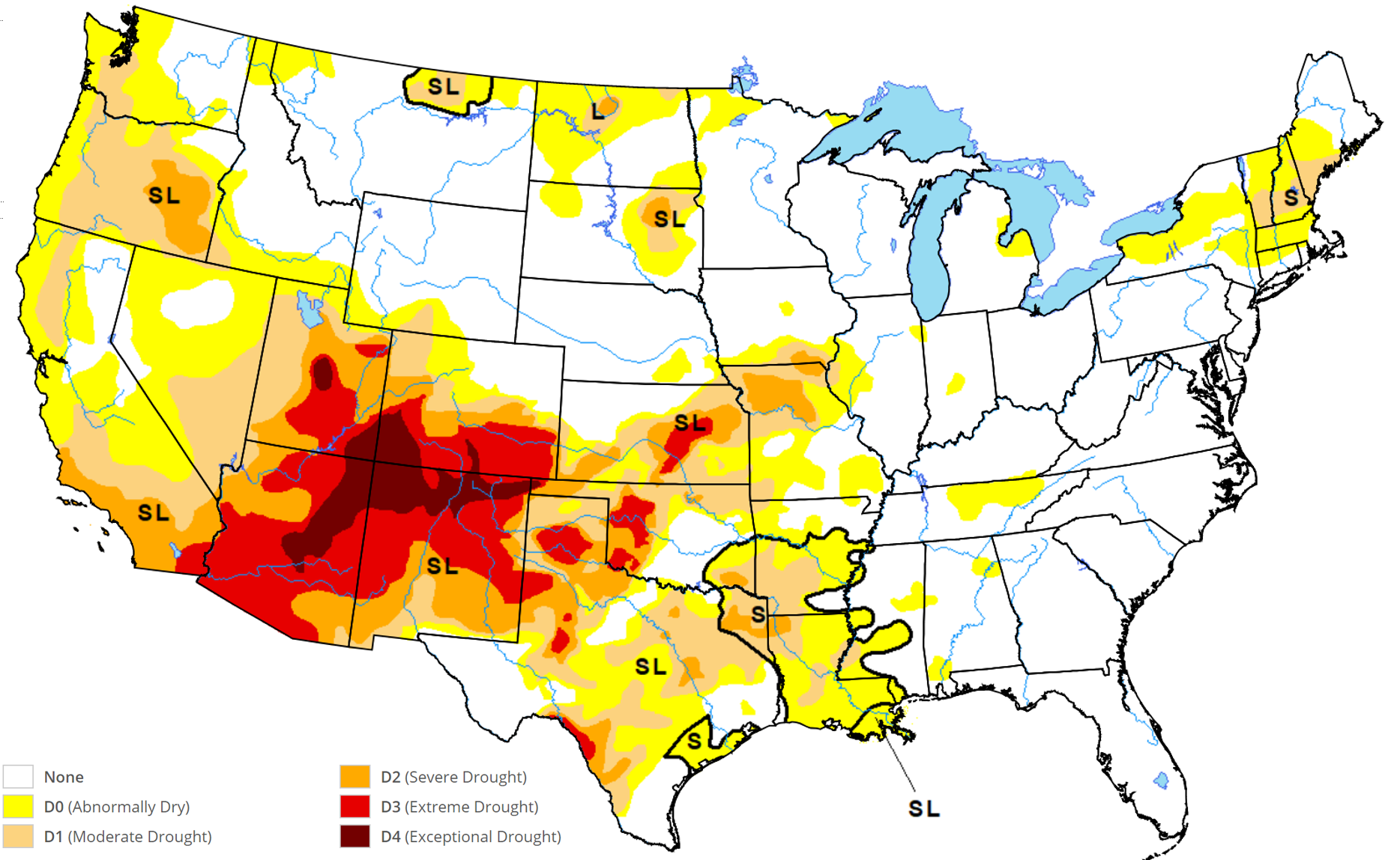
We probably sound like a broken record, but the on-going drought across southern Colorado and the Four Corners is no joke. Major wildfires are almost unavoidable in the coming months. With as dry as it’s been here as well, we’ve even seen fires burning further north, outside the drought’s boundaries.
Numerous wildfires have sparked across the state in the last week. I took the photo below over the weekend shortly after the Sugarloaf Fire ignited in Grand County which has grown to more than 1500 acres. A few other fires started on Saturday as well, fueled by very dry air, warm temperatures, and gusty winds.
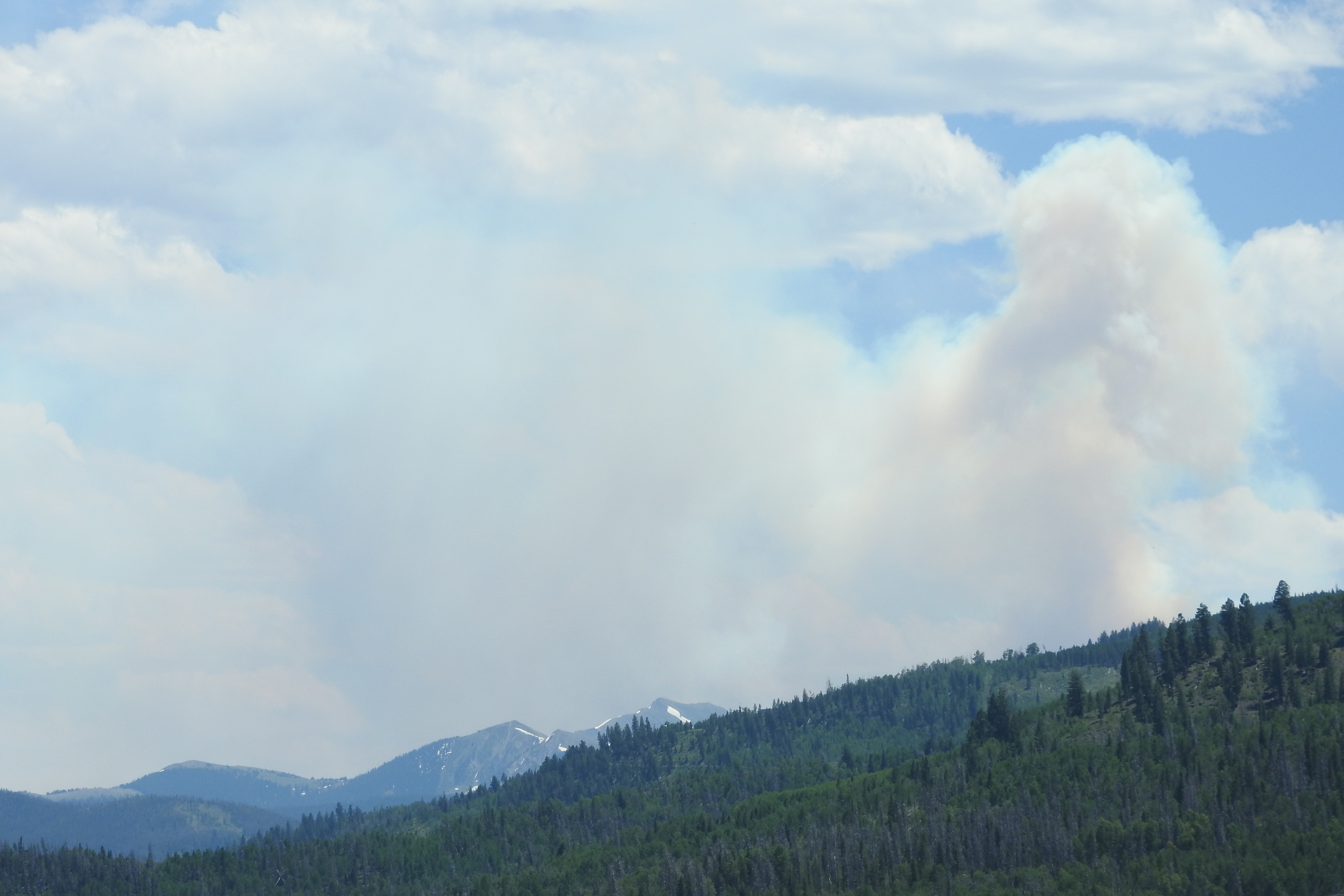
Sugarloaf fire smoke plume in Grand County.
The week ahead
Now in the month of July, it doesn’t take much cooperation from the atmosphere to push our temperatures into the 90’s. The average high temperature for today in Denver is 87 degrees. Early in the week a trough will be digging into the Pacific Northwest with a weak high pressure system aloft in Texas and a stronger one in New Jersey. As a result, southwest flow will ensue across Colorado for much of the week ahead. This will be enough to keep temperatures on the warm side, into the 90’s a few days early on, but not nearly as hot as we saw last week.
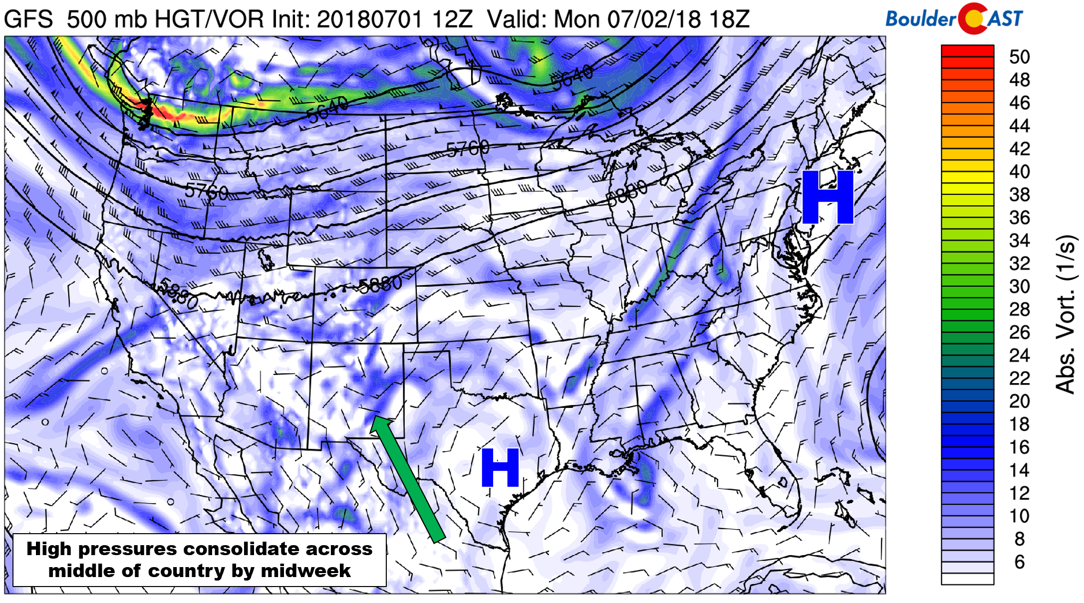
GFS 500 mb vorticity map for Monday.
Embedded in this southwest flow will be pockets of moisture and energy that will help fuel daily afternoon thunderstorms across Colorado beginning on Tuesday.
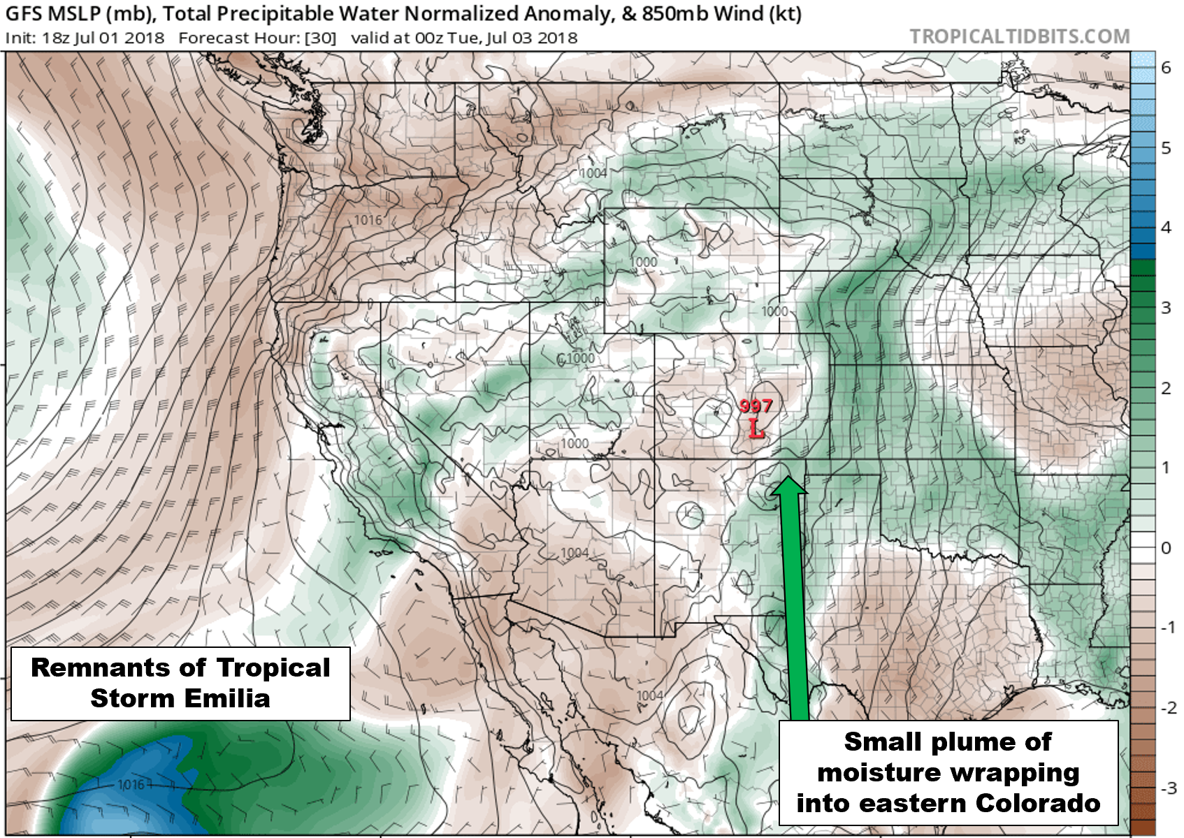
GFS moisture anomaly forecast for Monday evening.
As the week progresses, the ridges of high pressure will consolidate and eventually shift west to be centered across the southern Rockies later in the week. This motion will ultimately help funnel even more subtropical moisture into the region. We should see our storm chances increase a little bit each day.
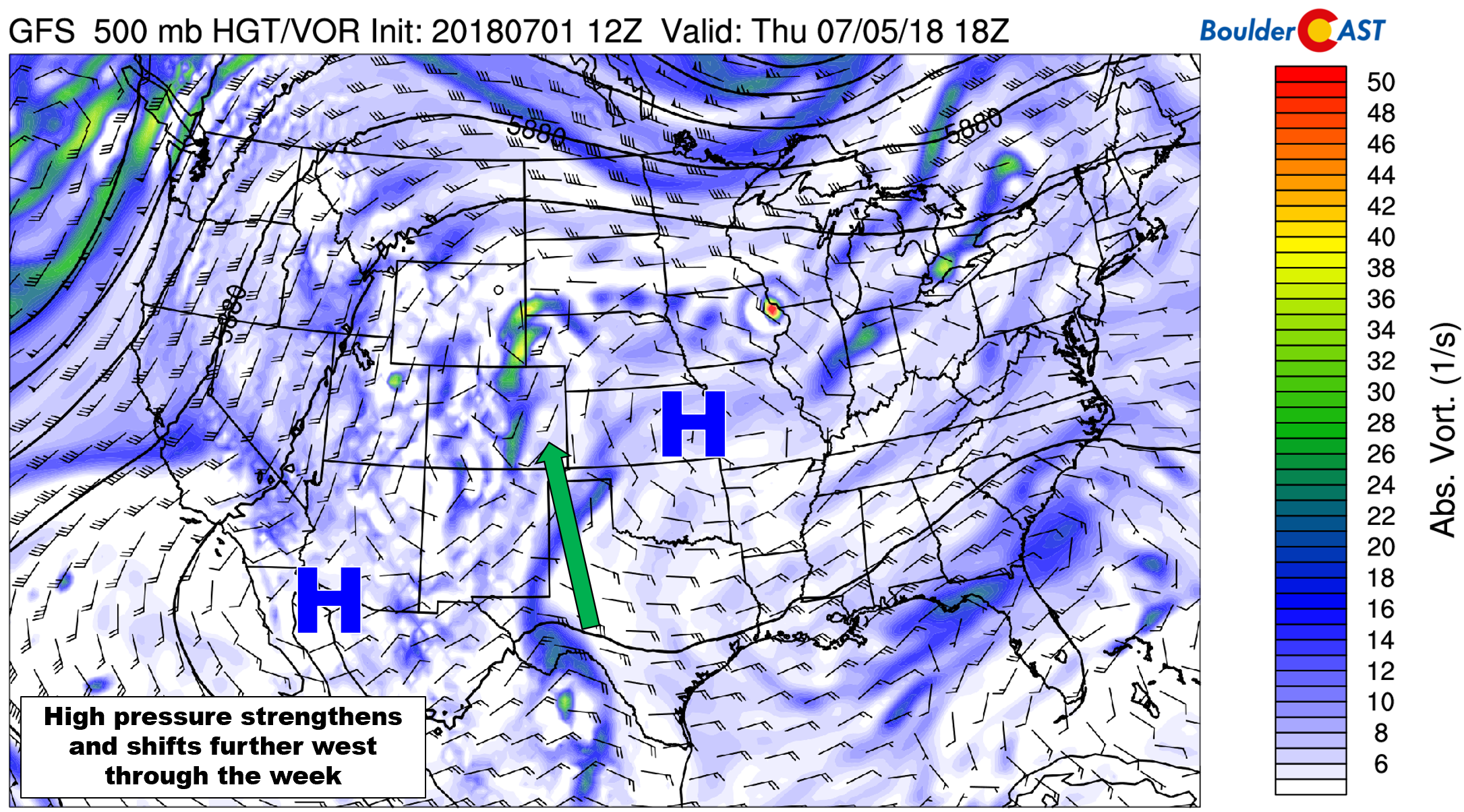
GFS 500 mb vorticity map for Thursday evening. High pressure has shifted westward, providing a better mechanism for moisture transport into Colorado.
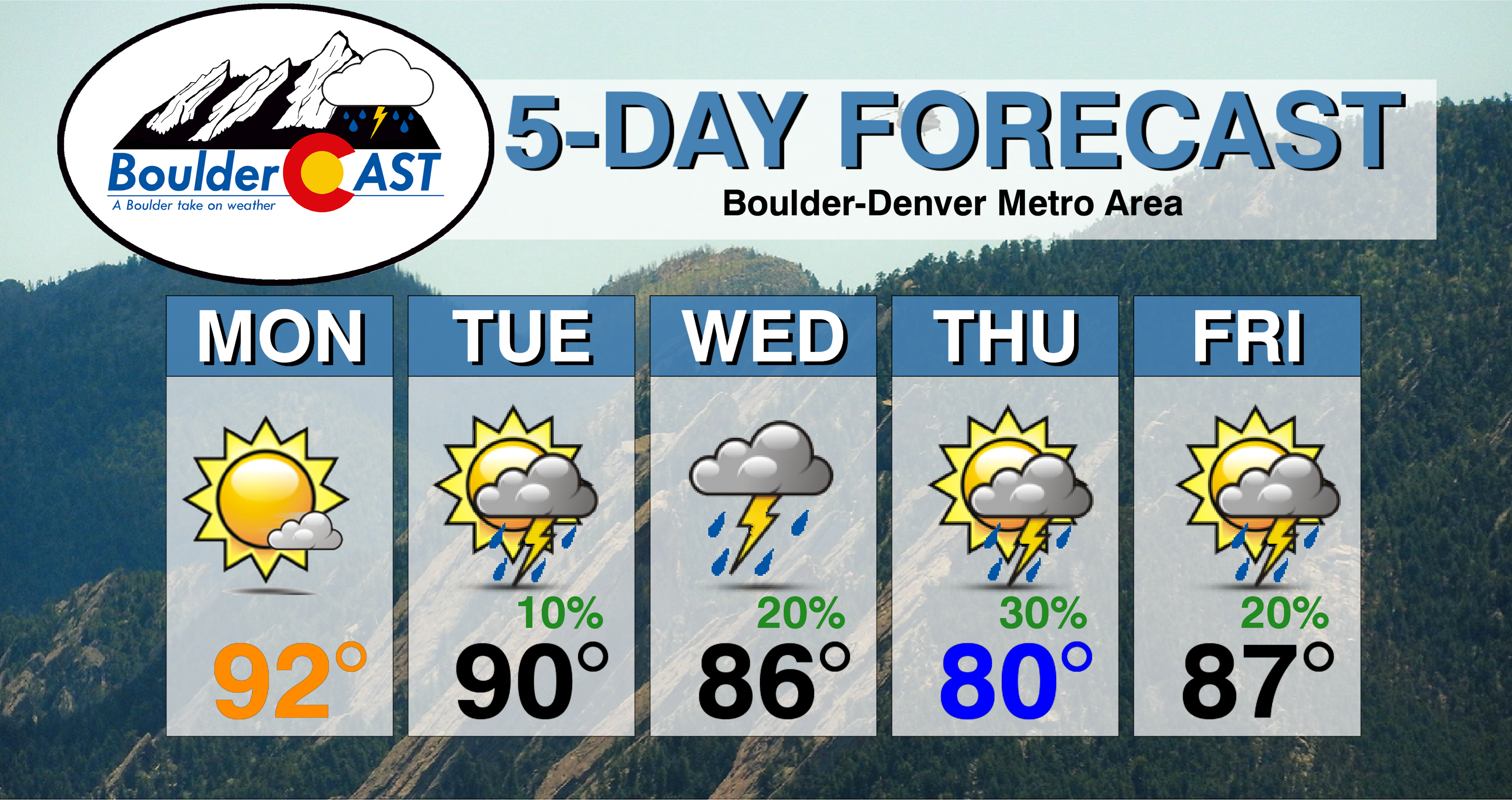
Temperatures Monday and Tuesday will be in the 90’s, with a slight chance of hit-and-miss storms Tuesday afternoon and evening.
For Independence Day, temperatures will likely be cooler due to a weak backdoor cold front sliding into the Metro area from Wyoming. There will be a few late afternoon and evening storms around, but we’re not expecting the action to be widespread enough to postpone any firework displays.
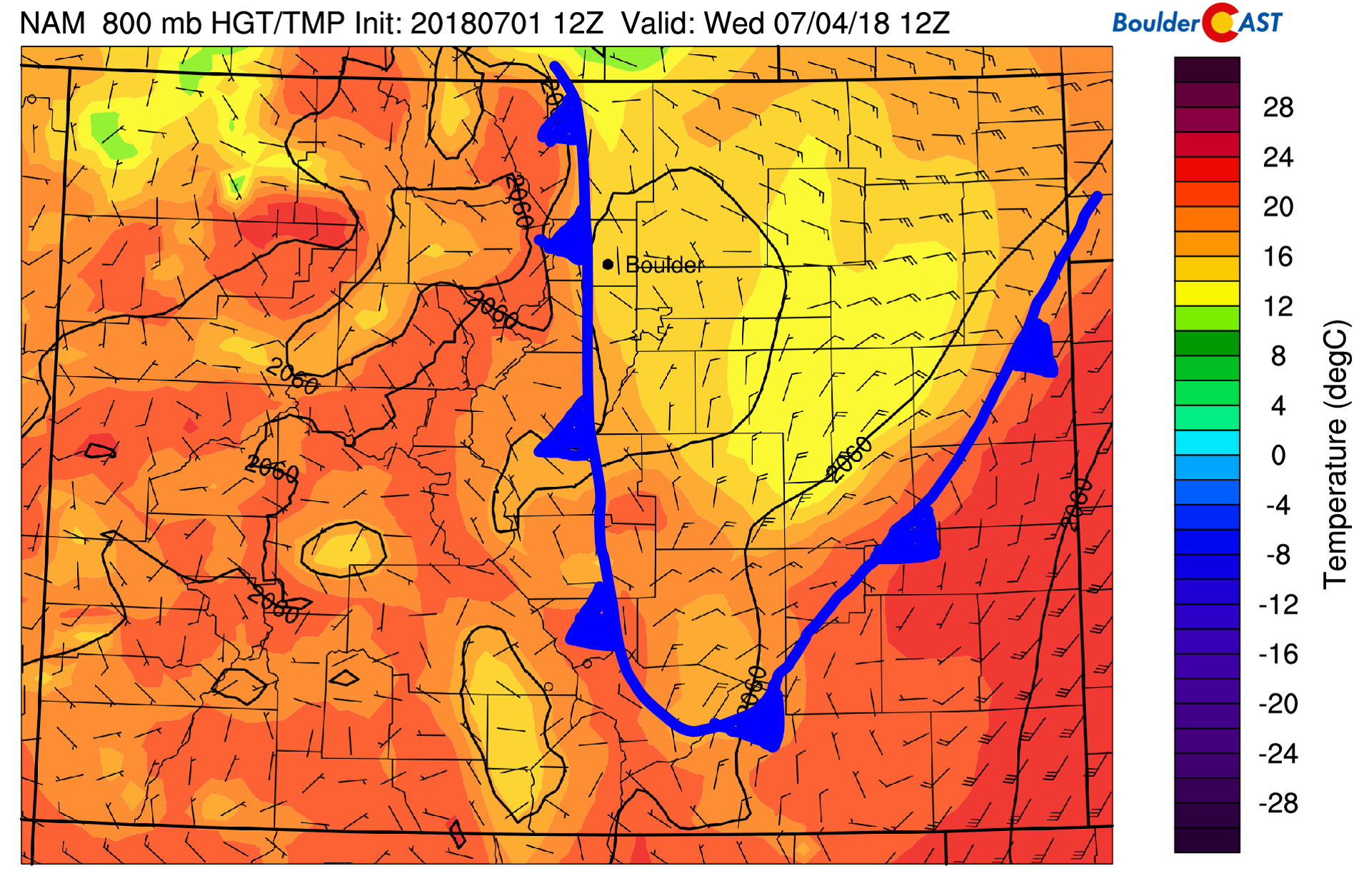
800 mb temperature and wind map for Wednesday morning. A weak cold front is expected to lower temperatures.
Storm activity by Thursday and Friday will be more widespread across the Denver Metro area thanks to the added moisture, both in the mid and lowest levels of the atmosphere. If you have any outdoor activities planned for these days, keep an eye on the forecast and to the sky for developing thunderstorms.
We’ll be back with our final forecast for Wednesday evening soon. Have a great week and holiday!
Forecast Specifics:
Monday: Mostly sunny and hot with temperatures in the lower 90’s on the Plains and upper 70’s in the Foothills.
Tuesday: Sunny early, then partly cloudy with isolated late day thunderstorms. Highs topping out near 90 degrees for the Plains and near 80 in the Foothills.
Wednesday: Partly to mostly cloudy and cooler thanks to a weak cold front. Expect widely scattered late afternoon and evening thunderstorms. A few towns could see their fireworks at sunset impacted. High temperatures in the middle 80’s across the Plains with mid 70’s in the Foothills.
Thursday: Morning sunshine giving way to the thick cloud cover by early evening. Scattered thunderstorms will develop through the evening. Highs near 80 degrees for the Plains and in the upper 60’s in the Foothills
Friday: Increasing clouds with scattered thunderstorms developing through the afternoon and evening, particularly across the higher elevations. Highs rebound back into the low to middle 80’s for the Plains and into the upper 60’s in the Foothills.
High Country: Storms will be a threat across the Mountains throughout the week. Monday will be the driest day statewide, while isolated to scattered storms are possible Tuesday through Friday depending on your mountain range of choice. Be sure to check out SummitCAST for twice daily updated forecasts for over 100 Colorado hiking destinations!
DISCLAIMER: This weekly outlook forecast was created Monday morning and covers the entire upcoming week. Accuracy will decrease as the week progresses as this post is NOT updated. To receive daily updated forecasts, subscribe to BoulderCAST Premium.

.
Share our forecast!


You must be logged in to post a comment.