
After yesterday’s cool and stormy weather, you would think we are right back in spring. Unfortunately, that is not the case with temperatures soon returning to the 90’s and even the potential for record high temperatures later in the week. Yes, the story this week will be the heat wave. Read on for our full outlook of the week ahead!
“Cool” to start
Yesterday’s low pressure system has tracked east into Nebraska today. In its wake, downslope warming will be taking over this afternoon, producing lots of sunshine and highs in the middle 80’s for the Metro area. Notice to the west of Colorado, a ridge of high pressure is located near Nevada and Utah (see below). This ridge will be the main story for the remainder of the week, sky-rocketing highs into the 90’s from Tuesday onward.
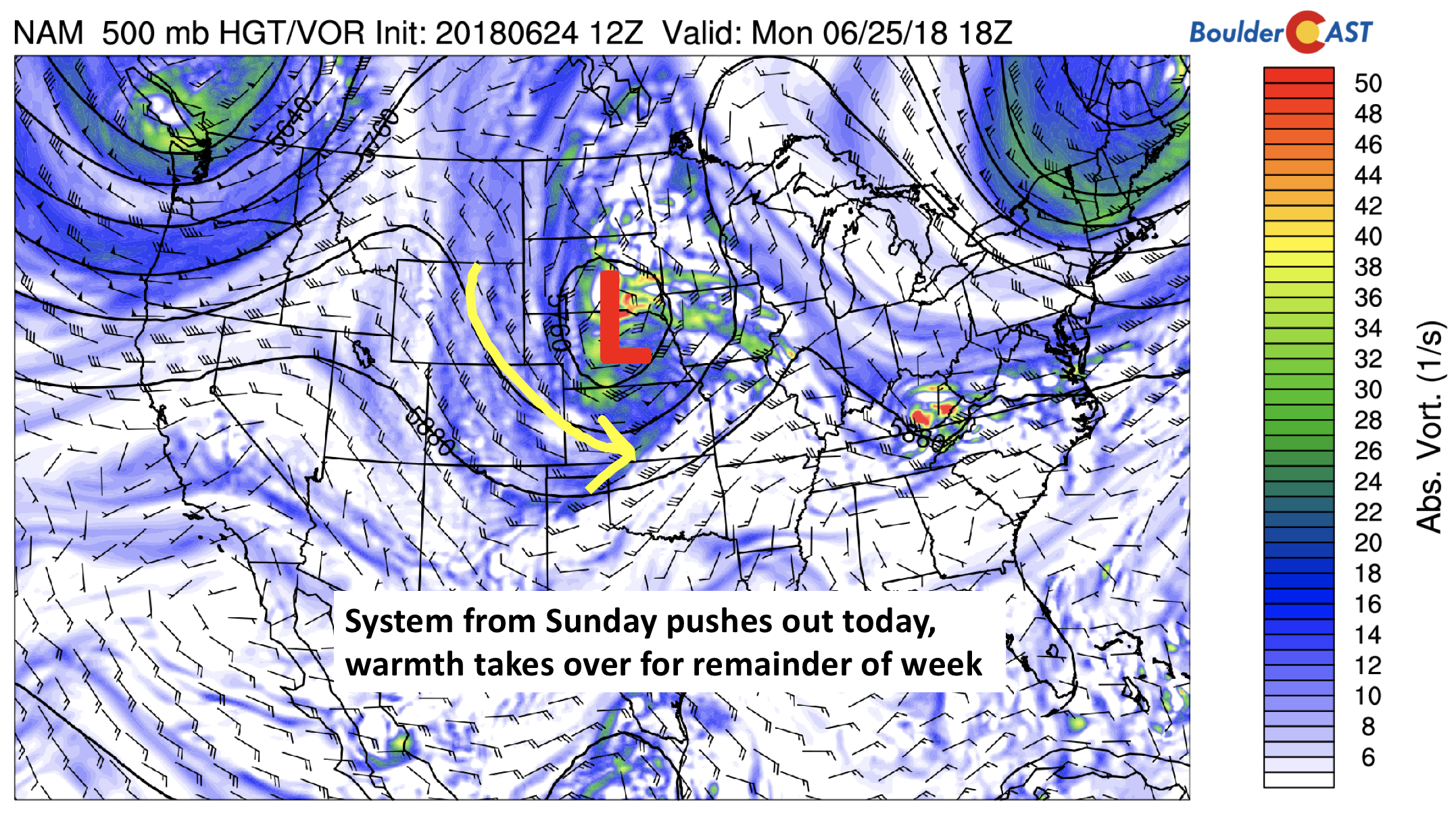
NAM 500 mb vorticity for today
Heat, possibly record territory, for remainder of week
From Tuesday onward, the Denver Metro will be under the influence of a strong ridge, ushering in heat from the Desert Southwest.

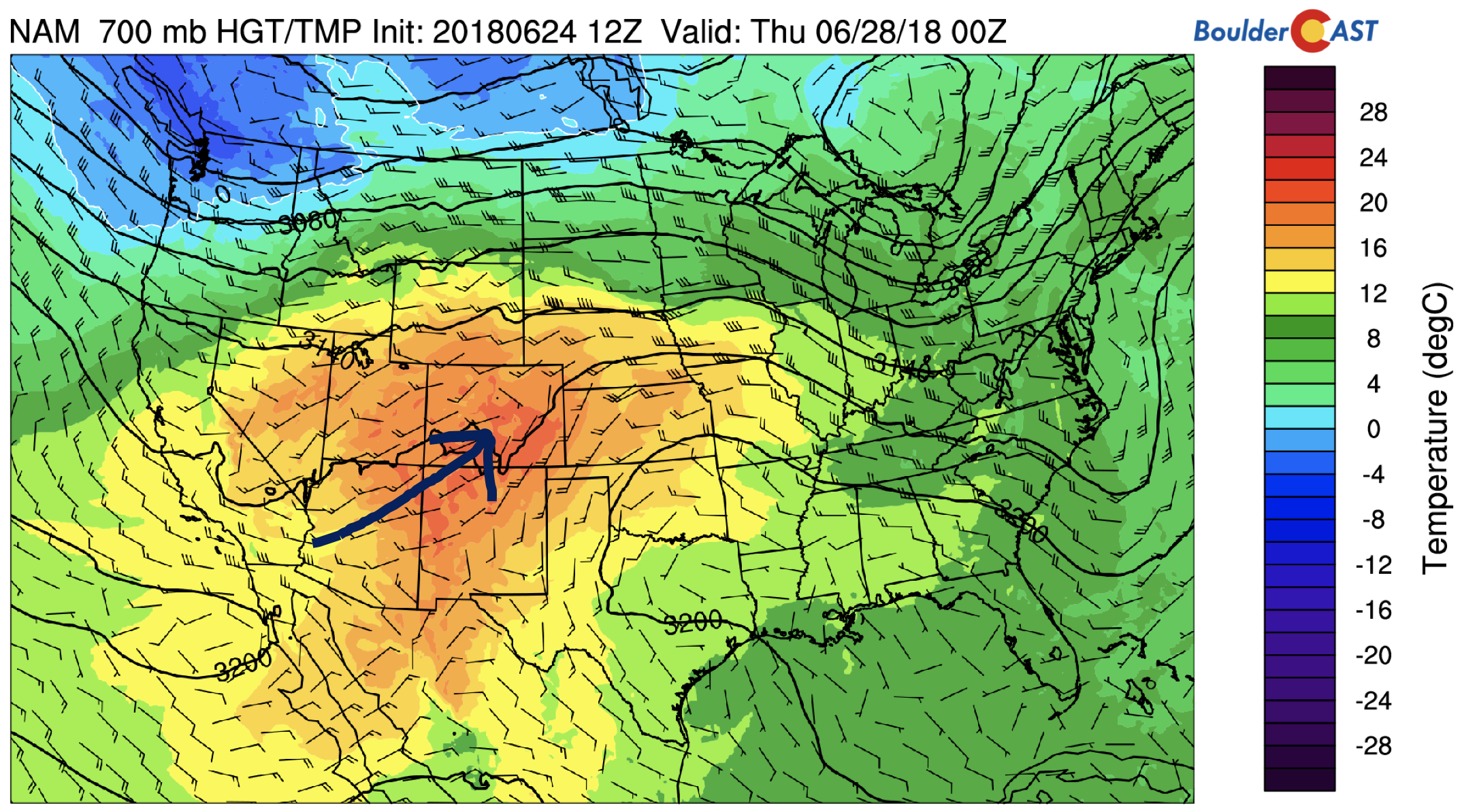
Below shows the 700 mb temperatures for Wednesday afternoon. Temperatures are near 18 degrees Celsius, easily supportive of mid to upper 90’s for our area.
The only chance of rain for the week will be on Wednesday. The ridge of high pressure will shift ever so slightly to our south, allowing for a weak resurgence of some moisture to flow into Colorado. Isolated afternoon storms in the High Country and Plains will be possible, alongside increased cloud cover during the afternoon and evening.
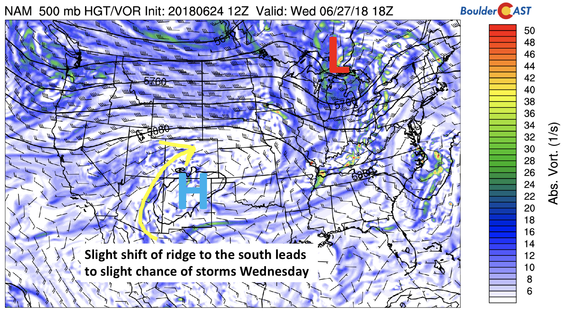
NAM 500 mb vorticity on Wednesday
Any storms will be spotty at best, about 10-20% chance during the early evening hours.
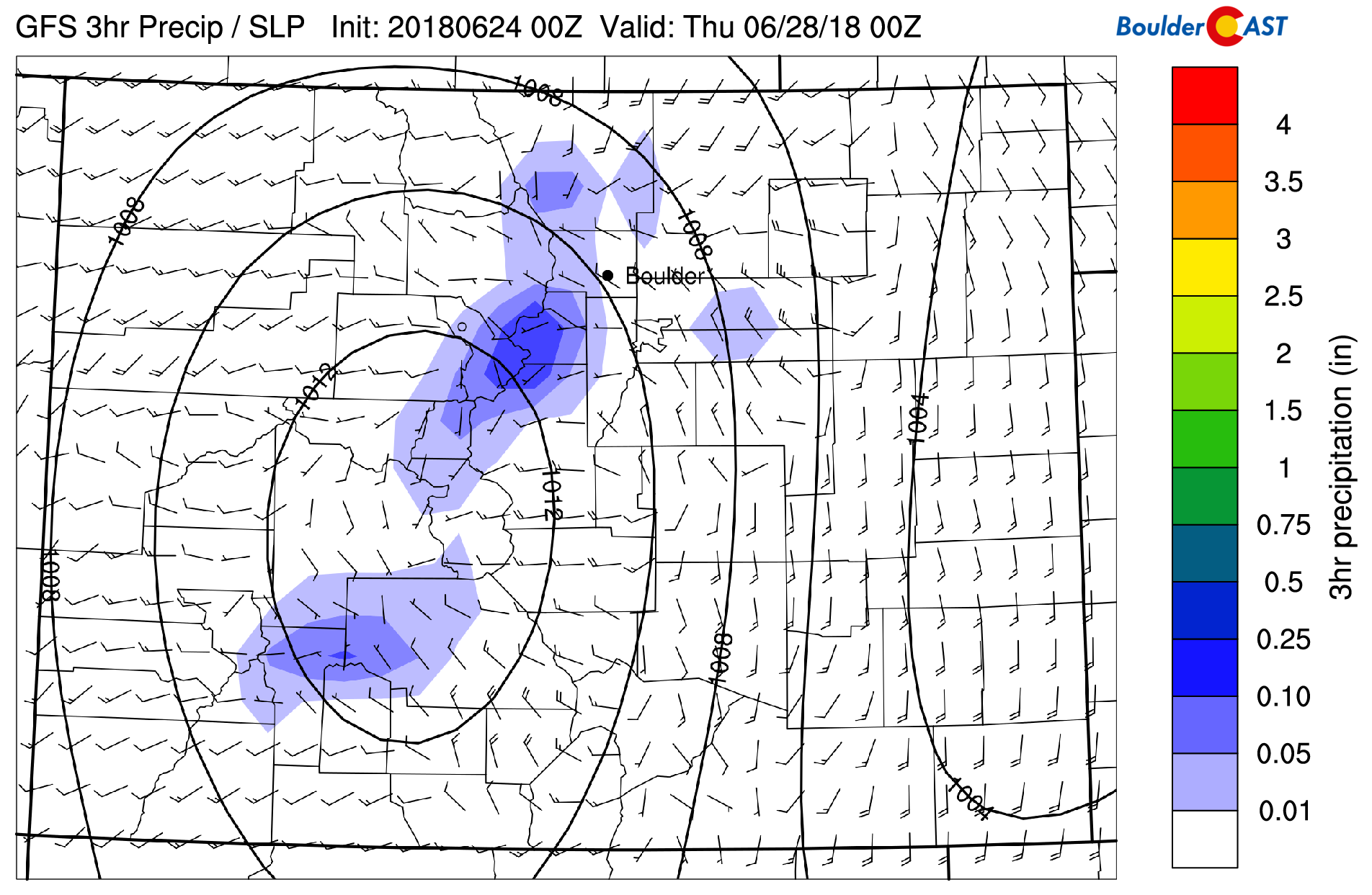
GFS precipitation Wednesday evening
Our warmest days of the week will be Wednesday and Thursday. We think that increased clouds will keep highs slightly in-check during the second half of the week, though mid to upper 90’s are still possible given the very warm airmass.
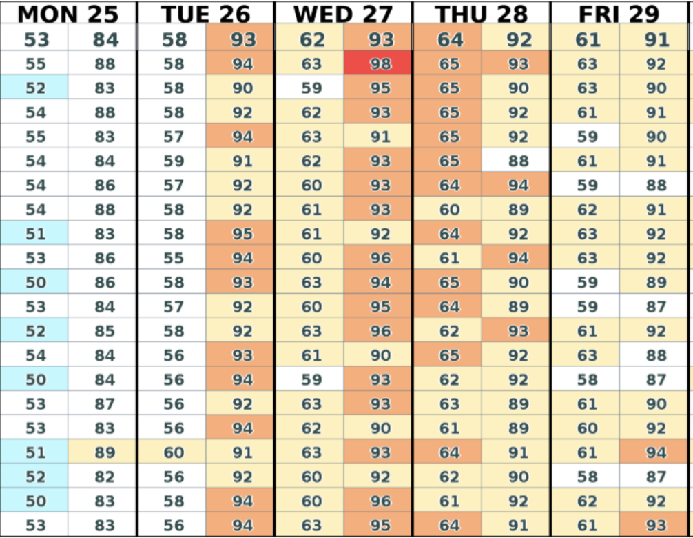
GEFS high and low temperature forecast for the week
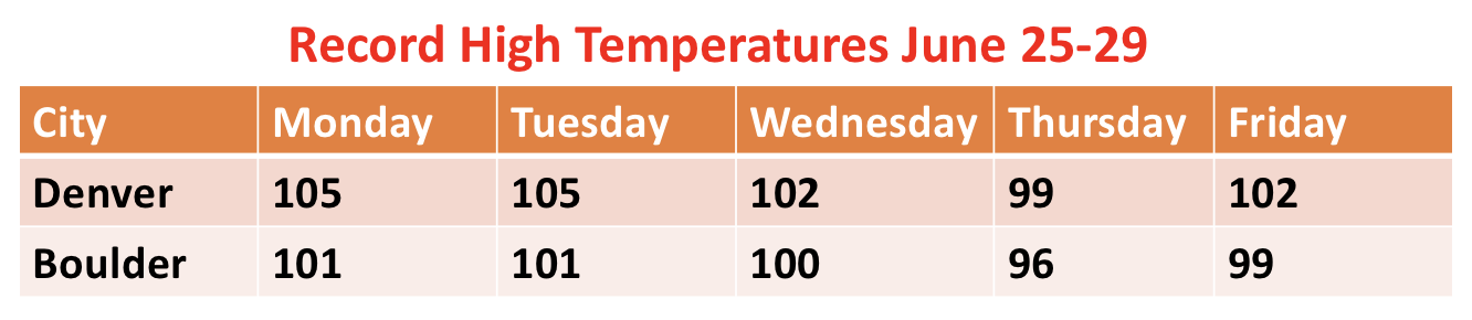
Will we be breaking any records? Unfortunately, this week’s heat wave coincides with a very hot stretch from back in 2012. During that heat wave six years ago, Denver set its all-time record high temperature on two straight days (105 degrees), while Boulder reach 101 degrees as well. The Flagstaff Fire just southwest of Boulder ignited during this time, too (June 26, 2012).
As a result, our only real chance of breaking any records is on Thursday for which the record high in Denver is 99 and 96 in Boulder. We’re predicting highs right around 100 degrees, which looks like a safe bet…even given the high clouds streaming in from the southwest.
Thursday and Friday will be dry following the slight chance of storms Wednesday. The precipitable water on Friday (below) falls to around 0.1 or 0.2 inches….VERY dry by late-June standards. This combined with highs in the upper 90’s will possibly make for dangerous fire conditions in drought prone areas of southern Colorado.
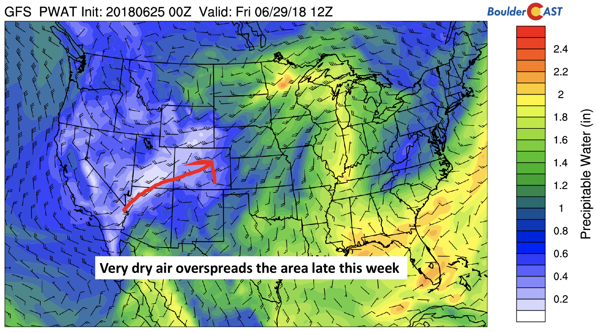
GFS precipitable water on Friday
Trough for the weekend, marginally cooler with chance of storms
Over the weekend, a trough is on track to influence the Pacific Northwest and to some degree Colorado. Its position as of Friday evening will be across Idaho (see below). Colorado will still be in the warm sector, to the east of the trough. Nevertheless, the dip of the jet stream will likely advance in some slightly cooler air for the weekend in the 80’s or upper 70’s, along with an increase in the chance of storms.
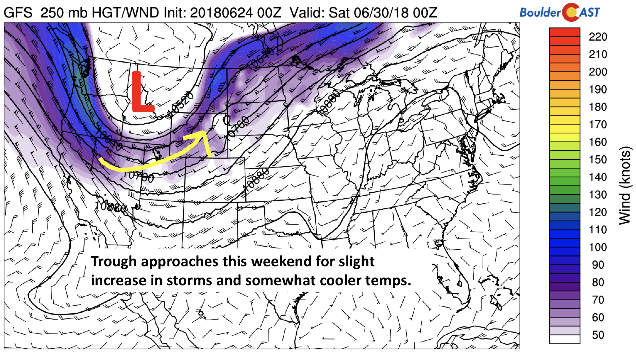
GFS 250 mb jet stream Saturday
Right now, the storm threat does not look all that significant, but it may be something to watch if you’re planning those outdoor activities for the upcoming weekend.
Forecast Specifics:
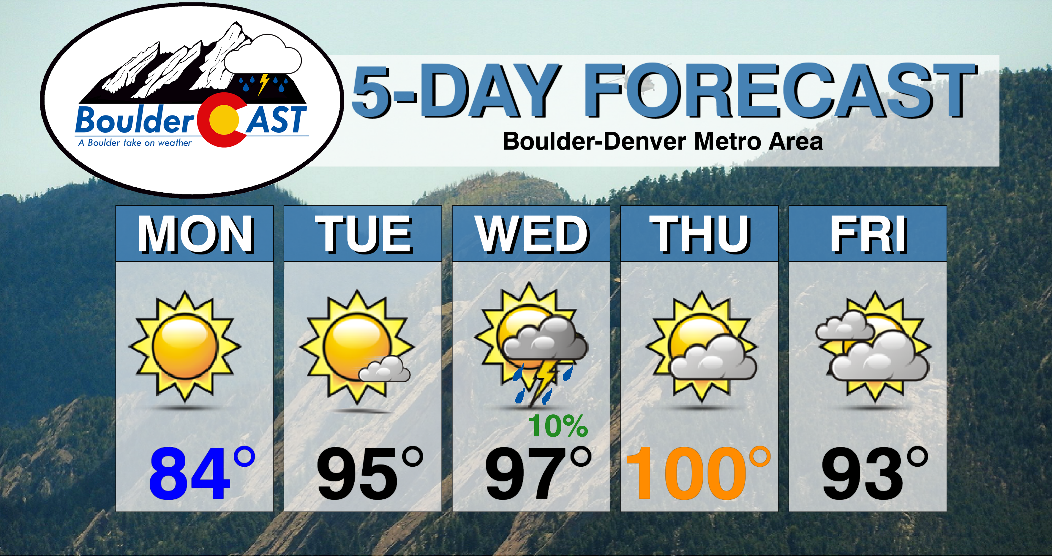
Monday: Mostly sunny and warmer. Highs in the middle 80’s on the Plains and middle 70’s in the Foothills.
Tuesday: Sunny skies becoming partly cloudy by late afternoon. Highs much warmer in the middle 90’s for the Plains and middle 80’s in the Foothills.
Wednesday: Sunny skies giving way to increasing clouds with a slight chance of isolated afternoon and evening storms. Highs in the mid to upper 90’s on the Plains and low 80’s in the Foothills.
Thursday: Partly cloudy, very hot, and possibly breezy. Fire conditions may be a concern. Temperatures will be nearing records in the upper 90’s to low 100’s for the Plains and upper 80’s in the Foothills.
Friday: Partly to mostly cloudy and slightly cooler with highs in the low to middle 90’s for the Plains and middle 80’s in the Foothills.
High Country: The Mountains will largely escape thunderstorms this week as moisture and lift will be lacking. The one exception will be Wednesday, where a monsoon-like flow will push in to lead to a 10-30% chance of storm activity. The remainder of the week looks fairly dry. For Friday and the weekend, the storm chances increase again, this time in response to a trough approaching from the west. Be sure to check out SummitCAST for twice daily updated forecasts for over 100 Colorado hiking destinations!
DISCLAIMER: This weekly outlook forecast was created Monday morning and covers the entire upcoming week. Accuracy will decrease as the week progresses as this post is NOT updated. To receive daily updated forecasts, subscribe to BoulderCAST Premium.

.
Share our forecast!


You must be logged in to post a comment.