It’s been a busy weather-week to say the least….There is usually only one or two days per year where a significant severe weather outbreak impacts the immediate Metro area. It just so happens this year those two days of severe weather occurred back-to-back! We review the damaging hailstorms that transpired earlier in the week and also look ahead to Friday’s forecast which may have large hail returning to the Boulder/Denver area.
Severe weather recap
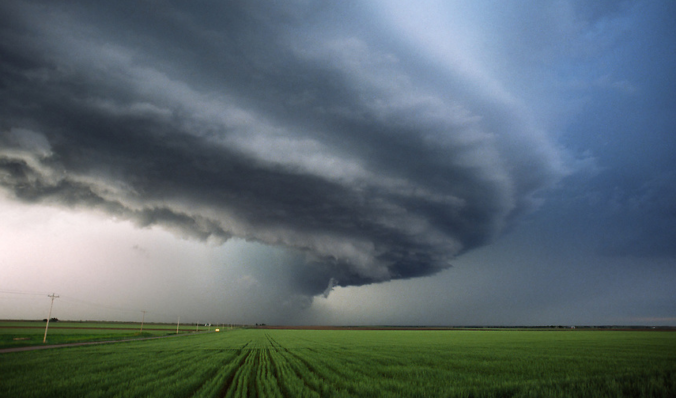
Severe weather occurs much less frequently west of Interstate 25 due to the close proximity to the mountains. Even still, it does happen. Who can forget the billion-dollar hailstorm in May 2017 which has kept the Colorado Mills Mall closed for more than a year now….or the rare westward-moving EF3 tornado that formed in Boulder County back in 2015? And now, for 2018: the multi-day large hail outbreak across the Metro area.
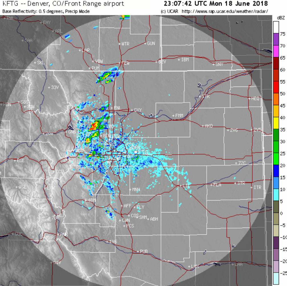
Shown below are all the severe weather reports from Monday this week. It was purely a damaging hail day, with a clear bias across the northern Denver Metro area.
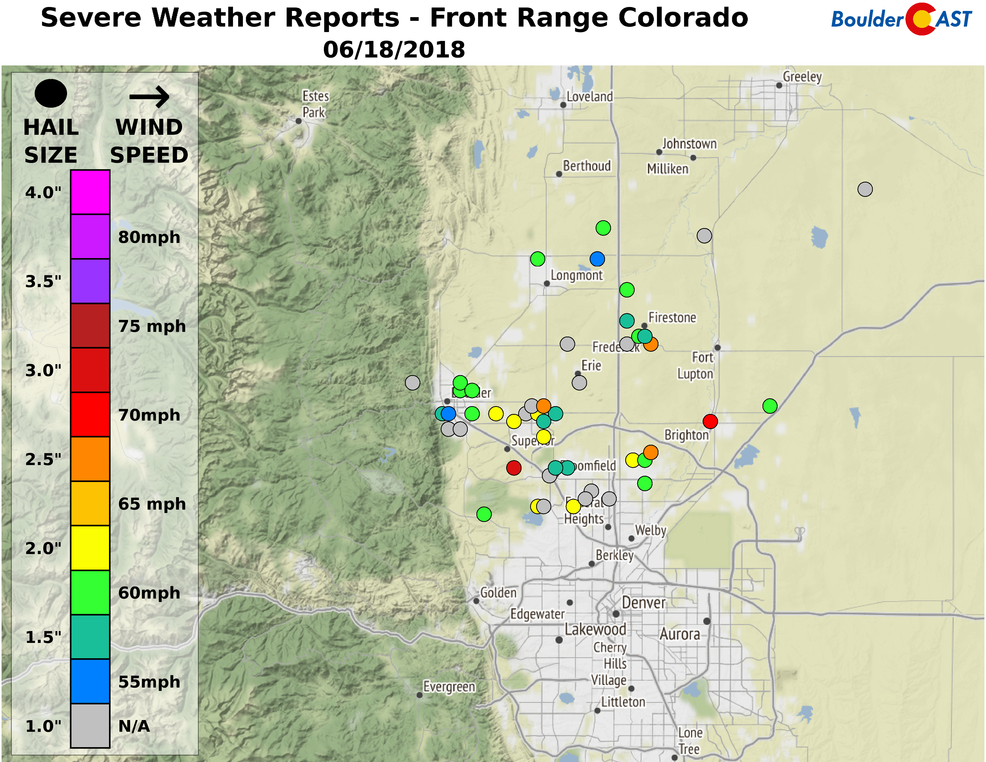
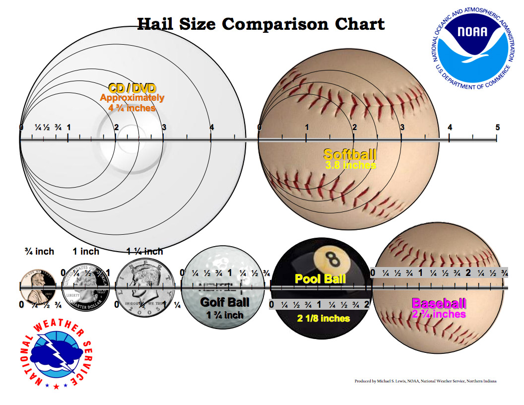
The largest hail reported was 3.00″ near the Costco in Superior. This hail is bigger than a baseball, but smaller than a softball.
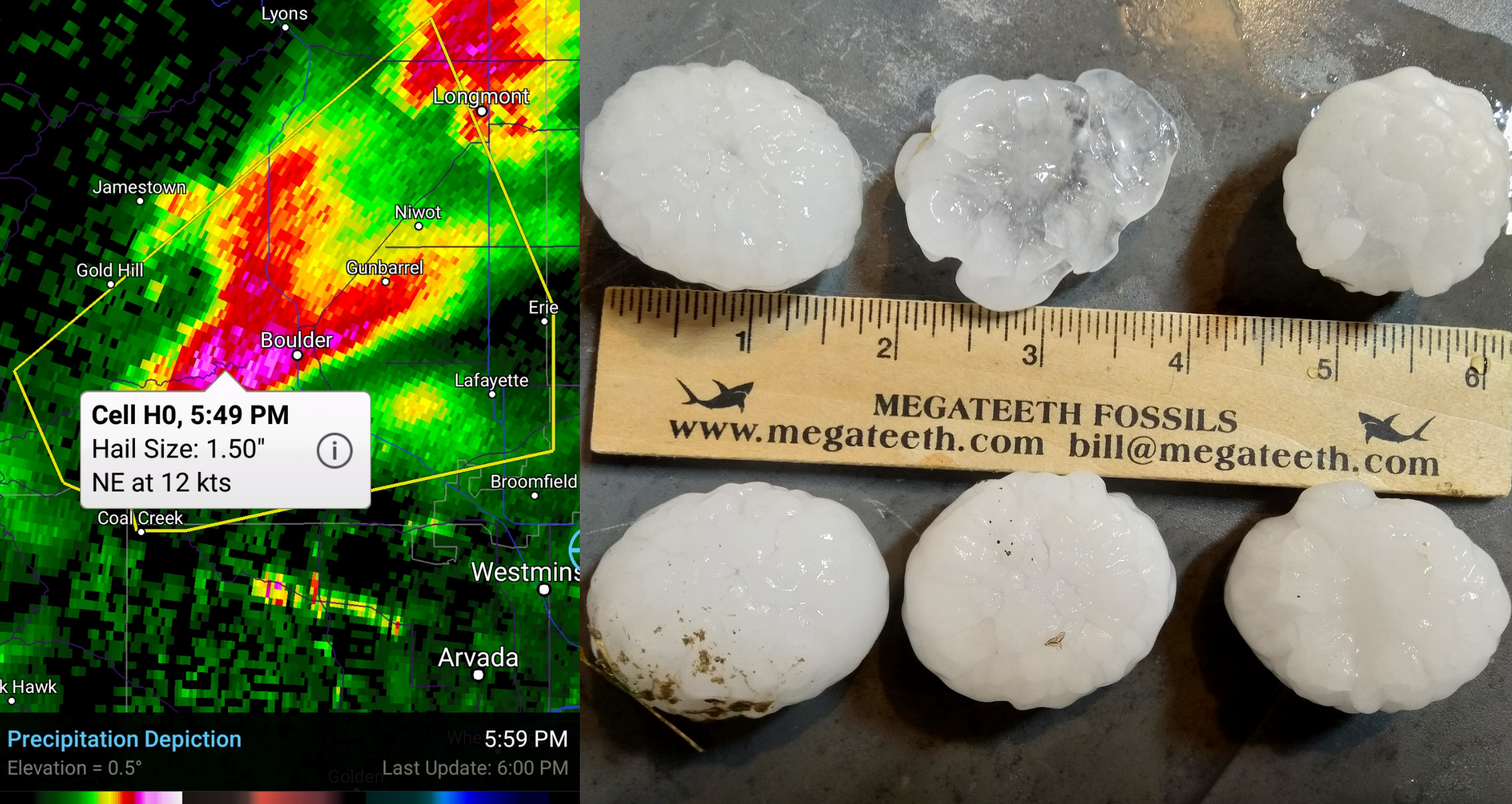
Here is an photo of the roughly 2″ hailstones that fell Monday at BoulderCAST Station, along with the radar image. Hail this big hasn’t occurred in Boulder in more than decade. While it may not make those that experienced hail damage to their property feel any better, this was a VERY rare occurrence. It was fairly surreal to see hail this size falling from the sky in a location so near to the base of the Foothills.
In addition to the hail, another story on Monday was the torrential rainfall that fell as nearly a half dozen supercell thunderstorms repeatedly formed and moved in a line northeast out of Boulder. The radar for Monday evening is shown below.
Meteorologists call this scenario” training”…where multiple storm cells form and move in a line over the same locations, over and over. As is often the case with training, the end result was a highly localized band of extraordinary rainfall totals beginning near Boulder stretching northeastward towards Sterling. While the official station in (south) Boulder only picked up around 1″ of rain on Monday, some remote locations out east saw 5 to 8″ (as estimated by radar). The largest actual rainfall observation we found was for 4.84″ in the “starred” location below, which does verify nicely with radar estimates.
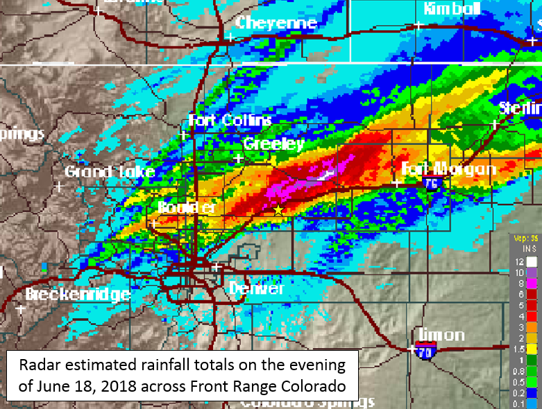
Doppler radar estimated rainfall totals for June 18, 2018. The yellow starred location reported 4.84″ of rainfall.
While many folks began picking up the pieces of their broken windshield or were on-hold with their insurance agents the next day, Mother Nature was back at it again with Round 2 of severe storms for the Front Range. On Tuesday, the southern Denver Metro area got in on the action as well with large hail up to 3.00″ falling near Centennial. Further north, a long-lasting supercell formed just northwest of Boulder. You can see the string of hail reports beginning near Niwot and then heading eastward from this cell.

Near Niwot, hail quickly accumulated to a few inches deep. As the sun came out shortly after, the warm moist air over-running the ice-cold hail on the ground caused a shallow layer of dense fog to form. This type of fog can sometimes form (though, rarely in Colorado) in the winter when a new, warm/moist airmass moves in over a bed of snow. It is appropriately called snow fog, while makes what is pictured below “hail fog”…I guess?
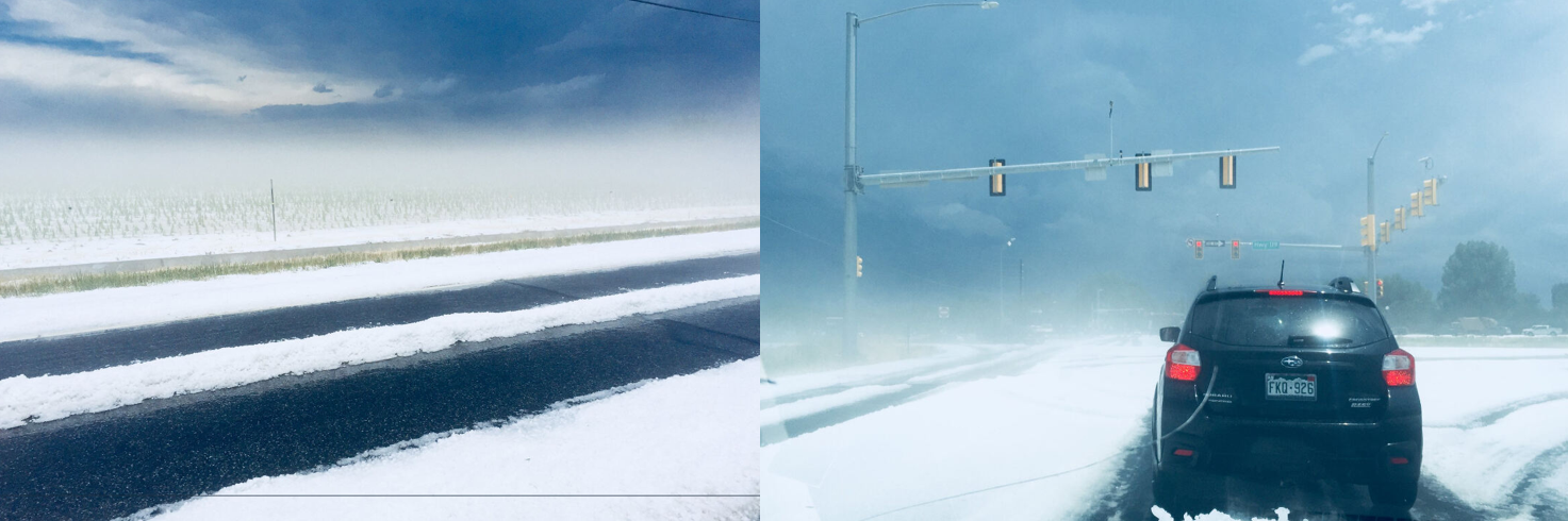
Photo credit: Alexander Sollie (via Twitter)
This particular supercell thunderstorm eventually spawned at least two tornadoes east of Interstate 76 and then finally dissipated near the Kansas border after tracking a solid 200 miles across the Plains of northeast Colorado!
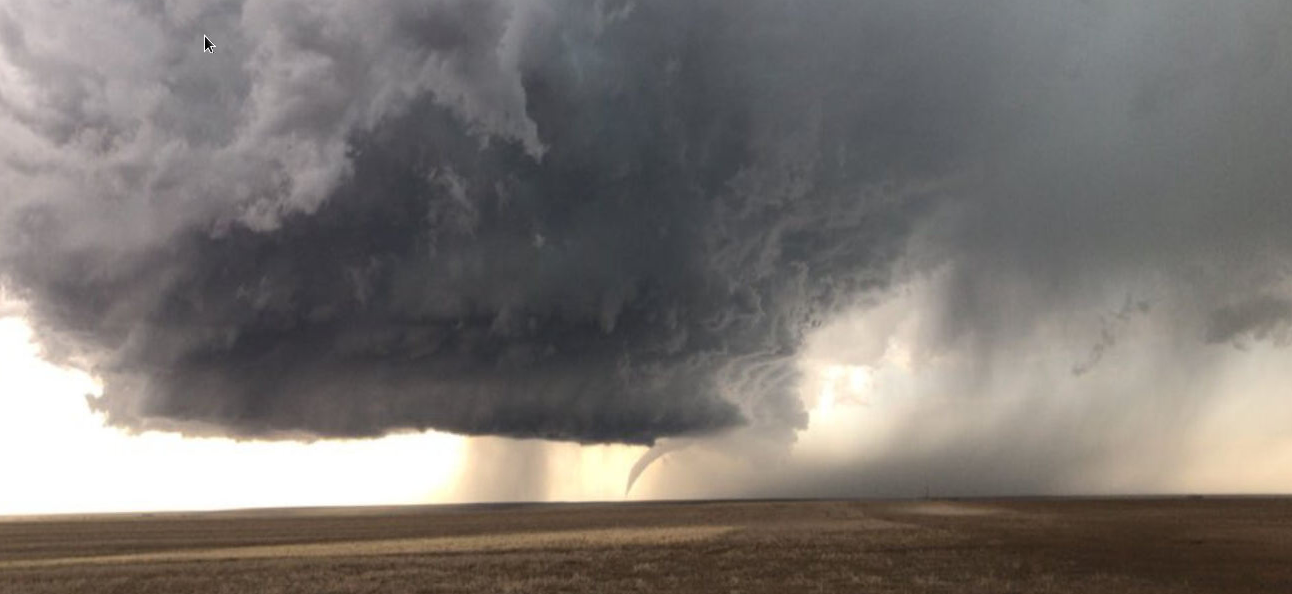
Tornado touchdown near Keenesburg, CO on June 19, 2018. Photo credit: @otisgee on Twitter
Large hail returns to the forecast on Friday
We’re not entirely out of the woods yet for damaging hail. In what is a very similar atmospheric set-up to what happened on Tuesday, low-level moisture will combine with a short-wave trough to produce a round of explosive afternoon thunderstorms across eastern Colorado on Friday.
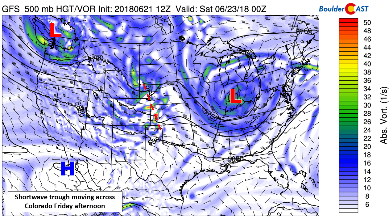
There will once again be favorable shear profile in place to produce supercell thunderstorms on Friday, though luckily for the Metro area, it looks as though the worst of it will be east of Denver. It’s all going to come down to the timing of the passing shortwave trough (indicated by the red line above). East of that trough, conditions will be conducive for explosive thunderstorm growth. West of that trough, large-scale sinking motion in the atmosphere will act to suppress storm development. The GFS model has the trough arriving just a tad too early for the Metro area (between 10:00 AM and 1:00 PM). In this case, there isn’t enough time for solar heating to reach its peak. The NAM model hints a perhaps a delayed arrival of the trough by a few hours, thus leading to a slightly better chance of severe weather clipping our region.
Ultimately, we do not like the timing of the trough and believe the immediate Boulder/Denver area should be in the clear from large hail on Friday. Any storms we do see could be earlier in the day than usual…think late morning to early afternoon….before the trough passes. A few of these early storms could produce hail in the realm of 1″ in diameter. The current (Day 2) severe storm outlook for Friday from the Storm Prediction Center is shown below. They also believe we’ll largely be “on the outside looking in” on Friday.
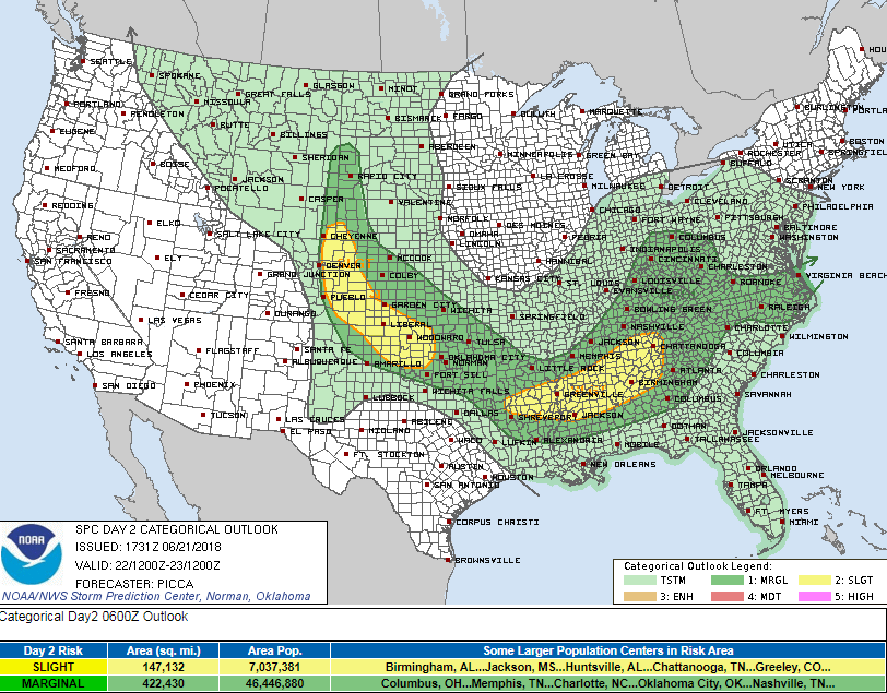
SPC outlook for severe storms on Friday
Beyond Friday’s chance of thunderstorms, a more spring-like trough will move into the northern Rockies over the weekend. This system has the potential to produce decent rainfall for the Front Range on Sunday. There’s still a lot of uncertainty on how that system will evolve, so we’ll leave it at that for now. Happy summer solstice everyone!
Share this forecast:
.


You must be logged in to post a comment.