The Front Range experienced its first significant rainfall in five months, with some areas receiving up to an inch of rain over the weekend. The start of the work week will be relatively cool. However, a strong ridge pattern known as an omega block will bring warm and dry conditions from Wednesday onwards, with temperatures rising into the 80s and potentially reaching record highs by Thursday. While there is no hope for any snow in our forecast yet, our 10th Annual First Snow Contest will open to entries later this week. Read on for all the details.
This week’s highlights include:
- Rainy Recap: The first decent precipitation event to hit the Front Range in five months produced up to 1″ of rain in some areas this past weekend
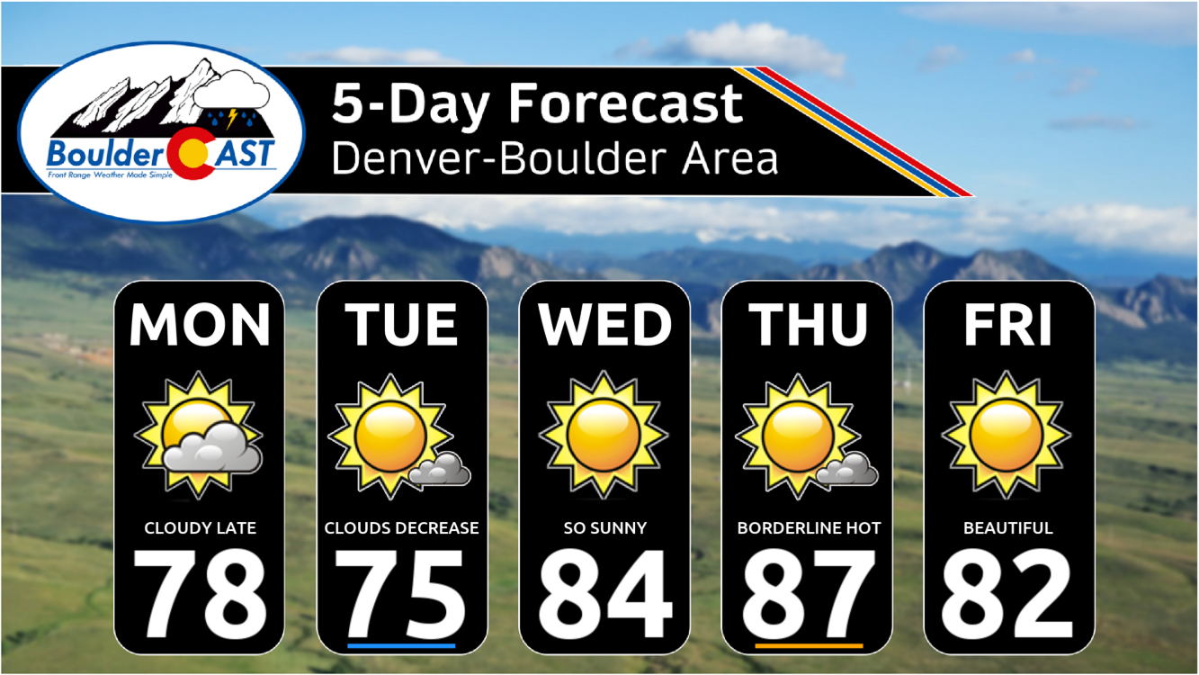
- A “Cool” Start to the Week: Monday and Tuesday will see highs in the 70s with clouds and sun, the “coolest” days of the week but still above normal
- Omega What Now? A strong ridge pattern known as an omega block will develop from Wednesday onwards keeping us warm & dry for the foreseeable future
- Heating Up: Temperatures will push into the 80s beginning Wednesday and even approach record highs on Thursday in the upper 80s
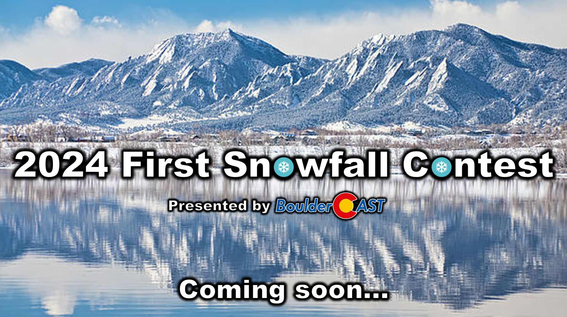
- Where’s the Snow? There’s not even a hint of snow in the long-range forecast just yet, but our 10th Annual First Snow Contest will open later this week!
DISCLAIMER: This weekly outlook forecast is created Monday morning and covers the entire upcoming week. Accuracy will decrease as the week progresses as this post is NOT updated. To receive daily updated forecasts from our team, among many other perks, subscribe to BoulderCAST Premium.

Go Premium, get all the perks.
Daily Forecast Updates
Get our daily forecast discussion every morning delivered to your inbox.
All Our Model Data
Access to all our Colorado-centric high-resolution weather model graphics. Seriously — every one!
Ski & Hiking Forecasts
6-day forecasts for all the Colorado ski resorts, plus more than 120 hiking trails, including every 14er.
Smoke Forecasts
Wildfire smoke concentration predictions up to 72 hours into the future.
Exclusive Content
Weekend outlooks every Thursday, bonus storm updates, historical data and much more!
No Advertisements
Enjoy ad-free viewing on the entire site.
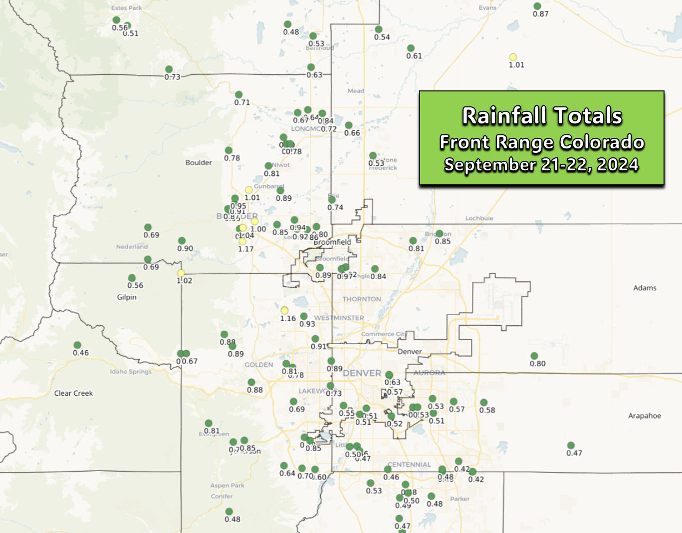
Weekend rain was our most substantial in five months
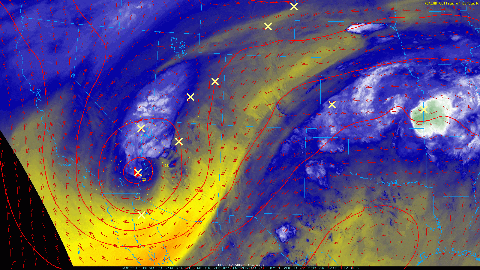
The highly-anticipated fall rainstorm arrived right on schedule this past Saturday evening, with raindrops continuing into late Sunday morning. A constant influx of moisture, upslope and energy from the passing pint-sized Four Corners Low led to a prolonged period of light to moderate rainfall in the Denver Metro area. The approach and passage of the low pressure can be seen in the water vapor animation below:
The 12-hour regional radar animation ending at 10AM Sunday is shown below. Look at all that moisture!
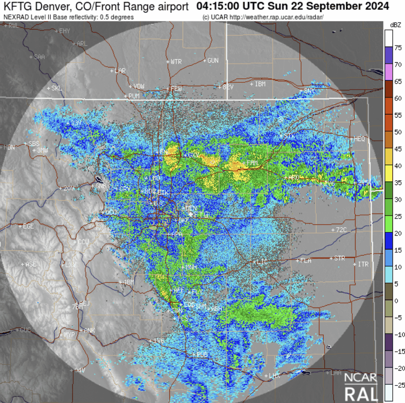
12-hour radar animation for Denver ending at 12PM on Sunday. Widespread rainfall encompassed the entire area.
Widespread light to moderate rainfall fell across our entire area, mainly focused on Saturday night and early Sunday morning. When it was all said and done, most locations picked up between 0.5 and 1″ of much-needed rainfall — more or less right in-line with our forecast. This was the biggest and most ubiquitous dump of precipitation on the Front Range since the late-April super-soaker rainstorm (that also had some snow)! Officially Boulder recorded 0.95″ of rain, with 0.94″ in Denver at DIA.
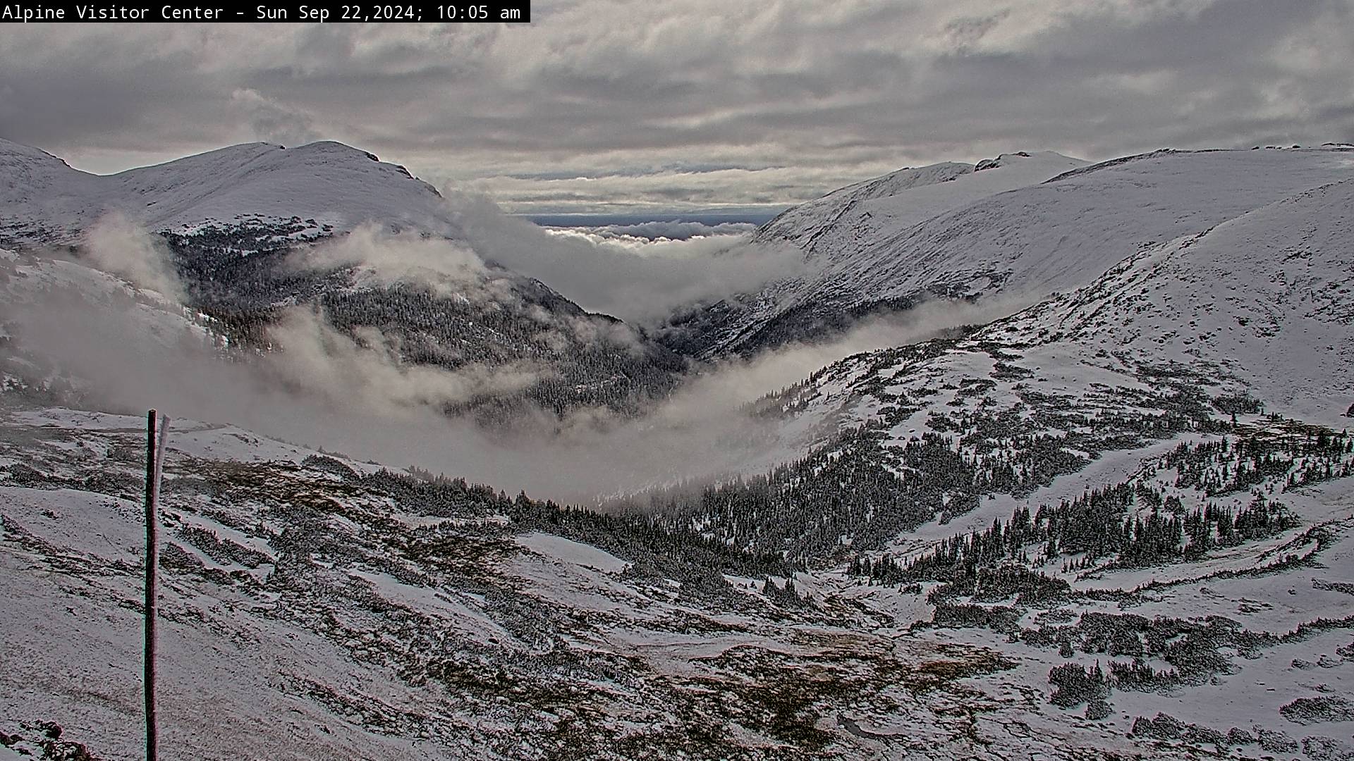
And as is usually the case with any good autumn upslope storm, temperatures were cold enough for snow in the Mountains. The wintry view from atop Rocky Mountain National Park (~11,800 feet) was stunning Sunday morning with all the surrounding peaks and valleys blanketed in a few inches of fresh snow. We observed accumulating snow as low as about 8500 feet elevation near Nederland, but it was only a wet dusting there where temperatures remained just a tad above freezing.
Watching paint dry would be more exciting than this week’s weather
We begin the week under the influence of dry northwest flow in the Front Range — flow left behind by the departing storm system which brought us the weekend rains. The residual trough from that storm is still located over Nebraska and Kansas as of early Monday morning. A secondary, weaker disturbance will drop southeast out of Canada leading to an increase in clouds for us late Monday afternoon into Tuesday.
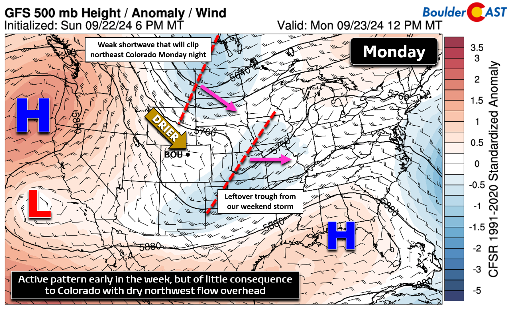
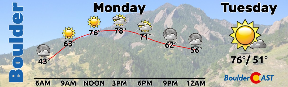
This secondary system is too dry on its own and not timed well (i.e. during the peak sunlight period) to produce any precipitation for us. Thus, Monday will be totally dry in the Denver Metro area with increasing late day clouds. There could be a rogue shower late in the evening or overnight across far northeast Colorado, but that’s about it. High temperatures on Monday will land just shy of 80 degrees. Tuesday will be a couple degrees cooler in the middle 70s following the passage of a weak frontal boundary associated to the weak shortwave. Morning clouds on Tuesday will yield to sunshine later on — the opposite of Monday’s sky conditions!
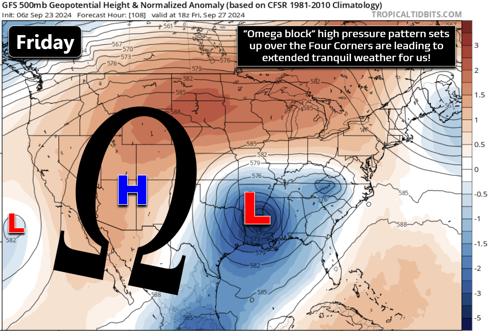
The rest of the week will see a dominant, blocking ridge of high pressure setup directly over Colorado. The pattern will generally stay very active all around the Rockies, but not within the Rockies. The GFS 500mb height anomaly forecast animation below runs through Saturday morning. After the aforementioned early week troughs scoot east, a strong ridge takes commanding hold across the Four Corners by Wednesday and sticks around at least into the upcoming weekend, if not much (much!) longer…
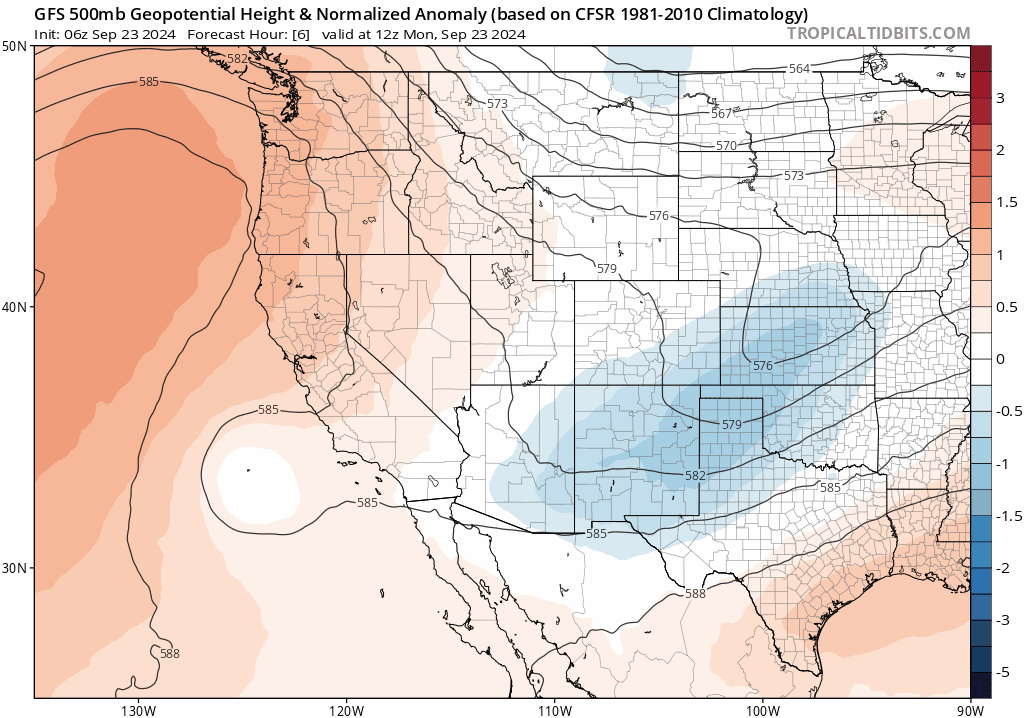
GFS 500mb height anomaly forecast animation for the entire week. Not another ridge!
By Friday, our ridge will take on the characteristics of an omega block, flanked both to the east and west by stagnant low pressure systems, which together will keep us protected from almost all weather in the foreseeable future. In fact, most guidance suggests that this ridging and/or omega blocking pattern will remain stationary across Colorado well into the month of October.
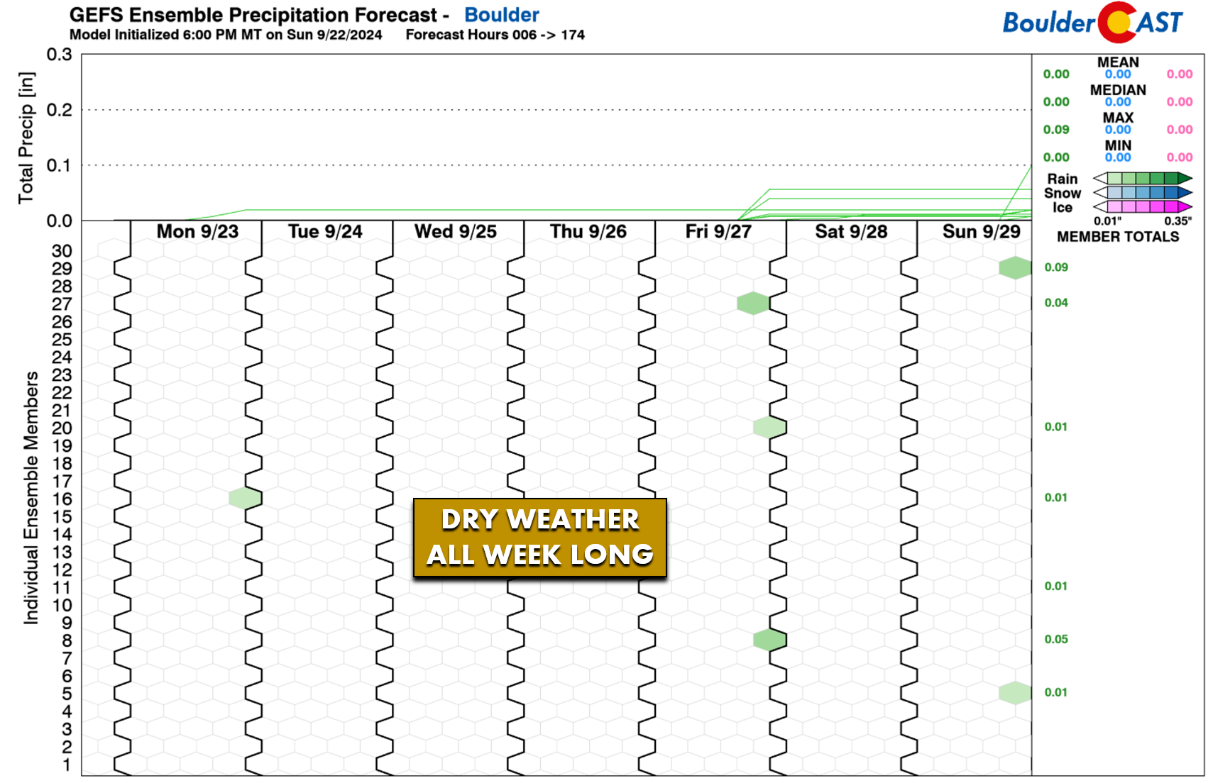
As you might imagine, a strong ridge such as this sticking around for so long will lead to persistent quiet weather for us. This time of year, that means unseasonable warmth, light winds, and no chance for rain (let alone our elusive first snow of the season). The GFS ensembles show essentially no precipitation in our area through Sunday:
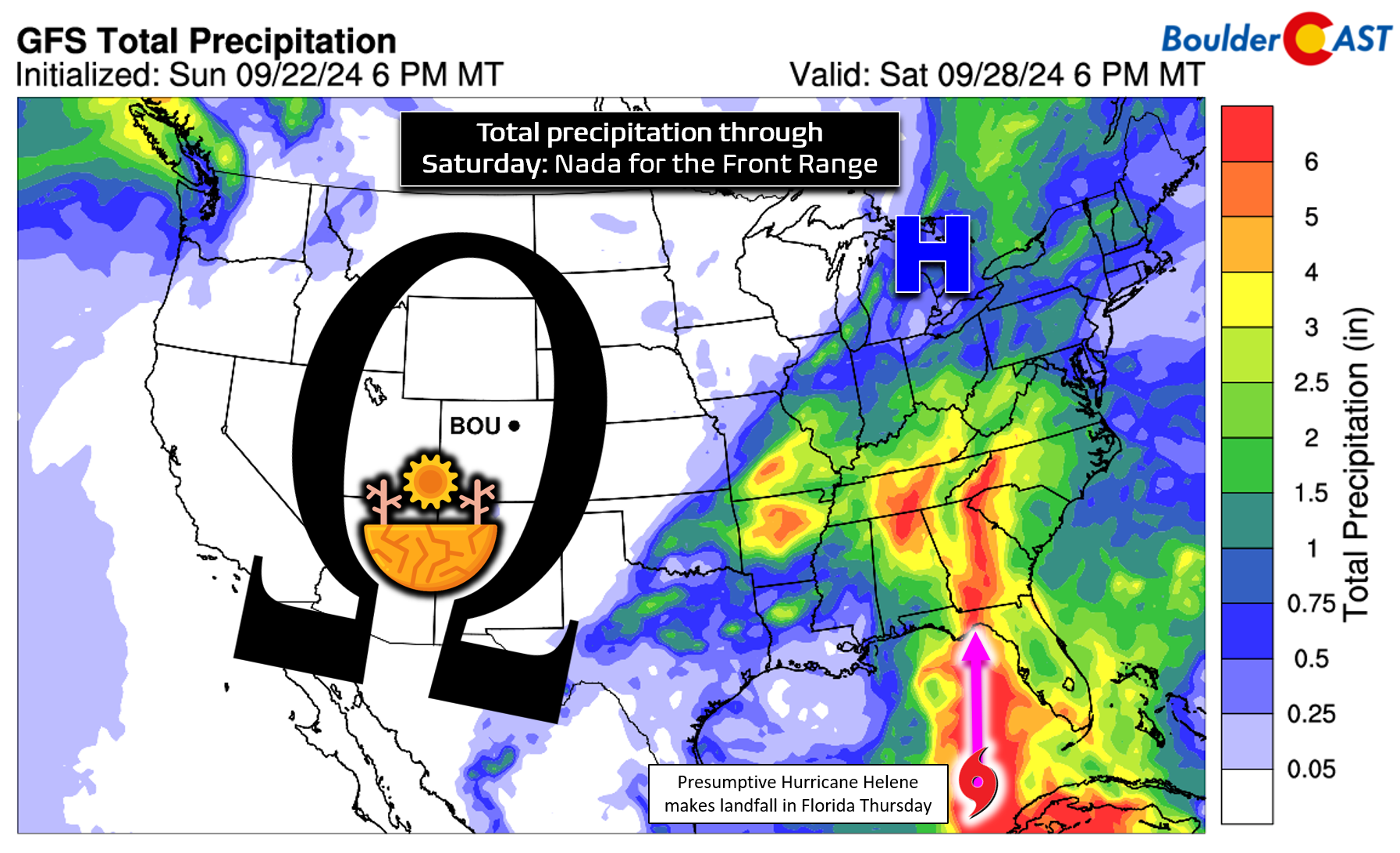
More generally, most the West will be totally dry this week as well, with the exception of Washington state, as the omega blocking pattern protects the broader region from any significant weather systems. The southeast United States will be rainy under the influence of a troughy pattern, and also thanks to the expected arrival of what is likely to be named Hurricane Helene into Florida late on Thursday.
All in all, this week’s weather is about as boring as it gets in the Front Range. The early week 70s, which by the way are still above normal for late September, will seem cool compared to the 80s that are brewing later in the week. Thursday in particular looks quite toasty with highs likely to push into the mid to upper 80s and encroach upon record highs. There will be widespread clouds around late Monday and early Tuesday, but otherwise this week will be definitively sunny.
Enjoy the quiet, “fall” weather this week and be on the lookout for our 10th Annual (2024) First Snowfall Contest — it’ll open up to entries later this week!
Forecast Specifics:
Monday: Lots of sun early, but skies become mostly cloudy by afternoon and evening. Temperatures reach the upper 70s on the Plains with middle 60s in the Foothills.
Tuesday: Overcast early becoming mostly sunny through the day. Temperatures will be the coolest of the week in the middle 70s on the Plains with middle 60s in the Foothills.
Wednesday: Sunny and warmer with temperatures reaching the lower to middle 80s on the Plains and lower 70s in the Foothills.
Thursday: Borderline hot and mostly sunny with highs in the upper 80s on the Plains and middle 70s in the Foothills. Record highs for the date are around 90 degrees.
Friday: A tad cooler but just as sunny. Look for highs to reach the low to middle 80s on the Plains with lower 70s in the Foothills.
Weekend: Staying warm and dry with temperatures in the 80s both days.
Get BoulderCAST updates delivered to your inbox:
DISCLAIMER: This weekly outlook forecast is created Monday morning and covers the entire upcoming week. Accuracy will decrease as the week progresses as this post is NOT updated. To receive daily updated forecasts from our team, among many other perks, subscribe to BoulderCAST Premium.
Go Premium, get all the perks.
Daily Forecast Updates
Get our daily forecast discussion every morning delivered to your inbox.
All Our Model Data
Access to all our Colorado-centric high-resolution weather model graphics. Seriously — every one!
Ski & Hiking Forecasts
6-day forecasts for all the Colorado ski resorts, plus more than 120 hiking trails, including every 14er.
Smoke Forecasts
Wildfire smoke concentration predictions up to 72 hours into the future.
Exclusive Content
Weekend outlooks every Thursday, bonus storm updates, historical data and much more!
No Advertisements
Enjoy ad-free viewing on the entire site.
Enjoy our content? Give it a share!


You must be logged in to post a comment.